Discovering the Trans Canada Trail, the World’s Longest Recreational Trail
Discovering the Trans Canada Trail, the World’s Longest Recreational Trail

“Epic” doesn’t begin to describe the Trans Canada Trail. As the longest network of multiuse recreational trails on Earth, it stretches over 17,000 miles — touching three oceans, passing through incredibly varied landscapes, and connecting more than 15,000 communities across the Great White North. Eight out of every 10 Canadians live within 30 minutes of the trail. If you’re seeking a coast-to-coast Canadian adventure, here’s everything you need to know about the Trans Canada Trail.
The History of the Trail
The concept of a national trail that would stretch from coast to coast was first discussed in 1992, when authorities sought a way of marking the country’s 125th anniversary. Also known as the “Sentier Transcanadien,” the trail would connect many shorter trails across the nation, with the potential to expand over time, and preserve greenspace for future generations. In a country as vast and sparsely populated as Canada, the trail would also signify a culturally diverse nation and serve as a reminder that rural communities are as valued as major cities.
The Trans Canada Trail launched in 2017, to coincide with Canada’s 150th anniversary, but since then it has evolved further. By August 2021, the length of the Trans Canada Trail exceeded 17,400 miles. Impressive though that is, the recreational path is set to grow even more, thanks to the continued commitment of local trail groups.
The real joy of exploring the Trans Canada Trail is traversing such diverse terrain. Some sections of the route are backcountry paths through pristine Canadian wilderness, while others follow roads or waterways through urban and rural communities. As such, adventurous trail-blazers are encouraged to partake in a range of outdoor activities along the way, such as hiking, cycling, paddling, horseback riding, cross-country skiing, and snowmobiling. In other words, it doesn’t really matter how you use the trail, as long as you enjoy the great outdoors.
Traversing the Trail
If you maintained a steady pace, covering 20 miles a day, it would take you more than two years — probably more — to complete the main section of the Trans Canada Trail, which stretches from St. John’s, Newfoundland, to Victoria, British Columbia. You’d need to add even more time if you planned to head up to the Arctic and back. Few have achieved such a feat, but those who have form an elite club. Just ask pioneering trailblazers Dana Meise and Sarah Jackson; both managed to finish this incredible trail in 2018 and 2017, respectively — a triumph that took them years.
A more recent thru-hiker who completed the trail is filmmaker Dianne Whelan. She set out on her groundbreaking journey in 2015, before the Trans Canada Trail’s official launch, and reached her destination six years later on August 1, 2021, having averaged about eight months each year on the trail. After achieving her ambitious goal, Whelan told reporters that she hoped to turn her experience into a documentary.
Another equally intrepid hiker is German-Canadian resident Melanie Vogel, who set out from Cape Spear in June 2017. Her plan is to head west from Newfoundland, through Nova Scotia and Québec, and on to Ontario and Manitoba, before reaching the cold tundra of Yukon and the Northwest Territories. After reaching the Arctic Ocean, she plans to travel south to Alberta before finishing in Victoria.
Though Vogel intended the journey to be a solo hike, a stray yellow lab, whom she named Malo, had other ideas and tagged along for company in Manitoba. The COVID-19 pandemic, however, forced Vogel to hang around in Yukon for a year, briefly abandoning her plans. Now, as restrictions in the Northwest Territories have finally lifted and the borders are now open, this remarkable woman intends to finish what she started. When she does, it will be an extraordinary achievement.
Highlights of the Trail
Many people don’t have the determination, stamina, and sheer grit necessary to finish the Trans Canada Trail in its entirety, but exploring sections of this epic route is for everyone. To get the most out of the trail, it’s rewarding to take time to explore the sights along the way. Planning such a trip is easy, thanks to an interactive map provided on the Trans Canada Trail website and a handy app that makes light work of logistics. Here are some especially breathtaking sections to help you get started.
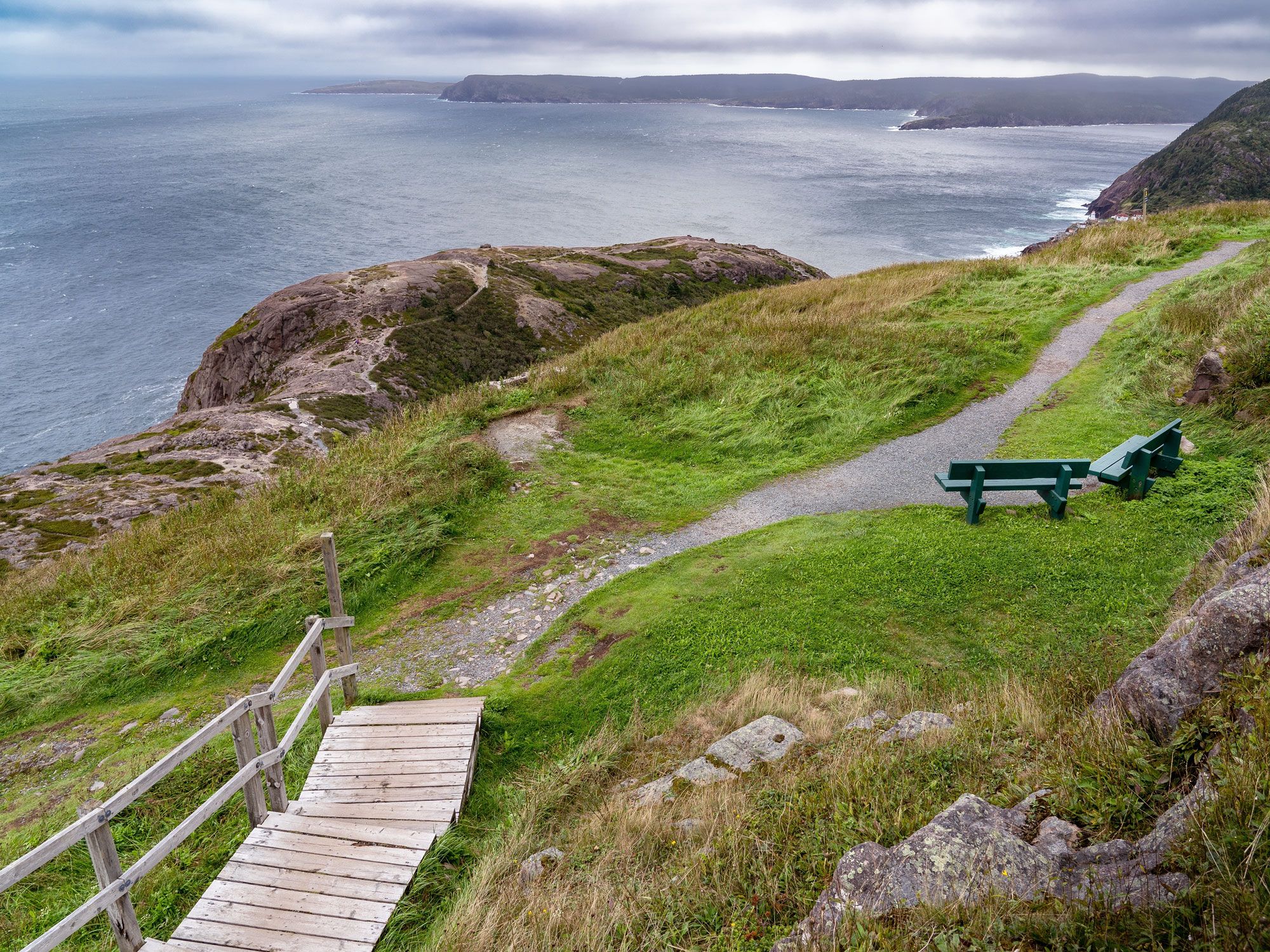
Fundy National Park
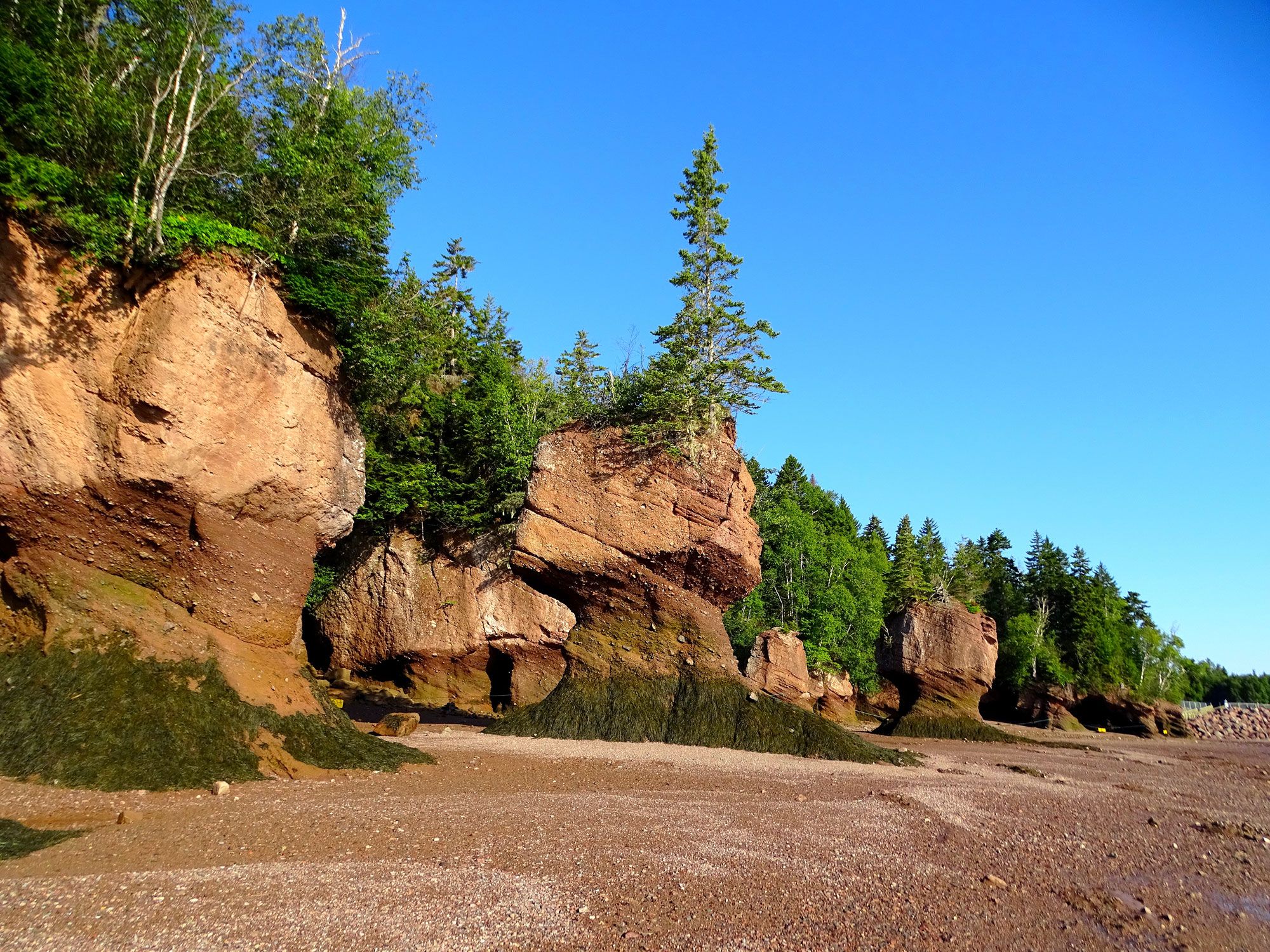
This trail capitalizes on the Bay of Fundy’s pristine beauty, offering visitors the chance to peer out from more than 20 scenic overlooks. From the Lighthouse Observation Deck, you’ll enjoy a breathtaking view of the bay all the way to the lighthouse at Quaco Head west of St. Martin’s, while the Fuller Falls Observation Deck gets you up close to one of the area’s prettiest waterfalls.
Cross a 275-foot-long suspension footbridge, admire the iconic sea stack known as Flowerpot Rock, and learn how the region’s early settlers made a living from the logging industry. With stretches past wild beaches along the coast, home to the highest tides on the planet, as well as 600-million-year-old rock formations, it’s not hard to see why this section is a clear favorite.
Waterfront Trail
Lake Ontario is the star of this waterfront path that links Toronto to the city of Burlington and beyond. Enjoy stellar views of well-known landmarks, such as the CN Tower, Fort York, and the Toronto harbor, as well as other attractions, such as the Humber Bay Butterfly Habitat (check out the monarchs when they gather here in September) and the Royal Botanical Gardens.
Stick to the shoreline for the flattest terrain. Continue on, by bicycle or on foot, through the Niagara Wine Region, stopping in some of the area’s charming vineyards. End your journey at Niagara Falls, where you can hop on the famous Maid of the Mist ferry, one of the best ways to appreciate the currents that create North America’s greatest cascade.
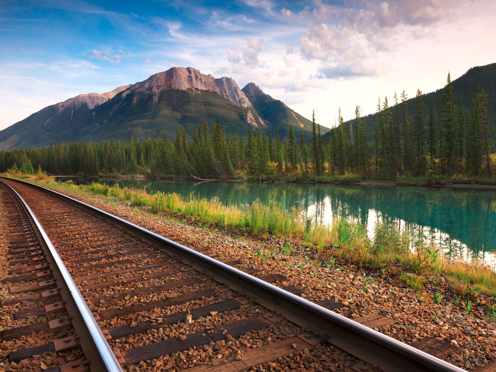
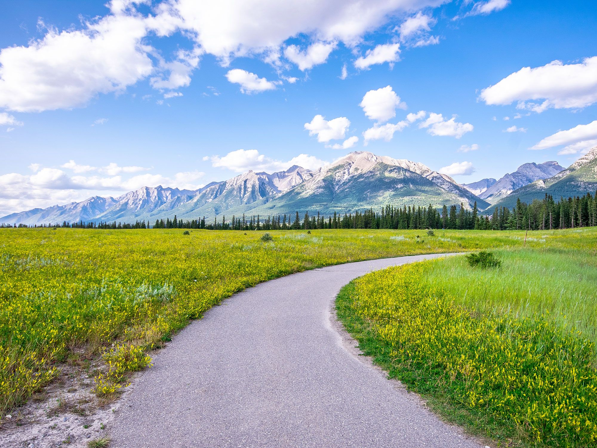
Kananaskis Country Trail
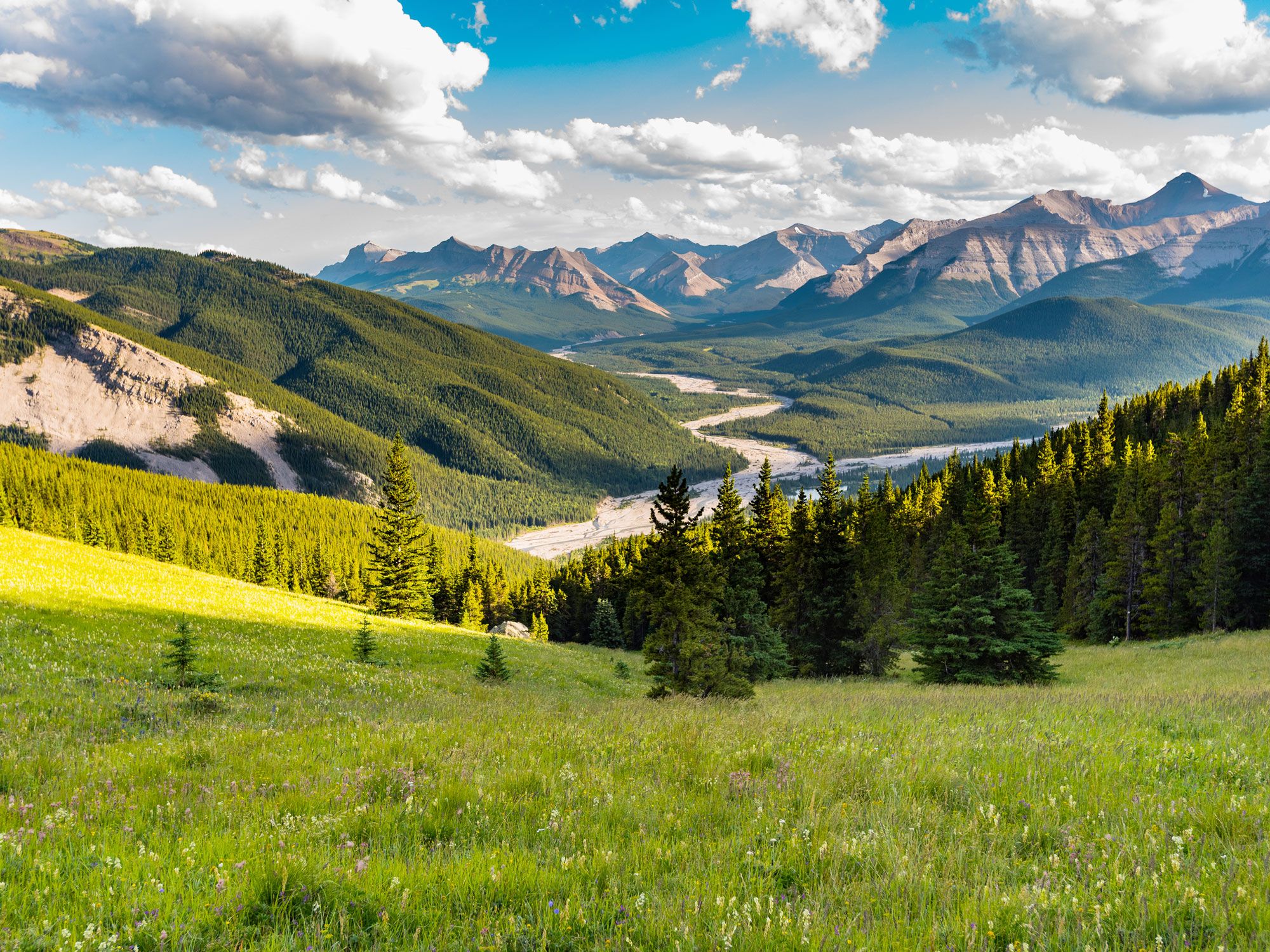
The Bow Valley and Quaite Creek trails meet to form the Kananaskis Country Trail. This is the highest point along the entire route, which skirts around alpine lakes with dramatic views of the Canadian Rockies. As you’d expect in Alberta, the trail offers endless unspoiled vistas, yet you’re barely an hour’s drive away from the bustling city of Calgary.
Get an adrenaline rush with a canyoning tour in Bow Valley, tackling a series of descents, jumps, slides, and rappels in this outdoor playground. The wilderness surrounding the trail shares many elements that you’d find in nearby Banff National Park — with a fraction of the crowds. In summer, hike or kayak; when the winter snow appears, swap your boots for cross-country skis.
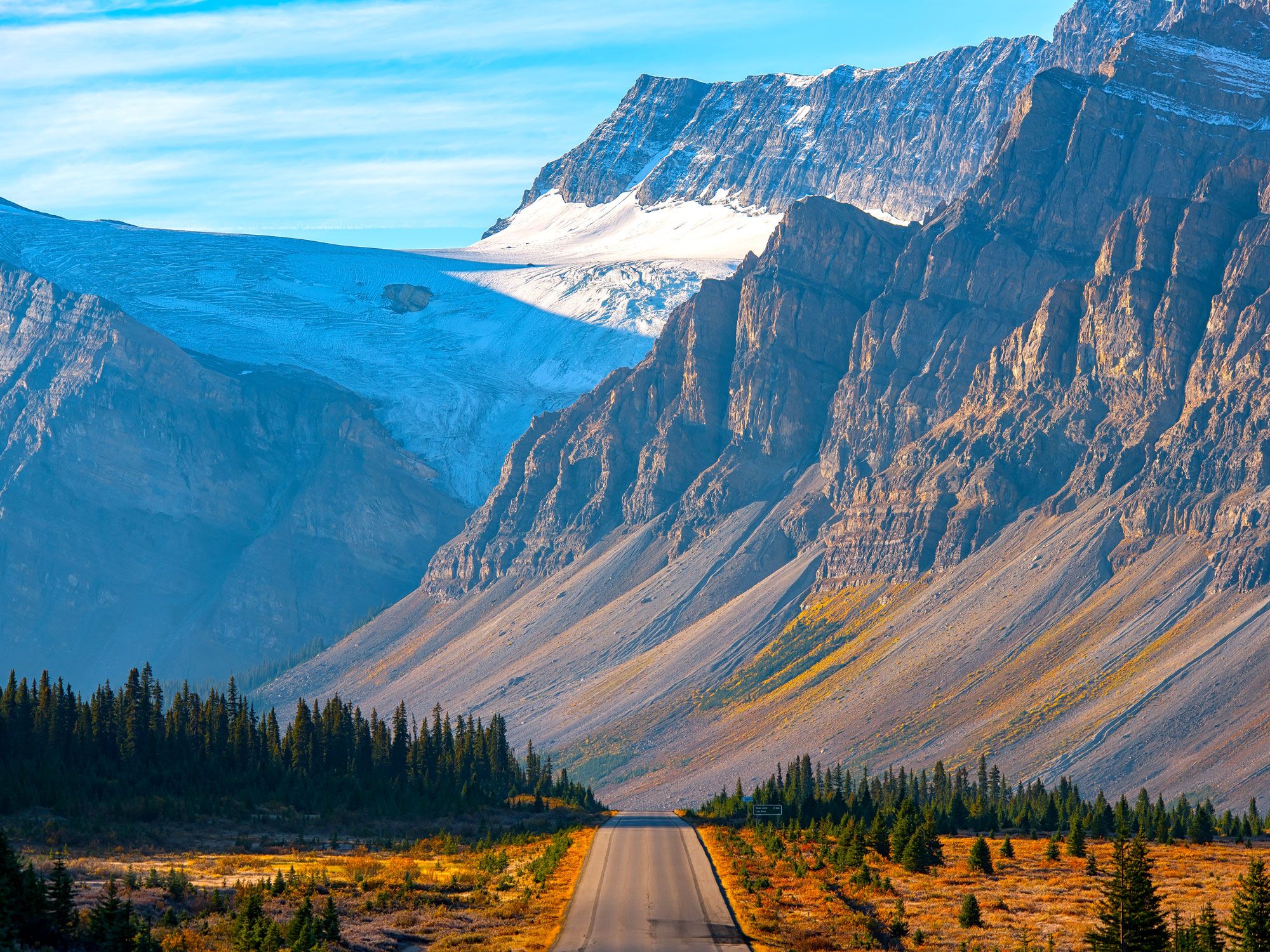
Sea to Sky Marine Trail
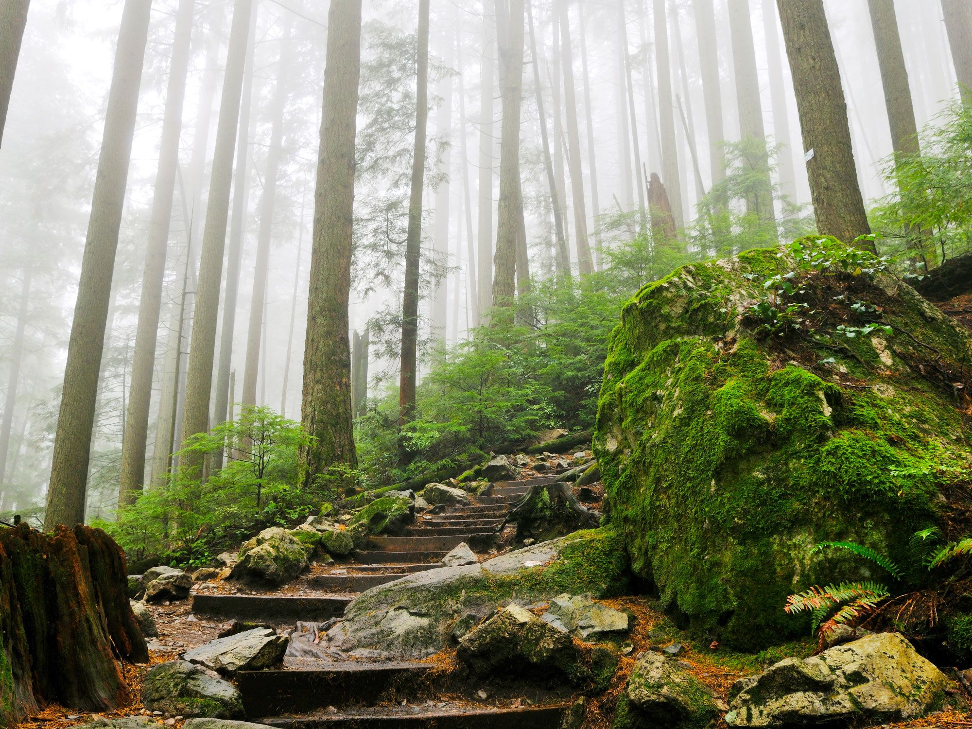
The Sea to Sky Marine Trail connects the Pacific Ocean to the snowy peaks of the Coast Mountains. Running from the British Columbian villages of Pemberton to Squamish for just over 100 miles, the section of the Trans Canada Trail passes Whistler, one of the country’s premier ski resorts, along the way. Expect jaw-dropping views of canyons and mountains, with craggy rocks punctuating dense groves of trees. Continue south toward Vancouver by kayak or canoe.
If you still have the energy, hike the Grouse Grind — dubbed Nature’s StairMaster — up Grouse Mountain. This grueling hike involves climbing 2,830 steps over an elevation gain of 2,800 feet in less than two miles, but the panoramic view at the top is well-worth the effort.
More from our network
Daily Passport is part of Inbox Studio, an email-first media company. *Indicates a third-party property.