There’s something about the geographic isolation of islands that captures the imagination. That’s even more true when they come with an intriguing, mysterious, hilarious, or just bizarre name (or nickname). From the atoll that inspired the name of a popular swimwear piece to one particularly disappointing isle, journey to all corners of the planet as we uncover 15 islands with highly unusual names.
Inaccessible Island – United Kingdom
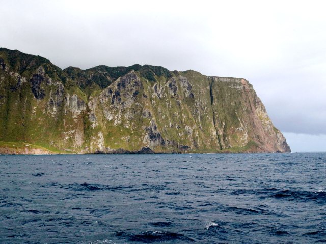
Inaccessible Island is not completely inaccessible, but it’s pretty close. A large rocky islet rising out of the frigid South Atlantic, the island is technically a territory of the United Kingdom, but to reach it, you’ll need to travel about eight days by boat from either South Africa or Argentina. However, that boat won’t get you all the way to the island — after getting official permission, Inaccessible Island can only be accessed on smaller boats, for about one week out of the year (if the weather cooperates).
On the island, you won’t find much: a small, rocky beach and a large number of seabirds. You will, however, have bragging rights to having set foot on one of the least-visited and most remote islands on the planet. There are two theories as to how Inaccessible Island got its name — one is that the Dutch explorers who arrived in 1656 were unable to traverse the steep cliffs to the island’s interior; the other is that a French captain named it after not being able to land there in 1778.
Wizard Island – Oregon
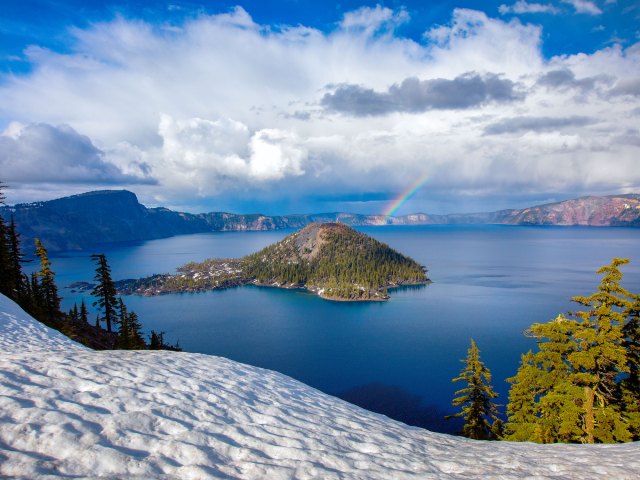
Is it Merlin’s hat or Dumbledore’s? Either way, the shape of this volcanic cinder cone rising from Oregon’s Crater Lake definitely resembles a wizard’s pointy hat, which is what inspired its name. The sorcerer’s chapeau was shaped around 8,000 years ago, when Mount Mazama erupted, and then collapsed. The resulting crater surrounding the cinder cone filled with snowfall, creating an incredibly clear — and bone-chillingly cold — lake that’s among the bluest (and cleanest) in the world. At 1,943 feet, it’s also the deepest lake in the U.S. Part of Crater Lake National Park, Wizard’s Island can only be accessed by boat. Make reservations well in advance (spots fill up quickly) and don’t forget to bring your wands — err — hiking poles.
Coffee Club Island – Greenland
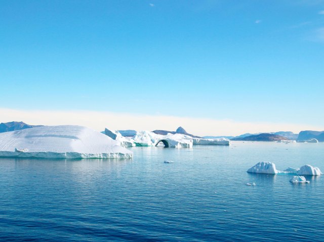
Although several upstart gravel banks attempt to challenge its title, Kaffeklubben (Danish for “Coffee Club”) Island is the northernmost point of land on the planet. (Other masses may be closer to the North Pole, but they tend to shift, submerge, and disappear.) U.S. explorer Robert E. Peary first spotted the island in 1900; Danish explorer Lauge Koch visited it in 1921 and named it after the coffee club in the University of Copenhagen Geological Museum. Visitors to the uninhabited island will need to bring their own coffee — and almost everything else — as there is little on Kaffeklubben except lichen, mosses, and wildflowers.
Bikini Atoll – Marshall Islands
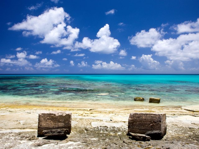
This ring-shaped coral reef halfway between Hawaii and Australia would be the perfect Pacific paradise — if it were not 10 times more radioactive than Chernobyl. Between 1946 and 1954, the U.S. government detonated 23 nuclear devices on the palm-fringed site, blasting the equivalent of 216 Empire State Buildings into the sky and causing entire sections of the atoll to disappear.
However, it had a lasting impact on popular culture: Four days after the first explosion, French engineer Louis Réard debuted a revealing two-piece swimsuit named after the atoll, hoping the name “bikini” would create a different kind of explosion. (The island’s name came from German colonizers, translated from the Marshallese name for the island, Pikinni.) Today the islets understandably remain uninhabited, but the coral reefs are amazingly robust.
Disappointment Island – New Zealand
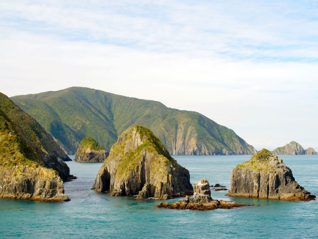
The New Zealanders who named this rocky spot for its frequent shipwrecks and its lack of resources obviously weren’t concerned with the island’s self-esteem. Part of the Auckland Archipelago, Disappointment is one of seven islands that sits about 290 miles off the southern coast of the nation’s South Island. The perpetually overcast archipelago is uninhabited by humans, but that is no disappointment to the wildlife population — 2,000-plus Southern right whales, nearly the entire population of white-capped mollymawks (a medium-sized albatross) on Earth, and the rare endemic Auckland rail, a bird once thought to be extinct.
Island of the Gods – Bali, Indonesia
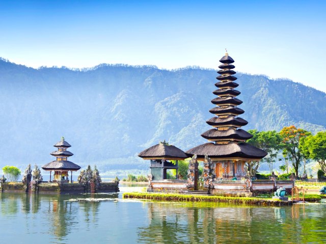
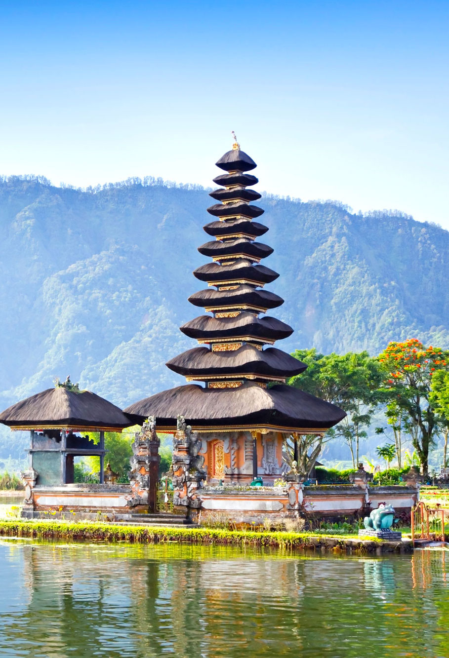
Island of the Gods is a grand (and fitting) moniker, but most probably know this Indonesian island by another name: Bali. The only majority-Hindu island in the most populous Muslim nation in the world, Bali is infused with spirituality. Small palm baskets called canang sari are ubiquitous, filled with flowers and other offerings to the gods. Small temples adorn rooms, larger temples adorn homes, and enormous and fantastically ornate temples dot the entire island. The landscape itself seems blessed, from imposing mountains, to emerald rice terraces and sugar-sanded beaches foamed by lush seas.
Island of Youth – Cuba
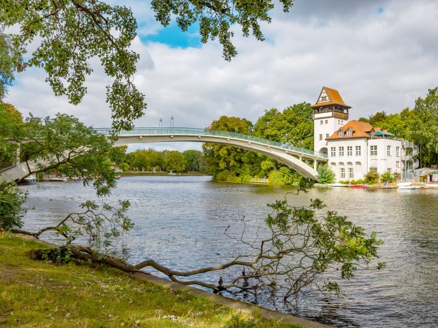
When claiming it for Spain, Christopher Columbus called this island — the second-largest in Cuba — La Evangelista. It’s also been called Isla de Cotorras (“Isle of Parrots”), Isla de Tesoros (“Treasure Island”), and Isla de Pinos (“Isle of Pines”). The island’s pirates and inhabitants heavily inspired both Robert Louis Stevenson’s Treasure Island and J.M. Barrie’s Peter Pan. In 1978, leader Fidel Castro renamed it yet again, dedicating the Isla de la Juventud (“Island of Youth”) to recognize achievements by Cuba’s Communist youth. That name stuck, and today the island is home to almost 100,000 people.
Society Islands
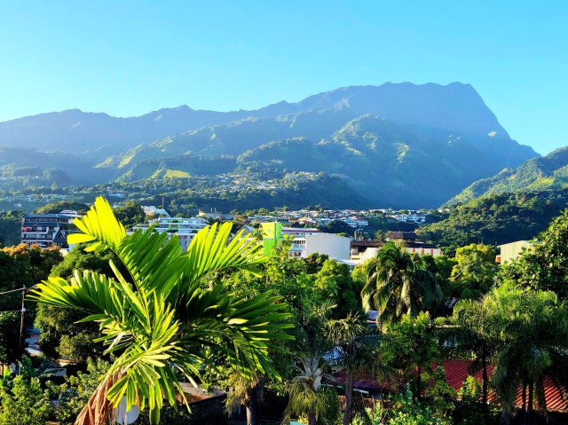
The name “Society Islands” may conjure up images of stuffy tea rooms and cigar smoke-filled clubs, but the breeze-kissed islands of this South Pacific archipelago are the opposite of stuffy. There are 14 islands comprising this French Polynesian paradise, and at least two should be quite familiar: Tahiti and Bora Bora. (The others are Moorea, Raiatea, Huahine, Taha’a, Tupai, Maupiti, Mopelia, Motu One, Manuae, Mehetia, Tetiaroa, and Maiao.) The larger volcanic islands are international tourism destinations, while smaller ones such as Motu One (Sand Island) are low-lying coral atolls.
English explorer Captain James Cook is credited with naming the islands when “discovering” them in 1769, although accounts differ as to the reasons for the name — one theory is that they are named for the Royal Society, which sponsored the first British scientific survey of the islands.
Christmas Island(s) – Australia and Kiribati
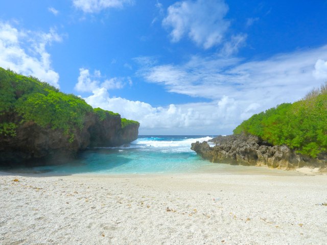
While there is no Thanksgiving Island, there are two Christmas Islands, both named for the day European explorers first landed there. The first Christmas Island is a small, dog-shaped island in the Indian Ocean, near Java. Once rich in phosphate (which has now mostly been mined), the island boasts a seasonally appropriate brilliant red crab population and is mostly covered in lush rainforest.
The second Christmas Island is a large coral atoll in the Pacific Ocean. Its local name is Kiritimati (in the Gilbertese language, “ti” is pronounced as an “s” sound, so it sounds like “Christmas”), and due to its position relative to the International Date Line, the island is one of the first inhabited places on Earth to experience New Year’s Day.
Easter Island – Chile
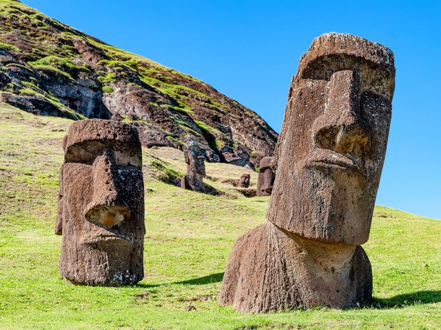
Dutch explorer Jacob Roggeveen first spotted Rapa Nui (as it is called by the Polynesians) on Easter Sunday in 1722. One of the most remote inhabited islands in the world, Easter Island is more than 1,000 miles from its nearest neighbor (tiny Pitcairn Island) and more than 2,000 miles from the coast of South America, the nearest continent. It is most famous for the myriad (887, to be exact) monolithic stone statues which preside solemnly over the land. Known as moai, the ancient guardians even have their own emoji.
Eel Pie Island – England
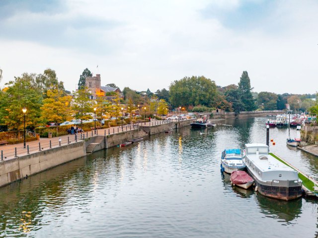
This eight-acre island in the middle of London’s River Thames is said to be named after the eel-filled pastries (a traditional Victorian-era working class dish) sold at an island inn. But the truly tasty story of Eel Pie is all in the music. The genteel 19th-century Eel Pie Hotel hosted tea dances before becoming a hotbed of jazz and blues shows in the 1960s. The Who, The Rolling Stones, and David Bowie all played there. The hotel eventually became a notorious hippie commune before it burned down in a mysterious fire. Visitors can still access Eel Pie Island by footbridge today.
Rainbow Island – Iran

This island in the Persian Gulf’s Strait of Hormuz is often called “Rainbow Island” for a clear reason: The unique geology of the site in the Persian Gulf’s Strait of Hormuz doesn’t need any fancy Instagram filters to demand attention. Hormuz is a salt dome, and the interaction with clay, water, and rocks results in soils in vivid shades of ochre, yellow, red, and orange across the island. There’s even a red beach — with red water!
Pheasant Island – France/Spain
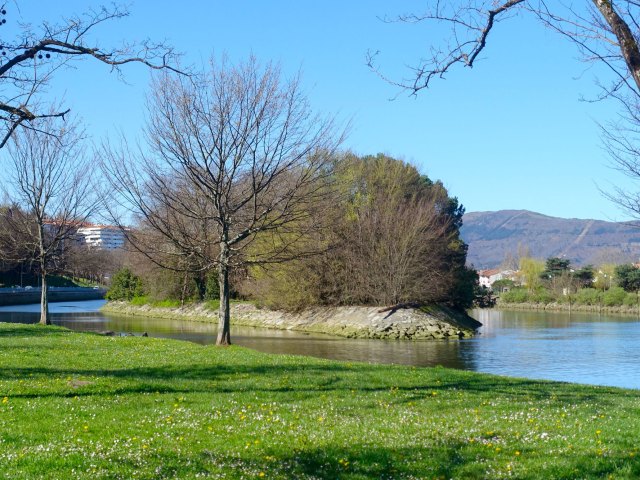
Don’t blame this unusual 700-year-old joint custody agreement on the pheasants after which this tiny two-acre island is named — Pheasant Island’s position is purely the result of politics. After France and Spain’s Thirty Years War, the two countries needed a neutral spot to sign the Treaty of the Pyrenees.
They found it tucked in the middle of the Bidasoa River, on the border between southwestern France and northeastern Spain, and established a condominium there — a political territory that two or more sovereign powers agree to share. Since then, a ceremony at the six-month split has handed control of the uninhabited (visitors are forbidden) island back and forth more than 700 times. So far, so pleasant.
Virgin Gorda – British Virgin Islands
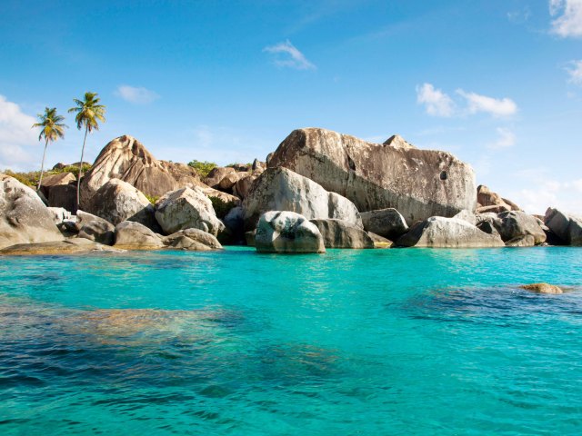
Christopher Columbus may have been at sea a bit too long when he spotted the third-largest island (after Tortola and Anegada) in the Caribbean archipelago. After deciding that the island’s dramatic topography resembled a woman lying on her side, he named the chain Las Vírgenes” after Saint Ursula and the 11,000 Virgins. Today, tourists from all over the world come to admire the boulder-sheltered beach grottoes known as The Baths and toast the “fat Virgin” with planters punch at the Bitter End Yacht Club.
Isle Royale – Michigan
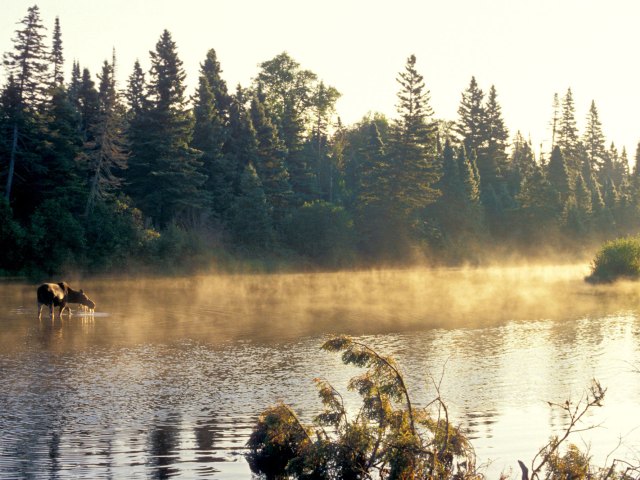
The Chippewa Native Americans called this island Minong, meaning “good high place,” but the 17th-century French Jesuit missionaries who came to the largest island in Lake Superior liked their monikers a little fancier. They renamed the island after their royal patrons. Today the “royal island” and the surrounding archipelago form Isle Royale National Park. Accessible only by boat or seaplane, this wild outcropping is home to beavers, moose, and the descendants of the Canadian grey wolves that crossed the frozen lake to emigrate there in the 1940s.
More from our network
Daily Passport is part of Inbox Studio, an email-first media company. *Indicates a third-party property.

