Though the U.S. is a relatively young nation, it’s easy to forget that the land it occupies has been shaped over 4 billion years. Across America, there are countless wonders that reveal America’s fascinating geological history — making them a must for history buffs and outdoor enthusiasts alike. From iconic monuments to underrated gems, here are eight historically significant U.S. natural attractions you shouldn’t miss.
Driftless Area – Wisconsin
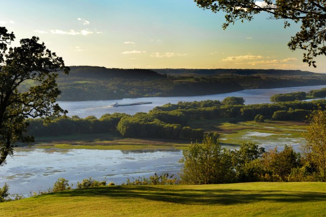
Around 10,000 years ago, much of Wisconsin was covered by a continental glacier. However, the glacier spared this nearly 25,000-acre region, endowing the geologically unique area (which extends into parts of Minnesota, Iowa, and Illinois) with its name.
Retreating glaciers leave behind “drift,” which are deposits of silt, gravel, and rock. This landscape has none. In its absence, the Driftless Area is left with a dramatic topography of rolling karst limestone hills and valleys, punctuated by the largest concentration of cold water streams in the world.
Today, the region is a highlight of America’s dairyland, with friendly small towns — including a number of Amish settlements — and well-regarded creameries that turn out some of the country’s best cheese. The Driftless is a four-season recreational draw as well, with outdoor enthusiasts flocking to fish for trout on the many streams, hike, cycle, or canoe the Kickapoo River.
On the Mississippi River, the Mississippi Flyway provides ample opportunities for birders, who come to witness the migration of great flocks of American white pelicans and tundra swans that fly low above the waters, while the year-round population includes large numbers of bald eagles.
Bonneville Salt Flats – Utah
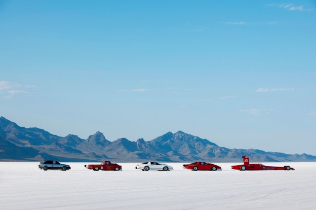
This otherworldly 30,000-acre expanse — about 90 minutes west of Salt Lake City near the Nevada border — is covered in a perfectly flat, glowing white salt crust that ranges from a few inches thick to five feet deep. The uniform layer, which looks like a frozen lake and prevents any vegetation, is a photographer’s dream, stretching almost as far as the eye can see, broken only by the Sierra Nevada Mountains in the distance. The area was once part of a vast, prehistoric, saltwater lake, part of the same system that created the Great Salt Lake.
A rest stop along I-80, just east of the town of Wendover, offers one of the best vantage points of the salt flats. From there, the uninterrupted views look especially surreal in the glistening summer heat. There’s even a spray station where visitors can clean the salt off of their shoes after exploring. This flat expanse has also been an international hub for auto racing since 1911, and multiple land-speed records have been set in and around the Bonneville International Speedway.
Devils Tower National Monument – Wyoming
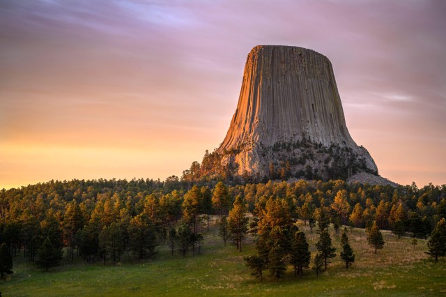
Fans of Close Encounters of the Third Kind will immediately recognize this dramatic rock formation towering 1,267 feet above the Belle Fourche River, as it was the backdrop for the film’s culminating UFO landing scene.
Located among the Black Hills of northeastern Wyoming, Devils Tower is much more than a film fun fact, though — for Northern Plains Tribes, it’s a sacred site. It is integral in oral histories, cultural narratives, and ceremonial rituals for multiple Native nations, all of whom refer to the landmark with a different ancient name. (Just a few examples: the Arapahoe call it Bear’s Tipi, the Kiowa call it Tree Rock, and the Lakota call it Bear Lodge.) And in 1906, President Theodore Roosevelt proclaimed Devils Tower the first official U.S. national monument.
Visible from miles in every direction, the flat, football-field-sized summit stretches roughly 180 feet by 300 feet, and its base — composed of a granite-like rock called phonolite porphyry — has a circumference of about a mile. That makes it popular with rock climbers — between 5,000 and 6,000 visit this singular rock formation each year.
Canyons of the Ancients National Monument – Colorado
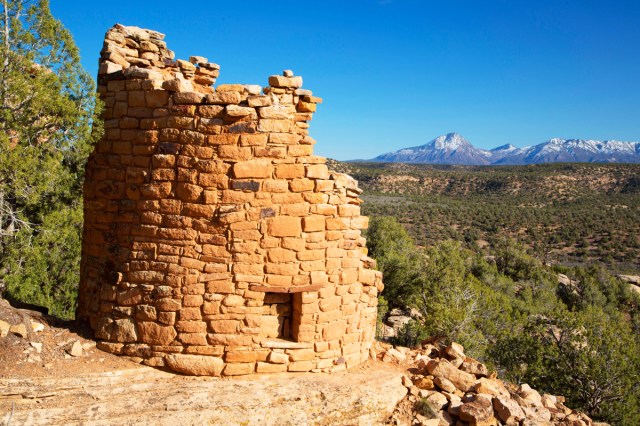
Covering more than 175,000 acres, Canyons of the Ancients National Monument is perhaps the richest archaeological region on the North American continent, containing an estimated 30,000 examples of cliff dwellings, kivas, rock art, and ceremonial sites. The Visitor Center and Museum alone holds a whopping 3.5 million items in a research collection documenting the history and culture of the historic Pueblo, Ute, and Navajo Native Americans who lived in the region. One site (Lowry Pueblo) is developed, with stabilized walls and an ADA-compliant restroom, nature trail and picnic area.
As for the rest of the monument, located in Colorado’s Four Corners region, you can explore by car (some unpaved roads will require high-clearance and all-wheel drive) and by mountain bike, on horseback, and on foot. Bring layers, snacks, and water — and don’t count on cell service in this remote and rugged region.
The Bison Range – Montana
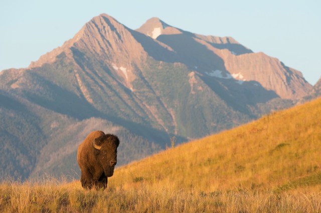
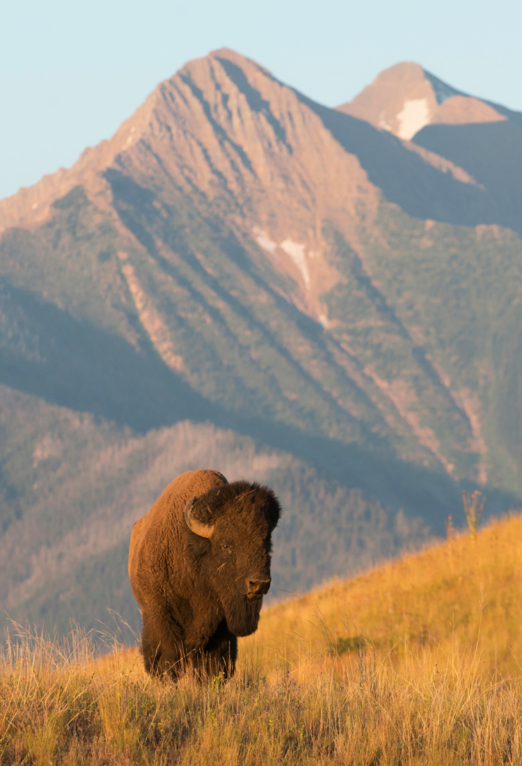
This 19,000-acre refuge within Montana’s Flathead Indian Reservation is home to an estimated 350 adult bison — plus dozens of babies each year — whose neighbors include elk, bighorn sheep, white-tailed deer, pronghorn, black bears, multitudes of birds, and the occasional grizzly and wolverine. Given the regularly sightings of the namesake beasts, plus the mountain-backed drama of their gorgeously green habitat, any visitor who’s ever driven the Bison Range’s two public roads has no doubt been amazed.
For the first time in more than a century, the range has recently been restored to tribal hands, thanks to a years-long, hard-fought campaign by the Confederated Salish and Kootenai tribes. The Montana Historical Society also agreed to return Big Medicine — a particularly sacred preserved white bison from the early 20th century — to the reservation.
Pinelands National Reserve – New Jersey
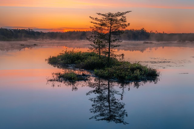
America’s first designated national reserve, New Jersey’s Pinelands National Reserve covers 1.1 million acres, accounting for 22% of the state’s total landmass and spanning an area larger than either Yosemite or Grand Canyon National Park. It consists of pine forests and wetlands that are rich with unique wildlife, including bobcats, birds, rattlesnakes, rare frogs, various orchids and ferns, carnivorous plants, and rare pygmy pitch pine and oak trees that rarely exceed 11 feet in height.
The soil is sandy and acidic and waterways are a cedar-stained tea-color. And underground, there’s a massive reservoir of sterile water comparable to melted glacial ice. Needless to say, the Pinelands is an incredible natural wonder — one that can be enjoyed by hiking, kayaking, birdwatching, camping, fishing, or swimming.
But it also has a long and checkered history, from its days as a hub for the shipbuilding and iron ore industries and its cranberry and blueberry production (domesticated blueberry bushes were perfected in the area), to its ghost towns, failed developments, and even a resident monster: the Jersey Devil. This kangaroo-like creature with bat wings, horns, and a forked tail, is said to have killed its family and terrorized locals for generations — even Joseph Bonaparte, brother of Napoleon, claimed to see it in 1820.
Congaree National Park – South Carolina
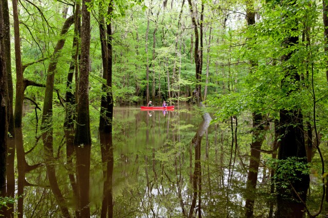
South Carolina’s only national park, Congaree features one of the world’s tallest temperate and hardwood forests, with some native loblolly pines towering as high as 170 feet.
Long before Congaree’s authorization as a national monument in 1976 and redesignation as a national park in 2003, the site’s floodplain was an important source of natural resources for the native Congaree population, and it later served as a haven for escaped enslaved persons. Today, the sanctuary sits 18 miles outside of the state capital of Columbia, which provides a stark contrast to Congaree’s forest of 500-year-old cypress trees.
The park is home to countless hiking trails, including a popular 2.6-mile boardwalk loop. Canoe rides are a popular activity along the slow-moving Cedar Creek, but perhaps no event is more popular at Congaree than the annual synchronous firefly viewing, which occurs for two weeks between May and June each year. Visitors can gaze at millions of fireflies in search of their mates, and their glowing throughout the sky creates a natural light show unlike any other.
Pictured Rocks National Lakeshore – Michigan
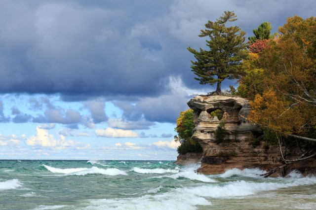
From the 15 miles of glacially carved cliffs that give this park its name to the nature that surrounds them (42 miles of shoreline, densely forested trails, and copious seasonal waterfalls), the wild beauty of this place is reason enough to visit Michigan’s Upper Peninsula. But because of a few particularities, the park has also become a pilgrimage site for enthusiast groups.
Located on Lake Superior’s fabled Shipwreck Coast — where sandstone reefs, thick fog, and monster waves can form a fearsome trio — Pictured Rocks National Lakeshore is the final resting place of at least 45 vessels, some still protruding evocatively from the water. You can scuba dive and snorkel among them or tour Au Sable Light Station, the 19th-century lighthouse that ultimately didn’t do them quite enough good. And if you want to see multiple wreck sites, you can even embark on a glass-bottom boat tour.
Beyond the shipwreck and maritime history fans, though, ice climbers come here from around the world each winter, when the rock faces freeze over and sprout what look like milky stalactites. The best time to experience this scene is the annual Michigan Ice Fest in February, when climbers of all skill levels gather for demos, classes, clinics and ice-cold lakeside beers.
More from our network
Daily Passport is part of Inbox Studio, which publishes content that uplifts, informs, and inspires.

