


The World’s Largest Uninhabited Island Looks Like Mars on Earth
The World’s Largest Uninhabited Island Looks Like Mars on Earth


The Canadian North is a vast, wild region. While wildlife and Indigenous communities have thrived in certain parts of the region for generations, much of it remains untamed and almost entirely uninhabited. One such place is Devon Island, where barren tundra, ice caps, and windswept ridges stretch almost 22,000 square miles. Although it’s nearly the size of the state of West Virginia (or, for a Canadian comparison, the province of Nova Scotia), Devon Island has no permanent human residents, making it the world’s largest uninhabited island. Instead, this remote corner of Canada has become somewhat of a natural laboratory, where scientists prepare for future space missions, polar bears and walruses roam the coasts, and the remnants of short-lived human settlements tell the story of one of Earth’s harshest environments.
High Arctic History
Devon Island is located in the High Arctic region of Nunavut, the newest and largest Canadian territory, with Baffin Island to the south and Ellesmere Island to the north. Long before European explorers arrived, early Arctic peoples and, later, Inuit groups inhabited the island, at least intermittently; some artifacts on the island date as far back as about 4,000 years. In 1845, the Franklin Expedition passed nearby in search of the Northwest Passage, and Inuit accounts, along with artifacts later discovered on the island, hint at encounters related to the lost ships HMS Erebus and Terror — fleeting moments in the island’s sparse human history.
Sovereignty and Human Settlements
The 20th century brought a more deliberate human presence to Devon Island. In 1924, the Royal Canadian Mounted Police (RCMP) established an outpost in Dundas Harbour, part of Canada’s effort to assert sovereignty in the High Arctic. By 1934, the outpost was leased to the Hudson’s Bay Company (HBC) as part of its network of trading centers. With HBC came a number of Inuit families, who were relocated from their homes in neighboring regions to hunt and live in the extreme Devon Island environment.
The settlement proved short-lived: The Hudson’s Bay post shut down two years later, and the Inuit workers were again relocated. The RCMP reopened the Dundas Harbour detachment in 1945, but by 1951, it was closed for good, leaving behind just a few weathered and abandoned buildings as well as a small graveyard — all monuments to the challenging environment.
An Otherworldly Place
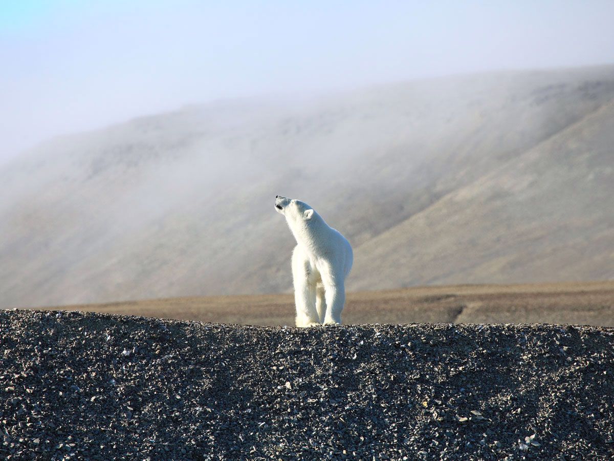
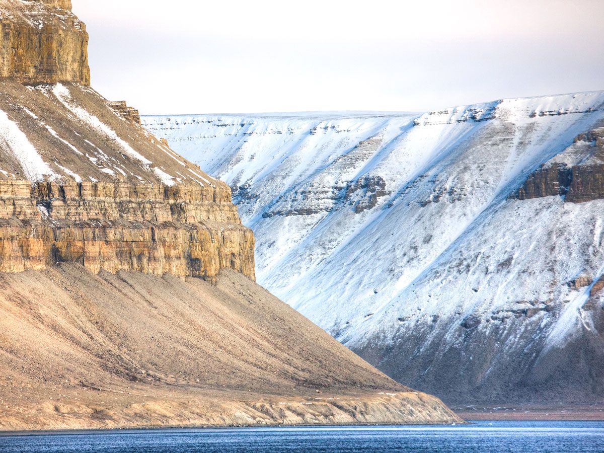
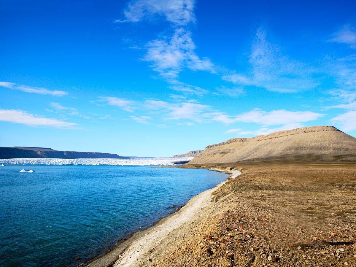
Today, Devon Island remains defined as much by what isn’t there as by what is. Temperatures barely crack 50 degrees Fahrenheit in the summer months — in fact, the year-round mean temperature is a paltry 3 degrees Fahrenheit — and its landscapes support little life. However, polar bears, seals, and walruses often roam the coasts, while small herds of muskoxen graze on what little grasses and mosses eke out of the polar desert’s barely-there soil.
The landscape’s stark emptiness gives it an otherworldly quality that lends the island its nickname, “Mars on Earth.” This is largely thanks to the 12-mile-wide Haughton Crater, formed roughly 23 million years ago. The island’s extreme cold, aridity, and isolation have preserved the crater’s geological features, allowing scientists to use the location as a stand-in for the red planet. Since 1997, NASA has used the Haughton Crater as a testing ground for Mars missions.
Researchers study how to navigate the terrain, experiment with habitat designs, and practice geological field techniques that could one day be used on other planets. Since communications are limited and the weather is extreme, every expedition requires careful planning and patience. Currently, even getting to Devon Island requires several flights across a few days, as well as the likelihood of waiting out severely inclement weather for up to a week at a time.
Arctic Adventuring
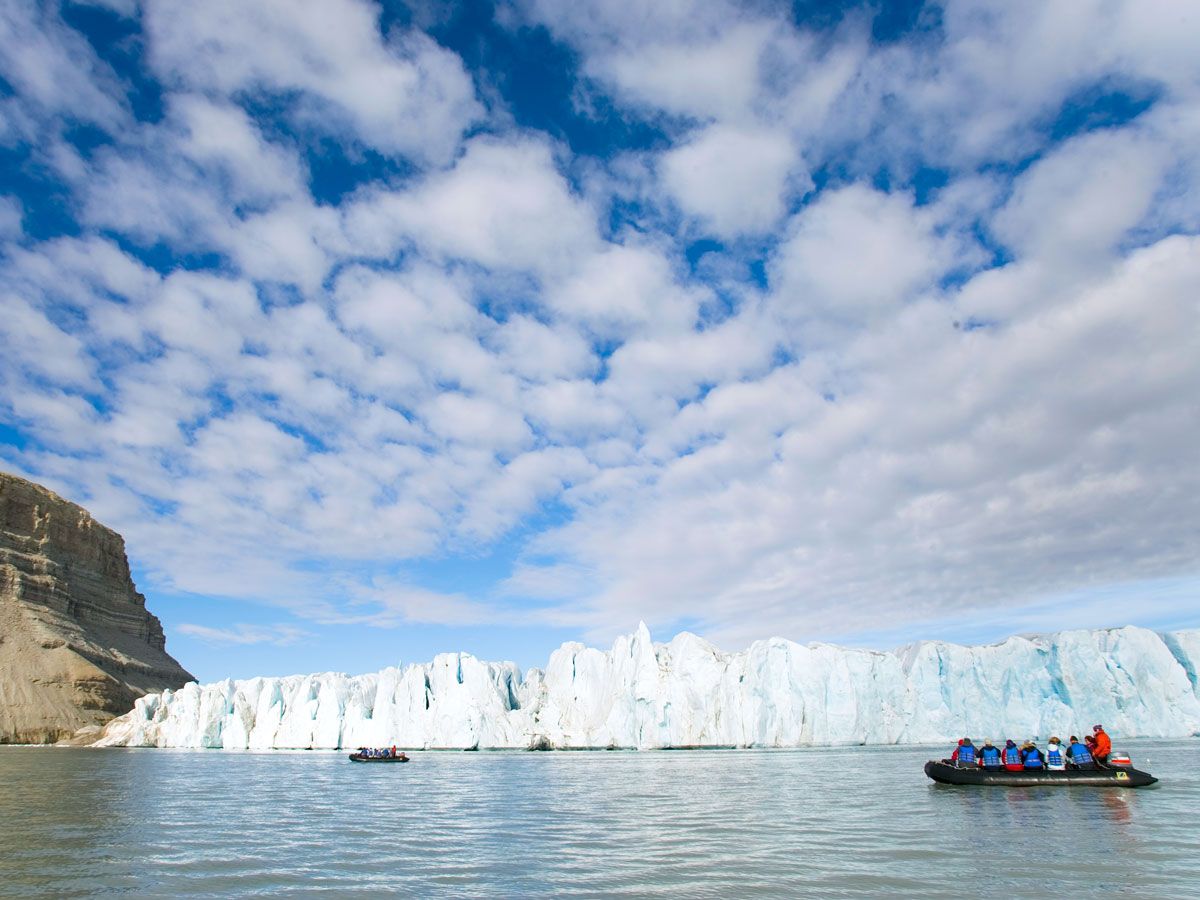
Devon Island certainly isn’t a conventional tourist destination, but its surreal landscape and scientific significance do draw some adventurous travelers. Only the well-prepared and self-sufficient can visit, though, so it’s usually as part of a research expedition or on guided Arctic cruises and tours. Visiting is less about comfort and more about experience: There are no hotels or restaurants, and anyone who does stay on the island does so in tents or temporary field camps.
Notably, in 2018, Google joined the Haughton-Mars Project to map parts of the island using its Street View technology. The team traversed key research sites, including the Haughton Crater, the Mars-like winding valley known as Astronaut Canyon, and the very dry, rocky Breccia Hills. It may not be as captivating as seeing the real thing, but virtually exploring the detailed imagery may be as close as many of us get to Mars — both the planet and the Arctic analog right here on Earth.
More from our network
Daily Passport is part of Inbox Studio, an email-first media company. *Indicates a third-party property.


