


From tiny ponds to bodies of water the size of entire countries, the United States is home to hundreds of thousands of lakes. America’s lakes create natural habitats for countless fish, bird, and amphibian species and play a key role in everything from recreation to trade, agriculture, and tourism. Discover the 10 largest lakes in the United States.
10. Lake Oahe – North Dakota and South Dakota
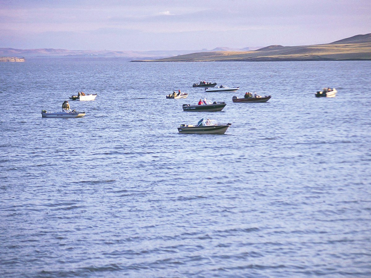
Surface area: 685 square miles
Lake Oahe stretches for 231 miles between Pierre, South Dakota, and Bismarck, North Dakota. This vast reservoir on the Missouri River boasts a 2,250-mile-long shoreline. The lake (along with Oahe Dam in Pierre) is named after the Oahe Mission, founded by the Dakota Sioux peoples in 1874.
Popular activities on and around Lake Oahe include boating, birding, camping, and hiking. Fishing is another big draw here, especially for walleye, channel catfish, northern pike, and smallmouth bass. A collection of 51 recreational areas provide easy access to the lake’s outdoor adventures.
9. Lake Okeechobee – Florida
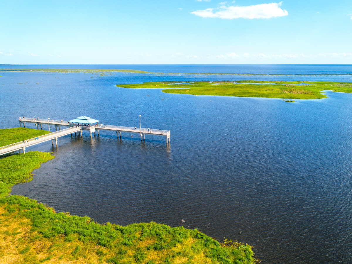
Surface area: 730 square miles
Part of the Greater Everglades ecosystem, Lake Okeechobee is the largest lake in the southeastern United States. Once home to the Calusa and Seminole peoples, the lake gets its name from the word for “big water” in the Hitchiti language. Lake Okeechobee connects to the Atlantic Ocean and Gulf of Mexico via the Okeechobee Waterway, a canal system built in the 20th century.
While alligators, manatees, turkeys, and wild hogs all inhabit the shores of Lake Okeechobee, it’s perhaps best known for the huge number of game fish in its waters. Anglers flock here to catch bass, bream, and black crappie, among other species. Admire the lake’s pretty waters via the Lake Okeechobee Scenic Trail (LOST), a 110-mile route that follows the entire perimeter.
8. Iliamna Lake – Alaska
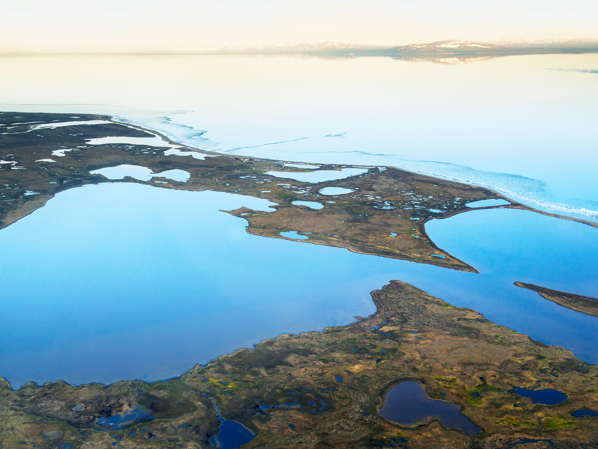
Surface area: 1,012 square miles
Iliamna Lake, Alaska’s largest lake, is located at the northern edge of the Alaskan Peninsula. Measuring about 80 miles long with a maximum depth of around 900 feet, this isolated body of water is reachable only by boat or plane.
According to the folklore of the Tanaina peoples, a giant blackfish lurks in the waters and is capable of biting holes in canoes. The villages of Kokhanok and Iliamna, just 30 miles from Lake Clark National Park and Preserve, serve as gateways to the lake. Visitors can spot bears and one of the world’s only populations of freshwater seals, while August and September are prime months for catching rainbow trout.
7. Great Salt Lake – Utah
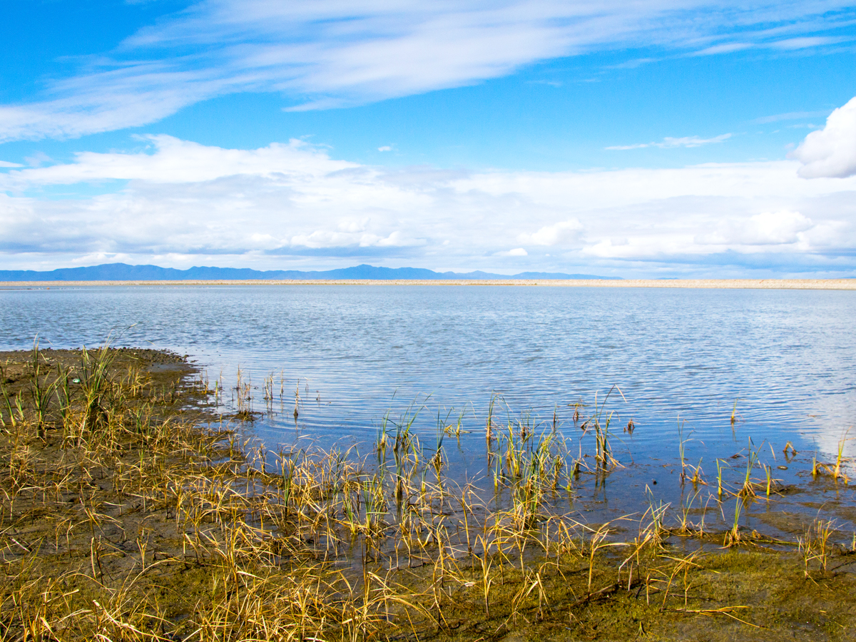
Surface area: 1,700 square miles
Located entirely in Utah, Great Salt Lake is the largest saltwater lake in the Western Hemisphere. It’s a remnant of the prehistoric Lake Bonneville, which once sprawled across present-day Utah, Nevada, and Idaho. The lake’s surface area fluctuates seasonally. Its smallest recorded surface area was 950 square miles in 1963, and the highest was 3,300 square miles in 1988. On average, it measures approximately 1,700 square miles.
About 10 million to 12 million migratory birds visit Great Salt Lake annually, including approximately a third of the world’s Wilson’s phalaropes. As for recreation, Antelope Island State Park is great for backcountry hiking and swimming, while Willard Bay State Park is popular for fishing and waterskiing.
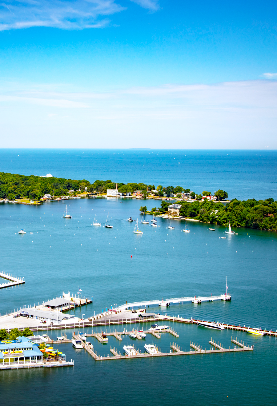
6. Lake of the Woods – Minnesota, Manitoba, and Ontario
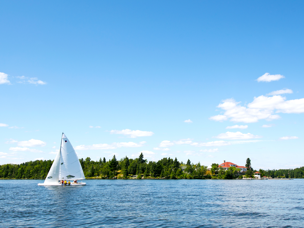
Surface area: 1,727 square miles
Straddling the U.S.-Canada border, the world’s longest international border, Lake of the Woods spans an area bigger than Rhode Island. Measuring approximately 70 miles long and 60 miles wide, the lake is home to 25,000 miles of shoreline and 14,552 islands, the majority of which lie in Ontario.
In winter, the lake freezes over, allowing ice roads to provide vehicle access from northernmost Minnesota to the state’s southern region without entering Canada, as would be required in warmer months. Northwest Angle, set above the 49th parallel, is the northernmost place in the contiguous United States.
5. Lake Ontario – New York and Ontario
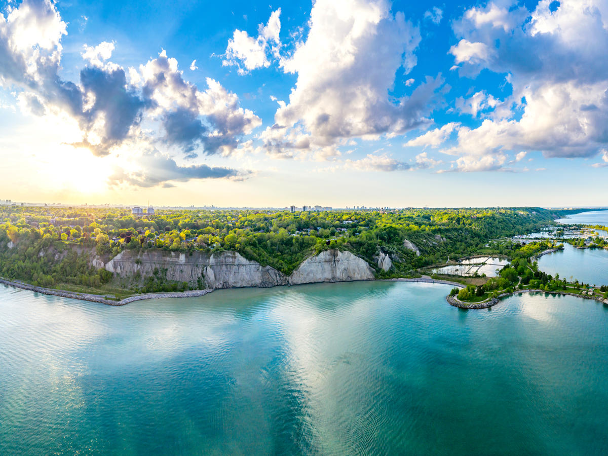
Surface area: 7,340 square miles
Lake Ontario is the easternmost and smallest of the Great Lakes, the world’s largest freshwater system. It acts as the system’s outlet, draining into the Atlantic Ocean via the St. Lawrence River. Similar to the other Great Lakes, Lake Ontario was formed at the end of the last ice age by glacial movement and meltwater. Its name is a derivation of the Iroquoian word kanadario, which means “beautiful lake.”
Roughly 100 beaches and 2,000 islands are scattered around the lake, including the Thousand Islands complex, home to Wellesley Island State Park. Major U.S. and Canadian cities such as Rochester and Toronto are located on the shores of Lake Ontario. In fact, some 25% of Canadians live within the lake’s watershed.
4. Lake Erie – Michigan, New York, Ohio, Pennsylvania, and Ontario
Surface area: 9,910 square miles
Lake Erie is the shallowest, warmest, and most biologically diverse in the Great Lakes chain. Its name means “long tail,” stemming from the Iroquoian word erielhonan.
Connected to Lake Ontario via the Niagara River and Niagara Falls, Lake Erie has 870 miles of shoreline. It’s a haven for thousands of migrating butterflies, shorebirds, songbirds, and waterfowl. Nutrient-rich soil from the lake’s watershed also aids in the cultivation of the Concord grapes, used at over 20 wineries in the Lake Erie Wine Country. Buffalo, Cleveland, and Toledo all sit on the shores of Lake Erie, with the latter being home to the National Museum of the Great Lakes.
3. Lake Michigan – Illinois, Indiana, Michigan, and Wisconsin
Surface area: 22,300 square miles
Stretching 300 miles north from the border of Illinois and Indiana, Lake Michigan is the largest lake located entirely within U.S. territory. It’s connected to Lake Huron via the Straits of Mackinac, where the 5-mile-long Mackinac Bridge links Michigan’s Upper and Lower Peninsulas.
A diverse climate supports natural habitats for 140 bird species, including the endangered piping plover, and rare plant species such as the dwarf lake iris. Lake Michigan is also home to the Sleeping Bear Dunes, which is the largest freshwater dune system on Earth. In Chicago, visitors can enjoy the Lakefront Trail, an 18.5-mile mixed-use pathway passing beaches, parks, and iconic city attractions.
2. Lake Huron – Michigan and Ontario
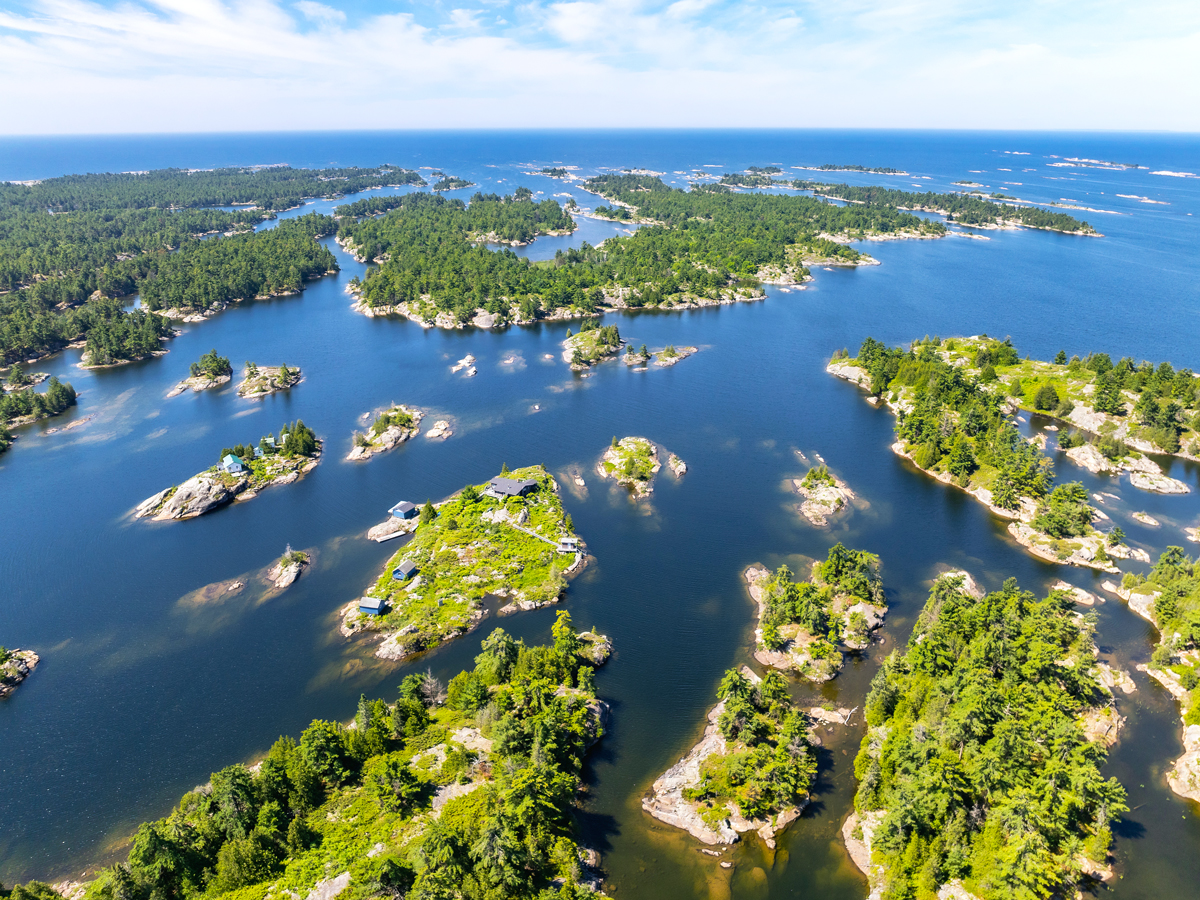
Surface area: 23,000 square miles
At 3,827 miles, Lake Huron has the longest shoreline of the Great Lakes. Its ecosystems range from freshwater beaches to forests, sand dunes, and wetlands. The shores of Lake Huron are home to seemingly endless stretches of sand, including the popular 8.7-mile-long Wasaga Beach.
Summertime water temperatures often exceed 70 degrees Fahrenheit, making the lake a haven for watersports. Thunder Bay National Marine Sanctuary is a hot spot for diving and kayaking. It’s close to Shipwreck Alley, where nearly 100 of the lake’s approximated 1,000 shipwrecks are found. The forested Les Cheneaux Islands are another favorite of boating enthusiasts.
Lake Superior – Minnesota, Wisconsin, Michigan, and Ontario
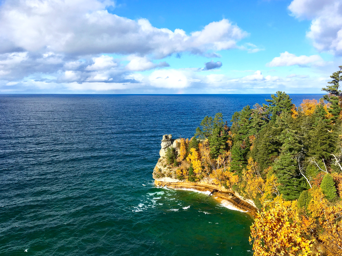
Surface area: 31,700 square miles
Holding 10% of the world’s fresh surface water, Lake Superior is the largest lake in the United States and the second-largest lake in the world. Its total area is roughly the same size as Austria. Lake Superior’s dramatic landscape features boreal forests, rocky shorelines, sea stacks, and wetlands. These habitats support hundreds of animal species, including the bald eagle, endemic siscowet lake trout, and endangered Canada lynx.
A major highlight of Lake Superior is Isle Royale National Park, renowned for diving, hiking, and kayaking. Another must-visit is the Great Lakes Shipwreck Museum at Whitefish Point, which reveals the fascinating (and often perilous) maritime history of the lakes.
More from our network
Daily Passport is part of Inbox Studio, an email-first media company. *Indicates a third-party property.