


Cruise Down 10 of the World’s Longest Highways
Cruise Down 10 of the World’s Longest Highways


Roadways criss-cross our planet, providing a vital transportation link between countries, cities, villages, and far-flung places. By some estimates, there are nearly 40 million miles of roads on Earth, ranging from tiny Main Streets to highways that span thousands of miles. If you’re looking to explore the latter on an epic road trip, buckle up and journey down 10 of the world’s longest highways.
10. Interstate 80 – United States

Spanning 2,899 miles, Interstate 80 is the second-longest highway within America’s Interstate Highway System. Starting in Teaneck, New Jersey, it passes through 11 states before finishing at the point where San Francisco’s Mission District, Potrero Hill and SoMa neighborhoods meet. This transcontinental road roughly follows the route of the Lincoln Highway — the nation’s first transcontinental road for automobiles — and also retraces historic emigrant routes, such as the Oregon Trail and California Trail. There are dozens of interesting and offbeat attractions to keep travelers busy along the way. Among them are Ohio’s Cuyahoga Valley National Park, the World’s Largest Time Capsule in Nebraska, and Tahoe National Forest in California’s Sierra Nevada Mountains.
9. Interstate 90 – United States
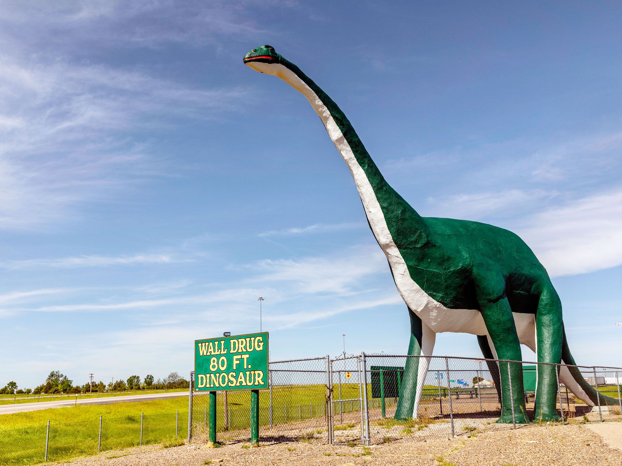
Beating Interstate 80 by just 121 miles to the top spot on the list of longest interstate highways is the 3,020-mile-long Interstate 90. It crosses 13 states in the northern part of the country, traveling between Boston and Seattle. From the shorelines of Lake Erie and Lake Michigan (two of the Great Lakes) to the Great Plains of South Dakota and the Rocky Mountains, the highway passes through many areas of breathtaking natural beauty. Due to its northerly location, temporary closures of the route are common in the winter following heavy snowfalls. A few highlights along the route include Minnesota’s 55-foot-tall Jolly Green Giant Statue, Mount Rushmore National Monument, and Garnet Ghost Town in Montana.
8. U.S. Route 6
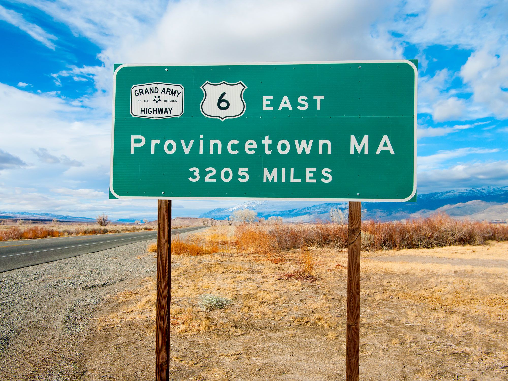
U.S. Route 6 makes it possible to drive for 3,199 miles from Provincetown, Massachusetts, on the northern tip of Cape Cod, to the city of Bishop, which sits close to the California-Nevada border. Starting in the east, the road passes the dune-covered beaches of the Cape Cod National Seashore before winding through 14 states. Travelers can look forward to exploring the northern suburbs of New York City, stargazing in Pennsylvania’s Cherry Springs State Park, and driving around the hair-raising Loveland Pass at the Continental Divide. In 1953, the route adopted the name Grand Army of the Republic Highway in honor of Civil War veterans.
7. Ruta 40 – Argentina
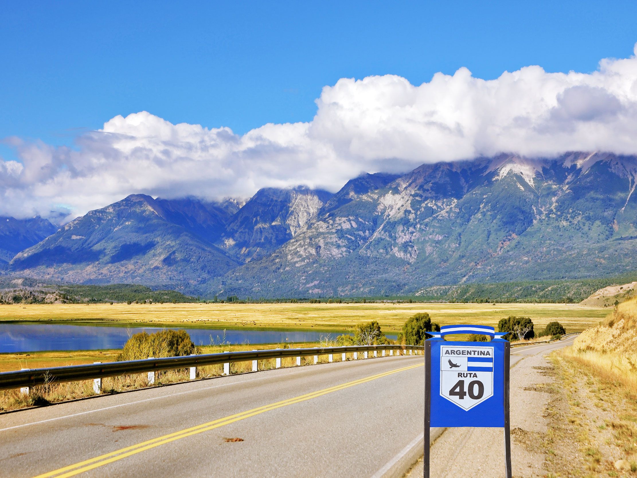
Ruta 40 is Argentina’s longest road, winding 3,227 miles from the town of La Quiaca, on the Bolivian border, to Cabo Virgenes, on the southeastern corner of the country. Che Guevara famously traversed a stretch of this part-paved, part-dirt track, a journey which was portrayed in the 2004 film The Motorcycle Diaries. The route crosses 11 provinces and dozens of national parks. From the Andes mountains and gigantic glaciers to vineyards and wild rivers, Ruta 40 offers an amazing showcase of Argentina’s natural treasures. Popular sights include the Salinas Grandes Salt Flats, Seven Lakes Road, and Perito Moreno Glacier, located within Los Glaciares National Park. At a staggering 16,050 feet in elevation, the Abray del Acay mountain pass is one of the highest in the world.
6. U.S. Route 20
Dating back to 1926, U.S. Route 20 is the longest road in America. Running almost parallel to Interstate 90, the route links Kenmore Square in Boston, Massachusetts, with the Pacific coast town of Newport, Oregon. The highway visits 12 states on its 3,365 mile coast-to-coast journey. Road trips along this epic highway take in several natural wonders, such as the Mississippi and Missouri rivers, Yellowstone National Park, and the wild beaches and sea stacks of Yaquina Bay State Recreational Site. For quirky roadside attractions, don’t miss Carhenge, Nebraska’s curious automobile homage to Stonehenge.
5. Golden Quadrilateral National Highway – India
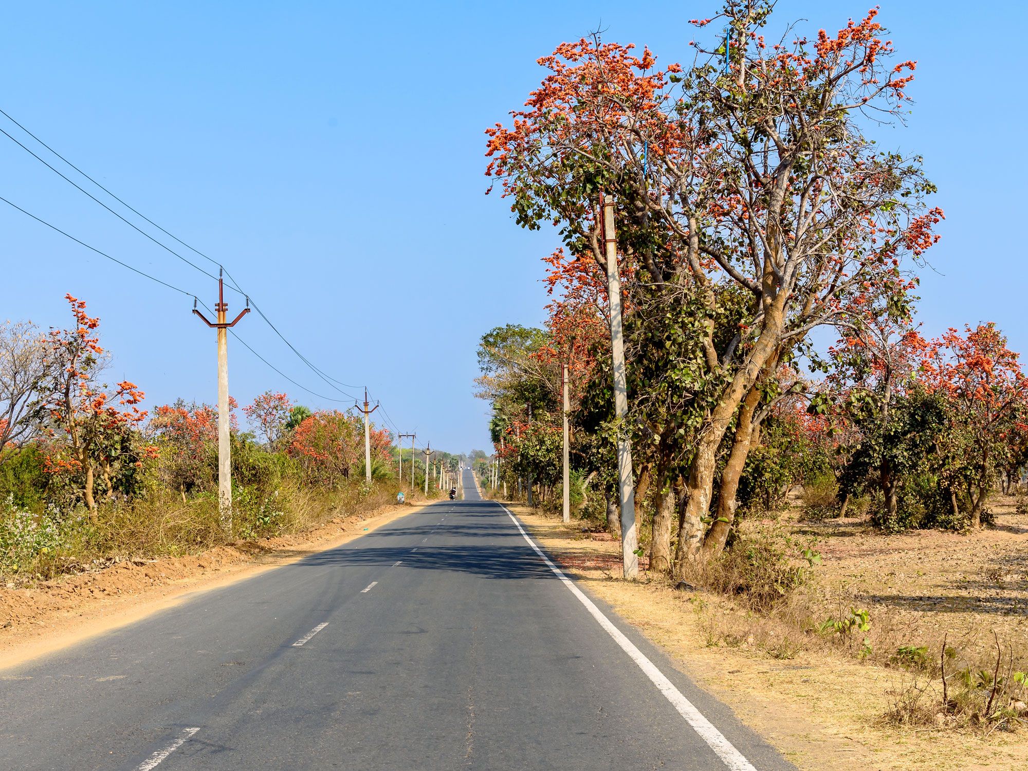
Covering an impressive 3,632 miles, the Golden Quadrilateral National Highway is India’s largest and most ambitious highway project, which created a network of roads that connect the country’s four major metropolitan cities: Delhi, Chennai, Kolkata, and Mumbai. Marking a line on a map between these cities forms a loose quadrilateral, hence the highway’s name. Comprised of four main sections, the entire highway runs through 13 states of India and provides links between the country’s key agricultural, industrial, and cultural centers. Anyone embarking on an adventure along India’s longest road will encounter mystical landmarks such as the Taj Mahal, Udaipur’s Lake Pichola (featured in the James Bond movie Octopussy), and the nation’s spiritual capital, Varanasi.
4. Trans-Canada Highway
Those wanting to travel coast-to-coast across Canada can do so via the 4,860-mile Trans-Canada Highway. It runs through each of Canada’s 10 provinces and crosses five different time zones. The route begins in St. John’s, Newfoundland, and ends in Victoria, British Columbia. Both are island cities, so it’s necessary to take a ferry to and from the mainland. Authorized in 1949, this epic road is marked by white-on-green maple leaf signs throughout. The Trans-Canada Highway connects the country’s major cities and also meanders around some of the nation’s most spectacular parks, including Glacier National Park, Yoho National Park, and Banff National Park.
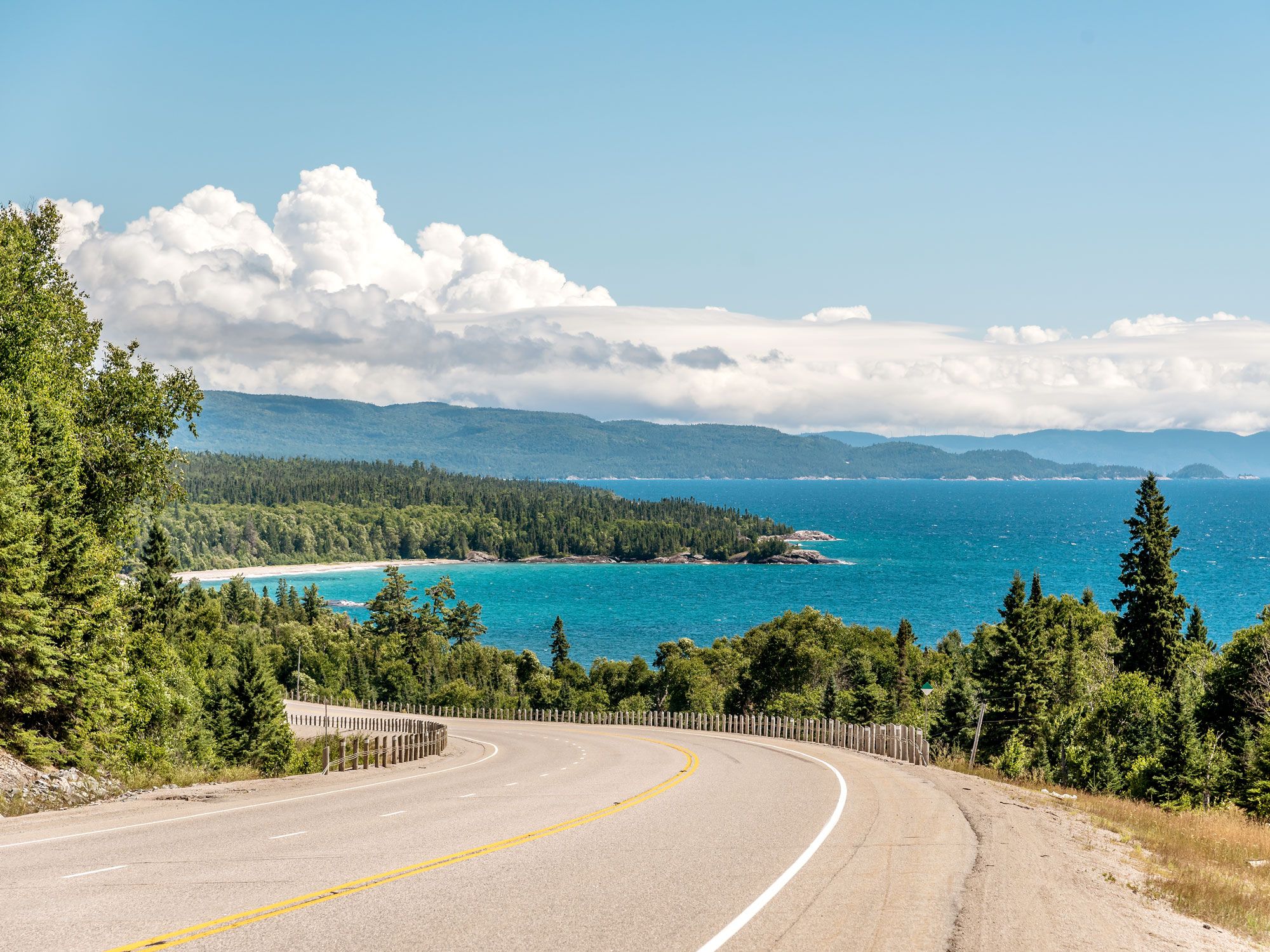
3. Trans-Siberian Highway – Russia

The Trans-Siberian Highway is a network of highways that extends across the width of Russia. Starting in St. Petersburg, on the Baltic Sea, it spans over 6,800 miles to Vladivostok, a port city on the Sea of Japan. The route passes through stunning regions such as the Ural Mountains, the wilderness of Siberia, and Lake Baikal, which is the world’s oldest and deepest lake. It also links a number of historic cities, including Nizhny Novgorod, Kazan, and Chita. Challenges facing road trippers include hundreds-mile-long sections that are far removed from civilization and extreme climatic conditions that range from stifling heat to sub-zero temperatures.
2. Highway 1 – Australia
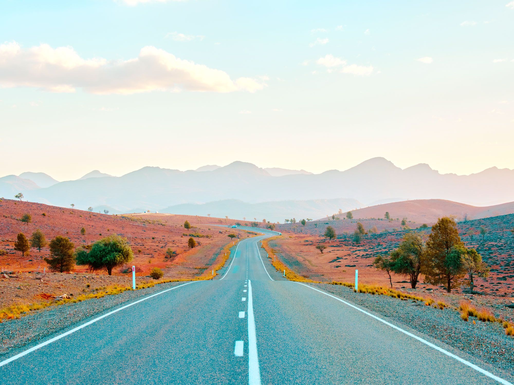
Australia is the world’s sixth-largest country by area, so it’s fitting that one of the world’s longest roads travels around this massive island-continent. Highway 1, nicknamed “the Big Lap,” is a 9,010-mile-long ring road that roughly traces the nation’s coastline in one enormous loop. Established in 1955, the highway connects most major Australian cities, including Sydney, Melbourne, Adelaide, Perth, Darwin, and Brisbane. A notable exception is Canberra, the nation’s inland capital. Highlights of the route include the arid lands of the Nullarbor Plain and the 90 Mile Straight, which is the country’s longest straight road. It also provides access to the popular beach towns along Queensland’s Great Barrier Reef coastline.
1. Pan-American Highway
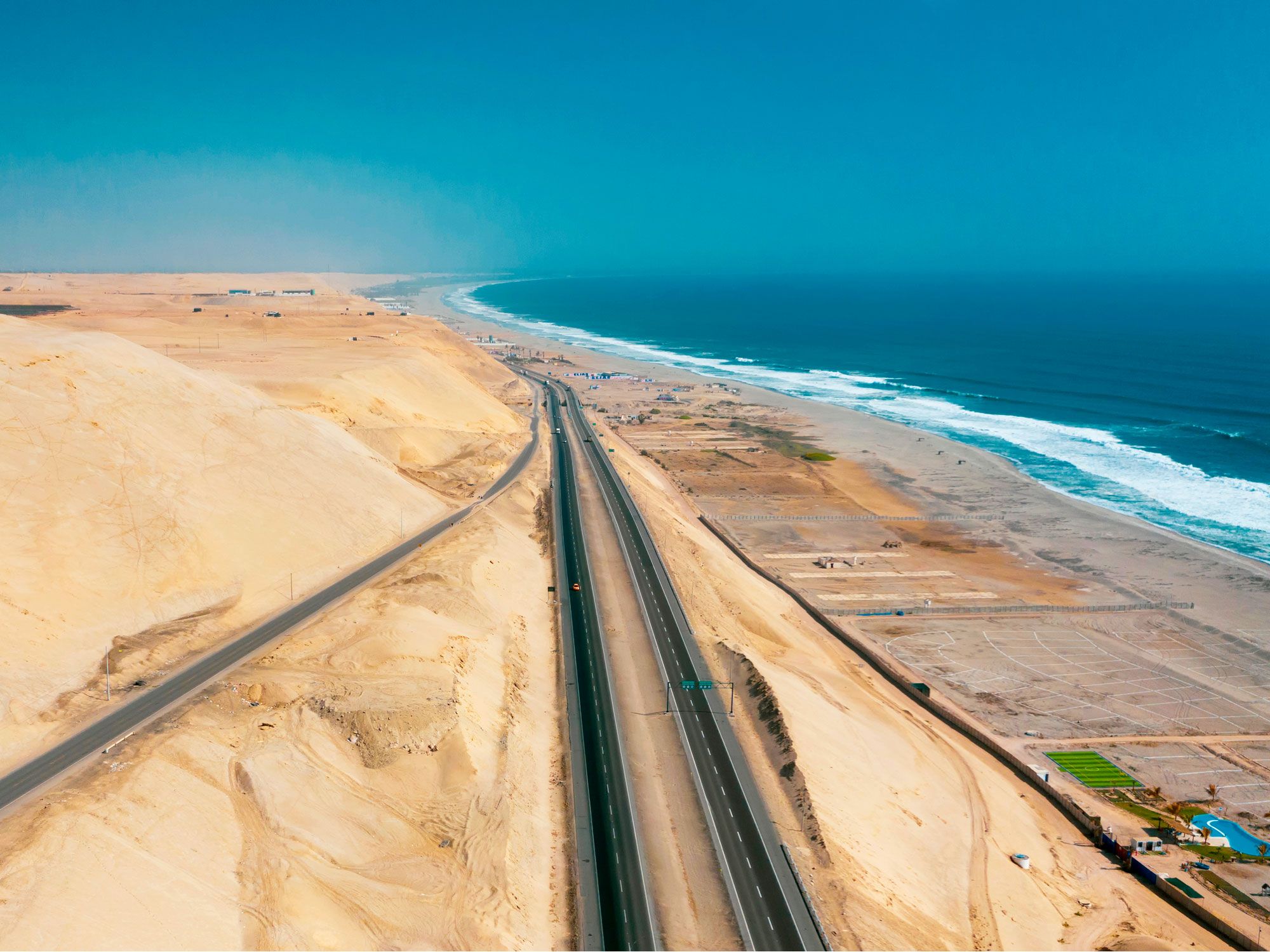
For the road trip to beat all road trips, there’s only one option: the cross-continental journey covering over 19,000 miles through 14 countries on the Pan-American Highway. This network of highways, generally considered the longest in the world, begins in Prudhoe Bay, Alaska, and travels all the way to the tip of South America in Ushuaia, Argentina, nicknamed “the end of the world.” The drive offers the chance to visit diverse and jaw-dropping landscapes, major cities, and dozens of small-town cultural treasures. Pan-American road trippers can discover the glaciers of Alaska and Canada’s Yukon territory, the neon lights of Las Vegas, Peru’s mysterious Nazca Lines, and the mind-blowing beauty of Patagonia. However, unless you have a taste for extreme off-roading adventure, it’s not possible to drive the entire highway: An impassable wilderness called the Darién Gap, between Panama and Colombia, briefly interrupts the route.
More from our network
Daily Passport is part of Inbox Studio, an email-first media company. *Indicates a third-party property.


