


The 10 Smallest U.S. States by Area
The 50 U.S. states span an impressive 3.8 million square miles, which is similar to the entire continent of Europe. But not every state is characterized by enormous swathes of land and water. Some are bite-sized regions that pack in rich histories, vibrant cities, and charming small towns within just a few thousand square miles. So, whether you’re drawn to colonial streets or scenic coastlines, take a look at the 10 smallest states by area.
10. West Virginia
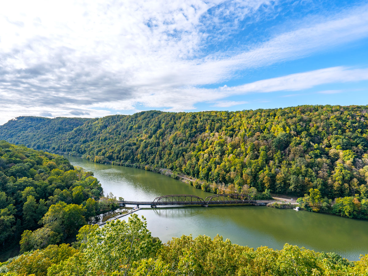
Area: 24,230 square miles
The Mountain State was first inhabited by Paleo-Indians some 12,500 years ago and later by the Cherokee and Delaware peoples, among other Indigenous tribes. From 1607 to 1861, the area was part of the British Virgin Colony, which later became the state of Virginia. In 1863, under President Abraham Lincoln and following the formation of an independent government by the state’s western counties, West Virginia branched off to become the 35th state. Interestingly, it is the only U.S. state created by presidential proclamation.
Today, West Virginia’s rugged natural scenery is a playground for outdoor adventures, from hiking and white water rafting around New River Gorge National Park to skiing on Snowshoe Mountain. A short section of the Appalachian Trail cuts through the Harpers Ferry National Historical Park, the ancestral home of the Shawnee and Tuscarora peoples that bore witness to pivotal battles during the Civil War.
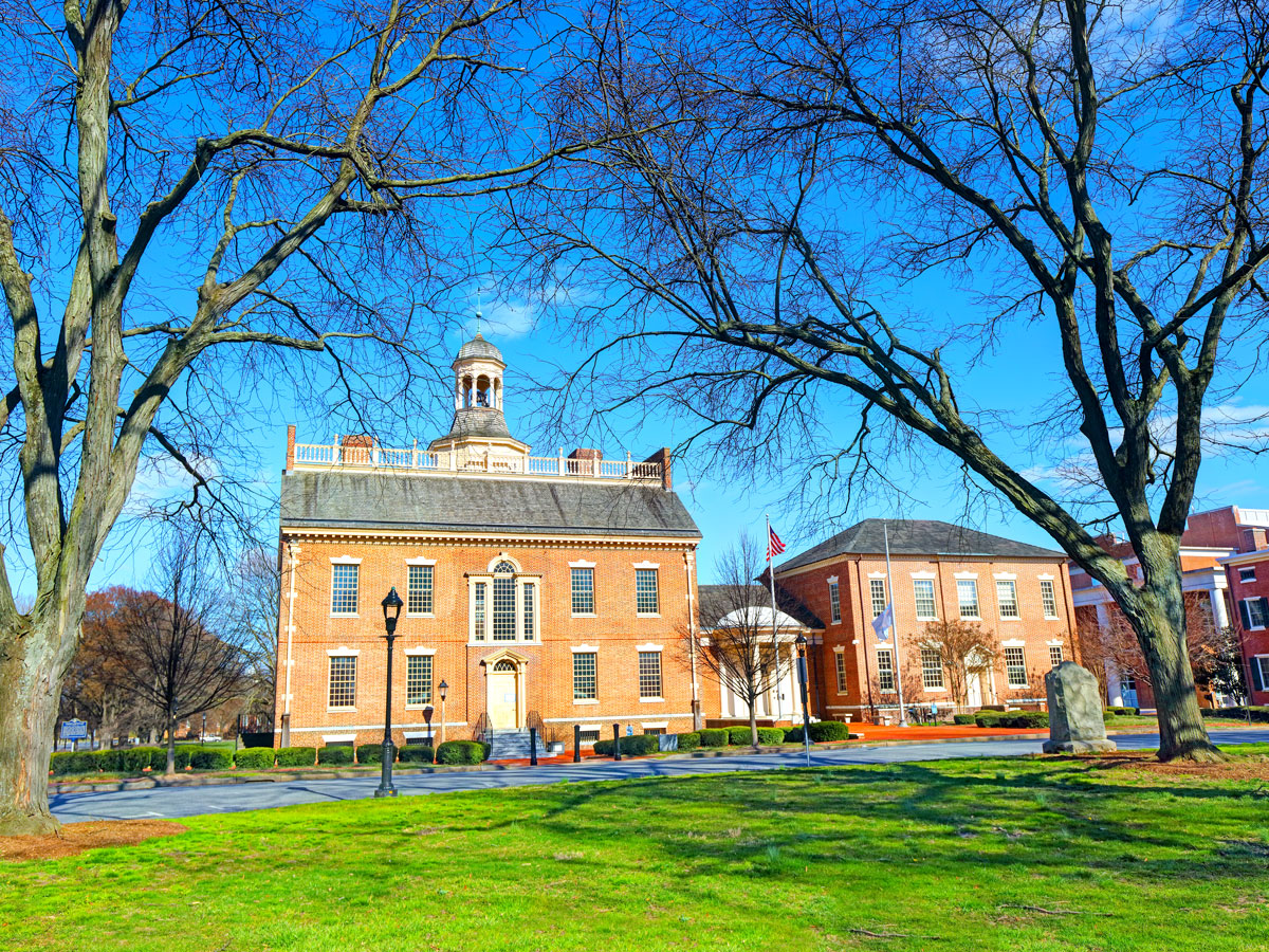
9. Maryland
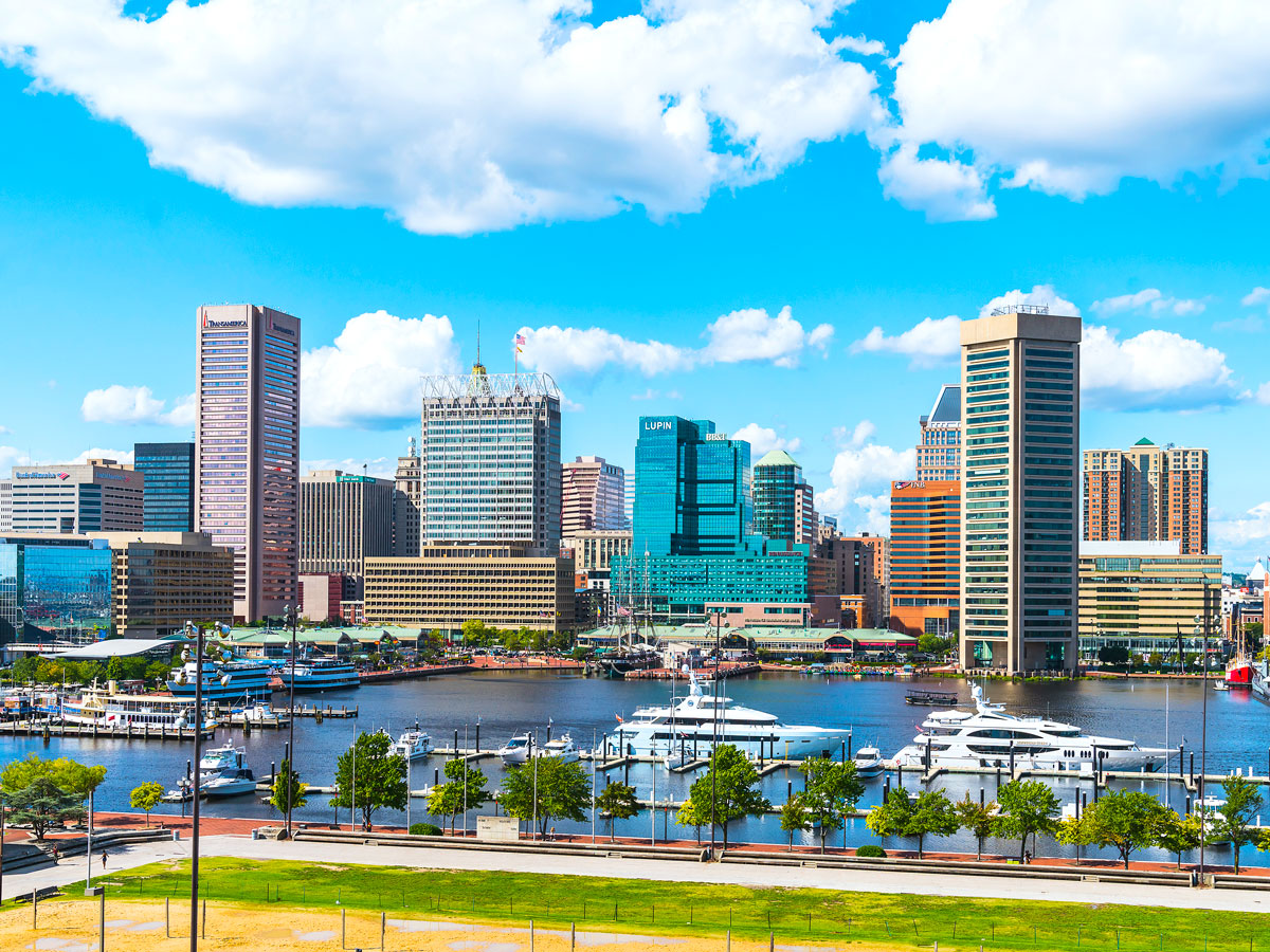
Area: 12,406 square miles
Founded in 1632 as a refuge for English Catholics, the Maryland colony quickly flourished thanks to its tobacco trade and busy ports. One of the original 13 colonies, Maryland is named after Queen Henrietta Maria of England. Historians also have found evidence of of Lenape, Nanticoke, and Powhatan peoples living in the region as far back as 13,000 years ago. In Baltimore, the Maryland Center for History and Culture brings state history to life through art, archaeological discoveries, and hands-on exhibits.
One of Maryland’s biggest draws is Chesapeake Bay, the northern portion of which is found within the state. It lures culture buffs and nature lovers with its mix of historical sites, waterfront towns, and wildlife reserves. Be sure to visit Harriet Tubman Underground Railroad National Historical Park to walk the terrain the famed abolitionist traversed while leading nearly 70 people to freedom in the 1800s. Elsewhere in Maryland, visitors can discover the sandy beaches, salt marshes, and wild ponies of Assateague Island.
8. Hawaii
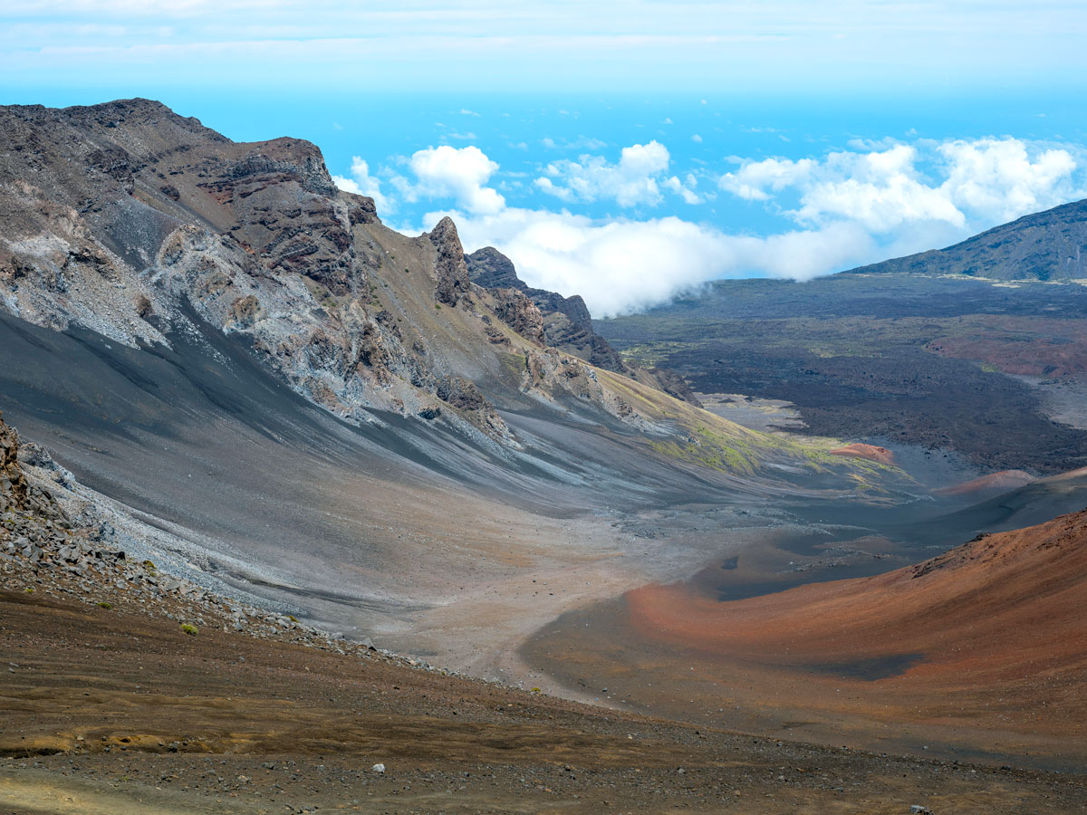
Area: 10,932 square miles
Around 1,500 years ago, Polynesian voyagers arrived on the islands of Hawaii, after paddling across the Pacific Ocean in double-hulled canoes and using the stars for navigation. In 1795, warrior chief Kamehameha, who later became the islands’ first king, established the Kingdom of Hawaii. By 1810, all of the islands had been unified. Hawaii continued as an independent kingdom until 1898, when it was annexed by the United States, and later admitted to the Union in 1959.
This remote Pacific chain is made up of eight main islands, six of which are open to visitors. Almost three-quarters of Hawaiian residents live on Oahu, where the bustling metropolis of Honolulu sits alongside the surf meccas of Waikiki and the North Shore. Spectacular natural wonders dot the archipelago’s landscape, including Hawaiʻi Volcanoes National Park and Haleakalā National Park. Notably, Hawaii is home to the tallest waterfalls in the U.S. and the world’s highest sea cliffs.
7. Massachusetts
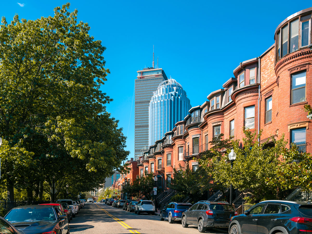
Area: 10,554 square miles
Officially declared a state in 1788, Massachusetts has witnessed many significant milestones in U.S. history, starting with the Mayflower ship landing at Provincetown on Cape Cod in 1620. Soon after, the Pilgrims established the Plymouth Colony, one of the earliest European settlements in North America. Around 150 years later, the Boston Tea Party was a catalyst for the American Revolution. And long before all of this, the state was home to the Mohegan, Mohican, and Wampanoag peoples.
From the Berkshire Mountains to the lighthouse-dotted Atlantic coastline, Massachusetts has a diverse geographical landscape. Martha’s Vineyard is a celebrity-favorite historic vacation spot known for its quaint harbor towns, while Nantucket welcomes tourists with its dune-backed beaches. In Boston, don’t miss the Freedom Trail, a 2.5-mile route incorporating 16 sites related to the American Revolution. And every March, the state capital hosts one of the most famous St. Patrick’s Day events outside of Ireland.
6. Vermont
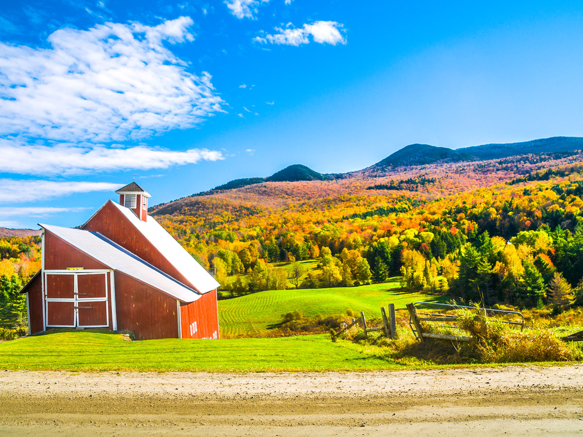
Area: 9,616 square miles
Like many states, Indigenous peoples were the first to inhabit Vermont, which was home to the Abenaki tribe, among others. When French explorer Samuel de Champlain arrived in 1609, he named the region “Les Monts Verts” after the Green Mountains. This inspired both the state’s official name and nickname, the Green Mountain State. Interestingly, Vermont briefly declared itself an independent republic in 1777 before ultimately joining the Union in 1791.
Today, Vermont is home to 55 state parks and a 150-mile stretch of the Appalachian Trail, part of which is shared with the Long Trail, running for 272 miles across the Green Mountains. In Stowe, small-town charm blends with first-rate skiing at Stowe Mountain Resort, while Burlington boasts a lively arts scene on the banks of Lake Champlain.
5. New Hampshire
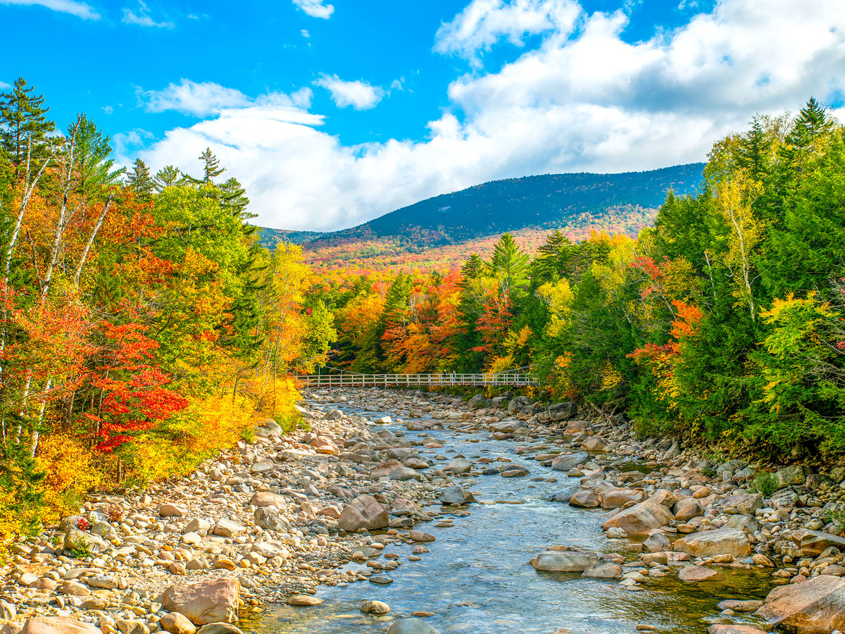
Area: 9,349 square miles
Vermont’s eastern neighbor is also the ancestral home of the Abenaki peoples, as well as the Pennacock peoples. Founded as the New Hampshire colony in 1623, it was the first colony to declare independence from England and was granted statehood in 1788. Today, New Hampshire is among the country’s best places to experience fall foliage — particularly the Kancamagus Scenic Byway winding through White Mountain National Forest.
Some of the highest annual snowfall in the country also makes New Hampshire a snowsports hot spot. Powder hounds can carve up on around 30 ski resorts, including the popular Breton Woods Ski Area. Those looking for a dose of culture will find well-preserved Georgian architecture in Portsmouth and historic mills around Dover. And beachgoers make the most of the shortest state shoreline, at just 18 miles.
4. New Jersey
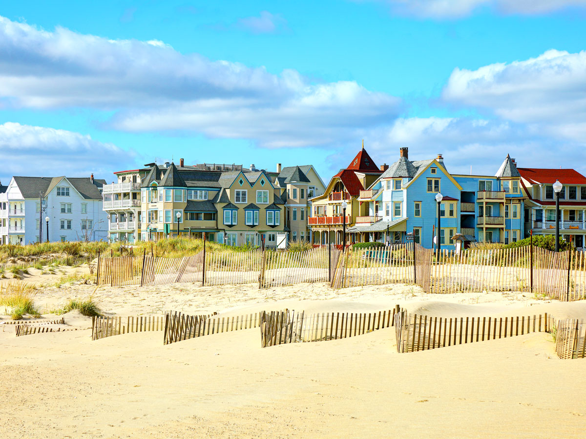
Area: 8,723 square miles
The earliest inhabitants of New Jersey were the Lenni Lenape peoples roughly 10,000 years ago. In the 1600s, the Dutch established the New Netherland colony, followed by a short-lived Swedish settlement. The English took control of the region in 1644, naming it after the isle of Jersey in the Channel Islands.
Sweeping beaches and American Revolutionary War history draw many visitors to the Garden State. Popular destinations include the entertainment-packed boardwalks of the Jersey Shore and Washington Crossing Historic Park, where George Washington’s troops crossed the Delaware River. New Jersey is also the “Diner Capital of the World,” with an estimated 450 diners spread around the state.
3. Connecticut
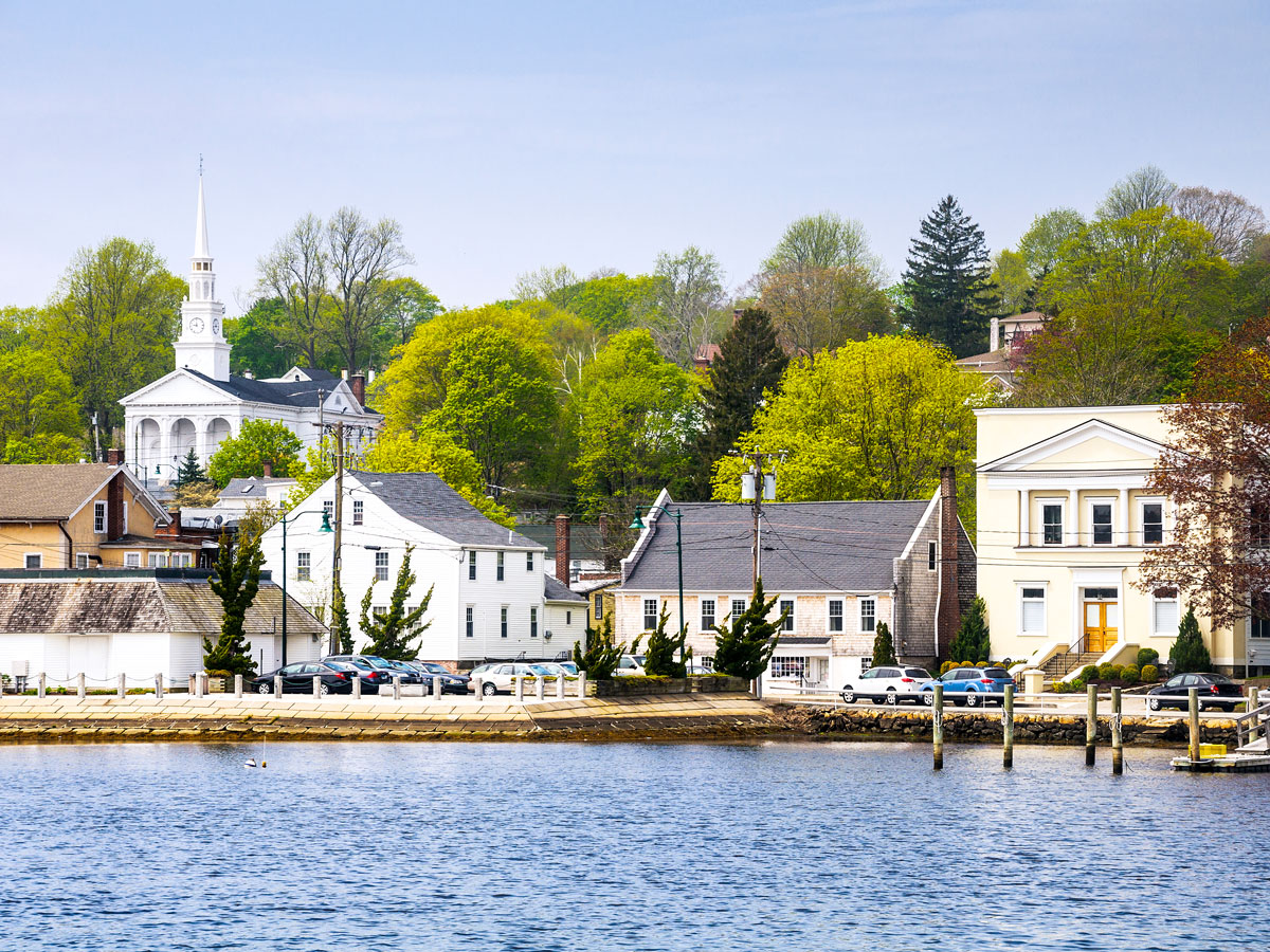
Area: 5,543 square miles
One of the six New England states, Connecticut stretches inland from the shores of Long Island Sound. Just 70 miles long and 110 miles wide, it’s one of the country’s most densely populated states, with around 760 people per square mile. Connecticut’s name means “land on the long tidal river” in the Algonquian language. Before the arrival of Dutch and English settlers, the Algonquian people were the main inhabitants of the region.
Despite its compact size, Connecticut packs in a variety of different landscapes, from the pastoral farmlands of Kent Falls State Park to the prehistoric lands of Dinosaur State Park and the vineyards of Litchfield County. Picture-perfect small towns steeped in maritime history sit along the state’s shoreline. See: Mystic, the epitome of New England charm and home to a working seaport, wharfside shops, and the Mystic Seaport Museum.
2. Delaware
Area: 2,489 square miles
The First State gets its nickname because it was the first of the 13 colonies to ratify the U.S. Constitution in 1787. Before that, the Lenni Lenape and Nanticoke peoples lived there for thousands of years prior to European colonization. The state’s small size means that, today, it’s split into only three counties: New Castle, Kent, and Sussex. This is the fewest number of counties of any state — a far cry from the 254 counties of Texas, the state with the highest number.
Life along Delaware’s Atlantic coast is centered on towns such as Bethaney Beach and Rehoboth Beach, featuring quintessential boardwalk entertainment and seafood restaurants serving blue crab and clams. Inland, Brandywine Creek State Park offers lush meadows and old-growth forests alongside tubing and kayaking adventures.
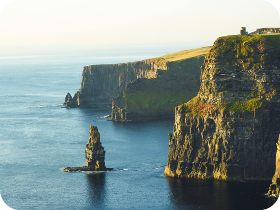
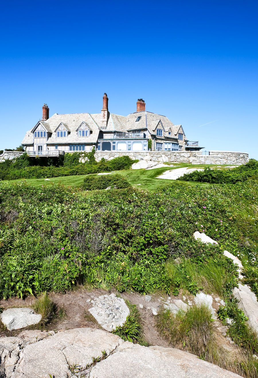
1. Rhode Island
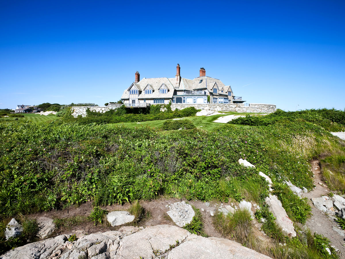
Area: 1,545 square miles
Measuring just 48 miles long and 37 miles wide, Rhode Island is the smallest U.S. state by area. With around 1,075 people per square mile, it’s also the third-most densely populated state. Some of the state’s earliest settlers were the Niantic, Narragansett, and Wampanoag peoples. In the 1600s, English minister Roger Williams established a colony after being expelled from Massachusetts for his views of religious freedom and separation of church and state.
Despite its small size, Rhode Island boasts a 400-mile coastline, which earned it the nickname the “Ocean State.” It meanders along Black Island Sound before cutting into Narragansett Bay and creating a series of dramatic bays, coves, and cliffs, from the surf break at Narragansett Beach to the calmer waters of Misquamicut State Beach. No visit is complete without a stop in Newport, famed for its maritime heritage, Gilded Age mansions, and prestigious regattas.
More from our network
Daily Passport is part of Inbox Studio, an email-first media company. *Indicates a third-party property.