


These Are America’s 7 Largest Islands
As the third-largest country in the world by area, the United States is blessed with a dazzling array of geological features — including over 18,000 islands. These bodies of land can be found in the waters of the Arctic, Atlantic, and Pacific oceans, as well as sprinkled throughout thousands of lakes and rivers. They range from small, tropical keys to vast mountain and volcano-clad landforms. Below, discover the natural wonders and cultural heritage of the seven largest islands in the United States by area.
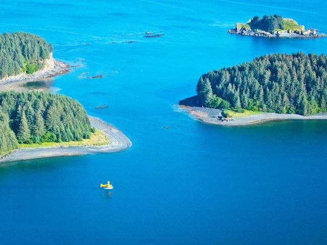
7. Admiralty Island – Alaska (1,664 Square Miles)
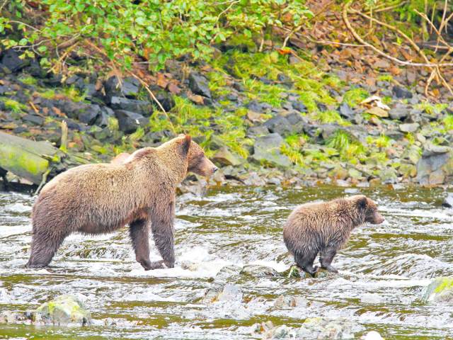
Admiralty Island is one of the ABC Islands in southern Alaska’s Alexander Archipelago. The island is home to the Tlingit peoples, who call it Kootznoowoo (Fortress of the Bears) in reference to the estimated 1,600 brown bears that inhabit the island — the highest concentration found anywhere in the world. But that’s not the island’s only fauna. Some 5,000 eagles — in addition to harbor seals, humpback whales, and porpoises — also call Admiralty Island home.
Landscapes across the island range from rainforest, tundra, and ice-field-covered mountains to bays, canals, lakes, and rivers. Over 90% of the island is protected under the Kootznoowoo Wilderness, itself part of Tongass National Forest. A great way to appreciate the incredible biodiversity of Admiralty Island is via the 32-mile Cross Admiralty Canoe Route.
6. St. Lawrence Island – Alaska (1,792 Square Miles)
Situated in the frigid waters of the Bering Sea, St. Lawrence Island is actually closer to Russia than it is to the state of Alaska. Stretching 90 miles in length and up to 22 miles wide, its untouched landscape is characterized by rugged coastlines and tundra. The island is home to a community of around 1,400 Yup’ik peoples, whose traditions thrive in the villages of Gambell and Savoonga. Most visitors come to enjoy the excellent birding opportunities, with some 2.7 million seabirds arriving on St. Lawrence Island during the nesting season. Among the many species are auklets, bluethroats, loons, and puffins.
5. Chichagof Island – Alaska (2,080 Square Miles)
Located adjacent to Alaska’s Admiralty Island, the entirety of Chichagof Island (also known as Shee Kaax) falls within the boundaries of the Tongass National Forest. Chichagof is covered in temperate rainforests and tall, mist-clad mountains, providing a natural habitat for a significant population of brown bears. Other wildlife commonly found here include bald eagles and humpback whales.
There are four villages on the island, which are home to communities of Tlingit peoples. The largest, Hoonah, is a popular jumping-off point for ATV, fishing, kayaking, wildlife, and wilderness tours. A museum and restored cannery at Icy Strait Point also offer fascinating insights into life on this remote island.
4. Prince of Wales Island – Alaska (2,230 Square Miles)
Also part of the Alexander Archipelago and Tongass National Forest is Prince of Wales Island. Stretching around 140 miles long and 65 miles wide, the island is larger than the entire state of Delaware. Around 6,000 people live here in a collection of 12 small communities.
For visitors, Prince of Wales is a paradise for outdoor adventures, including exploring the 990-mile-long coastline and a series of lakes by kayak or canoe. There are also numerous beaches, forest trails, and three totem pole parks, including Klawock Totem Park. Another highlight is the chance to delve deep into some of the island’s 850 caves and grottos — El Capitan Cave, the most popular, is accessible via guided tours during summer.
3. Puerto Rico – 3,425 Square Miles
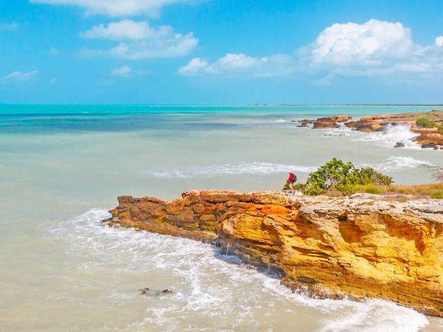
Puerto Rico, nicknamed the Island of Enchantment for reasons that become clear the moment you arrive, is an unincorporated territory of the United States in the Caribbean Sea. Larger than Rhode Island, Puerto Rico is home to dramatic mountain ranges rising above colorful cities fronted by pristine, palm-lined beaches.
San Juan, the island’s capital, is a UNESCO World Heritage site, known as a melting pot of history and cultures, including African, Spanish, and Taino influences. Brightly painted colonial houses and the La Fortaleza fortress are highlights of the vibrant Old San Juan neighborhood. Inland, El Yunque National Forest beckons with camping and hiking amid lush rainforests, crystalline mountain rivers, and waterfalls. For watersports enthusiasts, there’s great surfing along the northwest coast, scuba diving at Isla Mona, and snorkeling in calm turquoise waters throughout the island.
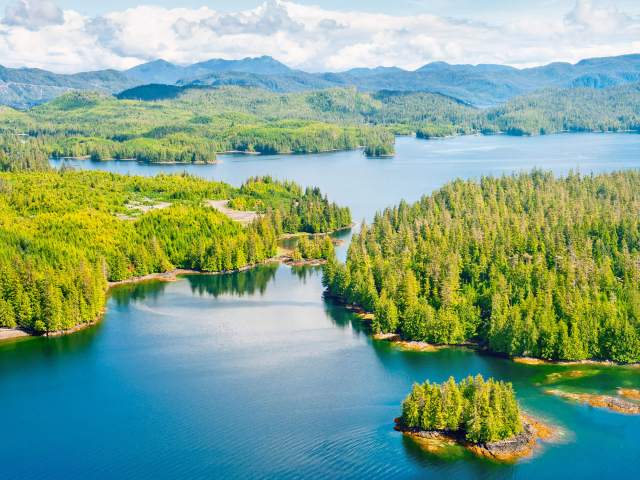
2. Kodiak Island – Alaska (3,588 Square Miles)
Sitting off Alaska’s Katmai Coast, Kodiak Island is the second-largest island in the United States. A year-round population of approximately 13,000 residents live here in six remote villages. The biggest of these, Kodiak, showcases the proud history and heritage of the island at the Alutiiq Museum and Kodiak History Museum.
Spanning 1.9 million acres, the Kodiak National Wildlife Refuge occupies two-thirds of the island, in addition to part of Afognak Island and all of Ban and Uganik islands. It’s characterized by rocky shorelines, glacial valleys, dramatic fjords, and soaring mountain peaks. As its name suggests, Kodiak Island is also the home of the Kodiak bear, which is the largest bear species on the planet. Popular tourism activities on the island include bear-spotting tours, fishing charters, scenic drives, and hiking.
1. Big Island – Hawaii (4,029 Square Miles)
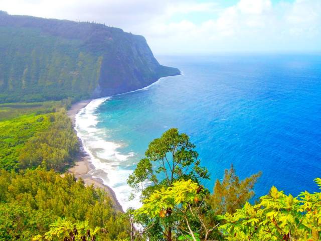
The island of Hawaii is almost twice the size of all of the other major Hawaiian islands combined — hence its “Big Island” nickname. The island’s size allows for incredible biodiversity and the presence of 10 of the world’s 14 climatic zones. In just a single day, it’s possible to travel between temperate coffee plantations and volcanic craters, alpine and tropical landscapes, and black and white sand beaches.
Towering above the Big Island is Mauna Kea, the highest point of Hawaii and a popular location for stargazing. Another focal point is Hawai’i Volcanoes National Park, home to two of the planet’s most active volcanoes (Kilauea and Mauna Loa). Along the coastline, Hawaii’s legendary surf culture can be experienced at spots like Honoliʻi Beach Park and Kahaluʻu Beach. Hilo, the island’s biggest city, showcases a vibrant blend of art galleries, shops and restaurants, serene gardens, and stunning state parks.
More from our network
Daily Passport is part of Inbox Studio, an email-first media company. *Indicates a third-party property.