8 Geographical Extremes To Add to Your Travel List
8 Geographical Extremes To Add to Your Travel List

If you’ve already been to the major countries on seemingly everyone’s travel list — places like France, England, Japan, and Italy — it might be time to get creative. How about the smallest country in the world, for instance, or maybe the largest lake? Here are eight unexpected geographic superlatives to add to your travel bucket list.
Largest Lake – Caspian Sea
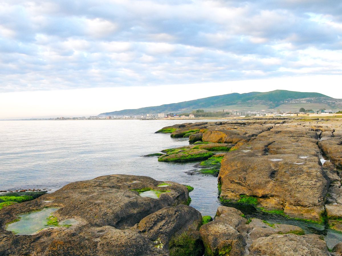
So big that it’s often considered a sea, the Caspian Sea is nevertheless the world’s largest inland body of water — and it isn’t even close. At 149,200 square miles, it dwarfs its closest competitor, Lake Superior, which spans 31,700 square miles between the United States and Canada. The Caspian Sea, meanwhile, spreads across parts of Turkmenistan, Kazakhstan, Russia, Azerbaijan, and Iran. Due to both its size and salinity (it’s about one-third as salty as most seawater), ancient peoples thought it was an ocean, hence its name. There are many appealing resort towns and sandy beaches to visit along the lake, many of which are located near Baku, the capital of Azerbaijan and the lowest capital city in the world.
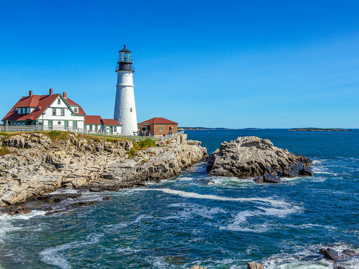
Closest State to Africa – Maine
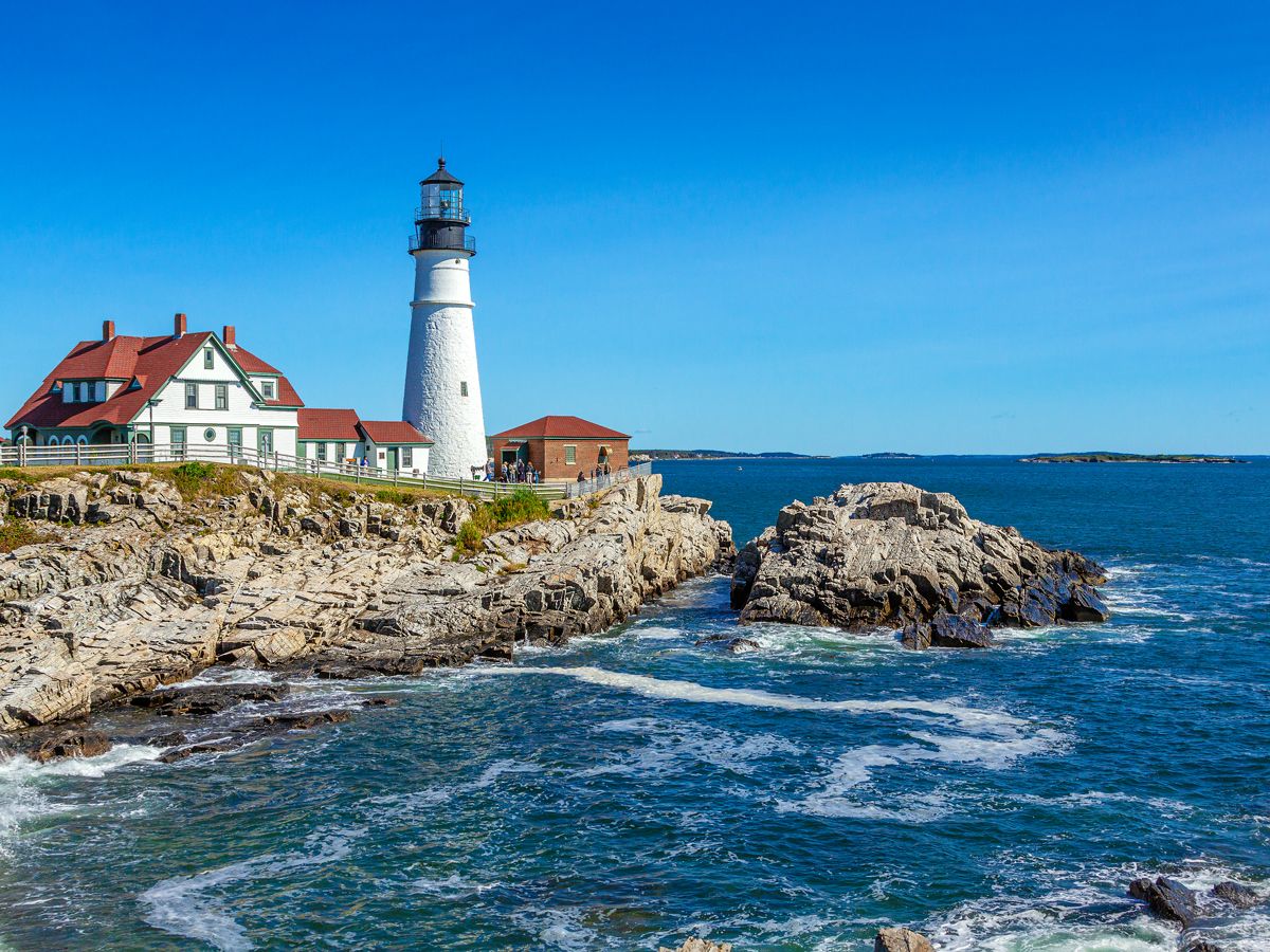
You might have already visited the charming towns and scenic coastline of Maine, but did you know the Pine Tree State holds a notable geographic distinction? Though it might seem counterintuitive when you first glance at a map, Maine is closer to Africa than any other U.S. state. It beats even Florida by more than 900 miles. The two closest points between Maine and Africa are a lighthouse on the Quoddy Head peninsula and El Beddouza, Morocco. However, given that they’re separated by a distance of 3,154 miles, Maine and Africa aren’t exactly close in absolute terms.
Easternmost and Westernmost State – Alaska
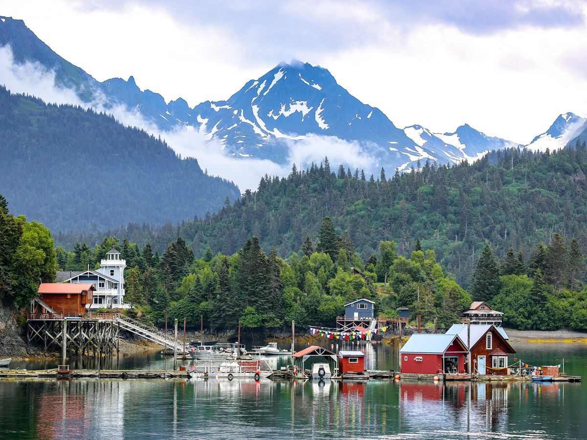
You would think, given its position at the edge of the country, that Maine is also the easternmost state. You’d be mistaken, alas, as Alaska is actually the easternmost and westernmost state due to the fact that the Aleutian Islands cross the 180th meridian — also known as the international date line. Going solely off the contiguous United States, Washington is the westernmost state and Maine (specifically aforementioned Quoddy Head) is indeed the easternmost.
Greatest Vertical Drop – Mount Thor
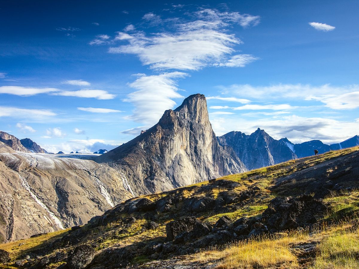
Mount Everest may be the tallest mountain on Earth, but it isn’t home to the planet’s greatest vertical drop. Canada’s Mount Thor is “only” 5,495 feet tall compared to Everest’s 29,032 feet, but if you tossed a rock from its cliff face in Auyuittuq National Park, it would keep falling for 4,100 feet. It’s the largest vertical drop on the planet, and one that takes about 26 seconds from top to bottom. Mount Thor isn’t the only mountain to best Everest in a key category, either. Hawaii’s Mauna Kea is actually taller, but because more than half of its 33,500 feet are underwater, it reaches a much lower point (13,802 feet) above sea level.
Smallest Country – Vatican City

At just 0.17 square miles, Vatican City is the world’s smallest country — even tiny Monaco, another European city-state that ranks second on the list, is more than four times larger at 0.8 square miles. An enclave located entirely within Rome, Catholicism’s holiest site has been independent from Italy since 1929. It’s also the smallest country by population, with just 800 or so residents. Vatican City does receive millions of visitors every year, though, many of whom come to see some of the world’s most famous artworks, such as Michelangelo’s ceiling fresco in the Sistine Chapel.
World’s Largest Island Within an Island Within a Lake – Vulcan Point
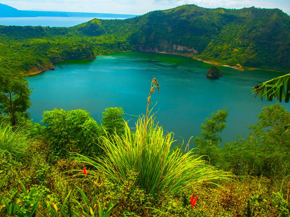
Try saying that five times fast. Vulcan Point is an island on Main Crater Lake, which itself is located on Volcano Island, which is located on Lake Taal, which is located on Luzon Island, which is part of the Philippines. That nesting doll of geography is hard to conceive of until you see satellite images that make it clear, but the images don’t give a sense of how active Taal Volcano is. It has erupted many, many times throughout its history, including on four occasions between 2020 and 2022.
Largest Island – Greenland
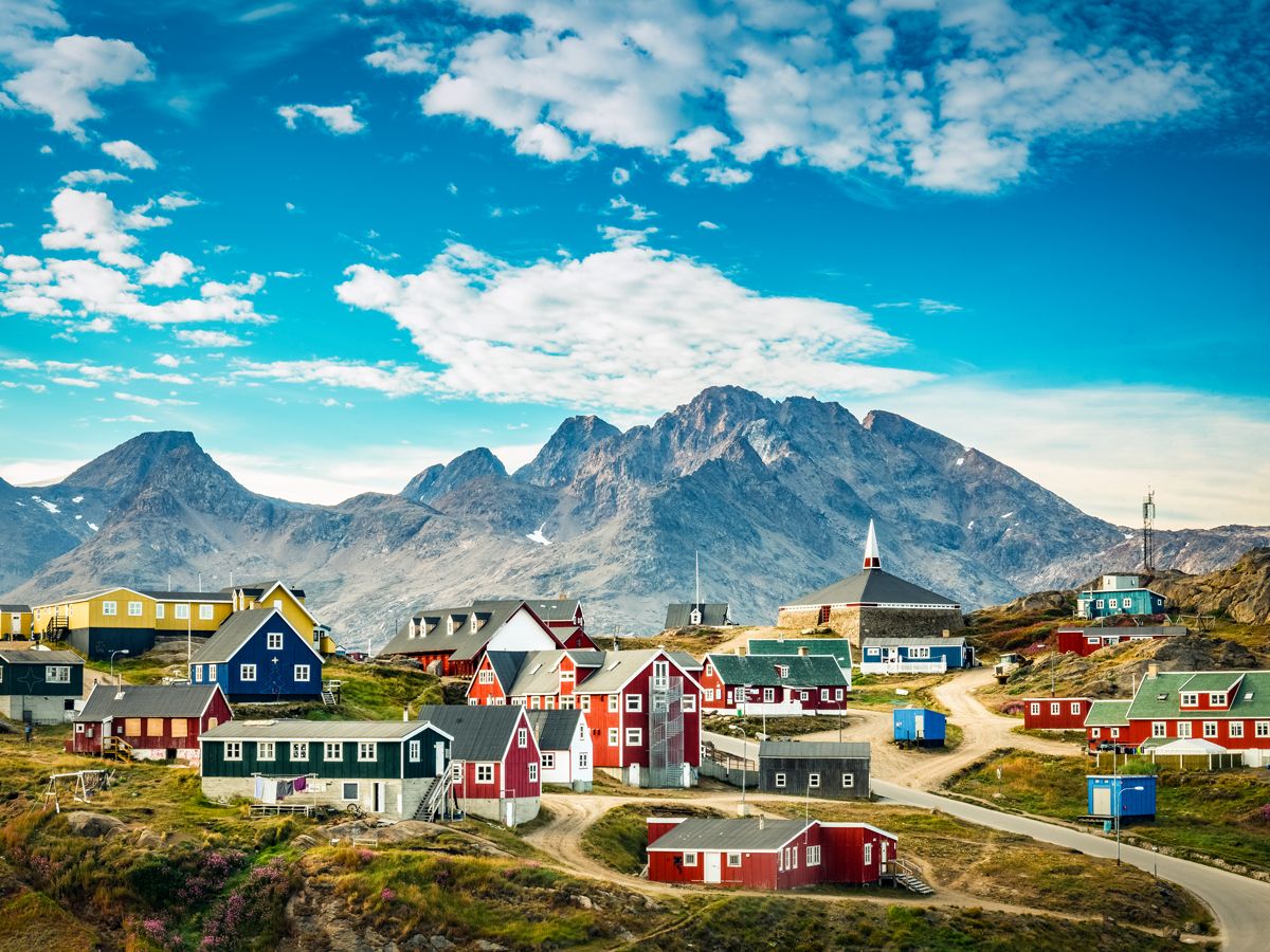
Greenland isn’t as big as it appears on most maps, which use projections that distort the size of certain landmasses, but it’s still the world’s largest island that isn’t a continent — by a considerable margin. Greenland measures more than 836,000 square miles, making it bigger than the United Kingdom, France, Germany, Italy, the Netherlands, Austria, Belgium, Denmark, Poland, Ireland, and Portugal combined. For all that, the island — an autonomous country within the Kingdom of Denmark — is home to just 56,000 people. But with its stunning glaciers and fjords, tourism to Greenland continues to grow.
Lowest Point in the Western Hemisphere – Death Valley
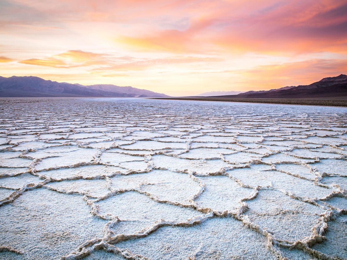
Should you ever find yourself in Death Valley’s Badwater Basin, you’ll have made your way to the lowest point in the Western Hemisphere, which sits at 282 feet below sea level. (The lowest point on the planet is the Dead Sea in the Middle East.) Formerly home to Lake Manly, which evaporated tens of thousands of years ago, the salt flats of Badwater Basin cover close to 200 square miles and make for one of the most striking landscapes you’ll ever see. Consider visiting in the winter, as the highest temperature ever recorded was also in Death Valley: 134 degrees Fahrenheit, which took place on July 10, 1913 (and hopefully won’t be topped anytime soon).
More from our network
Daily Passport is part of Inbox Studio, an email-first media company. *Indicates a third-party property.