“The City Under One Roof” and 4 Other Places With Unique Living Arrangements
By
Julia Hammond
Read time: 4 minutes
July 20, 2023
Updated: June 5, 2024
“The City Under One Roof” and 4 Other Places With Unique Living Arrangements
Culture •July 20, 2023•Updated: June 5, 2024
By Julia Hammond
Author
Julia Hammond
Julia is a U.K.-based travel writer whose work has been featured in The Independent, The Telegraph, The New Zealand Herald, and Culture Trip, among others. She’s an enthusiastic advocate for independent travel and a passionate geographer who has had the privilege of traveling to more than 130 countries in search of a story.
Some of the world’s communities buck the usual trends and opt for highly unconventional living arrangements. The reasons for this — and the ways people adapt to their environments — make them fascinating places to learn about and to visit. From a town of 6,000 people with just one street to a community that fills up an entire island, these are the stories behind five such towns and communities with unique living arrangements.
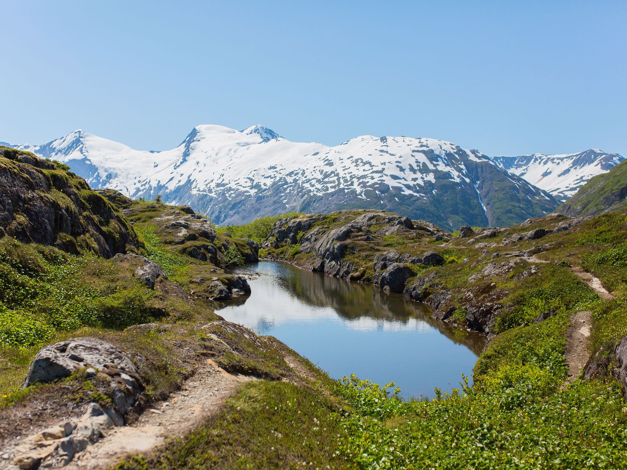
Whittier, Alaska, started out as an army base during World War II, when the U.S. military sought an ice-free Alaskan port in a secluded location. They found the ideal spot at the head of Passage Canal, a deep fjord that forms part of Prince William Sound, surrounded by mountains often shrouded in clouds. However, the army personnel needed somewhere to live, so in 1953 they constructed the 273,660-square-foot Buckner Building — and thus Whittier was dubbed “the city under one roof.”
When the army left town in 1960, the building sat empty and became derelict. The population of Whittier shrunk dramatically, and today it numbers fewer than 300 people. All but a handful of them live under a different roof: the 14-story Begich Towers, an army-built property turned condominium. As well as housing, the building features a medical clinic, police station, grocery store, post office, laundromat, council offices, and an indoor playground for Whittier’s school, which is connected to the main building via a tunnel.
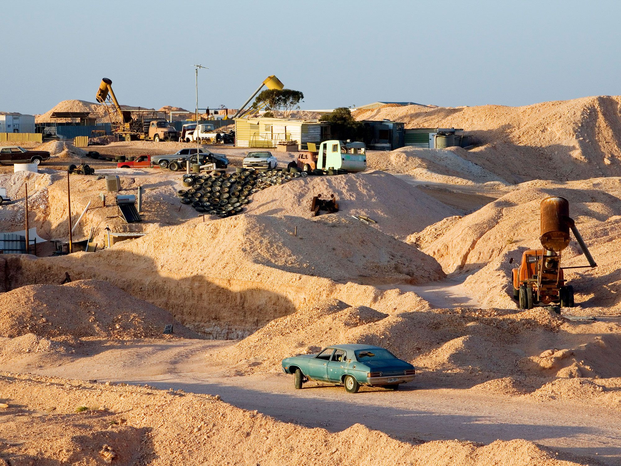
The South Australian mining town of Coober Pedy is located around 525 miles north of Adelaide. The town has a population of 1,566 people, and according to the latest census data, there are 142.4 males for every 100 females. Many residents come to mine opals, which are still found in rich seams below ground.
Unfortunately, the climate here is harsh and unforgiving — particularly in summer when average maximum temperatures can soar well above 90 degrees Fahrenheit. To cope, many of the population have moved into homes hewn from the hillside, excavating the rock to createsubterranean dwellings they call dugouts. They maintain a more comfortable temperature year-round, meaning there’s no need for expensive air conditioning. Another upside is that the ground is relatively stable, allowing for reasonably sized rooms.
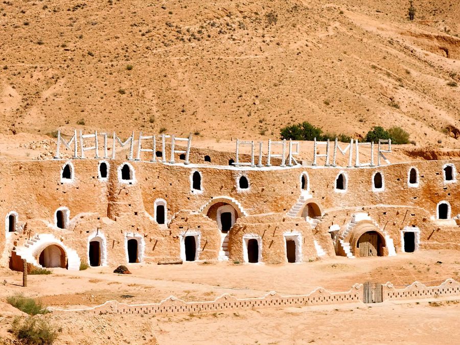
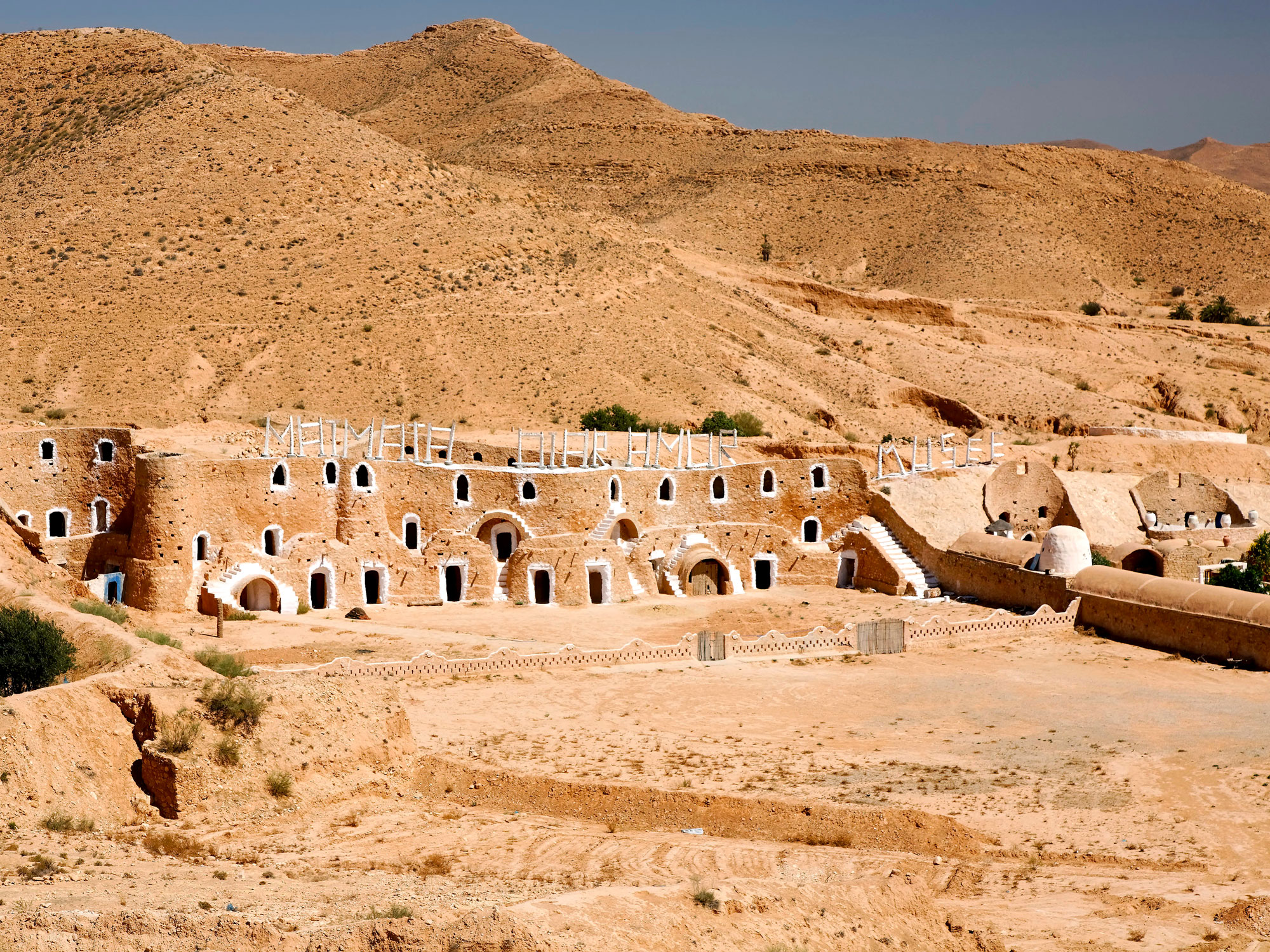
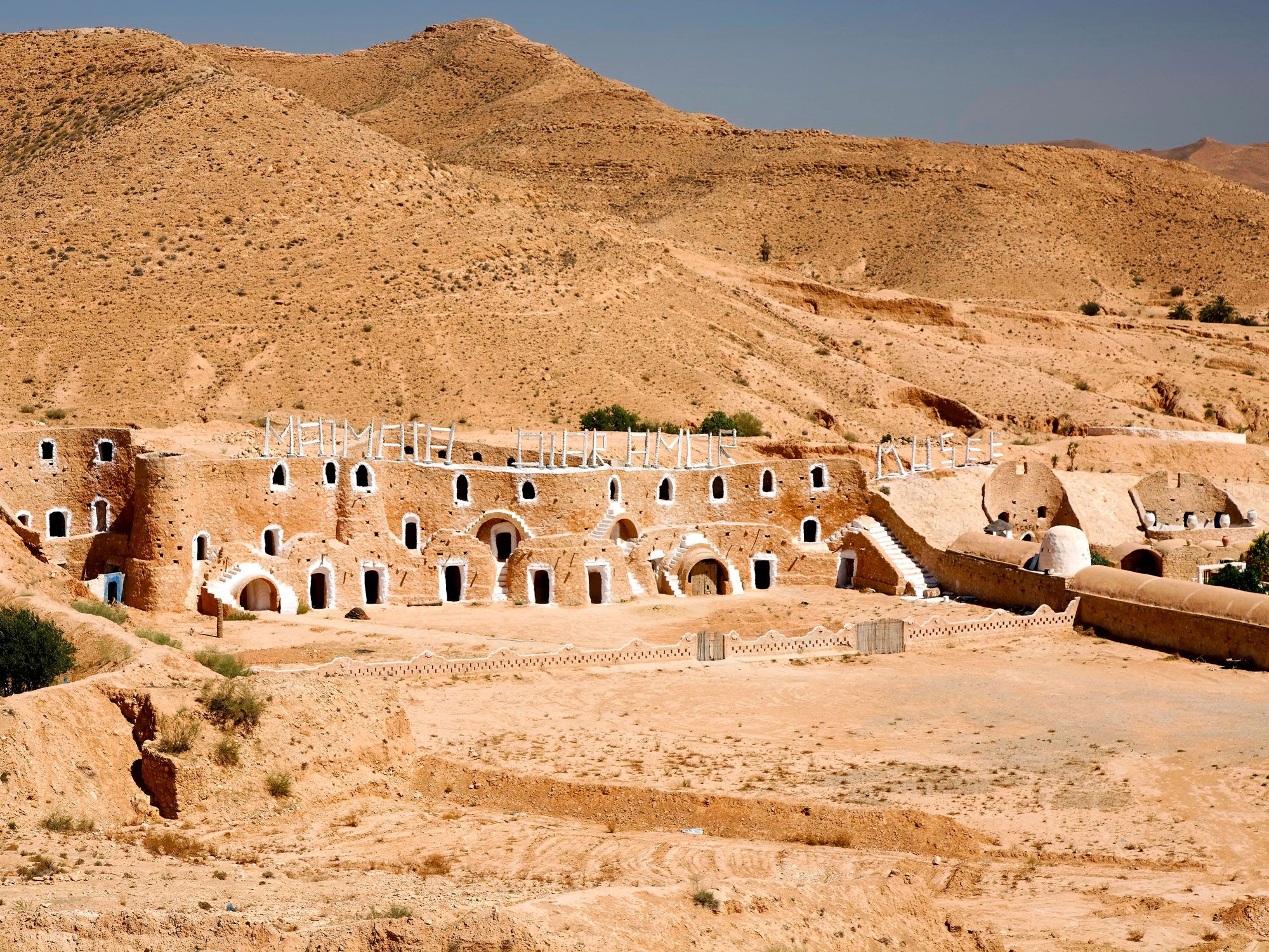
If you’ve heard of the Tunisian town of Matmata, a Berber village in the south of Tunisia, that’s most likely because of its role as a filming location in the Star Wars franchise. Although movie-themed tours have since become commonplace, the town’s star attraction are its unique living arrangements.
Some local residents of Matmata have chosen to live as troglodytes, which in this case means cave dwellers. They excavate a deep pit in the region’s soft sandstone and then dig caves into the sides, with rooms that overlook a hollow, central courtyard. Nevertheless, film fans will want to stay at the Sidi Driss Hotel, which featured in Star Wars Episode IV: A New Hope, as the home of Luke Skywalker and the Lars home on the planet Tatooine, and again in Episode II: Attack of the Clones.
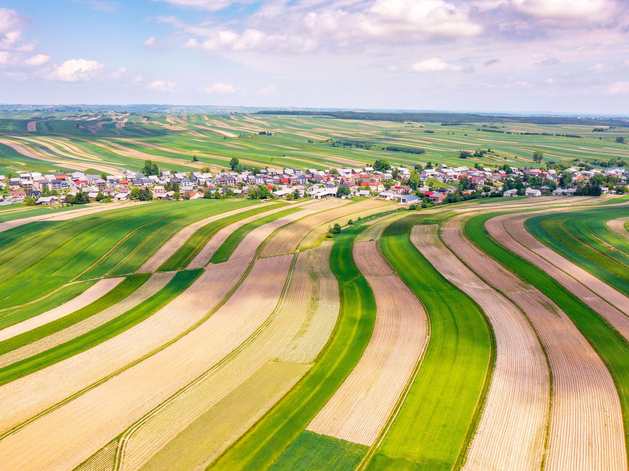
There’s nothing unusual about a village that has only one street — linear settlements are found all over the world, many following the course of a river or the flat floor of a valley. But what sets Sułoszowa, Poland, apart is its scale: The vast majority of the almost 6,000 people who live here share a single road. It stretches for more than five miles, with narrow perpendicular plots that branch off it like the legs of a centipede.
Other than the layout, life around Sułoszowa is pretty normal. Some earn a living through farming potatoes, wheat, or oats, noting that the long, thin strips of land they cultivate are an efficient shape to plough. Others commute to nearby Krakow, or make a living from tourism — the village is home to the 14th-century Pieskowa Skała Castle, which forms part of the Trail of the Eagle’s Nests and is also a short distance from Ojcow National Park.
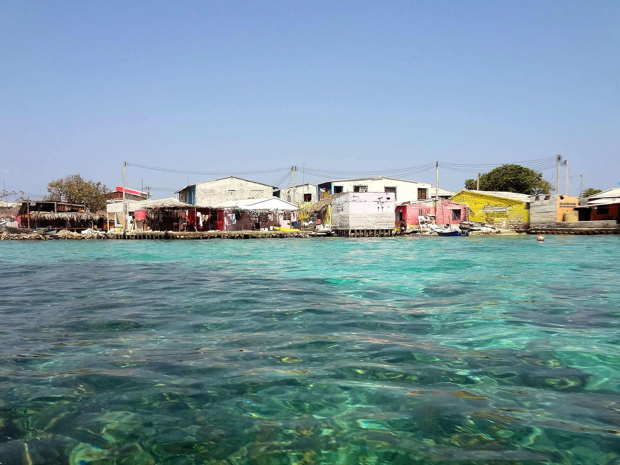
Santa Cruz del Islote is the most densely populated island on the planet. Measuring a total of just 2.5 acres, the island is located off Colombia’s Caribbean coast close to the Gulf of Morrosquillo. Around 1870, fishermen discovered this mosquito-free patch of coral and piled stone and anything else they could find on top to create reclaimed land.
Some estimates claim that today, more than a thousand people live on the island. Though these reports may be somewhat exaggerated (the actual number is likely between 500 and 900), space is clearly at a premium on Santa Cruz del Islote. Every available piece of land on this semi-artificial island has been developed. There’s a strong sense of community — around four dozen families occupy its approximately 100 houses. Day-trippers are welcomed, but the reality of life for the residents of Santa Cruz del Islote is a tough one, with limited services and many forced to work on neighboring islands.
Advertisement
More from our network
Daily Passport is part of Inbox Studio, an email-first media company. *Indicates a third-party property.
Fewer than 500 people worldwide have scaled the so-called Seven Summits — the highest mountain peaks on each of the seven continents. In 1985, an American businessman named Richard Bass was the first to climb to the top of all seven. While you’re probably familiar with lofty peaks like Mount Everest and Mount Kilimanjaro, can you name all seven? Below, discover the tallest peaks on each continent and the climbers who have made it all the way to the top.
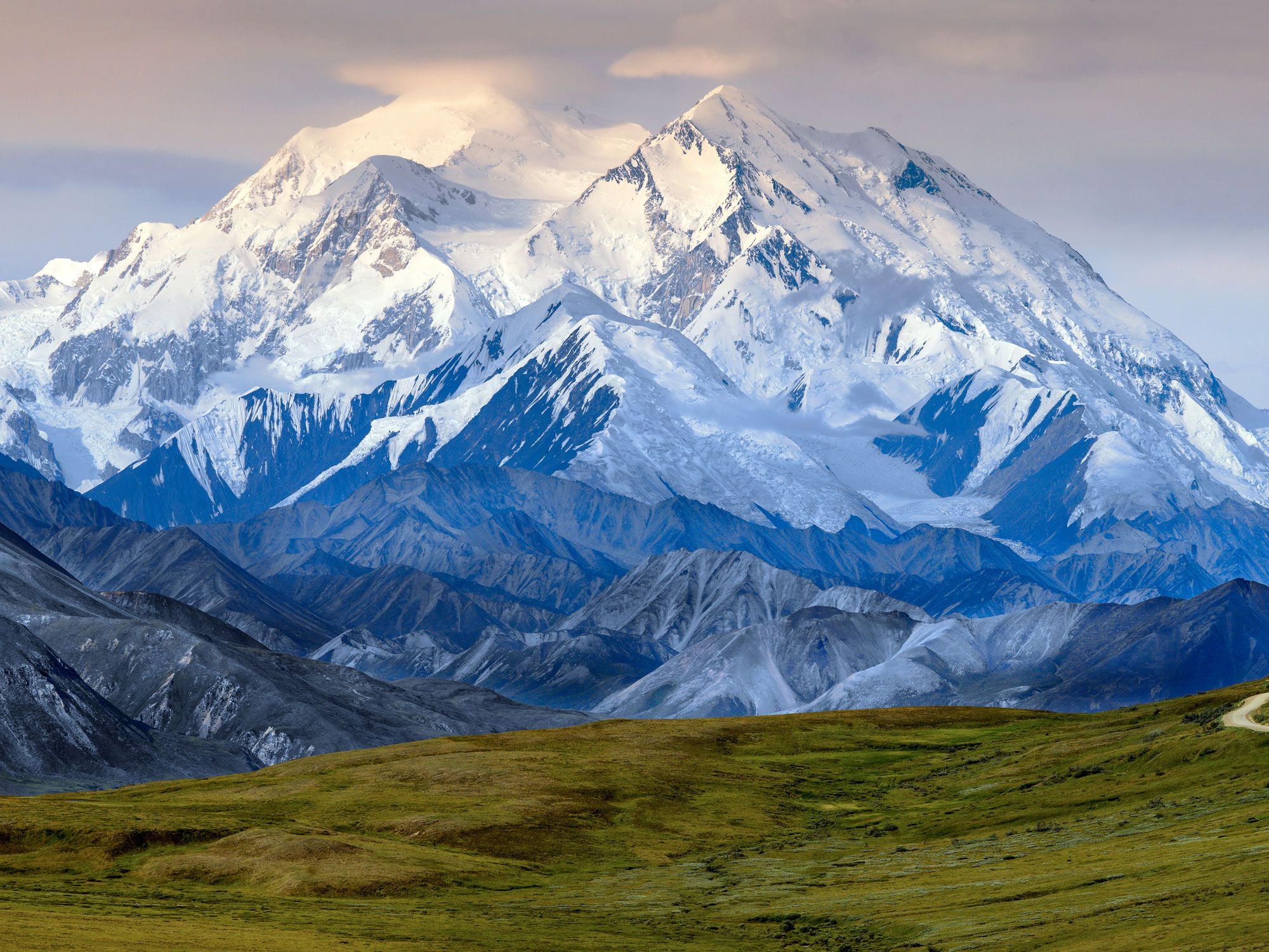
The highest peak in North America,Denali (formerly known as Mount McKinley) sits roughly in the center of the 600-mile-long Alaska Range in the south-central part of the state. The official elevation of the higher, more southerly of Denali’s two summits was established in the early 1950s at 20,320 feet above sea level. However, in 2015, the U.S. Geological Survey (USGS) reassessed Denali’s peak using state-of-the-art equipment and determined it to be 10 feet lower than previously thought.
In 1910, two prospectors of what was dubbed the “Sourdough Expedition” were the first climbers to conquer Denali’s North Peak. Hudson Stuck and Harry Karstens led a party to the South Peak, the true summit, on June 7, 1913. Today, hundreds of climbers attempt to reach Denali’s summit each year.
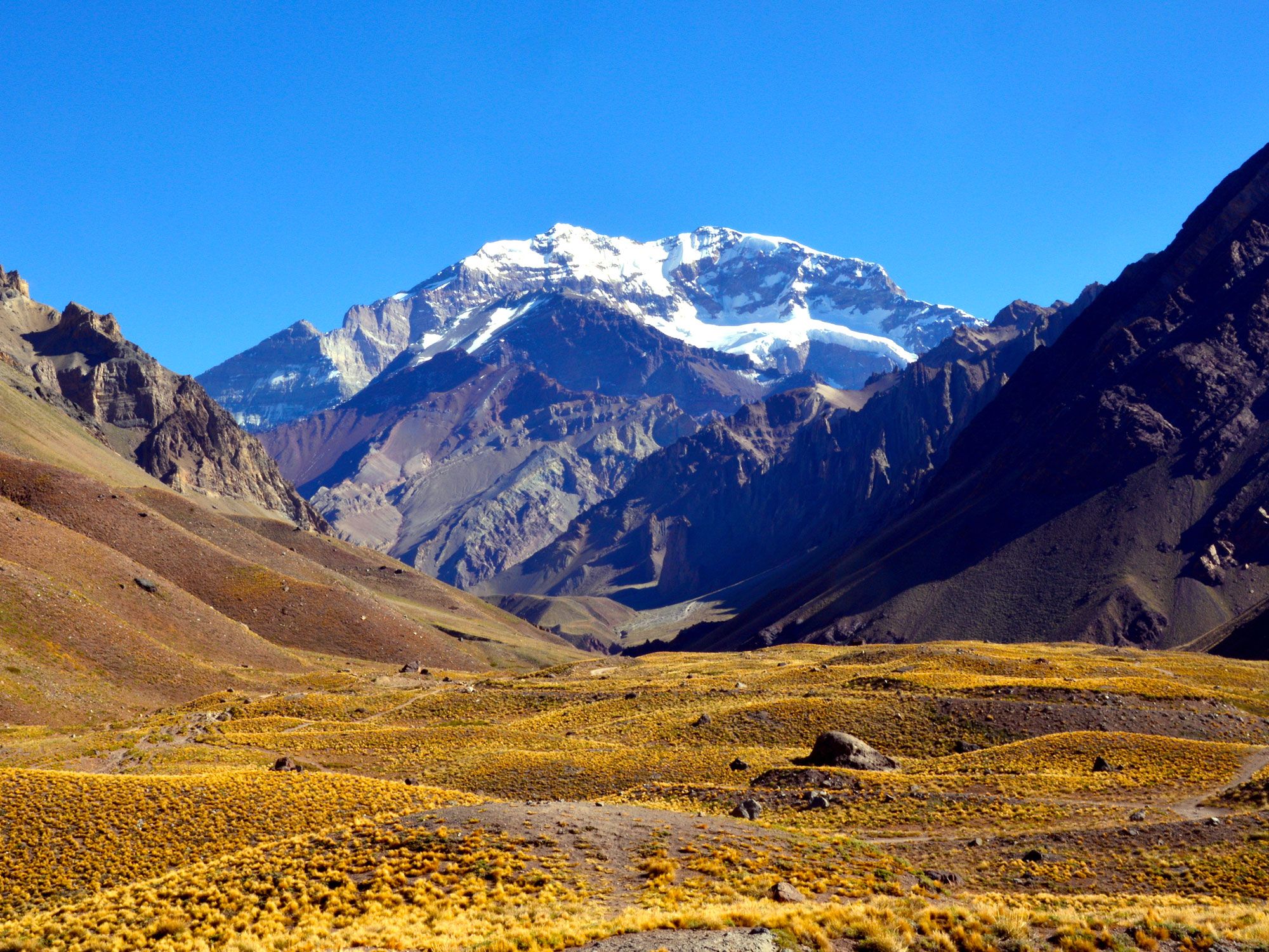
Mount Aconcagua, which straddles the Chilean border in the Andes mountains of west-central Argentina, is the highest point in both South America and the Western Hemisphere overall. However, its precise elevation has been debated since the early 20th century. In January 2001, a team of scientists using advanced GPS technology reported an elevation of 22,840 feet, but neither Argentina’s government nor the National Geographic Society recognizes this figure. The peak’s 22,831-foot height established by the Military Geographical Institute of Argentina remains the generally accepted figure.
Mount Aconcagua has a north and a south summit, which are connected by a ridge. The lower southern summit has been measured at 22,736 feet, while the higher northern summit was first reached in 1897 by Swiss climber Matthias Zurbriggen.
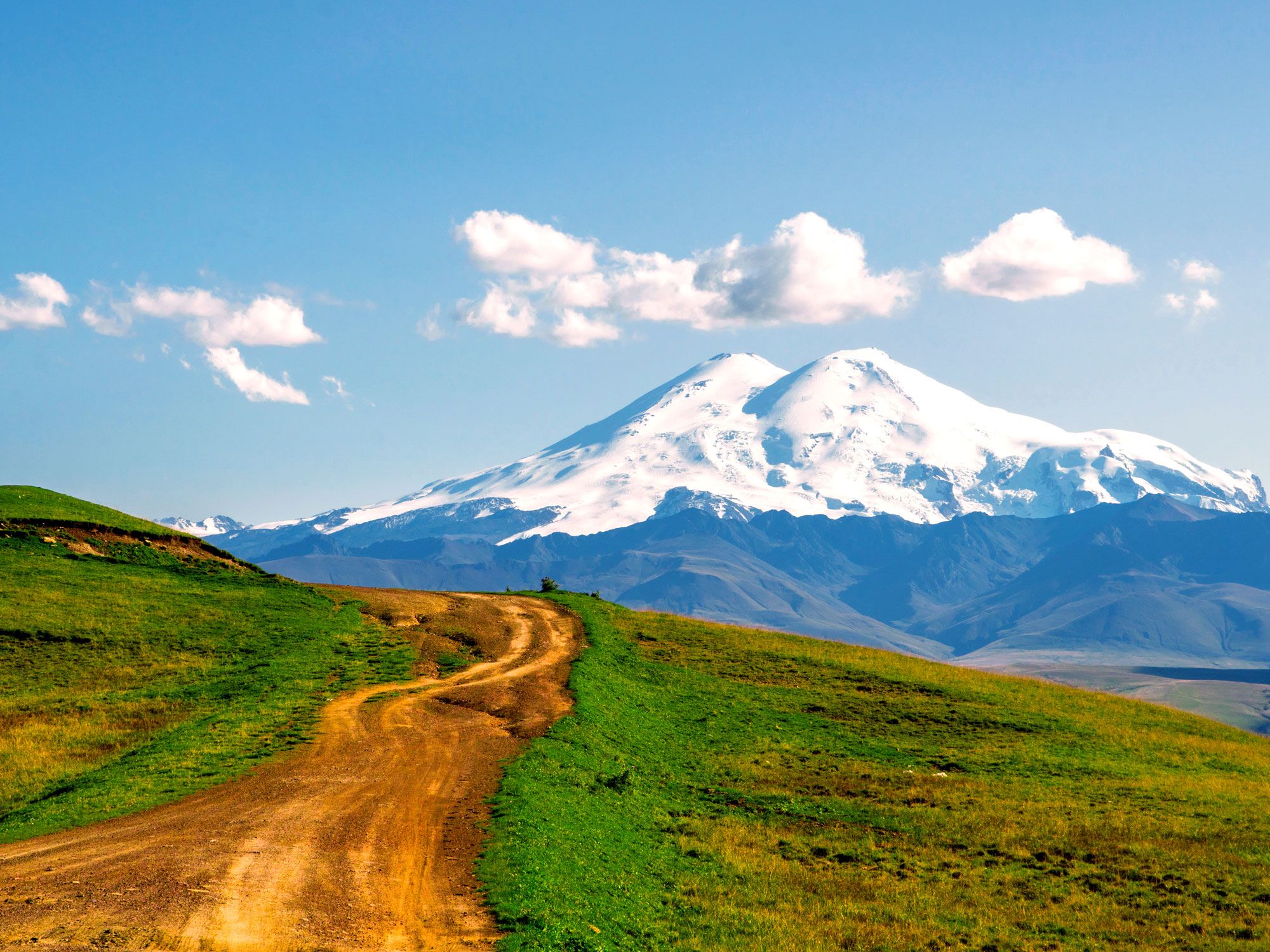
The highest peak of the Caucasus mountains — and the highest point in Europe — is Mount Elbrus in southwestern Russia. Formed more than 2.5 million years ago, this extinct volcano has twin cones that extend to elevations of 18,510 feet and 18,356 feet. The taller cone was first ascended in 1874 by a British expedition led by Swiss guide Peter Knubel. Elbrus is covered by 22 glaciers, which feed the Kuban River.
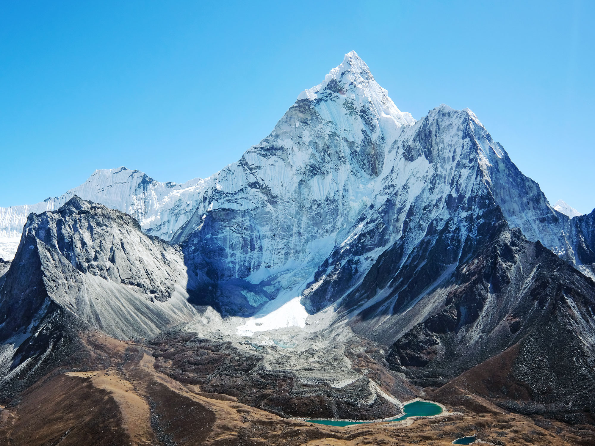
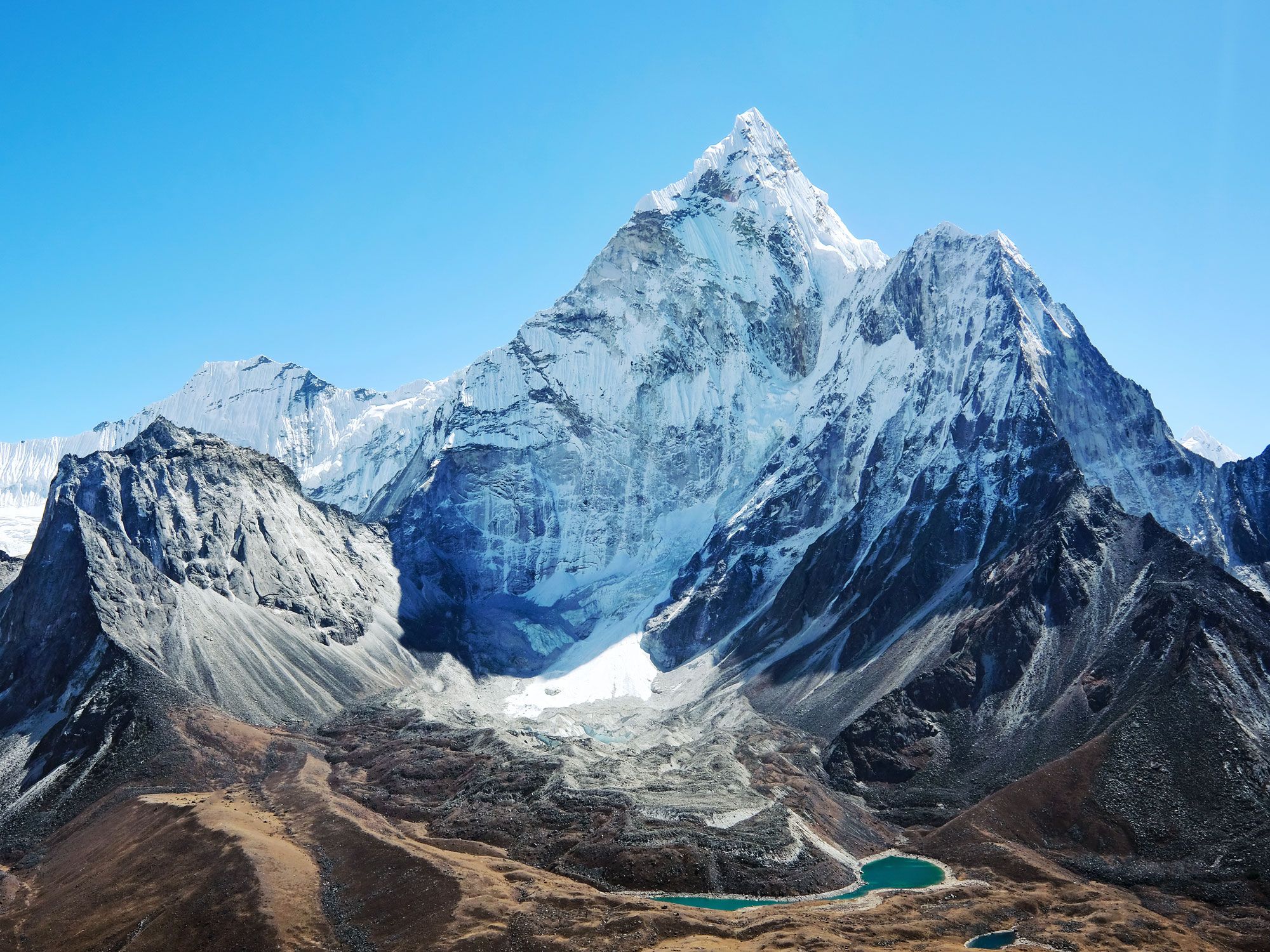
Mount Everest, the highest mountain in Asia and Earth’s highest peak above sea level, lies on the border between Nepal and the Tibet Autonomous Region of China in the Himalayas. The majestic mountain reaches an elevation of 29,032 feet — and it’s still growing. In 2020, researchers from Nepal and China jointly announced that the world’s tallest peak is even taller than originally thought.
Everest was first recognized as the highest point on the Earth’s surface by the governmental Survey of India in 1852. Major expeditions up Everest began in the 1920s, but it wasn’t until 1953 that Edmund Hillary and Tenzing Norgay— members of an expedition sponsored by the Royal Geographical Society and the Alpine Club — reached its summit. But mystery still surrounds the disappearance in 1924 of George Mallory and Andrew Irvine, who may have reached the summit before vanishing. Mallory’s body was found at 26,760 feet in 1975; Irvine remains missing.
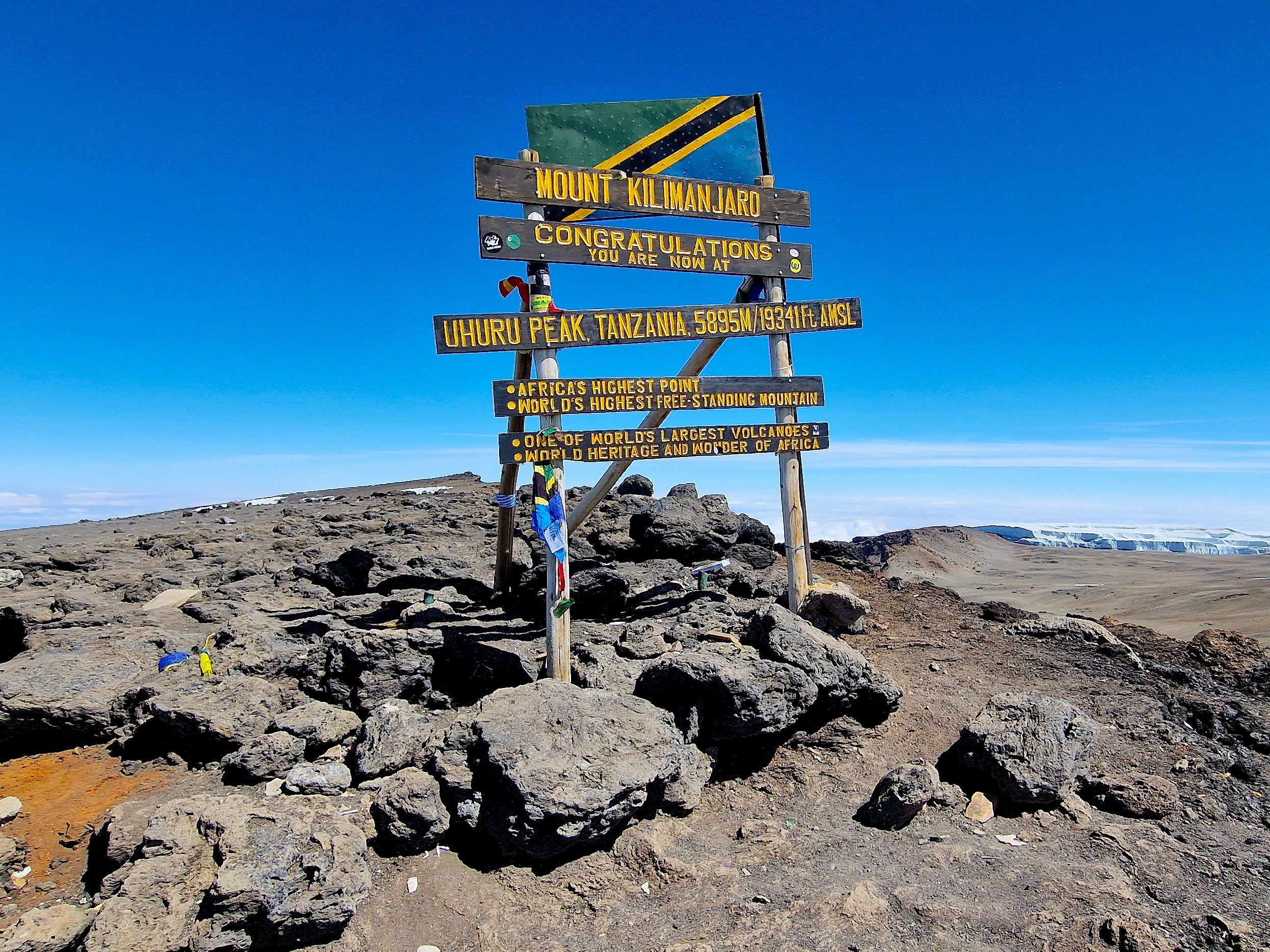
The highest peak in Africa, Kilimanjaro is a volcanic massif in northeastern Tanzania, near the Kenyan border. The massif extends approximately east-west for 50 miles and consists of three principal (extinct) volcanoes. The youngest and highest of these has a central cone, Kibo, that rises to 19,340 feet.
In 1889, German geographer Hans Meyer and Austrian mountaineer Ludwig Purtscheller were the first to reach the Kibo summit. Mount Kilimanjaro National Park, established in 1973 to protect the mountain as well as the six forest corridors that extend downslope through the montane forest belt, was designated a UNESCO World Heritage site in 1987.
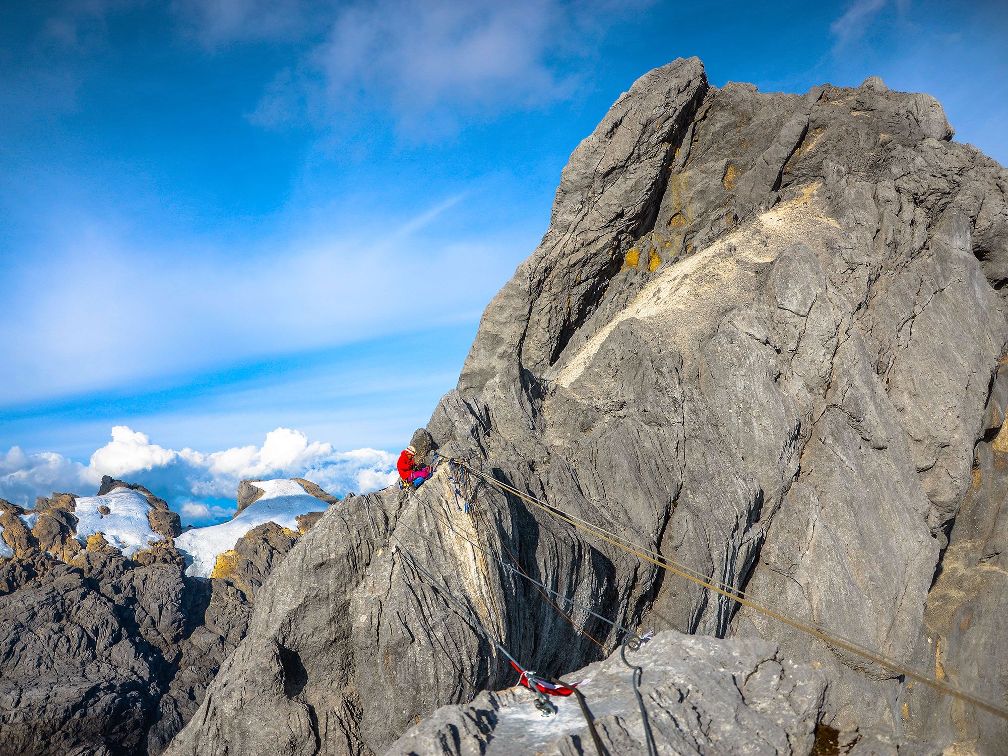
Though there’s some disagreement on the highest peak in Australia, if a wider net is cast Down Under to include Oceania, the region’s highest mountain is Puncak Jaya (also known as Mount Carstensz). Found in the Sudirman Range of the west-central highlands on the island of New Guinea, Jaya Peak rises to an elevation of 16,024 feet, and is the world’s highest island peak.
Dutch explorer Hendrik A. Lorentz first reached Jaya Peak’s snowfield in 1909, but it was another 53 years before an expedition led by Austrian explorer and writer Heinrich Harrer (author of Seven Years in Tibet) climbed its summit in 1962.
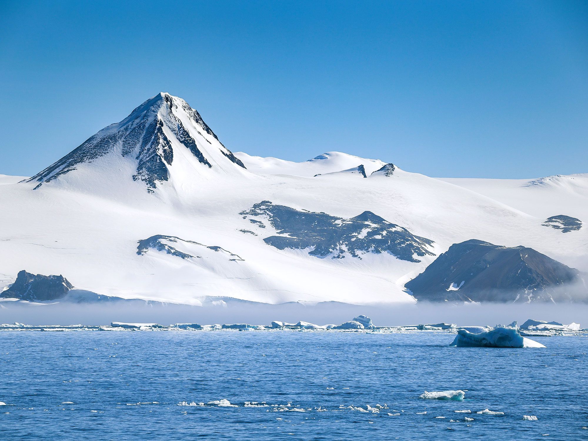
Discovered in 1935 by American explorer Lincoln Ellsworth, Mount Vinson (also known as the Vinson Massif) is the highest mountain in Antarctica. Located in the Sentinel Range of the Ellsworth Mountains, in the western part of the continent, the peak overlooks the Ronne Ice Shelf. It rises to an elevation of 16,050 feet above sea level.
Vinson is named for Carl Vinson, a U.S. congressman who championed exploration of Antarctica. Its summit was first reached in 1966 by an American expedition that was supported by the American Alpine Club and the National Science Foundation.
Advertisement
More from our network
Daily Passport is part of Inbox Studio, an email-first media company. *Indicates a third-party property.
Architecture •July 13, 2023•Updated: July 25, 2023
By Sarah Etinas
Aqueducts were incredibly useful in ancient times. For centuries, these conduits transported water to cities and towns that needed it, which were often many miles away. In particular, the Roman Empire was well-known for its advanced system of aqueducts, which were constructed from 312 BCE to 226 CE. Today, only a few of these ancient feats of engineering are still standing, all the more impressive when you consider they’ve remained for more than a millennium. From Spain to India and Peru, here are five of the most spectacular ancient aqueducts around the world.
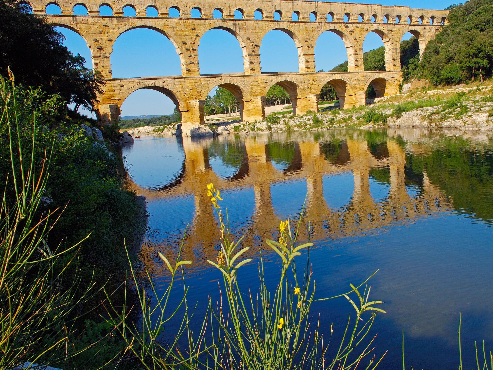
One of the the best-preserved examples of a Roman aqueduct standing today, France’s Pont du Gard was built in the first century CE. Part of a 31-mile aqueduct built to carry water over the Gard River to the Roman city of Nîmes, the three-story Pont du Gard is the world’s tallest Roman aqueduct bridge (reaching 160 feet tall) and the most-visited ancient monument in France.
In 1985, it was designated a UNESCO World Heritage Site as “an outstanding example of bridges built in ancient times” and “a technical as well as artistic masterpiece.” Visitors can stroll along the 3.5-mile Aqueduct Trail for the best views and check the Pont du Gard Visitor Center and Museum. Be sure to stick around for the evening bridge lighting at nightfall.
France’s Pont du Gard and Spain’s Aqueduct of Segovia have a surprising number of similarities. Both were built under the rule of the Roman Empire, both were constructed around the year 50 CE and are exceptionally well-preserved today, and both were named UNESCO World Heritage Sites in 1985.
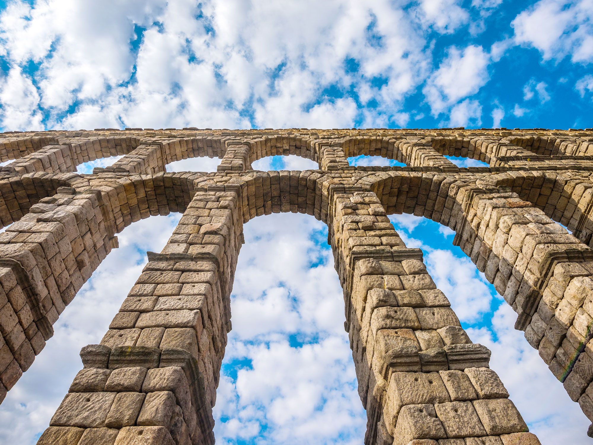
A symbol of the city where it stands, the Aqueduct of Segovia is still in use today, transporting water for 10 miles from the Frío River to central Segovia. The 2,388-foot-long structure was made with granite blocks from the nearby Guadarrama Mountains and features 165 scenic arches. While the aqueduct of Segovia doesn’t have dedicated walking trails or a museum like the Pont du Gard, it does have a few unique viewpoints, including Azoguejo Square and Mirador del Postigo.
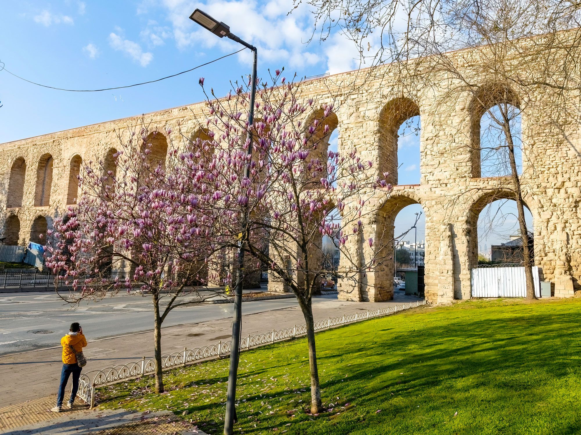
Built in 373 CE, the 3,186-foot-long Aqueduct of Valens was built to supply water to Constantinople, now called Istanbul. Named after Roman Emperor Valens, the Aqueduct of Valens is believed to be the longest aqueduct of its time, spanning 265 miles. While many ancient aqueducts were left to stand on their own away from modern developments, the Aqueduct of Valens remains standing in the heart of modern-day Istanbul. Cars will even drive right through this aqueduct’s ancient arches when traveling on Atatürk Boulevard.
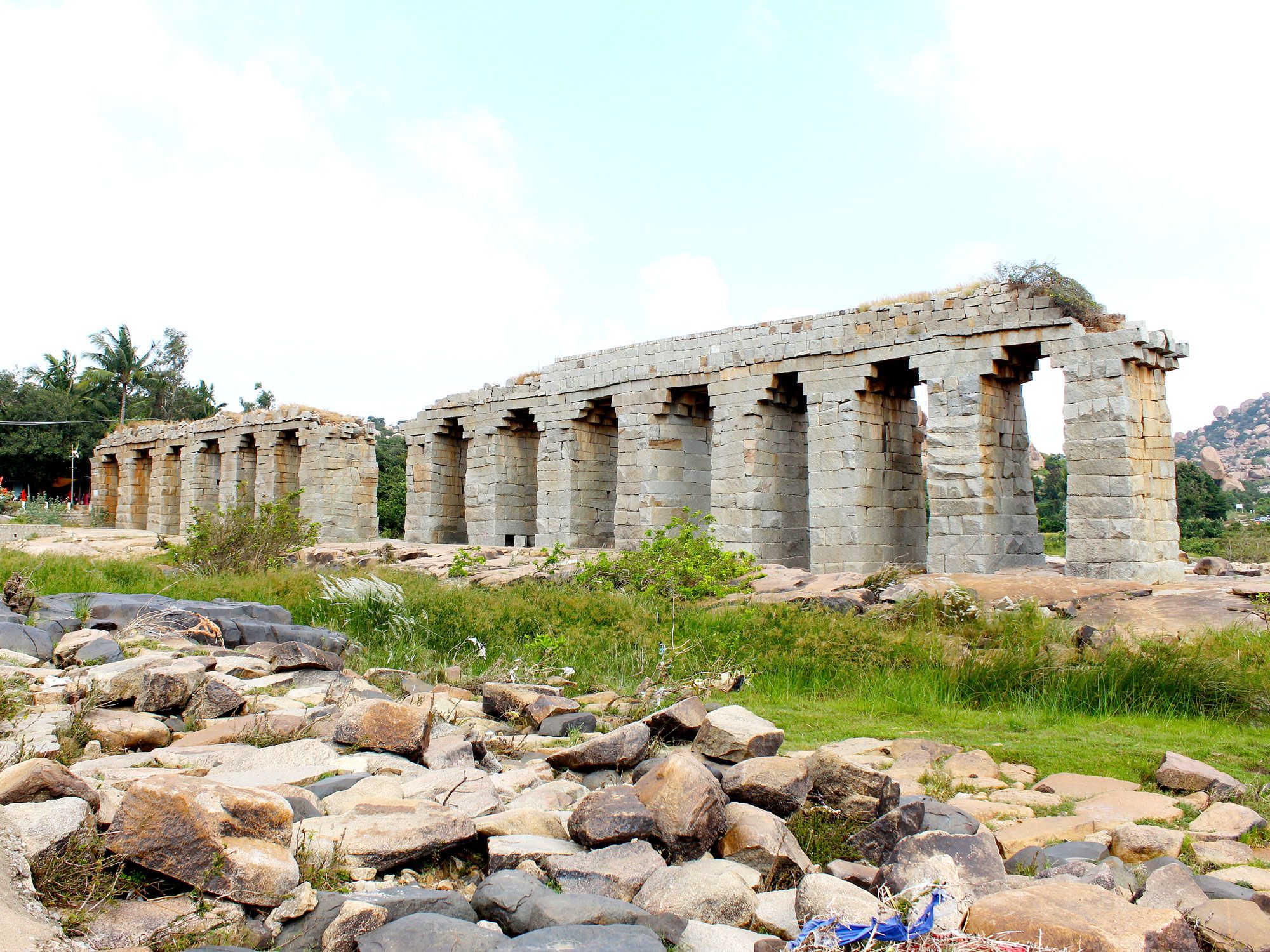
While the aqueducts of the Roman Empire — built across Europe and into the Middle East — tend to be the better-known ancient aqueducts, other nations and empires constructed remarkable aqueducts of their own. Located in Hampi, India, Bukka’s Aqueduct was built under the reign of Bukka Raya I (1356-1377 CE) in the Hindu Kingdom of Vijayanagara. Unlike many of the Roman aqueducts, the system was primarily underground to provide water to the village of Hampi — part of an advanced network of irrigation channels that connected its temples, palaces, and storage tanks. Today, the ruins at Hampi, including the aqueduct, are a UNESCO World Heritage Site.
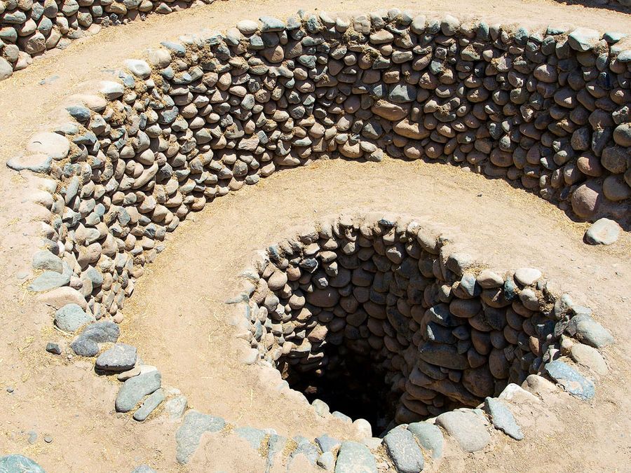
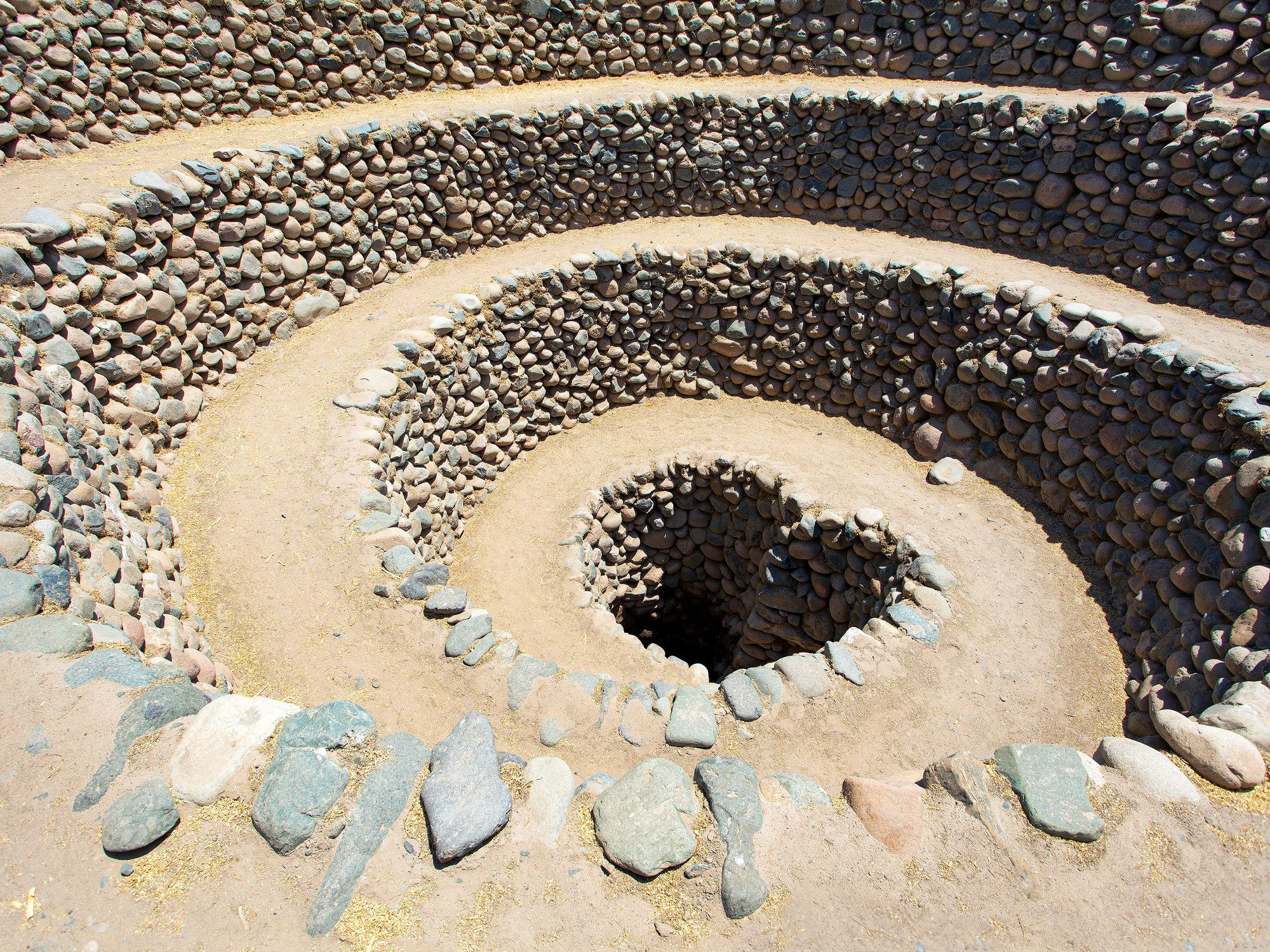
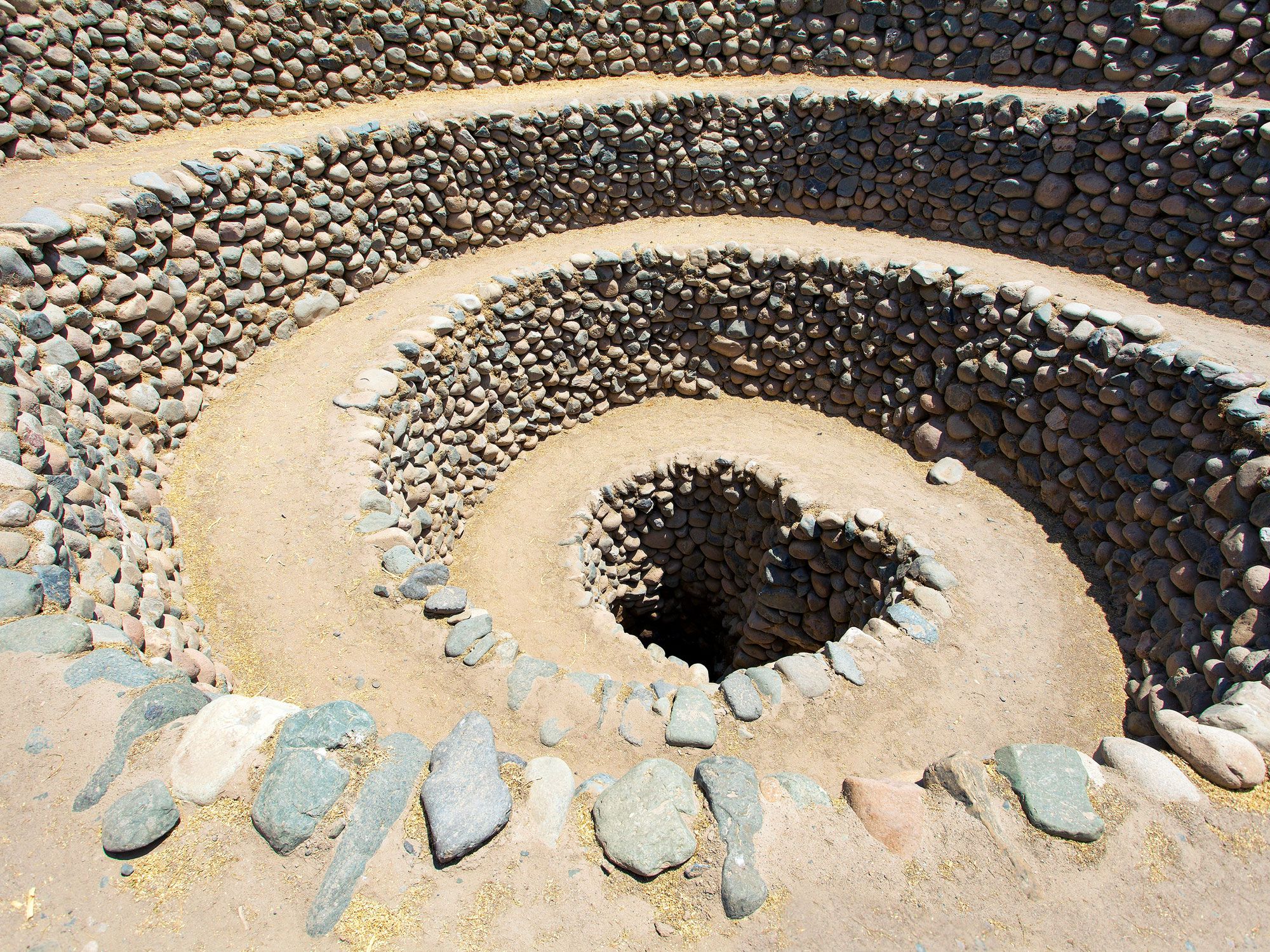
The Nazca Aqueducts were built by the Nazca peoples who inhabited the southern coast of modern-day Peru starting around the first century BCE. Like Bukka’s Aqueduct, the system — built to store water from the nearby Rio Grande River — is mostly underground. In fact, the only part of this water transportation system that you can see from the surface are the puquios, which are the spiraling rock paths that guide water into the underground aqueduct system. This clever set-up allowed the desert-living Nazca people to thrive in the region’s arid climate for approximately 900 years.
Advertisement
More from our network
Daily Passport is part of Inbox Studio, an email-first media company. *Indicates a third-party property.
National parks protect and preserve unique and invaluable natural environments across the globe, from glaciers and mountains to desert valleys and marine areas. They also often offer up-close encounters with wildlife and glimpses into the lives of ancestral groups. Today, there are thousands of national parks spread across hundreds of countries. These are nine of the biggest national parks on the planet.
9. Vatnajökull National Park – Iceland (4,633 Square Miles)
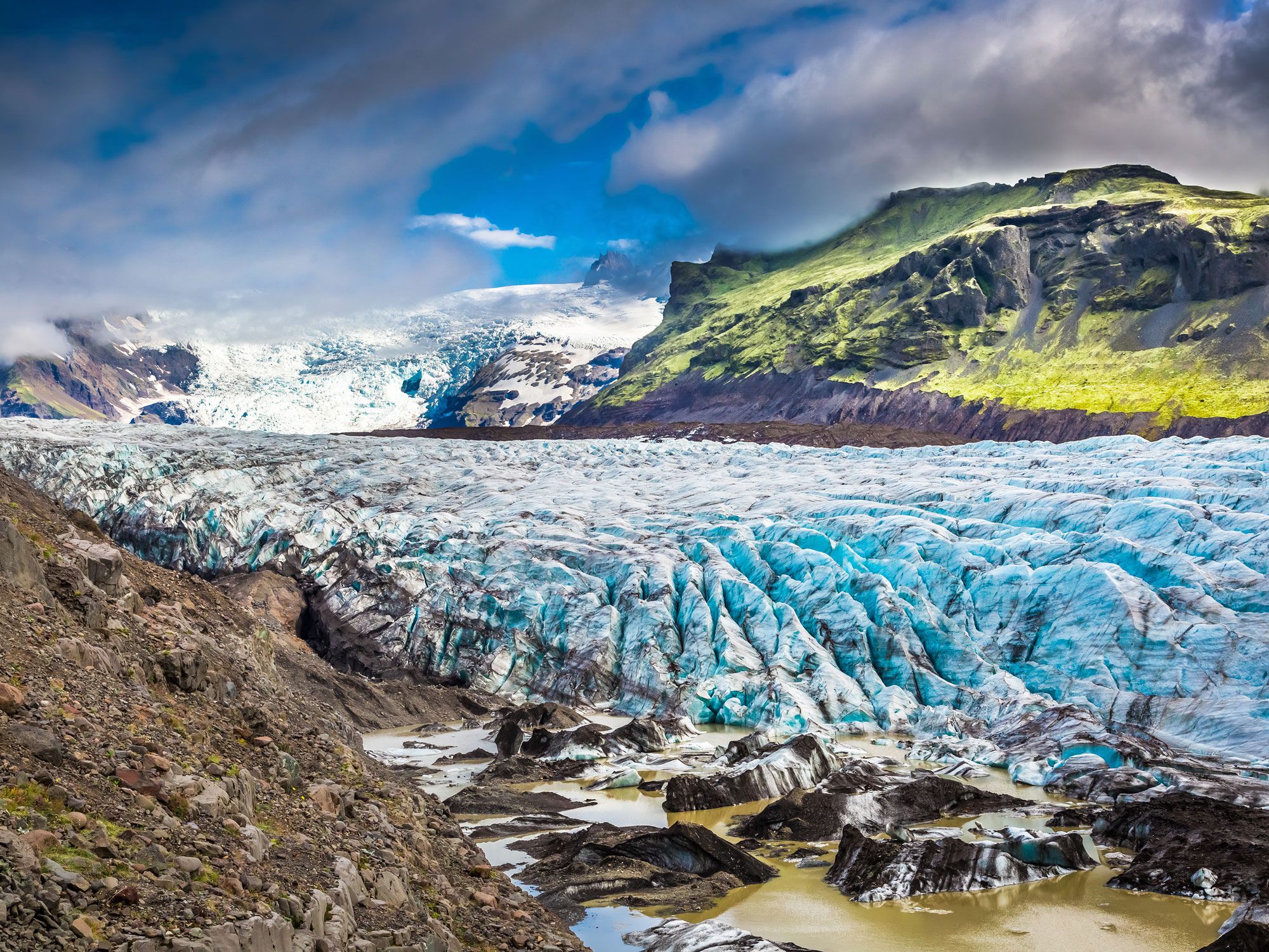
One of three UNESCO World Heritage Sites in Iceland, Vatnajökull National Park is an unforgettable meeting point of fire and ice. It’s where glaciers and volcanoes stand side-by-side and help shape a landscape that ranges from black sands and birch forests to geothermal springs, glacial rivers, and thundering waterfalls.
The park itself occupies 13% of Iceland’s total area and shelters one of the world’s largest glaciers, Vatnajökull. Other notable features are the horseshoe-shaped Ásbyrgi Canyon and the deafeningly powerful Dettifoss Waterfall. Biking and hiking are popular ways to explore the landscape, including a multi-day alpine hiking route between the wilderness areas of Snæfell and Lónsöræfi.
8. Death Valley National Park – California (5,270 Square Miles)
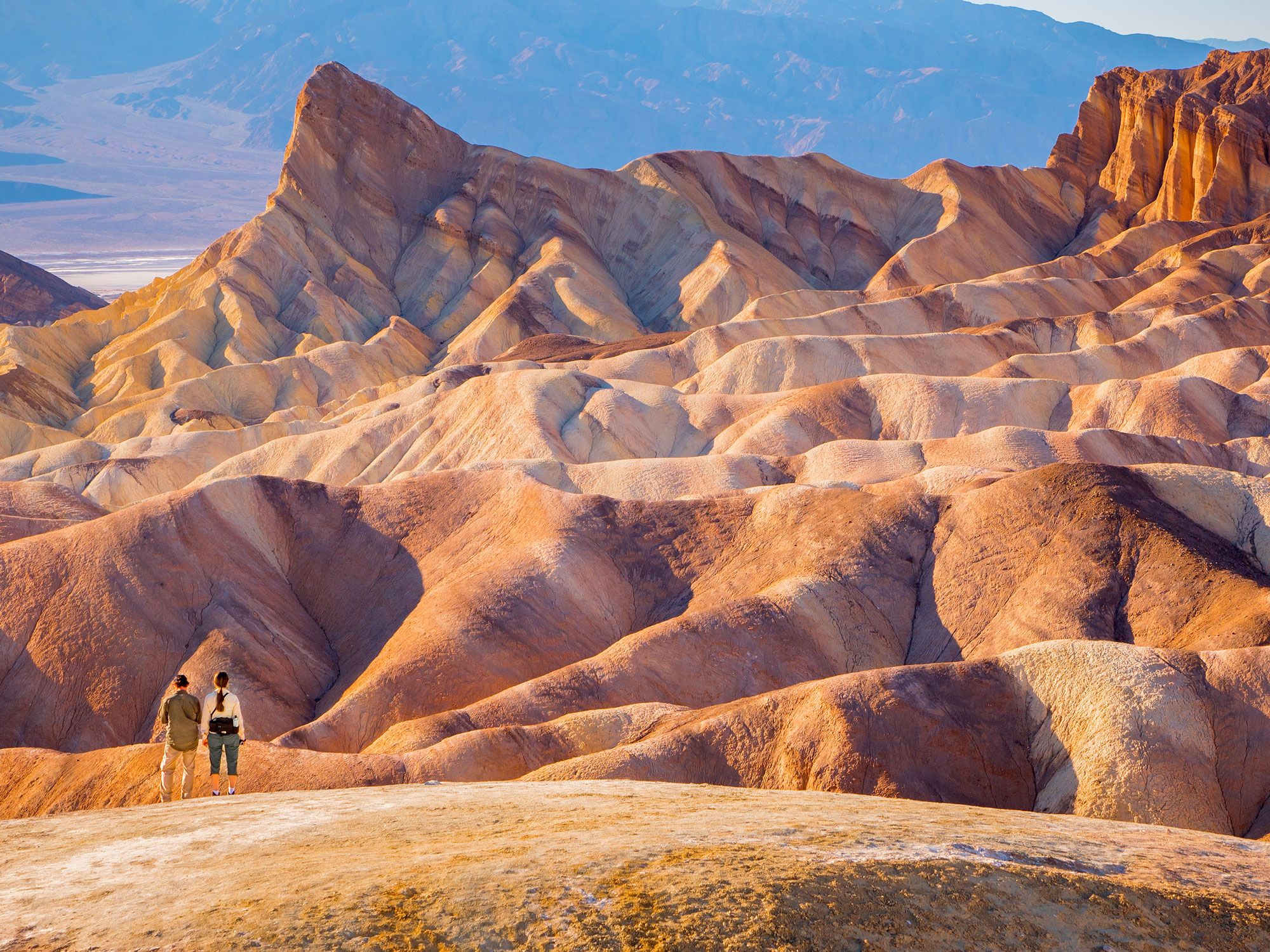
The site of the world’s hottest recorded air temperature, Death Valley National Park is located in California’s Mojave Desert between the Amargosa and Panamint mountain ranges. This often unforgiving desert region is marked by extremes — from North America’s lowest point at Badwater Basin to, yes, even sometimes snow-capped mountains, large wildflower meadows, and oases home to tiny fish species.
In spite of the name and its triple-digit summertime temperatures, the park is a surprisingly welcoming place for visitors. Easy hikes — best explored in the cooler winter months — pass by spectacular sights like Badwater Salt Flat and Mesquite Flat Sand Dunes. Golfers can even play 18 holes within the solitude of the park at the one-of-a-kind Furnace Creek Golf Course.
7. Kruger National Park – South Africa (7,523 Square Miles)
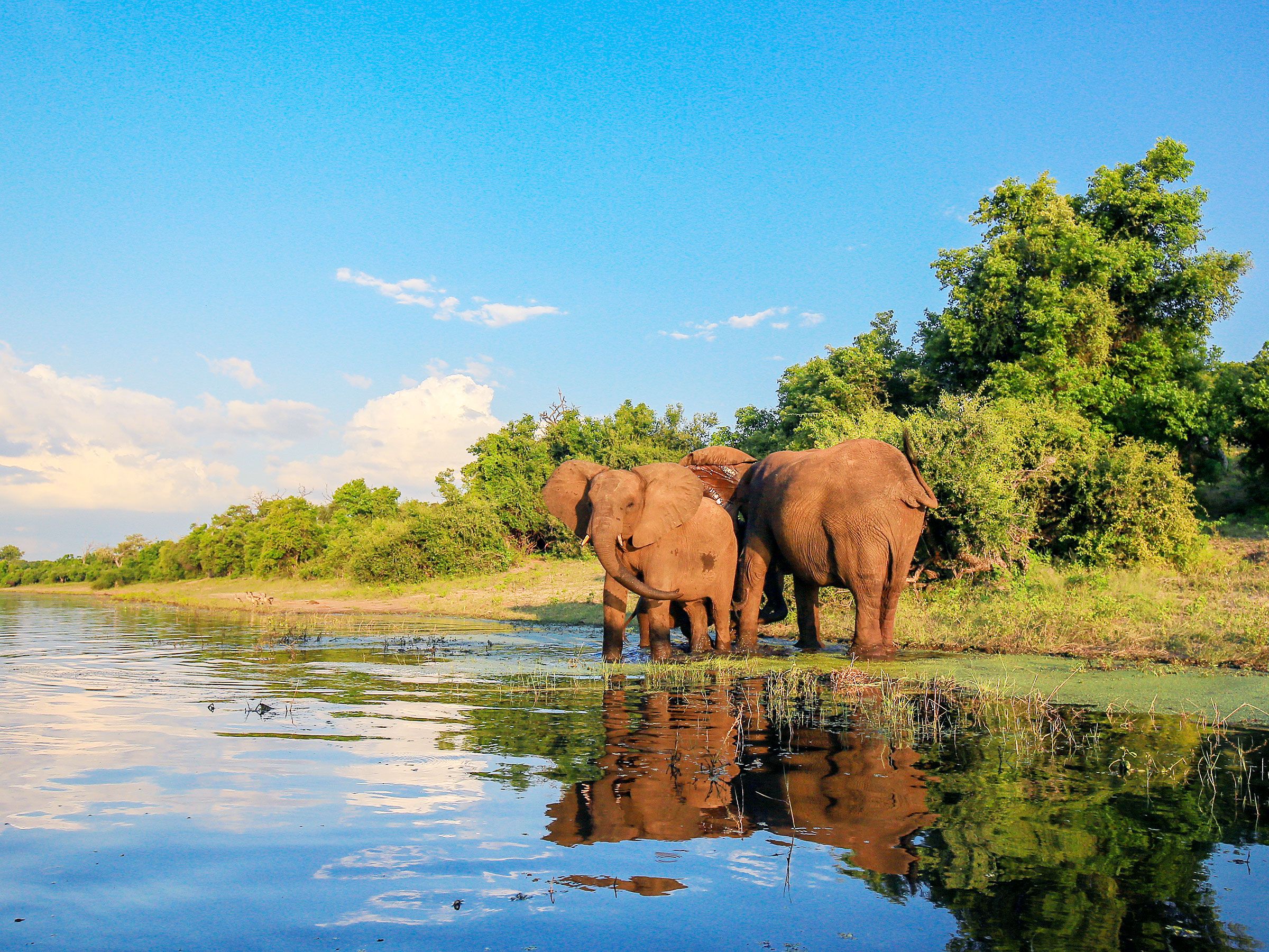
Few places on Earth are as revered for spotting majestic wildlife as Kruger National Park. Hundreds of thousands of visitors arrive here annually on self-drive and guided Jeep safaris to search for Africa’s iconic “Big Five”: lions, leopards, rhinos, elephants, and buffalo.
In addition to the wildlife, Kruger National Park is home to dozens of archaeological sites such as Masorini and Thulamela. They act as reminders of humankind’s interaction with nature over thousands of years and how people have helped in the creation and conservation of the park. Intimate interactions with the park’s free-roaming animal residents await at waterholes and along rustic backpacking and wilderness trails.
6. Denali National Park and Preserve – Alaska (9,492 Square Miles)
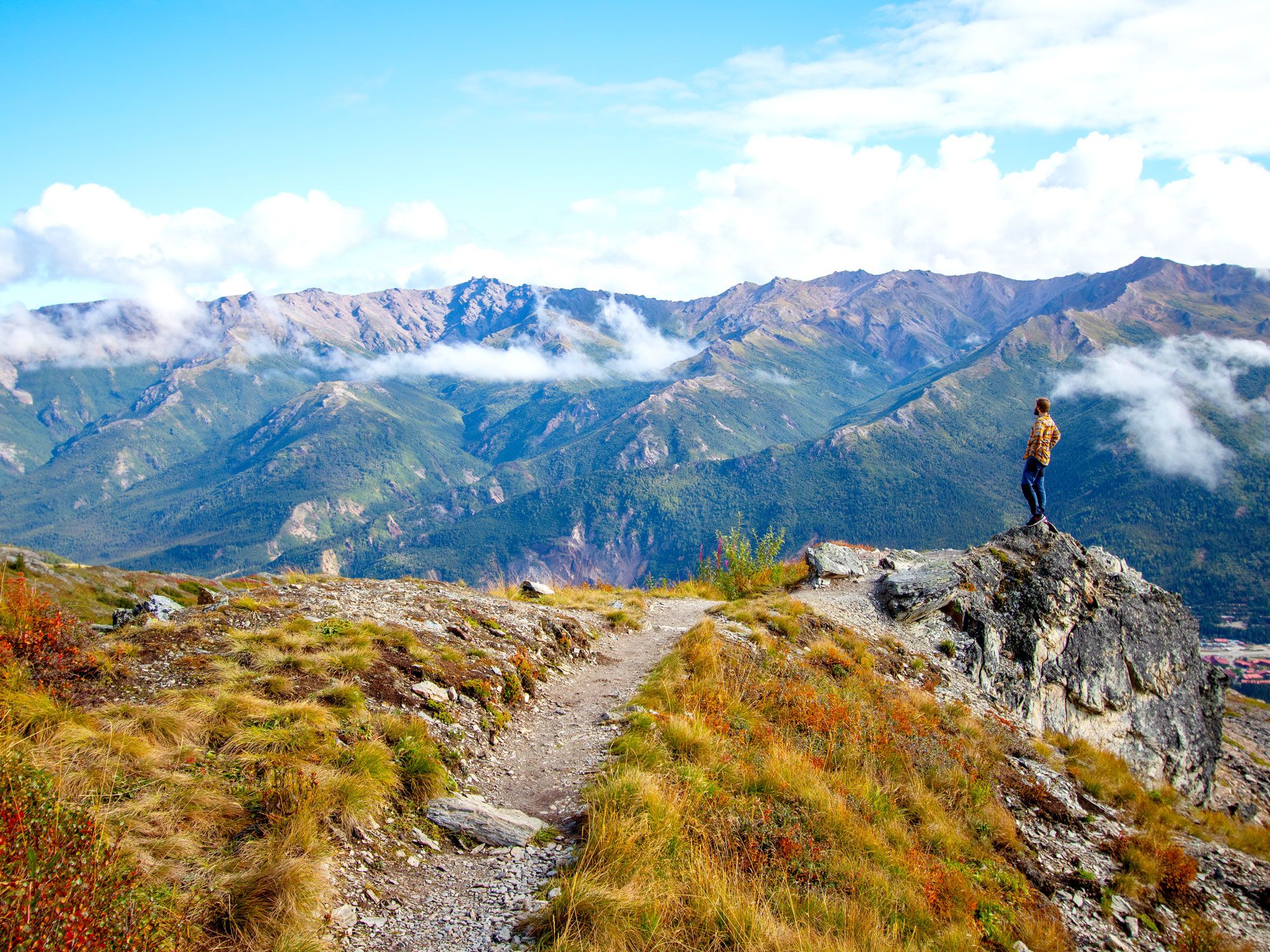
The colossal 20,310-foot Mount Denali, North America’s highest peak, dominates the landscape of Denali National Park and Preserve. Glaciers, rivers, boreal forests, and alpine tundra also shape this dramatic landscape. It all creates a natural habitat for Denali’s own “big five,” which include caribou, Dall sheep, grizzly bears, moose, and wolves. Hiking, biking, dog-sledding, flightseeing, and snowmobiling are popular activities within the park, while a stop at the Denali Visitor Center offers an educational insight into the history and culture of the region.
5. Gates of the Arctic National Park and Preserve – Alaska (13,238 Square Miles)
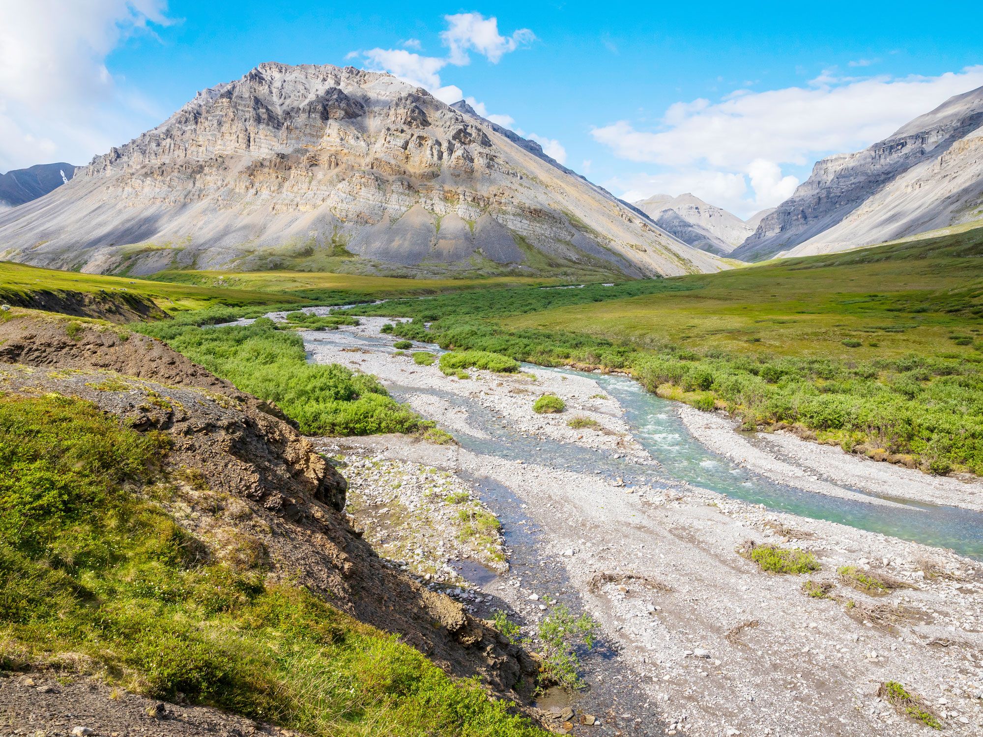
With no roads and no trails, northern Alaska’s Gates of the Arctic National Park and Preserve is the true definition of an untouched wilderness. Here, rugged mountains — from the dramatic granite spires of the Arrigetch Peaks to the massive Brooks Range — tower above an expansive tundra and meandering rivers.
Despite the lack of infrastructure, this is a dreamlike destination for solitude seekers and backcountry explorers. With challenges like boggy terrain and tussocks, accomplished hikers often consider six miles as a reasonable daily target. Along the way are numerous chances to take in magnificent vistas and spot caribou, lynx, muskox, and other wildlife.
4. Wood Buffalo National Park – Canada (17,300 Square Miles)
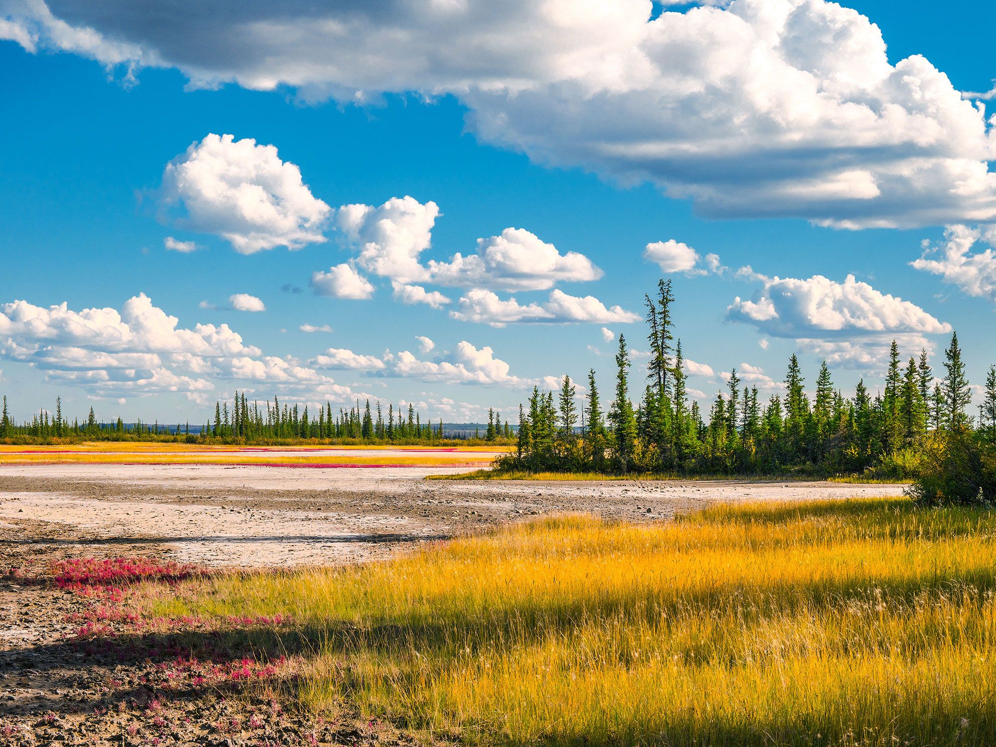
Wood Buffalo National Park, Canada’s largest national park, straddles the border of the province of Alberta and the Northern Territories. Consisting of boreal forests, plains, and wetlands, the park is home to the world’s biggest free-roaming herd of wood bison and an important colony of whooping cranes. Indigenous groups, including the Cree, Dene and Métis peoples, have inhabited the region for over 8,000 years.
Recreational opportunities within the park include day hikes to the ethereal landscapes around Grosbeak Lake and summertime watersports at Pine Lake. The park is also the world’s largest International Dark Sky Preserve, and a great vantage point for experiencing the northern lights.
3. Namib Naukluft National Park – Namibia (19,216 Square Miles)
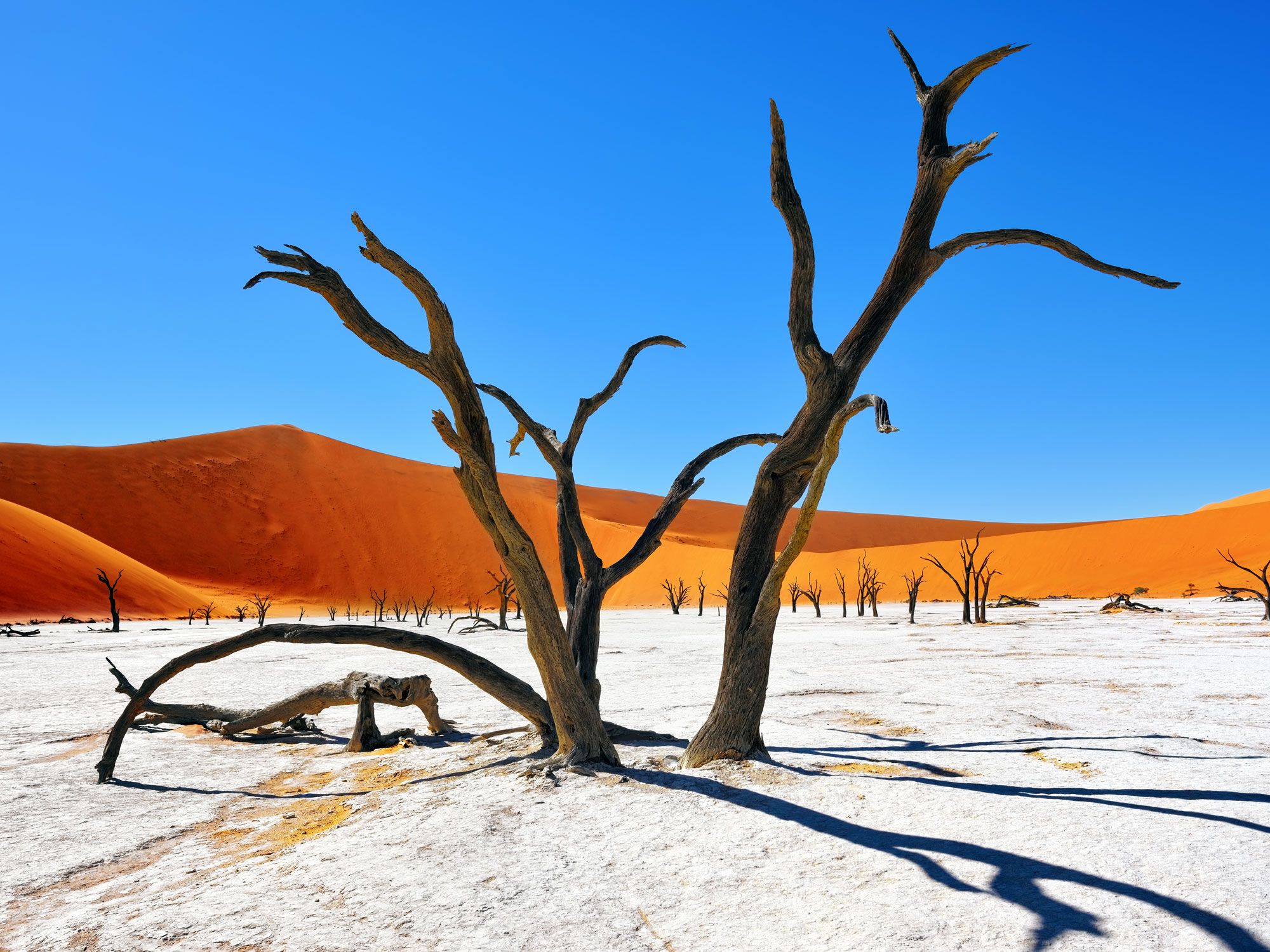
Distinguished by a collection of towering sand dunes that appear as giant red mountains, Namib Naukluft National Park occupies a significant portion of the Namib Desert, a coastal desert in Southern Africa considered the oldest desert on the planet. The most famous and tallest of the dunes is Sossusvlei, which rises over 1,000 feet and can be climbed on foot.
Another popular area to visit is Deadvlei, where ancient pitch-black camel thorn trees sprout from a bleached white clay pan. Oryx, springboks, wolves, and almost 350 bird species thrive in this arid region. Those who visit typically do so on four-wheel-drive and overland safari tours.
2. Wrangell-St Elias National Park and Preserve – Alaska (20,625 Square Miles)
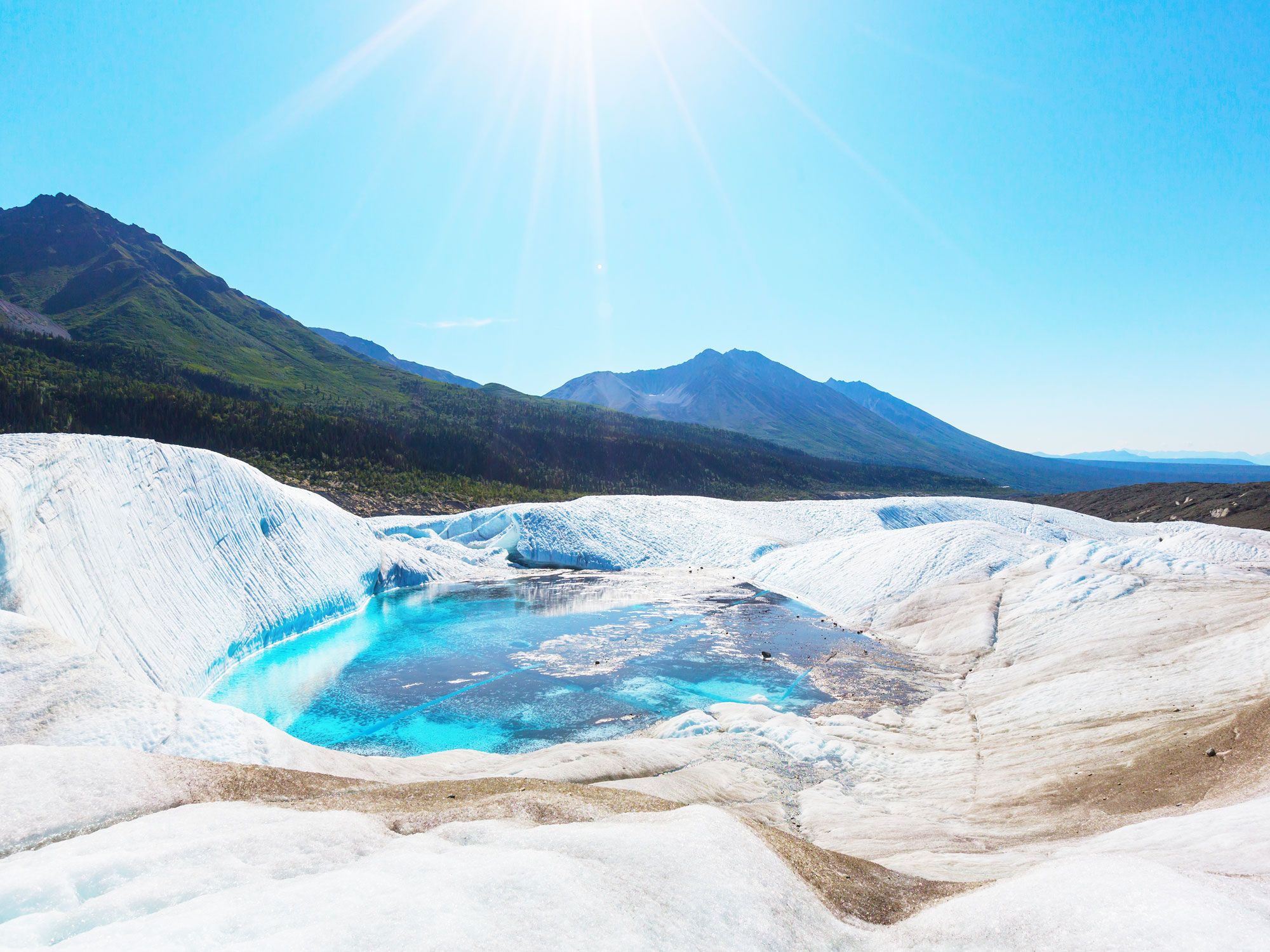
The third Alaskan park on the list, Wrangell-St. Elias National Park and Preserve also has the honor of being the largest national park in the U.S. It stretches from the shores of the Gulf of Alaska to the 18,008-foot summit of Mount St. Elias — one of seven of North America’s 20 tallest peaks located inside the park.
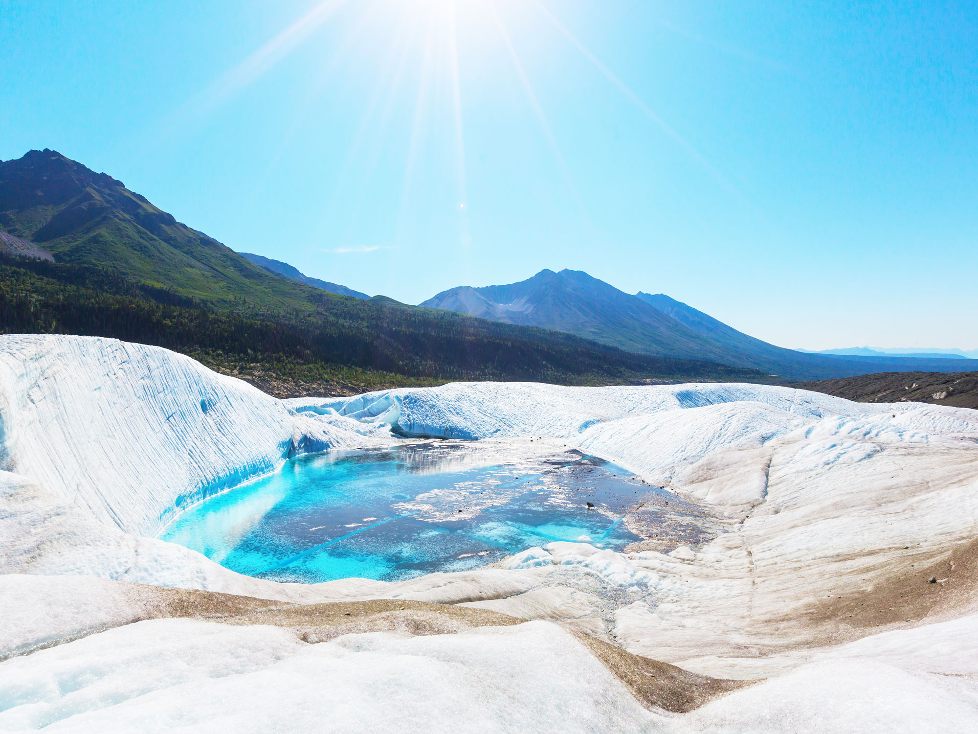
While almost a third of the park is glaciers, it’s still rich in wildlife, namely bald eagles, brown bears, and caribou. Opportunities for adventure range from boating on backcountry rivers to day hiking, mountaineering, and winter sports such as snowshoeing.
1. Northeast Greenland National Park – Greenland (375,000 Square Miles)
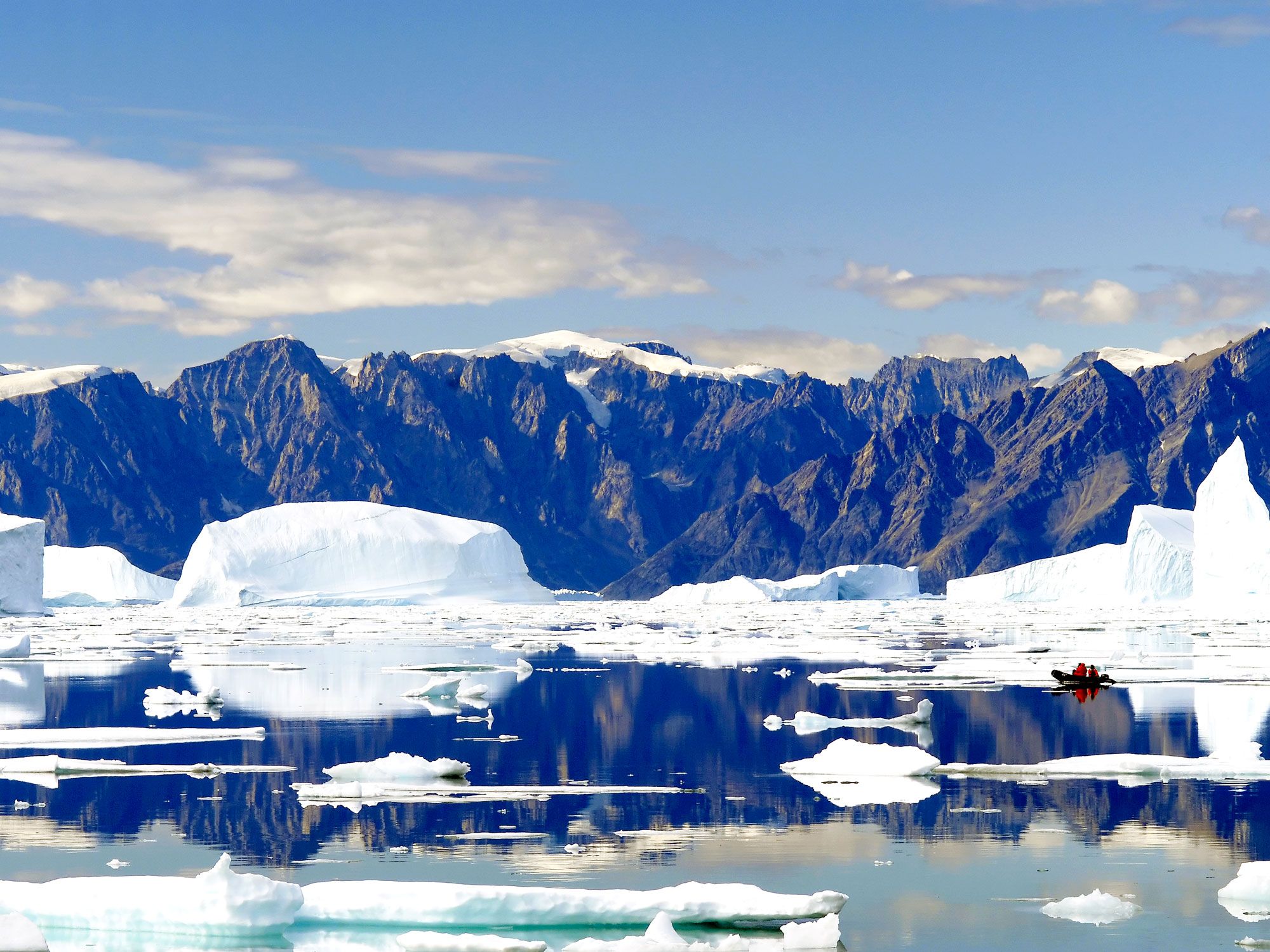
Taking top spot on the list of the world’s largest national parks is the impossibly vast Northeast Greenland National Park. It occupies an area that’s almost as big as France and Spain combined. It’s also the only national park in Greenland and the northernmost national park in the world.
Visitors can discover a diverse and awe-inspiring landscape made up of fjords, glaciers, ice fields, mountains, and tundra. Within this rugged park reside varied wildlife species, including the arctic fox, musk oxen, and polar bear. Despite an often inhospitable climate, the park has around 40 permanent residents, plus their faithful sled dog companions.
Advertisement
More from our network
Daily Passport is part of Inbox Studio, an email-first media company. *Indicates a third-party property.
Julia is a U.K.-based travel writer whose work has been featured in The Independent, The Telegraph, The New Zealand Herald, and Culture Trip, among others. She’s an enthusiastic advocate for independent travel and a passionate geographer who has had the privilege of traveling to more than 130 countries in search of a story.
In 2007, more than 100 million votes were cast ina poll to decide the New 7 Wonders of the World. From a selection of more than 200 iconic sites — such as the Pyramids of Giza, the Statue of Liberty, and the Eiffel Tower — voters settled on seven places of outstanding cultural and historic significance. While you’re probably already familiar with the New 7 Wonders of the World, here are seven fascinating facts you might not know.
The Tiles That Clad Christ the Redeemer Bear Concealed Messages
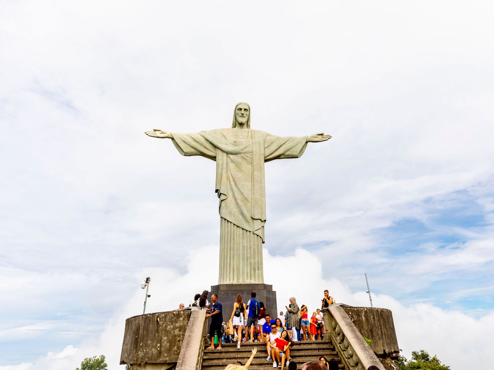
The world’s largest Art Deco monument, Cristo Redentor (Christ the Redeemer) looks over Rio de Janeiro from the top of Corcovado Mountain in Brazil’s Parque Nacional da Tijuca. A mosaic of soapstone tiles covers the 125-foot-tall concrete structure, which depicts Jesus with his arms outstretched, reaching a wingspan of 92 feet. But many visitors don’t realize that the workers who prepared and installed the soapstone tiles in 1922 wrote wishes on the back, which are now hidden from sight. And that’s not the only secret on the inside: The statue also contains a four-foot-wide heart.
From time to time, the statue is even damaged by lightning strikes. Checks on the statue’s structural integrity are carried out from inside, via stairwells and access tunnels. The maintenance team enters through a door roughly aligned with Christ’s right ankle, but there’s also a trapdoor in his right shoulder.
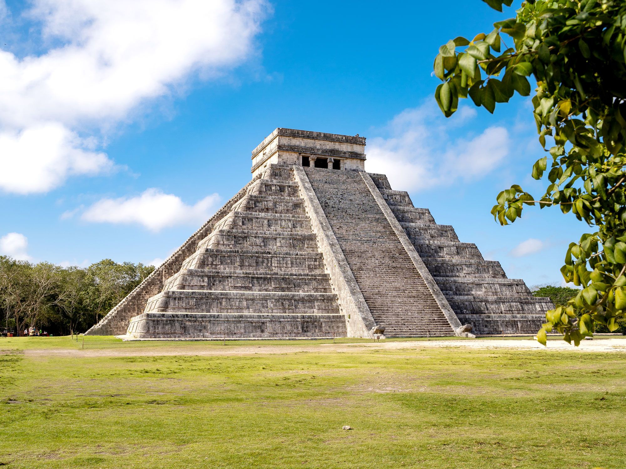
Mexico’s Yucatán Peninsula is famous for both its Mayan ruins and abundance of cenotes, the sinkhole lakes that form when the permeable limestone above them collapses. Archaeologists continue to explore the area, and in 2015, they found evidence which points to there being water directly underneath Kukulcán, Chichén Itza’s temple pyramid.
Archaeologists and geophysical researchers from the University of Mexico carried out an electrical resistance survey, which indicated that there was a water-filled cavity under the layer of rock which supported the pyramid. At its widest point, this cenote measures about 114 feet in diameter. You don’t have to walk very far to get a sense of what it might look like: Cenote Xtoloc, open to the elements, is situated between Kukulcán and El Caracol observatory.
A Door at Machu Picchu Might Lead to a Secret Chamber Filled With Gold
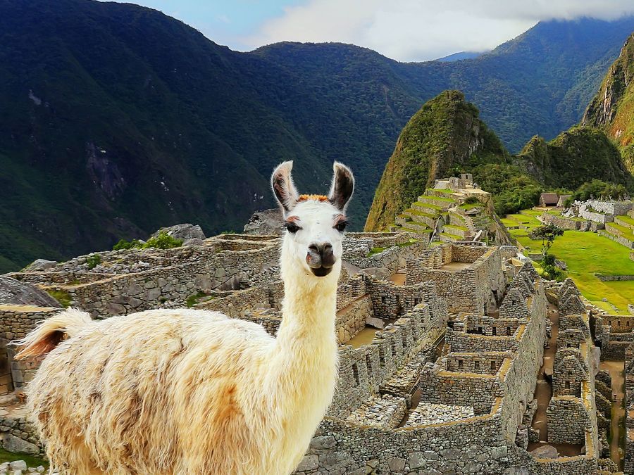
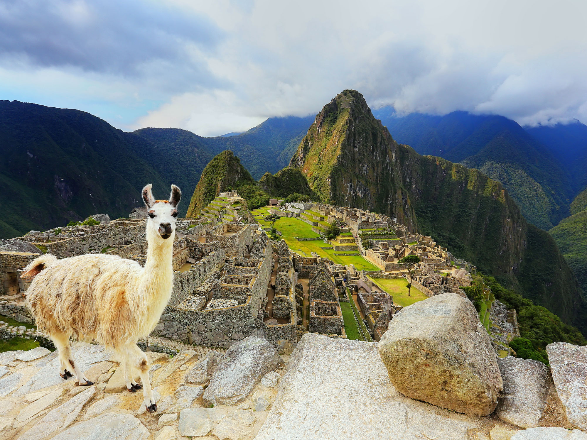
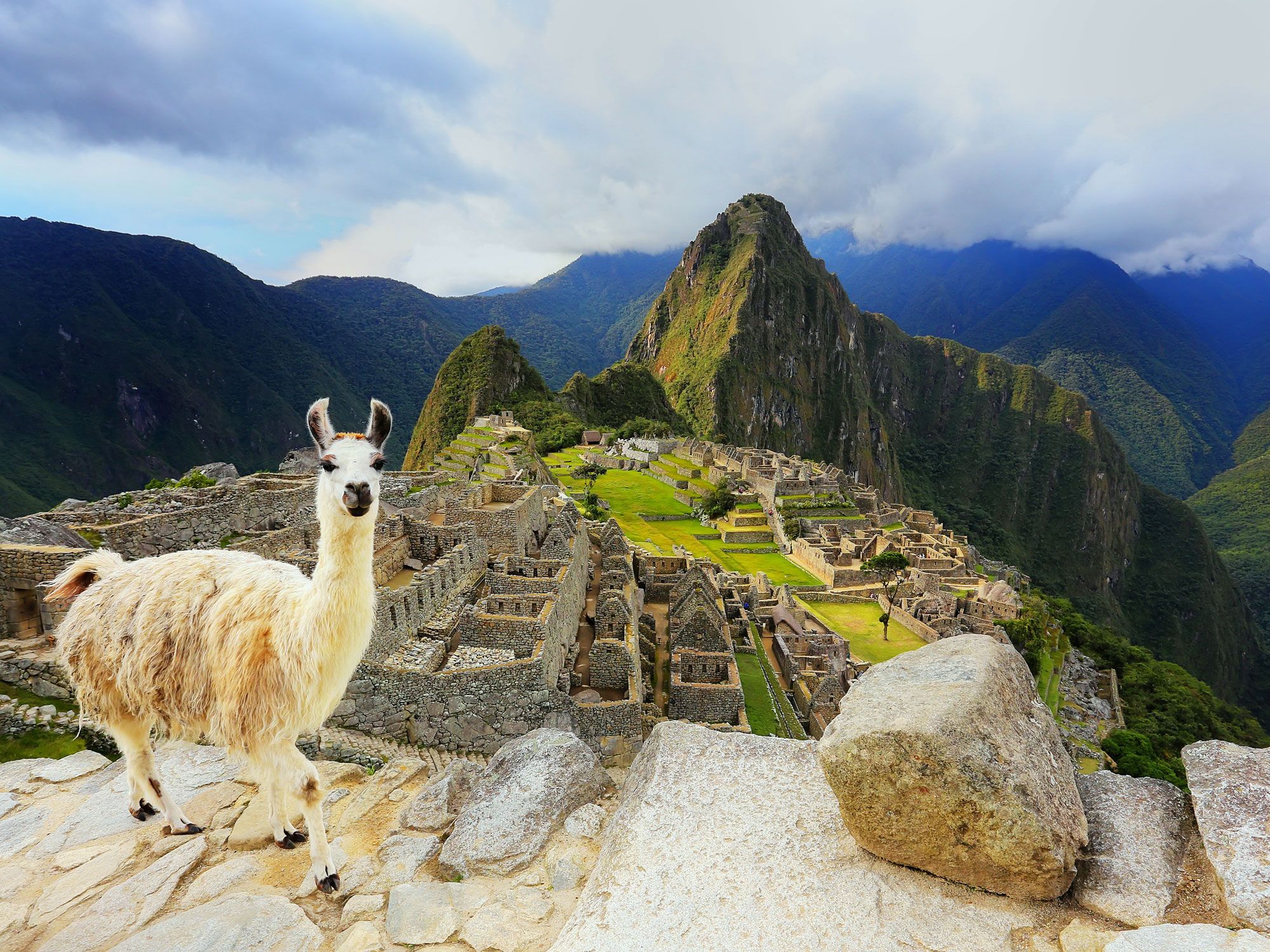
More than a million people visit Machu Picchu in Peru every year, but few visit a cave on the far side of Huayna Picchu, the peak which rises above the former Inca citadel. The Temple of the Moon is a ceremonial shrine with niches cut into the cave walls. As with the purpose of Machu Picchu in general, there’s plenty of speculation about what they were used for, though a popular theory suggests they might have held mummies.
It’s possible there are more secrets yet to be unlocked. In 2011, French explorer Thierry Jamin came to Machu Picchu to investigate what appeared to be a sealed door. With permission from Peru’s Ministry of Culture, he used ground-penetrating radar technology to try to determine whether there was anything behind it. He believes he may have found an Inca funerary chamber filled with gold, but Jamin has yet to convince the authorities to give him permission to excavate.
There’s a Basement at the Taj Mahal, But It’s Off-Limits
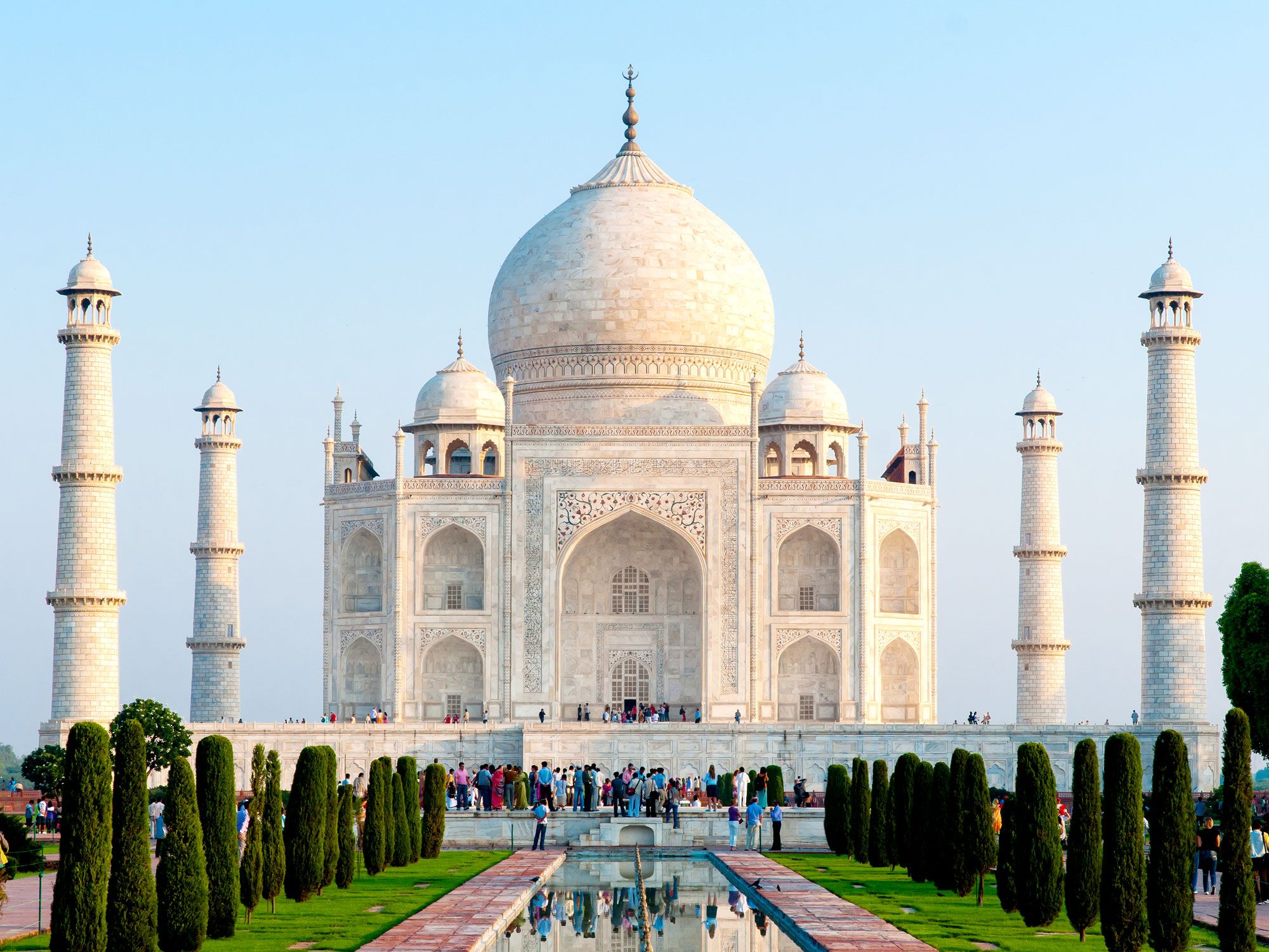
Eagle-eyed travelers visiting the Taj Mahal in Agra will spot sealed-up passages leading below ground. Built by Shah Jahan to honor his late wife Mumtaz Mahal, this lavish 17th-century mausoleum is enveloped in white marble, which features intricate carving and inlay work studded with precious and semi-precious gems. But what lies beneath?
Some locals may remember the rooms being accessible until the late 1970s, but since then, flooding from the adjacent Yamuna River and the need for restoration has kept them closed. In 2022, India’s High Court rejected a request to have them opened up. Rumors abound as to what might be behind closed doors, but photos that have emerged suggest that there’d be little to see, and certainly nothing as striking as what’s above ground.
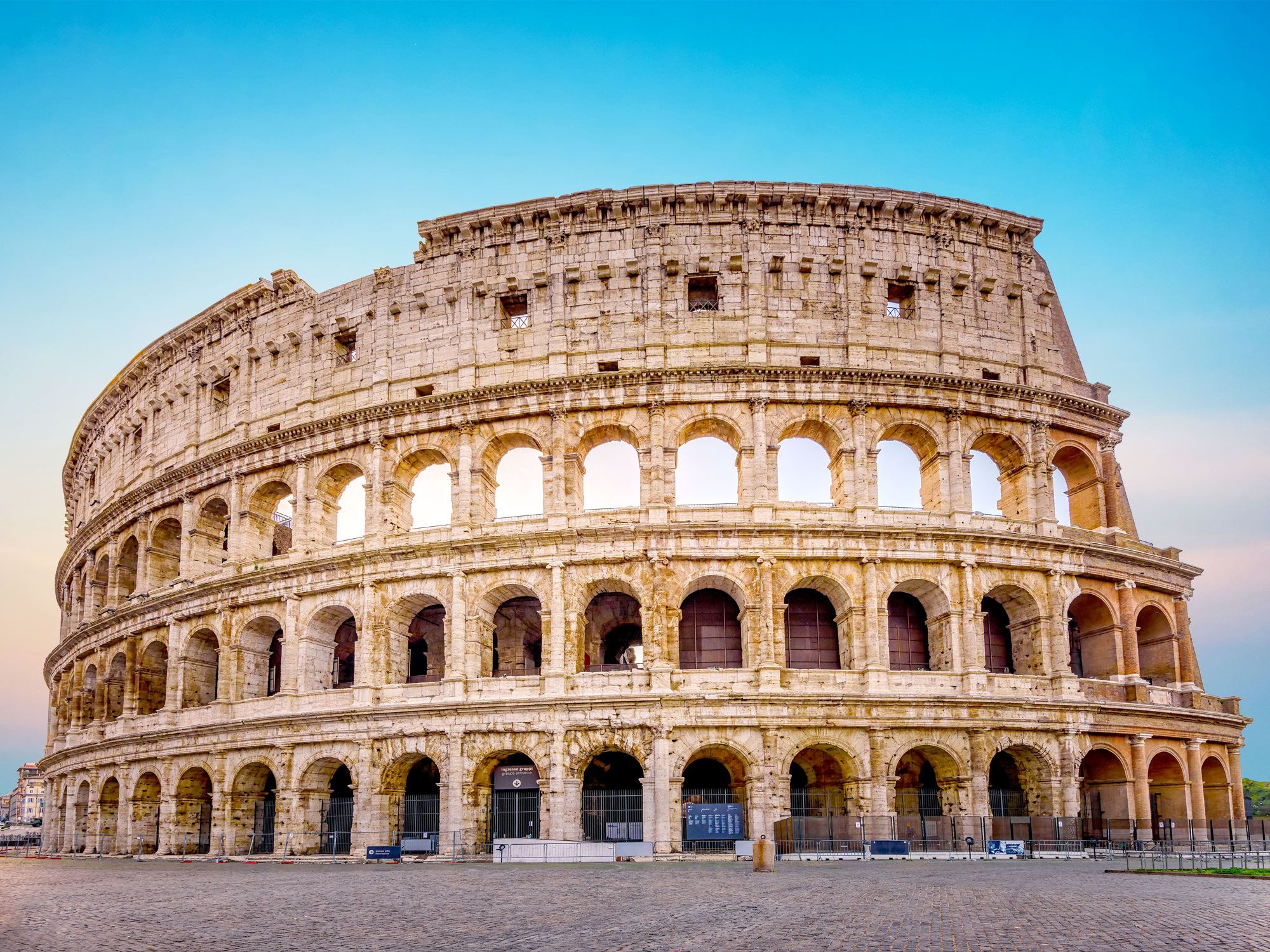
At its peak, Rome’s Colosseum had a capacity of 50,000 people, making it the largest structure of its kind anywhere in the Roman Empire. These spectators would pour in through 80 entrances to watch gladiator fights and other shows; the amphitheater was designed so that they could take their seats quickly.
However, arguably the most interesting part of the structure is that which sits beneath the level of the arena, with its dense network of rooms and passageways. Archaeologists excavated the sewers beneath the Colosseum in 2022 hoping to find out more about how the arena was flooded for water-based spectacles such as mock sea battles. Instead, they learned about the people who watched, uncovering discarded fruit seeds and pips, dropped coins, and even the bones of small dogs.
The Great Wall of China Has a Series of Hidden Doorways
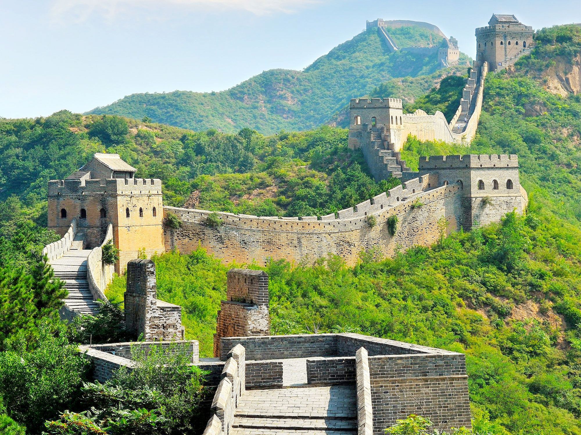
Here’s a conundrum: What would be the point in going to all the trouble of building a massive defensive wall yet putting doors in it? A 2020 National Geographic documentary about the Great Wall of China highlighted this curious architectural detail. In the documentary, archaeologist and presenter Allan Maca explained that the doorways would be large enough to allow a person through. A few are even large enough to accommodate a person on horseback.
The findings stem from the work of Professor Li Zhe of Tianjin University and his team, who used drones to map around 220 of the wall’s hidden doorways. These heavily camouflaged doorways would have likely been used by the military when they needed to dispatch scouts, to launch surprise attacks, or to receive supplies.
There’s a Smaller Version of Petra Just Up the Road
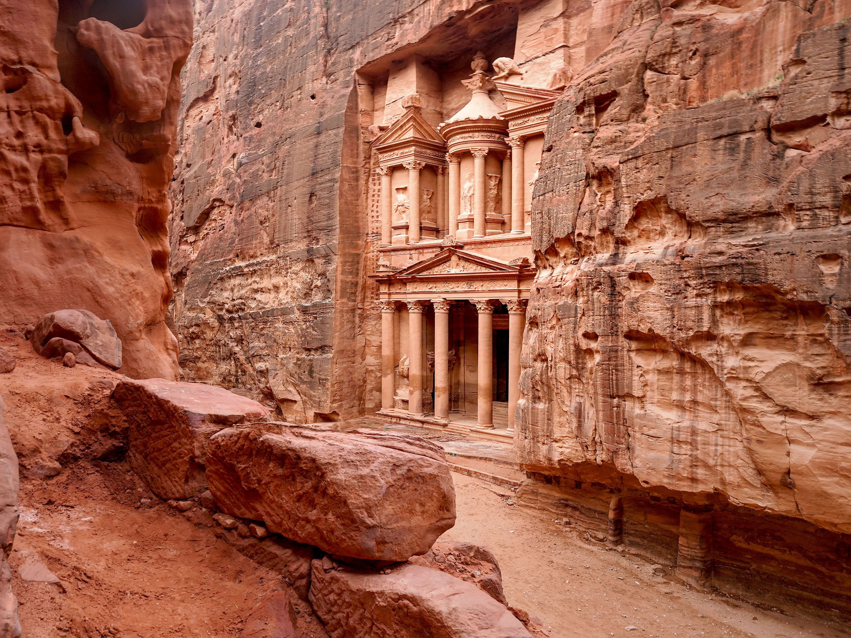
Three miles from the UNESCO World Heritage Site of Petra, Jordan, visitors will find a remarkably similar, though smaller, ancient settlement. It’s called Siq al-Barid (the Cold Siq), but it’s known to foreign tourists as Little Petra, and it was probably a suburb of Petra during Nabatean times.
Like its larger counterpart, it’s squeezed into a narrow sandstone gorge and boasts carved façades, tombs, irrigation channels, and rock cisterns. Steps cut out of the rock lead to the upper stories of temples and rock-hewn spaces once used as dining rooms. There are also a number of interesting frescoes at the Painted Biclinium (Painted House). One features a picture of a winged Eros with a bow and arrow and Pan playing a flute. Another depicts grapevines, which confirms that this was a wine producing area during the Nabataean Empire, which reached its heydey in the first century CE.
Advertisement
More from our network
Daily Passport is part of Inbox Studio, an email-first media company. *Indicates a third-party property.
Daily Passport writers have been seen in publications such as National Geographic, Food & Wine, CBC, Condé Nast Traveler, and Business Insider. They're passionate about uncovering unique destinations and sharing expert tips with curious travelers.
Just how low can you go on the surface of the Earth? Though most of the planet’s surface is at sea level — which shouldn’t be too surprising when you consider 71% of Earth is covered by water — there are a select few land points that descend to far greater depths. In fact, many of the lowest places on Earth are on the surface of lakes, though they have seasonally fluctuating depths, thanks to intermittent flooding, rainfall, and evaporation. Below, journey down to the 10 lowest points on the planet.
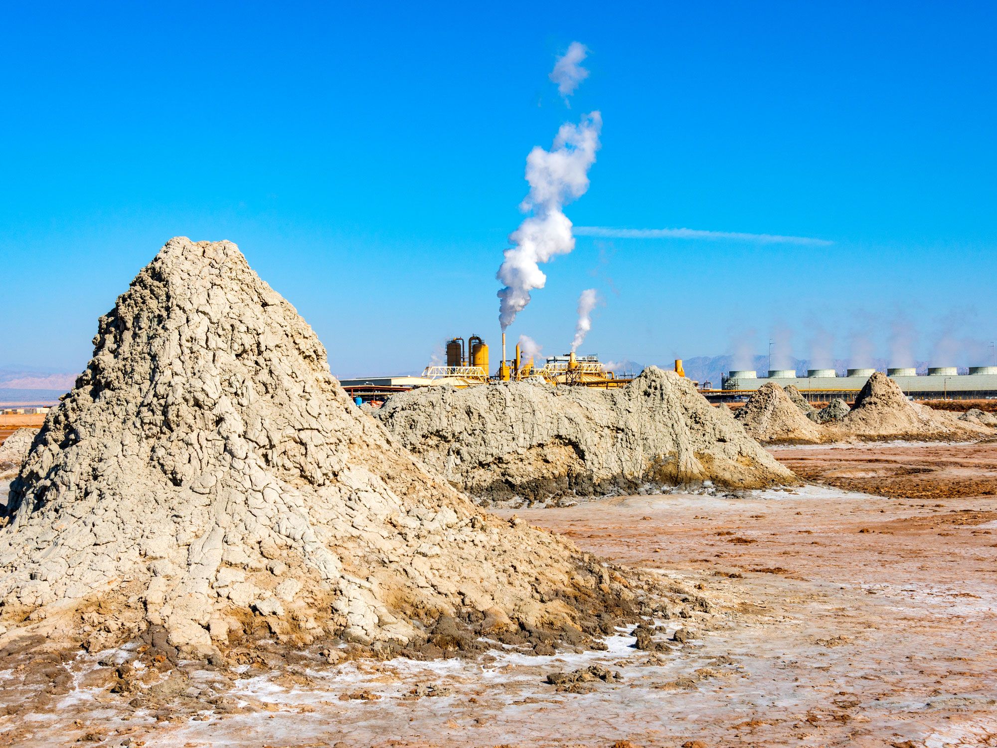
California’s Salton Sea — a highly saline, shallow body of water in the Colorado Desert at the southern end of the state — was once a thriving resort community in the 1950s and 1960s. For decades, local farmers using water from the nearby Colorado River for agricultural purposes allowed the fertilizer-contaminated runoff to flow back into the lake basin. Since the endorheic lake basin has no drainage flow, this caused a huge rise in the water’s salinity and massive subsequent die-offs of fish and birds, among other wildlife.
As a result, the lake began to emit an odor which drove tourists away; today, many of the beach towns remain abandoned. There’s still a community of artists lingering in the area, though — and the tourism industry is slowly growing again, thanks in part to the nearby cities of Indio and Coachella about 15 miles north of the lake. The latter is home to a massively popular yearly music festival of the same name.
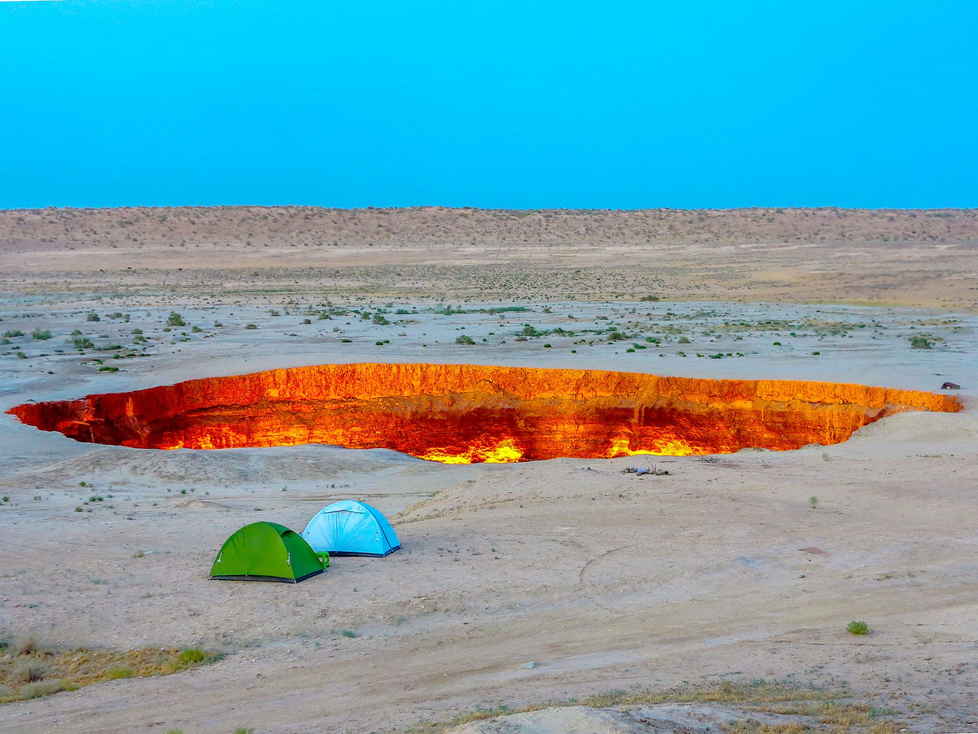
The Akjagaýa Depression is located in the Karakum Desert of Turkmenistan, one of the driest areas in the country. The depression is actually contained within Sarykamyska Lake, the waters of which fluctuate in elevation — so much that the lake itself has disappeared and then reappeared several times. The desert is also where you’ll find the Darvaza Gas Crater, also called the “Door to Hell,” a natural gas field that has been perpetually burning since 1971.
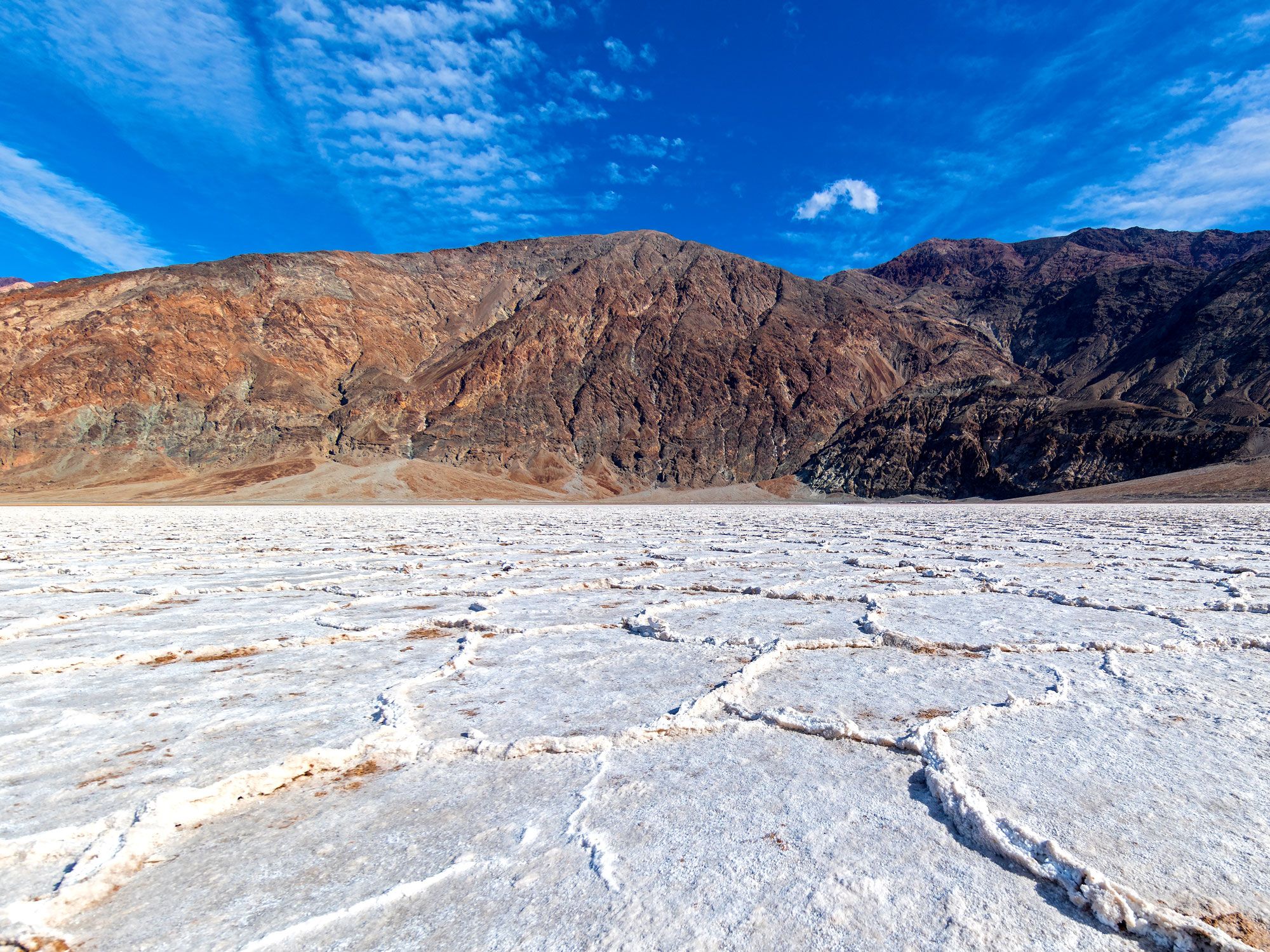
8. Badwater Basin – Death Valley, California (-282 Feet)
Death Valley holds the dual distinction of being the hottest place on the planet and one of the lowest. On July 10, 1913, a reading of 134.1 degrees Fahrenheit was taken at the desert’s Furnace Creek Ranch, which is the hottest air temperature ever recorded on Earth.
Extremely hot temperatures aren’t unusual in the world’s very low places, because air warms as it gets lower (and cools as it rises). And very low places are common in this part of California, thanks to the San Andreas Fault running beneath it and periodic water breakthroughs from nearby rivers causing erosion. The lowest point in Badwater Basin is actually within an area of salt flats, but the flats can be treacherous to traverse since they are composed of mud covered by a thin crust of salt. Technically, the sign that marks the lowest point is located a few miles east.
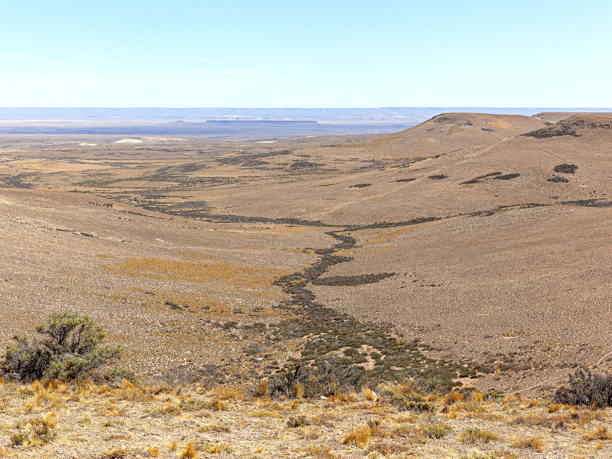
Located within the Great San Julián Depression (Gran Bajo de San Julián), this salt lake is part of Argentina’s southernmost Patagonia region. The depression ends in high cliffs before it drops off into the Atlantic Ocean, which lies just to the east. The lake’s name translates to “Coal Lake,” and dinosaur fossils have been found in the endorheic basin.
Unlike some other low points in the world, there’s not much tourism centered around the site, which sits on private property and isn’t accessible by public road (although the depression can be viewed from afar from the highway). Mountains loom in the distance, and the small port city of Puerto San Julián is about 30 miles east, but until then, there’s nothing but salt, scrub, and howling winds to be seen in the lake basin and its surroundings.
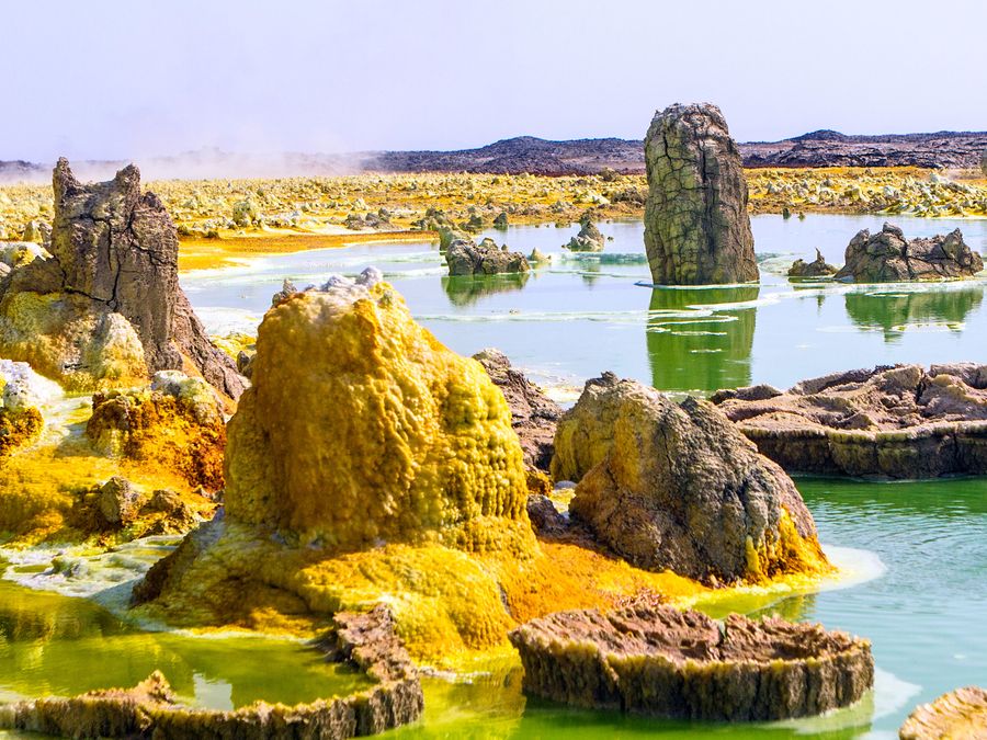
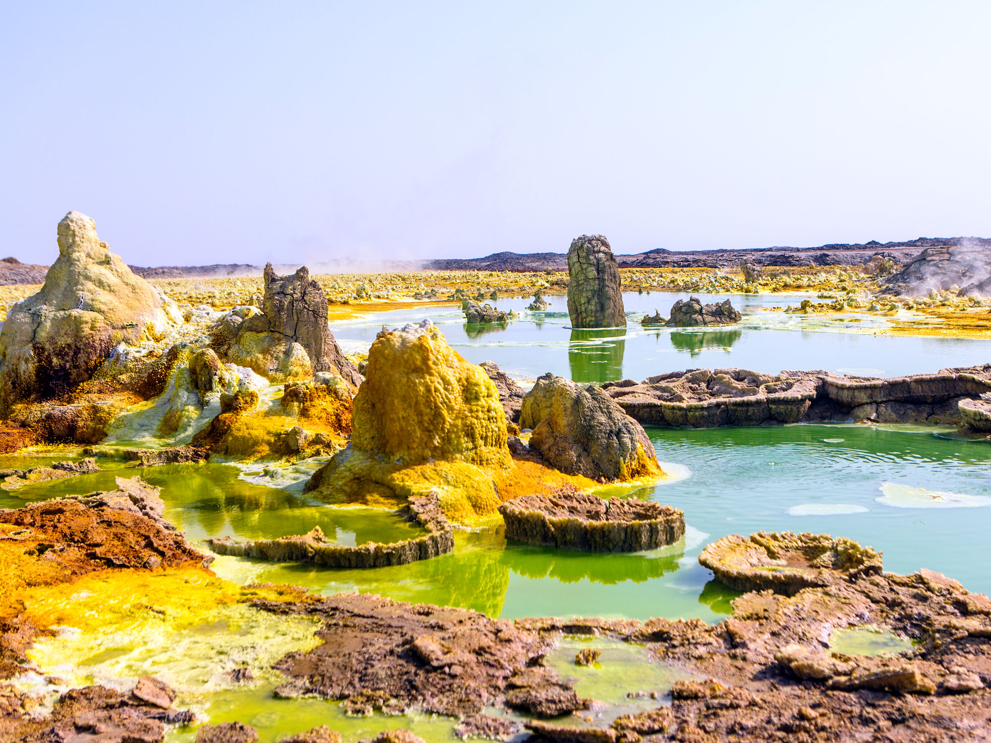
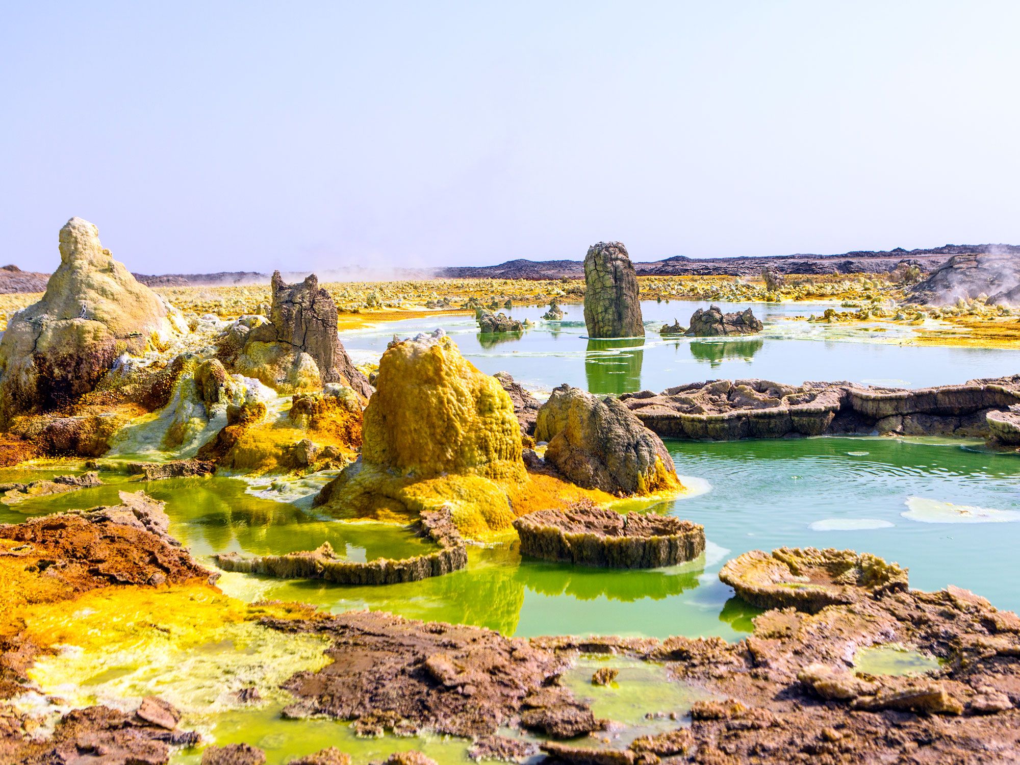
In northeast Ethiopia is another one of the hottest places on Earth. It’s home to the planet’s sixth-lowest point, located in the Danakil Depression, which sits inside the larger Afar Depression (also called the Afar Triangle). Created by the convergence of three tectonic plates and characterized by active volcanoes, sulfur springs, lava lakes, and toxic gasses in the air, the Danakil Depression contains one of Earth’s most otherworldly landscapes, often compared to the surface of Venus.
Temperatures average in the mid-90s but regularly soar to 120 degrees Fahrenheit. Visitors can take tours on camelback to view the colorful neon-toned landscape of oranges, greens, and yellows, which are caused by oxidized iron and sulfur deposits. The Danakil Depression is also the site where the famous Australopithecus fossil known as Lucy was discovered in 1974.
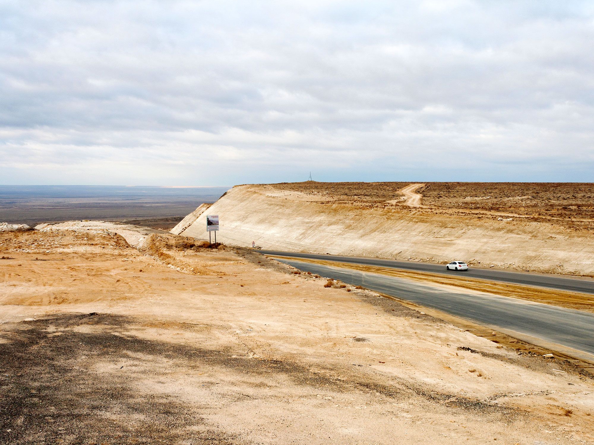
Vpadina Kaundy is located inside a 25-mile-long karst trench called Karagiye, on the Mangyshlak peninsula near the eastern shores of the Caspian Sea. Translating to “Black Mouth” or “Black Jaw” in Turkic, Karagiye was formed when a series of limestone, dolomite, and gypsum caves collapsed. (Vpadina Kaundy is the name for the lowest point within the trench, not the trench itself.)
A seasonal lake lies at the bottom of the trench, as well as a stream originating from a human-drilled well that flows back into a hole in the ground. Karagiye is known for creating its own unusual long rain clouds, which rise above it. Snakes, hares, wild mouflon sheep, and yellow corsac foxes live along the verdant floor inside the trench, while the air above it is home to a population of vultures. Locals also visit the trench to gather mushrooms, the only ones that grow on the Mangyshlak peninsula.
At an elevation only two feet lower than Vpadina Kaundy, this 7,500-square-mile sinkhole in northwestern Egypt, near the Mediterranean Sea, is famous for its high cliffs and spectacular black sand dunes. First measured by English geologist Dr. John Ball in 1917, the Qattara Depression is about the size of Lake Ontario, and comprises wild palm and acacia groves, salt marshes, and dry but occasionally flooded lake beds — the latter are characterized by swaths of sticky mud covered by a salt crust. The sinkhole was formed over millennia as salts in the soil slowly eroded the bedrock into sand, which was then blown away by the wind, exposing the water table beneath the bedrock.
Qattara means “dripping” in Arabic, a reference not to the mud or flooded lake beds but a natural spring, Ain El Qattara, one of a handful of natural oases found here. The Qattara Depression is home to fauna such as gazelles, jackals, cheetahs, and wild sheep, as well as cattle, which are bred by nomadic Bedouin ranchers. The depression was also the scene of a crucial defeat against the Axis powers in the First and Second Battles of Al Alamein in 1942. Tanks couldn’t pass through the swamp, so the British Empire’s forces were protected.
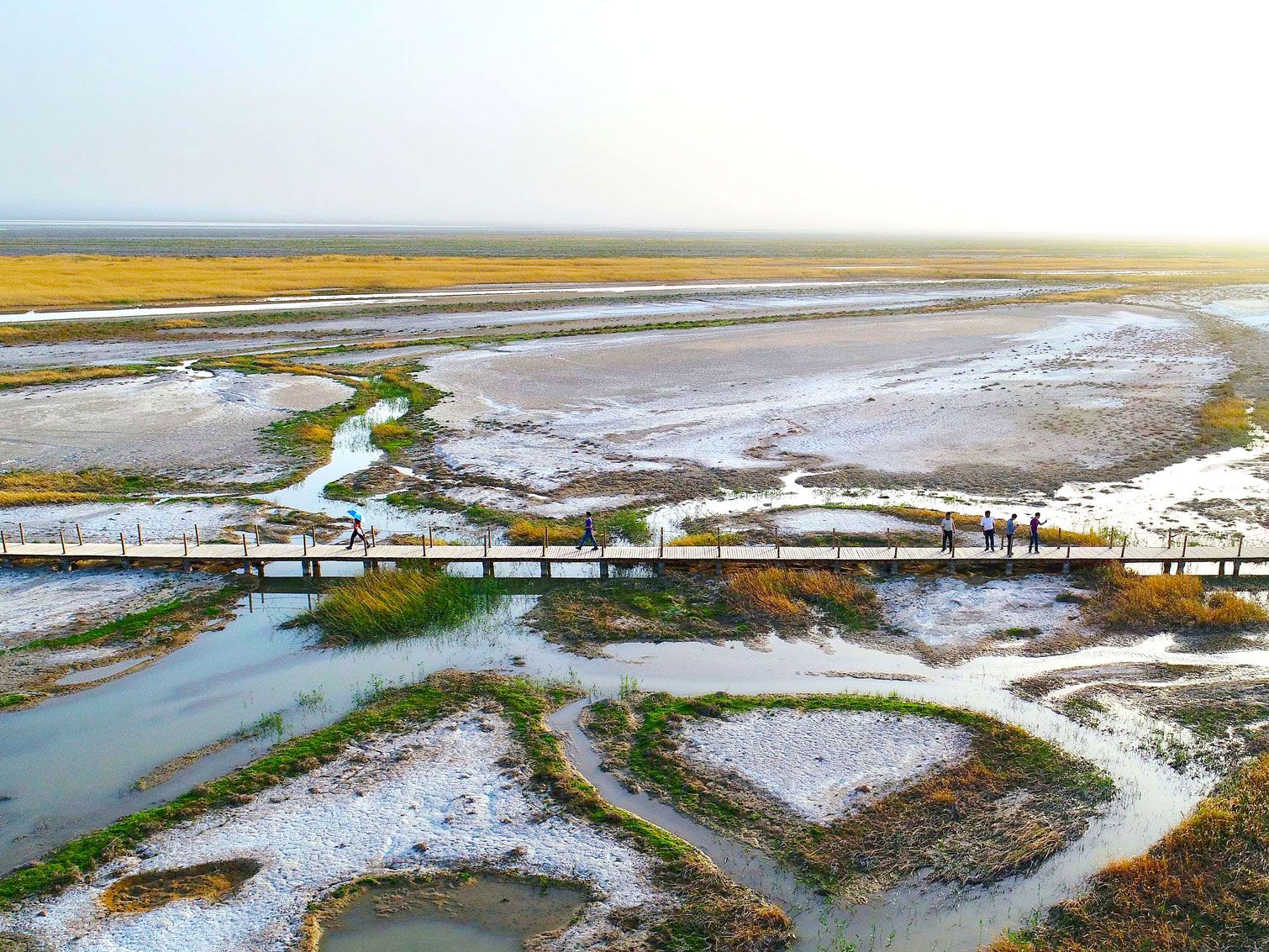
Ayding Lake is known as Aydingköl in Uyghur, which translates to “moon lake.” It was named for the salt ring around its edge, which gave it the appearance of a shining moon. The lake is the remnant of a 2-million-square-mile inland sea that was formed by the Himalaya Mountains approximately 250 million years ago. Thanks to wells and diversion channels being drilled for irrigation purposes, the lake completely dried up, leaving only mudflats, silt swamps, vegetation, and salt pans today.
Ayding Lake is located in the center of the Turpan Depression, in the Xinjiang Autonomous Region of western China. Desertlike in the northwest and tropical in the southeast, the 20,000-square-mile basin is a fruit-producing agricultural region, particularly known for its grapes and melons, which are irrigated via tunnels that tap groundwater from higher areas. In addition to being China’s lowest point, it’s also China’s hottest place: On July 24, 2015, a new record was set at Ayding Lake when the temperature reached 122.5 degrees Fahrenheit.
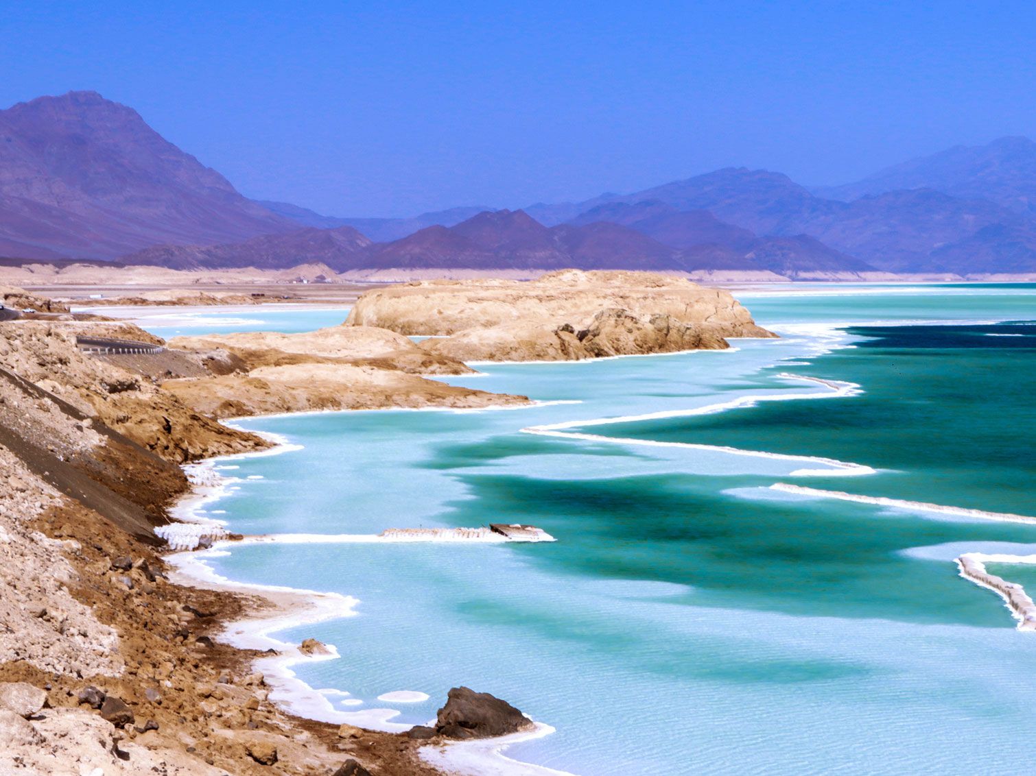
Lake Assal is also located in the Danakil Desert, a 140-mile drive east of Djibouti. There, you’ll find an inhospitable but beautiful landscape, with pale blue waters and rocky mountains rising in the distance. Look closely, though, and you’ll see that everything that surrounds Lake Assal is encrusted in salt. Due to evaporation from high heat and the lake’s lack of an outflow, the salinity of the water is 10 times higher than that of the ocean. Taking a swim in Lake Assal stings one’s eyes and leaves an oily, salty patina on the skin. In fact, the water’s viscous texture is the reason for its name: Assal means “honey” in Arabic.
The lake and the Danakil Desert are located within the Afar Depression, along with several other extremely low hypersaline lakes, such as Lake Bakili and Lake Afrera. The nomadic Afar people who live in the region use the lake for salt extraction and have established trade routes that lead from the lake through the mountains of Ethiopia. These roads are also used for trading coal and sorghum, among other commodities, all of which are transported by donkey and camel.
1. Dead Sea – Jordan/Israel/West Bank (-1,412 Feet)
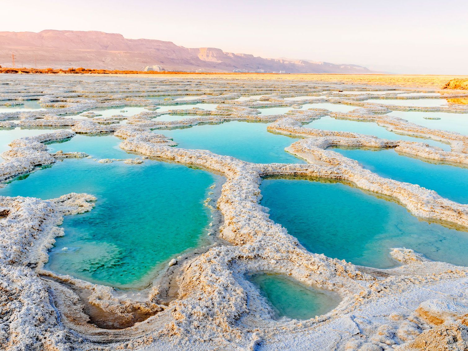
In the Jordan Valley, the Dead Sea is situated on the mostly north-south geopolitical border that separates Jordan and Israel, and the West Bank’s southeastern corner also falls within the lake. With shores located at 1,412 feet below sea level, the world’s lowest point blows all other contenders out of the water, so to speak — it’s easily double the depth of the surface of Lake Assal.
Also a hypersaline lake, the Dead Sea is 9.6 times saltier than the ocean. Anyone can easily float in the water as a result of its high salt content. As such, it’s one of the world’s oldest health resorts, patronized even by the biblical Herod the Great, and tourists still flock to its shorelines on all sides. The name “The Dead Sea” never actually appears in the Bible, however. In Hebrew, it was called Yām ha-Melaḥ (the Sea of Salt), and in other texts it was referred to as ha-Yām ha-kadmoni (The Eastern Sea) or Yām ha-‘Ărāvâ (The Sea of the Arabah).
Advertisement
More from our network
Daily Passport is part of Inbox Studio, an email-first media company. *Indicates a third-party property.
5 Lesser-Known UNESCO World Heritage Sites You Should Know About
By
Daily Passport Team
Read time: 5 minutes
July 13, 2023
Updated: July 25, 2023
5 Lesser-Known UNESCO World Heritage Sites You Should Know About
Culture •July 13, 2023•Updated: July 25, 2023
By Daily Passport Team
Author
Daily Passport Team
Daily Passport writers have been seen in publications such as National Geographic, Food & Wine, CBC, Condé Nast Traveler, and Business Insider. They're passionate about uncovering unique destinations and sharing expert tips with curious travelers.
It all started in 1978 with the original list of 12 UNESCO World Heritage Sites, and today there are more than 1,100 places around the globe designated for their scientific, cultural, or historical value. Chances are, you’ve heard of UNESCO sites such as the Taj Mahal, Vatican City, and the Statue of Liberty, but there are many places that don’t receive as much recognition. Check out these five lesser-known UNESCO World Heritage Sites you should visit.
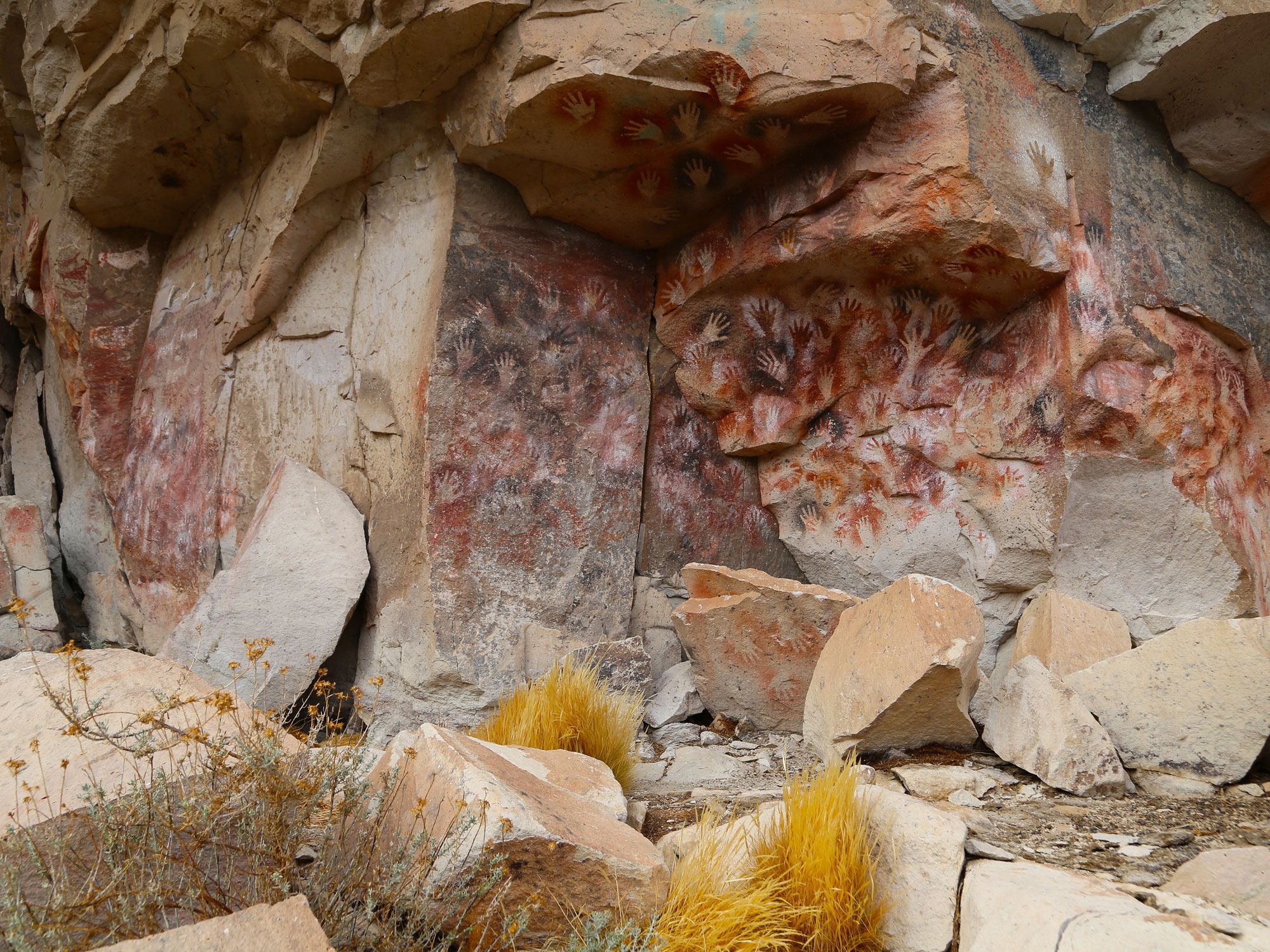
The name of Cueva de las Manos translates literally to “cave of hands” and refers to the thousands of curious handprints that line the walls of this cave in Río Pinturas, in the southern region of Argentina. While the cave is named for the palms that adorn the interior stone, visitors can also find paintings of birds, pumas, and other animal creatures throughout the caves. The cave’s paintings — made of natural elements like iron oxide and manganese — represent the culture of the area, which was last inhabited around 70 CE. The origins of the cave date back somewhere between 9,300 and 1,300 years ago, and the prints are remarkably well-kept considering their age.
The site was chosen as a UNESCO World Heritage Site in 1999 since it “bears witness to the culture of the earliest human societies in South America.” Local groups have taken considerable efforts to preserve the caves and recognize their value as an important archaeological site. The caves are open to the public and provide a one-of-a-kind experience. If you’re planning a trip, a guided tour will give you the greatest understanding of the historical and cultural significance of the site.
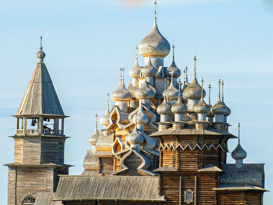
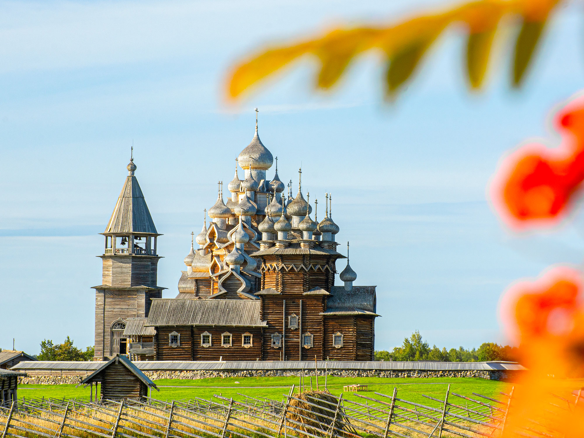
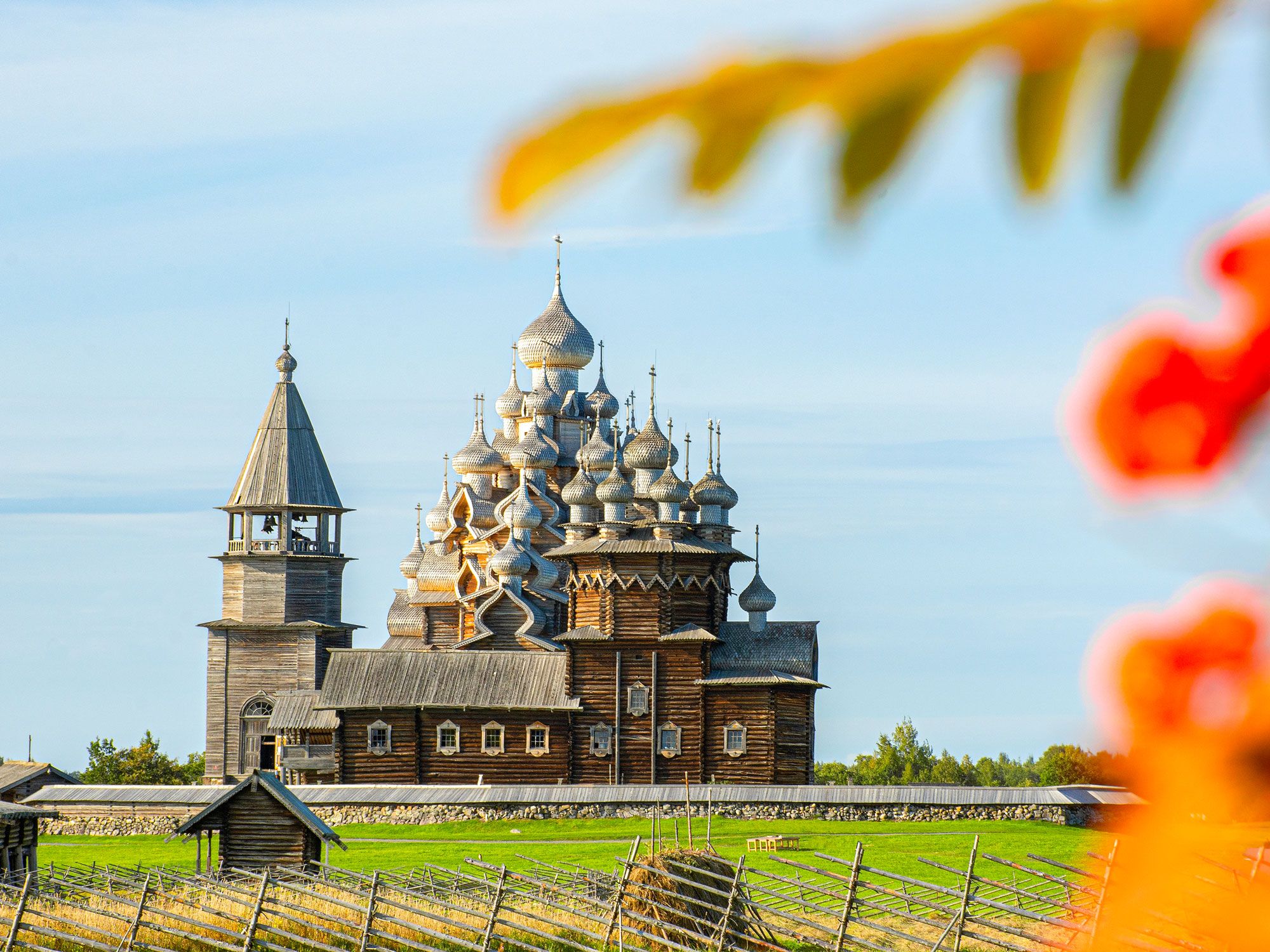
While Kizhi Pogost doesn’t have the same bold colors or global recognition as the striking St. Basil’s Cathedral in Moscow, the intricate attention to detail on the structure is just as mesmerizing. Located in the Republic of Karelia, Russia, Kizhi Pogost consists of the Church of Transfiguration and the Church of Intercession. The buildings are built entirely of wood without the use of a single nail.
Kizhi Pogost is located along the peaceful Lake Onega and earned its place on the UNESCO World Heritage list in 1990 as an exceptional example of Russian architecture. The churches were not the first buildings to be constructed on the island and the original buildings burned down in the late 1600s. The Church of Intercession and The Church of Transfiguration were subsequently built on the island several decades later. Today, the buildings serve as an open-air museum and are accessible by ferry. If you plan to visit, be sure to allow enough time during the day as overnight stays are not allowed.
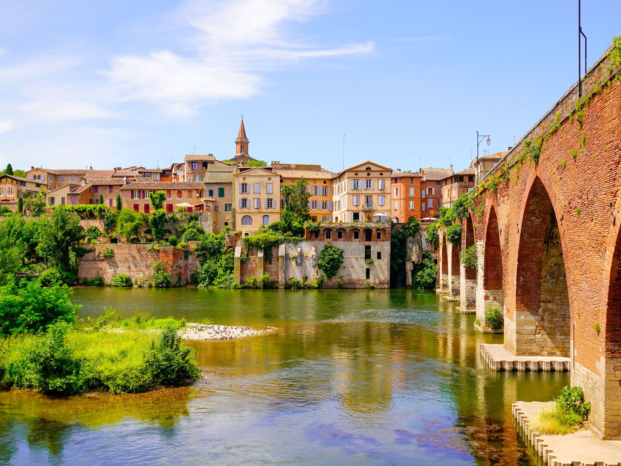
The Episcopal City of Albi is a remarkably preserved example of medieval architecture. The city is located on the Tarn river and dates back to the 10th century. A visit to the city is like being transported back to a different time. The city joined the UNESCO World Heritage list in 2010 as an example of early architecture and early development.
The Episcopal Palace and Saint Cecilia’s Cathedral are the most recognizable and imposing structures in the city, but the Berbie Palace, the Castelviel, and the village of Saint-Salvi are equally as mesmerizing. The Episcopal City of Albi attracts more than a million visitors annually and is open year-round. If you’re visiting France, consider adding this piece of history to your itinerary.
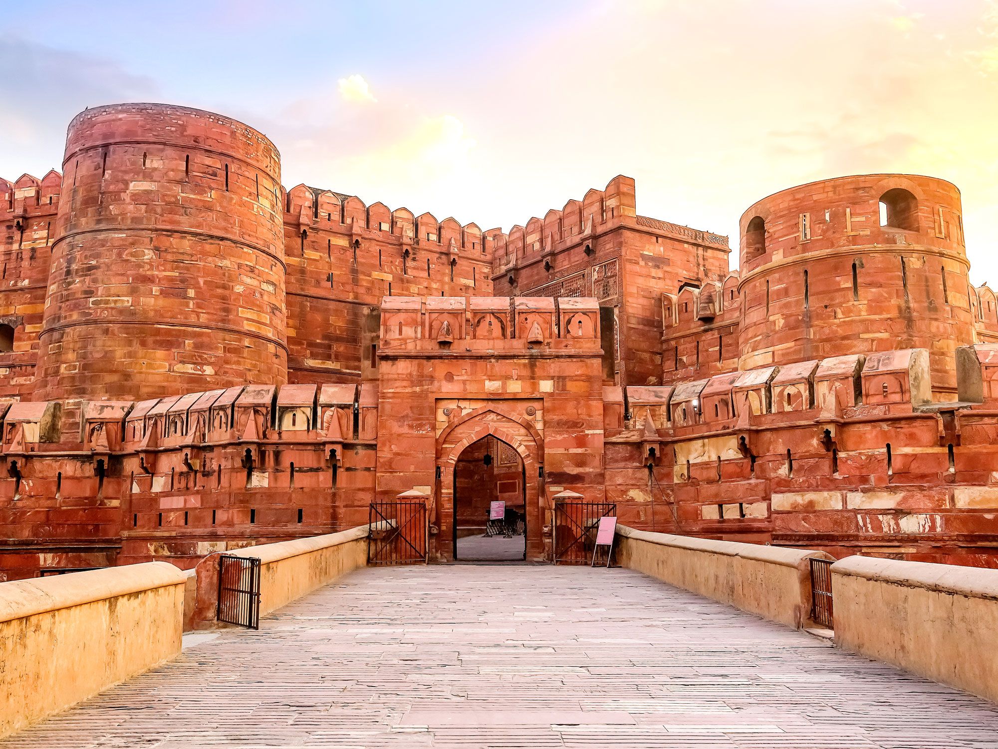
The Taj Mahal might be India’s most recognizable structure, but Agra Fort, which is located just outside the gardens of the mausoleum is just as demanding of your attention. The fort was the primary residence for the emperors of the Mughal Dynasty until 1638. The Government of Uttar Pradesh considers the fort a walled city. Within the city, you can find prominent landmarks such as the Jahangir Palace and the Khas Mahal, as well as two mosques.
The red sandstone structure is an extraordinary example of Mughal architecture. Built in the early 1600s, the site is still open to the public. Though the fort originally had four gates, two have since been walled up. Visitors can only access the fort through the Amar Singh Gate. Agra Fort is located approximately 125 miles south of Delhi. If you are visiting the area to see the Taj Mahal, you really should consider adding a visit to Agra Fort.
Tsingy de Bemaraha Strict Nature Reserve – Madagascar
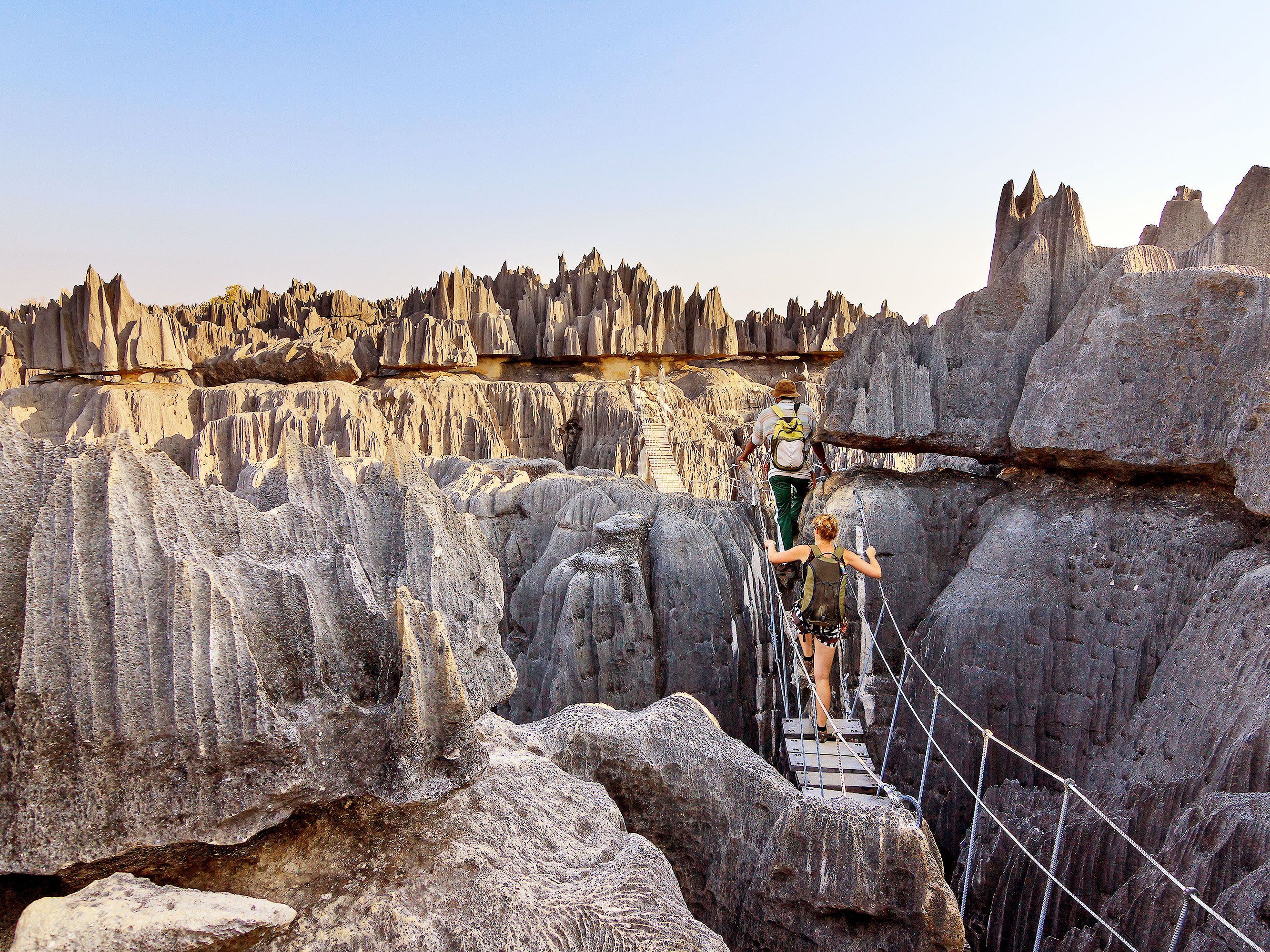
The Tsingy de Bemaraha Strict Nature Reserve is a behemoth of a natural wonder that doesn’t get enough attention. The reserve, which is located in central Madagascar, features towering, natural limestone structures that UNESCO describes as limestone needles.
The name Tsingy translates to “walking on tiptoes.” An aerial view of the area shows just how powerful these natural structures are and why the name so aptly fits. The enormous structures date back nearly 200 million years and are thought to be the result of heavy rainfall. The site joined the UNESCO list in 1990 as a unique and rare phenomenon in addition to being the home to several species of rare flora and fauna.
Most guides recommend at least two to three days to fully experience the area. Tours are available and highly recommended. Plan carefully as the Tsingy de Bemaraha Strict Nature Reserve is only open during the Madagascar dry season, which runs from April through November. Grand Tsingy is open from June to November.
Advertisement
More from our network
Daily Passport is part of Inbox Studio, an email-first media company. *Indicates a third-party property.
7 Historic U.S. City Trails to Explore From Coast to Coast
By
Jersey Griggs
Read time: 5 minutes
July 10, 2023
Updated: July 25, 2023
7 Historic U.S. City Trails to Explore From Coast to Coast
History •July 10, 2023•Updated: July 25, 2023
By Jersey Griggs
Author
Jersey Griggs
Jersey is a travel and lifestyle writer whose work has appeared in publications such as Condé Nast Traveler, Business Insider, and Bust. When she’s not exploring her adopted home state of Maine, she’s likely planning her next big trip.
Intertwining a city’s past and present, urban historic trails are one of the best ways to explore a city. Found throughout the U.S., these trails lead travelers to historical, architectural, and cultural landmarks, while also revitalizing old corridors and breathing fresh life into urban spaces. Take a hike on one of these seven historic U.S. city trails for a fascinating (and free) glimpse into the country’s urban history.
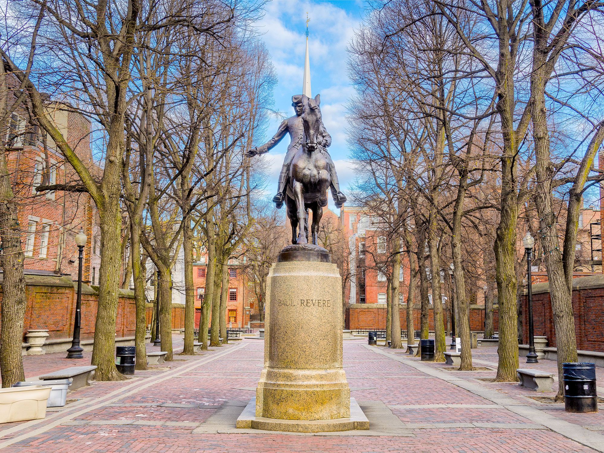
One of the country’s most famous historic trails, the Freedom Trail runs for 2.5 miles through several prominent Boston neighborhoods, including Charlestown, the North End, and downtown. Marked by a red strip along the city sidewalk, the trail traces the foundations of early America and highlights 16 of the city’s most historic sites, ranging from burial grounds to meeting houses to the USS Constitution, the oldest warship still afloat, and Boston Common — established in 1634 as America’s oldest public park.
To learn more about the significance of these sites, download the trail app and head to Boston Common to start the self-guided tour. Or you can listen to anecdotes about the city’s history from knowledgeable guides dressed in colonial garb on the Walk Into History Tour. Other specialized tours include the Revolutionary Women tour, which highlights the stories of women during the war, and the Lantern Led tour, which focuses on Boston’s macabre past.
After opening in 2015, the Lafitte Greenway transformed an abandoned shipping passageway into a 2.6-mile-long public green space. This multi-use trail follows the pathway of the former Carondelet Canal, built in 1794 as a shipping corridor between New Orleans and Lake Pontchartrain.
Home to the city’s largest farmers market, as well as free fitness classes and community art installations, the Greenway strives to benefit the community by providing a variety of services to the public. Future plans to continue the trail’s environmental stewardship include planting 1,000 cypress trees and installing numerous bioswales to assist with stormwater management.
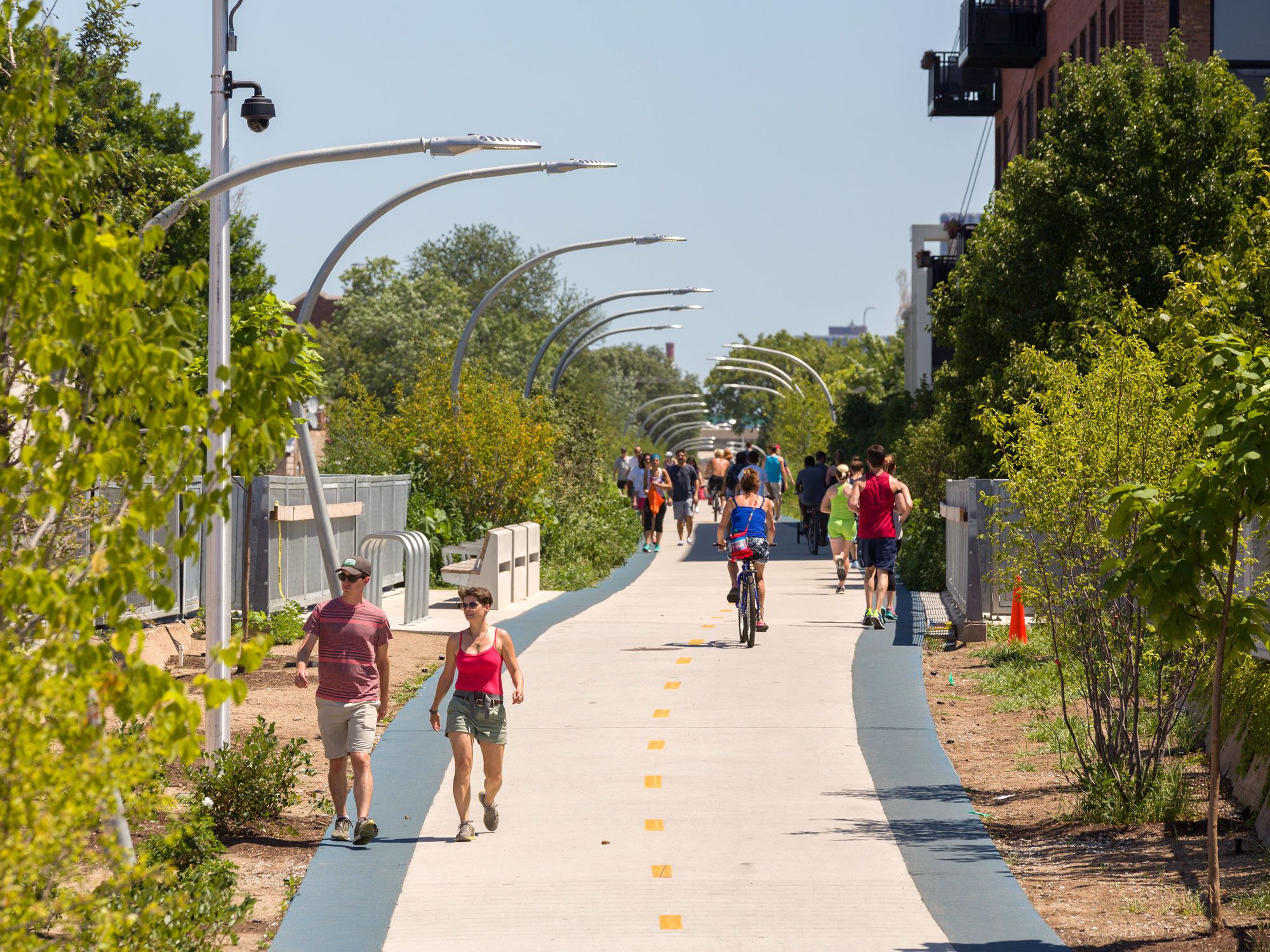
Stretching 2.7 miles long, the 606 is built on the former tracks of Chicago’s historic Bloomingdale Line, an elevated train line initially built after the Great Chicago Fire as the city attempted to rebuild. Although it functioned for nearly a century as a way to ship manufacturing goods to the city’s northwest side, the shipping corridor became defunct in the 1990s.
Since then, the rail trail has been revitalized to connect the popular and diverse neighborhoods of Wicker Park, Bucktown, Humboldt Park, and Logan Square. Named for the 606 zip code shared by Chicago residents, the trail is set above city streets, allowing walkers, cyclists, and rollerbladers to remain unencumbered by automobile traffic. Art installations line the path, including the Graffiti Garden and Birds Watching, a 40-foot-long sculpture composed of reflective bird eyes.
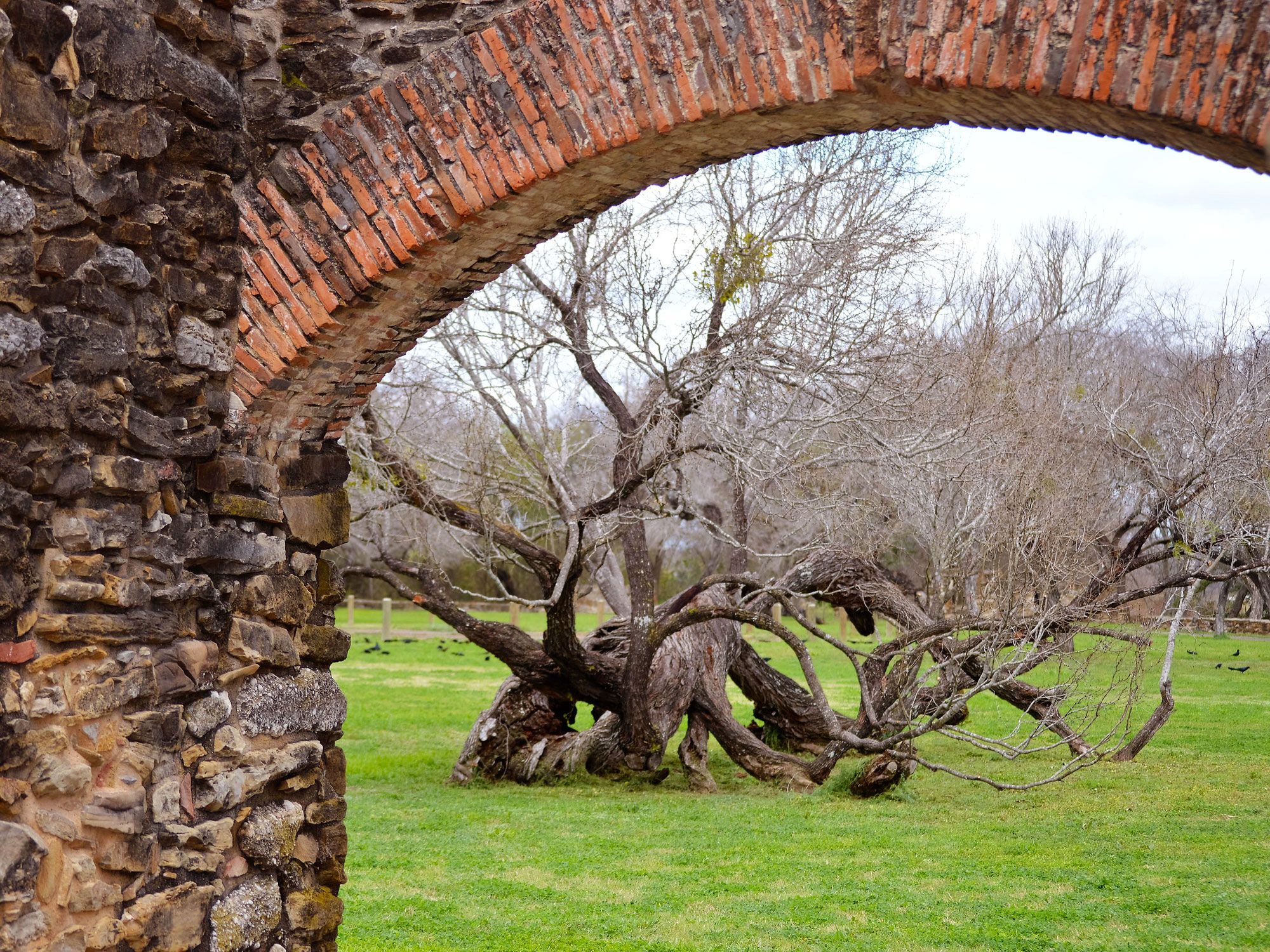
Connecting five Spanish missions (many of which are still active churches), this 13.9-mile loop traverses through the heart of San Antonio and is open to both pedestrians and bicyclists. As each mission is approximately two to three miles apart, the San Antonio Missions Trail can be completed in segments or as one continuous journey.
The most famous mission along the trail is Mission San Antonio de Valero — better known as the Alamo, it was the site of a historic battle during the Texas Revolution in 1836. Mission San José is the city’s largest mission, while Mission Espada was Texas’ first mission. Mission Concepción is one of the oldest unrestored churches in the country, and Mission San Juan was formerly a self-sustaining artisan commune.
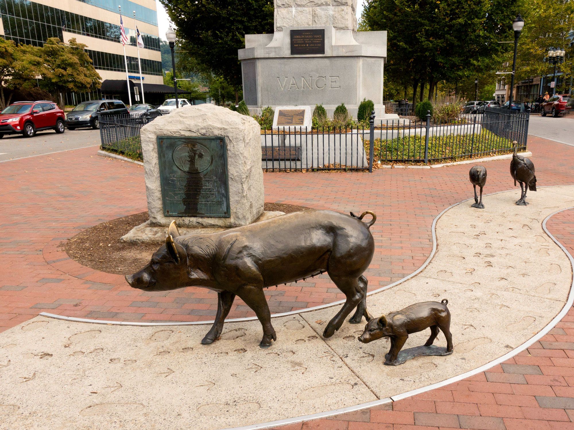
This 1.7-mile self-guided trail in historic Asheville was established in 1989 as part of local efforts to rejuvenate the city center. Now, the city’s eclectic downtown boasts a vibrant mix of restaurants, galleries, and outdoor events that draw locals and visitors alike.
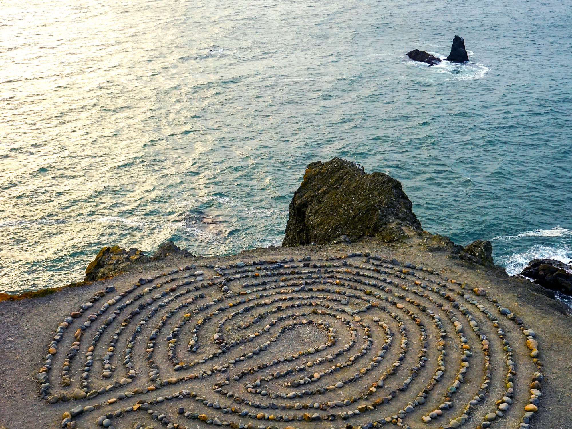
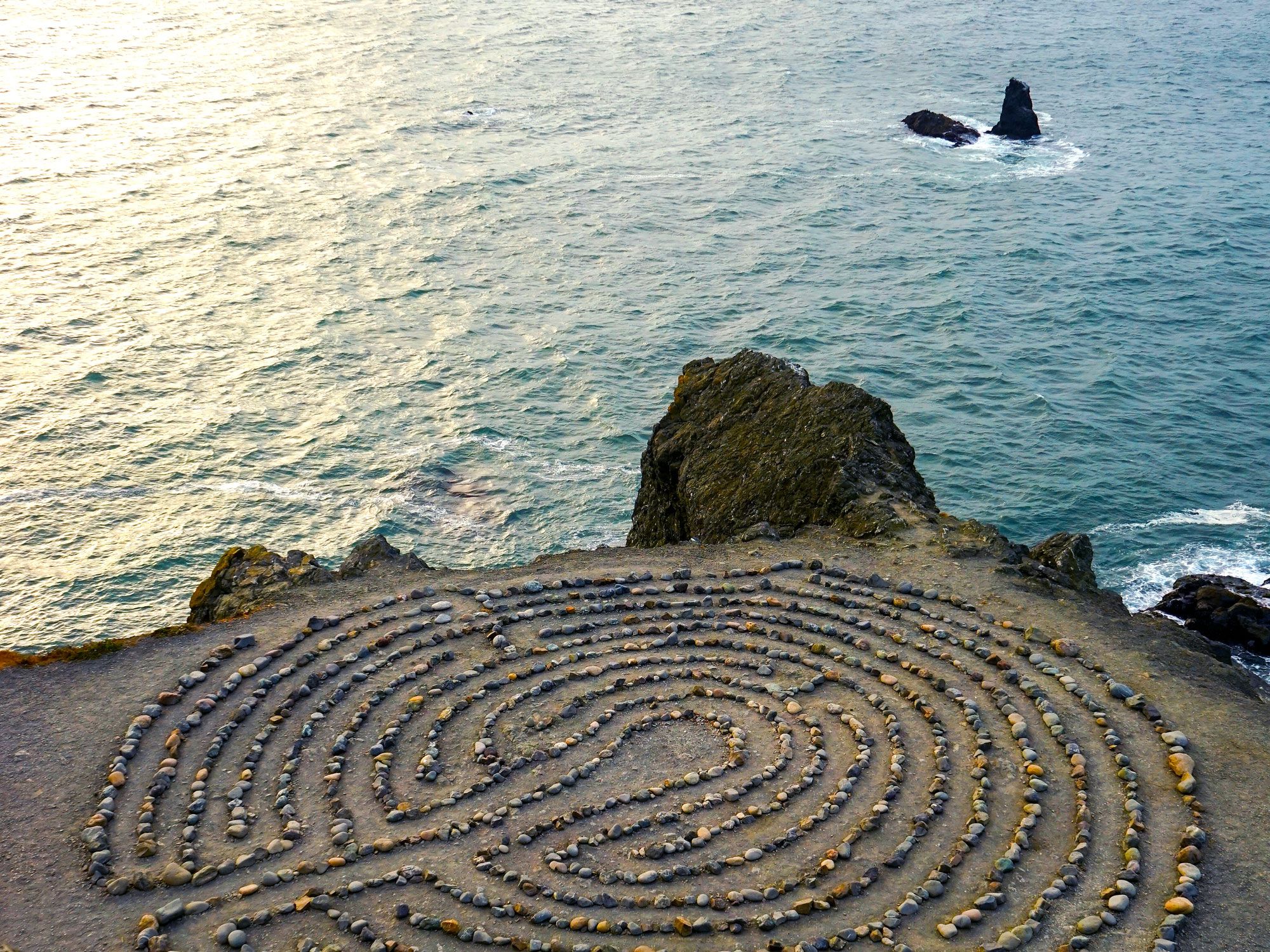
Open year-round to foot traffic, this 3.4-mile loop in San Francisco’s Golden Gate National Park winds through cypress trees, across open meadows, and alongside rocky cliffs. On a clear day, Lands End Trail provides views of the Pacific coastline and the Golden Gate Bridge, while historic shipwrecks can be spotted during low tide.
Nicknamed Point Lobosby Spanish settlers who frequently spotted sea lions (lobos marinos) lounging on the rocky shoreline, this region has a storied history. It was inhabited seasonally by the Ohlone tribe for thousands of years and later became a popular resort destination in the 1800s. Today, visitors can explore the ruins of Sutro Baths, a 19th-century swimming facility for the San Francisco elite, or stop by the latest iteration of the Cliff House (the original burned down in 1894).
Three Rivers Heritage Trail – Pittsburgh, Pennsylvania
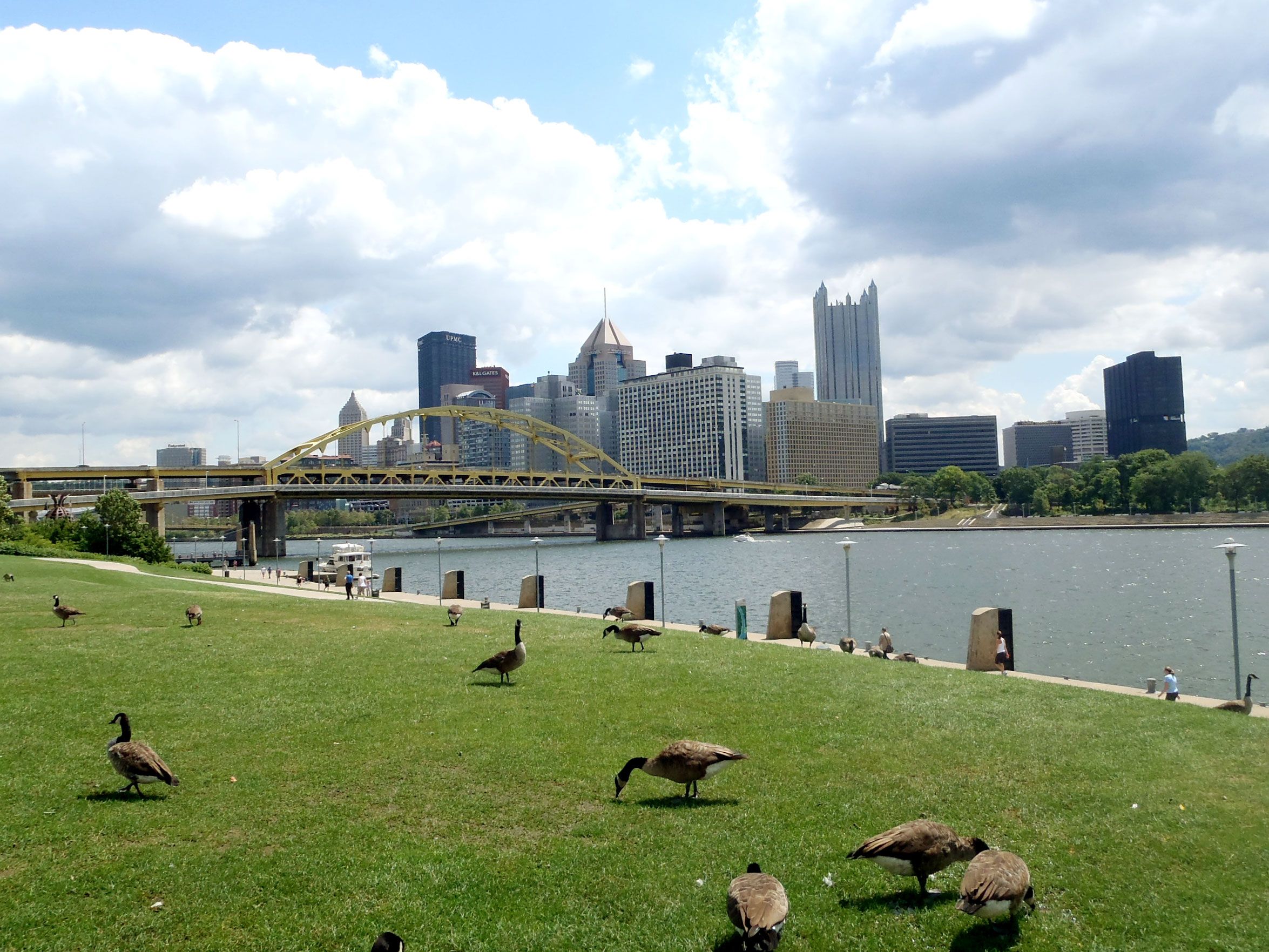
The Three Rivers Heritage Trail is a 33-mile riverfront trail system in Pittsburgh. Running along the banks of its namesake waterways (the Allegheny, Monongahela, and Ohio Rivers), the urban trail is divided into non-linear segments that connect various Pittsburgh neighborhoods, business districts, and historic sites.
Popular for walking, running, and cycling, the trail extends outward from Point State Park — which marks the confluence of Pittsburgh’s three major rivers and is considered to be the city’s birthplace. The trail system also features an extensive system of interpretive signs, providing information about historic Pittsburgh sites, including the Phipps Conservatory and Botanical Gardens and the Byham Theater.
Advertisement
More from our network
Daily Passport is part of Inbox Studio, an email-first media company. *Indicates a third-party property.
5 Hard-to-Reach Natural Wonders That Are Worth the Effort
By
Daily Passport Team
Read time: 5 minutes
July 7, 2023
Updated: January 9, 2026
5 Hard-to-Reach Natural Wonders That Are Worth the Effort
Outdoors •July 7, 2023•Updated: January 9, 2026
By Daily Passport Team
Author
Daily Passport Team
Daily Passport writers have been seen in publications such as National Geographic, Food & Wine, CBC, Condé Nast Traveler, and Business Insider. They're passionate about uncovering unique destinations and sharing expert tips with curious travelers.
Some places are so wild and special that access must be limited, because too many visitors can harm fragile ecosystems. As a result, many destinations have instituted a permit system to control the number of people entering a particular area — and often the demand for those permits far outstrips the supply. While some permits are granted on a first-come, first-served basis, other places now rely on lotteries to distribute these once-in-a-lifetime outdoor experiences. Below are five hard-to-reach natural wonders in the U.S. that will make any outdoor lover feel like they’ve won the lottery.
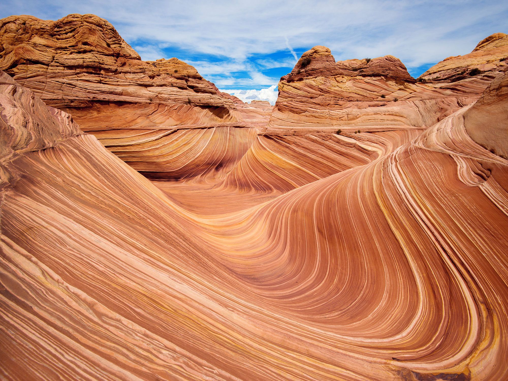
Blame it on Microsoft: This geologic wonder in the Paria Canyon-Vermilion Cliffs Wilderness, straddling the border of northern Arizona and southern Utah, was relatively unknown until 2009, when Microsoft featured a photo of the Jurassic-era cliffs as its desktop wallpaper on the Windows 7 release. Since then, hikers from around the world have flocked to the surreal sandstone formation in the Coyote Buttes area, which features undulating curves striped in yellow, pink, brown, yellow, and vermilion. The Wave’s sudden popularity prompted the Bureau of Land Management to institute a permit system, allowing 64 hikers per day to visit the area.
Permits to hike to the Wave for a total of 48 people (up to 12 groups maximum) are issued via online lottery held four months in advance. Permits for another 16 people (four groups maximum) are awarded via a “walk-up” daily lottery held two days in advance. The daily lottery must be applied for via mobile phone, and your location must be in the geo-fenced area near the site. There’s no marked trail on the six-mile round-trip hike, so you’ll need to use a map and compass or GPS for navigation.
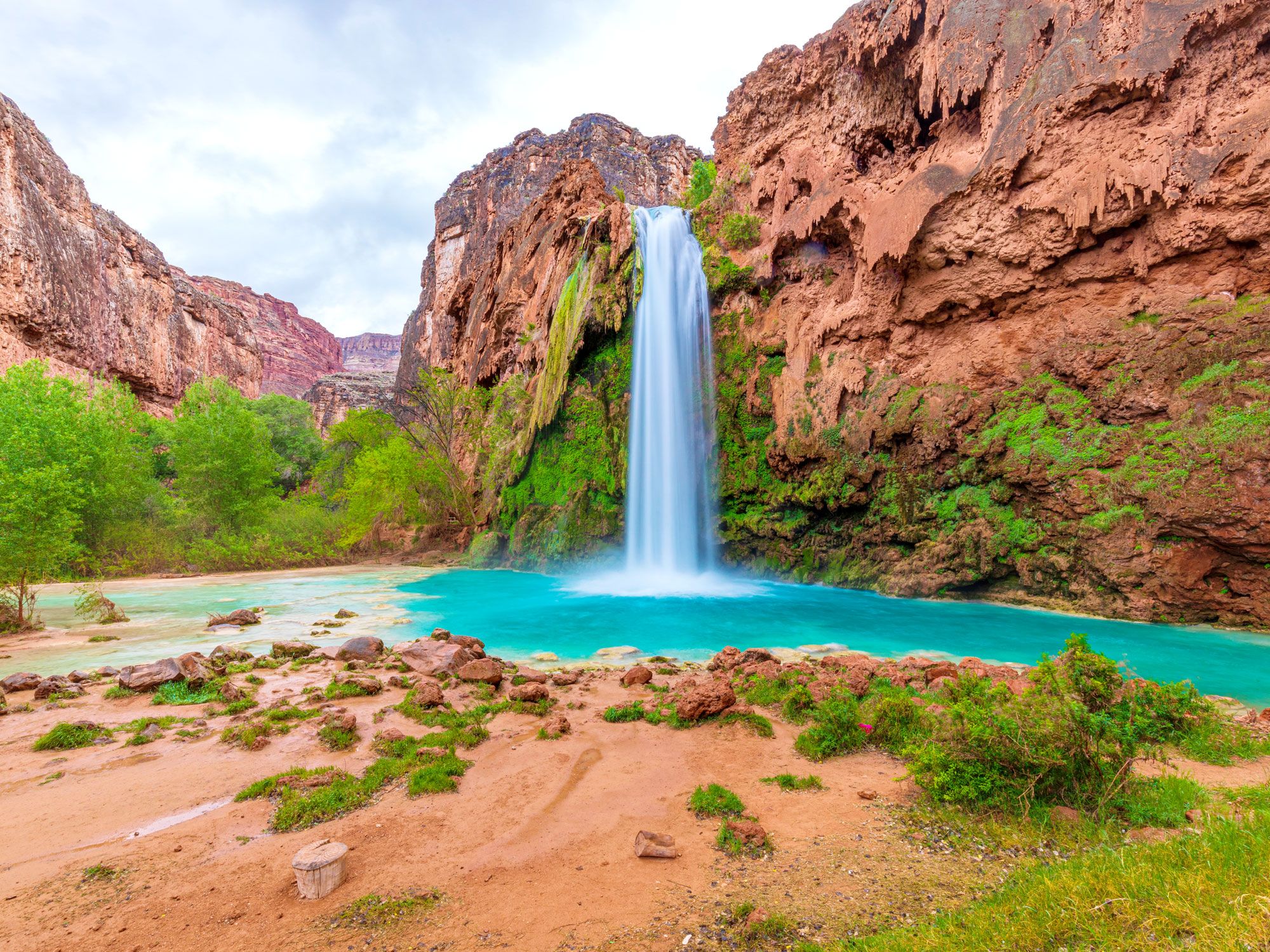
Crashing falls foam over majestic red sandstone into the turquoise pools at this remote and rugged paradise, tucked close to the Grand Canyon on the Havasupai Indian Reservation. The tribe has lived in this magical area for more than 800 years, and all visitors must have a permit and also abide by the reservation’s regulations — which prohibit alcohol, coolers, campfires, dogs, and drones, among other things. Havasupai is a sovereign Native American nation with its own rules, customs, and laws. Visitors should be respectful of the land, the people, and their fellow visitors.
To protect the fragile environment, tourist numbers are limited. Reservations are required for all hikers and campers (no day hiking is allowed). For the upcoming 2026 season, online reservations open up at 8 a.m. Arizona time on Saturday, February 1, 2026. People who are lucky enough to snag one will still need to make the challenging 8-mile trek from the top of the canyon on foot, mule, or horse. Touring by helicopter is also an option — there are no reservations taken, but you can get on the waiting list each morning, weather permitting. The hike from the falls to the camping area is an additional two miles, but weary travelers can reserve campsites along the river or stay at the tribe’s rustic lodge.
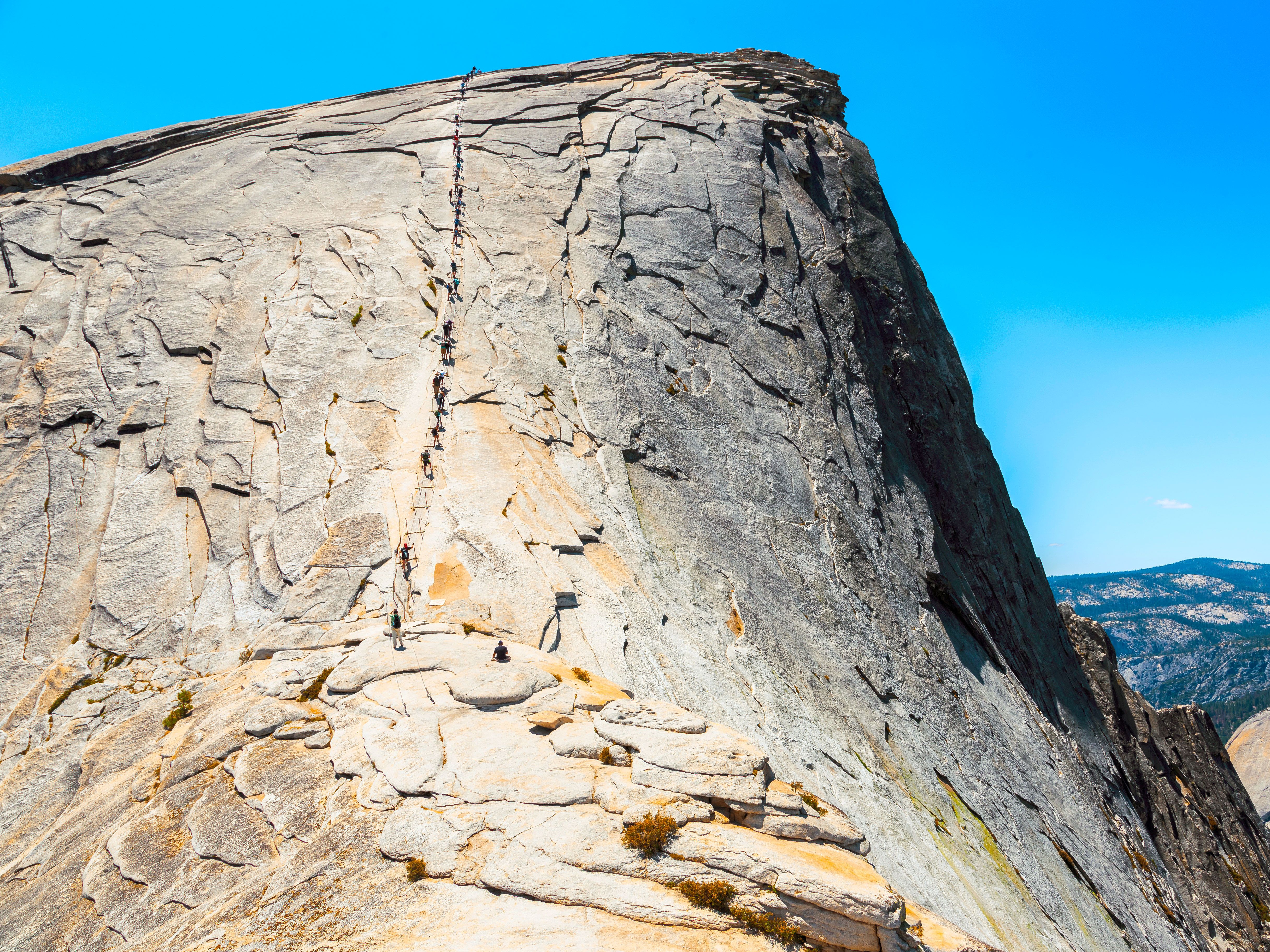
Towering 5,000 feet above Yosemite Valley — and 8,800 feet above sea level — Half Dome is a rite of passage for serious hikers, who test their fitness on the 10- to 12-hour trek to the top of the massive granite outcropping, an icon of Yosemite National Park. The last 400 feet to the summit are accessible without rock-climbing equipment by two parallel metal cables, which the park installs each year between late May and mid-October, depending on weather. Gloves are highly recommended, and sturdy hiking shoes and boots are a must.
Thousands of people ascend the cables each season, all of whom are required to hold a non-transferable permit. The month-long lottery opens each March. If you aren’t selected, you can still enter the daily lottery to win a permit allowing access two days after the drawing. Lucky climbers will be rewarded with stunning panoramic views of the valley as well as Vernal and Nevada Falls.
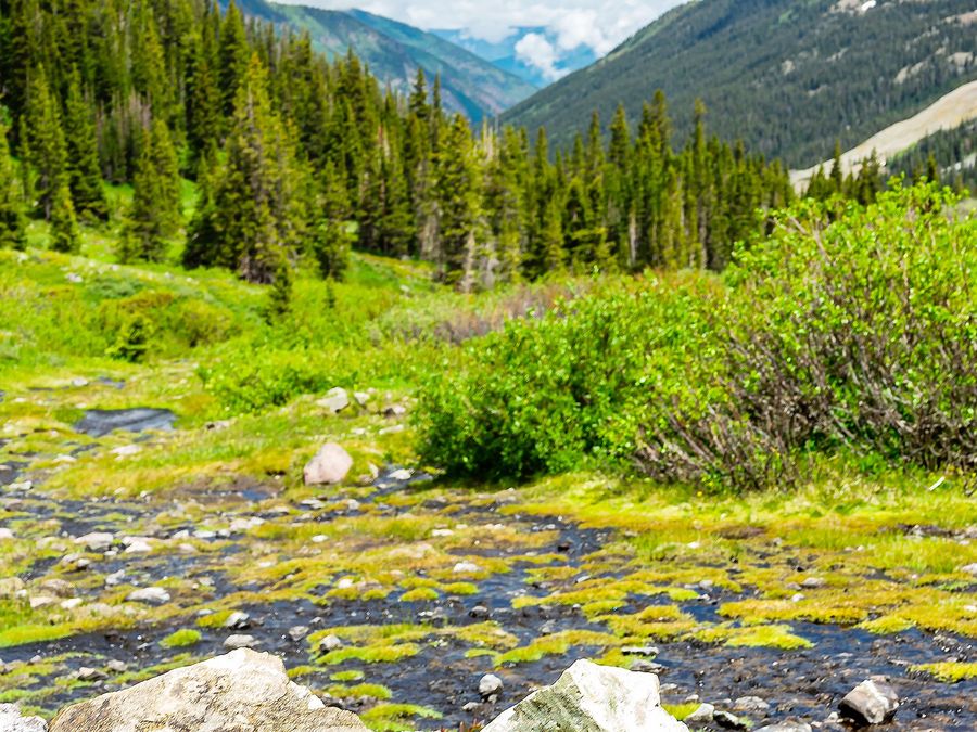
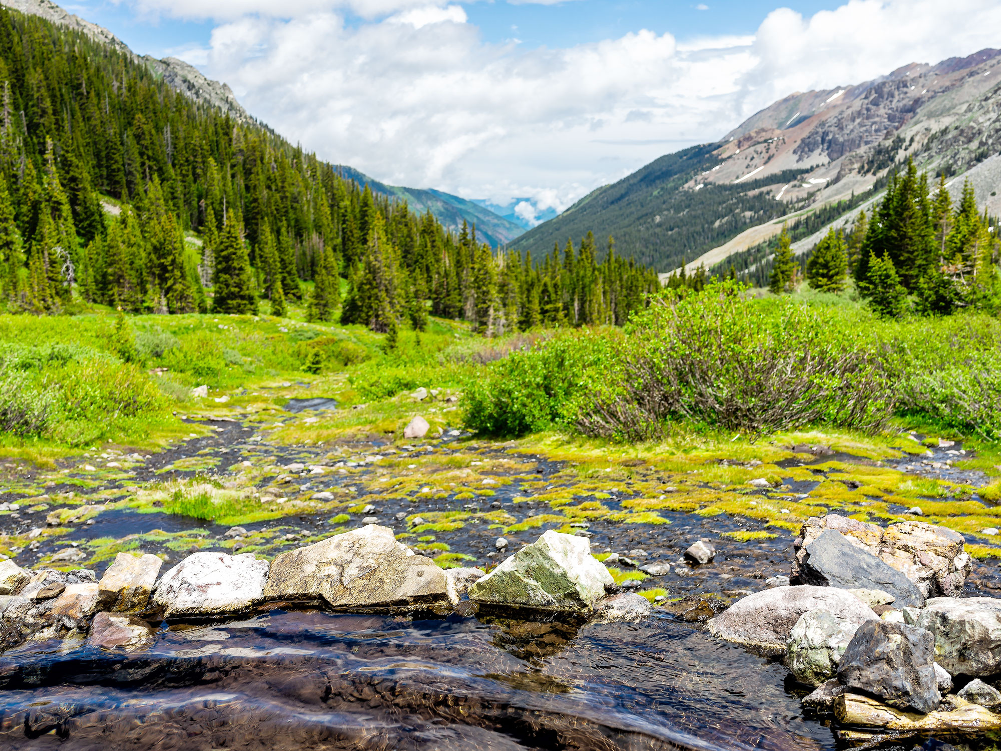
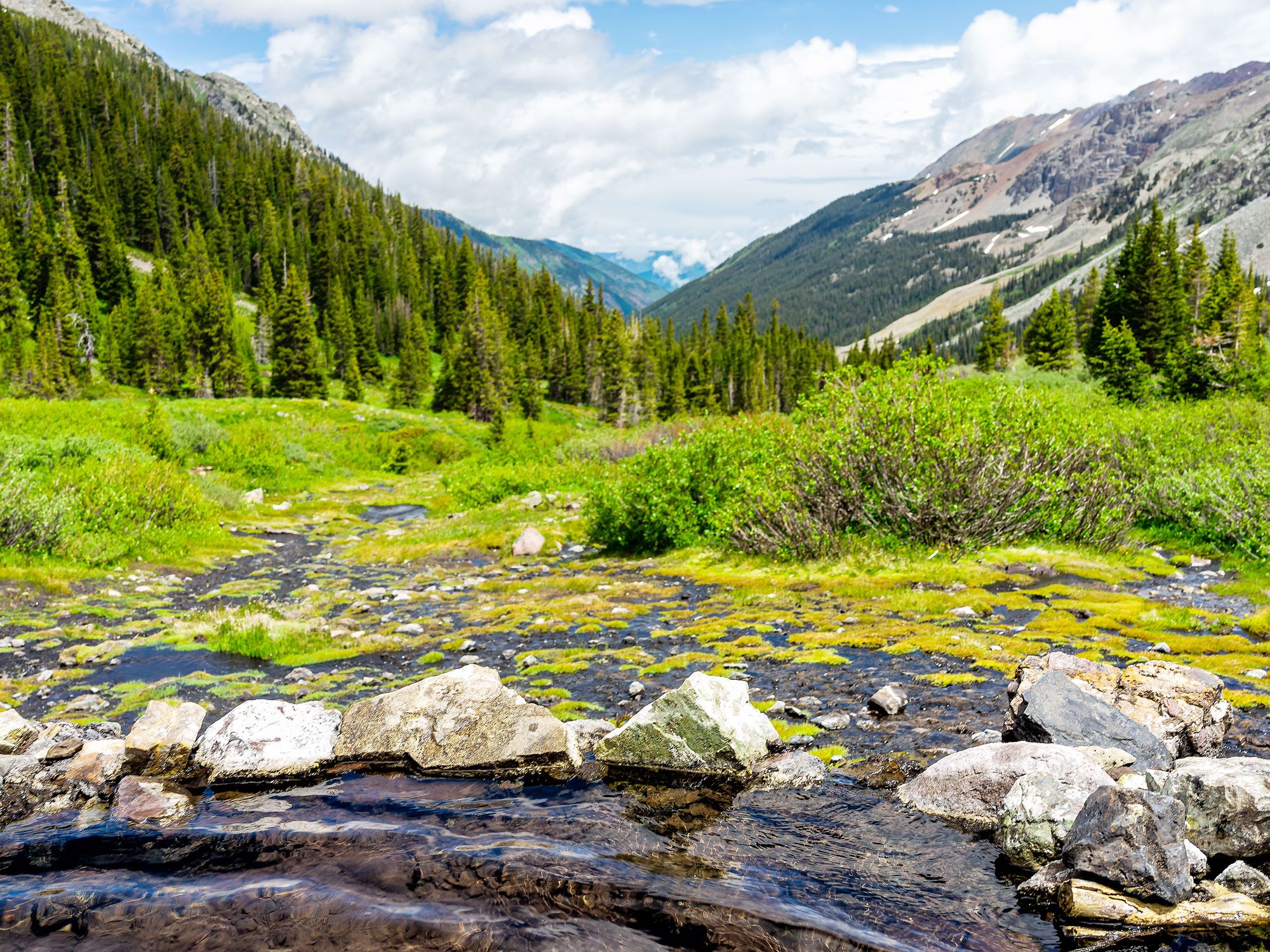
There’s no lottery, but you’ll need to be fast on the (electronic) draw to score an overnight camping spot at these heavenly hot springs in Colorado’s grand Maroon Bells-Snowmass Wilderness. Located deep in the White River National Forest near Aspen, the geothermal springs can only be reached by a strenuous 17-mile round-trip hike into the Rocky Mountains.
But those who get an overnight permit and can handle the exertion (along with the 11,200-foot altitude) will find Conundrum well worth the journey. Surrounded by glorious peaks, the clothing-optional pools are roughly three feet deep and 100 degrees Fahrenheit in temperature, and are large enough to accommodate around a dozen people at a time. While permits for overnight camping are required year-round, the period between July through September offers the best weather and the least chance of snow.
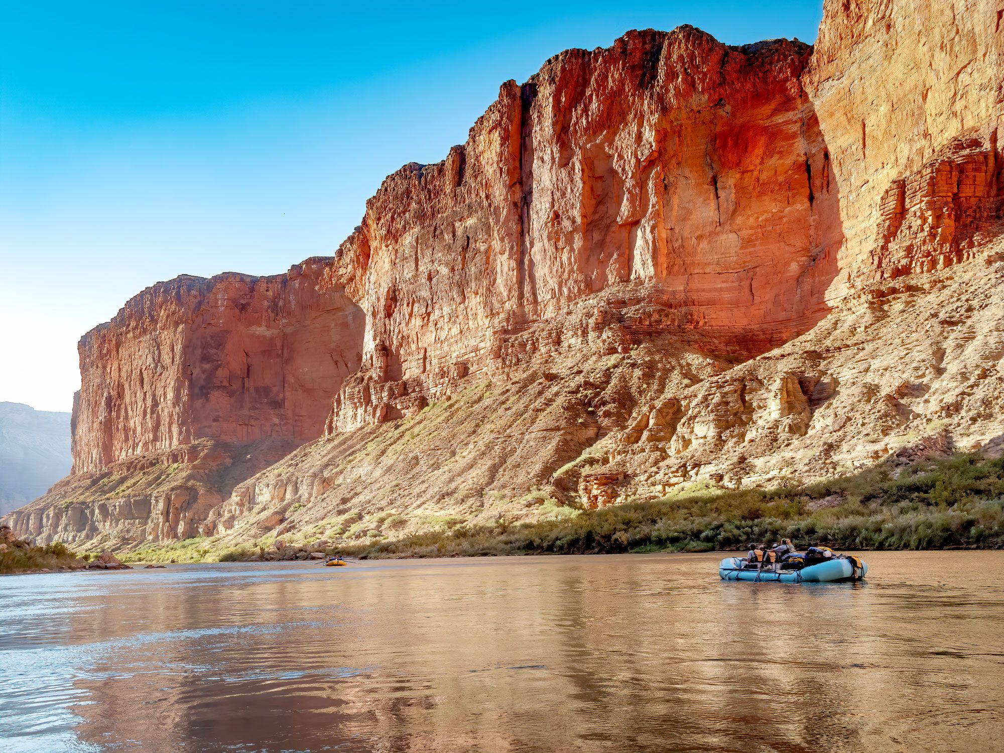
Rafting the Colorado River surrounded by the awe-inspiring walls of the Grand Canyon is the ultimate bucket list experience for many people, but guided tours with private outfitters often cost thousands of dollars. Every February, the National Park Service opens a three-week weighted lottery that allows private rafters the chance to request up to three dates in the following year for non-commercial guided tours of between 12 and 25 days.
For shorter trips of two to five days, rafters can apply for first-come, first-served permits from Diamond Creek to Lake Mead. (These can be applied for one year in advance.) There are a few restrictions: At least one of the permit holders must possess the necessary skills and experience to navigate the river’s whitewater environment. Though the process may seem burdensome, consider this: Prior to instituting the lottery, the waitlist for non-commercial permits to raft the canyon was 25 years long!
Advertisement
More from our network
Daily Passport is part of Inbox Studio, an email-first media company. *Indicates a third-party property.
17 Fascinating Sacred Sites and Pilgrimage Routes, From Mecca to Mount Kailash
By
Daily Passport Team
Read time: 11 minutes
July 7, 2023
Updated: March 29, 2024
17 Fascinating Sacred Sites and Pilgrimage Routes, From Mecca to Mount Kailash
Culture •July 7, 2023•Updated: March 29, 2024
By Daily Passport Team
Author
Daily Passport Team
Daily Passport writers have been seen in publications such as National Geographic, Food & Wine, CBC, Condé Nast Traveler, and Business Insider. They're passionate about uncovering unique destinations and sharing expert tips with curious travelers.
Around the globe, there are sacred sites and pilgrimage trails that hold profound significance for particular cultures and religions. From the 1,000-year-old Camino de Santiago of Spain to the “Wailing Wall” of Israel and Mecca, Saudi Arabia — the birthplace of Islam — these places have drawn countless visitors over the years. For those who wish to journey in search of a higher sense of purpose, walking in the footsteps of pilgrims throughout history can be an enlightening way to travel. Check out these 17 sacred pilgrimage sites and the fascinating stories behind them.
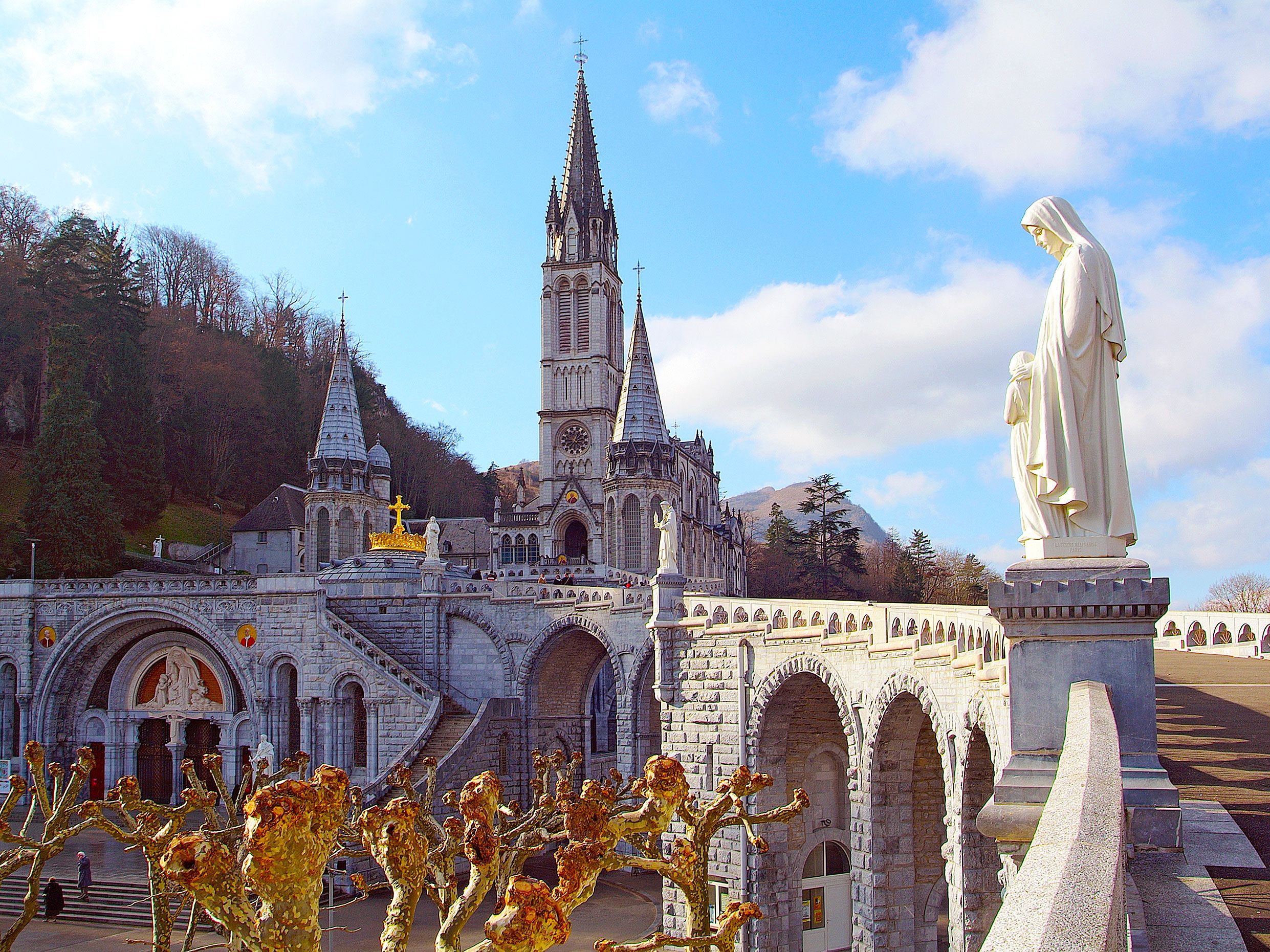
Located in the foothills of the Pyrenees, the French city of Lourdes has been a pilgrimage site for Catholics since the 19th century. As the story goes, St. Bernadette was collecting firewood near a grotto when she witnessed several visions of the Virgin Mary, who told her to build a chapel on the site. Since then, a magnificent cathedral has been erected near the grotto, which is believed to contain healing waters that induce miracles.
To receive the grotto’s healing powers, pilgrims can fill up jugs of the holy water or immerse themselves in the water entirely. The site is also home to the Marian Procession, a celebration that brings believers and the infirm together for a joint blessing from a priest.
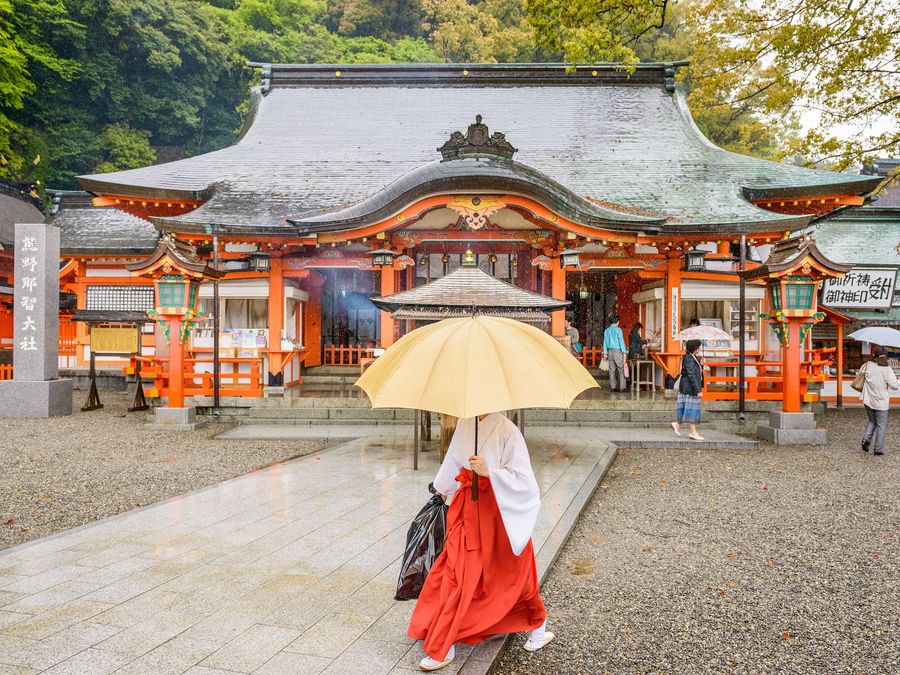
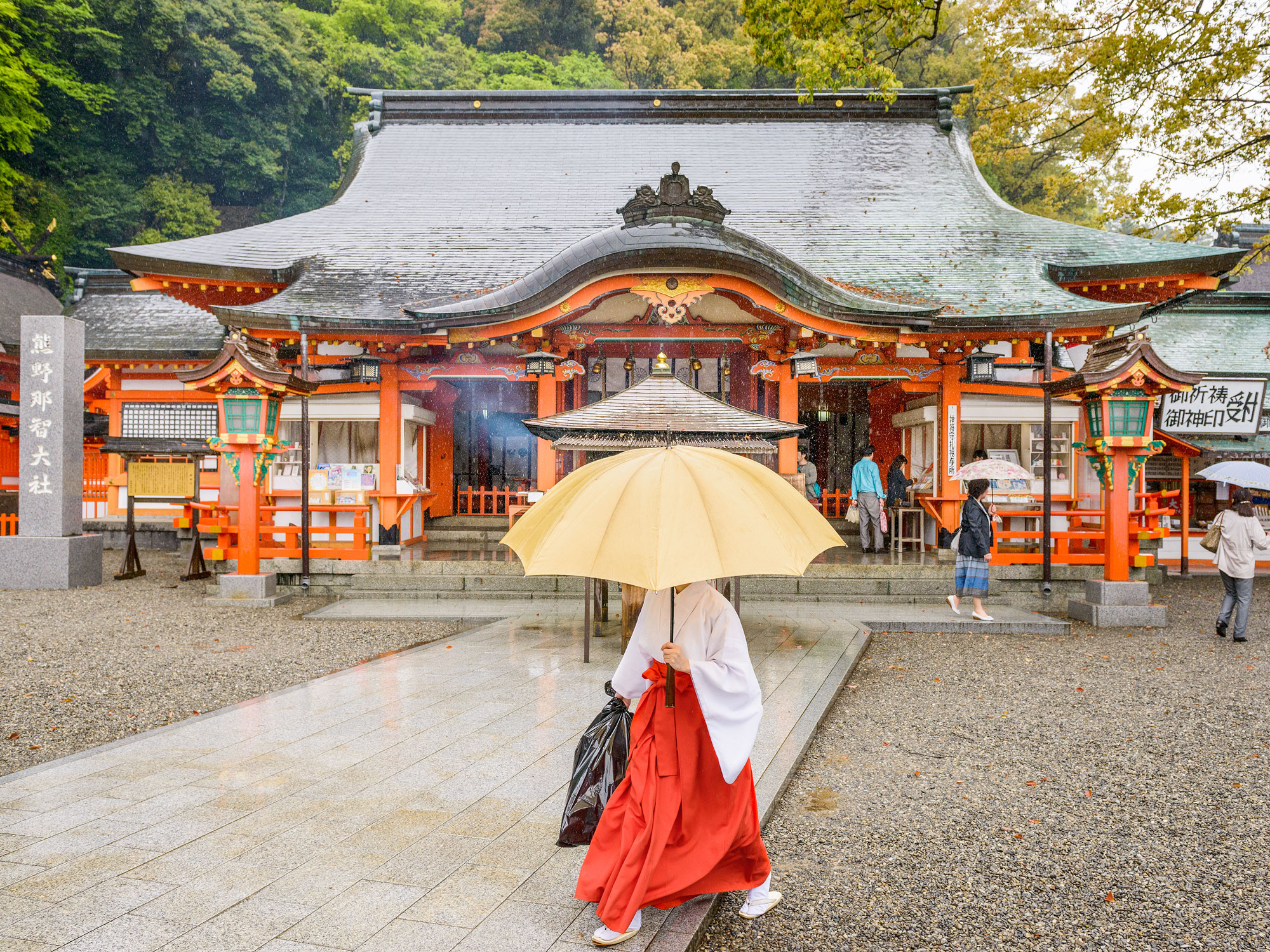
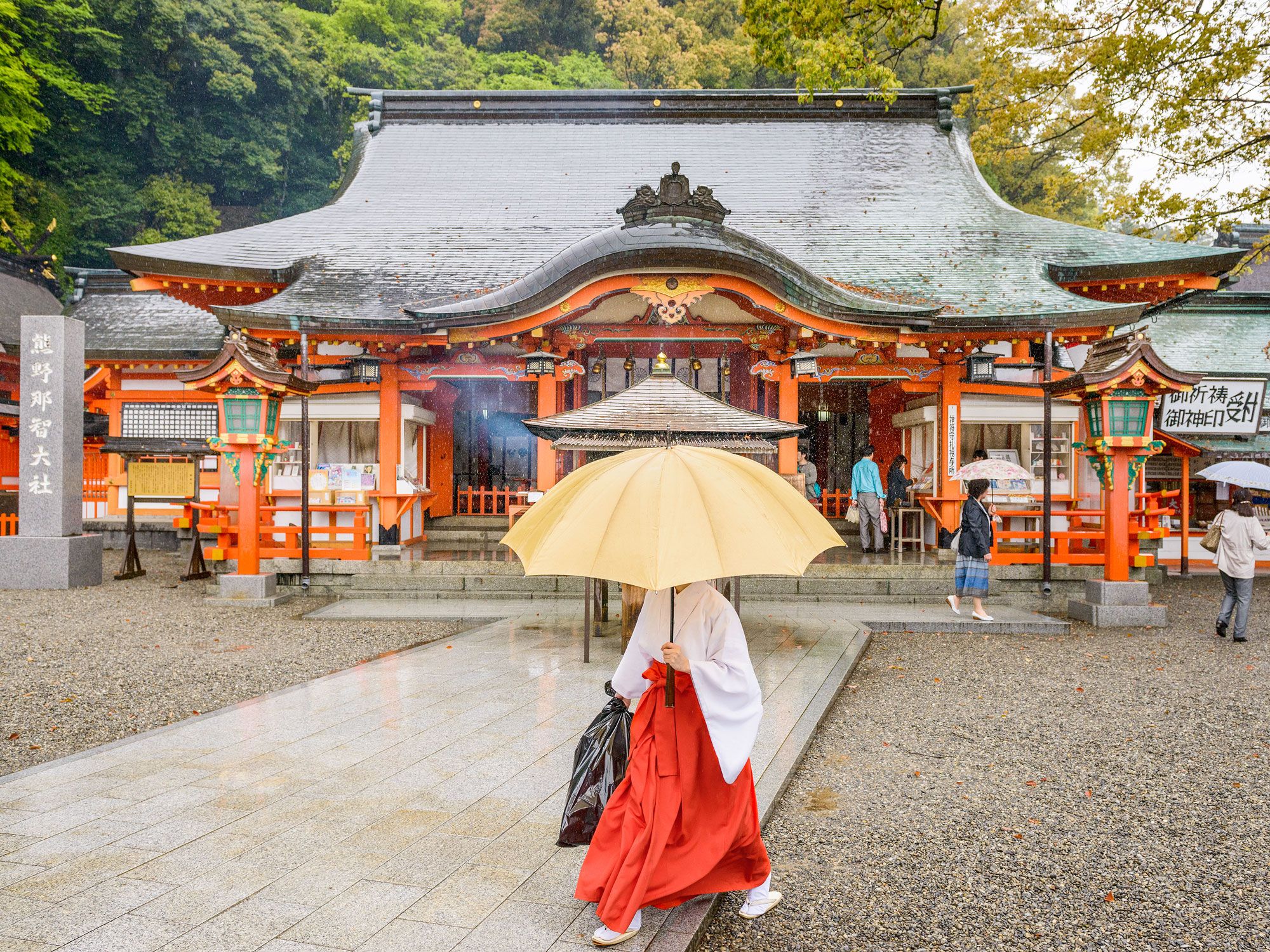
A UNESCO World Heritage Site, Kumano Kodo is a pilgrimage through the mountains in the Japanese region of Kansai, consisting of a network of ancient routes once used by emperors. All five routes connect at Hongū Taisha, a sacred Shinto shrine in the mountains of Wakayama Prefecture. Since the trails link to two other significant shrines, Hayatama Taisha and Nachi Taisha, Kumano Kodo draws pilgrims from across Japan.
The most popular pilgrimage route is Nakahechi, a 10-mile trek known for its ease and accessibility. To make the spiritual journey, Kumano Kodo pilgrims need not rough it; the trail system has plenty of guesthouses for overnight stays along the way.
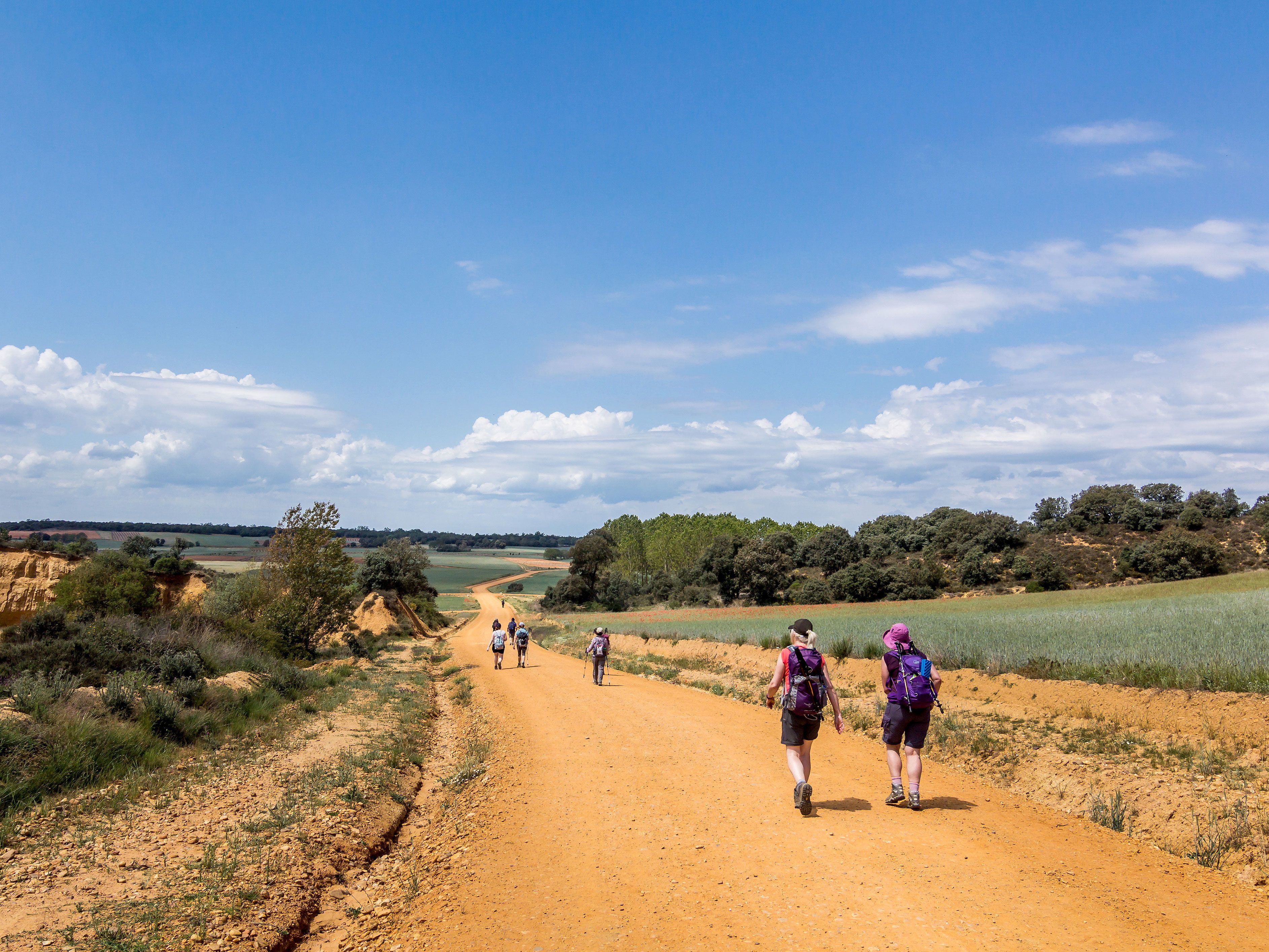
The ancient pilgrim routes in this network across Europe all lead to the same place — the tomb of St. James in northwestern Spain. Also known as the “Way of St. James,” the Camino de Santiago has over a dozen trails to choose from and attracts hundreds of thousands of trekkers annually.
Of these trails, the Camino Francés (French Way) is the most popular, starting in the town of St. Jean-Pied-du-Port, France, and following a fairly flat traverse for 478 miles before ending in the city of Santiago de Compostela. As a bonus, the original route preferred by pilgrims traveling to the tomb is an optional detour along the way in the city of Oviedo. Before starting the journey, all pilgrims should request a credential, which serves as a passport and allows free stays in hostels along the way.
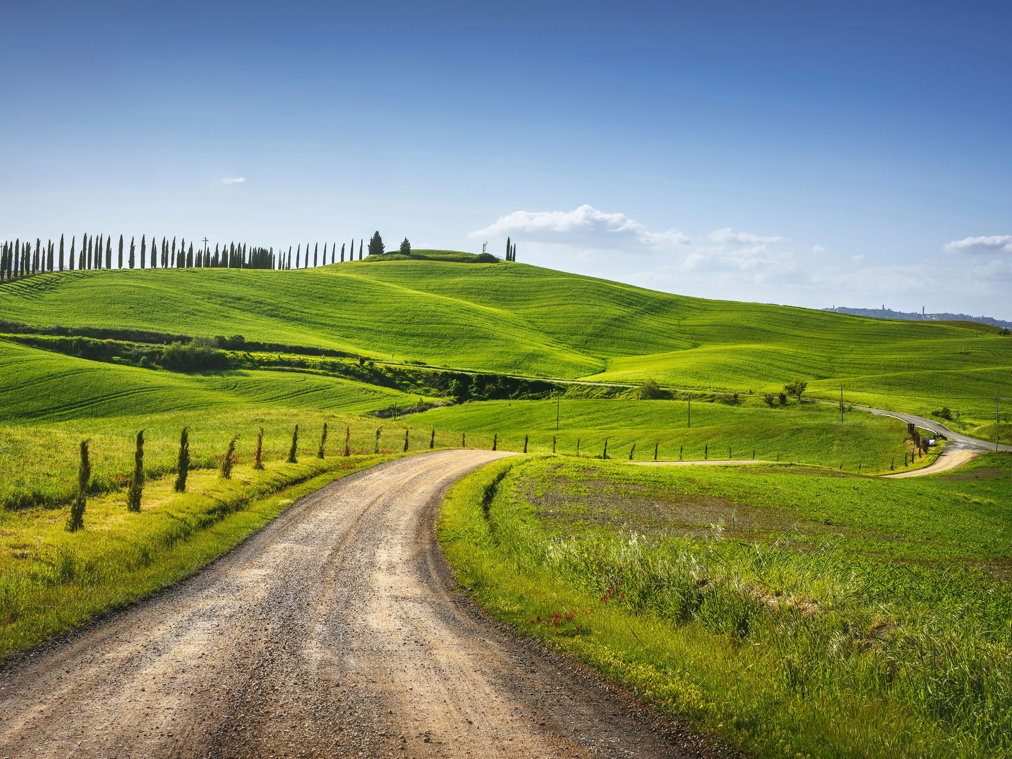
They say all roads lead to Rome, and in the case of Via Francigena, the adage proves true. The 1,200-mile-long medieval trail once led pilgrims from Canterbury to Rome, with routes through France and present-day Switzerland. Today, the trail is a popular way for travelers to see Europe on foot, especially in Tuscany, where Via Francigena leads travelers through swaths of sunflowers and acres of olive groves. This Tuscan portion of Via Francigena is divided into 15 sections, starting at Cisa and ending at Aquapendente; sections vary in length and difficulty and can be enjoyed for a day’s walk or a multi-day journey.
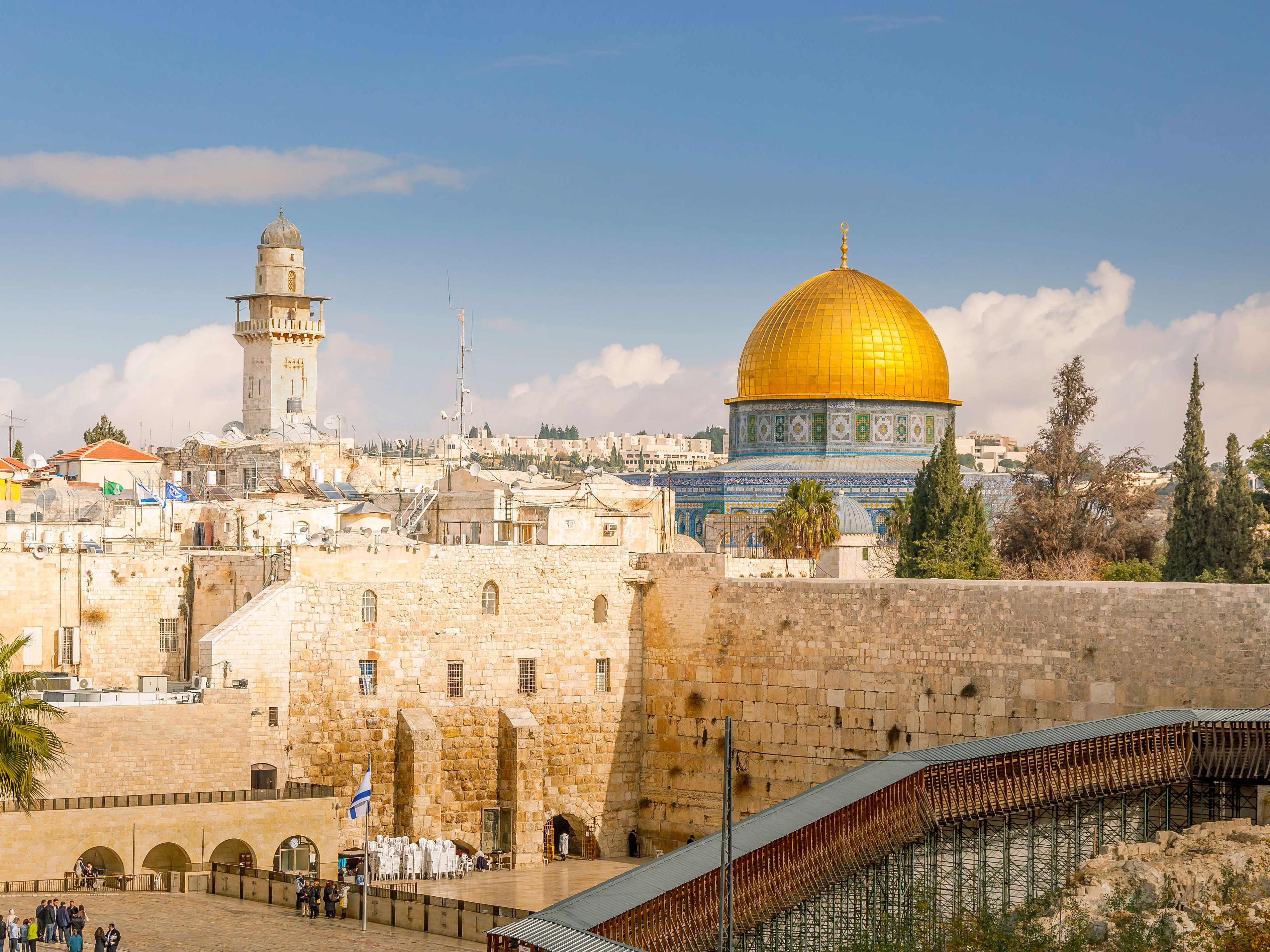
The Western Wall, also known as the “Wailing Wall,” is an important pilgrimage site for people of the Jewish faith. Originally built by King Herod in 20 BCE, the wall survived a Roman attack and has since become a sacred place for Jewish people.
As a symbol of the Temple of God, the wall is visited by thousands of people annually, who recite prayers, which are either spoken aloud or written on paper and placed into the wall’s cracks. In 2010, the oldest piece of writing in Jerusalem was found in the wall — a 3,350-year-old prayer — demonstrating how long this pilgrimage tradition has been upheld.
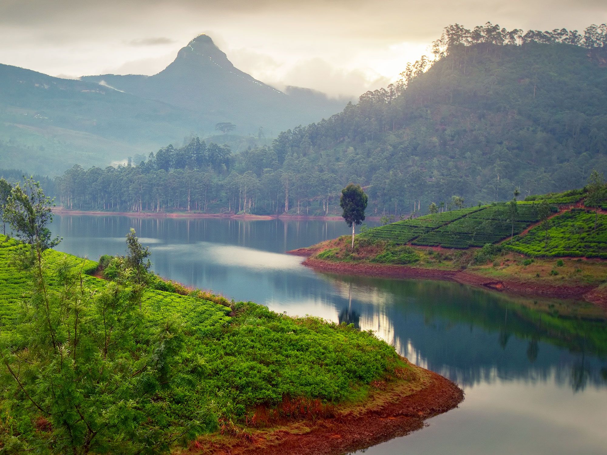
Pilgrims have been climbing Sri Pada (also known as Adam’s Peak) since the fourth century, with kings, scholars, and even Marco Polo himself making the strenuous journey to the top of the Sri Lankan mountain. The summit of the 7,359-foot-tall peak is home to a gold-painted pavilion that houses two bells — pilgrims ring one of the bells in accordance with how many times they have completed the journey.
Considered holy by people of Buddhist, Christian, and Hindu faith, Sri Pada has a pilgrimage season starting in December and ending in May, with most hikers making the journey in the dark for a clear view at dawn. During high season, the trail is lined with locals selling refreshments to weary travelers en route.
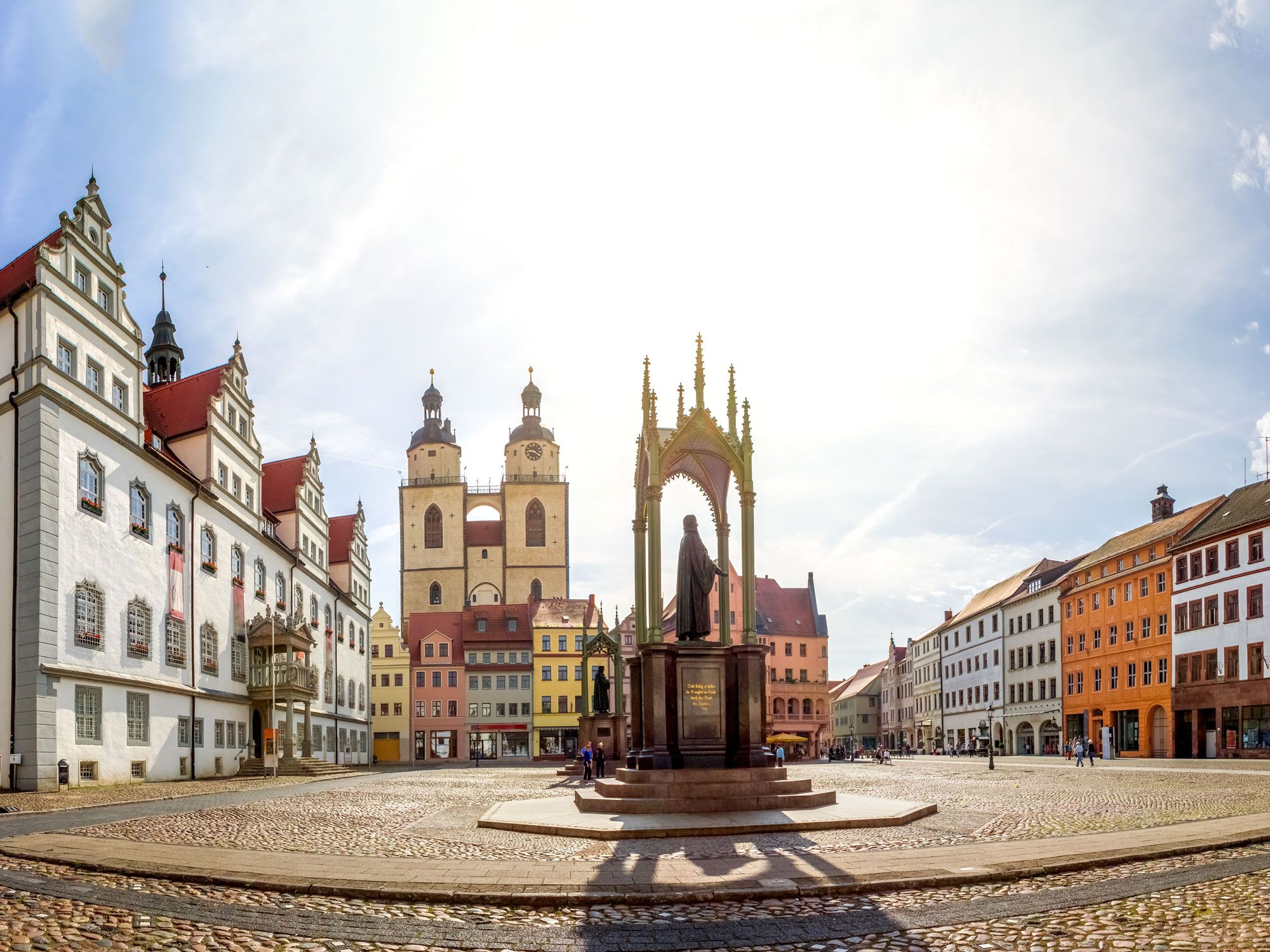
In addition to being a charming medieval town in Germany, Wittenberg is a sought-after destination for people of the Lutheran faith. As the city where Martin Luther began his own branch of Protestantism, Wittenberg attracts pilgrims from around the world, who wish to see the sacred Lutheran sites scattered throughout the village.
These sites include Castle Church, where Luther posted his reformation beliefs in a book entitled 95 Theses, in addition to City Church, the site where Luther preached about his reformations. (It was also where he was married and baptized his own six children.) The pilgrimage often includes a visit to the house where Luther lived with his family, which is well-preserved and contains many of his old books and writings.
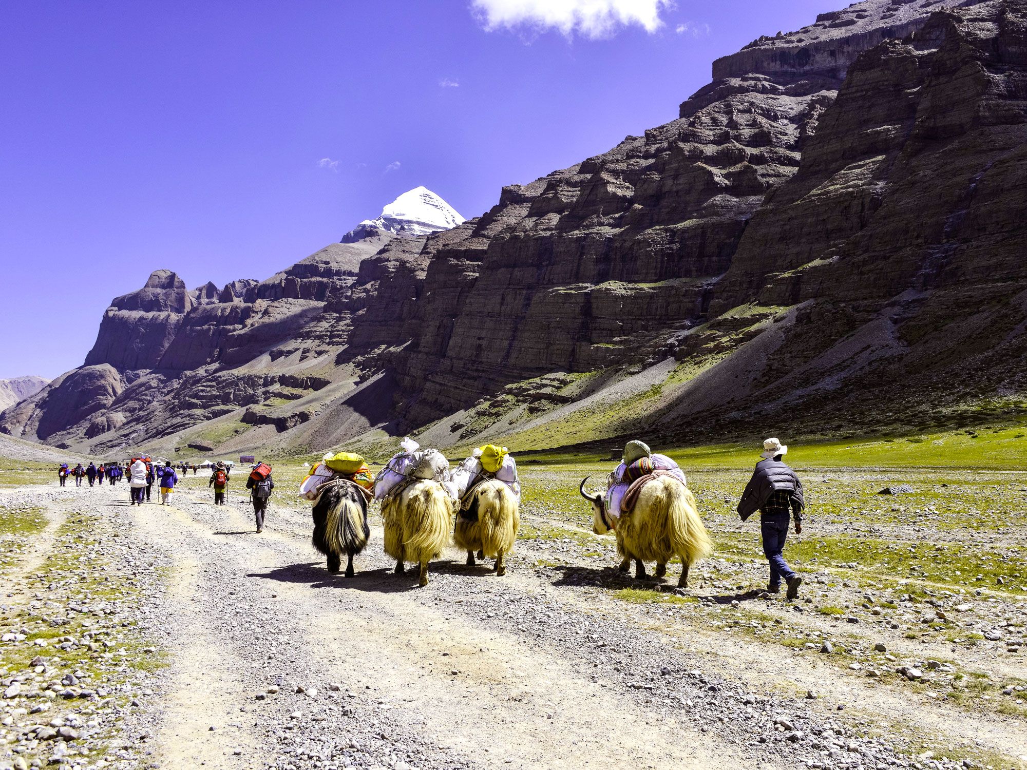
Although it’s one of the holier pilgrimage sites, few make the journey up Mount Kailash, a 22,000-foot-tall mountain in Tibet. It is considered sacred by Hindus, Jains, Buddhists, and Bonists alike, but Mount Kailash is so ancient that it transcends modern religion. The peak is at the center of an ancient origin myth that believes it to be the mythical Mount Meru, which was considered the birthplace of the world in ancient Asian culture.
Today, followers of Bonism, Tibet’s ancient religion, believe that climbing Mount Kailash will exonerate them from their sins. Bonists are required to hike the mountain’s circuitous route counter-clockwise, with one lap known as a kora. To assure enlightenment, these pilgrims must complete 108 koras, which is no small feat despite the eternal reward.
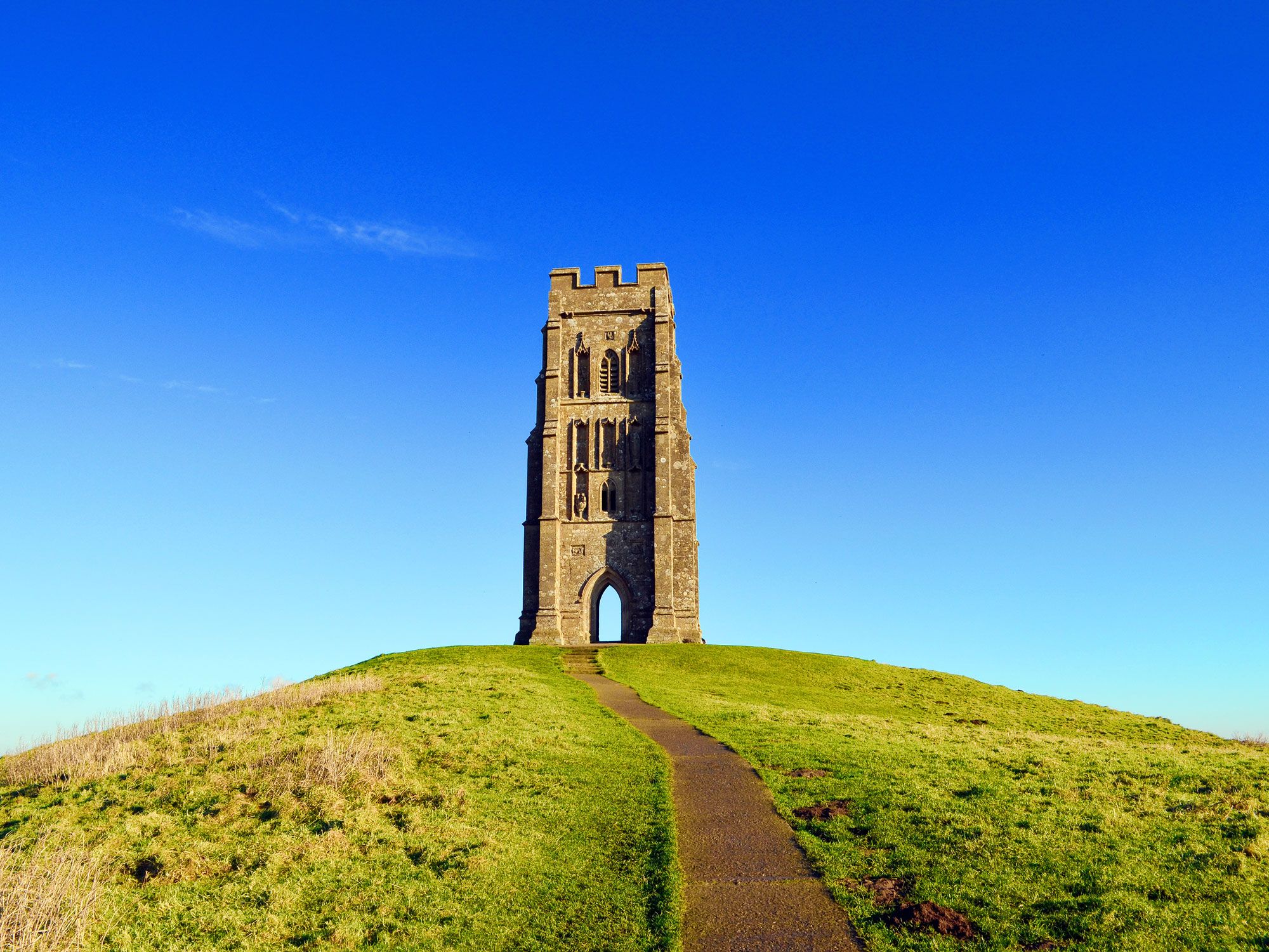
The Glastonbury area has long been associated with legends, including that of King Arthur and Queen Guinevere, who are believed to be buried in the town’s local church. As a result, myths surround Glastonbury Tor, the region’s conical hill that houses a 14th-century church atop the summit. Purported to have a strong energetic current due to its position over ley lines, which are supernatural lines that run throughout the universe, Glastonbury Tor is often associated with Avalon, the isle of enchantment in Celtic folklore.
Others believe that the hill’s hollow interior is home to fairies, while some say it is an entrance to the underworld. Regardless, it’s one of the most spiritual sites in the country, with strong Pagan roots that draw pilgrims to its summit. At only 500 feet above sea level, the hike up the Tor is a short trek, with buses that run closer to the hill’s summit for an easier trip.
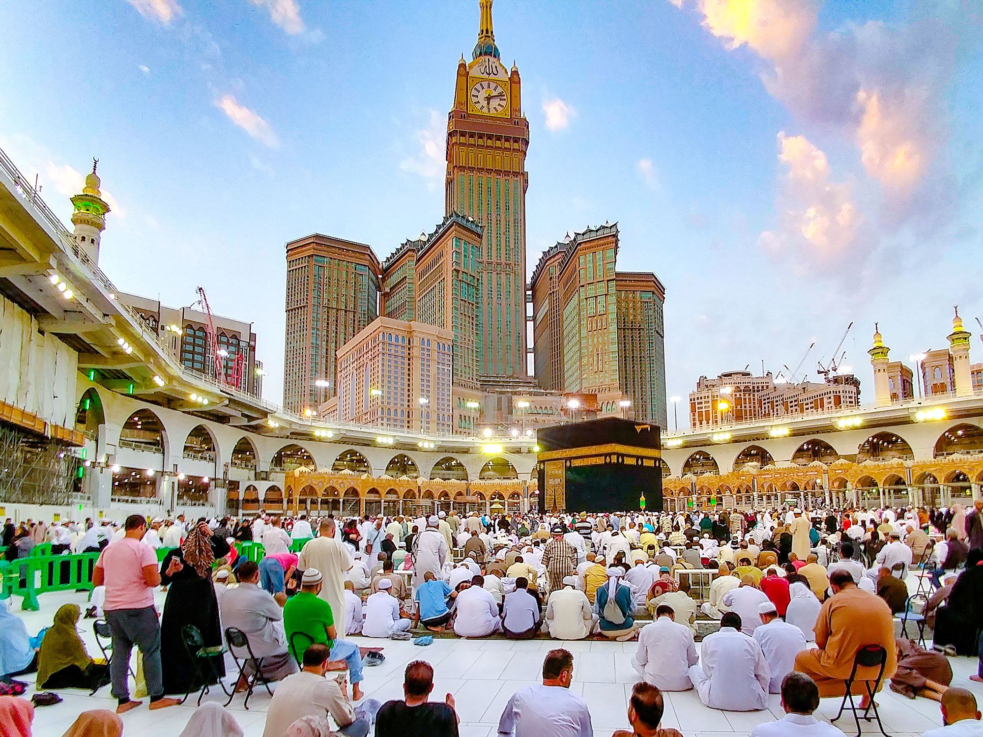
The journey to Mecca is arguably one of the most famous pilgrimages in the world — after all, the word “mecca” is defined in Merriam-Webster as “a place regarded as a center for a specified group, activity, or interest.”
As the birthplace of the prophet Muhammad and the site associated with the beginning of Islam, Mecca is visited by Muslims making the Hajj pilgrimage. As one of the pillars of Islam, this journey is expected to be completed by Muslims at least once in their lifetimes, along with other important acts such as fasting during Ramadan. As a result, millions of Muslims congregate annually to make the pilgrimage during the last month of the Muslim calendar.
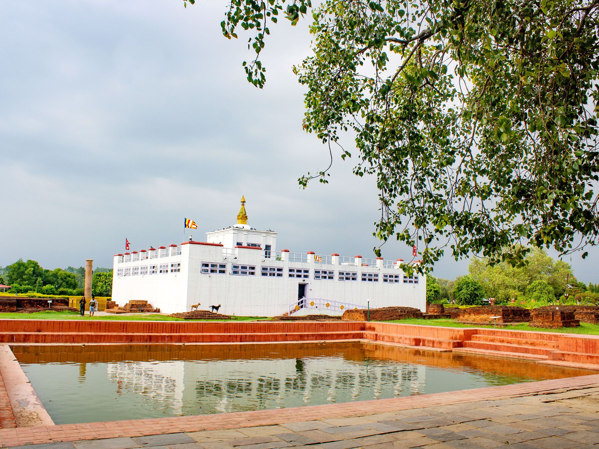
Listed as a UNESCO World Heritage Site as the birthplace of Buddha, Lumbini is a Buddhist pilgrimage site in the Rupandehi District of Nepal. Since the Buddha once asked his disciples to visit Lumbini, it is considered one of the four major Buddhist pilgrimage sites and is often completed as a way to pay respect to the Lord Buddha. As a result, the sacred site is home to several monuments that honor the Buddha, also known as Siddartha.
In addition to Devdaha, the ancient capital where Siddartha spent his earliest years, the Maya Devi Temple resides in Lumbini. This ancient shrine was built to honor Siddartha’s mother and is one of the most revered sites for Buddhist pilgrims.
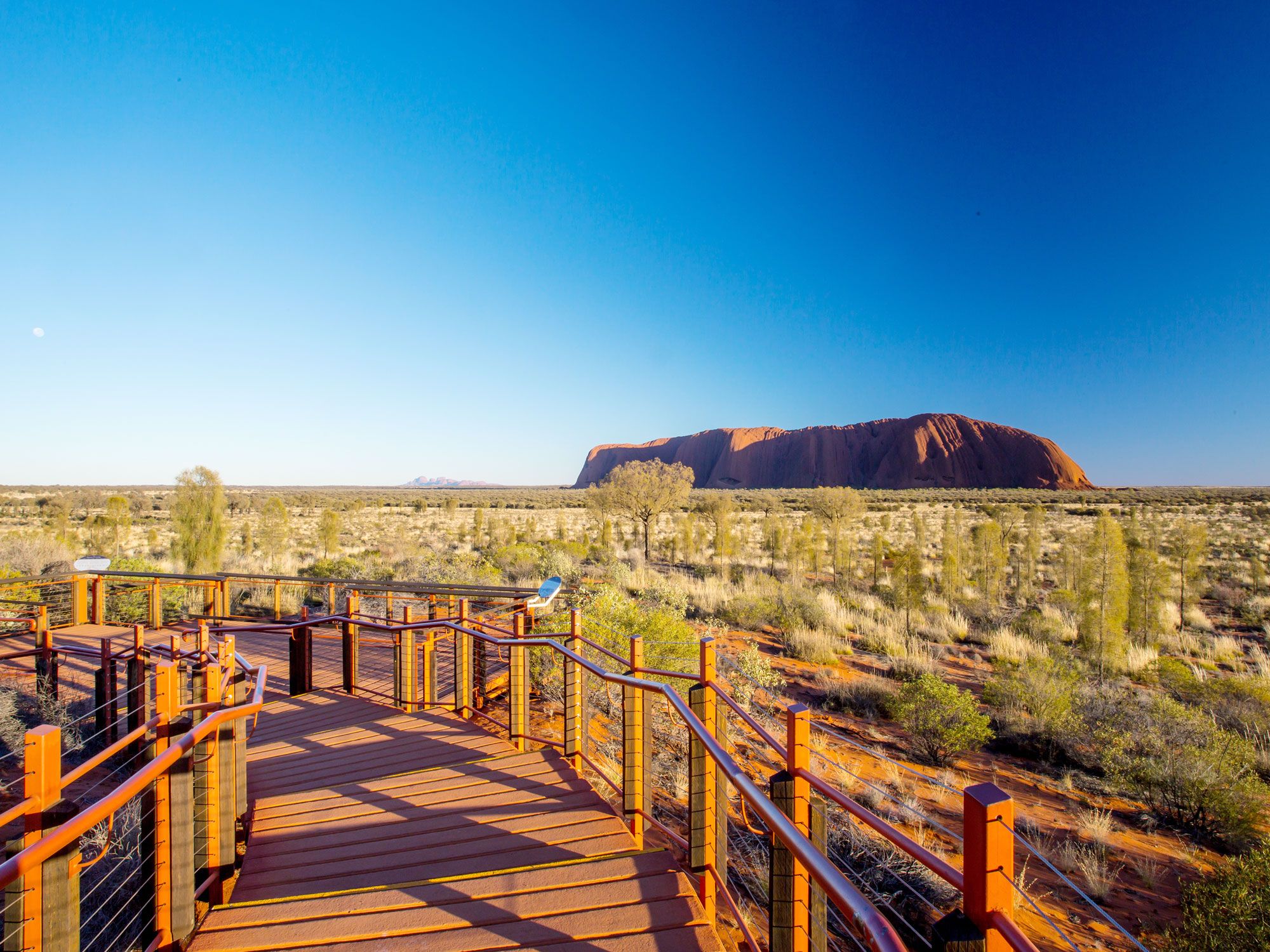
Uluru, also known as Ayer’s Rock, translates to “the great pebble” in the language of Australia’s Aboriginal people. A stunning rock formation that rises out of the Northern Territory’s landscape, Uluru is one of the most sacred sites of the local Aboriginal tribe, known as Aṉangu. Since the site has been a significant part of Aṉangu culture for 30,000 years, visitors to the park are no longer allowed to climb Uluru, as it is a pilgrimage for Indigenous people only.
However, visitors are permitted to walk around the base of Uluru, a journey that takes roughly four hours. There are also several smaller sections of the base walk that can be completed, including the Mala walk, which features caves adorned with ancient petroglyphs.
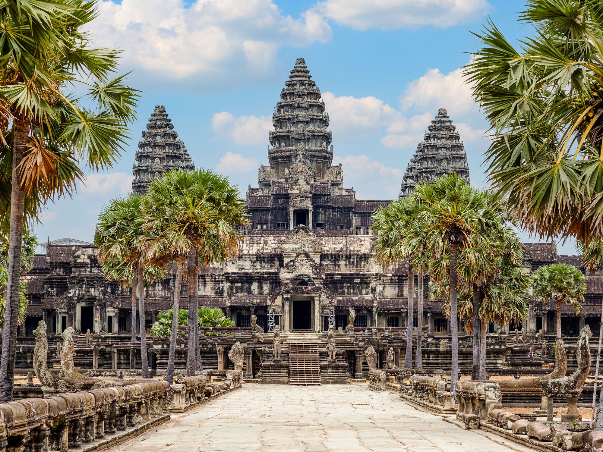
As an ancient complex of temples built in Cambodia during the 12th century, Angkor Wat is consistently lauded as an architectural achievement. Built by the Khmer civilization, the massive complex was first constructed to honor the Hindu god Vishnu, before becoming a Buddhist site at the end of the century.
As a result, the complex is built in accordance with the sacred cosmology of both religions, often employing the number 108 and all of its divisions. Although it would eventually fall into disuse, Angkor Wat was an important pilgrimage site for Buddhists during the 14th century. After being rediscovered in the 1840s, pilgrims and tourists alike began to return to the sacred site, which is the largest religious complex in the world.
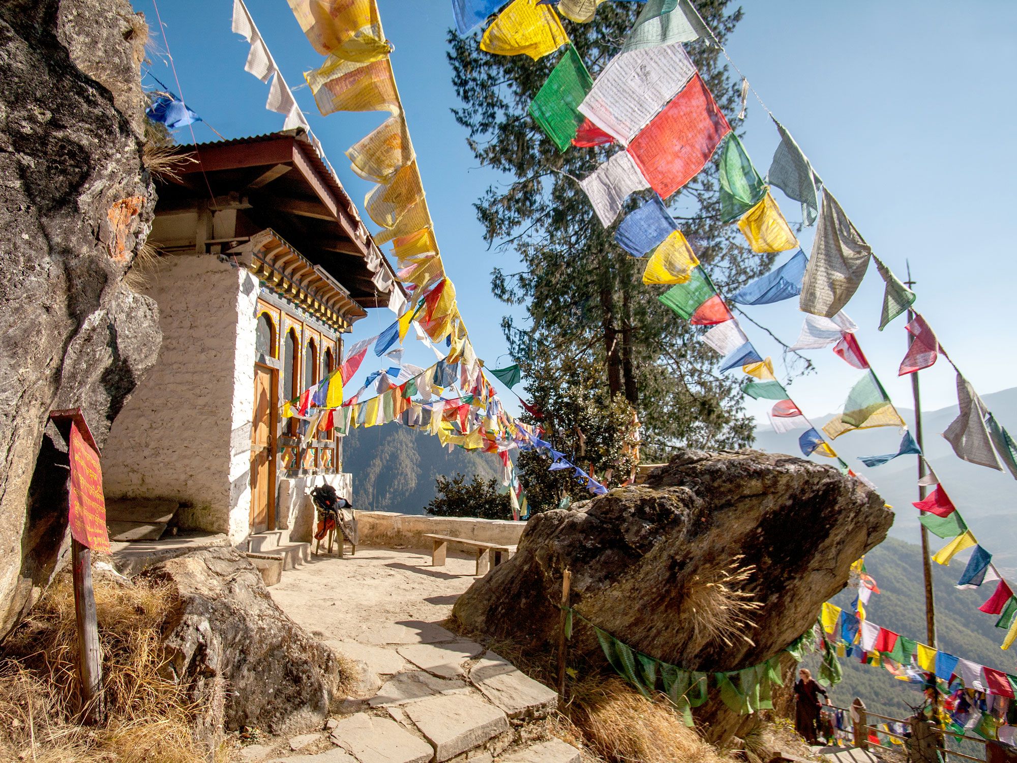
One of the most sacred sites in Bhutan, Paro Taktsang, also known as “Tiger’s Nest,” is a requisite pilgrimage for Tibetan Buddhists. Bhutanese pilgrims journey up a trail of over 1,000 steps to a cliffside monastery, which was built surrounding a cave to honor Guru Padmasambhava in 1692.
Situated 10,000 feet above sea level, the original pilgrimage trail was a death-defying journey alongside a cliff. In recent years, it has been rebuilt with protective guard rails in the more precipitous spots. Buddhist monks are often stationed on the way up, offering pilgrims refreshments on their journey, which usually takes four to five hours round-trip.
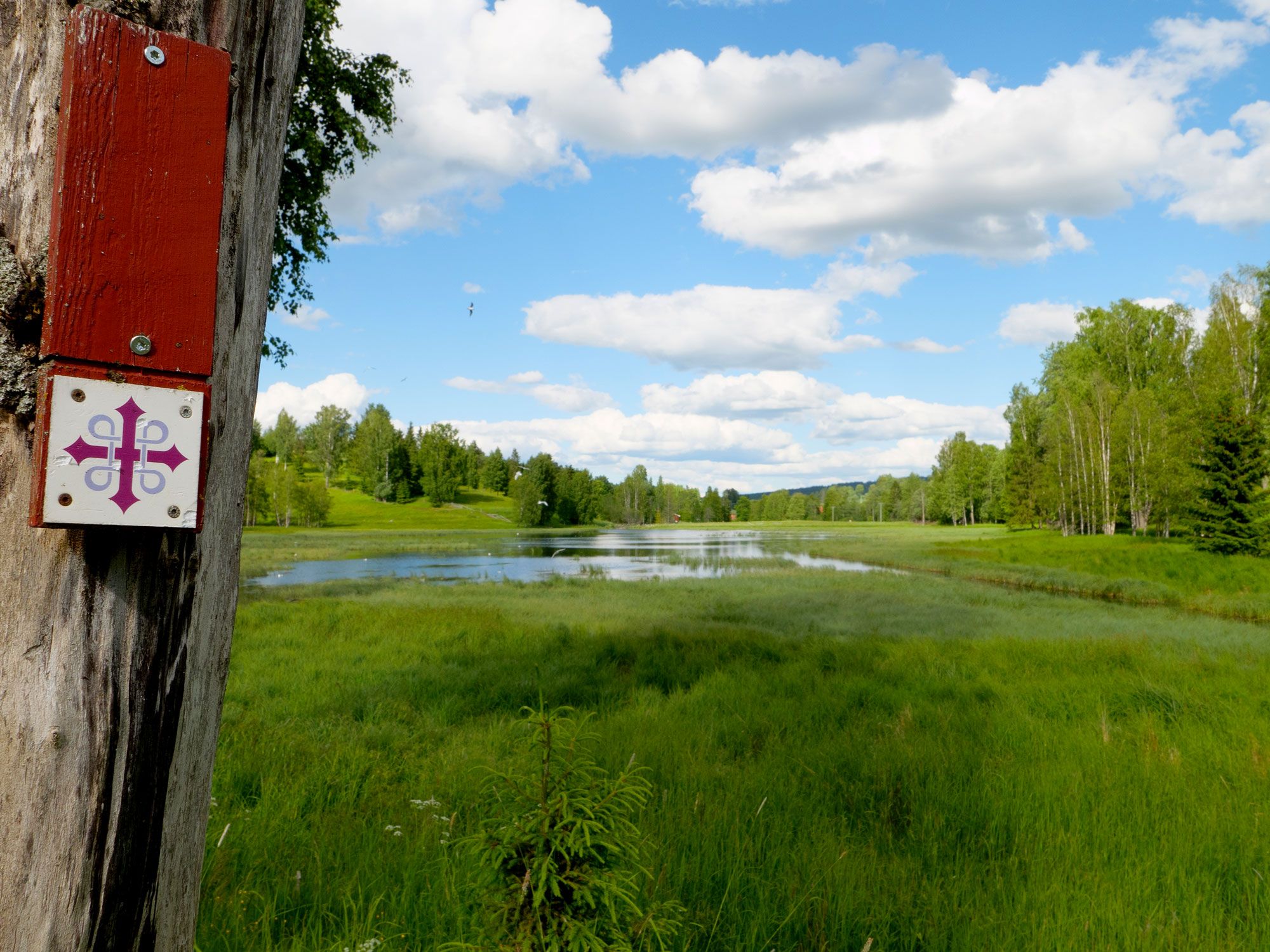
Norway’s most famous pilgrimage is in honor of St. Olav, a former Viking king who was canonized for his efforts to spread Christianity in Scandinavia. His shrine is located in a cathedral in Trondheim, and it is here that pilgrims walk to pay their respects.
There are nine different St. Olav Ways, all of which meander for a collective 1,864 miles through the Norwegian countryside. The most well-trodden path is Gudbrandsdalsleden, a 400-mile-long trail that begins in Oslo and takes over one month to complete. Since it was also once the main road during the Middle Ages, it’s likely that St. Olav used the trail himself, which makes the experience all the more meaningful.
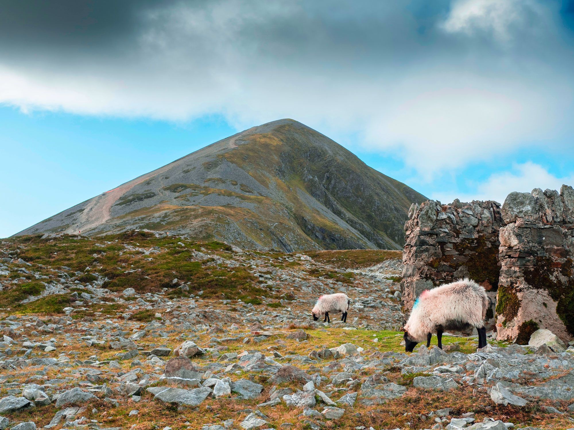
The fourth-tallest mountain in Ireland, Croagh Patrick is a pilgrimage route that dates back thousands of years. Long before Christianity was the dominant religion in the British Isles, the mountain was where Pagans gathered to celebrate the beginning of the harvest season.
Today, the mountain is named for none other than St. Patrick himself, who was on a mission to convert Pagans to Christianity in the fifth century and fasted atop the mountain for 40 days. From then on, the mountain’s summit became a sacred site. As an important piece of Ireland’s history, Croagh Patrick is a popular pilgrimage for Christians and seculars alike — the somewhat arduous journey takes a minimum of four hours and requires a difficult scramble toward the top.
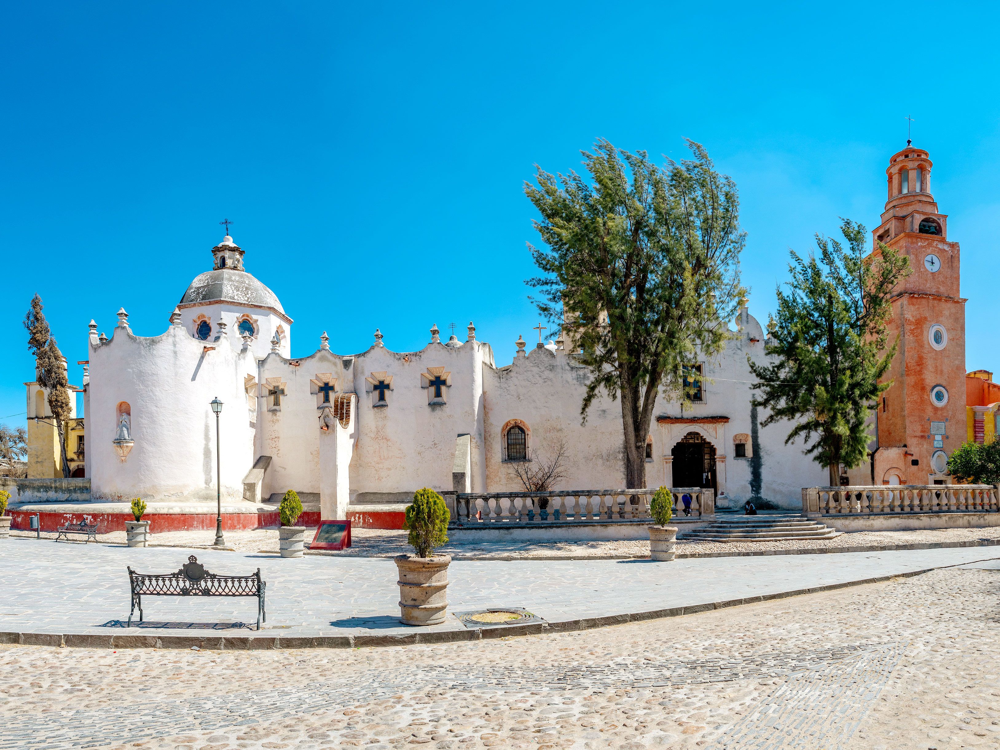
A mere 7.5 miles from the bustling town of San Miguel de Allende is the Sanctuary of Atotonilco, which translates in the Indigenous language to “Place of the Hot Waters.” Located in a region known for its thermal springs, the land was acquired in the 18th century by a local priest, who subsequently built a church. Since then, nearly every inch of the church’s interior has been painted with murals depicting religious scenes, earning the church the moniker “Sistine Chapel of Mexico.”
With its dormitories, meeting halls, and dining rooms, Atotonilco has space to accommodate those who seek healing. As a result, thousands of pilgrims make the journey to Atotonilco every year, especially before Holy Week. At this time, there is an annual procession when hundreds of pilgrims walk in the dark from Atotonilco to San Miguel de Allende, an overnight journey that ends at sunrise.
Advertisement
More from our network
Daily Passport is part of Inbox Studio, an email-first media company. *Indicates a third-party property.