
Post Banner Image
Culture

A Guide to Regional Barbecue Styles Around the U.S.
By Daily Passport Team
Read time: 5 minutes
July 7, 2023
Updated: July 25, 2023

A Guide to Regional Barbecue Styles Around the U.S.

By Daily Passport Team
Author
Daily Passport Team
Daily Passport writers have been seen in publications such as National Geographic, Food & Wine, CBC, Condé Nast Traveler, and Business Insider. They're passionate about uncovering unique destinations and sharing expert tips with curious travelers.

Barbecue is one of America’s most beloved — and debated — culinary traditions. From the Carolinas to Hawaii, each region of the U.S. has their own take on barbecue, from the smoking process to the sauces and sides. And each region will probably tell you theirs is the best. Wondering what all the fuss is about? Here are four of the most popular regional barbecue styles in the U.S., explained.

Texas
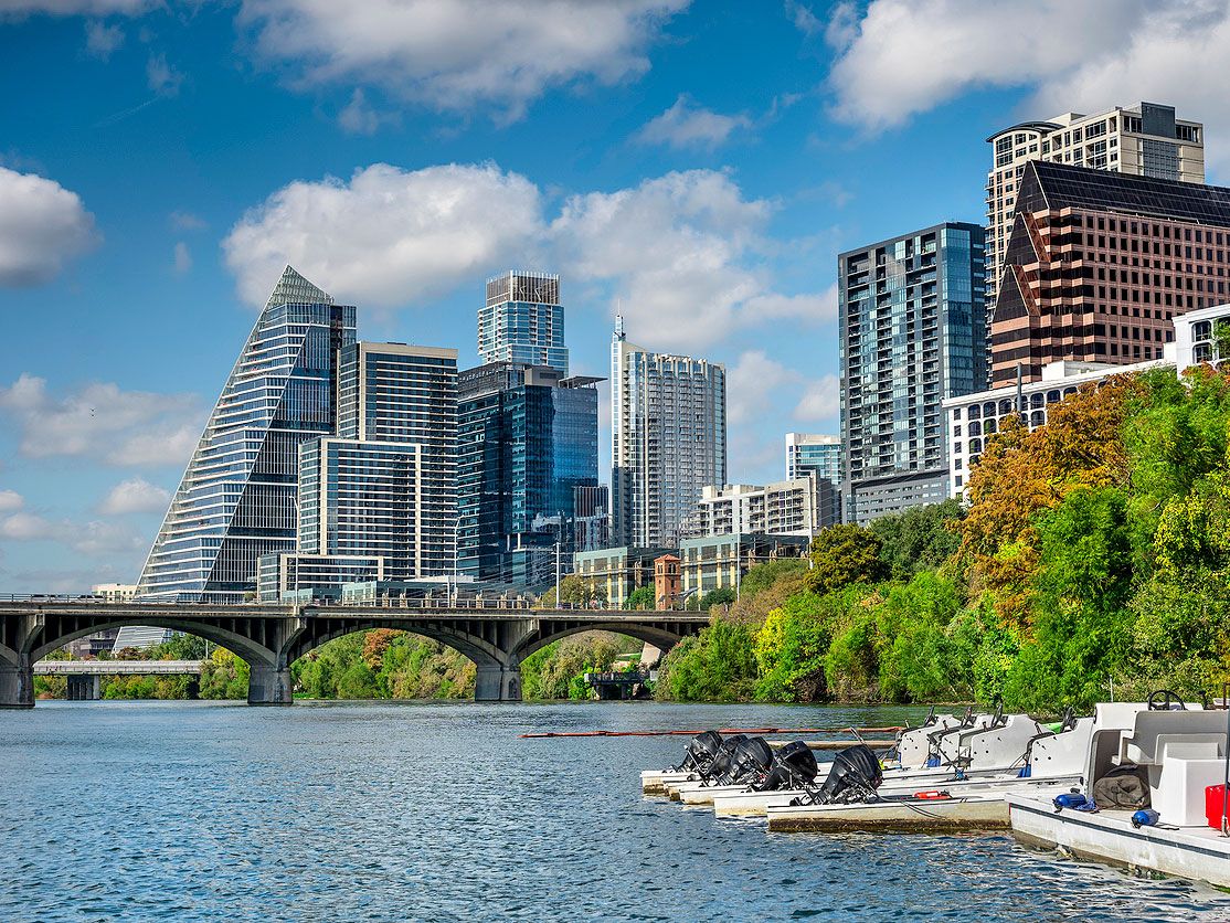
Downtown Austin, Texas, skyline with Colorado River
Photo credit: Pgiam/ iStock

The Lone Star State boasts several different (and equally tasty) barbecue traditions thanks to its vast and varied geography. German immigrants introduced their butchering techniques, while the eastern side of the state stayed true to more southern roots. Mexican cuisine introduced barbacoa, and cowboys eschewed smoking their meat. However, Hill Country (in Central and South Texas) is the perhaps most iconic spot for finding flavorful, smoky fare — drawing ‘cue lovers from around the world.

The Meat: The cow dominates in this cattle country, and beef — brisket, to be exact — is the favorite cut for smoking. Plump and well-seasoned sausages come in second, which is a nod to the many descendants of German immigrants who call the Hill Country home.

The Sauce: Forget it partner, this is Texas! Well, this was Texas, where sauce was scorned by old-timers who insisted it obscured the quality of the meat. Times have changed, however, and today sauce is available everywhere. World-famous Franklin Barbecue in Austin offers a ketchup-y, vinegary sauce enlivened with Worcestershire and hit with a few shots of espresso.

The Sides: Pickles and onions aren’t actually sides in Texas, but rather an integral accompaniment to every smoky slab of meat. As is common in most regions, cabbage slaw brings a welcome lightness and acidity to an otherwise heavy meal. Beans (baked and sweet or cowboy pintos) also make an appearance, along with macaroni and cheese, collard greens, and crispy, fried okra.

The Carolinas
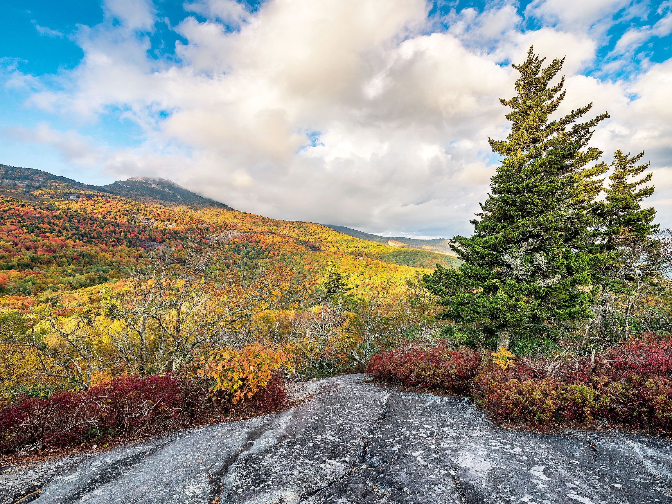
Autumn colors in the Blue Ridge Mountains of North Carolina
Photo credit: anthony heflin/ Shutterstock

The Meat: Whether hailing from North or South, residents of the Carolinas take their ‘cue seriously. “Barbecue” is a noun, and the protein almost exclusively refers to pork — slowly smoked over hickory wood and then “pulled” (shredded) or chopped after the pig (either the whole hog or shoulder) has achieved tender, juicy perfection. The meat is then piled atop slices of squishy white bread — maybe a bun if you’re in a fancier joint.

The Sauces: Sauce is where the regional characteristics of the Carolinas really come into play, although they often overlap. In coastal, eastern North Carolina, barbecue sauce is spicy, vinegar-based, and is used to coat the pork and as a mopping sauce. Western North Carolina in Appalachian country, however, builds on this classic with the addition of tomato sauce or ketchup to create a sauce they refer to as “dip.” In the Gold Belt of South Carolina, German immigrants even incorporated their beloved mustard. You can also find both eastern and western barbecue styles on the menu in a pocket of northeast Arkansas as well as in Missouri’s southeastern “Bootheel” region, an area you’d think would lean towards the more local flavors of Memphis or St. Louis.

The Sides: In the Carolinas, there’ll be slaw for sure next to your delicious ‘cue. Not coleslaw, but rather simply “slaw,” which is mostly vinegar and cabbage with a bit of ketchup for color. Plain, boiled, white potatoes are still popular in the east, while corn sticks — the love child of cornbread and deep-fried hushpuppies — reign supreme. In South Carolina, you can also dig into hash, which is a thick, gravy-like, pork stew ladled over a mound of plain, white rice, grits, or bread.

Hawaii
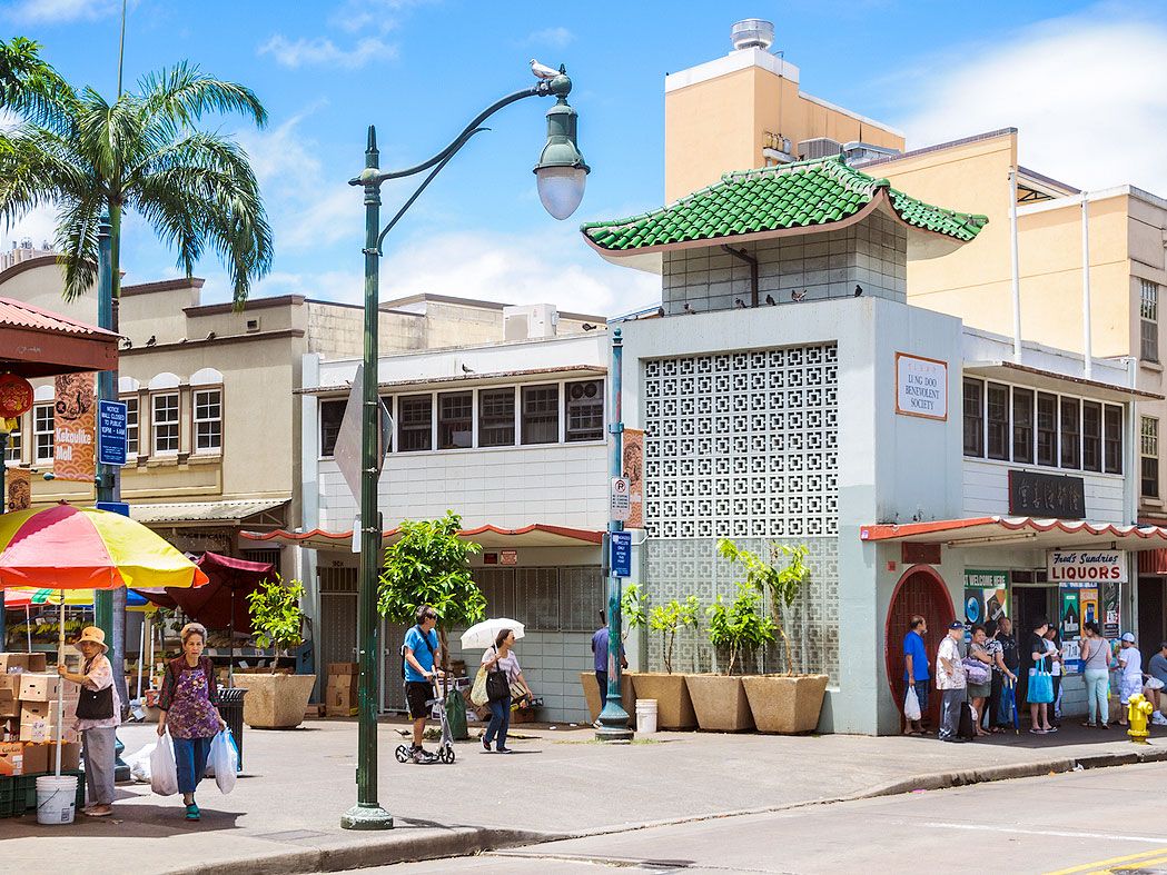
Street scene in Honolulu, Hawaii

The islands of aloha aren’t lazy in the barbecue department, and though the more-steamed-than-smoked feast differs from traditional southern barbecue, no one at the luau will complain. The centuries-old ritual involves digging a deep fire pit called an imu, which is then covered with volcanic rocks to retain the heat and layered with banana and ti leaves to protect and add flavor to the food. In goes the bounty, which is then sealed to gently steam for the better part of a day.

The Meat: While whole roast pig is the highlight of Hawaiian barbecue, almost any delicious food can be incorporated into an imu such as poultry, seafood, breadfruit, and starches like sweet potatoes and taro. Kalua pork (from the shoulder) is a sure winner if you don’t possess a whole hog. And skip the sauce to start. While kukui nuts and seaweed used to go in the pit, today’s chefs only use sea salt while cooking. Condiments like chile pepper water and Maui onions are added tableside.

The Sides: What a luau lacks in strong smoke, it makes up for in accompanying dishes. Hawaii’s side dish hustle is strong. In addition to traditional treats like poi (a paste made from pounded taro), Hawaiians enjoy lomi lomi salmon (rubbed with onions and tomatoes), poke (chopped raw fish), and creamy potato-macaroni salad.

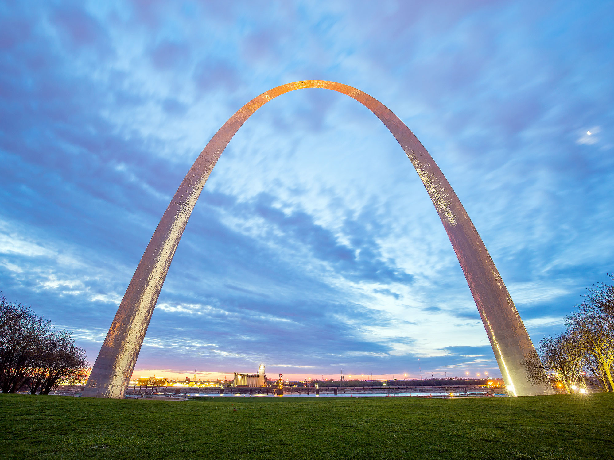
Missouri
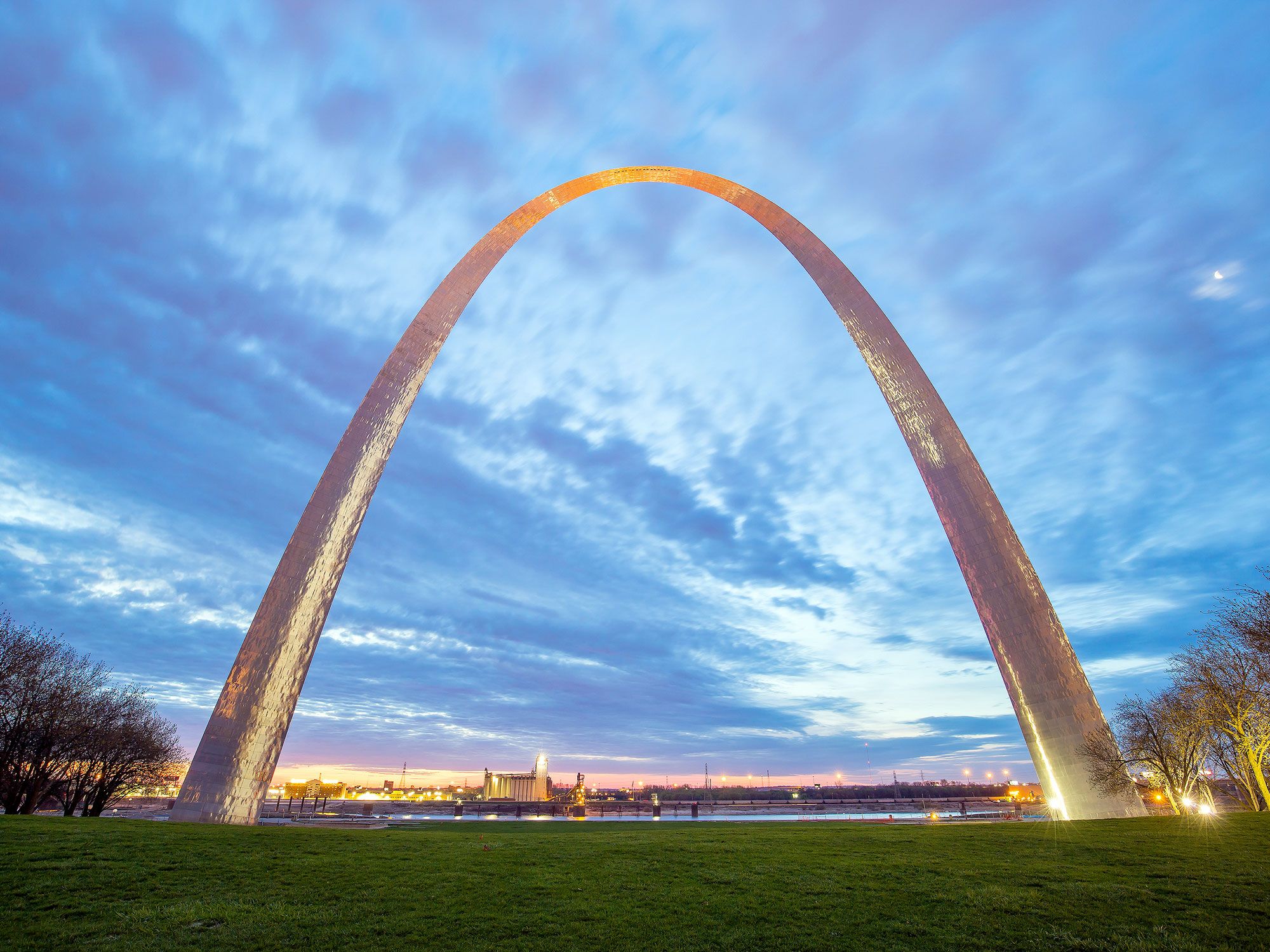
Gateway Arch in St. Louis, Missouri, at dusk
Photo credit: f11photo/ Shutterstock

Located over 200 miles apart, the cities of Kansas City and St. Louis are separated by the rest of Missouri. They’re rivals in sporting teams, civic pride, and barbecue. Truth be told, the two cooking styles aren’t that different, but there’s enough variety to keep the argument interesting.

The Meat: Both cities go big for baby-back ribs, and baby-backs even outsell St. Louis-style ribs in St. Louis. But the favorites branch off from there. Kansas City is famed for its burnt ends, the crispy, caramelized ends of briskets that are double smoked and served on plates, in sandwiches, or simmered with sweet beans. St. Louis doesn’t turn up its nose at the nose — ask patrons who line up at Smoki O’s for pig snoot, which is just what you think it is: thinly sliced, crispy pig nose eaten like a potato chip.

The Sauces: If you like Sloppy Joes, you’ll dig the molasses sweet sauce slathered on barbecue in Kansas City — darkened with ketchup and carrying very little kick. It’s Memphis-style, but minus the rub and laid on much thicker. On the east side of the Show-Me State, St. Louisans like their ribs caramelized with a thinner, vinegar-based sauce carrying slightly more heat.

The Sides: Middle America throws everything on the melting pot table at a barbecue and the sides reflect that. Soul food makes a prominent appearance, and you’ll find slow-simmered green beans and macaroni and cheese along with coleslaw, root beer baked beans, and corn. Eat up!

Post Banner Image
Culture

Paris for Pros: 9 Landmarks to Visit Besides the Eiffel Tower

By Daily Passport Team
Read time: 7 minutes
July 7, 2023
Updated: November 1, 2023

Paris for Pros: 9 Landmarks to Visit Besides the Eiffel Tower

By Daily Passport Team
Author
Daily Passport Team
Daily Passport writers have been seen in publications such as National Geographic, Food & Wine, CBC, Condé Nast Traveler, and Business Insider. They're passionate about uncovering unique destinations and sharing expert tips with curious travelers.

There’s a reason Paris is called the “City of Light” — and not just because of the Eiffel Tower’s sparkling light show every evening. One of the world’s most-visited cities, the French capital dazzles visitors with world-famous restaurants, art galleries and museums, chic boutiques, and landmarks to fill weeks worth of vacation time. After you’ve checked off the big hitters — Notre-Dame, the Eiffel Tower, the Louvre, Sacré-Coeur — you may be wondering where to head next. Here are nine under-the-radar landmarks to check out on your next Parisian adventure.  

Louis Vuitton Foundation

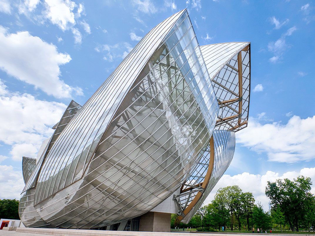
Geometric, abstract exterior of the Louis Vuitton Foundation in Paris
Photo credit: BERK OZDEMIR/ iStock

With a striking modern, abstract exterior covered in giant panels of smooth glass, the Louis Vuitton Foundation — designed by famed architect Frank Gehry — is impossible to miss. Since the art museum and cultural center opened in 2014, the foundation has housed a permanent collection of 268 pieces from 102 artists, in addition to two temporary displays of modern art, which rotate annually. The minimalist interior includes exhibits on pop art, expressionist art, and music and sound, displaying works from both the 20th and 21st centuries. Don’t forget to visit the auditorium, designed to showcase live artistic performance, such as dance and music. Lovers of the arts will fall hard for the whole experience.

Palais Garnier

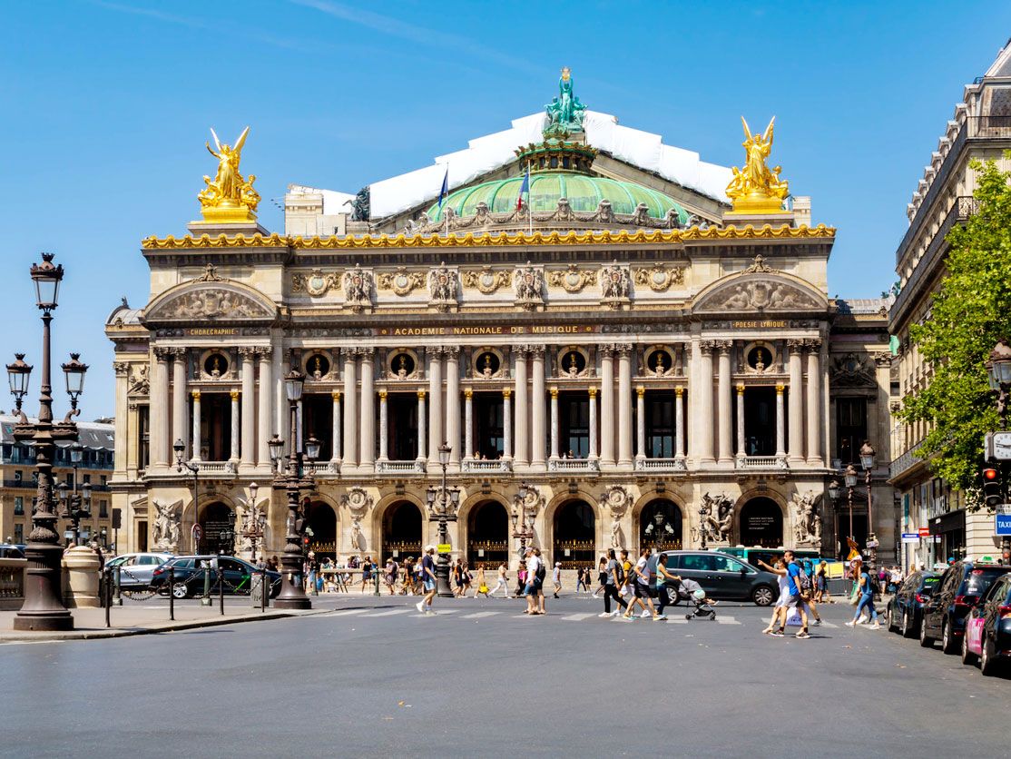
Exterior of Palais Garnier in Paris, France
Photo credit: Blazenka Babic/ iStock

Even if you’re not into opera, visiting the Opéra National de Paris, also known as Palais Garnier, will feel like stepping into a fairy tale. The magnificent building in the ninth arrondissement was constructed between 1861 and 1875 under the orders of Emperor Napoleon III to host the Paris Opera. The 98-foot-tall vault constructed of swirled marble and double staircases impresses from the moment you step inside. The horseshoe-shaped auditorium embellished in marble, stucco, and velvet includes an eight-ton bronze and crystal chandelier that hangs prominently. Attend an opera, ballet, or symphonic concert to fully experience this magnificent space. Currently, the venue produces 380 shows a year to over 800,000 audience members. Experiencing a Parisian opera is one way to feel a true connection with the city.
The Molitor

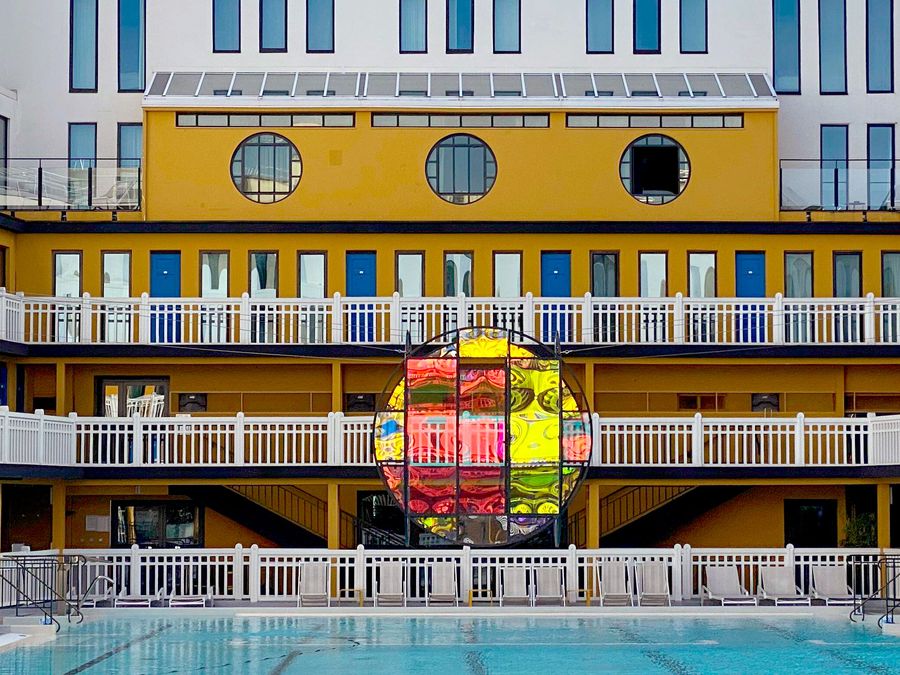
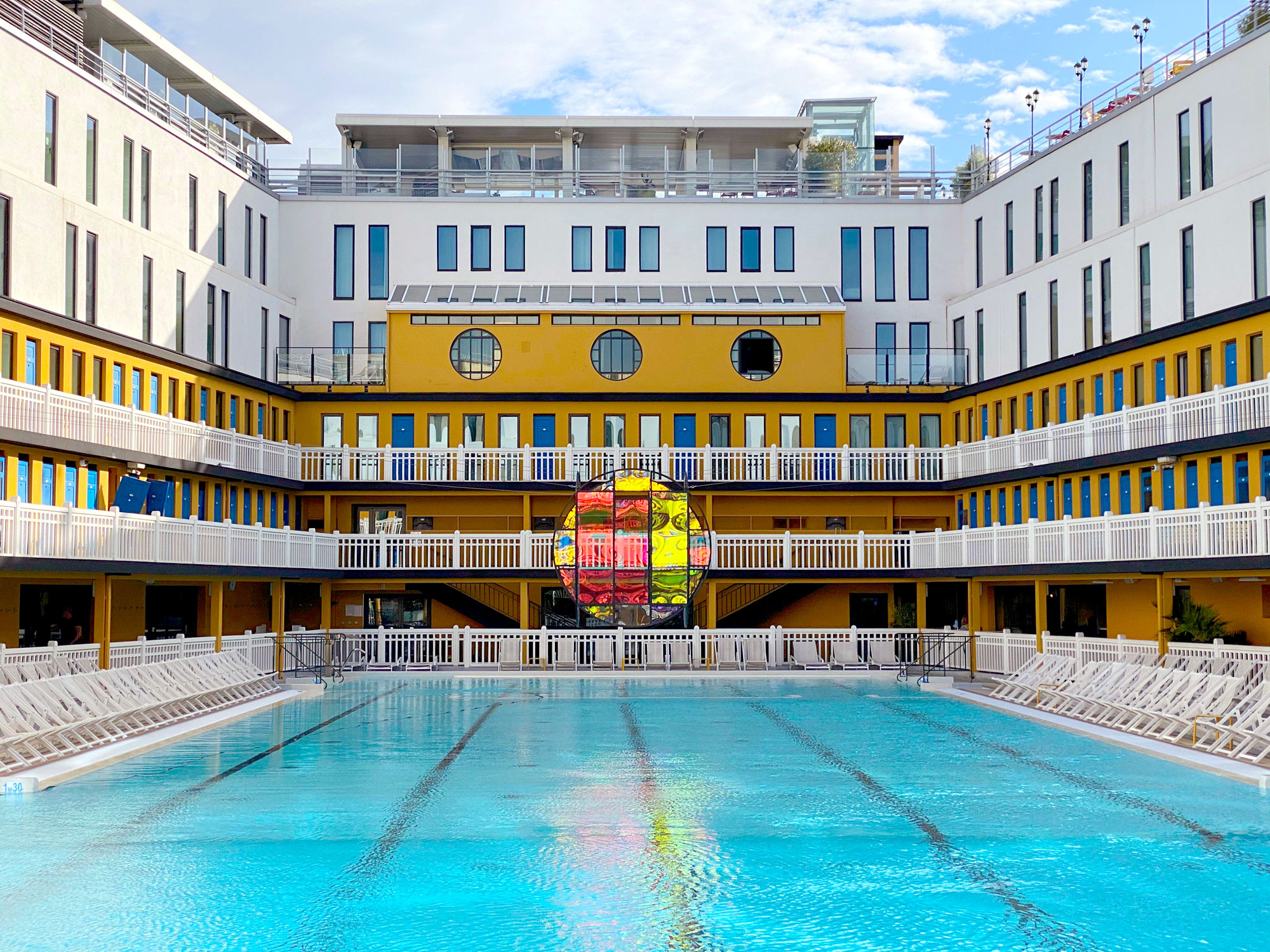
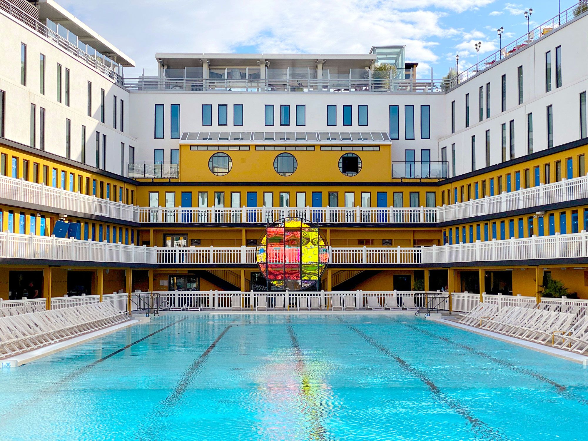
Swimming pool in courtyard of the Molitor building in Paris
Photo credit:  Life on white/ Alamy Stock Photo

Not only is the Molitor a historical monument, but it’s also a modern-day pool, spa, hotel, bar, rooftop space, art gallery, and restaurant rolled into one. A symbol of Parisian luxury, this urban resort opened in 1929 and for six decades was the place locals came to swim, sunbathe, play sports, and socialize. When it closed in 1989, the artistically-minded patrons who frequented the Molitor occupied the abandoned building and turned it into a hub for creativity and expression.

During the 1990s, the building was covered in colorful graffiti and hosted parties, events, fashion shows, and concerts. Fast-forward to present-day, and the city has revamped the Molitor. However, the building’s history has not been erased — the city’s first street art graffiti has been preserved on the hotel’s lobby walls and corridors. The restaurant and spa are open to the public, and the Molitor hosts numerous cultural and sporting events. The building holds many of Paris’ decade-old secrets for those who want to dig beneath the surface.

The Statues of Liberty

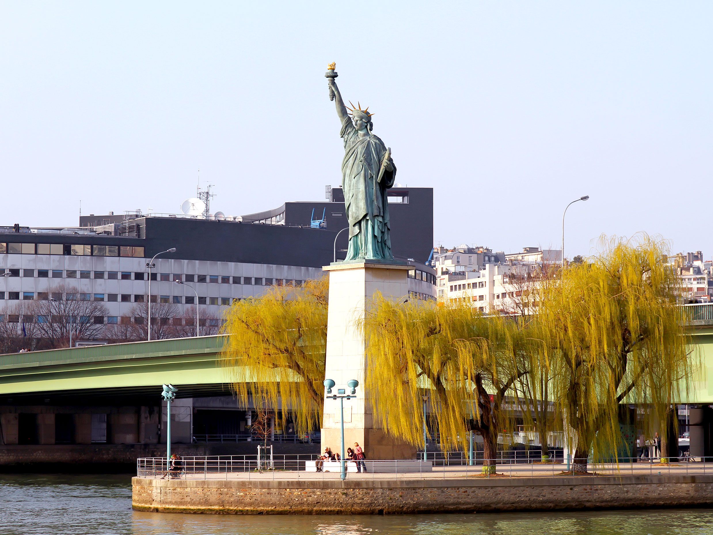
Mini replica of the Statue of Liberty in Paris, France
Photo credit: Denis Kuvaev/ Shutterstock

If you thought that the Statue of Liberty was in New York, you’d only be partly right. Scattered across Paris are a number of replicas of the famous statue, which the French gifted to the United States to commemorate the alliance of the two nations during the Revolutionary War. The most prominent (and largest) statue stands on a plinth on the Île aux Cygnes beside the Pont de Grenelle (Grenelle Bridge). It’s a quarter of the scale of its North American counterpart, and was gifted to Paris in 1889 by its American expat community.
The Musée d’Orsay’s Lady Liberty greets visitors as they arrive. Standing a little under 10 feet tall, the piece is also the work of acclaimed French sculptor Auguste Bartholdi. Until 2011, it stood in the Jardin du Luxembourg (Luxembourg Gardens), where another — a bronze copy — replaced it a year later. And there’s more: The bronze Lady Liberty, which until recently graced the courtyard at the Musée des Arts et Métiers, is on loan to the U.S. for a decade, but the museum retains the original plaster casts that were used to create the original.
Cimetière des Chiens

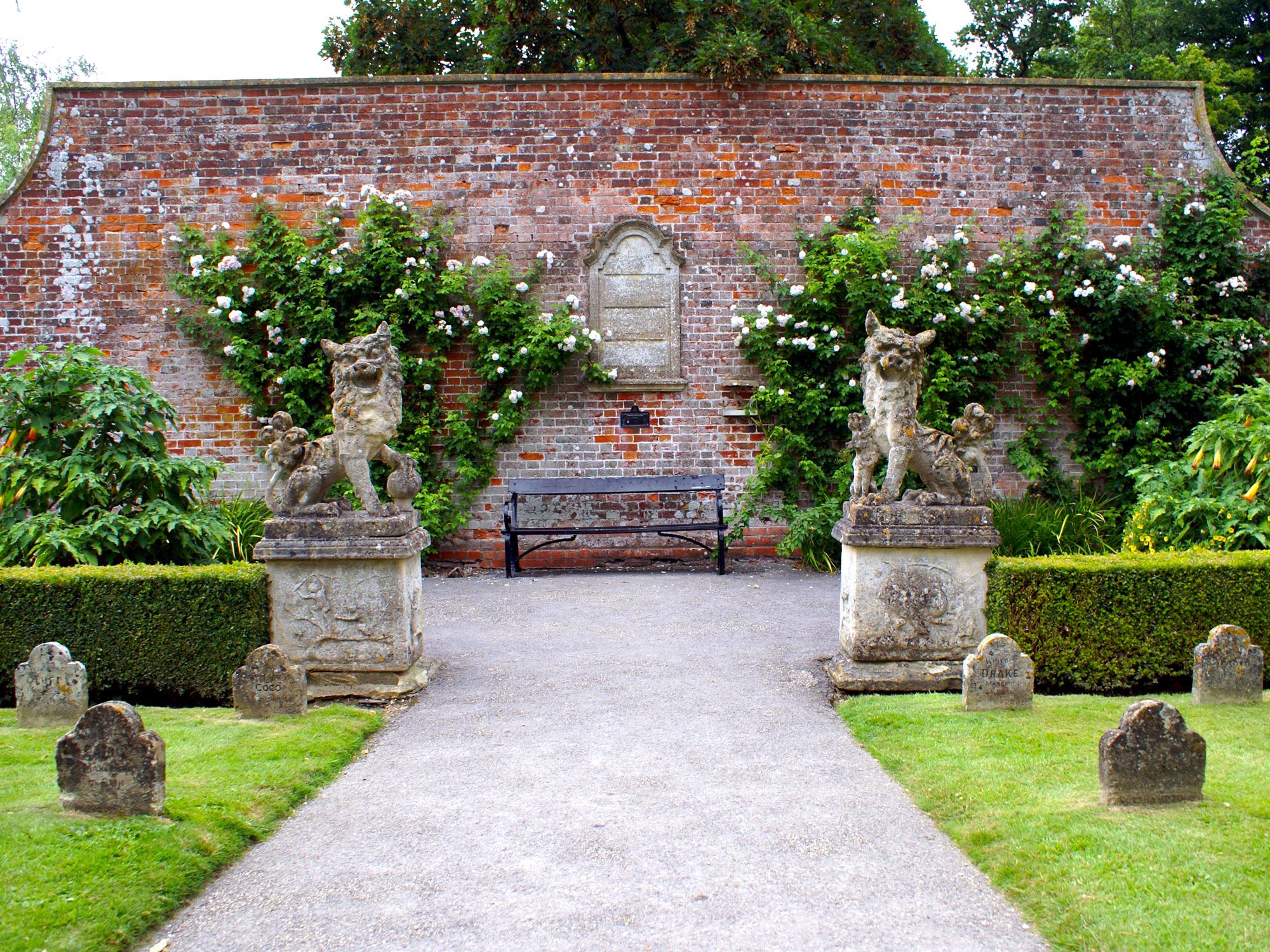
Gardens filled with cat statues and tombstones in Paris' Le Cimetière des Chiens
Photo credit: rosesmith/ Shutterstock

Animal lovers, be prepared to shed a tear or two as you visit this suburban pet cemetery in the Asnières-sur-Seine neighborhood. Its full name is Le Cimetière des Chiens et Autres Animaux Domestiques — the cemetery for dogs and other pets. In a tranquil spot beside the river, you’ll find the graves of much-loved canines and feline family members, famous animal actors, and heroes, including the grave of Rin Tin Tin, a German shepherd that starred in his own children’s television series. Rescued as a puppy from a World War I battlefield, Rin Tin Tin went on to star in 27 Hollywood movies before his death in Los Angeles in 1932. Also look out for the monument to a Saint Bernard named Barry. A poignant inscription reveals that he saved 40 human lives before making the ultimate sacrifice while trying to rescue the 41st. Actually, the legend isn’t true, though the sentiment is admirable — this canine hero died in old age after living out his retirement in a Swiss monastery.

Rue Dénoyez

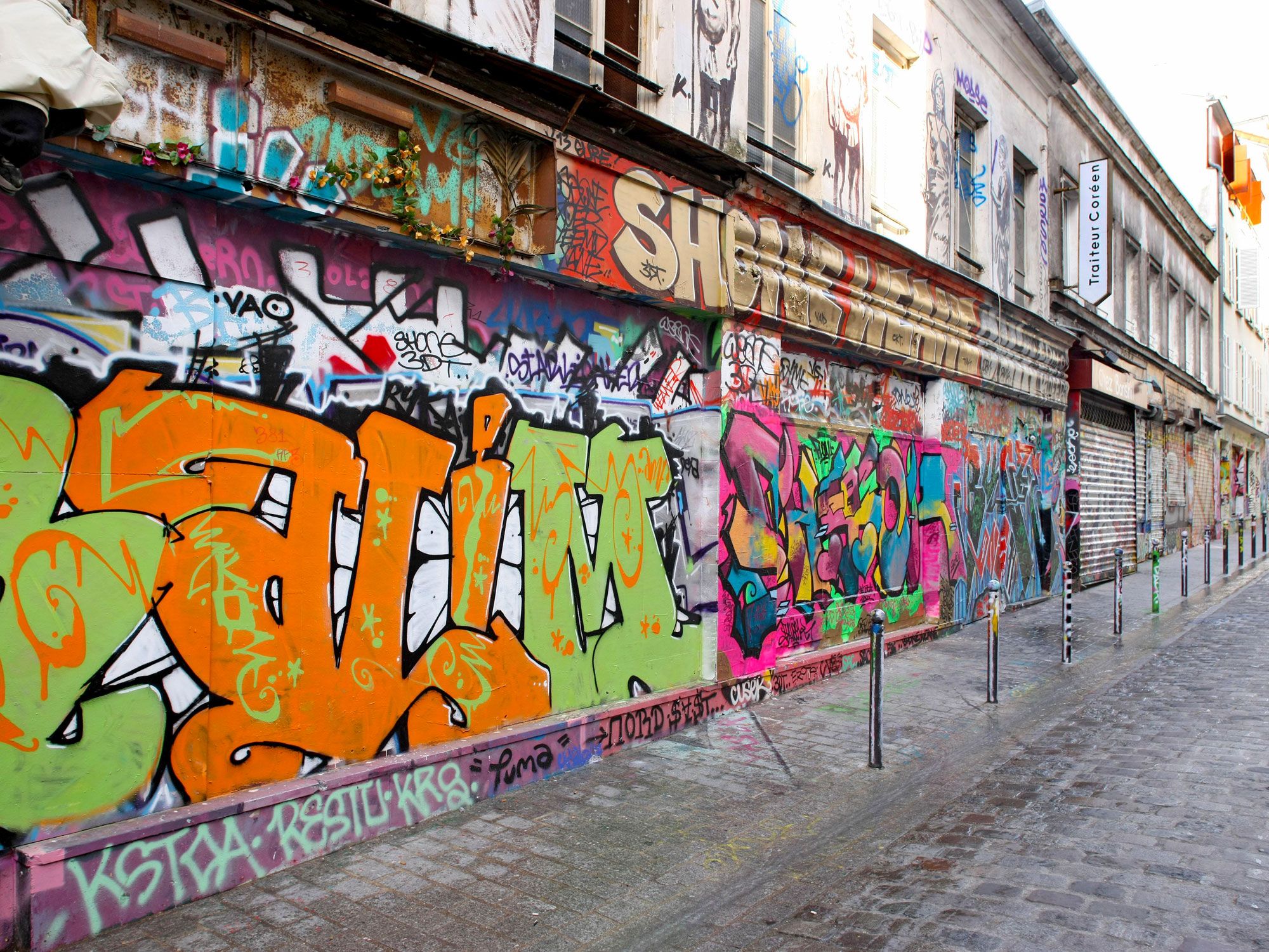
Graffiti-covered buildings on Rue Dénoyez in Paris, France
Photo credit: Photo 12/ Alamy Stock Photo

Dubbed “Street Art Alley,” this quirky Parisian street is one of the city’s most colorful corners. In many parts of the capital, daubing the walls is not permitted, but this lane is a rare exception. Street artists capitalize on this and have created a vivid and multi-faceted mural composed of the work by some of the city’s best graffiti artists married with the creative use of mosaics and household objects like teapots and toys. The art is organic and haphazard, but the end result is one of delightful whimsy, guaranteed to put a smile on your face.

Pâtisserie Stohrer

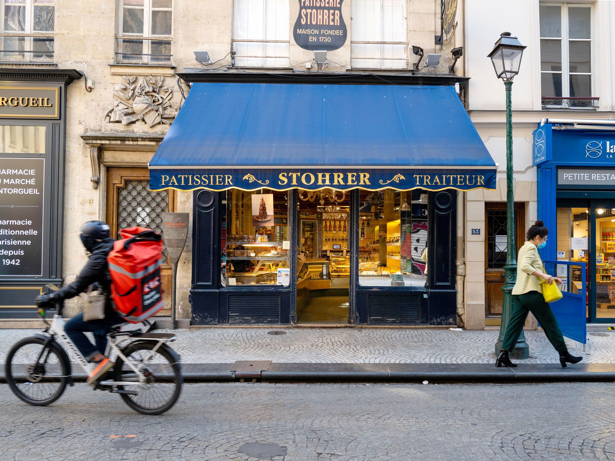
Pâtisserie Stohrer in Paris, France
Photo credit: Wirestock, Inc./ Alamy Stock Photo

Nicolas Stohrer, pastry chef to King Louis XV, opened this historic patisserie almost 300 years ago in 1730. Pâtisserie Stohrer is the oldest bakery in the city and has an enviable reputation for baking what many consider to be the best vol-au-vents (hollow puff pastries) in Paris. When the monarch’s fussy father-in-law complained his brioche was too dry, Stohrer soaked it in wine. Later switching to hard liquor, the rum baba was born. Stohrer’s culinary inventions didn’t stop there — he was also responsible for creating the crème chiboust (a famous cream tart filled with Italian meringue), the puits d’amour (a hollow pastry filled with red currant or raspberry jam), and the traditional-style religieuse (two buns filled with cream and topped with chocolate ganache). Unsurprisingly, discerning foodies with an insatiable sweet tooth have been coming to this spot on Rue Montorgueil ever since.

Pagoda Paris

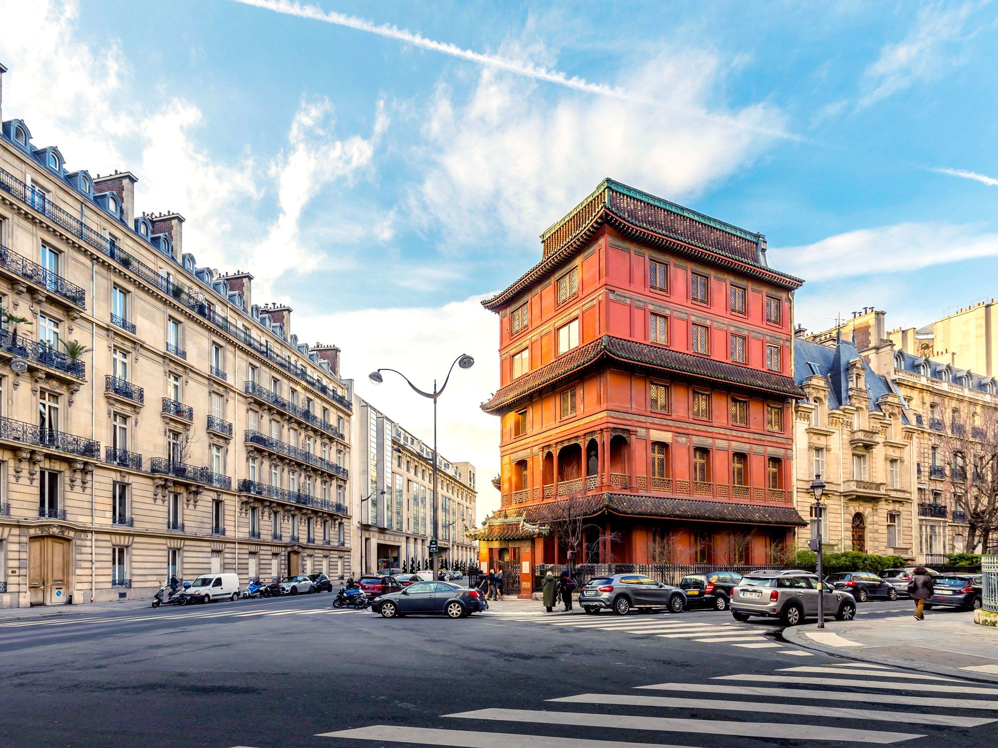
Pagoda Paris on street corner
Photo credit: JEROME LABOUYRIE/ Alamy Stock Photo

The Pagoda Paris started out as a “hôtel particulier,” a term which distinguished the building as a grand private residence. An art and antique dealer named Ching Tsai Loo bought the place in 1925 and set about transforming the building into a gallery that would match the splendor of the pieces he intended to display. From the red walls and tiered exterior to the lavish Shanxi lacquer panels that adorn the interior rooms, the modern-day art gallery is a triumph of Chinese architecture. For a time after Loo’s death in 1957, the building was neglected, but today, it remains fully restored. The pagoda is also a breathtaking event venue that frequently hosts cocktail receptions, private dinners, conferences, photo shoots and fashion shows.

Centre Pompidou

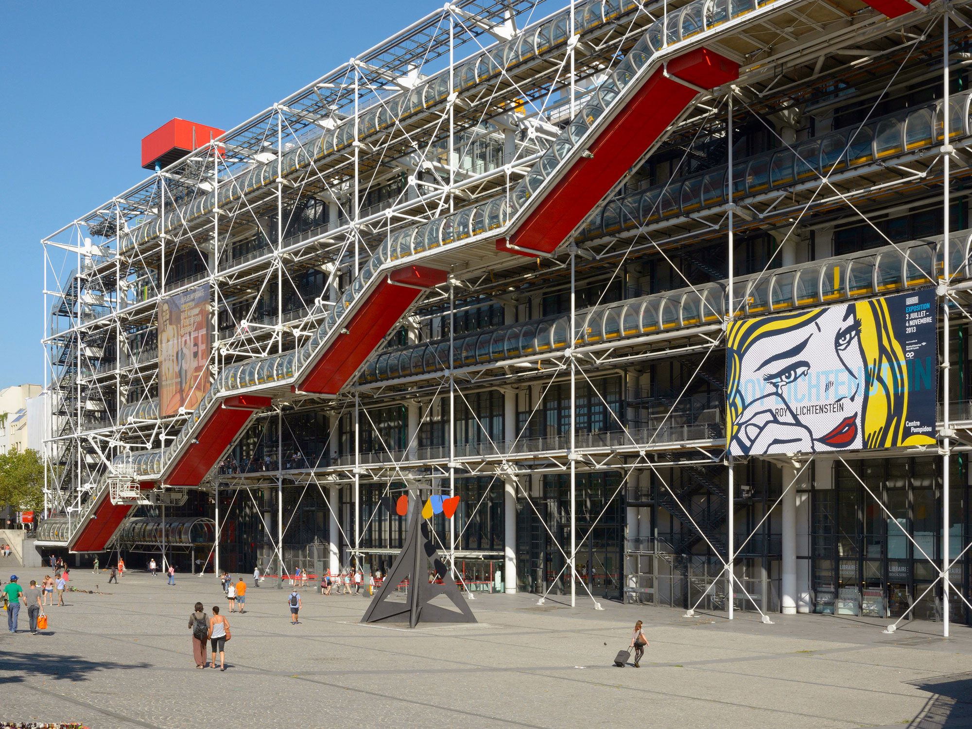
Pompidou Center in Paris covered in scaffolding
Photo credit:  imageBROKER.com GmbH & Co. KG/ Alamy Stock Photo

The futuristic design of the Centre Pompidou made it one of the most controversial buildings in Paris when it opened in 1977. Architects Richard Rogers and Renzo Piano designed this landmark. In fact, locals refer to it as the Beaubourg after its location, rather than calling it the Pompidou Center. Hidden behind the façade of this cultural hub is a public library and the Musée d’Art Moderne de Paris, where you’ll find works by the likes of Picasso, Matisse, Warhol, and Kapoor. But no matter what’s on display inside, it’s always the exterior systems that steal the show. Anything functional is color-coded: green for plumbing, blue for climate control, yellow for electrical, and red for anything involving safety or movement, such as the diagonal escalator which Parisians affectionately dub the “Caterpillar.”

Post Banner Image
Architecture

Ready for Takeoff: The World’s Most Unique Airport Architecture

By Bradley O'Neill
Read time: 5 minutes
July 6, 2023
Updated: October 12, 2023

Ready for Takeoff: The World’s Most Unique Airport Architecture

By Bradley O'Neill

When many of us picture airport terminals, fluorescent-lit interiors, confusing signage, and maze-like corridors come to mind. But in many cities, drab terminals are a thing of the past. They’ve been replaced by modern, light-filled architectural wonders that combine nods to local cultures with the functionality needed to seamlessly transport thousands of passengers each day. These eight airports feature some of the world’s most unique airport architecture.

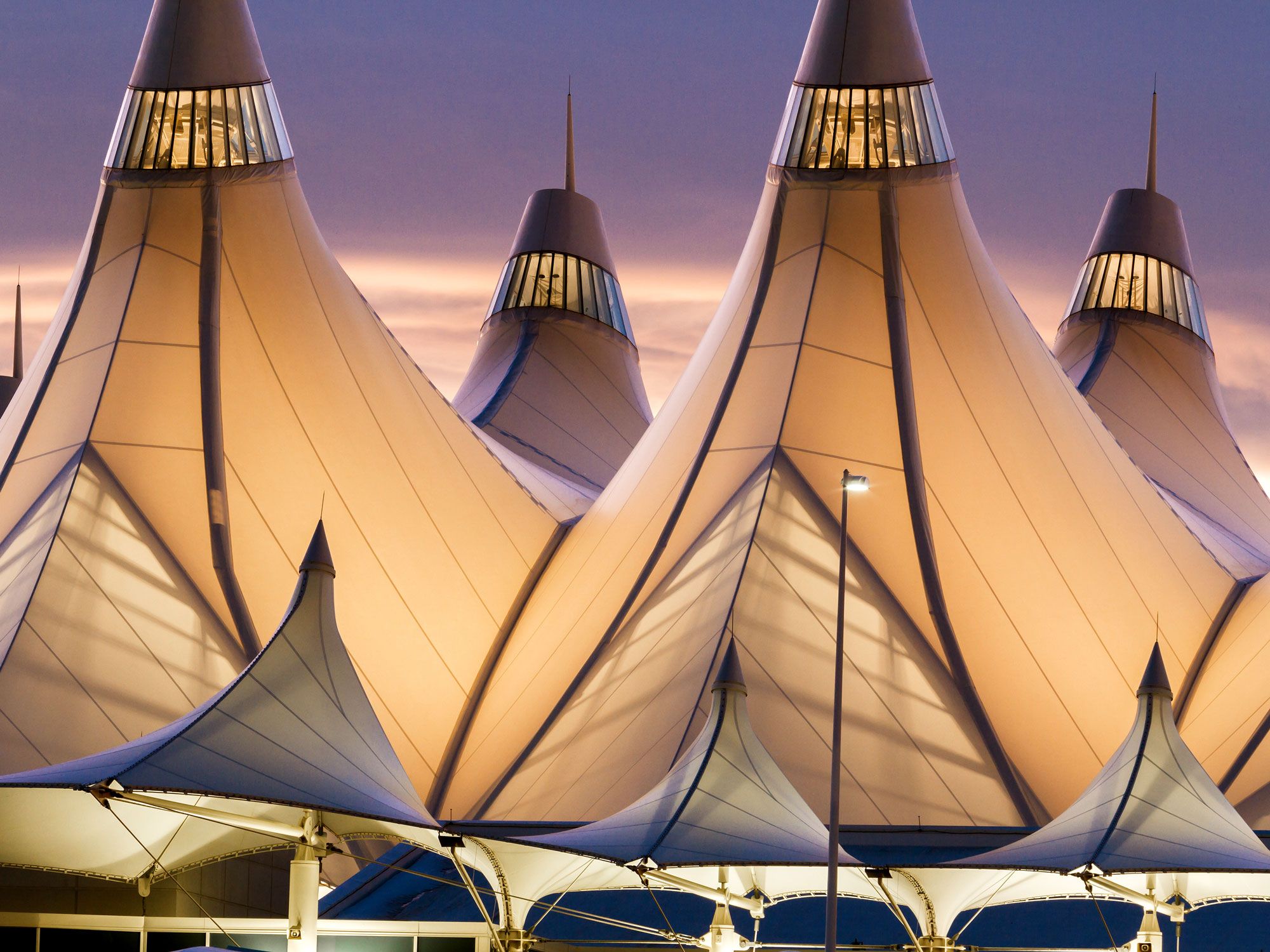
Denver International Airport – Denver, Colorado

Close-up of fabric-covered tents topping terminal at Denver International Airport, seen during dusk
Photo credit: Arina P Habich/ Shutterstock

Travelers arriving at Denver International Airport — America’s largest airport by land area — are welcomed by a towering symbol of the region. A series of soaring fabric-covered tents represent Colorado’s iconic Rocky Mountains, along with the prairie wagons and Native American teepee tents of the state’s history. Designed with sustainability in mind, the translucent roof allows natural light to flood into the 2.6-million-square-foot Jeppesen Terminal.

The airport’s on-site solar farm consists of 9,000 panels that take advantage of Denver’s 300 days of sunshine to produce 3.5 million kilowatts of electricity each year. As a result, DIA — as it’s known by locals — became the first airport added to the Environmental Protection Agency’s Performance Track, which recognizes facilities that excel in protecting human health and the environment. 

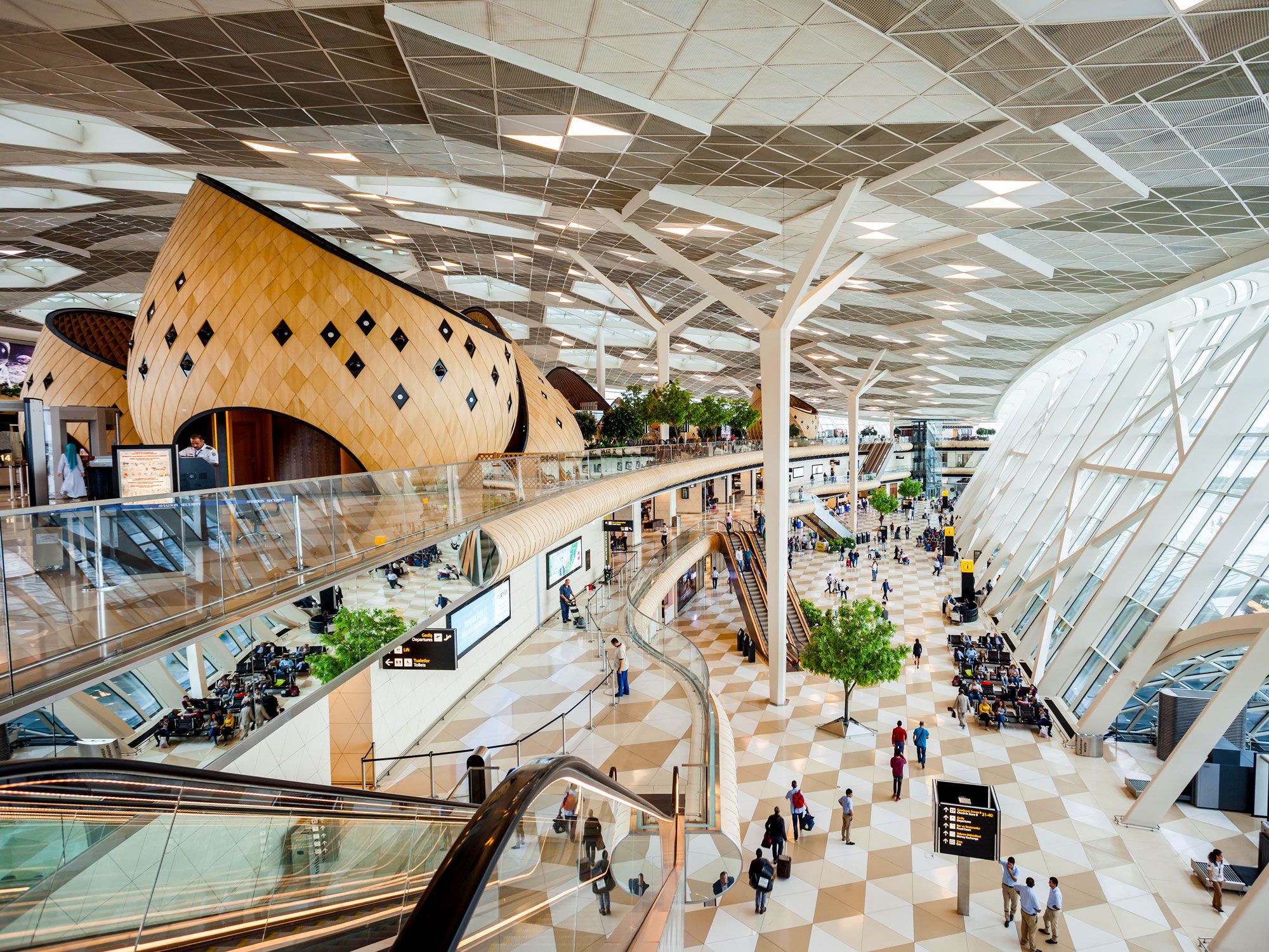
Heydar Aliyev International Airport – Baku, Azerbaijan

Interior of terminal at Hydar Aliyev International Airport in Azerbaijan
Photo credit: Andrey Khrobostov/ Alamy Stock Photo

The design of Heydar Aliyev International Airport takes inspiration from Azerbaijani hospitality. Scattered throughout the terminal’s passenger areas are a collection of wooden cocoons. These imaginative and intriguing spaces vary in size and host everything from cafés and kiosks to shops and a children’s play area. Equally eye-catching are the atrium floors, whose 3D diamond patterns mimic the cocoon’s shingles. Architects used Dekton, a stone material known for its durability and uniform, natural color. The airport’s exterior glass walls also permit daylight to bathe the interior.

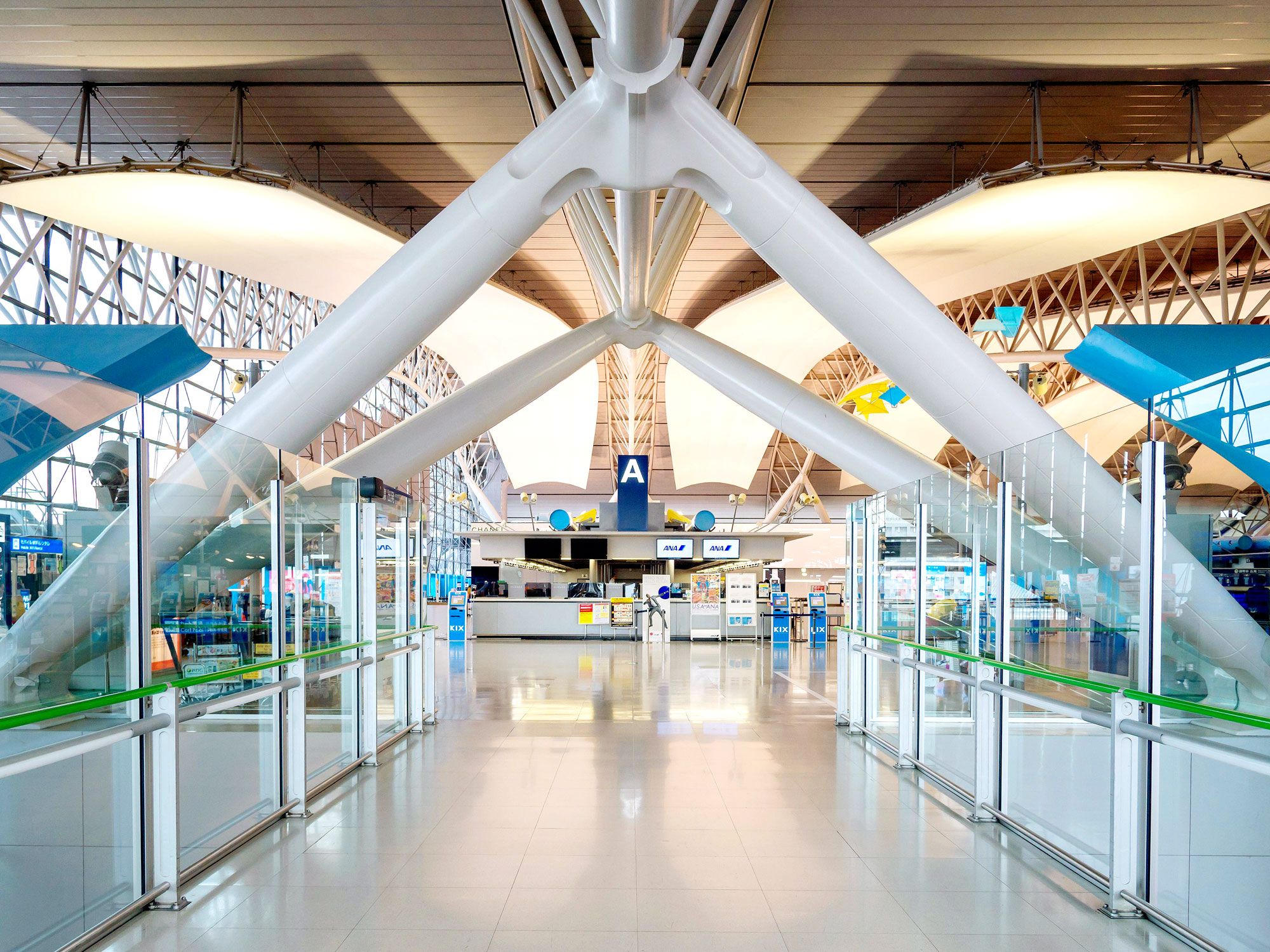
Kansai International Airport – Osaka, Japan

Interior of terminal at Kansai International Airport in Japan
Photo credit: Panom Bounak/ Alamy Stock Photo

Set on an artificial island in Japan’s Osaka Bay, Kansai International Airport became the world’s first ocean airport when it opened in 1994. Located about three miles offshore, the airport can operate 24 hours a day with minimal noise pollution for Osaka’s residents. Kansai’s primary 1.1-mile-long terminal houses 42 aircraft gates and was the world’s longest terminal when it opened. The building features 82,000 curving steel panels and a wave-like roof designed to not obstruct views from the control tower. It’s a deliberately lightweight structure that can withstand the effects of an earthquake. Inside, travelers will find hanging sculptures by Japanese kinetic sculptor Susumu Shingu, which promote the natural flow of air emitted from huge ducts. 

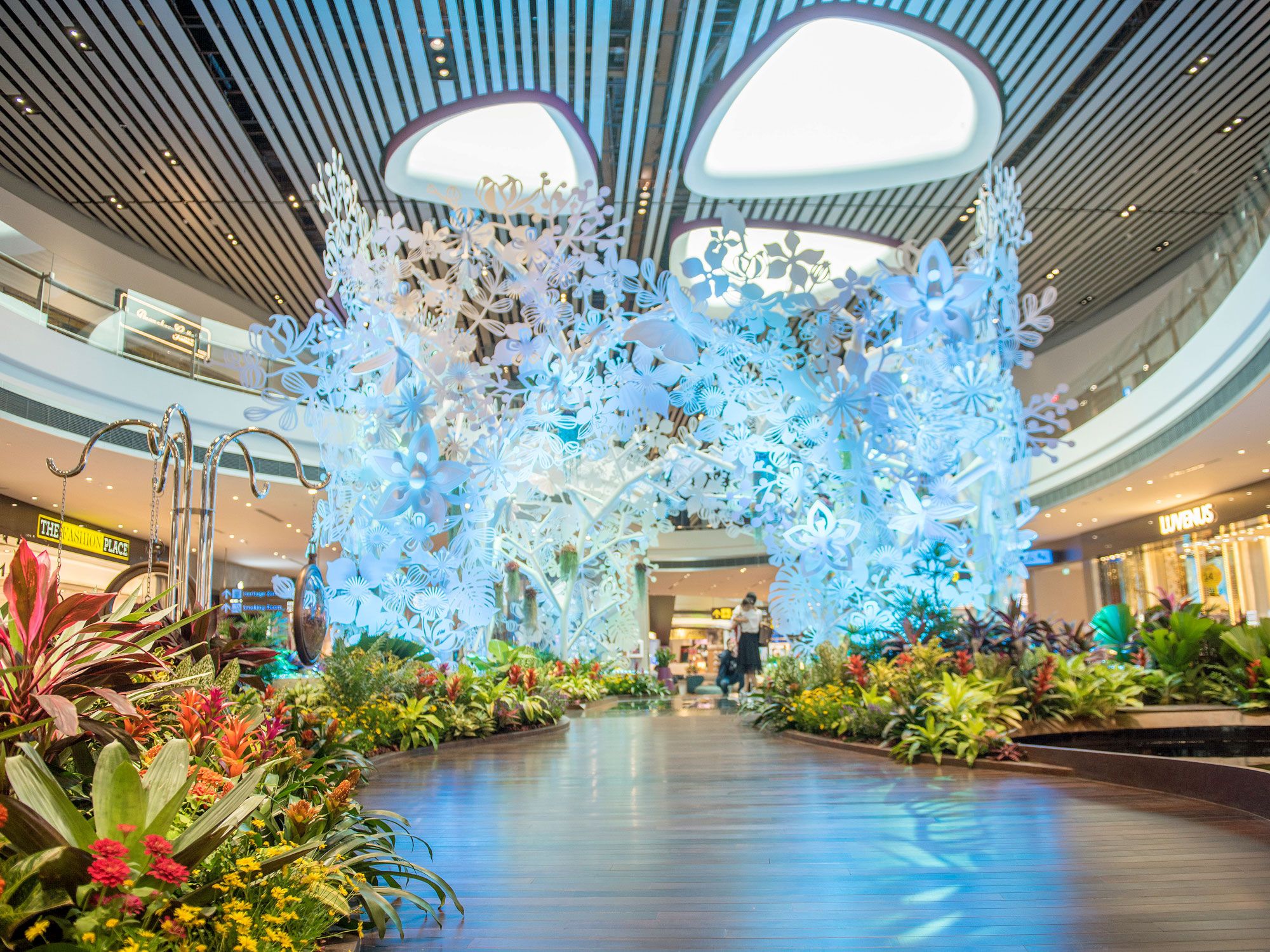
Singapore Changi Airport – Singapore

Indoor garden at Singapore Changi Airport
Photo credit: Erwin Tan/ Alamy Stock Photo

Frequently topping SkyTrax’s list of the World’s Top 100 Airports, Singapore Changi Airport is famous for its innovative amenities — from a butterfly garden to an attached shopping center, the Jewel, featuring the world’s tallest waterfall — and passenger-friendly designs. Terminal 3, in particular, features a steel-and-glass structure and a spacious nine-hectare roof above the arrival, departure, and ticketing areas. The terminal building has a light modulation system made up of glass skylights and sensor-operated aluminum louvers, which control the amount of natural light that enters during the day. At night, they reflect artificial light to create consistent illumination, all helping to regulate lighting and cooling costs.

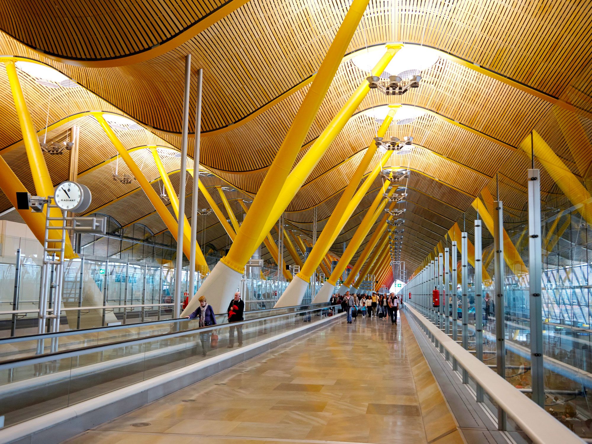
Madrid-Barajas Airport – Madrid, Spain

Sloping, wave-like roof inside Madrid-Barajas Airport in Spain
Photo credit: Radharc Images/ Alamy Stock Photo

As one of Europe’s busiest airports, with 35 million annual passengers, Madrid-Barajas Airport looked to a design with a defined progression of spaces for its newest terminal. The resulting Terminal 4, opened in 2006,  has a distinctive wave-shaped roof that reflects the airport’s surroundings. Inside, huge supporting “trees” punctuate the roof and allow daylight to illuminate the upper level. The terminal features a north-south orientation, with facades facing east and west, which is the ideal layout for protection against solar gain. Bridges span light-filled passenger walkways, and bamboo strips and a 0.6-mile-long stretch of “trees” painted in graduated color contribute to a harmonious and calming atmosphere throughout.

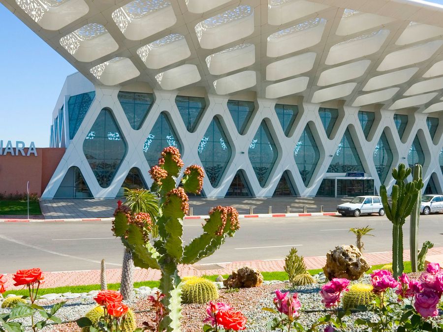
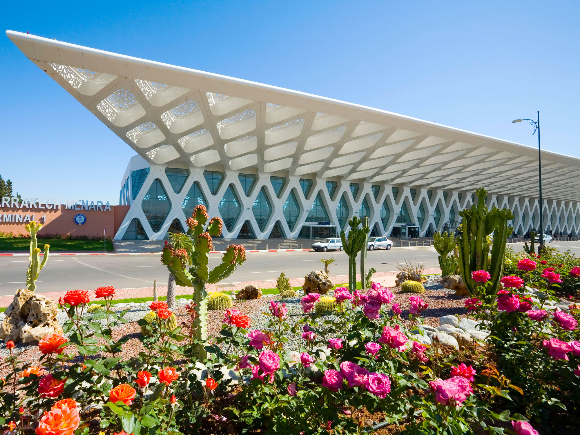
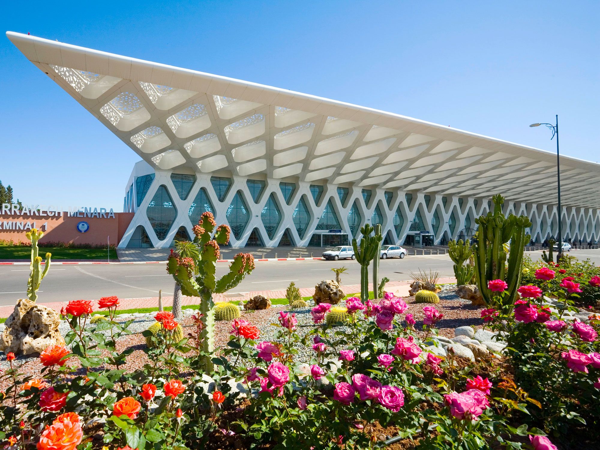
Marrakech Menara Airport – Marrakech, Morocco 

Striking terminal building of Marrakech Menara Airport in Morocco
Photo credit: Peter Phipp/Travelshots.com/ Alamy Stock Photo

Visitors to Marrakech Menara Airport are welcomed by a striking cantilevered canopy clad in white aluminum panels. The structure serves to protect the terminal interior from the beating desert sunshine, and its facade appears to change color according to the time of the day. Decorated with stylized Islamic motifs, it’s a prime example of merging contemporary architecture with traditional art, with the rhythmic patterns of the arabesques filtering daylight into the atrium. Inside, passengers will find an ode to Moroccan traditions, including granite floors and rhombus-shaped columns. Rest spaces feature armchairs and sofas draped in regional fabrics, while replica Islamic mosaics adorn the ceiling. 

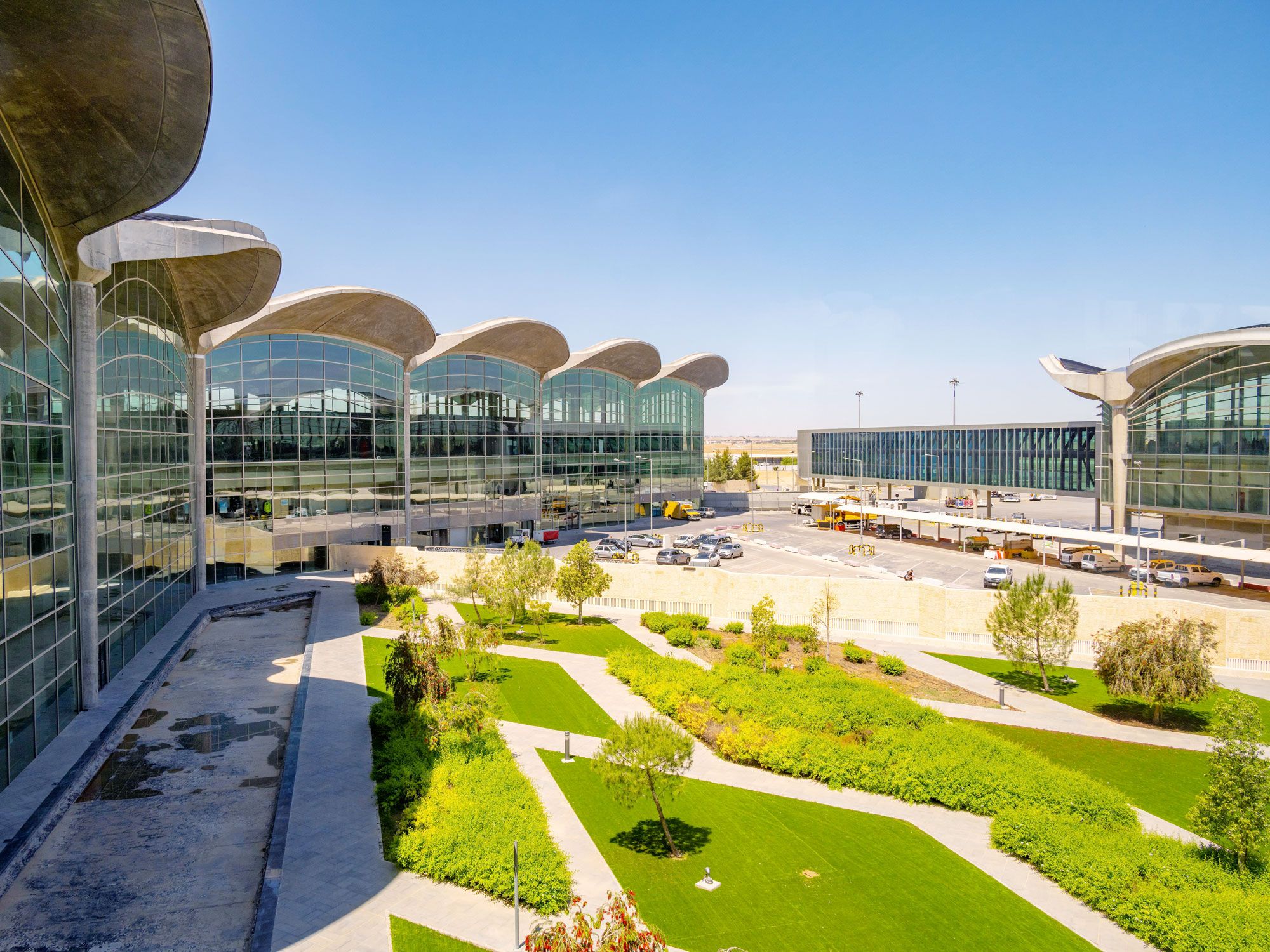
Queen Alia International Airport – Amman, Jordan

Glass-paneled terminal building and greenery at Queen Alia International Airport in Jordan
Photo credit: Ian Goodrick/ Alamy Stock Photo

The eye-catching tessellated roof canopy at Queen Alia International Airport is made up of concrete domes that evoke images of a campsite filled with the Arab Desert’s emblematic bedouin tents. Concrete was chosen for its ability to absorb the desert heat and thus provide passive environmental control. Plus, each dome is a modular unit, which allows for easy future expansion. The undersides of these domes replicate the surface of a leaf with desert-like shades of creams and browns, and geometric Islamic patterns adorn the soffits. On the terminal’s inside, lofty courtyards take inspiration from the concept of vernacular Arabic buildings. 

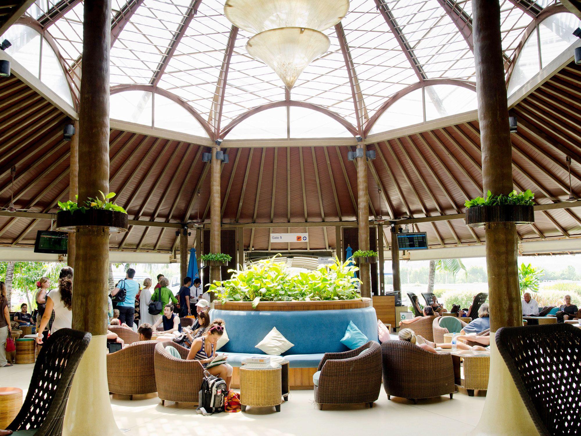
Samui Airport – Koh Samui, Thailand

Passengers waiting in open-air terminal of Samui Airport in Thailand
Photo credit: imageBROKER.com GmbH & Co. KG/ Alamy Stock Photo

Opened in 1989 and privately owned by Bangkok Airways, Samui Airport welcomes tourists to Koh Samui, Thailand’s second-largest island located in the Gulf of Thailand. The airport replicates its natural surroundings while incorporating elements of Polynesian architectural designs. Architects built the terminal using local materials such as palm, rattan, and wood. The use of palm leaves, coupled with an open-plan layout, acts as a natural cooling system, which in turn minimizes the airport’s carbon footprint. Lush vegetation is common throughout the concourse, and unique touches, like an aquarium in the restroom, help to instill an air of tranquility.

Post Banner Image
Outdoors

13 Underrated U.S. State Parks to Visit

By Daily Passport Team
Read time: 8 minutes
July 6, 2023
Updated: November 14, 2024

13 Underrated U.S. State Parks to Visit

By Daily Passport Team
Author
Daily Passport Team
Daily Passport writers have been seen in publications such as National Geographic, Food & Wine, CBC, Condé Nast Traveler, and Business Insider. They're passionate about uncovering unique destinations and sharing expert tips with curious travelers.

When most people think about America’s parks, they think of places like Yellowstone and Yosemite, but there are many state parks that can rival even some of the best national parks. The U.S. is home to more than 6,600 state park sites which protect over 14 million acres of diverse landscapes, from arid deserts to coastal forests and soaring mountains. If you were to explore one every day, it would take you over 18 years to see every state park. Don’t know where to start? Check out these 13 standout state parks around the country and the features that make them well worth the visit.

Mushroom Rock State Park – Kansas

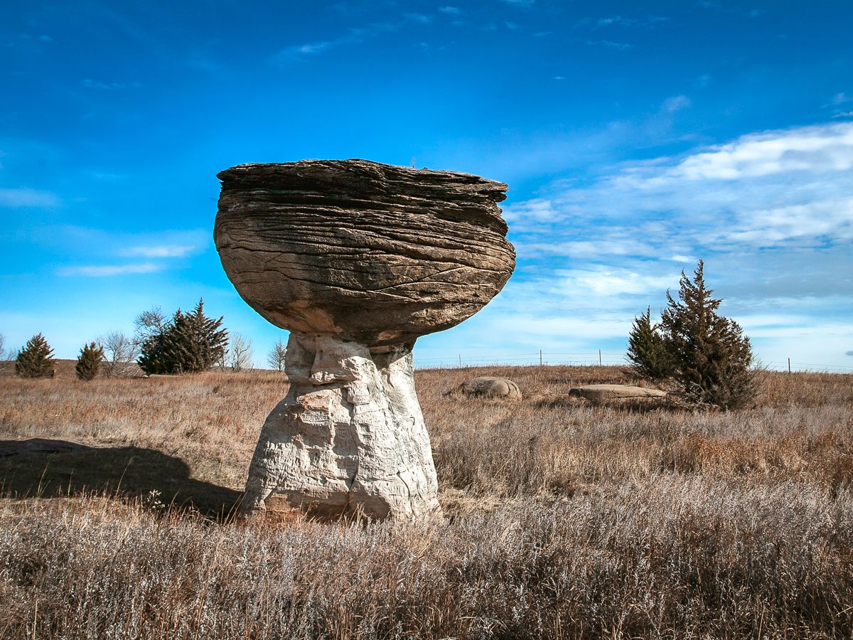
Mushroom-shaped rock formation in Mushroom Rock State Park, Kansas
Credit: fotoguy22/ iStock via Getty Images Plus 

Mushroom Rock State Park’s claim to fame isn’t just its diminutive size. As Kansas’ tiniest state park, it spans only five acres, but more importantly, it’s known for its unusually shaped rocks. There are dozens of these mushroom-like formations — the largest of which spans about 27 feet in diameter — strewn about the Smoky Hills northwest of Marquette, along the Prairie Trail Scenic Byway. The rocks date to the Cretaceous Period, a geologic era from about 144 million to 66 million years ago. Millions of years of wind and erosion, paired with the receding waters of a long-gone inland sea, resulted in their odd shapes, which have long fascinated passersby. Access to Mushroom Rock’s postcard-worthy vistas of whimsical stones and big Kansas sky couldn’t be easier — the trail is less than a quarter of a mile from the park’s entrance.

Katy Trail State Park – Missouri

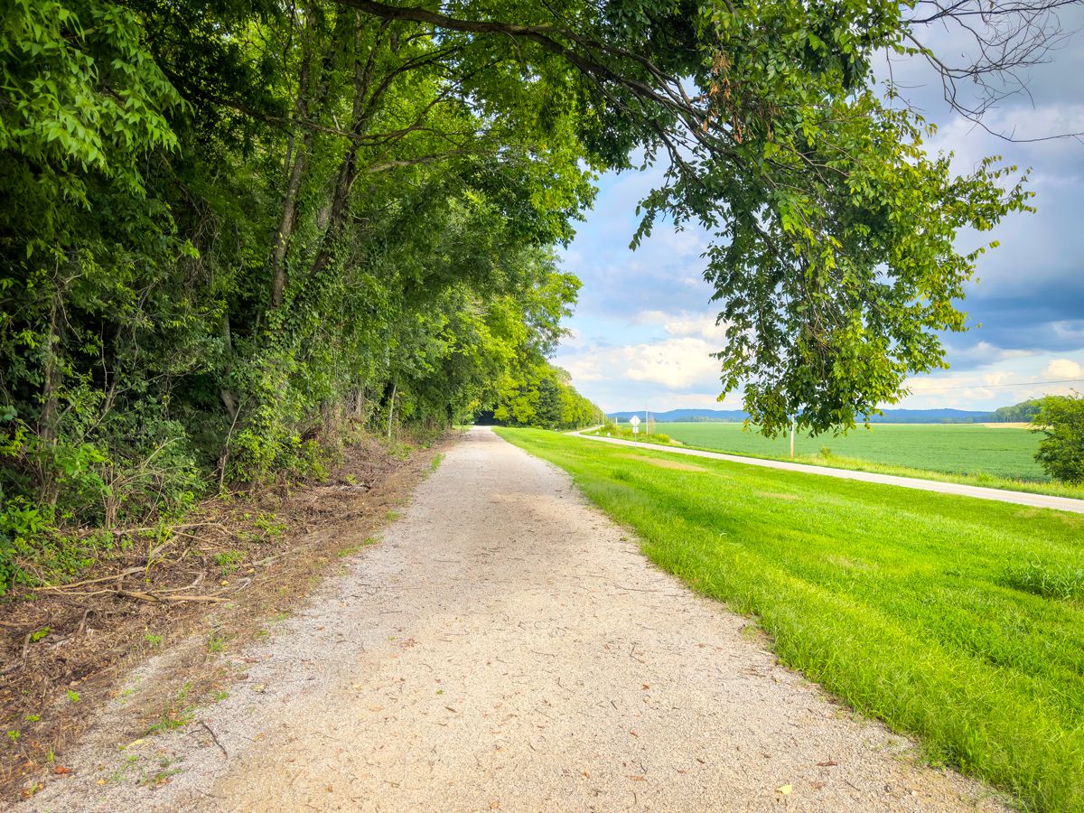
Empty trail in Katy Trail State Park, Missouri
Credit: marekuliasz/ iStock via Getty Images Plus 

Stretching almost 240 miles and spanning nearly the full width of Missouri, Katy Trail State Park features America’s longest continuous rail-trail. Officials repurposed the Missouri-Kansas-Texas (MKT) rail system, affectionately known as the Katy, which shut down in 1986. The first section of the trail opened in 1990. Open to walkers, hikers, cyclists, and horseback riders, the trail runs along parts of the Missouri River — spanning bucolic farmland, charming villages that sprung up along the rails, fantastic views from bluffs overlooking the river, and unspoiled stretches packed with wildlife ranging from migrating birds to mountain lions.

Caddo Lake State Park – Texas

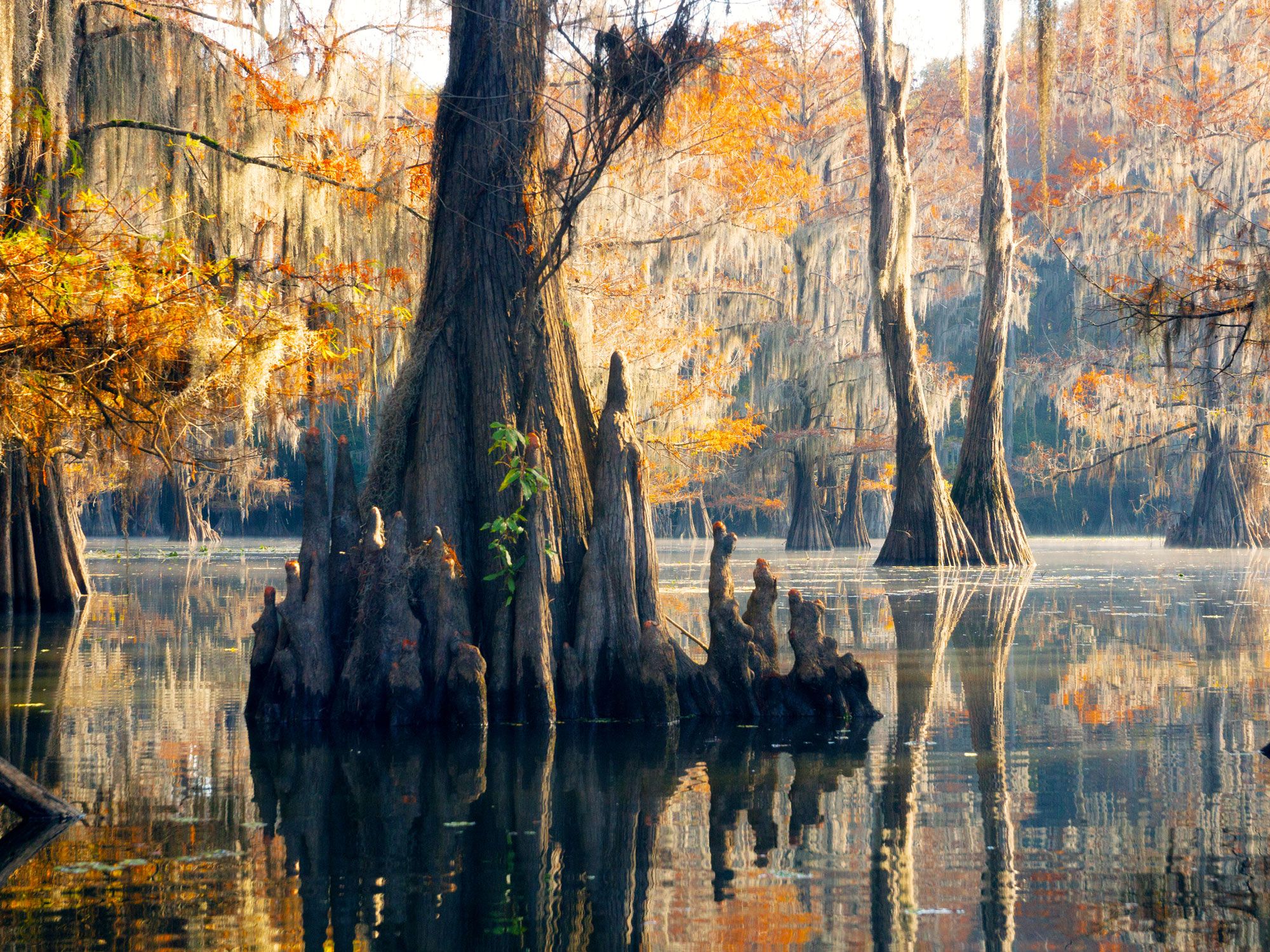
Cypress grove in Caddo Lake State Park in Texas
Photo credit: IrinaK/ Shutterstock

One of the rare state parks made up of more water than land, East Texas’ Caddo Lake State Park takes its name from a 26,000-acre lake with a large cypress grove rising out of its dark waters. The scenery is even more eerie in fall, after the trees have shed their leaves and appear bald. The short stumps you’ll see poking up through the water’s surface are called cypress “knees,” which are above-ground extensions of bald cypress root systems. This is the world’s largest intact cypress forest — and one of the country’s few forests that are better explored by boat than on foot.

Chugach State Park – Alaska

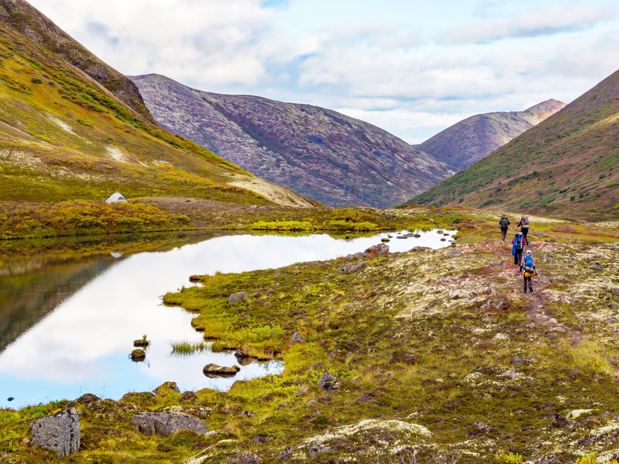
Hikers next to mountain lake in Chugach State Park in Alaska
Photo credit: Jonathan A. Mauer/ Shutterstock

Alaska is home to the largest state park system in the U.S., covering over 3.3 million acres, and Chugach State Park sits just beyond the foothills at the edge of Alaska’s largest city, Anchorage. Located about a 25-minute drive from downtown, Chugach covers 773 square miles, which also makes it the country’s largest urban park. The wildlife-rich habitat features animals such as black and brown bears, moose, lynx, foxes, mountain goats, wolves, Dall sheep, river otters, and beavers. The park is also known for its recreational activities, including fishing, hiking, mountain biking, horseback riding, ATV riding, snowmobiling, and camping. 

Crater of Diamonds State Park – Arkansas

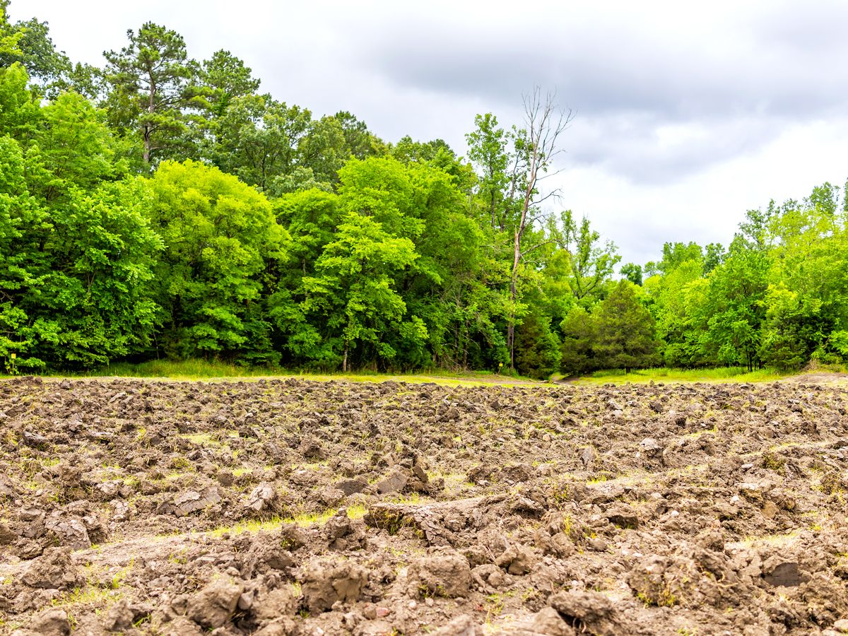
Plowed brown soil in Crater of Diamonds State Park, Arkansas
Credit: krblokhin/ iStock via Getty Images Plus 

For just the price of a visitor’s pass, you can keep any diamond you find at Arkansas’ Crater of Diamonds State Park. And it’s not completely inconceivable you will unearth one: Park officials report that one or two diamonds are found here every day. The 37-acre diamond search field is what’s left of a lava tube of a 3 billion-year-old volcano, after explosive activity in the ancient volcano forced a litter of sparkling rocks nearly all the way to the Earth’s surface, and erosion did the rest. Since its opening in 1972, more than 30,000 diamonds have been uncovered at Crater of Diamonds State Park, as have thousands of lesser gems such as agates, amethysts, jasper, and quartz.

Custer State Park – South Dakota

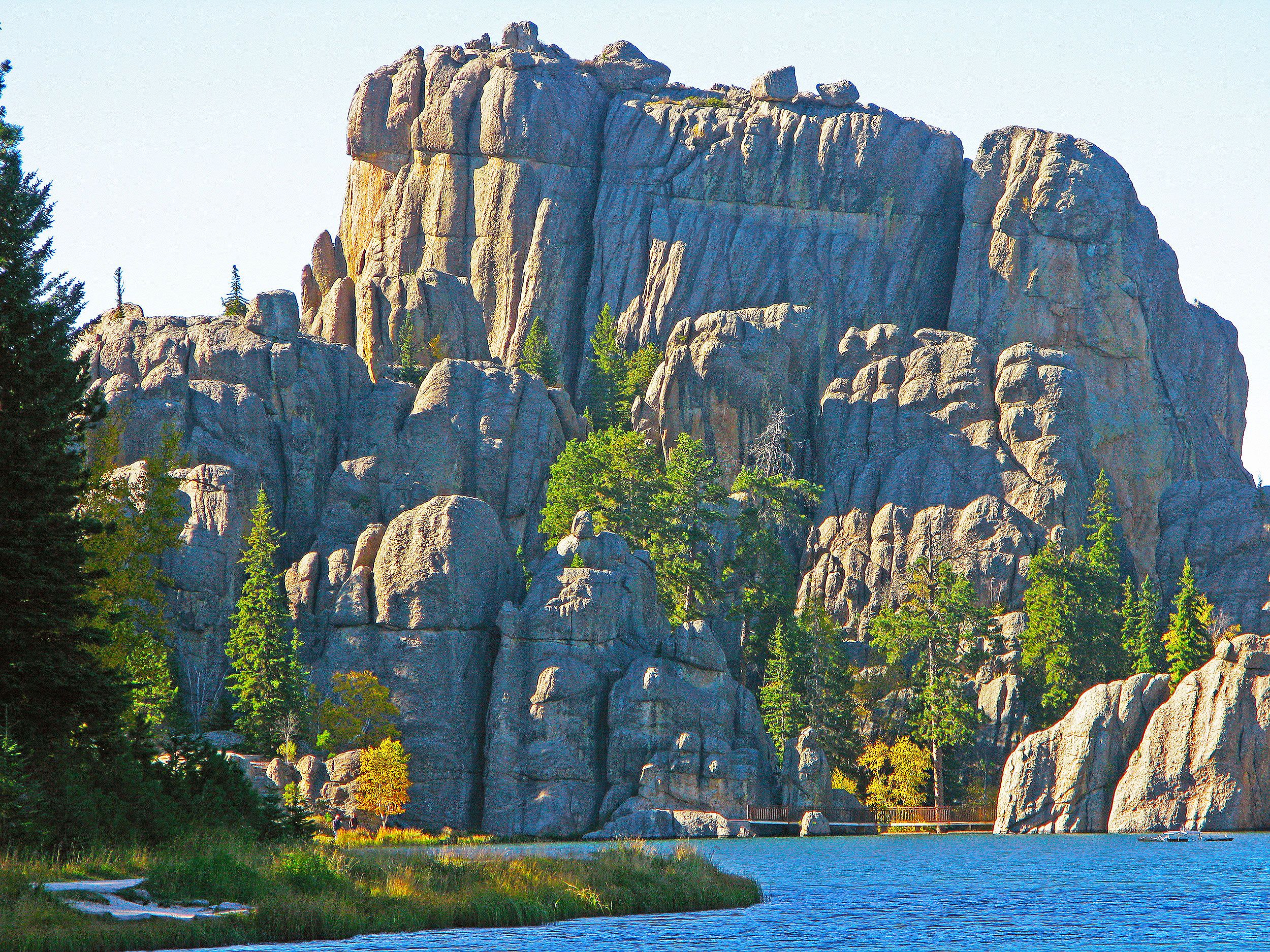
Dramatic rock formation and lake in Custer State Park in South Dakota
Photo credit: JimCottingham/ Shutterstock

Many visitors come to Custer State Park — covering over 70,000 acres in South Dakota’s Black Hills — to swim, paddle boat, fish, or simply admire the view of the incredibly picturesque Lake Sylvan. However, the park is perhaps best known for its herd of approximately 1,500 free-ranging bison, one of the world’s largest bison herds. Drive the 18-mile Wildlife Loop Road, and there is a good chance you’ll come to a halt when bison cross in front of you. Watch out for wild turkey, deer, elk, pronghorn antelope, bighorn sheep, and mountain goats, too.

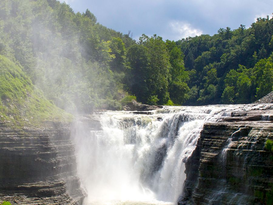
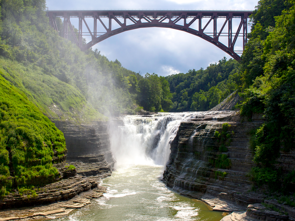
Letchworth State Park – New York

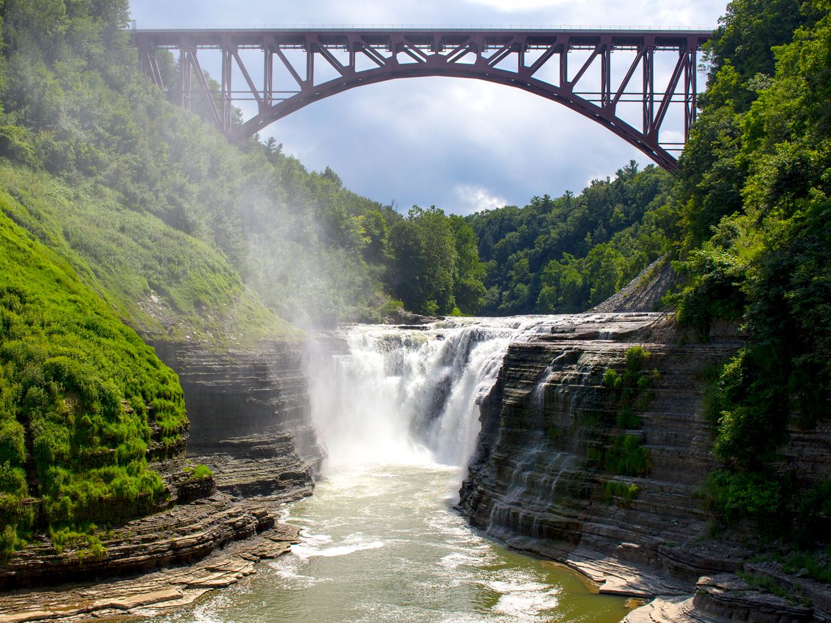
Bridge spanning waterfall in Letchworth State Park, New York
Credit: Patrick Donovan/ Moment via Getty Images 

Even some lifelong New Yorkers are unaware that their state is home to the so-called “Grand Canyon of the East.” Letchworth State Park, about 35 miles southwest of Rochester, is where an idyllic gorge channels 17 miles of the Genesee River toward Lake Ontario, sporting cliffs as deep as 550 feet and made of shale dating back approximately 380 million years. Spanning over 14,000 acres, the park features nearly every species of North American tree and 66 miles of hiking paths, which include the pioneering Autism Nature Trail — a mile-long loop with sensory stations that individuals with autism or related disabilities can explore with their loved ones.

Humboldt Redwoods State Park – California

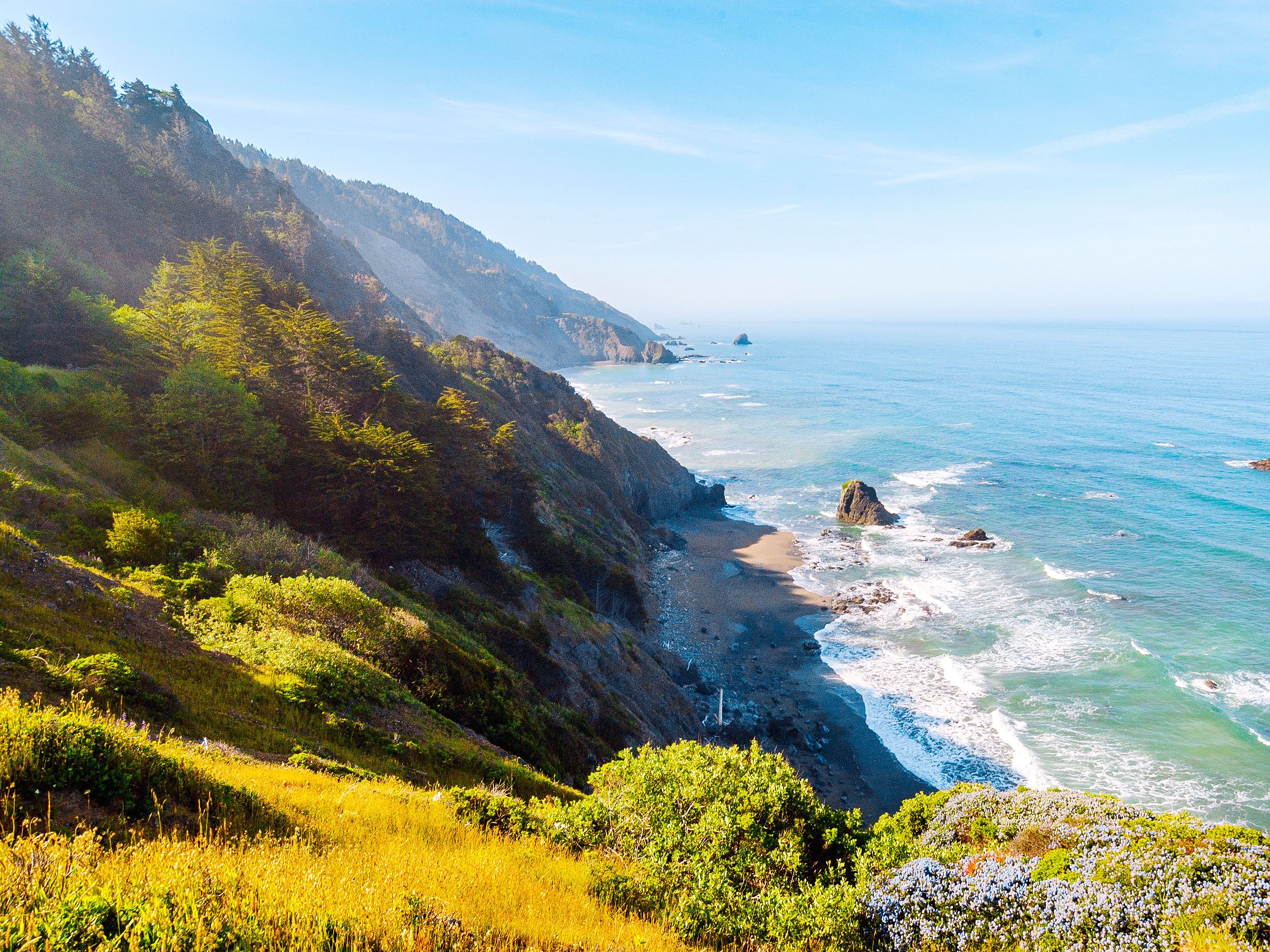
Coastal cliffs and Pacific Ocean below in Humboldt Redwoods State Park in California
Photo credit: Zack Frank/ Shutterstock

There are only a handful of places on the planet where you can see redwood trees, the world’s tallest and largest trees, and Northern California’s Humboldt Redwoods State Park is one of them. The 53,000-acre park is home to the Avenue of the Giants, which features the world’s largest old-growth contiguous redwood forest. Visitors can drive along the 31-mile roadway to explore the park and gaze up at the soaring trees. Just off the famous avenue is Founder’s Grove, where you can marvel at the Dyerville Giant. Once standing 362 feet tall, this was the tallest tree in the park before it fell in 1991. According to local lore, when it crashed, the ground moved the earth so much that it registered on a nearby seismograph.

Kodachrome Basin State Park – Utah

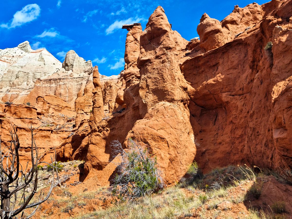
Red rock formations in Kodachrome Basin State Park, Utah
Credit: Federica Grassi/ Moment via Getty Images 

Utah is home to a scenic state park that’s incredibly photogenic — so photogenic, it was named after a film brand. Located south of Bryce Canyon National Park, Kodachrome Basin State Park is known for its 67 monolithic spires, called sedimentary pipes, that range from six feet to a whopping 170 feet tall. In fact, it’s believed that this basin is the only place on Earth in which you can find these strange geological formations. But it isn’t just the sand pipes that earned Kodachrome its name — the stunning colors of the basin inspired the National Geographic Society to name it after the then-popular color film brand in 1948.

Hot Springs State Park – Wyoming

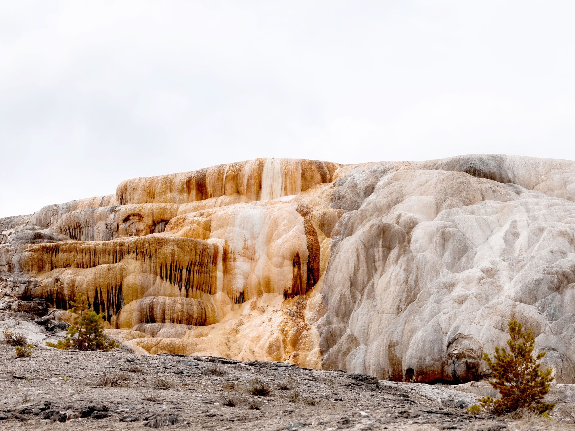
Mineral-covered rock formations in Hot Springs State Park in Wyoming
Photo credit: EB Adventure Photography/ Shutterstock

Located in the aptly named town of Thermopolis, Hot Springs State Park in Wyoming has long been famous for its healing waters. The area’s renowned springs once attracted everything and everyone from dinosaurs and prehistoric peoples to Native American tribes and early pioneers. In the early 1900s, a sizable medical community was established in Thermopolis, using the hot springs to promote restoration. Thanks to a treaty signed by the Arapahoe and Shoshone tribes, which provided public access to the springs in 1896, visitors today can enjoy free 20-minute soaks — either indoors or out at the Wyoming State Bath House.

Valley of Fire State Park – Nevada

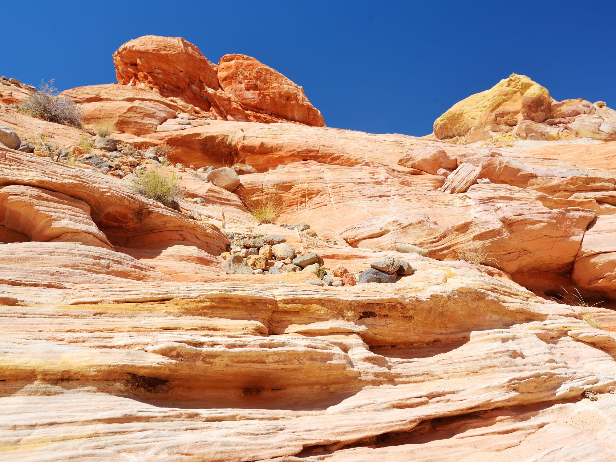
Striated red rock landscape of Valley of Fire State Park in Nevada
Photo credit: MNStudio/ Shutterstock

About 45 miles northeast of Las Vegas lies the otherworldly landscapes of Valley of Fire State Park. The area has been home to prehistoric civilizations since 300 BCE and is named for its stunning appearance at sunset — its sandstone outcroppings rise out of the Mojave Desert and turn a brilliant shade of red just before nightfall, making the entire valley look as if it’s on fire. The 40,000-acre park is also home to ancient petrified trees and petroglyphs that date back over 2,000 years.

Pfeiffer Big Sur State Park – California

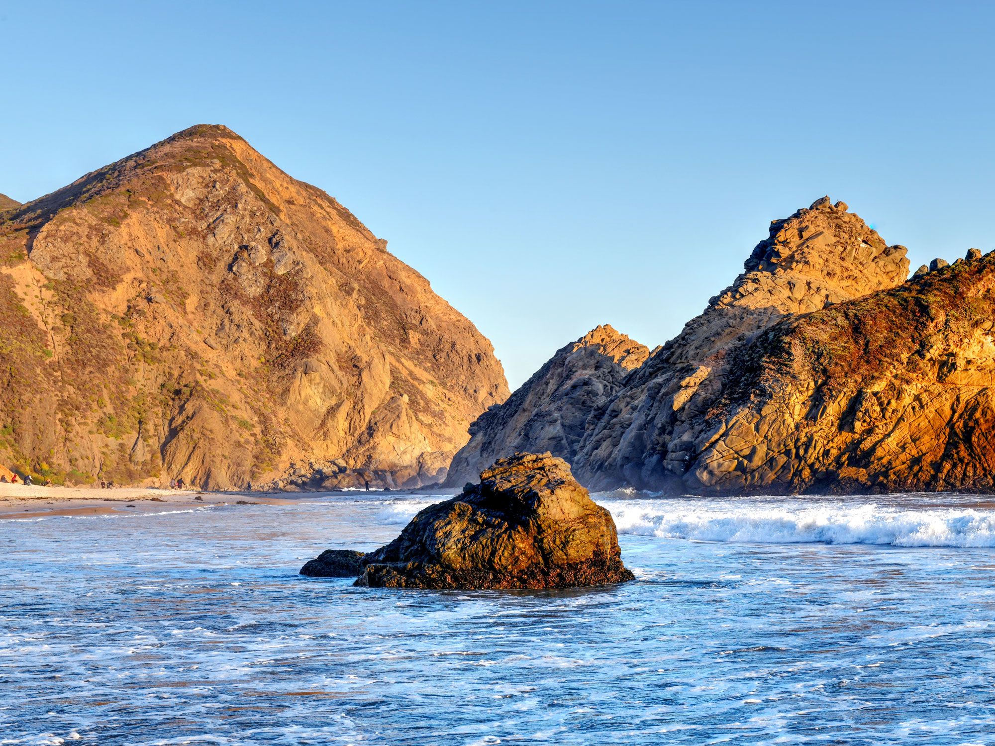
Rock formation off the coast of Pfeiffer Big Sur State Park in California
Photo credit: Felix Lipov/ Shutterstock

There are only a handful of purple sand beaches on the planet. Most are located in Canada, but you’ll also find one in Pfeiffer Big Sur State Park, situated along California’s famed Big Sur Coast. The phenomenon occurs thanks to the high concentration of manganese in the cliffs, which are eroded during rainstorms. Not all of the sand at Pfeiffer Big Sur Beach is purple, but visitors can see stunning swirls of deep purple along the north side of the beach near the tide pools. The phenomenon will be clearest after a recent rainstorm.

Grayson Highlands State Park – Virginia

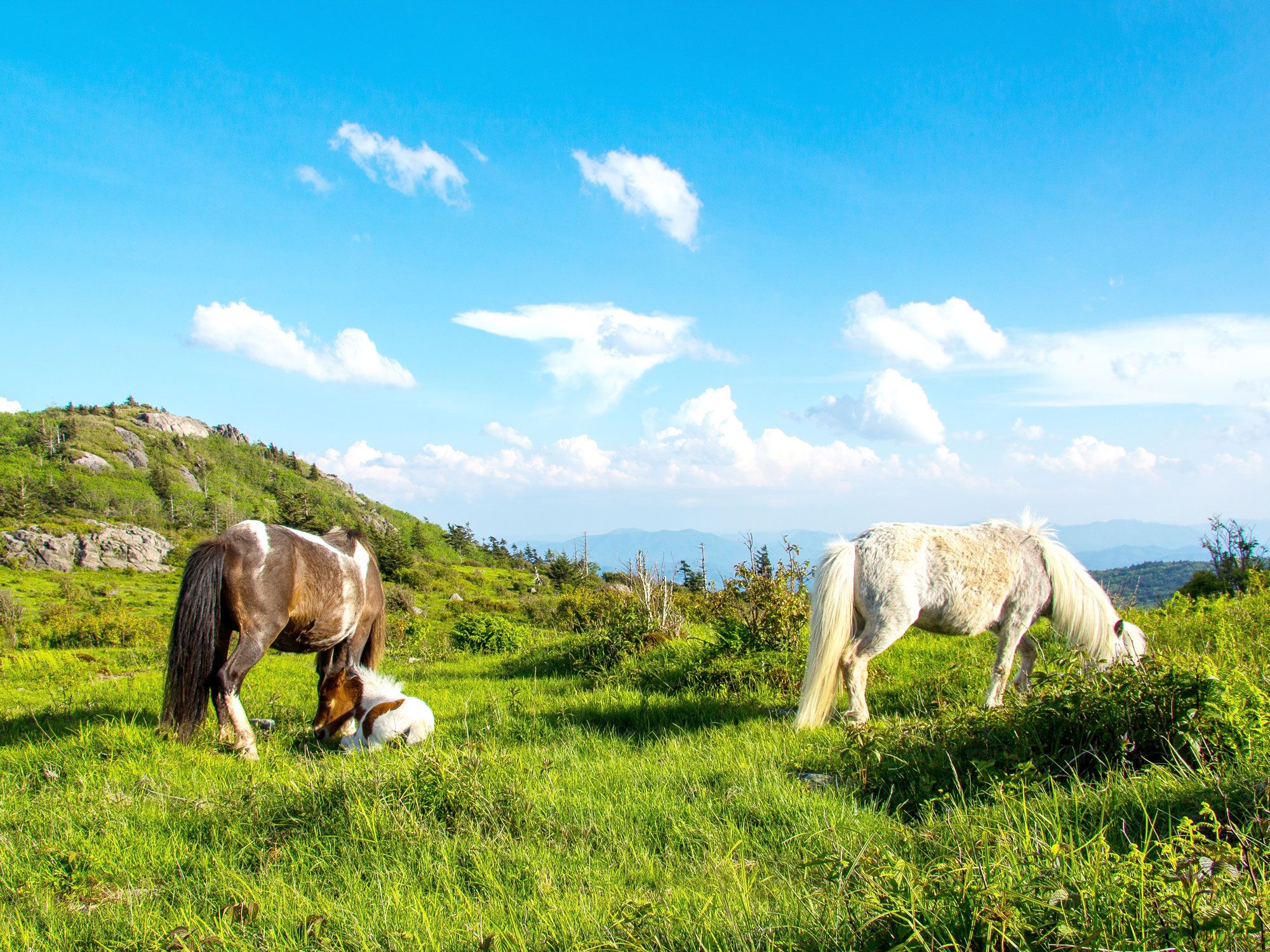
Ponies grazing in Grayson Highlands State Park in Virginia
Photo credit: Adam Mustafa/ Shutterstock

Many consider the Grayson Highlands ponies to be the highlight of Grayson Highlands State Park, located in southwestern Virginia near the North Carolina border. The thriving population of ponies, which each stand only about four feet tall, are believed to be descendants of the Chincoteague and Assateague horses that were released into the area in 1975 by the U.S. Forest Service. The best way to see them is by hiking the Rhododendron Trail from Massie Gap; it winds across Wilburn Ridge to Rhododendron Gap, where the ponies often frequent. The hike also provides a great opportunity for photos with breathtaking mountain peaks in the backdrop.

Post Banner Image
Geography

6 Cities and Countries That Span 2 Continents

By Julia Hammond
Read time: 5 minutes
July 6, 2023
Updated: July 1, 2024

6 Cities and Countries That Span 2 Continents

By Julia Hammond
Author
Julia Hammond
Julia is a U.K.-based travel writer whose work has been featured in The Independent, The Telegraph, The New Zealand Herald, and Culture Trip, among others. She’s an enthusiastic advocate for independent travel and a passionate geographer who has had the privilege of traveling to more than 130 countries in search of a story.

Continents are defined by National Geographic as “Earth’s seven main divisions of land.” Ranked in order of size, they include Asia, Africa, North America, South America, Antarctica, Europe, and Australia (sometimes referred to as Oceania). For many of us, identifying which continent we live on is straightforward. But when you reach the edges of continents, it can be a little trickier to figure out where one ends and another begins. That’s especially true of these transcontinental countries and cities.

Istanbul, Turkey

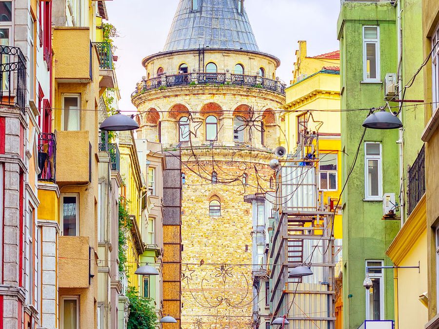
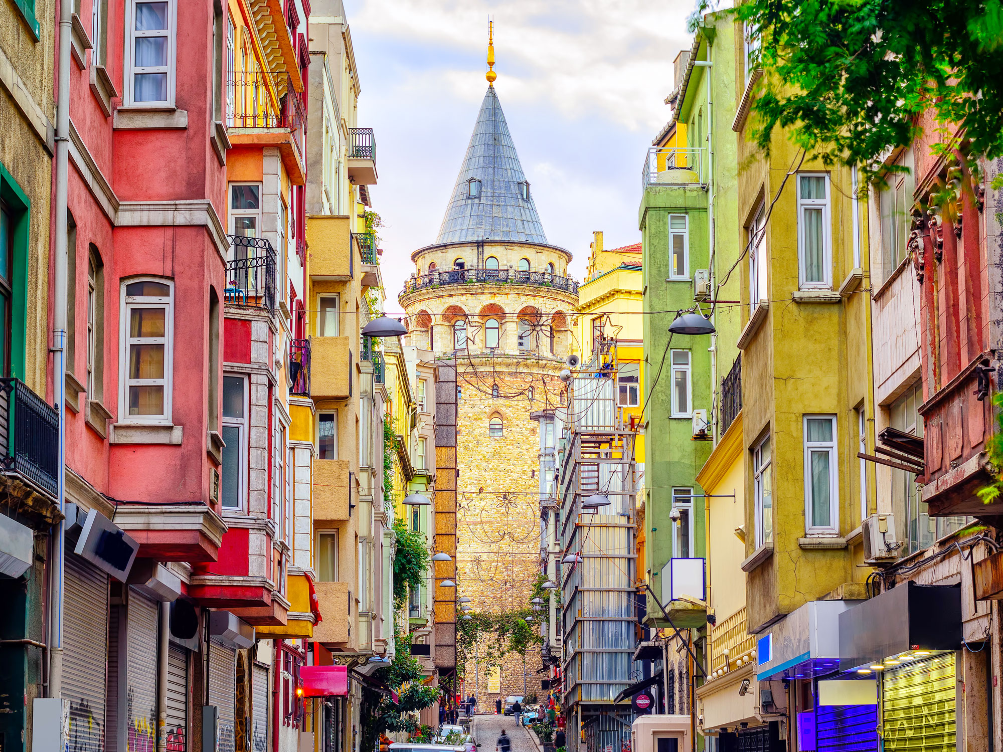
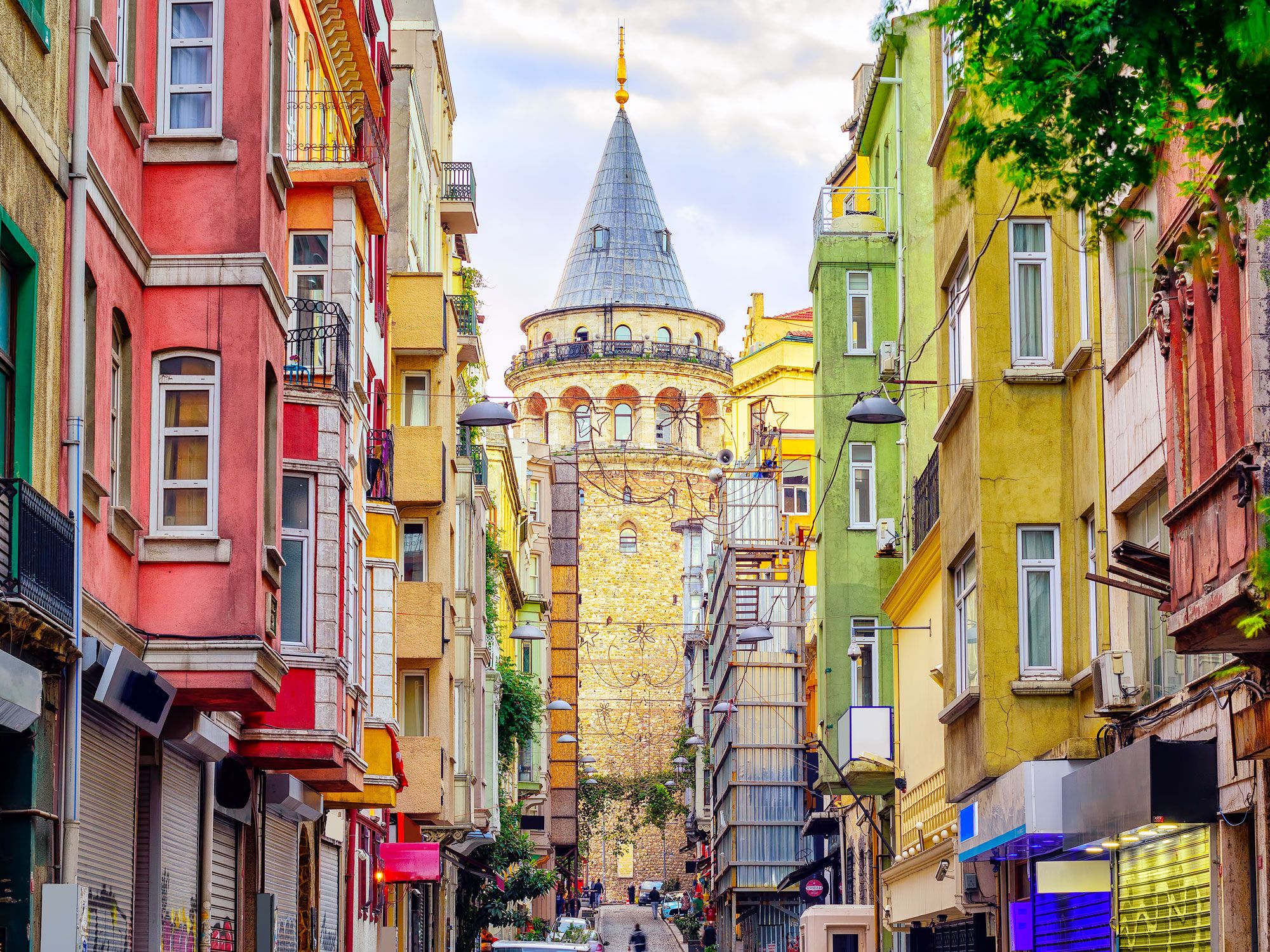
Colorful buildings in Istanbul, Turkey
Photo credit: Boris Stroujko/ Shutterstock

Istanbul — the world’s most famous transcontinental city — is bisected by the Bosphorus Strait, one of the world’s most important waterways. Europe sits on the western side of the strait, which connects the Black Sea to the Sea of Marmara and the Mediterranean. On the other side is Asia, where a significant portion of Istanbul’s urban area lies. Formerly called Constantinople, Istanbul was once the capital of the Roman, Byzantine, and the Ottoman Empires, thanks to this strategic location. Though Istanbul is no longer the Turkish capital, as Europe’s most populous city, it still retains considerable influence.

Turkey itself is a transcontinental country, as the vast majority of its area lies on the Anatolian Peninsula in western Asia. The European section, called East Thrace, represents approximately 3% of Turkey’s area about about 10% of its population. The Turks were originally nomads who migrated eastwards from the Altai Mountains in Asia; some, like the Seljuks, settled in Anatolia. In this respect, though Turkey is transcontinental, it has stronger ties to Asia than to Europe. 

Atyrau, Kazakhstan

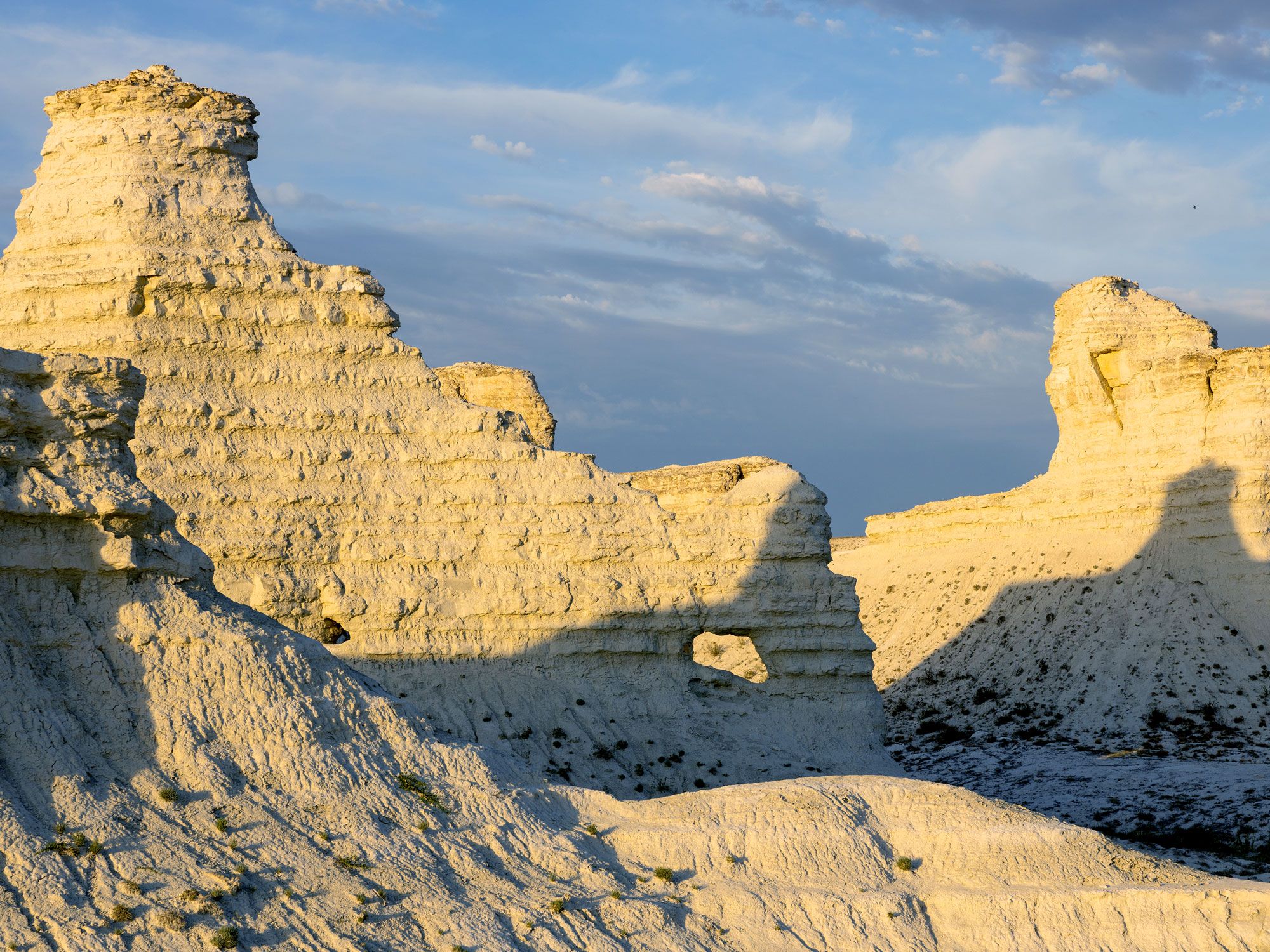
Rocky landscapes of Kazakhstan
Photo credit: Kira0Kirina/ Shutterstock

Continuing east from Turkey, there’s no consensus on the dividing line between Europe and Asia. North of the Caspian Sea, however, things are a little simpler — Russia and Kazakhstan are both considered transcontinental nations. Here, Europe and Asia are split by the Urals mountain range and the Ural River. The boundary runs broadly north to south through Russia, connecting the Novaya Zemlya archipelago in the Arctic region to the northwest corner of Kazakhstan at the Caspian Sea. 

Kazakhstan is culturally part of Central Asia; however, at the mouth of the Ural River, you’ll find the transcontinental city of Atyrau. There’s a pavilion close to Atyrau Square on Abay Street that reads Азия (Asia); on the opposite bank, an identical landmark is marked Европа (Europe).

In the 17th century, this Kazakh city — then known as Guryev — was founded as a fishing port thanks to an abundance of sturgeon in the nearby waters. Today, it supports a metro population of more than 355,000 people, largely due to the employment opportunities stemming from the presence of nearby oil deposits. Atyrau isn’t the only transcontinental city on the Ural River, either — the Russian cities of Magnitogorsk and Orenburg also straddle the water and thus the two continents.

Suez, Egypt

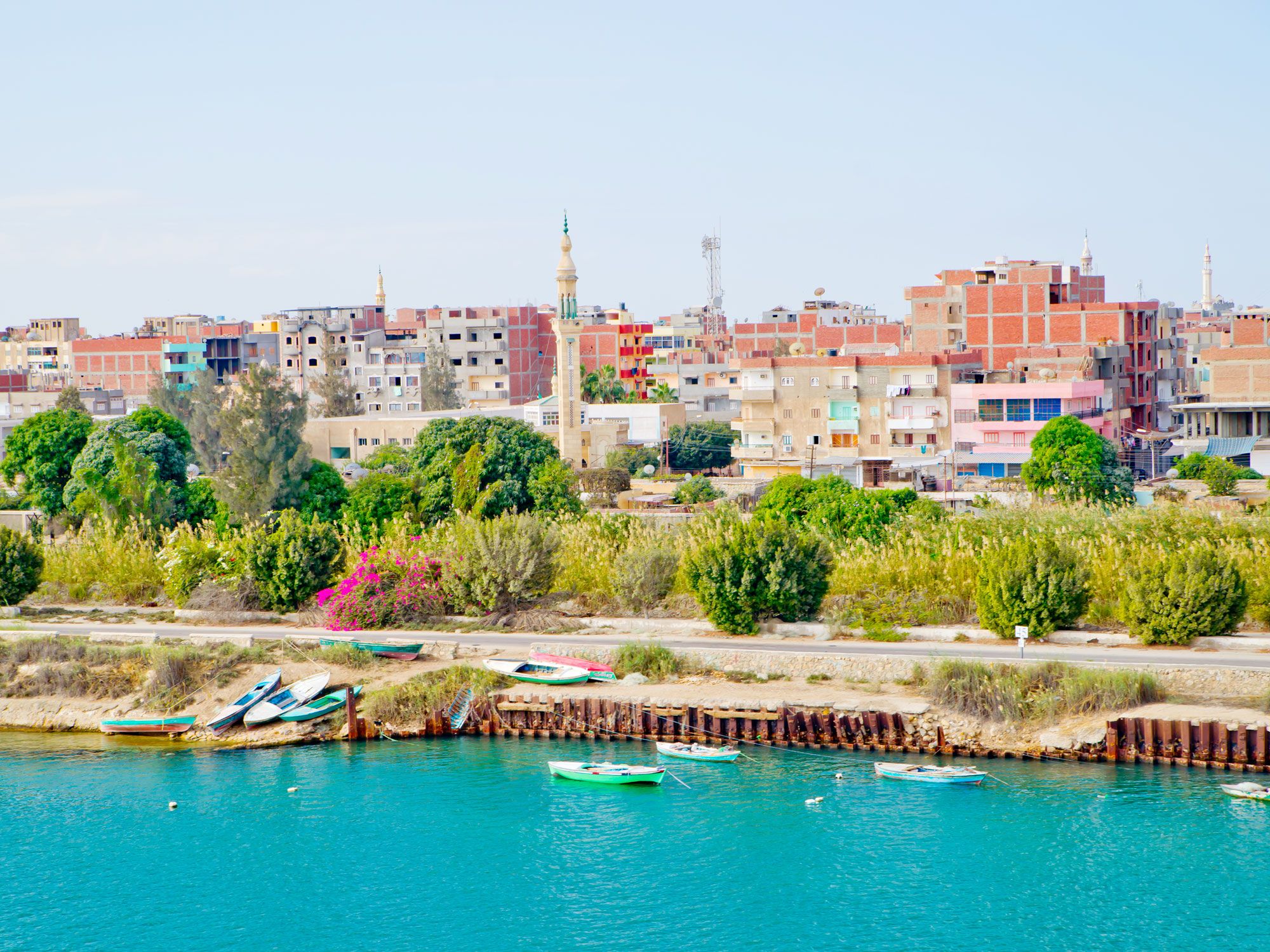
Buildings along Nile River in Egypt
Photo credit: Tony Moran/ Shutterstock

While most of Egypt is located in North Africa, its territory also contains part of the Sinai Peninsula, which is classified as part of Asia. The two continents were once connected by a narrow piece of land called the Isthmus of Suez. When the Suez Canal was completed in 1869, it created a narrow gap, severing the two continents. In places, the waterway wasn’t even large enough for two ships to pass each other. Since then, it’s become one of the busiest shipping lanes in the world, and to accommodate the increase in traffic, the canal has been significantly widened. 

The city of Suez, a large port at the southern end of the canal, started out as the ancient Greek city of Clysma and later became the al-Qulzum. Today, it is administered as part of the Governorate of Suez, a small part of which is located within Asia. As a consequence, the city of Suez is therefore sometimes referred to as transcontinental, even though most of its built-up areas are situated on the west bank of the canal in Africa. 

Iceland

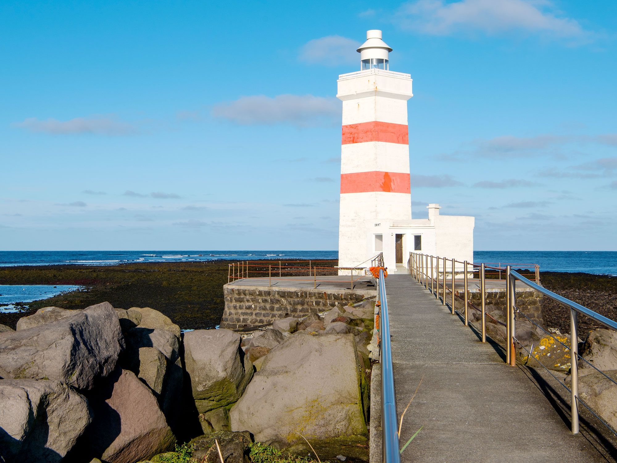
Lighthouse on rocky coast of Iceland
Photo credit: Ralf Broskvar/ Shutterstock

The island nation of Iceland straddles the North American and Eurasian plate boundaries in the North Atlantic Ocean. This rift in the landscape is evident in multiple places. The most accessible of these to visitors are on the Reykjanes peninsula, at the Bridge Between Continents, and in Thingvellir National Park. While Iceland technically spans two continental plates, politically, it is considered European. 

To understand why, we need to go back to the ninth century. When Norseman Ingólfur Arnarson arrived in 874, Iceland was uninhabited. He settled in a place he called Reykjavik, meaning “smoky bay.” Formal ties to the Nordic countries endured for a thousand years, during which time sovereignty passed to Denmark. Iceland was granted home rule in 1874 and eventually became an independent nation in 1944. However, its links to the other Nordic nations in terms of trade, the free movement of labor, and governmental collaboration, remain strong. So although geologically, the country can be considered partly North American, in practice its roots are firmly planted in Europe.

Panama and Colombia

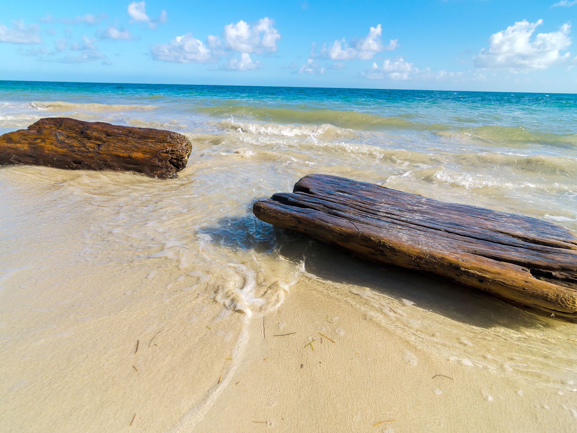
Driftwood on beach in Panama
Photo credit: Structured Vision/ Shutterstock

Identifying where the precise boundary between North and South America sits is surprisingly difficult. Politically, Panama is part of Central America, and therefore, by extension, part of North America. Meanwhile, the majority of Colombians identify as South American, though some of the country’s islands, such as San Andrés and Providencia, are in North America. Many geographers accept that the border between Panama and Colombia also forms the continental boundary between North and South America. 

However, some argue that you should look to plate tectonics — that is, where the Panama plate boundary meets the North Andes plate boundary. Over time, the north west of Colombia is being shunted eastwards by the Panama plate. The border between the two countries falls somewhere within the Darién Gap, a mountainous region characterized by dense forest and swampy ground. The Pan-American Highway ends abruptly at Yaviza, Panama, and around 60 miles further south, it restarts in Colombia. Law enforcement in this remote and inaccessible place is challenging, another factor that contributes to the region’s enigmatic status. 

Post Banner Image
Outdoors

6 Cool Cenotes to Visit Around the World

By Fiona Mokry
Read time: 4 minutes
July 6, 2023
Updated: July 25, 2023

6 Cool Cenotes to Visit Around the World

By Fiona Mokry
Author
Fiona Mokry
Fiona has spent her career exploring the world and working in the travel industry, turning her lifelong passion into a profession. From planning custom trips to sharing stories as a travel writer for publications such as The Discoverer, she’s all about helping others experience the world in a deeper, more meaningful way.

Beaches and lakes offer plenty of opportunities for a dip, but those seeking a little more adventure should seek out a cenote. Cenotes are deep, natural sinkholes that form through centuries of erosion, as the limestone bedrock above collapses and reveals a cave of groundwater below. Mexico’s Yucatán Peninsula houses the largest concentration of cenotes in the world, with an estimated 6,000 of these spectacular natural swimming holes. While Mexico certainly hogs the cenote spotlight, there are other, equally stunning cenotes around the world to discover. Here are six spectacular cenotes you should visit.

Ik Kil Cenote – Mexico

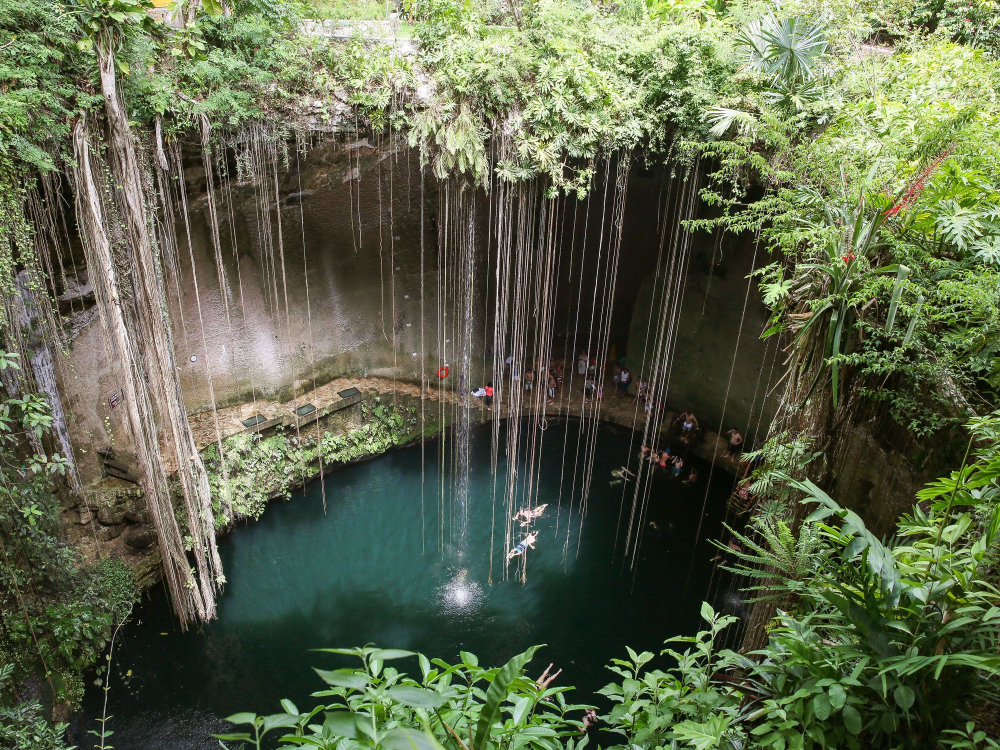
Vines dangling over swimmers in Ik Kil Cenote in Mexico, seen from above
Photo credit: RightFramePhotoVideo/ Shutterstock

Located in the central Yucatán Peninsula, the breathtaking Ik Kil Cenote is draped in vines that dangle 158 feet from the cylindrical opening in the cliffs above. The blue-green waters plunge over 130 feet deep and fill a naturally-formed pool that stretches nearly 200 feet in diameter. Not only is Ik Kil a memorable place to take a dip, but its cultural significance is also profound. The Maya peoples believed the cenote was home to the God of Rain, Chaac, and considered the area sacred. Archeologists have found bones and jewelry in the pool’s depth, proving that human sacrifices were once performed here. Combine your cenote expedition with a visit to Chichen Itzá, an ancient Mayan city located in the archeological site just two miles away.

Thunderball Grotto – Bahamas

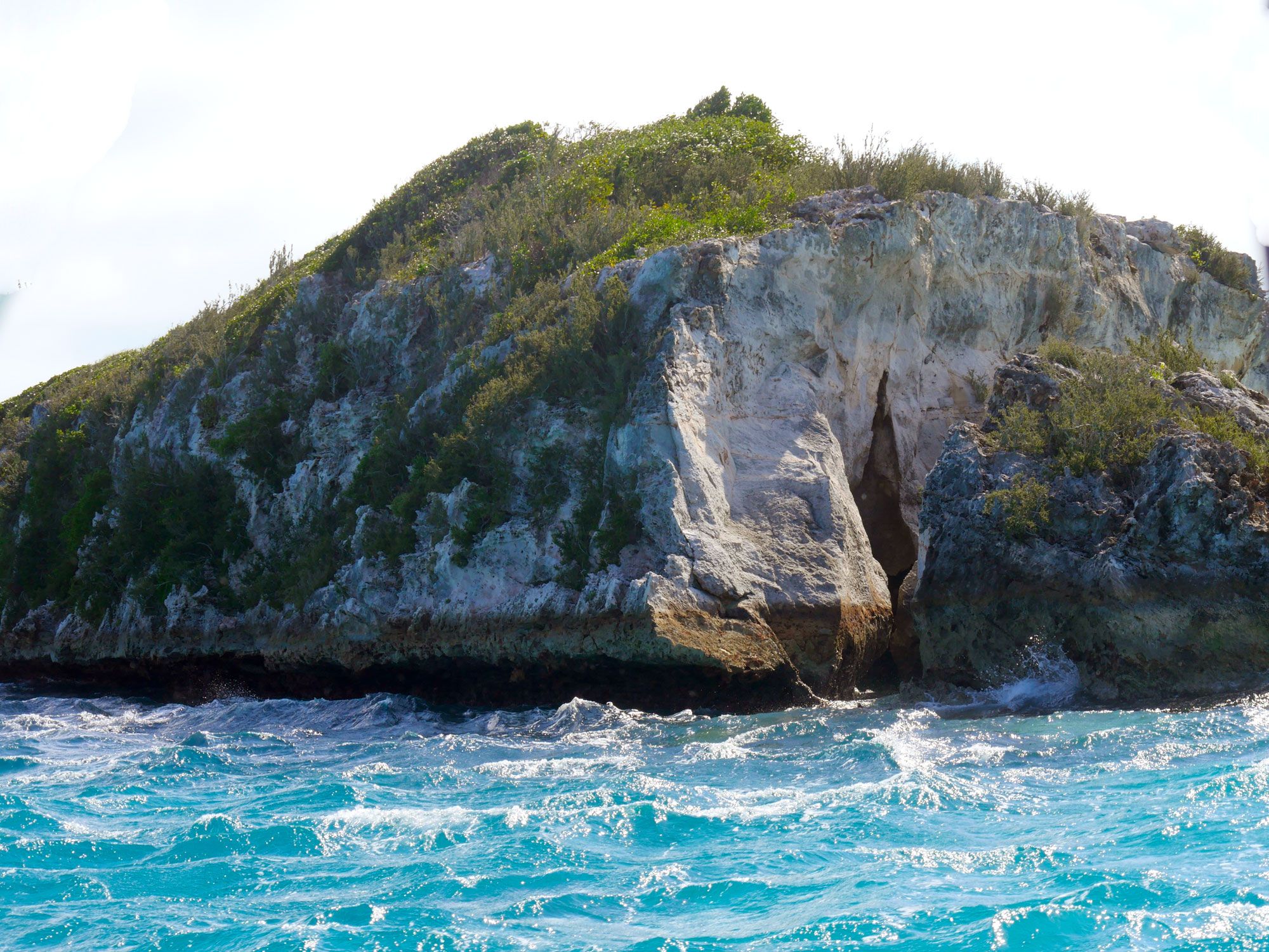
Entrance to Thunderball Grotto in the Bahamas, seen across the waves
Photo credit: RaksyBH/ Shutterstock

Located just off Staniel Cay in the Exumas island chain of the Bahamas, Thunderball Grotto (also sometimes referred to as “the James Bond Cave” for its feature in the 1965 film Thunderball) is an underwater cave system that can be explored with or without scuba equipment. With a discreet entrance, this grotto is lit by streaming sunbeams and teems with tropical fish and colorful corals. To access the cenote, you can take a boat or even swim over from Pig Island. At first glance, it looks like nothing more than a large rock sitting in the water, but swim closer and you’ll find secret entryways that open up into spacious caves and swimming holes.  

Dos Ojos – Mexico

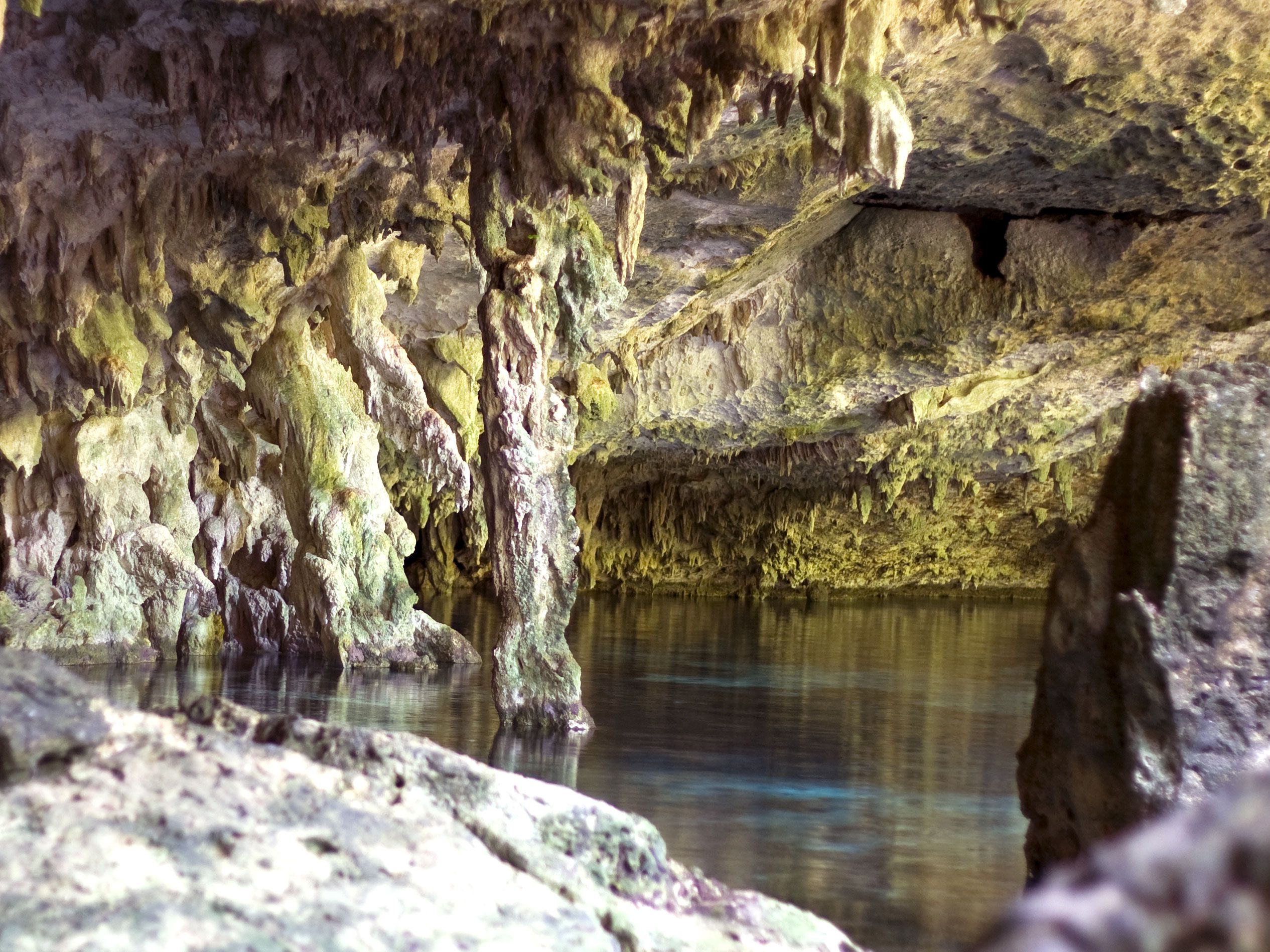
Interior of Dos Ojos cenote in Mexico
Photo credit: Armin Lehnhoff/ Shutterstock

Scuba divers, take note: Dos Ojos, about a 30-minute drive north of Tulum, is one of the best cenotes to visit if you’re interested in an extreme underwater adventure. Translating to “two eyes,” Dos Ojos was named for its dual water-filled sinkholes that are connected via a 1,300-foot underground waterway. Divers can descend in one cave, swim underwater, and emerge in the other. Even if you’re not a diver, Dos Ojos is still worth a visit for the snorkeling and cave exploration above the water line alone. However, Dos Ojos is one of the most popular cenotes in the area, so it does tend to get crowded. 

Cenote Taak Bi Ha – Mexico

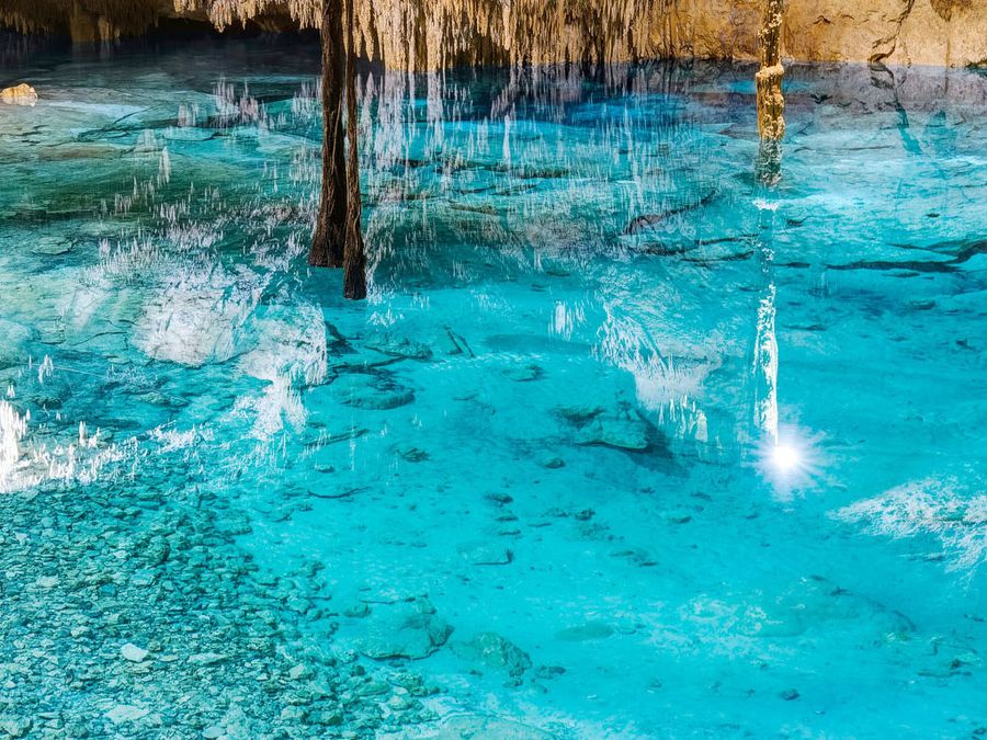
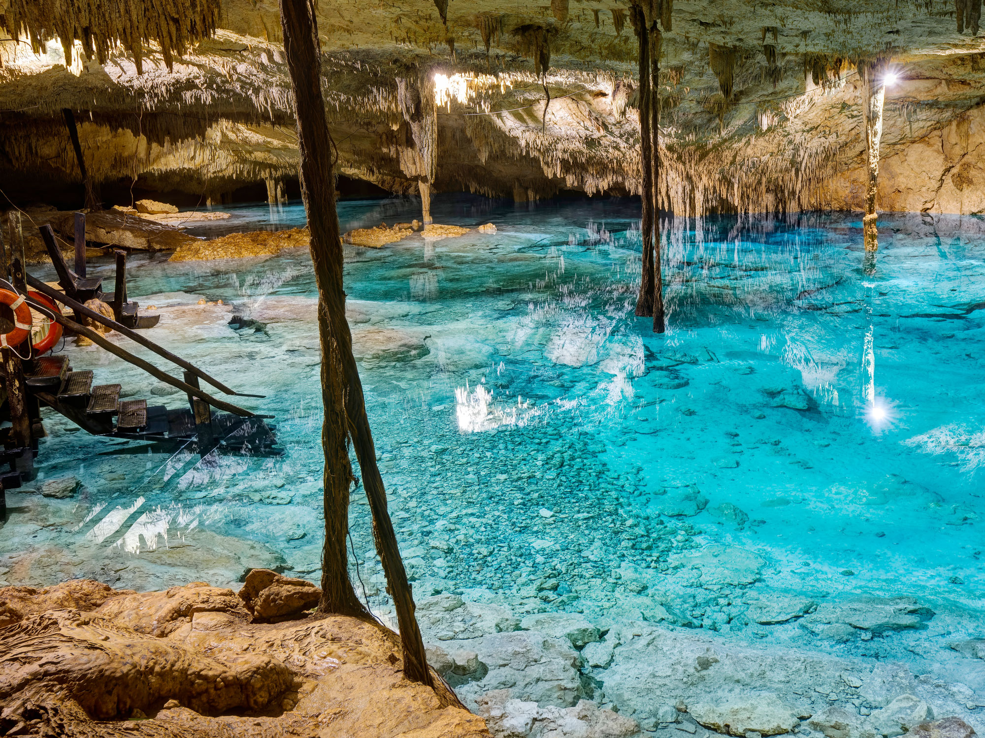
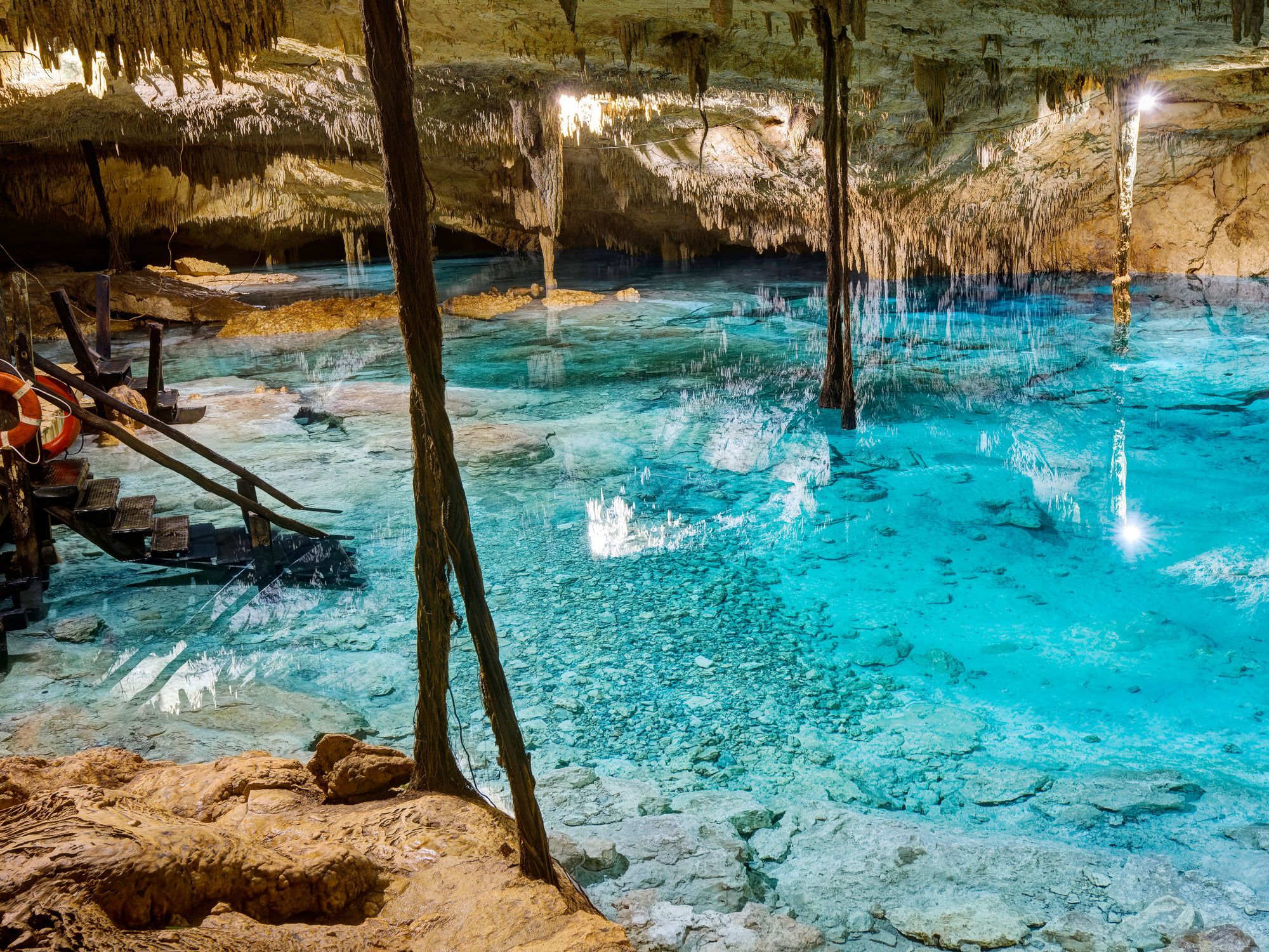
Crystalline waters inside the Cenote Taak Bi Ha in Mexico
Photo credit: Serge Yatunin/ Shutterstock

If you’re looking to beat the crowds and don’t mind paying a slightly steeper entrance price (about $20 USD), head to Cenote Taak Bi Ha, also approximately 30 minutes north of Tulum. Here, you can slip into the crystal-clear turquoise waters from several wooden ladders or rustic platforms, and swim just below hundreds of low-hanging stalactites. As you swim or snorkel at this cenote (whose name means “hidden route of water”), you can watch the bubbles from scuba divers as they disappear into the deep waters below. 

Chinhoyi Caves – Zimbabwe

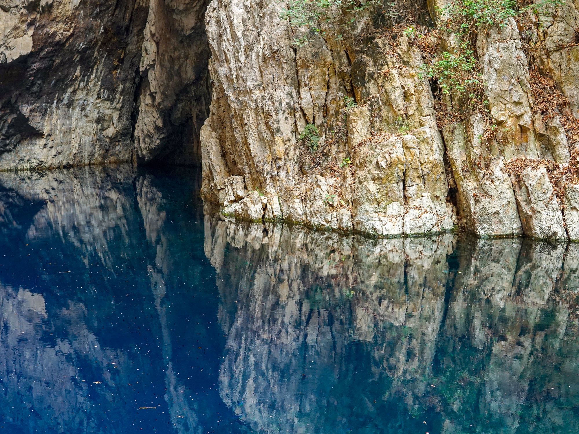
Water-filled interior of Chinhoyi Caves in Zimbabwe
Photo credit: KITAMU/ Shutterstock

Located in northwestern Zimbabwe, Chinhoyi Caves feature a dramatic limestone and dolomite sinkhole known locally as Chirorodziva, meaning “cave of the fallen.” According to legend, the name stems from a 1830s event in which a migrating tribe came upon the current occupants and flung them into the pool below. The main cave, dubbed the Wonder Hole, sits 150 feet below the cliffs and is filled with stunning cerulean waters. The underwater systems are frequently explored by technical and experienced divers. Though swimming is not allowed, novice explorers have multiple viewpoints and a public barbeque area to enjoy. 

Blue Hole – Jamaica

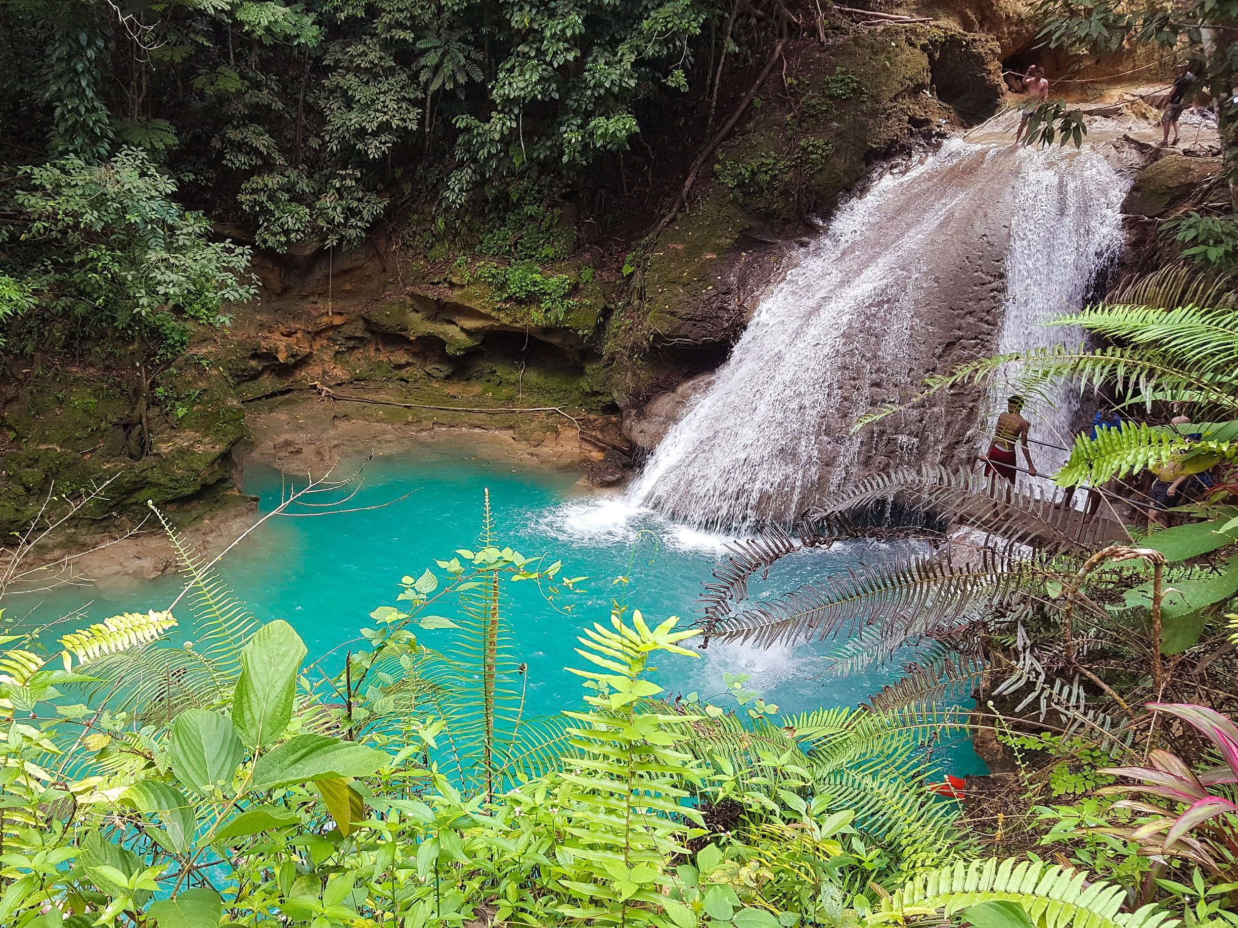
View of Blue Hole in Jamaica, seen from above
Photo credit: Sheldon B/ Shutterstock

There’s plenty to love about Jamaica: beautiful beaches, luxurious resorts, jungle-shrouded waterfalls, and delicious cuisine. Add Jamaica’s Blue Hole to the long list of must-see attractions in this Caribbean paradise. Located on Jamaica’s northern coast in Ochos Rios, the series of cascading pools that make up the hole are continuously filled by a spectacular waterfall. Swimming, cliff-jumping, rope-swinging, and hiking are all popular activities in this scenic area. 

Post Banner Image
History

6 Historic Urban Neighborhoods to Explore Around the World

By Bennett Kleinman
Read time: 6 minutes
June 28, 2023
Updated: July 25, 2023

6 Historic Urban Neighborhoods to Explore Around the World

By Bennett Kleinman
Author
Bennett Kleinman
Bennett is a New York City-based staff writer for Daily Passport. He previously contributed to television programs such as the Late Show With David Letterman, as well as digital publications like the Onion. Bennett has traveled to 48 U.S. states and all 30 Major League Baseball stadiums.

Walking the streets of historic city neighborhoods offers a fascinating glimpse into centuries of urban culture, and also provides a fresh perspective on the evolution of the cities around them. While it may be tempting to crane your head upwards and admire a towering new skyscraper, consider giving your neck a break and instead exploring these six historic urban neighborhoods around the world.

Old Montreal – Montreal, Quebec

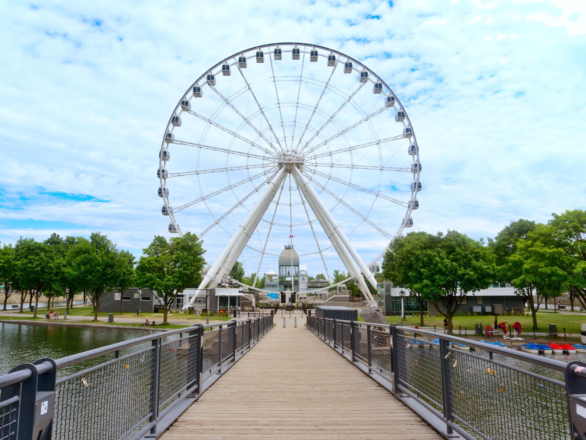
Bridge leading to Ferris wheel in Old Montreal neighborhood of Montreal, Canada
Photo credit: Rania Mekky/ Shutterstock

Though the region was known for its fur trade long before, the neighborhood of Old Montreal has origins dating back to 1642, when French settlers first began to develop this area along the St. Lawrence River. This once-thriving port neighborhood no longer serves the important commercial function it once did, but it remains an architectural and historical gem. Old Montreal features ornate Gothic-style buildings left and right, with structures dating back to the 17th century that still stand today. Impressive cathedrals, including the Notre-Dame Basilica — which opened in 1829 — make the neighborhood even more picturesque. 

Visitors can also take a stroll down Saint-Paul Street, the oldest street in Montreal, which was paved in 1672. Lined with shops and eateries, Saint-Paul Street terminates at Place Jacques-Cartier, a scenic public square named for the explorer who claimed Canada for France in 1535. No matter where you turn, you’ll find vestiges of Canada’s New France colony throughout Old Montreal.

Beacon Hill – Boston, Massachusetts

Charles Street Meeting House in Boston, Massachusetts
Photo credit: Jorge Salcedo/ Shutterstock

Located in the heart of downtown Boston, Beacon Hill reflects the early history of the United States. The neighborhood’s name dates to 1635, when British colonists erected a wooden beacon to warn those in the nearby countryside of potential danger. A residential community was established in 1737, when a merchant named Thomas Hancock built Beacon Hill’s first home — that residence was later passed on to his nephew, Founding Father John Hancock. 

Today, you’re bound to come across a historic building no matter where you turn in Beacon Hill. Take, for instance, the Charles Street Meeting House, which was the site of many impassioned anti-slavery speeches from leaders such as Frederick Douglass and Harriet Tubman. Then there’s the Massachusetts State House, which boasts a brilliant gold dome — it was originally made of wood until it was covered in copper by Paul Revere’s company in 1802, and later golf leaf in 1874. Beacon Hill isn’t just known for its legendary buildings but also for its centuries-old public spaces, including Boston Common. This grassy expanse was established in 1634, making it America’s oldest park. It has served many purposes over the years, from housing troops to welcoming dignitaries such as Martin Luther King Jr. and Pope John Paul II. 

Greenwich Village – New York, New York

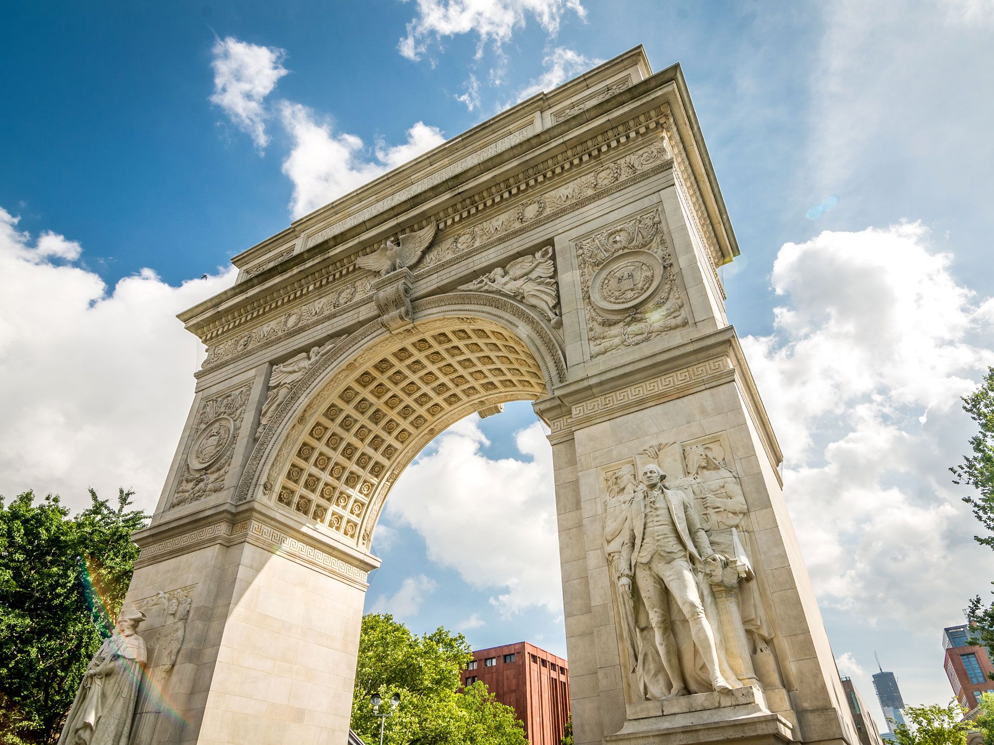
Washington Square Arch in Greenwich Village, New York City
Photo credit: stockelements/ Shutterstock

Few New York City neighborhoods capture the essence of Manhattan in the 1960s quite like Greenwich Village. Nestled in the shadows of the city’s modern skyscrapers, the historic district of Greenwich Village was officially founded in 1969, even though artists like Mark Twain and Salvador Dalí had come to Greenwich Village long before then in search of inspiration. The district was home to the city’s first studio space designed specifically for artists — Tenth Street Studios stood at 51 West 10th Street from the 1850s until it was knocked down in the 1950s.

In the 1960s, Greenwich Village cemented its reputation as a cultural epicenter, welcoming countless musicians, such as John Lennon, Janis Joplin, and Bob Dylan — the latter of whom was known for performing at local venues such as Cafe Wha? Greenwich Village also played a key role in the gay rights movement of the late 1960s, beginning with the Stonewall Riots at the Stonewall Inn, which has since been added to the U.S. National Register of Historic Places. The neighborhood is home to several unusual architectural quirks — for example, it’s where you can find the smallest plot of land in Manhattan, a tiny triangle covering an area of just 500 square inches. The Village is also home to one of the city’s last extant gas-powered streetlights, which used to line every city street.

Gothic Quarter – Barcelona, Spain

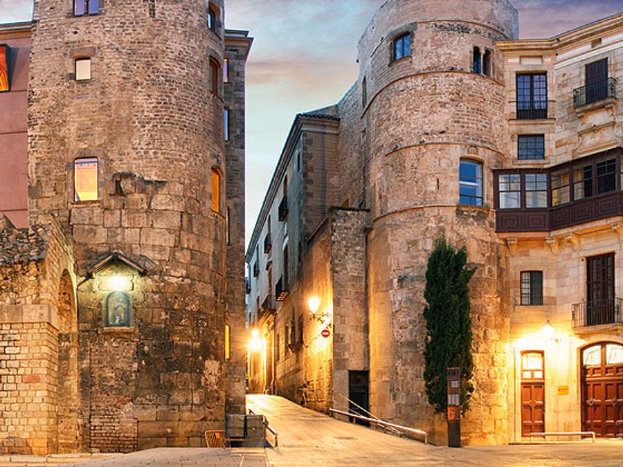
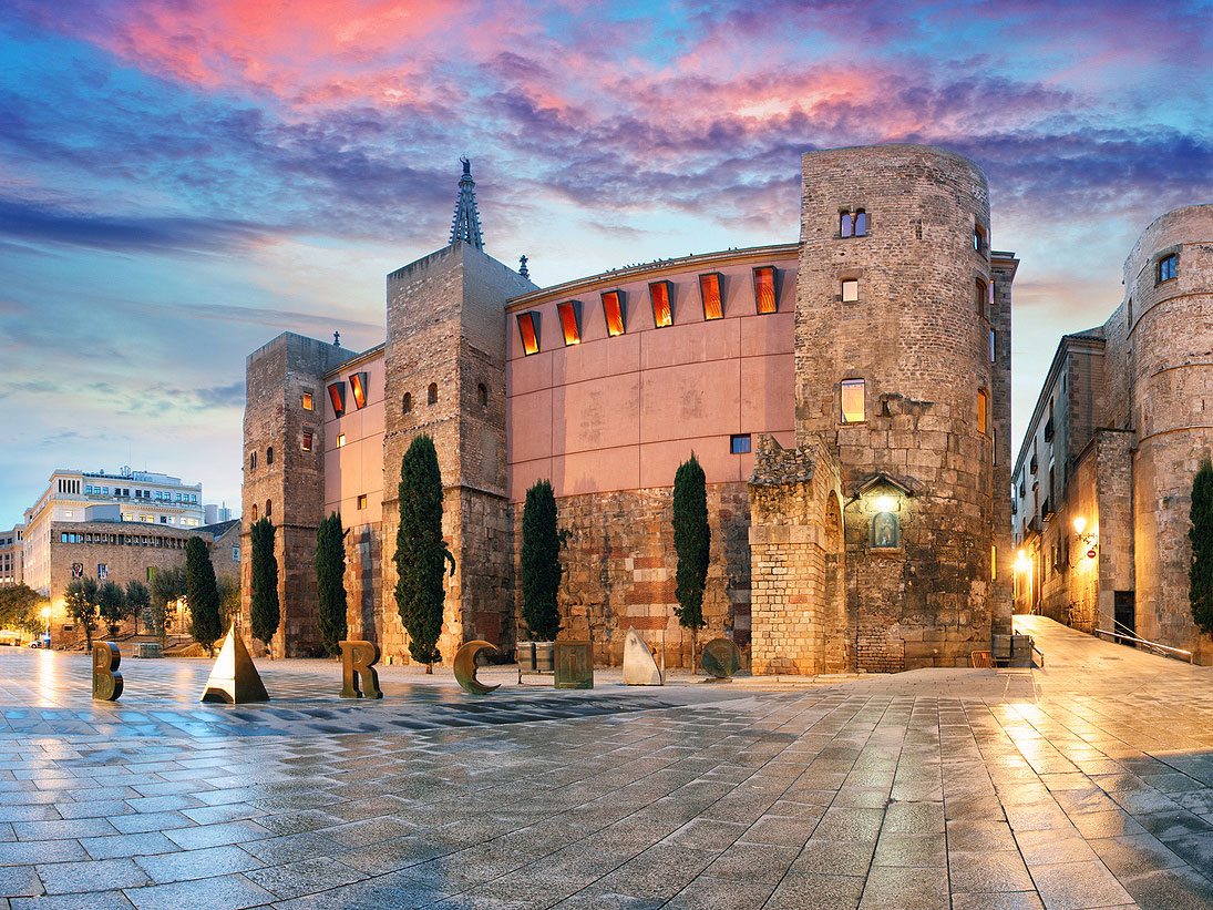
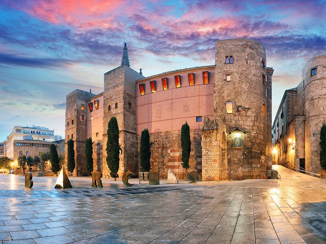
Historic structure in the Gothic Quarter in Barcelona, Spain
Photo credit: TomasSereda/ iStock

Barcelona’s modern-day Gothic Quarter occupies a site founded by the Romans several millennia ago as a colony known as Barcino. Though that time period is long gone, the Gothic Quarter still features ancient remnants of the Roman Empire, such as the four surviving columns of the Temple d’August, which dates to the first century BCE. The Gothic Quarter is also home to the Sinagoga Major de Barcelona, a synagogue dating to the third century CE, reflecting the neighborhood’s history as a hub of Barcelona’s Jewish community during the Middle Ages.

As centuries passed, the Gothic Quarter evolved into a beautiful bastion of Spanish architecture, including early work from famed Catalan architect Antoni Gaudí. In fact, the Gothic Quarter’s Plaça Real is the site of one of Gaudí’s very first projects in 1879 — the architect was tasked with designing the square’s signature lampposts. 

Hyde Park – Chicago, Illinois

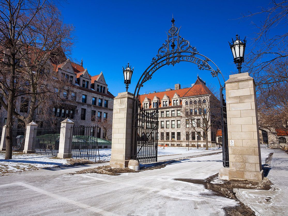
Campus of University of Chicago in Hyde Park, Illinois
Photo credit: stevegeer/ iStock

Once known as Hyde Park Township, this historic neighborhood was annexed by the city of Chicago in 1889. Four years later, Hyde Park’s Midway Plaisance served as the focal point of the 1893 World Columbian Exposition. That’s far from the only historic attraction in Hyde Park — the 540-acre Jackson Park also contains a 17th-century style Osaka Garden established in 1934. Hyde Park’s Museum of Science and Industry is the largest science center in the Western Hemisphere, and is one of the few remaining buildings that was constructed for the 1893 world’s fair. 

Hyde Park is also where you can find Promontory Point, a human-made peninsula constructed in 1937. Designed in the style of the Midwestern Prairie School of architecture, this natural viewpoint juts out into Lake Michigan and offers scenic views of the downtown Chicago skyline. Architecture buffs can take a trip to the Frederick C. Robie House, designed by pioneering American architect Frank Lloyd Wright in 1908.

Shinjuku Golden Gai – Tokyo, Japan

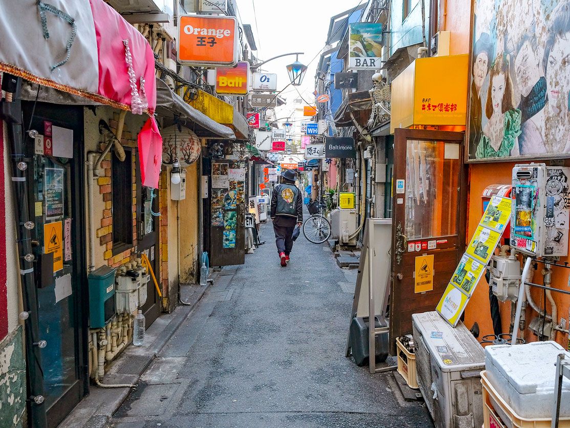
Narrow alleyway in Tokyo's Golden Gai neighborhood
Photo credit: OscarEspinosa/ iStock

Tokyo’s Golden Gai neighborhood has a relatively recent history, as it rose to prominence as a black market in the wake of World War II. However, the region soon developed into a haven for artists and journalists who gathered at local pubs to exchange ideas. Golden Gai is made up of just a mere six alleyways, and its popular bars and taverns — of which there are an estimated 250 today — encompass an area smaller than a football field. 

Despite the neighborhood’s small blueprint, these establishments remain untouched by modern development. Instead, this area continues to serve as a place for locals and tourists alike to gather for the exchange of ideas and culture as they’ve been doing since the late 1950s. The neighborhood even survived an attempt in the 1980s by the Yakuza — Japan’s organized crime syndicate — to burn down the buildings so that they could be developed. However, Golden Gai’s supporters stood guard, ensuring that the district could be preserved for future generations.

Post Banner Image
Geography

7 International City Names You Might Be Mispronouncing 

By Daily Passport Team
Read time: 6 minutes
June 28, 2023
Updated: July 25, 2023

7 International City Names You Might Be Mispronouncing 

By Daily Passport Team
Author
Daily Passport Team
Daily Passport writers have been seen in publications such as National Geographic, Food & Wine, CBC, Condé Nast Traveler, and Business Insider. They're passionate about uncovering unique destinations and sharing expert tips with curious travelers.

Often, one of the most enriching parts of visiting a new country is being welcomed by locals as one of their own. It helps to learn some of the local language when you’re visiting a new place, and the first step is accurately pronouncing the name of where you are. While some city names are more straightforward than others, these seven city names are often said incorrectly. Learn the proper pronunciation and explore the histories of these commonly mispronounced city names.

Ljubljana, Slovenia

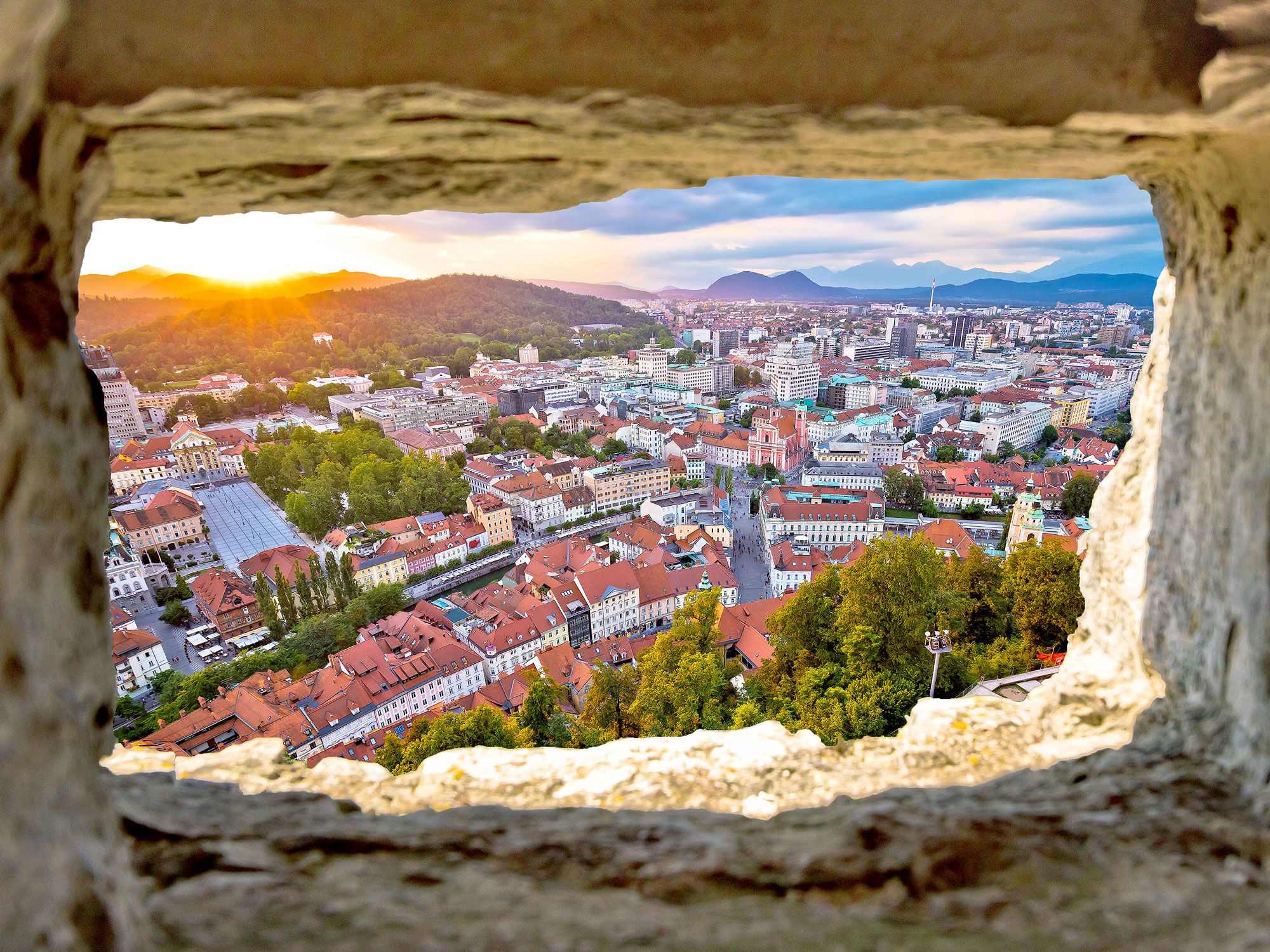
View of Ljubljana, Slovenia, through wall opening
Photo credit: xbrchx/ Shutterstock

Not much will trip up an English speaker more than two consonants next to each other that don’t seem to match — leading some to try and pronounce this city’s name like “luh-joob-luh-jana.” In the actual pronunciation, the sound changes based on where the J is. It should be “loo-blee-AH-nah.”

Ljubljana is the capital of Slovenia, located in the middle of this central European country between Italy and Croatia. Though it’s Slovenia’s largest city and a university town, it’s also one of the smallest capital cities in Europe, with a population of less than 300,000. Local legend says that Jason and the Argonauts from Greek mythology founded the city when they fled from King Aetes. They stopped at a large lake, where Jason defeated a sea monster — which is now known as the Ljubljana dragon and is represented on the city’s coat of arms.

Ísafjörður, Iceland

Sheep on the coastline of Iceland
Photo credit: Julia Bjornsdottir/ Shutterstock

This Icelandic city name is so tricky to pronounce that even the internet gets it wrong most of the time. You’ll likely hear (and read) it as “eye-sah-fyord-er,” but when listening to an actual Icelandic speaker, it sounds like this: “EE-suh-fyord-irsh.”

Known as the capital of the Westfjords region, Ísafjörður is the largest town on this peninsula that juts off the northwest corner of Iceland. Only about 2,600 people live there, mostly working in the fishing industry. It was founded in the 16th century with an ancient church and trading post, and salt fish production fueled the town’s growth in the mid-1800s. Now, aside from having some of the best views of dramatic fjords in Iceland, Ísafjörður is a base for adventure travelers — from there, visitors can explore the Westfjords on hiking or biking trails, horse trails, skis, or kayaks.

Budapest, Hungary

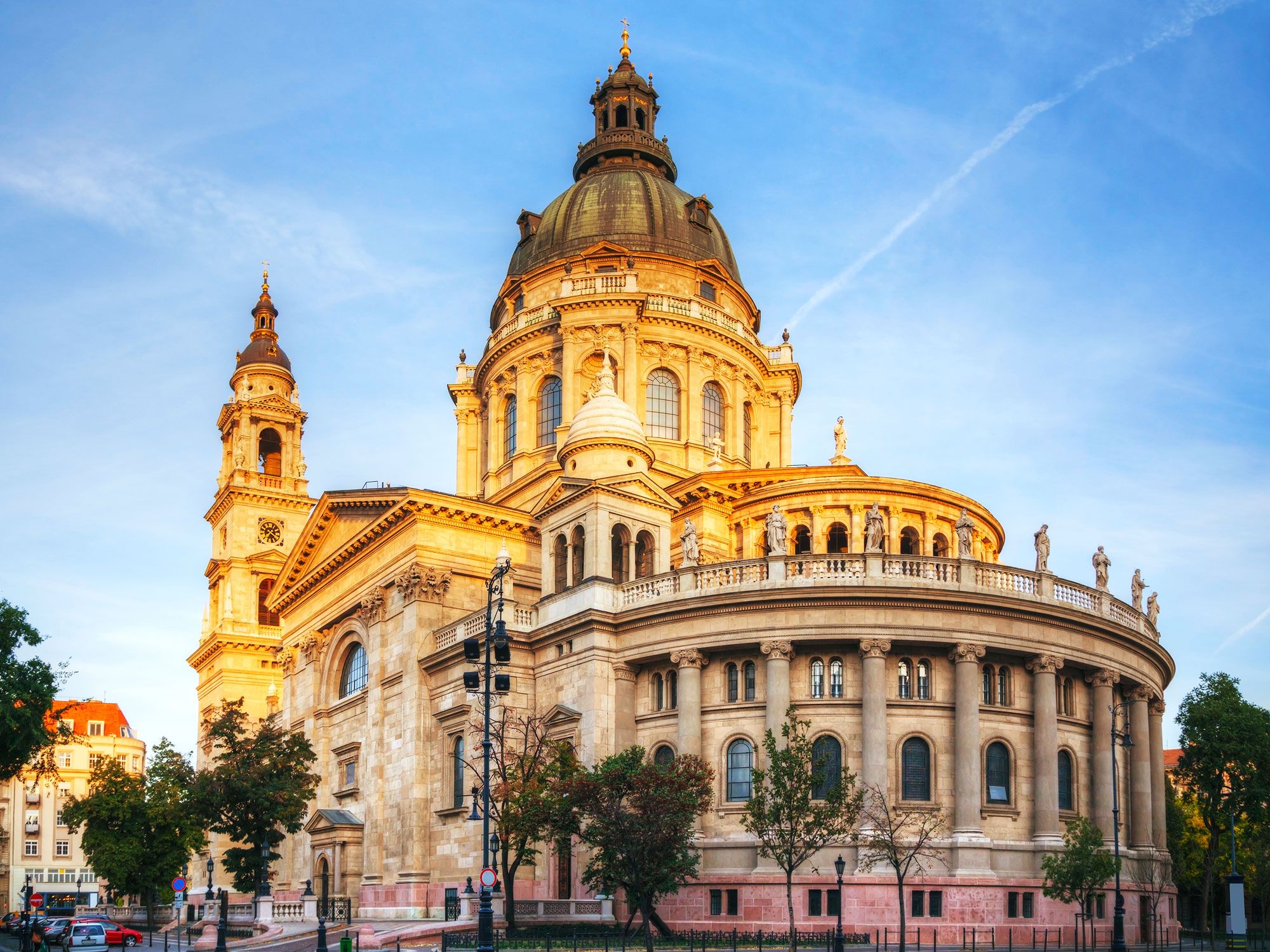
Building in Budapest, Hungary
Photo credit: photo.ua/ Shutterstock

When Budapest, the capital of Hungary, was founded in 1873, it was the result of three different cities merging together: Buda, Óbuda, and Pest. Two distinct sides to the city still remain, Buda and Pest, split in two by the Danube River. Buda sounds much like you would expect it to, “boo-duh.” But if you want to sound like a local, make sure you’re pronouncing Pest properly. It should be “pesht,” not “pest.” So, the city as a whole is pronounced “BOO-duh-pesht.”

On the Buda side, the city stretches up a riverside hill, called Castle Hill. This is where most of the historic sites and tourist attractions in the city are located, including the 13th-century Buda Castle, Matthias Church (built in 1269), and a Holy Trinity statute, built in 1714 under the superstition that it would keep the plague away. The Pest side comprises about two-thirds of the city. Unlike Buda, it’s flat, and home to the ornate Hungarian Parliament Building, pubs fashioned out of old ruins, the central market hall, and museums dedicated to the city’s Jewish history.

Brisbane, Australia

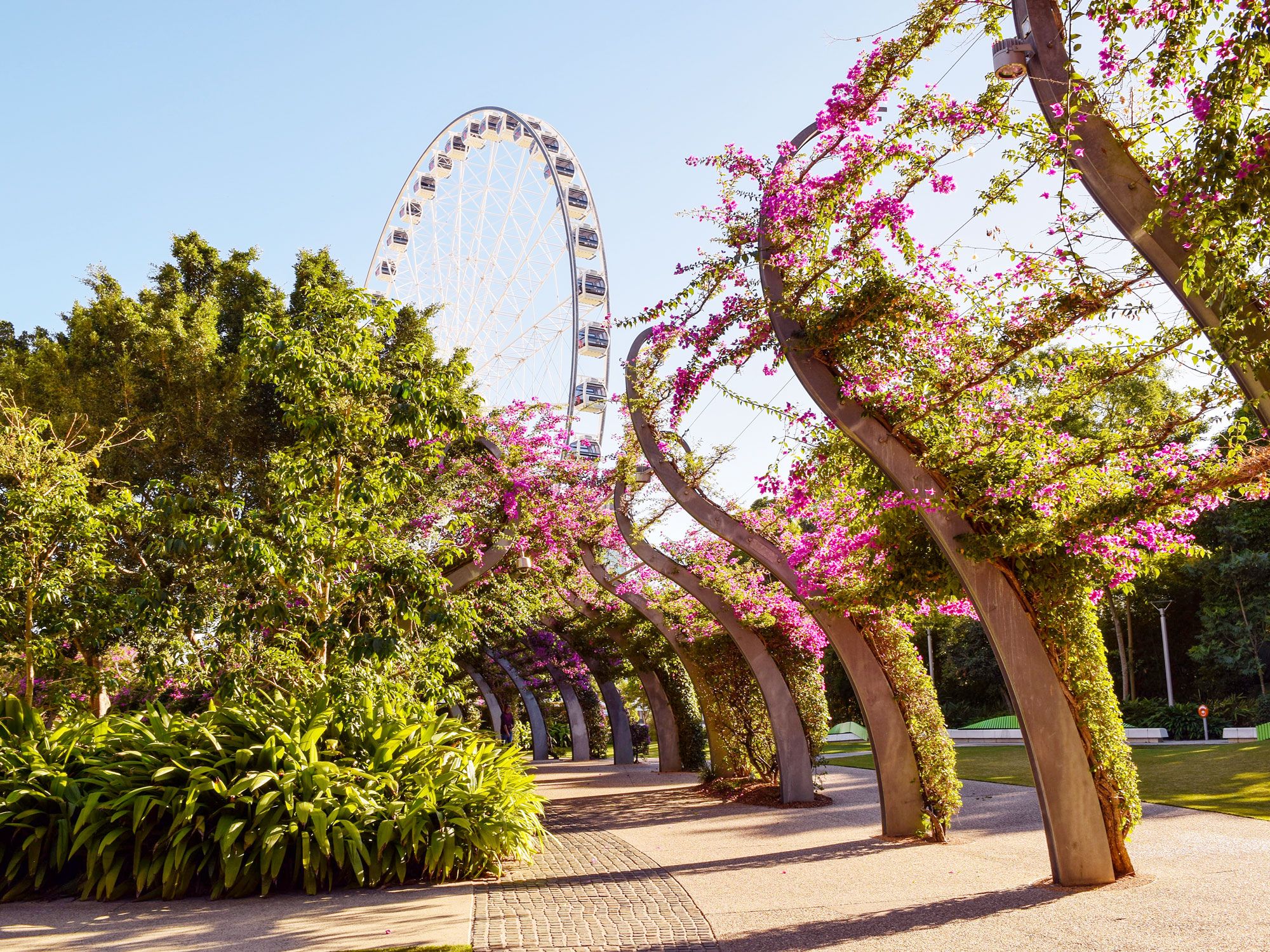
Park and Ferris wheel in Brisbane, Australia
Photo credit: AdrianoK/ Shutterstock

It may look like “briss-bayn,” but this coastal Australian city’s name is actually pronounced “briz-bin.” (If you want to go to “briss-bayne,” you’ll be asking for directions to a town in California.) Brisbane is the capital of Australia’s Queensland state in the northeast corner of the country. Islands, sports, and beaches make Brisbane a gem for outdoor enthusiasts — especially surfers, who flock to the Gold Coast, about an hour away from the city, for one of the world’s longest wave rides.

The Jagera and Turrbal Aboriginal clans lived in what’s now Brisbane for about 40,000 years before colonizer John Oxley arrived from England in 1823. Settlers began to arrive en masse the following year, including an influx of entrepreneurs, which made the burgeoning city a major center of commerce. Another population boom occurred during World War II, boosting the population to about 750,000. Now, it’s the third largest city in Australia with 2.5 million people — about half the population of either Sydney or Melbourne.

Edinburgh, Scotland

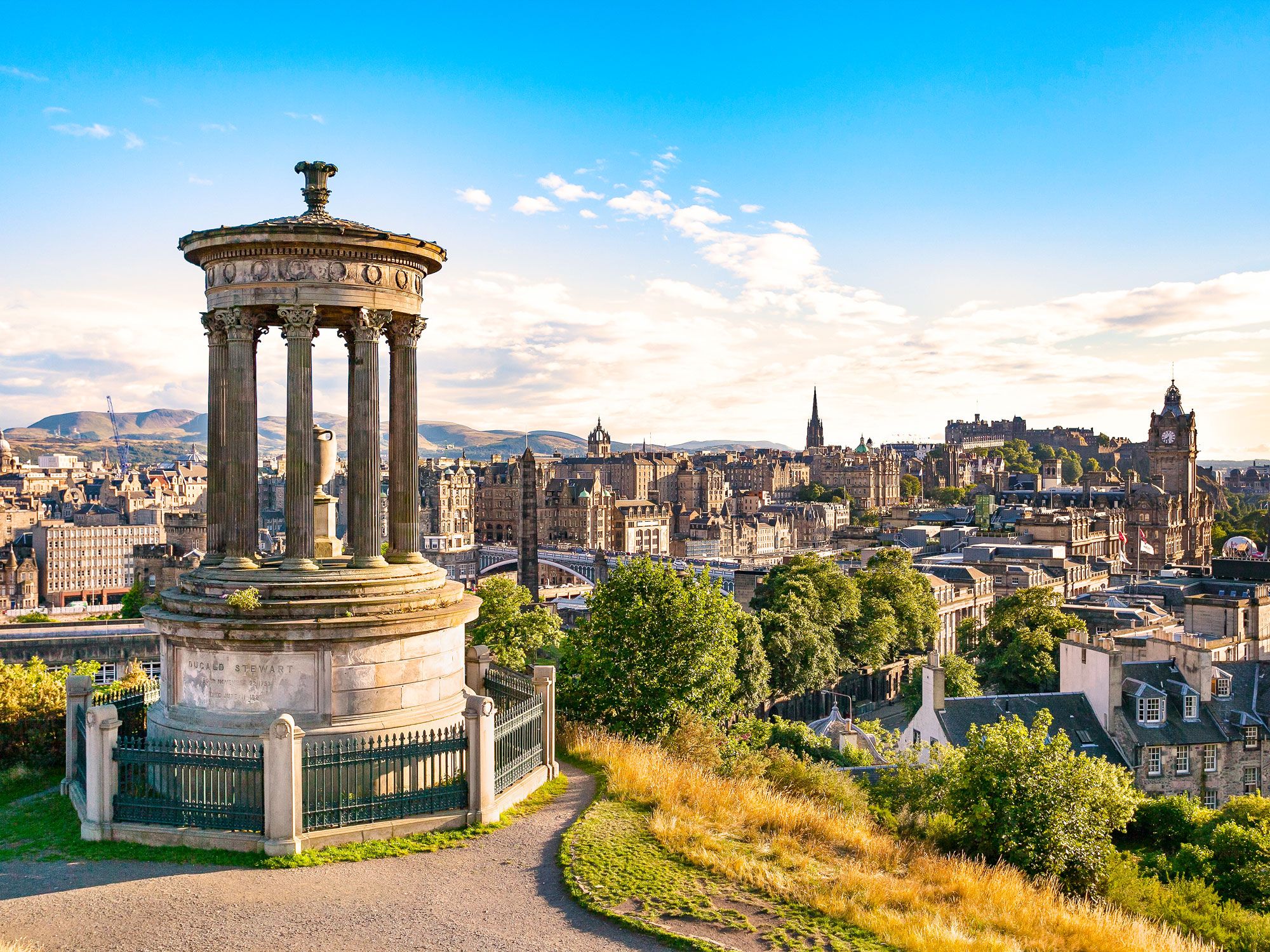
Hilltop monument overlooking Edinburgh, Scotland
Photo credit: Studio51/ Shutterstock

If you’re a fan of the Outlander television series, you likely already know how to pronounce this city that plays heavily into the time-traveling drama. If not, the city’s pronunciation might be surprising: It’s not “ee-din-burg” — rather, “ED-in-BURR-uh.” The city is Scotland’s capital and has a long history that’s very much still visible in the old town and along Edinburgh’s narrow alleyways, called closes.

The city, located on Scotland’s eastern coast close to the border with England, dates back to 600 CE when it was just a fort on a hill. Edinburgh Castle was built in 1103, and part of it still remains in use by the Scottish military today, while the rest is a museum and a tourist attraction. The road stretching a mile out from the castle is called the Royal Mile and connects the castle with the Abbey at Holyrood, which was built in 1128.

Leipzig, Germany

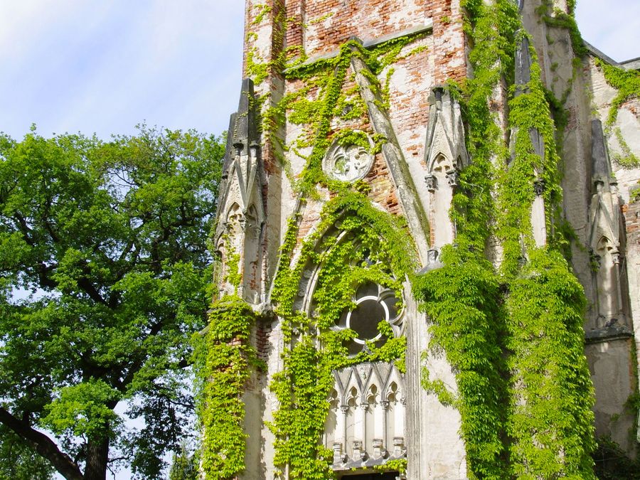
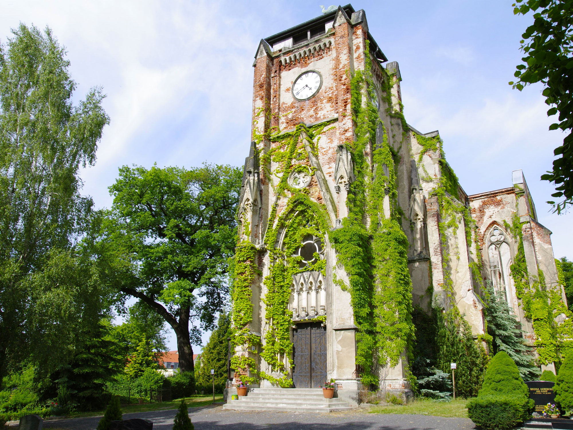
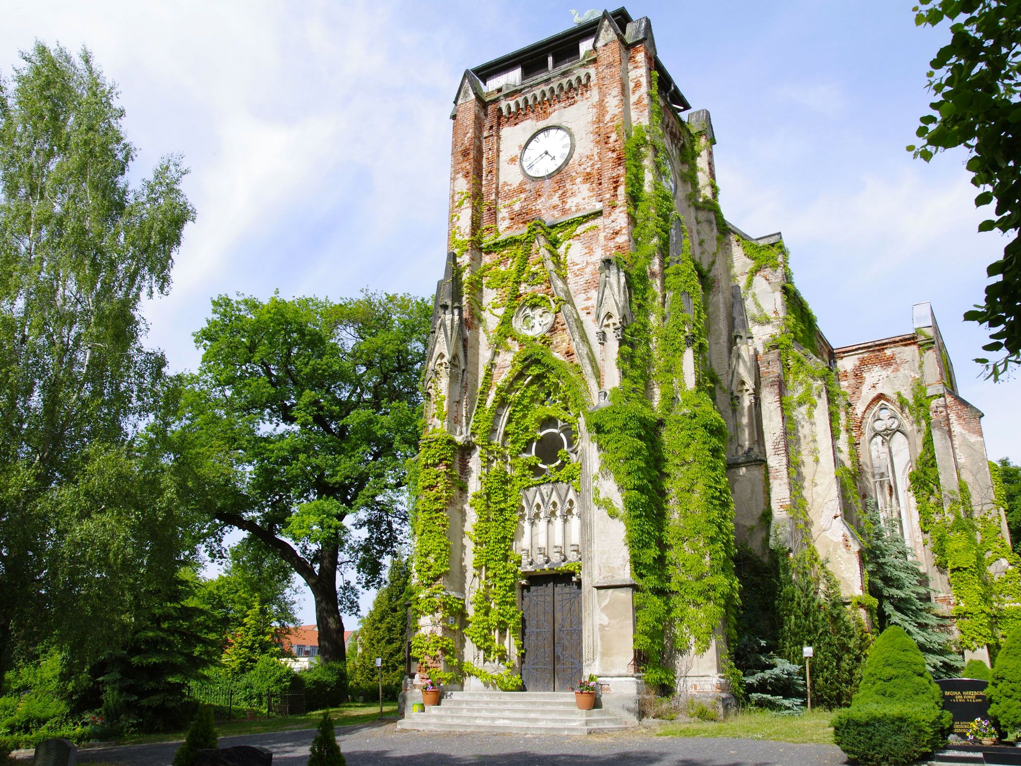
Ivy-covered church in Leipzig, Germany
Photo credit: Wirestock Creators/ Shutterstock

Leipzig, commonly mispronounced as “LEAP-zeeg,” is actually pronounced as “LIEP-zig.” The first syllable rhymes with “sty.” The city is located in eastern Germany, just north of where the Pleisse, Parthe, and Weisse Elster rivers connect. Leipzig is quickly growing a reputation as an artistic and creative enclave, an alternative to the ongoing gentrification of Berlin. It’s home to historical thinkers and figures like Bach, Neitzsche, Kafka, and Wagner, as well as more than 15,600 cultural and historical monuments.

Leipzig has been settled since the 5th century BCE, originally as a trading post and then a permanent Slavic settlement. It was first called Lipzk, named after the linden trees nearby. Then, in 928, the German castle Urbs Lipzi was built, and the city became known as that until it was renamed to Leipzig in 1165. Today, people come to Leipzig for the art and music; annual markets (the Christmas market is extremely popular); museums and battle monuments; and historic churches.

Toledo, Spain

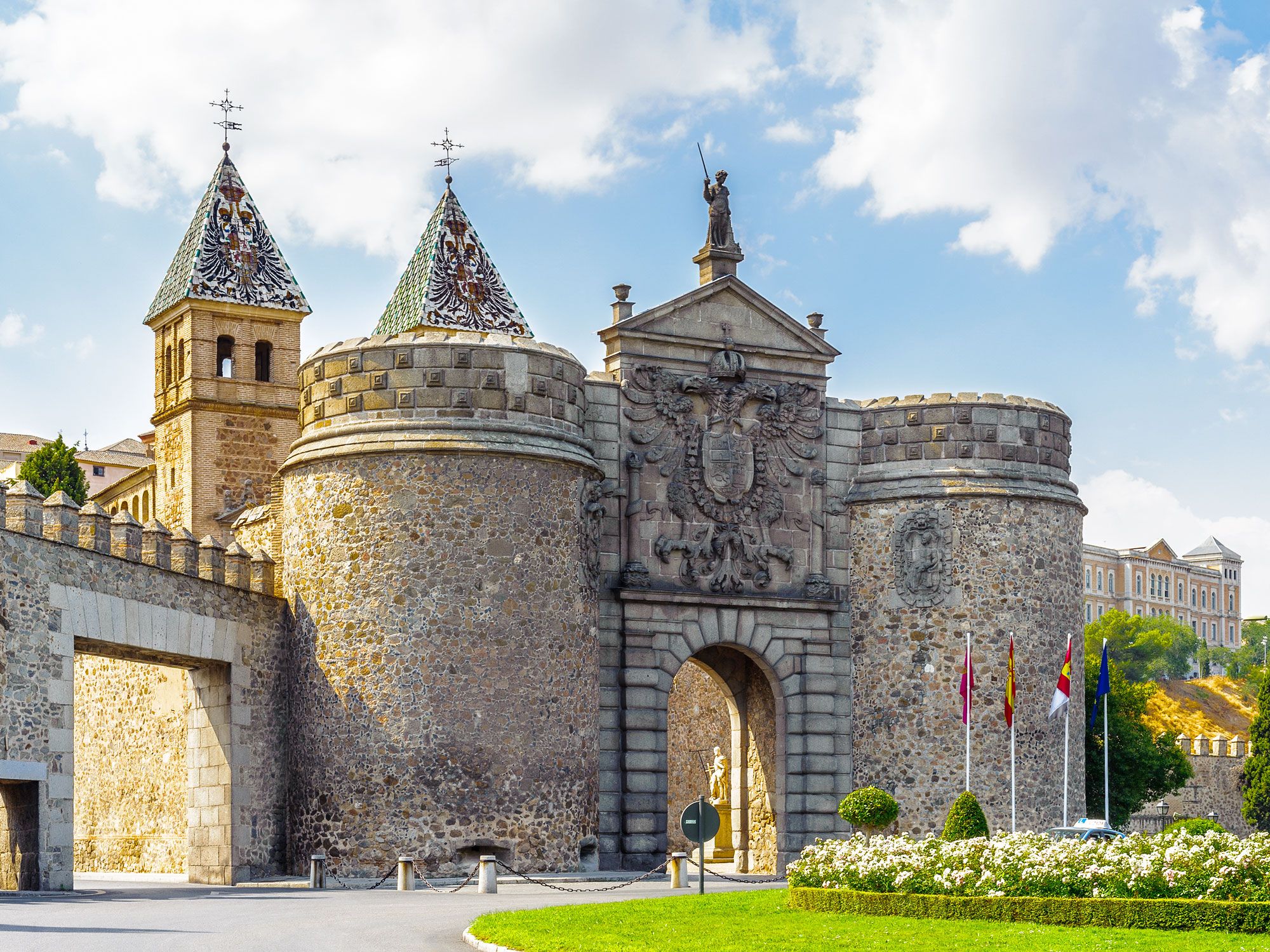
Ancient fortress in Toledo, Spain
Photo credit: Anton_Ivanov/ Shutterstock

In the plains of central Spain, the ancient city of Toledo rises up on a hill. But don’t pronounce it like “toe-LEE-doh” — you’re not in Ohio. The proper way to say the city name in Spanish is “toe-LEH-doh.” Many people know Toledo as the home of 17th-century artist El Greco, who painted his own version of the city on the hill as he observed it from a distance. But the moody tones of the painting belie the beauty of the city’s golden tones and cobblestone streets.

Toledo is an ancient Roman city, conquered by Marcus Fulvius Nobilior in 193 BCE. A large community of Arabic-speaking Christians moved in during the Moorish period, and by the 11th century, the city had become a hub for a mixture of Arab, Christian, and Jewish culture. The castle at the center of town was built in 1531. Today, Toledo’s cobblestone streets wind up the hill to the foot of the castle. Along the way you can still catch glimpses of ancient fortifications, bridges, walls, and gateways. The historic city center was added to the UNESCO World Heritage List in 1986.

Post Banner Image
Architecture

Still Standing: 5 Ancient Walls to Explore Around the World

By Daily Passport Team
Read time: 6 minutes
June 28, 2023
Updated: April 14, 2026

Still Standing: 5 Ancient Walls to Explore Around the World

By Daily Passport Team
Author
Daily Passport Team
Daily Passport writers have been seen in publications such as National Geographic, Food & Wine, CBC, Condé Nast Traveler, and Business Insider. They're passionate about uncovering unique destinations and sharing expert tips with curious travelers.

Many ancient civilizations built walls to keep out intruders, mark territorial lines, or sometimes just show off a kingdom’s wealth and power. Often stretching for hundreds of miles, these walls were constructed by hand without modern tools or building plans, yet many have withstood the test of time for centuries. Here are five ancient walls around the world that you can still visit today.

Hadrian’s Wall, United Kingdom

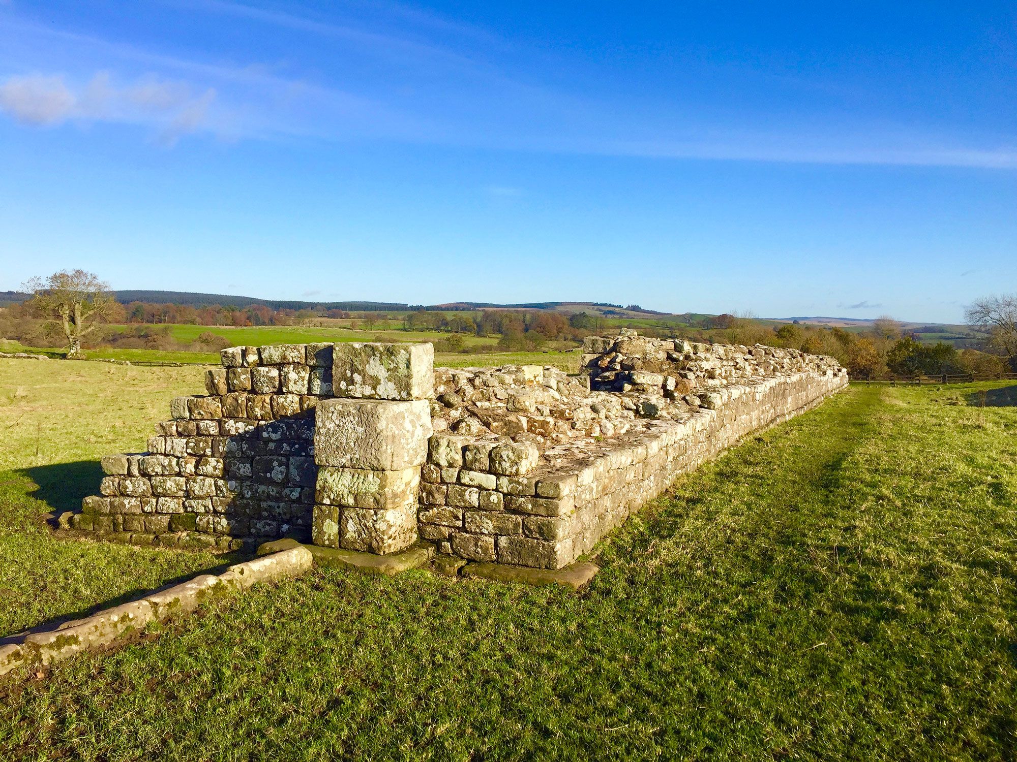
View of ancient Hadrian's Wall in the United Kingdom
Photo credit: Whitney Hubbell/ Shutterstock

When Roman Emperor Hadrian took power in 117 CE, he wanted to secure his empire, and one area under threat was the northern territory of what is now considered Great Britain. Roman armies had already taken over most of the island, but “barbarian tribes” of Picts in the far north (present-day Scotland) created issues for the Romans. Hadrian needed a way to protect the empire’s land from northern invasions, so he ordered his army to build a wall that would stretch across the width of the island.

While Hadrian originally considered building a simple turf wall, he later settled on a design that used local stone as the primary material. The 73-mile wall began in the east at Wallsend and ended in the west at Solway Firth. It stood almost 20 feet high in some places and was nearly 10 feet wide. Although exact numbers aren’t available, historians estimate that at least 15,000 men spent approximately six years constructing Hadrian’s Wall, including its stone forts and bridges.

Nearly 2,000 years later, there are areas where the original wall remains standing, but many areas of the wall have all but disappeared — not due to poor construction by the builders, but rather because of local residents recycling the building materials. Builders dismantled areas of the wall and took the stone for constructing houses, churches, and new walls. Fortunately, conservation efforts put a stop to that in the 19th century, and Hadrian’s Wall is now part of a UNESCO World Heritage Site that receives thousands of visitors every year.

Great Zimbabwe Walls, Zimbabwe and Mozambique

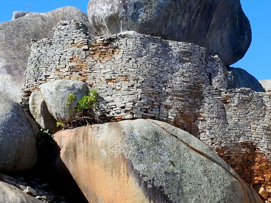
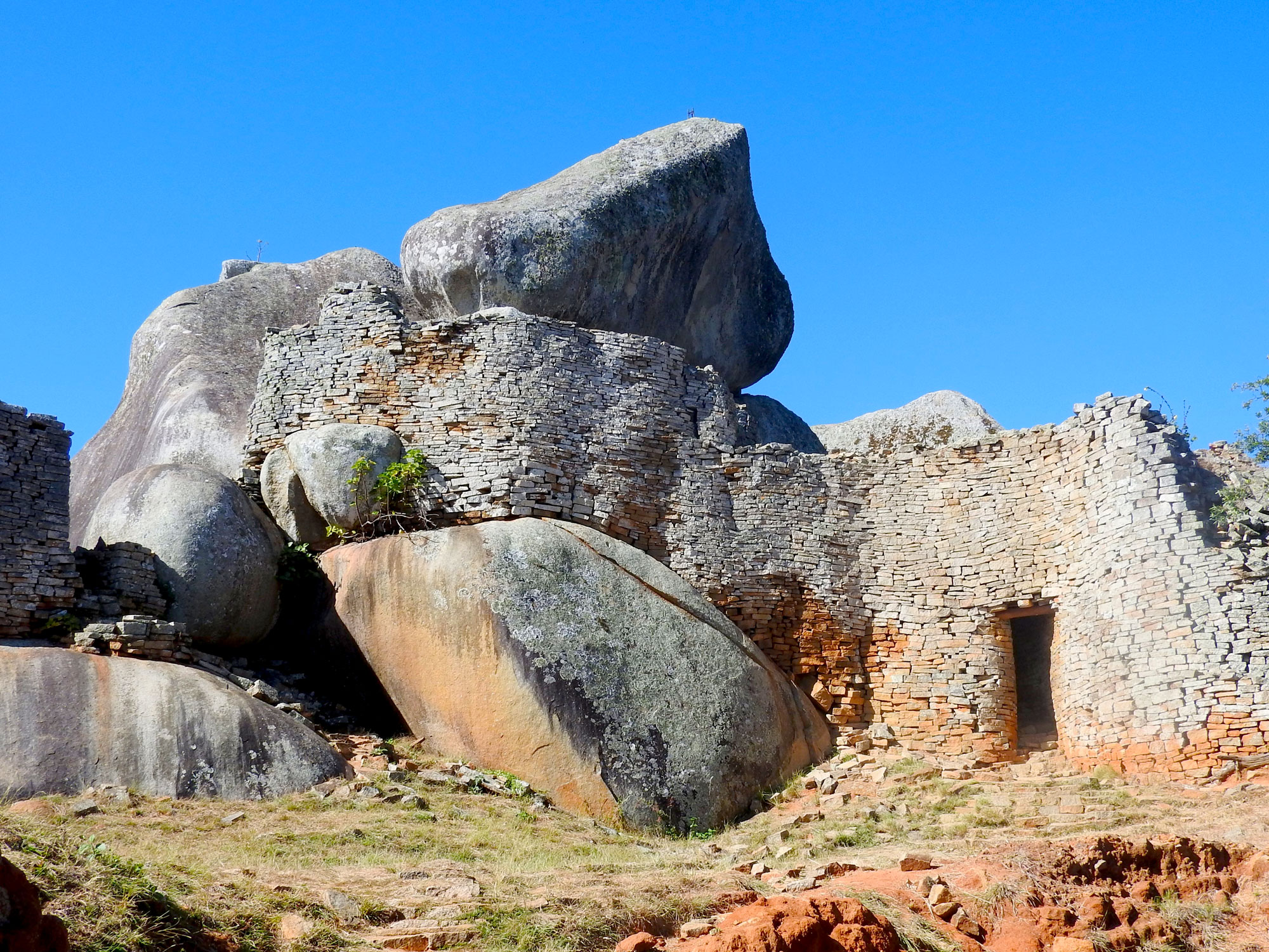
View of a section of the Great Zimbabwe Walls
Photo credit: Fazwick/ Shutterstock

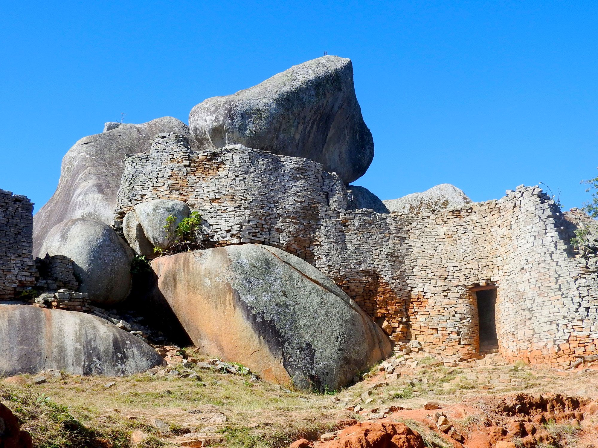
Great Zimbabwe was a thriving center of trade in sub-Saharan Africa from the 11th century through the 15th centuries. The walled complex sprawled across more than 1,800 acres, making it the largest ancient stone complex in Africa after Egypt’s Great Pyramids. A Bantu group of people known as the Shona constructed and expanded Great Zimbabwe over about 300 years. They built the walls from exposed granite in the nearby hills by carefully layering the rocks without mortar. At its peak, Great Zimbabwe was home to about 18,000 people, with a few hundred members of the noble class living within the well-guarded fortress.

When European explorers visited the site in the late 19th century, many plundered the site in search of hidden wealth from the surrounding gold mines, leading to the unfortunate destruction of many areas within the site. Years of outsiders digging for artifacts and treasures to donate to museums has threatened the structural integrity of the walls. The remaining ruins consist of three main areas: the Hill Ruin, the Great Enclosure, and the Valley Ruins. The highest wall at 36 feet tall and over 800 feet long lies within the Great Enclosure. This is where historians believe religious rituals and administrative functions took place in the lost city.

It was only in the early 20th century that archeologists confirmed that the Shona people constructed the fortress, which is now a protected UNESCO World Heritage Site. Today, travelers can visit the walls of Great Zimbabwe, but it’s important to be cautious and explore the fragile site with a guide.

Western Wall, Israel

Image of the Western Wall in Jerusalem
Photo credit: Joshua Haviv/ Shutterstock

Jerusalem is home to many ancient sites that carry great religious importance to the world’s Abrahamic faiths. Two of the most important sites are the Al-Aqsa Mosque and the Dome of the Rock. Together, the two sites comprise an area called Temple Mount. This is the site where people of the Jewish and Christian faiths believe Abraham prepared his son Isaac for sacrifice. It’s also where Muslims believe the prophet Muhammad ascended into heaven. The shared importance has made the Temple Mount a point of contention for centuries.

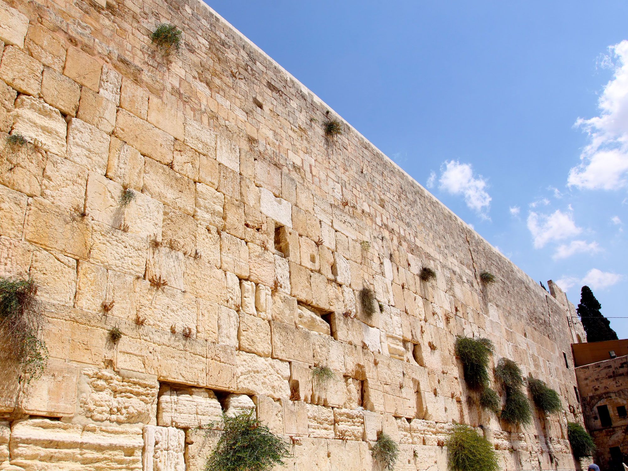
King Herod built the wall in 20 BCE during an expansion of the Second Temple, a holy site for the Jewish faith. People have gathered for centuries at a particular section of the wall to call out prayers to God. This section of the wall is known as the Western Wall or the Wailing Wall. Slips of paper fill the cracks along the length of the 160-foot-long wall — each containing a written prayer.

The Western Wall has long been a site of pilgrimage for Jewish people, while its proximity and connection to nearby Islamic sites make the wall important for Muslims too. Visitors of all faiths can visit the Wailing Wall, where they can also take tours of the ancient tunnels excavated underneath the site.

Theodosian Wall, Turkey

Image of the Theodosian Wall in Turkey
Photo credit: steve estvanik/ Shutterstock

Originally named after the Byzantine Emperor Constantine, Constantinople (later called Istanbul) continued to grow with each successor. When Theodosius II took the throne in 408 CE, he ordered the construction of fortifying walls to protect the city. An earthquake destroyed the walls about 25 years after their completion, but citizens set to work rebuilding them.

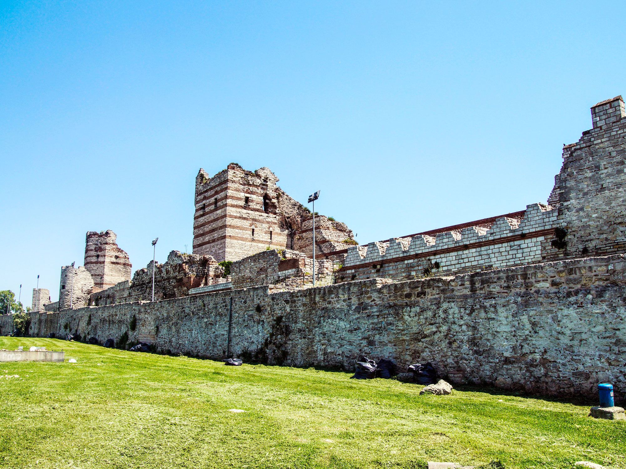
At the same time, they added an exterior wall and a moat to further protect the city. The original wall was between 36 and 46 feet high and 16 feet thick. Towers up to 66 feet tall gave defenders a scenic view of the land and the perfect place to spot incoming invasions.

Ultimately, the wall was about four miles long and included large stone, marble, and gold gates for people to enter and exit the city. One of the most historically significant gates was called Edirnekapi. This was the gate where Fatih Mehmet entered and retook the city from the Christians. Today, those who visit Istanbul can see large parts of the red brick and limestone monoliths that made up the Theodosian wall.

Walls of Babylon, Iraq

Ruins of the Walls of Babylon in Iraq
Photo credit: Mahmoud Suhail/ Shutterstock

The fertile land between the Tigris and Euphrates rivers in modern-day Iraq is often called the Cradle of Civilization. It was home to several ancient cities, including Babylon, which lies in the heart of Mesopotamia. You might be familiar with stories about the Tower of Babel and the magnificent Hanging Gardens of Babylon.

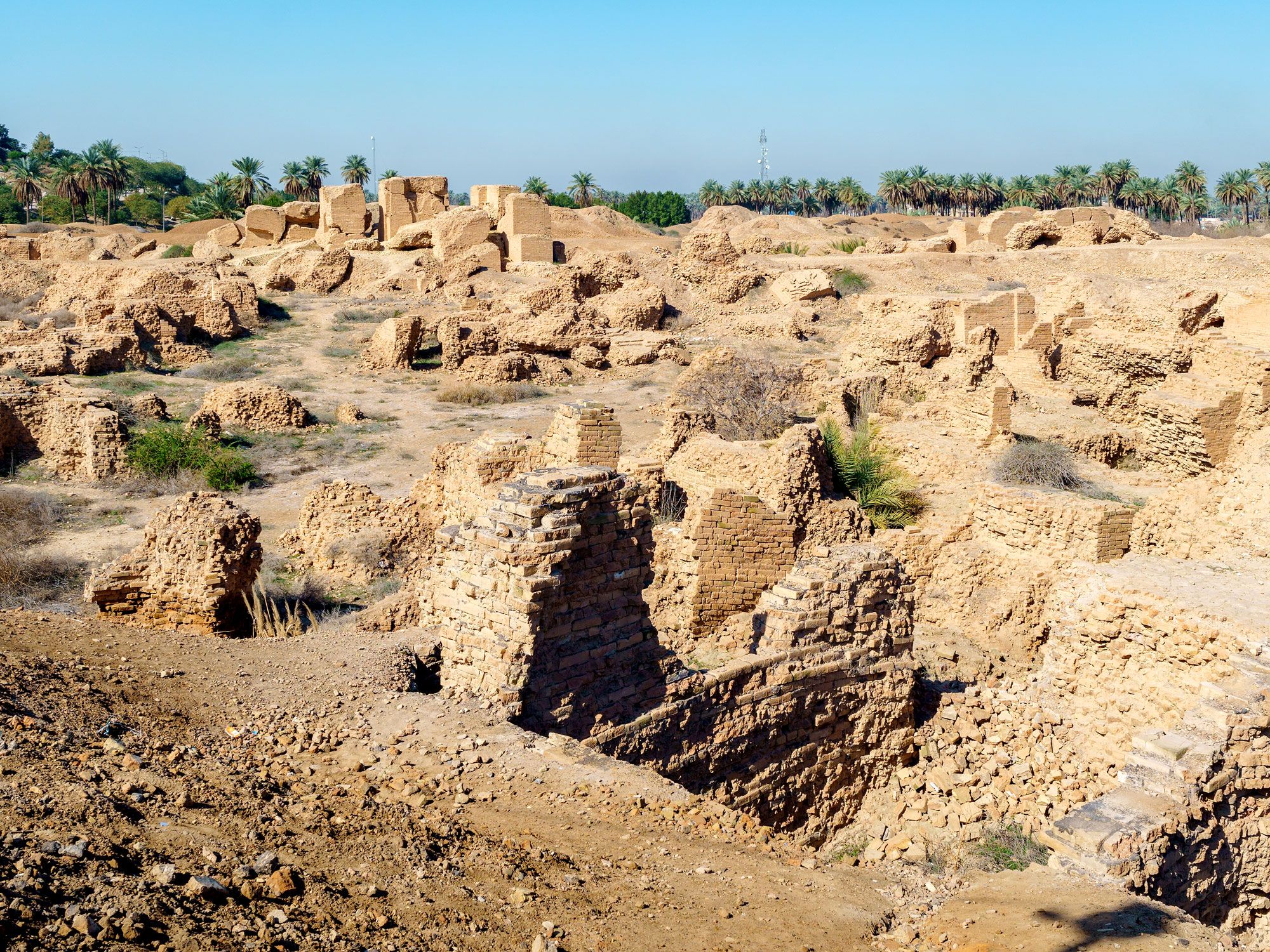
Historians trace the emergence of Babylon to around 1894 BCE. But the civilization really reached its golden age between the sixth and seventh centuries BCE, when Nebuchadrezzar II ordered the construction of a third wall to further strengthen Babylon’s double-walled defenses. The walls were so wide and solidly built that the ancient Babylonians could race chariots along the top of them.

Parts of those walls still stand today, but the site suffered some damage as a result of conflict in the region. Saddam Hussein famously rebuilt the ruins of Babylon in the 1980s, but wars in Iraq kept the sites closed to tourists for years. The UNESCO World Heritage Site reopened in 2009. Travel to this site south of Baghdad is still restricted for many travelers, who dream of someday being able to see the famous walls where the Hanging Gardens once stood.

Post Banner Image
Outdoors

The Tallest Waterfalls in the U.S.

By Bradley O'Neill
Read time: 5 minutes
June 28, 2023
Updated: October 12, 2023

The Tallest Waterfalls in the U.S.

By Bradley O'Neill

Waterfalls are among the many diverse and majestic natural features of the U.S. The country is home to over 17,000 documented waterfalls, which range from thundering torrents of water to tiny cascades. In fact, the U.S. (and Canada) share one of the world’s most iconic waterfalls, Niagara Falls, yet this impressive sight pales in height compared to the country’s tallest waterfalls. From Hawaii to the Pacific Northwest, here’s where to find them.

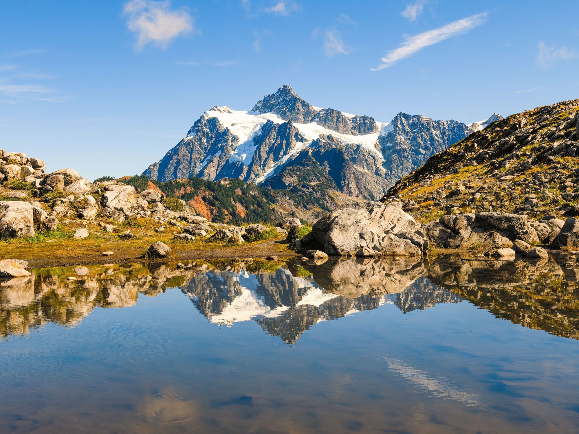
10. Seahpo Peak Falls, Washington – 2,200 feet

Image of Seahpo Peak in Washington reflecting on lake
Photo credit: Ian Dewar Photography/ Shutterstock

The rugged alpine landscapes of North Cascades National Park — about three hours northeast of Seattle — are home to four of the 10 tallest waterfalls in the country. Seahpo Peak Falls cascades over a peak of the same name, which is found on the eastern arm of 9,131-foot-tall Mount Shuksan. Though it’s over 2,000 feet tall, the waterfall is narrow and has a limited flow rate, making it sometimes difficult to see. But other noteworthy sights in this area of the park include Sulphide Creek Falls and hiking trails such as Shuksan Lake Trail and Mount Blum Climbers Trail. 

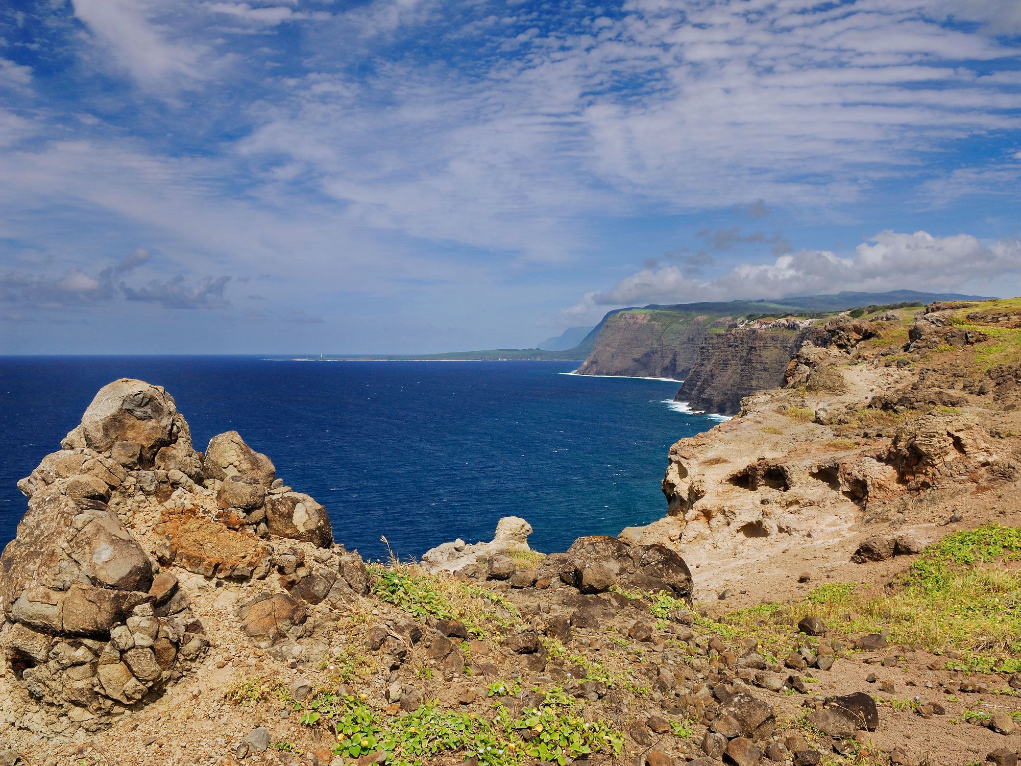
9. Haloku Falls, Hawaii – 2,297 feet

Rugged cliffs and coastline of Molokai island in Hawaii
Photo credit: Reimar/ Shutterstock

The Northeastern shore of the Hawaiian island of Molokai is a fairytale-like setting of dazzling green scenery and multiple spectacular waterfalls. Haloku Falls lies in an area known as Haloku Sea Cliffs. Stretching between the Pelekunu and Wailea valleys, they are the world’s tallest sea cliffs. Haloku Falls spills down the face of these towering basalt cliffs into the Pacific Ocean. The only way to see it is via boat or flight tour.

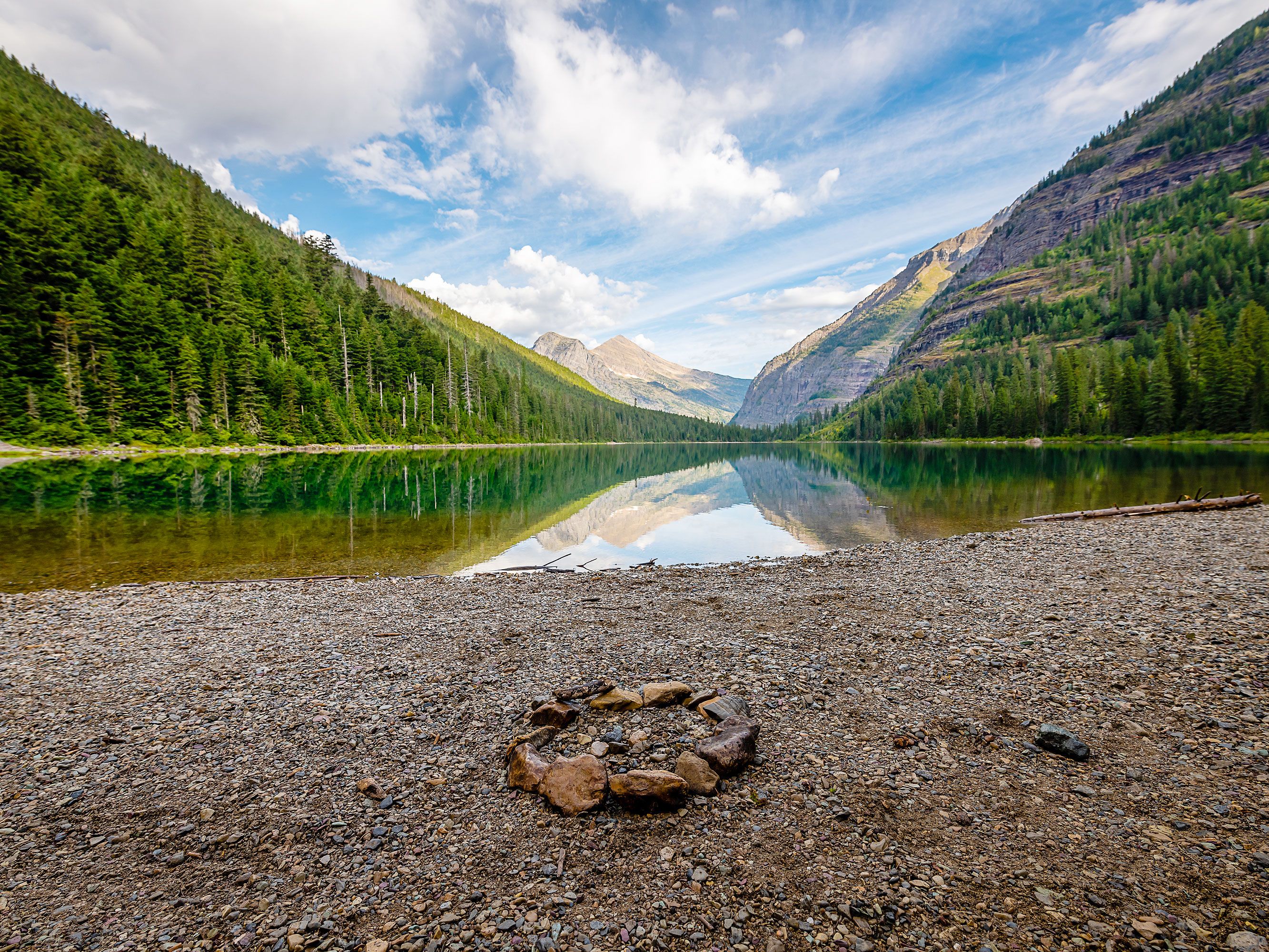
8. Sperry Glacier Falls, Montana – 2,300 feet

Glacial lake in Montana surrounded by mountains and forest
Photo credit: Chris LaBasco/ Shutterstock

Located in Montana’s Glacier National Park, Sperry Glacier Falls flows from Sperry Glacier down toward Avalanche Lake. Fed by the glacier’s melt, the waterfall has three distinct drops, each interspersed by sections of rock and boulder cascades. The lower section of the waterfall drops over the same cliffs as Monument Falls, which often cause confusion in distinguishing the two. Visitors can hike through virgin forests to Avalanche Lake to get views of the cliffs down which both waterfalls plunge. 

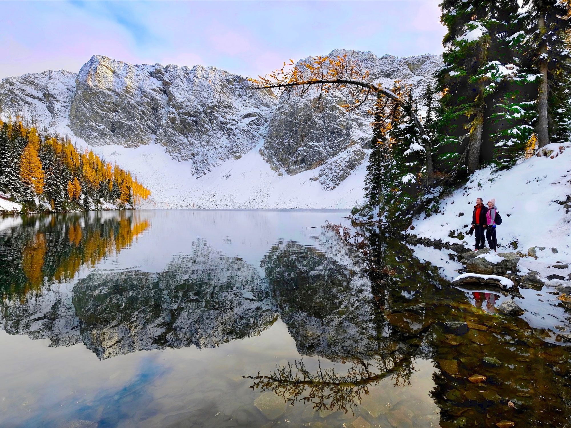
7. Cloudcap Falls, Washington – 2,400 feet

Image of Cloudcap Peak reflecting on lake in North Cascades National Park, Washington
Photo credit: Marina Poushkina/ Shutterstock

A small glacier below Cloudcap Peak on Mount Shuksan marks the start of Cloudcap Falls. Much of this waterfall in North Cascades National Park is concealed by bedrock, making it difficult to see from ground level. Observing it is usually only possible by air — the same applies for the adjacent Sulphide Creek Falls. The waterfall flows strongest during the snowmelt season in spring; by late summer it’s often almost completely dry. 

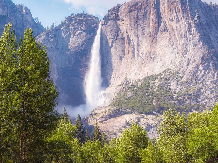
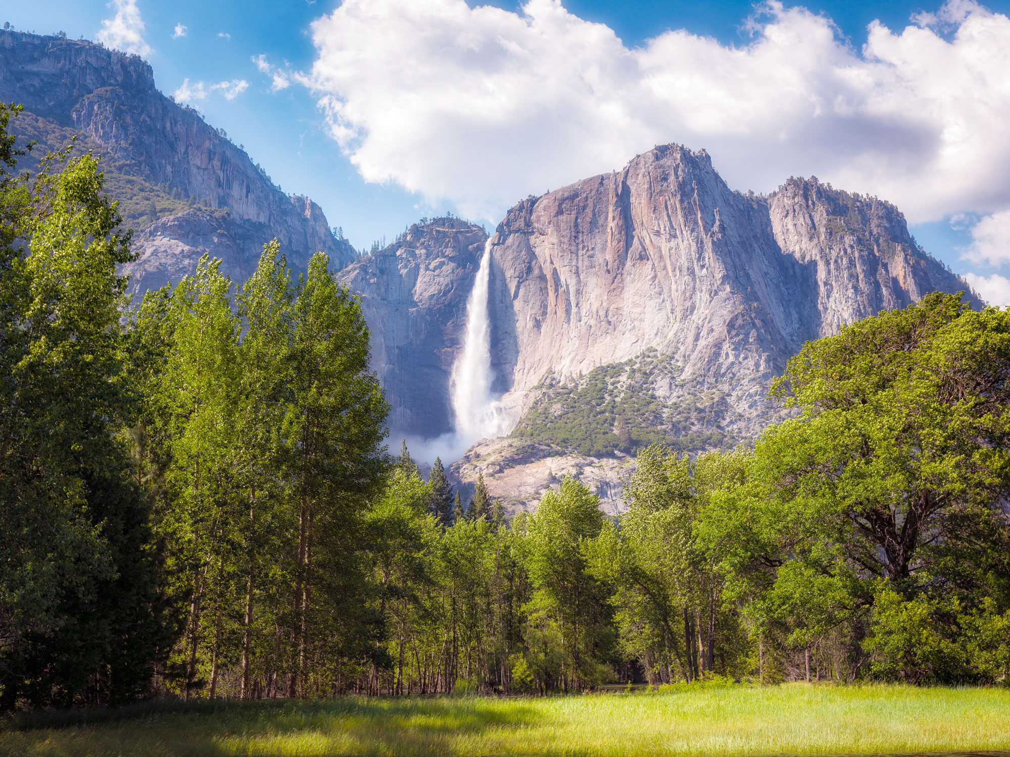
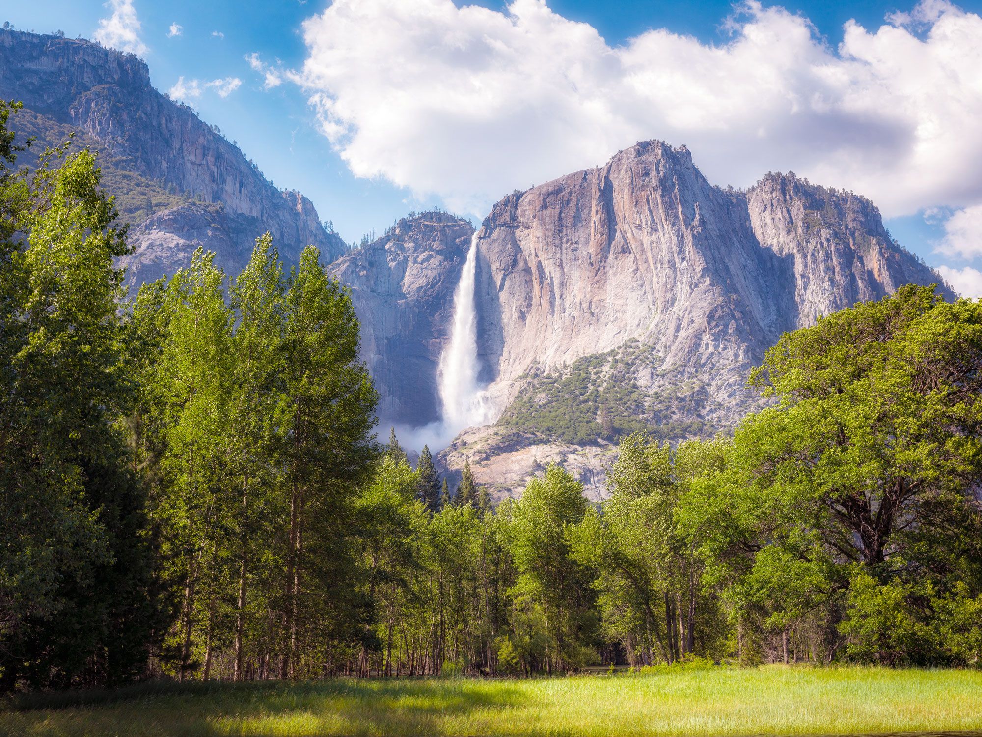
6. Yosemite Falls, California – 2,425 feet

View of Yosemite Falls in the distance
Photo credit: Mike Ver Sprill/ Shutterstock

Nestled amid the Sierra Nevada range, Yosemite National Park is characterized by steep mountain slopes and looming granite monoliths. When the winter snow melts, water flows through gaps in the mountains to the valley floor, creating dozens of waterfalls. One of these is Yosemite Falls, which is made up of three separate cascades: Upper Yosemite Fall (at 1,430 feet tall), the middle cascades (675 feet), and Lower Yosemite Fall (320 feet). Together, these waters flow from November to July, with peak visiting time from April to June. Scenic trails loop around the lower falls and to the summit. 

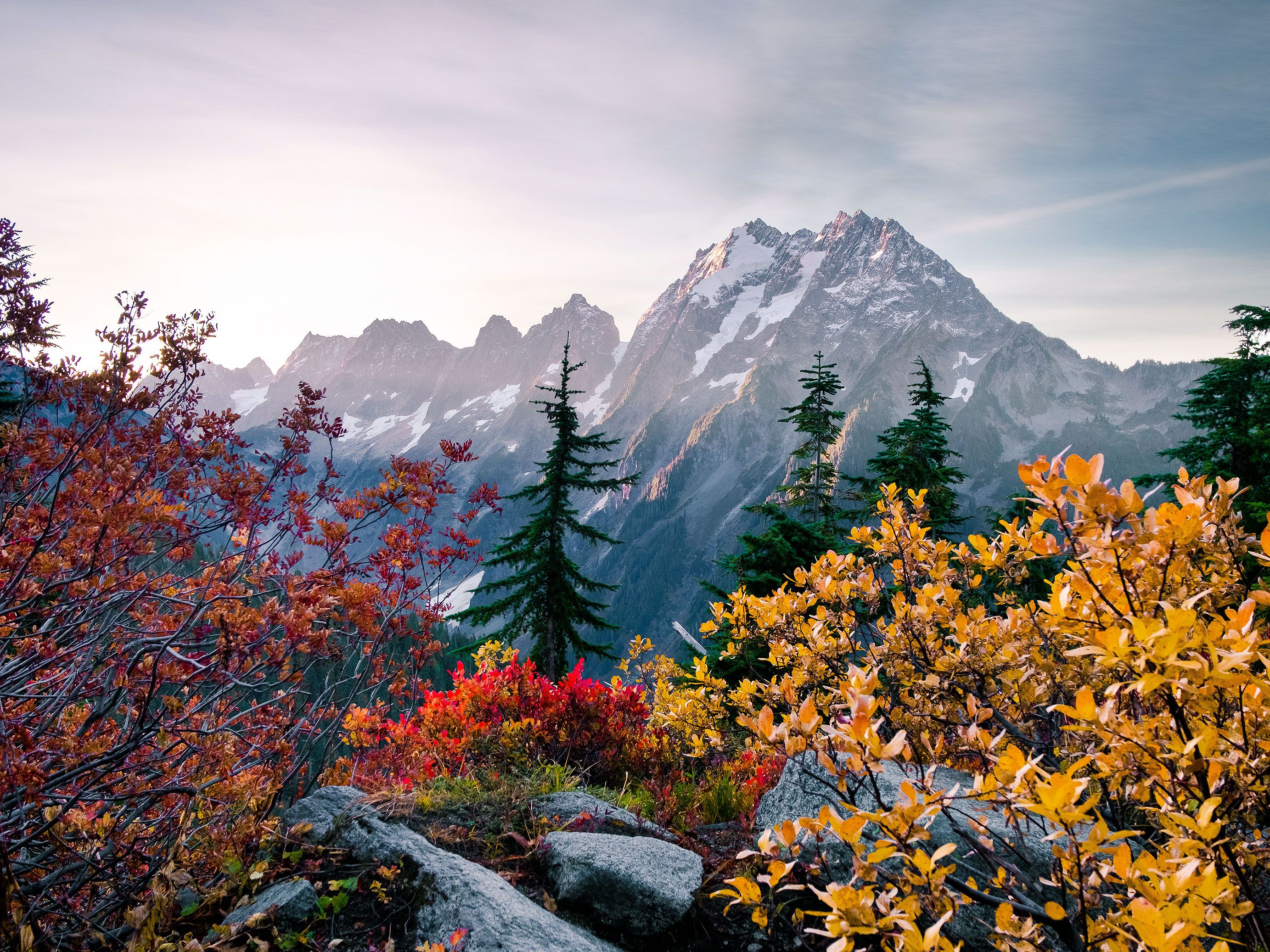
5. Johannesburg Falls, Washington – 2,465 feet

View of Johannesburg Mountain in Washington in the distance
Photo credit: Tobin Akehurst/ Shutterstock

When the snowmelt streaming off the glaciers in North Cascades National Park starts flowing towards Johannesburg Mountain, it converges at the peak to form Johannesburg Falls. This striking cascade has five drops, the biggest of which features a freefall of around 800 feet. June through October is when the flow rate is heaviest and most impressive, and one of the best spots to witness it is the Cascade Pass Trailhead. Those looking for more outdoor adventure can embark on a day hike toward Cascade Pass, where you’ll traverse pass falling ice from glaciers, yellow glacier lilies, and views of Mount Rainier. 

4. Colonial Creek Falls, Washington – 2,568 feet

Mountainous landscape of North Cascades National Park, Washington
Photo credit: Andrew Bertino/ Shutterstock

Also situated in North Cascades National Park is the tallest waterfall in the lower 48. Colonial Creek Falls begins as a meltwater lake at Colonial Glacier and features 13 drops that fall a total of 2,568 feet. There are several ways to experience the beauty of the falls and encompassing snow-capped peaks, including Ross Dam Trailhead Viewpoint and Thunder Arm Bridge Viewpoint. The Colonial Creek Falls Trail is a challenging route that passes by the picturesque Pyramid Lake and cuts through dense forests for a more up-close view of the falls. 

3. Waihilau Falls, Hawaii – 2,598 feet

View of Waihilau Falls in Hawaii surrounded by lush greenery
Photo credit: stockstudioX/ iStock

Hawaii’s Big Island is the location for the first of three Hawaiian waterfalls to make the list of America’s tallest cascades. Waihilau Falls consists of three separate falls that flow into the Waihilau River. Surrounding the falls are postcard-perfect landscapes marked by rainforests and towering cliff faces which are rarely visited by the average tourist. Intrepid hikers can discover this secluded and unspoiled natural attraction via a series of difficult trails and ascents

2. Pu’uka’oku Falls, Hawaii – 2,756 feet

Hiking trail by like in Hawaii
Photo credit: Joe Belanger/ Shutterstock

Pu’uka’oku Falls is the second waterfall in the list situated on the rugged northeastern coast of Hawaii’s Molokai island. Plunging from the sheer Haloku Sea Cliffs into the Pacific Ocean, it’s fed by seasonal streams that fill up during the island’s rainy season from November to March. The waterfall displays a narrow curtain that cuts through the cliff’s thick and lush vegetation. During periods of high winds, the fall rarely reaches the ocean; instead the water begins to rise up again just above the surface. 

1. Olo’upena Falls, Hawaii – 2,953 feet

View of small waterfall in Hawaii
Photo credit: pick-uppath/ iStock

The tallest waterfall in the United States, Olo’upena Falls is another majestic sight along the three-mile-long stretch of the Haloku Sea Cliffs on the island of Molokai. Just a short distance to the west of Pu’uka’oku Falls, Olo’upena is a multitiered cascade that appears during the rainy season. Its thin veil of whitewater contrasts spectacularly with the surrounding greenery. Like the other falls on Molokai’s northeastern coast, it’s inaccessible by foot — tourists wanting to glimpse its beauty can do so via boat or helicopter tour.