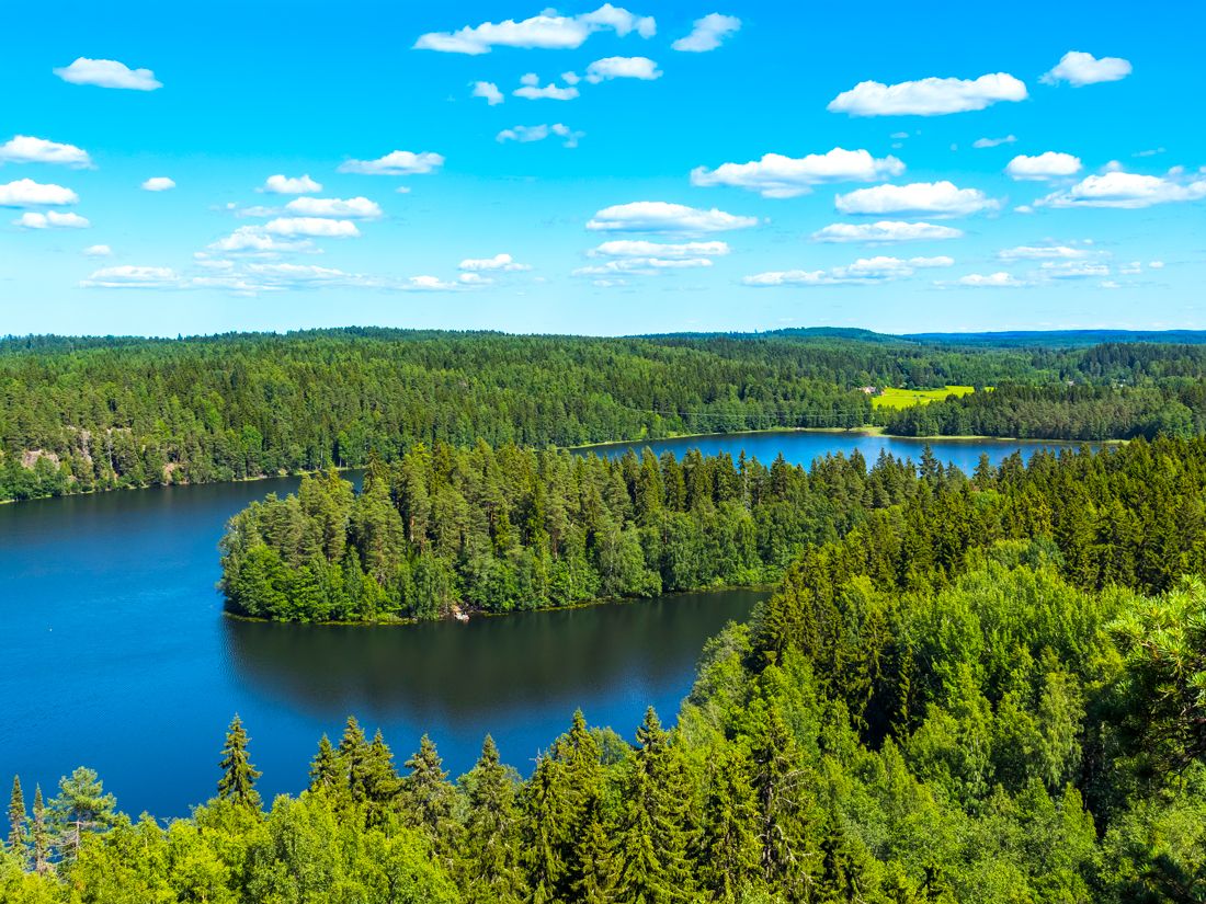
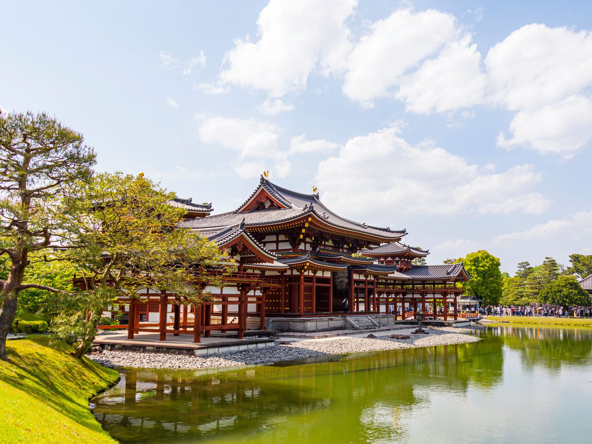
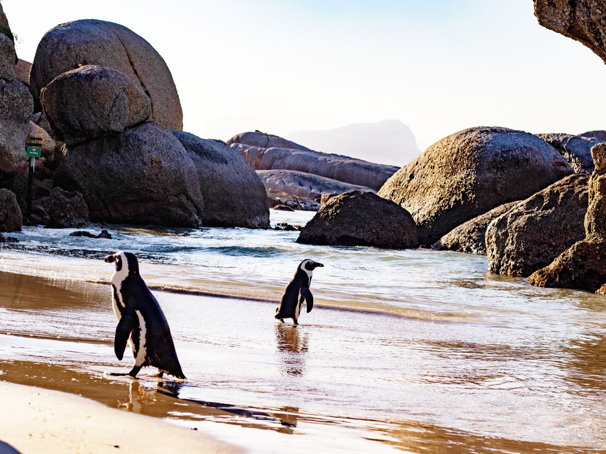
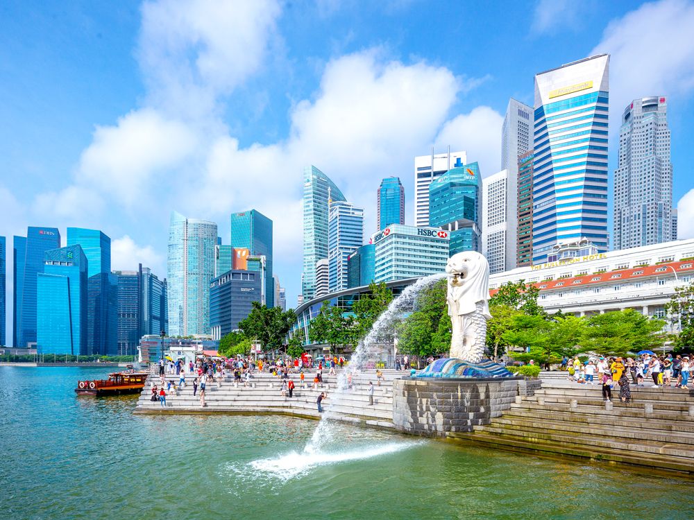
When most people think about islands, they picture pristine beaches with swaying palm trees, clear blue water, and abundant sunshine. While there are plenty of islands that fit that description, there are also islands that provide another kind of allure — ones home to animals that you’d never expect to find. Discover eight islands with unique animal populations, from monkeys to pigs, cats, and tree kangaroos.
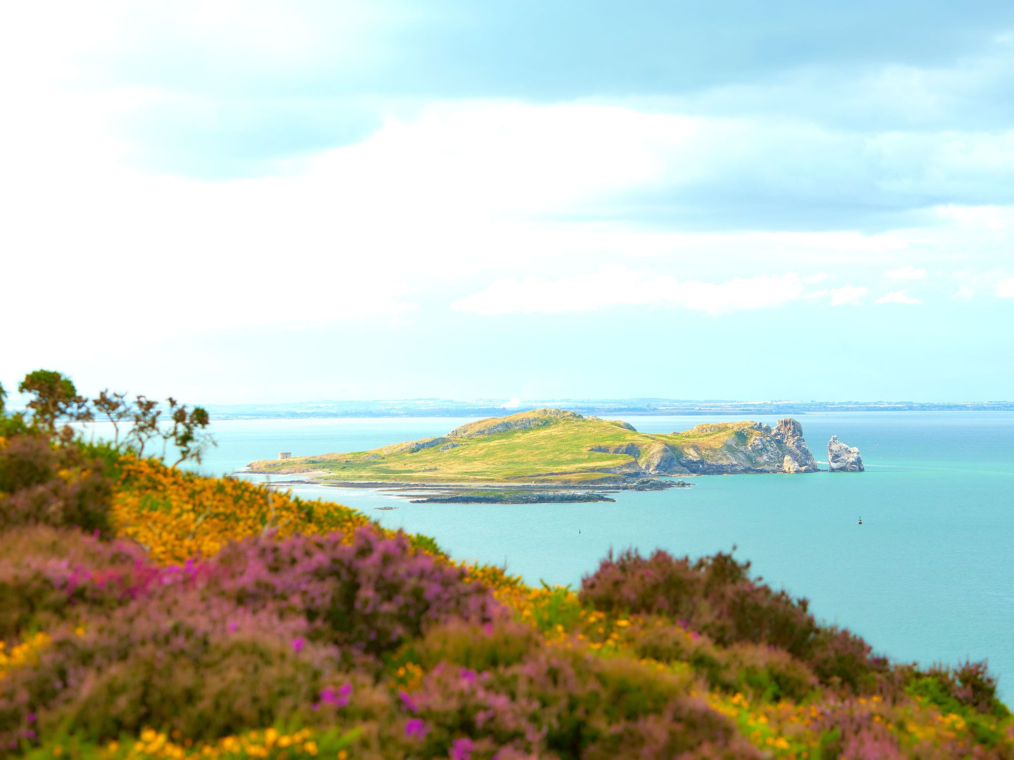
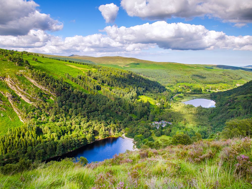
If you happen to meet someone in an Irish pub who tells you about a large group of wallabies living off the coast of Ireland, it’s not just a tall tale or the Guinness talking. Though wallabies are native to Australia, a “mob” (the term for a group of the marsupials) have taken up residence on the privately owned Lambay Island, 2.5 miles off the coast. The wallabies have been here since the 1950s, when the wealthy Barings family who own the island introduced them from Australia. The population took off when the Dublin Zoo, which had a surplus of wallabies, shipped them over to the island in the 1980s. There are anywhere from 60 to hundreds of them living there today — but as they’ve never been tagged and are good at hiding, getting an official count is unfeasible.
The rugged conditions on the island proved ideal for the adorable creatures. Thought temperatures are often much cooler here than in their native home, to compensate, the Lambay Island population started growing dense coats of fur. In the winter months — when grass, roots, and plants are less plentiful — they join the island’s cows, feasting on hay. The island can be visited on a day trip by boat, and overnight stays are available in a private cottage.
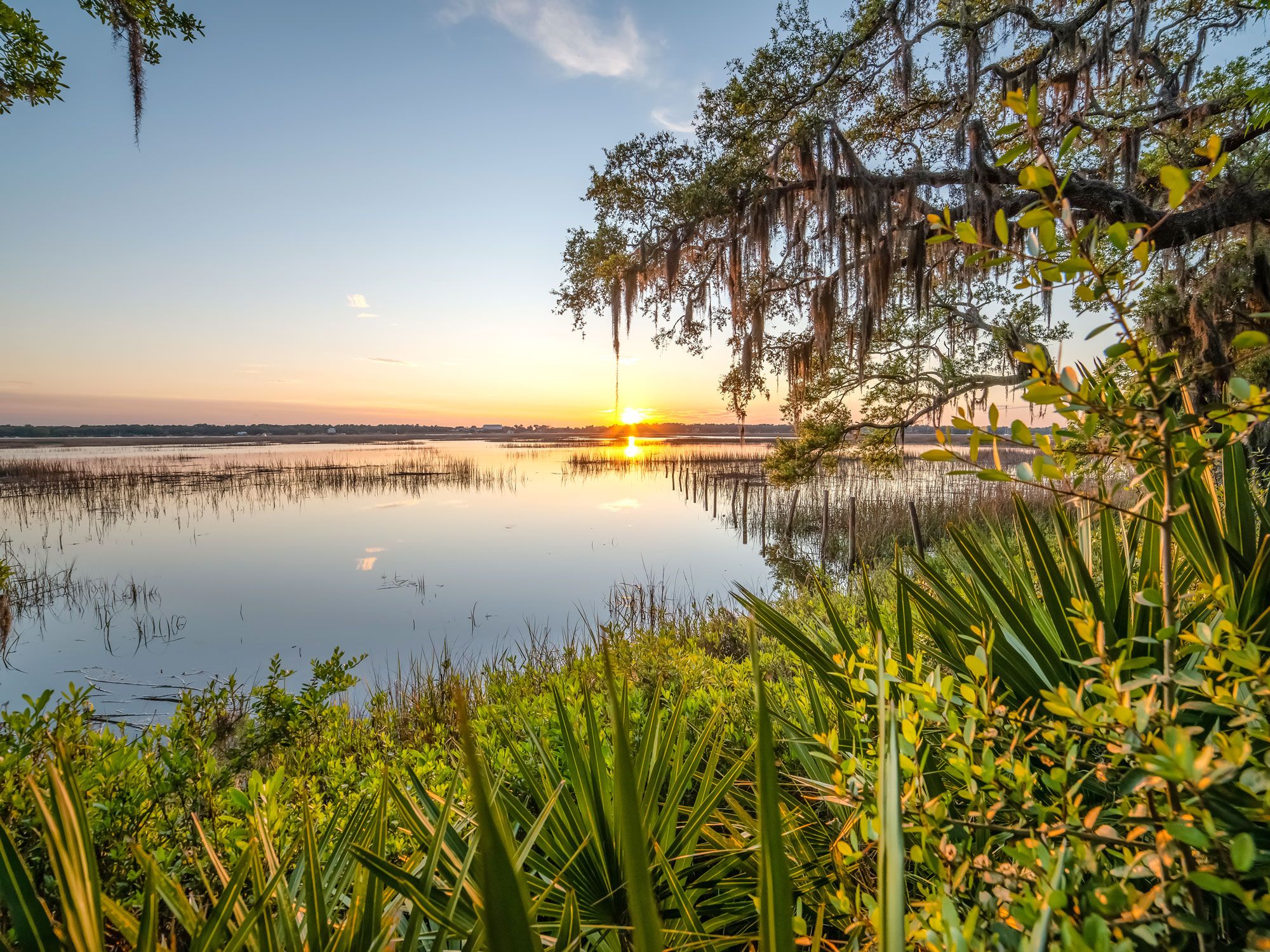
Morgan Island, also known simply as Monkey Island, is nestled off the coast of Beaufort in South Carolina’s St. Helena Sound. But this isn’t a place to sunbathe on the sand — it’s strictly for monkeys, with around 3,500 of them who live here. This unusual colony began when 1,400 rhesus monkeys arrived from a Puerto Rican research center in 1979, brought here by the U.S. government to establish a self-sufficient breeding program after India banned the exportation of research animals.
Since 2002, the 370-acre island has belonged to the South Carolina Department of Natural Resources, although the colony of monkeys is owned by the National Institute of Allergy and Infectious Diseases. Private companies are contracted to care for the monkeys, and there is no research conducted on the island. Instead, the monkeys are sent to researchers who are working on medical treatments and vaccines.
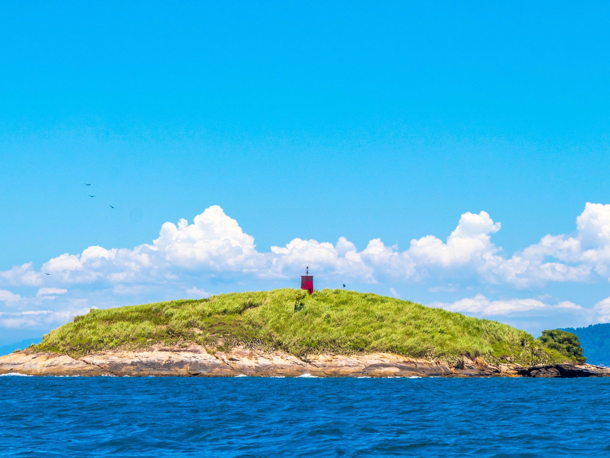
Ilha da Queimada Grande is more commonly known as Snake Island. Located off the coast of Sao Paulo in southeastern Brazil, the small, uninhabited island is home to nearly 4,000 golden lancehead vipers, which don’t exist anywhere else on the planet and are one of the world’s deadliest snake species. Their venom can kill a person in less than an hour. While several people once lived on the island in the early 1900s in order to run the lighthouse, that’s no longer the case today. The Brazilian government strictly controls visits to Snake Island, but, for obvious reasons, it’s unlikely to attract many visitors.
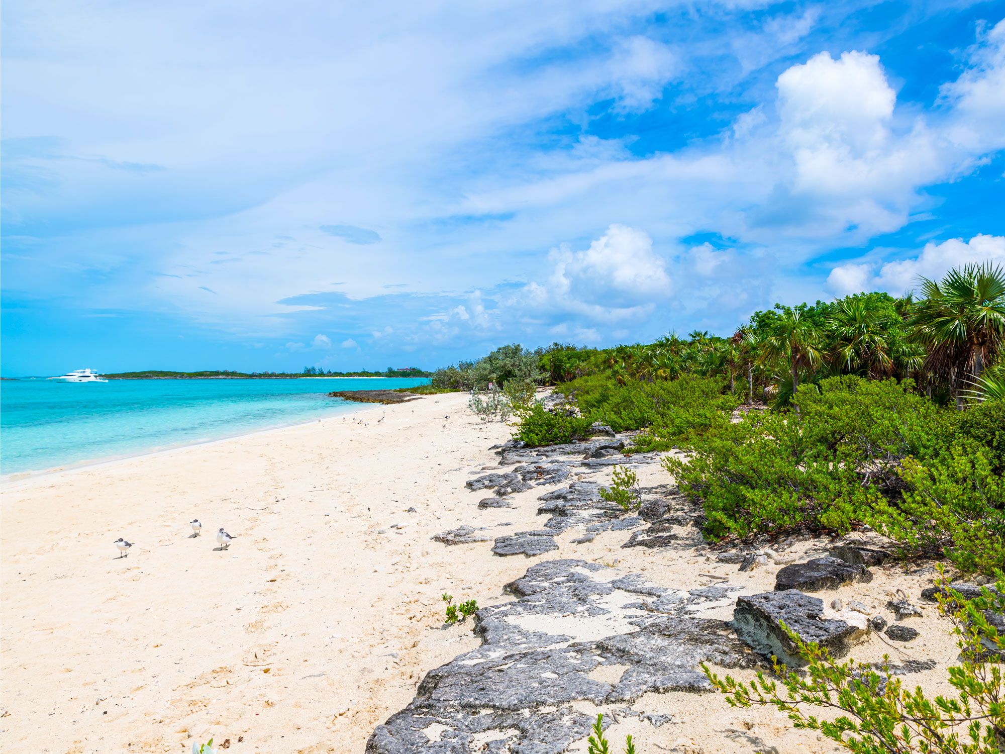
Pig Beach on Big Major Cay, one of the uninhabited Exuma Islands, takes its name from its population of feral pigs. It’s become an Instagram hotspot, with countless photos posted of the pigs lounging on the sand and swimming through the translucent blue waters.
In addition to capturing photos of the animals, visitors come to swim with the pigs. As the sandy beach can only be accessed by boat, it requires chartering a boat or taking a guided tour. The porky, four-legged creatures delight in being fed by visitors, so they’re more likely to approach humans who feed them. While feeding is permitted, it’s best to stick to pitted fruits and veggies to support the pigs’ health.
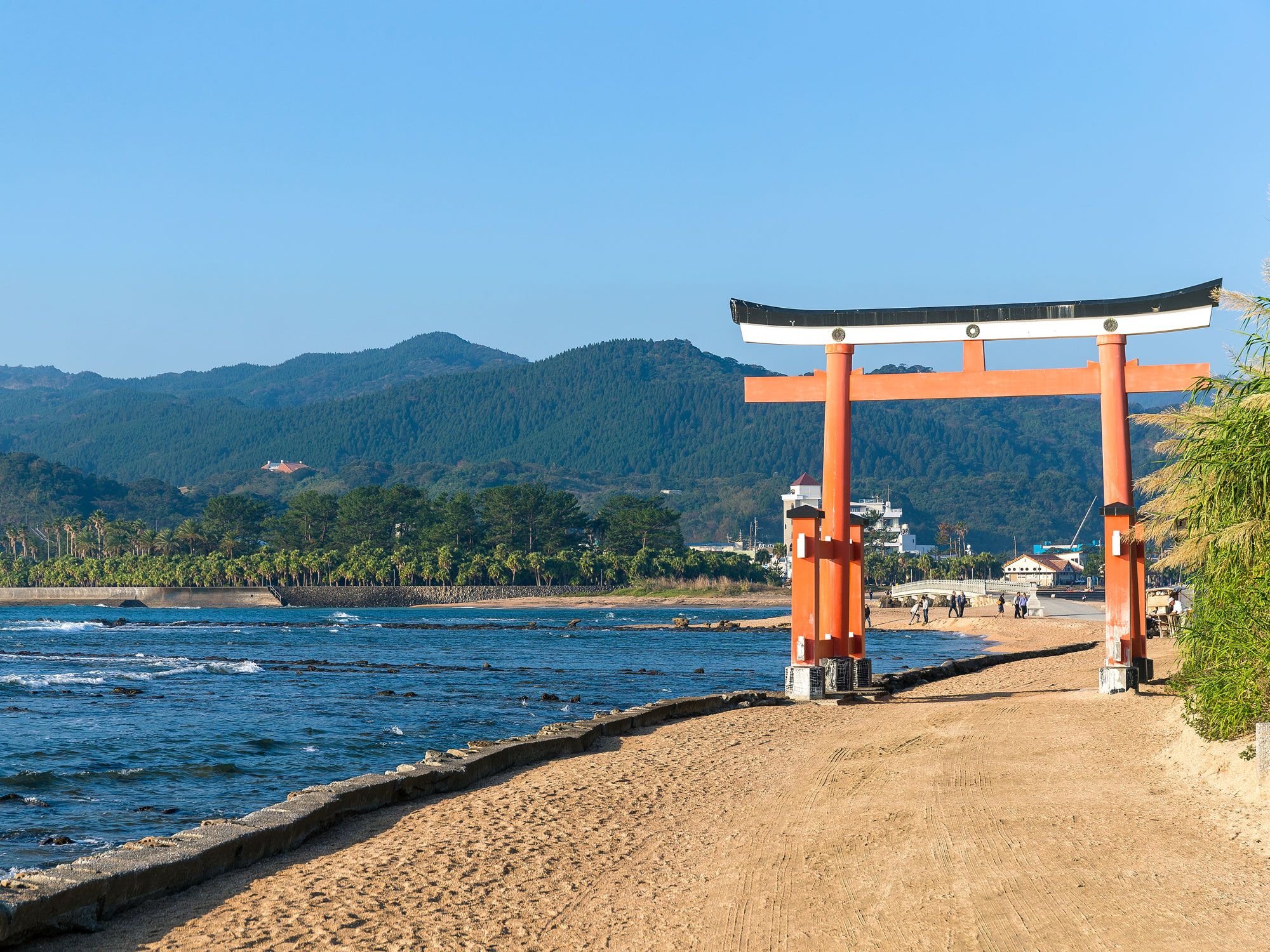
Feline lovers are heading in droves to Aoshima, now better known as Cat Island. On this tiny, sleepy island in the Ehime Prefecture of Japan, just off the coast of Miyazaki, the cats outnumber the human residents by about 10 to one. The one-mile-long island is home to just 13 permanent human residents, most of them over the age of 75, and 130 cats. The cats were originally brought in to solve the island’s problem with mice that were attracted to the silkworms used to make silk for fishing nets. Needless to say, there is no longer an issue with rodents on Aoshima, but you will be swarmed by felines should you arrive with cat food in hand.
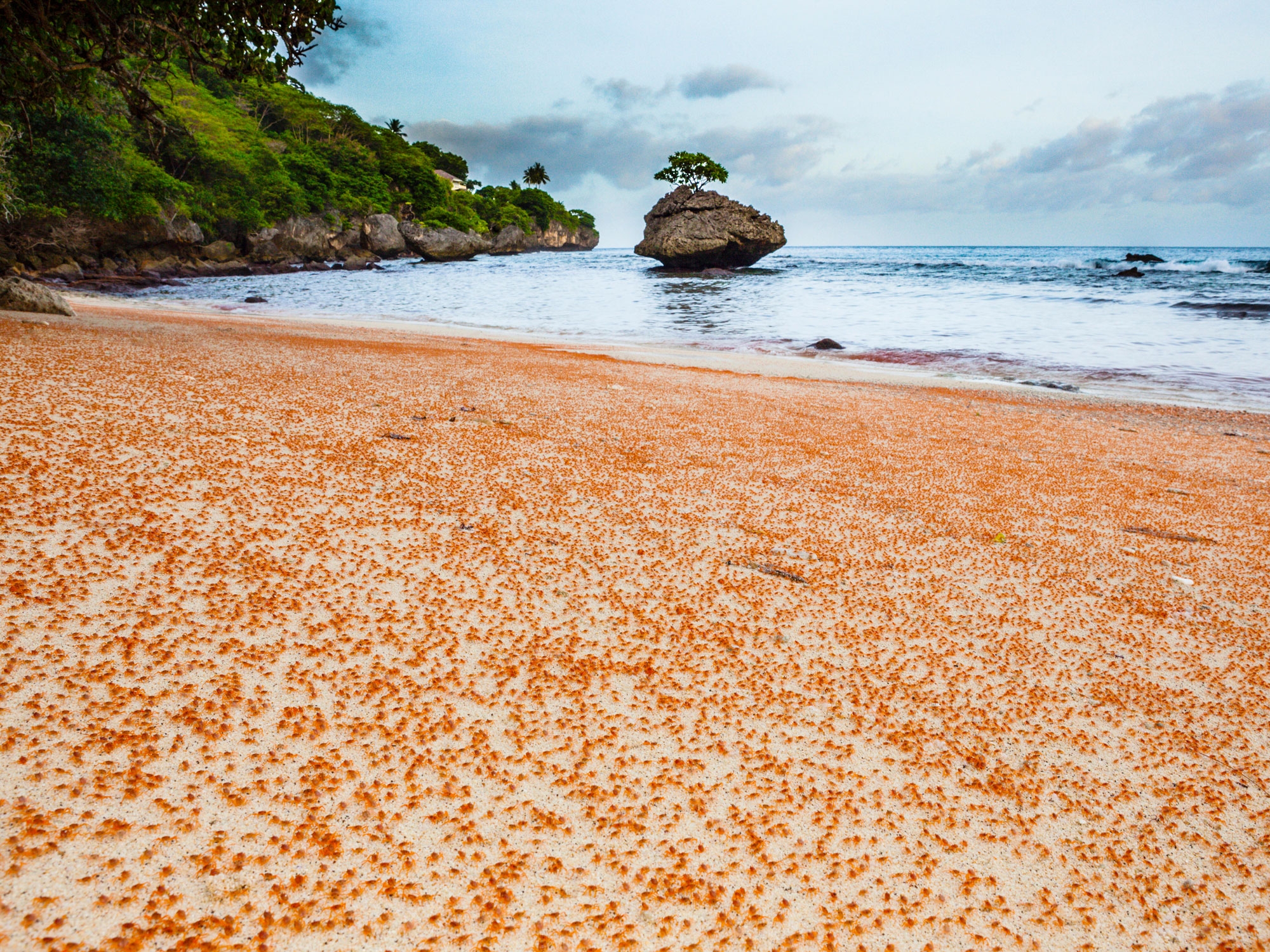
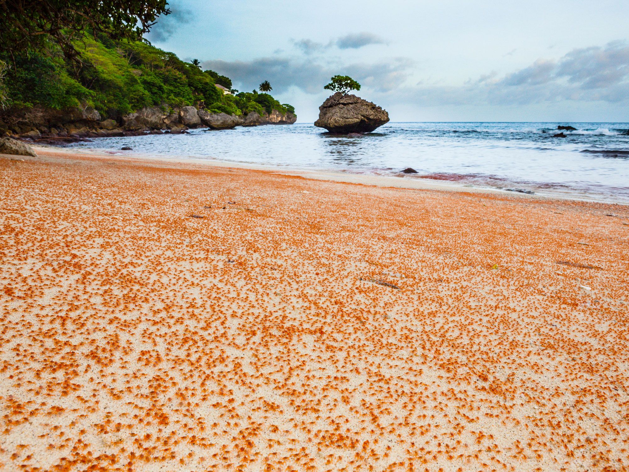
Located in the Indian Ocean, about 900 miles west of the Australian mainland, Christmas Island is an Australian territory. However, its nearest neighbor is Indonesia, located 200 miles north. Nicknamed the “Galápagos of the Indian Ocean,” Christmas Island is famous for its whale sharks, sea birds, magnificent coral reefs, and — in particular — its red crabs.
There are few spectacles more jaw-dropping than the sight of some 50 million of these crabs scuttling towards the sea in their annual migration. In fact, there are so many of the creatures that a moving carpet of red blankets the landscape as the animals emerge from burrows, gardens, parks, and rocky outcrops. The migration, which is linked to the phases of the moon and sea levels, begins during the first rainfall of the wet season — which is typically in October or November, though some years it may not occur until January. Across Christmas Island, every red crab leaves its home at the same time to start marching toward the ocean to mate and spawn.
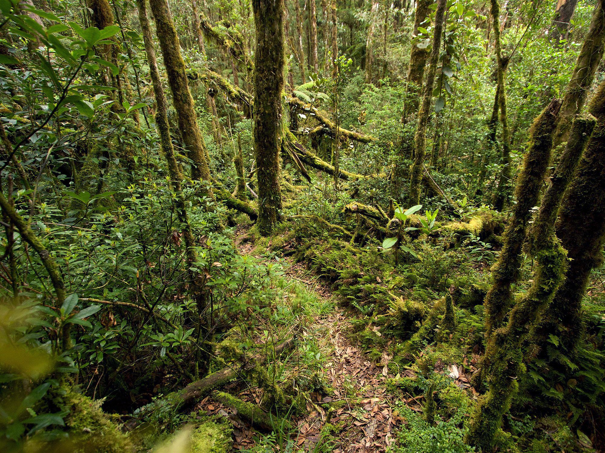
The Huon Peninsula of northeastern Papua New Guinea is the only place in the world where you’ll find Matschie’s tree kangaroos. These cute creatures — which look more like teddy bears that have come to life than kangaroos — live high in the island’s mountainous cloud forests, with their treetop homes often stretching as high as a 10-story building. Like kangaroos, they’re great jumpers, easily bounding up to heights of 60 feet. Sadly, there are estimated to be less than 2,500 living in the wild, threatened by unsustainable hunting practices.
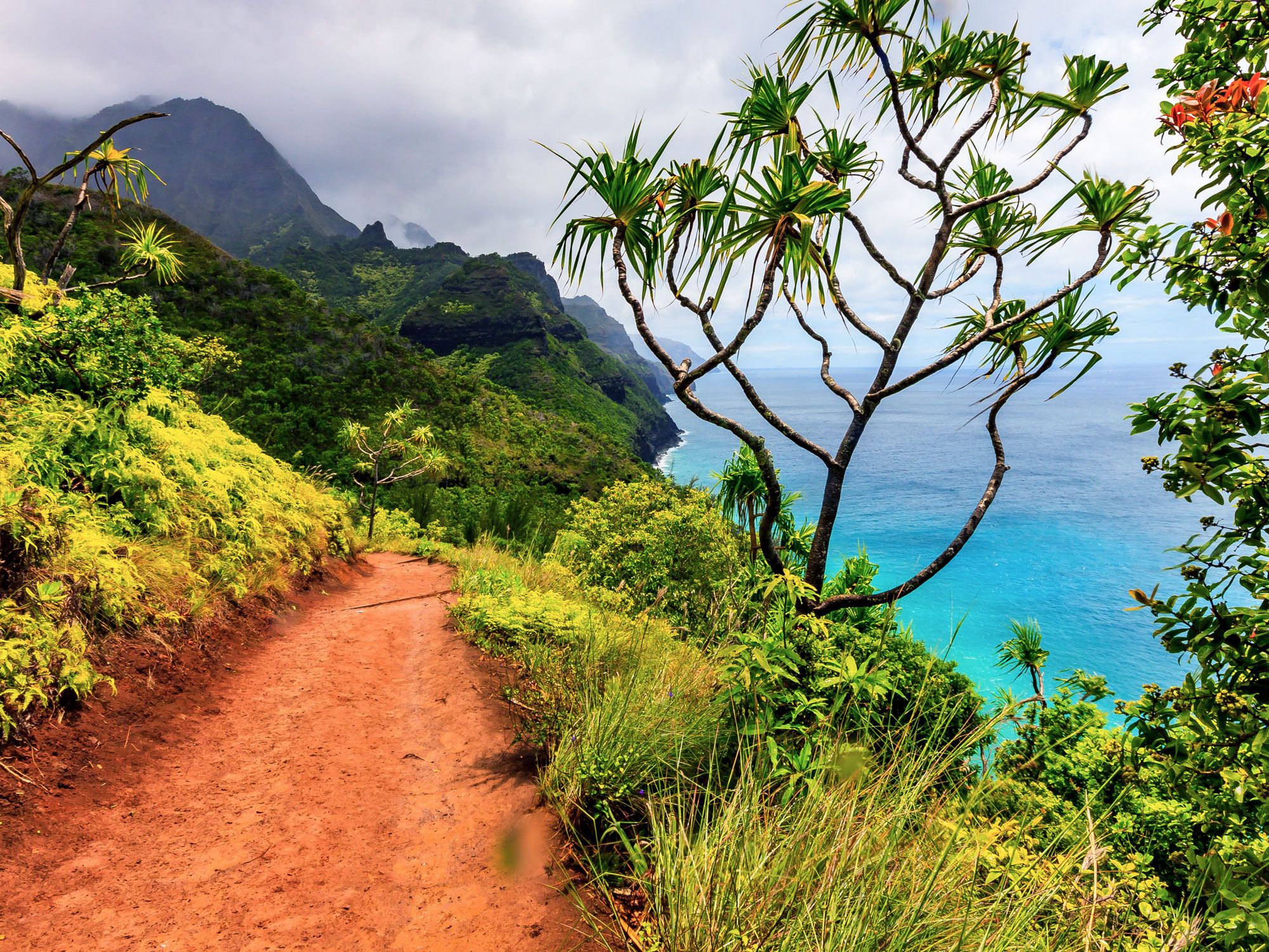
The moa might sound like an exotic creature, but that’s the name for chickens in the Hawaiian language. And if you’ve ever been to Kauai, you know that moas have taken over the island. There are estimated to be as many as 450,000 chickens roaming freely across the lush Garden Isle, which is home to only about 75,000 human residents.
You’ll see them walking downtown sidewalks, across beaches, through car parking lots, and just about everywhere else you go. The crows of the roosters are heard throughout Kauai on any given morning, providing a natural wake-up call. The birds, many of which have beautiful, bright-colored feathers, are a feral hybrid of domesticated chickens and the red junglefowl, believed to have been introduced by ancient Polynesians.
Advertisement
More from our network
Daily Passport is part of Inbox Studio, an email-first media company. *Indicates a third-party property.
Why Frida Kahlo’s Mexico City “Blue House” Should Be on Your Travel List
By
Nicole Villeneuve
Read time: 7 minutes
July 27, 2023
Updated: April 23, 2024
Why Frida Kahlo’s Mexico City “Blue House” Should Be on Your Travel List
Culture •July 27, 2023•Updated: April 23, 2024
By Nicole Villeneuve
Author
Nicole Villeneuve
Nicole is a writer and researcher with over 15 years of experience seeking out arts, culture, and lifestyle stories in places like remote northern Quebec and the unforgettable streets of Amsterdam. Her work has also appeared in PureWow, Brit + Co, AUX TV, and CBC.
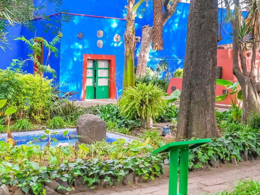
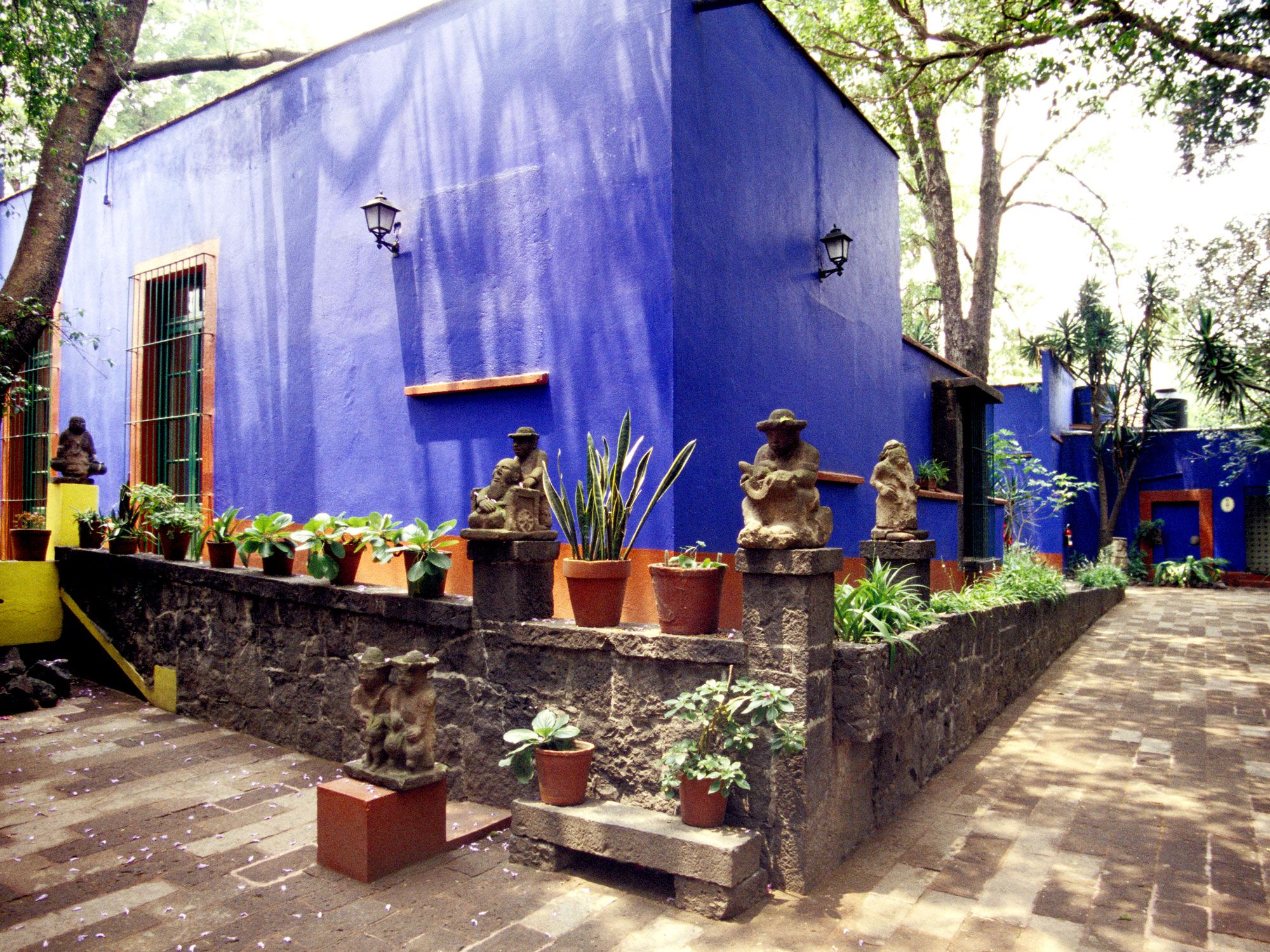
The Blue House — known locally as La Casa Azul — is more than just a museum in Mexico City. With its unmissable cobalt-blue color, it is the longtime home and final resting place of Frida Kahlo, one of Mexico’s most celebrated artists. Kahlo left an indelible mark on the art world with her vibrant and emotionally introspective works, many of which were painted in this family home. Now, as one of Mexico City’s most popular cultural institutions, the Frida Kahlo Museum offers visitors an intimate opportunity to delve into the artist’s life and her enduring legacy. Below, learn the fascinating story of Kahlo’s life in the Blue House and how to visit this must-see Mexico City attraction.
An Artist Is Born
Magdalena Carmen Frida Kahlo y Calderón was born in 1907 in her family’s home, the residence now famously known as the Blue House. At just six years old, Kahlo was struck with polio. It was the first of many health setbacks that would plague her most of her life — and also greatly influence her artwork. The illness not only disrupted her childhood, sending her to recover in bed for nine months, but also permanently injured her right leg and foot, leaving her with chronic pain and reduced mobility.
During this isolated time, Kahlo spent many hours with her father, photographer Guillermo Kahlo, and found herself drawn to his artistic pursuits. Although she began sketching at a young age, Kahlo was more interested in the sciences and instead dreamed of studying medicine. In 1922, she was selected for Mexico City’s esteemed National Preparatory School. During her time here, Kahlo crossed paths with Diego Rivera, a renowned Mexican artist who had been commissioned to paint a mural at the school. The encounter marked the beginning of the pivotal roles they would play in each other’s lives.
At the age of 18, Kahlo’s dreams of a career in medicine were put on hold when she was involved in a serious bus accident. She suffered several severe injuries and would endure some 32 surgeries as a result. Kahlo’s long and painful recovery period led to more exploration of her artistic side, and she started painting to pass the time in bed at her family home. Her mother hung mirrors in her room, and Kahlo began to paint herself, including her first of many self-portraits, 1926’s Self Portrait in a Velvet Dress. The artwork — one of several now displayed at the Frida Kahlo Museum — depicts the artist set against a dark background of swirling waves; the stoic gaze that later became characteristic of her art is already front and center. “I paint self-portraits because I am so often alone,” Kahlo once said, “because I am the subject I know best.”
Following months of recovery, Kahlo once again crossed paths with Diego Rivera, deciding to show him her paintings and seek his advice. Their relationship blossomed, and a year later, they married in 1929.
After marrying Rivera, Kahlo underwent a personal and professional transformation. She embraced traditional Tehuana clothing, which would become her signature look, reflecting her ideas about identity and also symbolizing her burgeoning artistic interest in Mexican folk art. In the early 1930s, as Kahlo traveled the United States with Rivera, she suffered several difficult pregnancies that tragically ended prematurely. These experiences, coupled with the loss of her mother in 1932, inspired some of her most raw and poignant works, including Henry Ford Hospital‘ (1932) and My Birth (1932).
In 1933, Kahlo and Rivera returned to Mexico and moved into their newly constructed house and studio. Their new home became a gathering place for activists and intellectuals, including revolutionary Leon Trotsky when he was forced to flee the Soviet Union, and surrealist writer André Breton, who was a strong advocate for Kahlo’s work. However, by the late 1930s, following infidelities and other difficulties, Kahlo and Rivera’s relationship was strained, and they divorced in 1939. By 1940, however, the couple had reconciled, moving into Kahlo’s childhood home — and starting their life in the Blue House together.
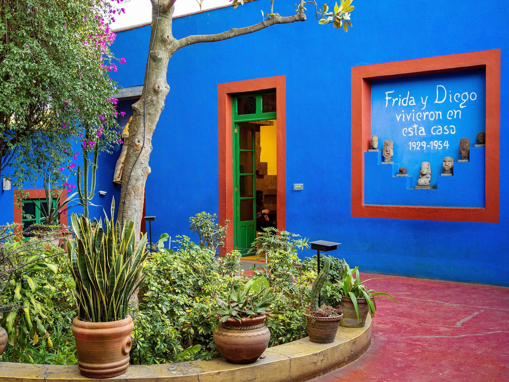
The Kahlo family home was built in the once-rural Coyoacan neighborhood in 1904, three years before Frida was born. Kahlo’s parents — father Guillermo Kahlo, a German-born photographer, and her mother, Matilde Calderón — originally designed the home with French influences, but Kahlo and Rivera later adapted and expanded it to resemble a more traditional Mexican style. The couple also gave the Blue House its signature cobalt color, painting the home in the early 1940s not only as a piece of Kahlo’s art, but to represent and honor the Indigenous peoples of Mexico.
For Kahlo, the Blue House was not just a house but a sanctuary — her “private universe” — that encapsulated her identity and creative spirit. The interior also came to represent her unique artistic vision: She adorned the walls with paintings of both hers and Rivera’s, and filled the rooms with her personal collection of Mexican folk art, ceramics, and religious artifacts.
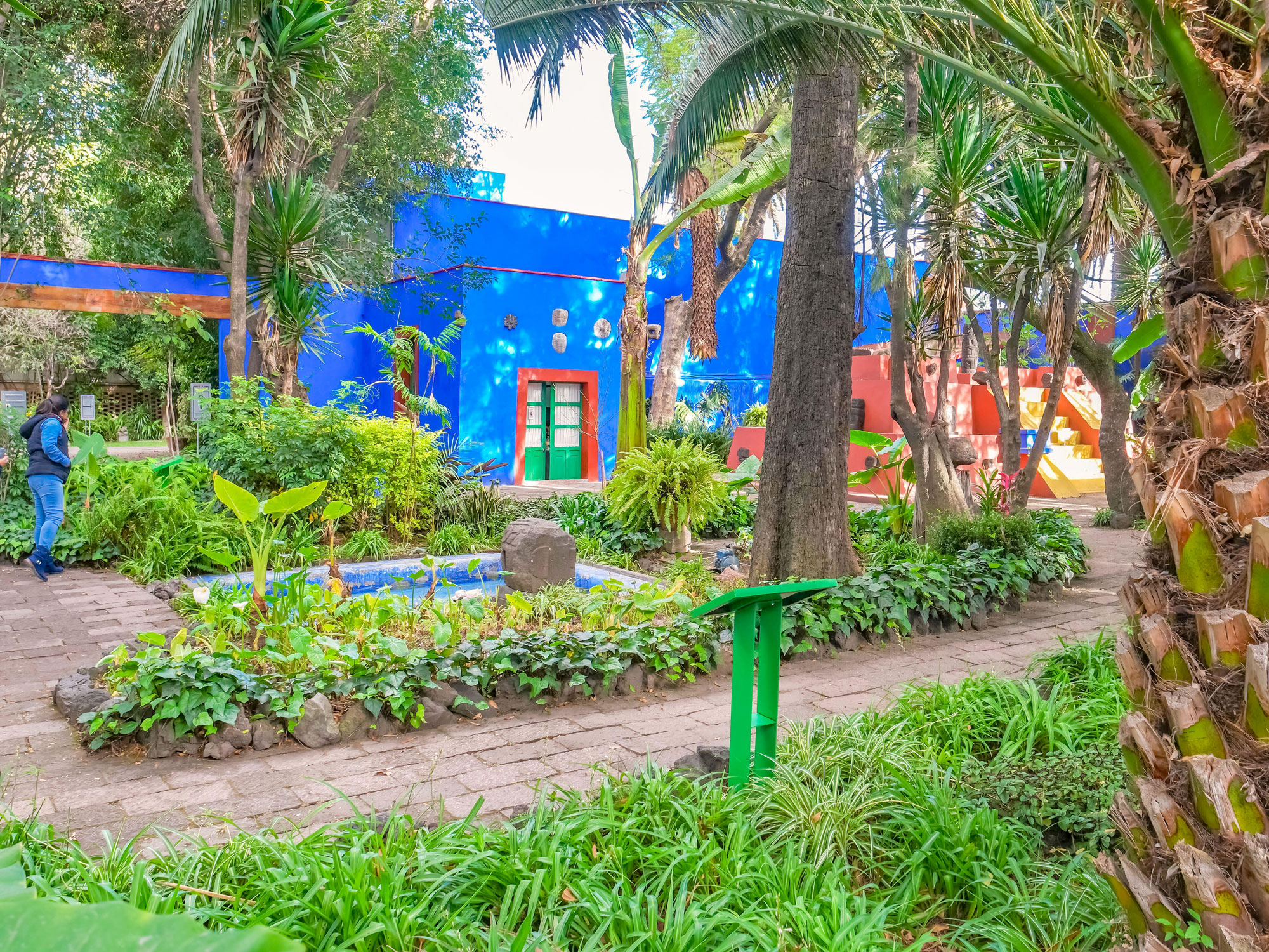
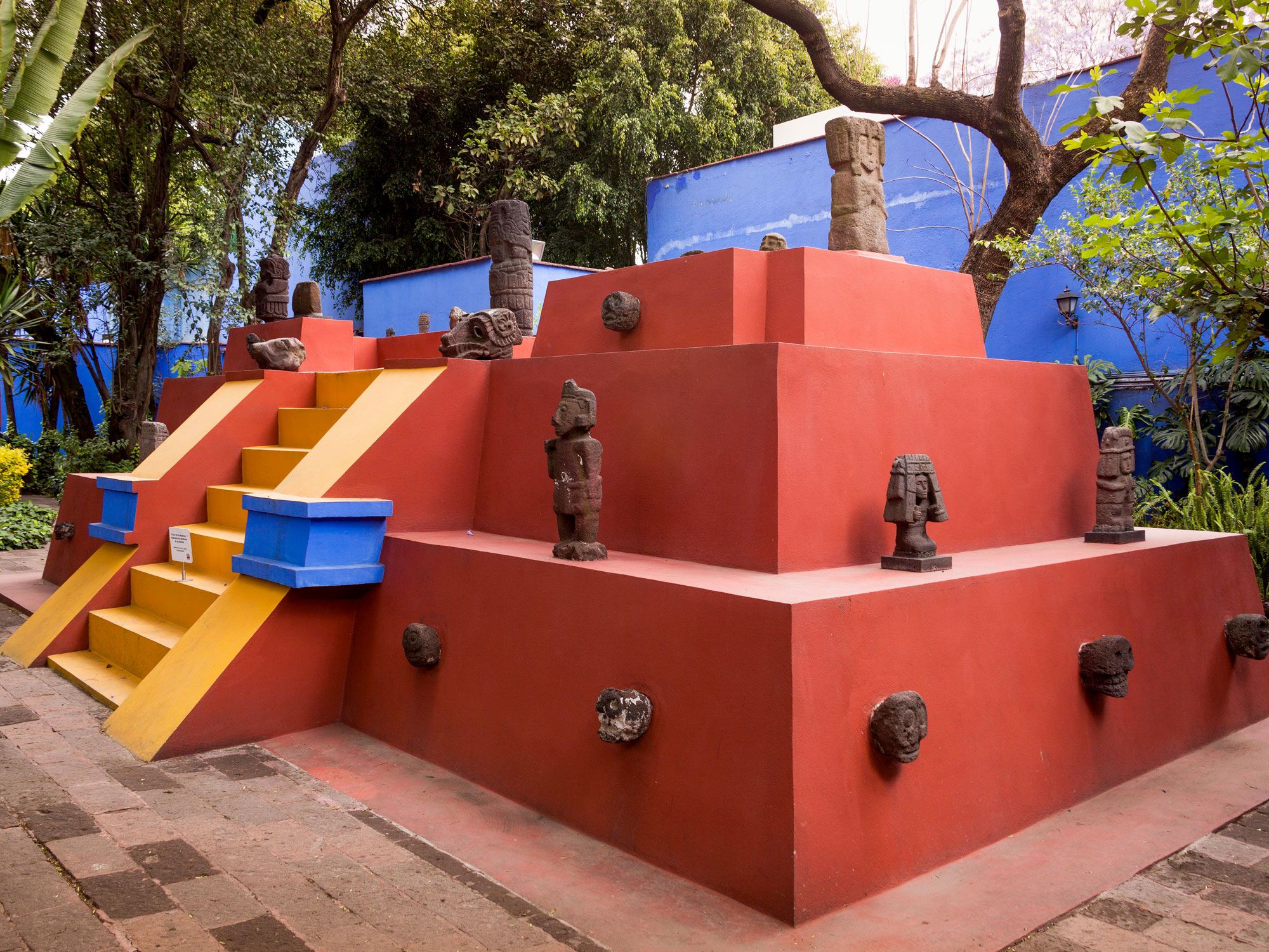
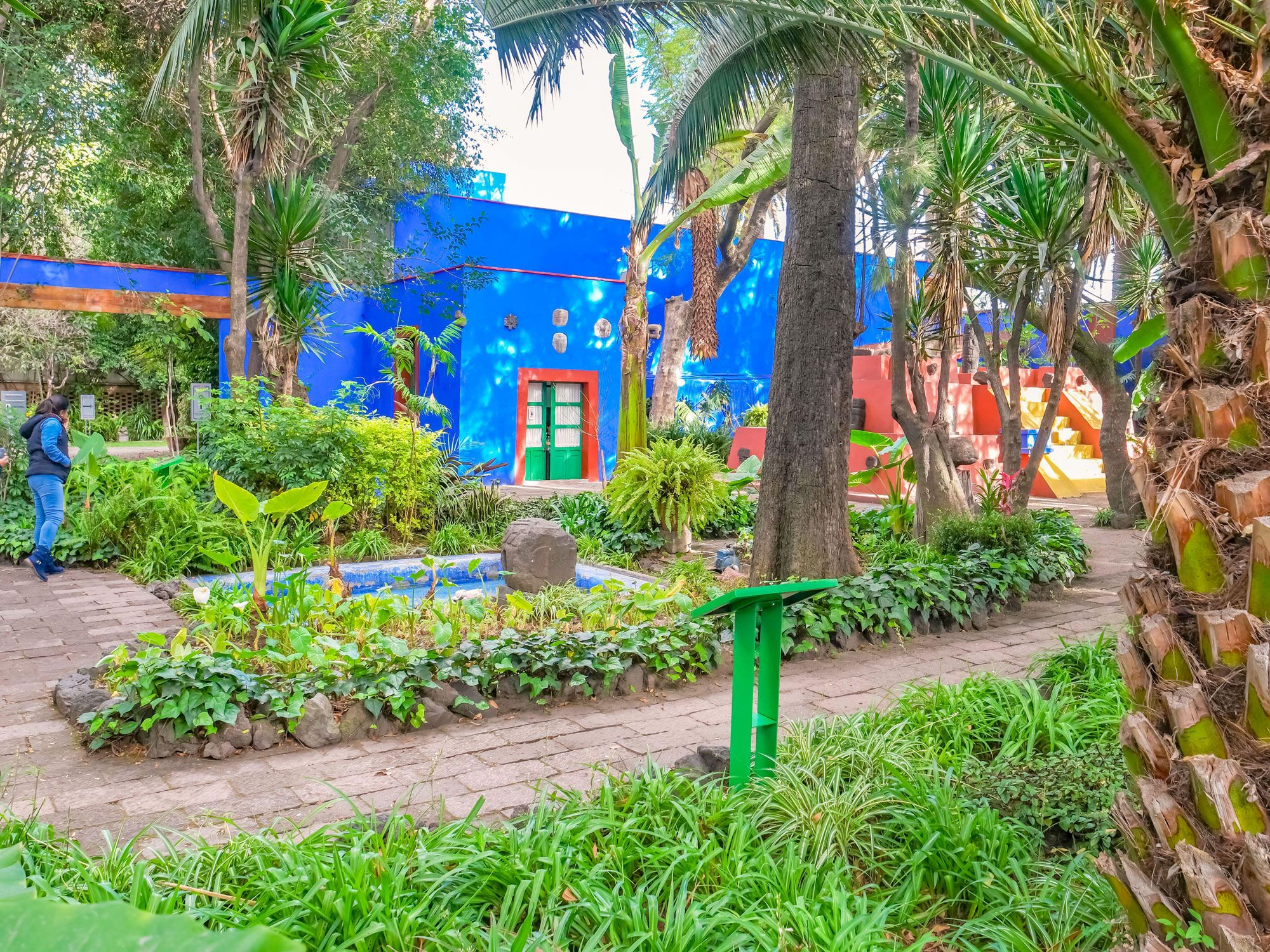
Kalho also replaced much of her parents’ roses and palms with native tropical and desert plants such as cacti, yucca, and canna-lily. This laid the groundwork for Kahlo and Rivera’s courtyard filled with pre-Columbian sculptures, now one of the museum’s highlights. For Kahlo, the garden served a purpose beyond decoration or entertainment — she saw it as an integral part of her artistic expression and often incorporated the greenery into her paintings.
After Kahlo’s death in 1954, Rivera worked on turning the Blue House into a museum to honor Kahlo’s memory and showcase her work. It opened in 1958, a year after Rivera’s own death. Today, the Blue House allows visitors to explore these intimate spaces — a rare opportunity to see where the legendary artist lived, loved, suffered, thrived, and created her exceptional art.
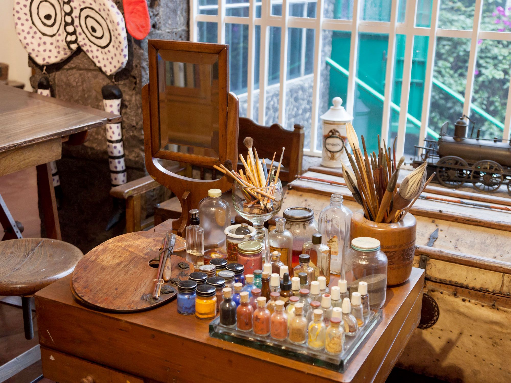
Remarkably, the Blue House remains practically frozen in time, preserved almost as Kahlo left it. It showcases a robust collection of her personal belongings and demonstrates the ups and downs of her complex life — from her iconic Tehuana dresses and corsets to other personal mementos such as letters, photographs, and many medical devices used throughout her years of ailments. Through these exhibits, visitors can discover how the Blue House became the backdrop for Kahlo’s profound self-exploration and artistic expression — and now, a living testament to her enduring legacy and impact.
The Blue House is one of the most-visited museums in Mexico City, welcoming about 25,000 visitors monthly, so it’s essential to plan out your visit in advance. The museum is closed on Mondays, as well as certain holidays. Tickets can be purchased online in advance, but it’s still likely you’ll wait in a long line to get in, as the number of people allowed inside at one time is limited. (Weekdays tend to be less busy.) The museum has a separate line for guided tour groups, another option to consider for a deeper dive into Kahlo’s life and artwork.
After taking in the ambiance of Kahlo’s living quarters, including her preserved studio space, visitors can explore the other rotating thematic exhibits. And don’t forget to bask in the lush courtyard garden, still immaculately preserved all these years later.
One key rule to visiting the Blue House is that photography is generally not allowed, unless you purchase a specific no-flash photography pass. Touching the exhibits and leaning on walls or any other part of the residence is not tolerated in order preserve Kahlo’s historic space.
A ticket for the Blue House also includes admission to its sister museum, the Anahuacalli, which was built by Rivera to house his collection of more than 45,000 pieces of pre-Columbian artifacts. A round-trip bus between the two museums is available.
After exploring the Blue House, take time to wander through the charming Coyoacan neighborhood. The Coyoacan Market, Frida Kahlo Park, and Leon Trotsky Museum are other attractions worth checking out nearby — they’re not only landmarks on their own, but together, they enhance the immersive Frida Kahlo experience of Mexico City.
Advertisement
More from our network
Daily Passport is part of Inbox Studio, an email-first media company. *Indicates a third-party property.
Bennett is a New York City-based staff writer for Daily Passport. He previously contributed to television programs such as the Late Show With David Letterman, as well as digital publications like the Onion. Bennett has traveled to 48 U.S. states and all 30 Major League Baseball stadiums.
The Big Apple is one of the world’s most popular places to visit. As America’s largest metro area, New York City contains five distinct boroughs — Manhattan, Queens, Brooklyn, the Bronx, and Staten Island. These five boroughs not only have their own presidents and local government, but they also boast their own unique cultural heritage. The differences between the various boroughs and neighborhoods within them are part of what makes New York such a fascinating city to so many. Have you visited all five boroughs? Dive into these interesting facts about each of the five boroughs of New York City.
History of the Boroughs of New York City
Credit: Michael Lee/ Moment via Getty Images
The history of New York City dates back to the arrival of Dutch settlers in the early 17th century, who called their settlement New Amsterdam. When the English took over, they renamed it New York, which has remained its permanent name since 1674. For centuries, the name “New York” only referred to the island of Manhattan, as places like Brooklyn, the Bronx, Queens, and Staten Island were all separate jurisdictions of their own.
During the 1800s, various proposals were floated to combine these five distinct regions into one giant metropolitan area. Proponents of the idea believed it would help the city run more efficiently — and that this new “mega city” would become the economic and cultural center of the entire nation.
A majority of locals were in favor of the idea, though, notably, many residents of Brooklyn worried that it would negatively affect their idea of regional identity. Finally, in 1894, the consolidation proposal was put up for a vote, and it passed with 177,043 votes in favor and 133,309 against. On January 1, 1898, the City of Greater New York was officially formed with its five distinct boroughs that we know today.
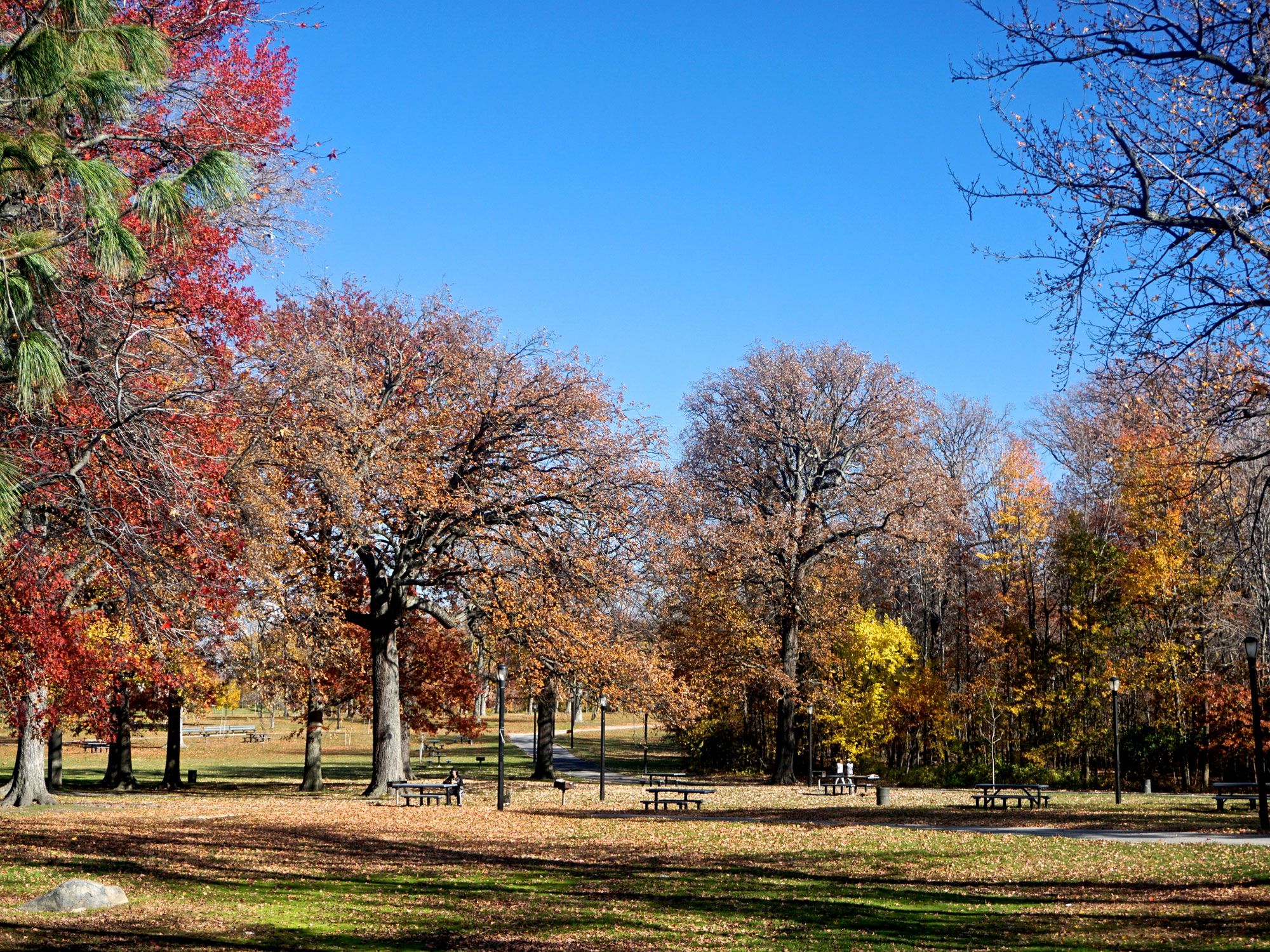
Approximately 1.4 million New Yorkers live among the Bronx’s 42 square miles. The borough is located at the northernmost end of New York City and borders Westchester County to the north. A quarter of the Bronx is covered by parkland, making it the Big Apple’s greenest borough.
Major Landmarks
• Yankee Stadium: Built in 2009, this iconic baseball stadium is home to the 27-time World Champion New York Yankees. The season begins in late March or early April and ends with the playoffs each October. Buy yourself a cap, a hot dog, and a ticket in the bleachers for an iconic New York experience. • New York Botanic Garden: You won’t find a more beautiful landmark in the Bronx than the borough’s botanical garden. It’s home to historic plants like a Japanese winterberry and columnar tulip tree planted back in 1895, as well as a 155-foot-tall tree located in the Azalea Garden. • Van Cortlandt Golf Course: The Bronx is also home to America’s first public municipal golf course, which opened in 1895. Back in the day, it was common to see A-listers like Babe Ruth and the Three Stooges playing, and it remains popular among New Yorkers today.
Culinary Highlights
• Arthur Avenue: If you love Italian food, Arthur Avenue is a must-visit. This culinary mecca dates back to the 1700s, and it remains the home of local institutions such as Teitel Brothers — which opened in 1915 — and Casa Della Mozzarella, where you can enjoy hand-pulled fresh mozzarella. • City Island: City Island is a quaint fishing neighborhood that’s a well-kept secret for serving up the best seafood in New York City. Most of the fare is caught just a few hundred feet away. • Liebman’s Deli: This 71-year-old Bronx institution is one of the best classic Jewish delis in the city. Try their traditional plates of pastrami on rye, hearty bowls of matzo ball soup, or decadent chocolate babka.
Other Attractions
• Bronx Zoo: This beloved attraction has been at the forefront of city wildlife conservation since first opening in 1899. Today, it’s home to over 11,000 animals, with upwards of 650 individual species, spread out across 265 acres. • Edgar Allen Poe’s Cottage: While Edgar Allan Poe is more commonly associated with the city of Baltimore, the Bronx is home to a cottage where the famous author resided from 1846 to 1849. During this period, he wrote classics such as Annabel Lee and The Bells. • Birdwatching: City Island isn’t just known for its seafood — several unique bird species inhabit the area, making it a hotspot for birdwatchers. That includes the bright green parrots that were first brought in from South America and can now be frequently seen flying above the island.
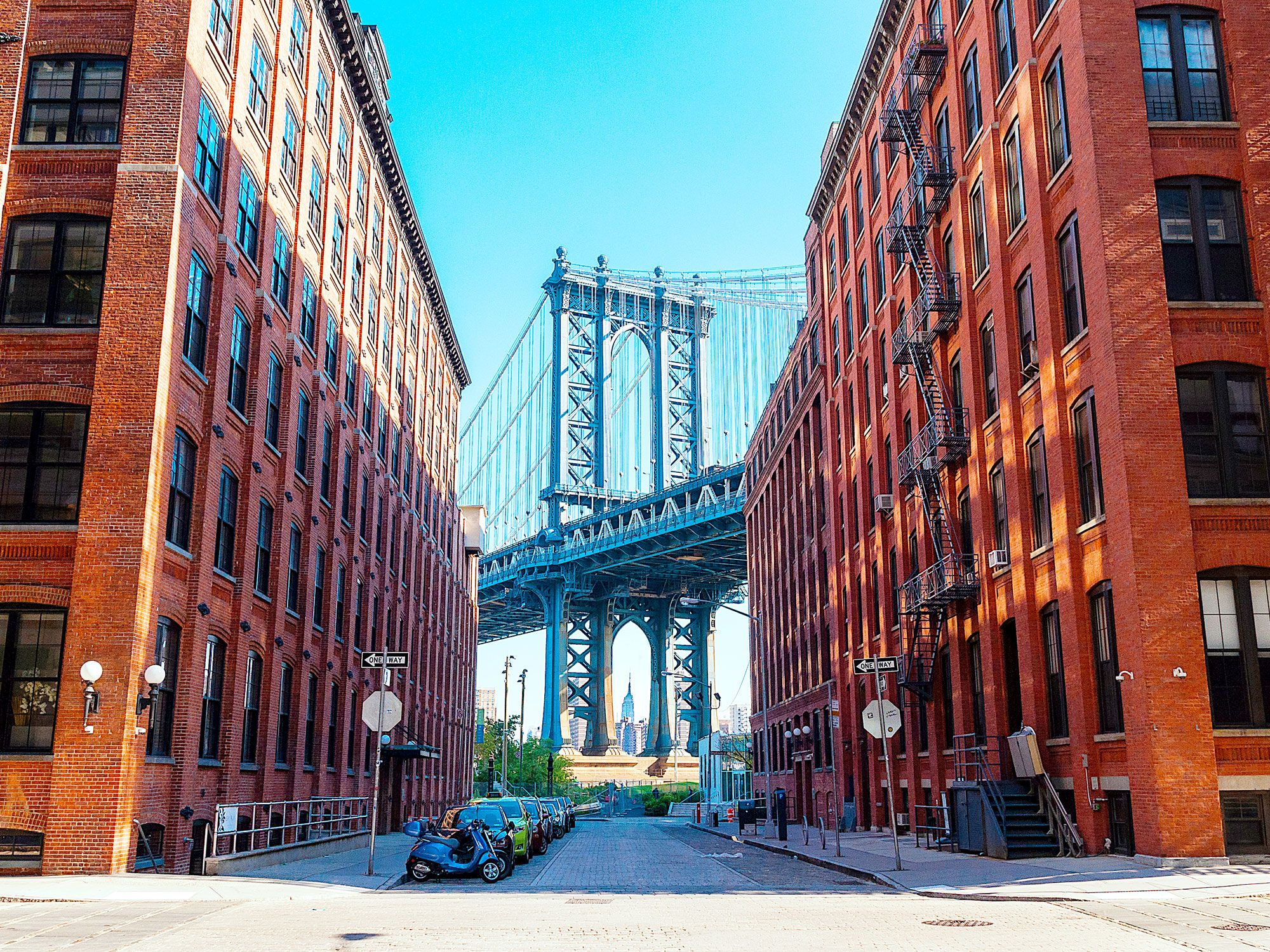
Brooklyn’s Its 2.7-million-plus residents put its population in line with the entire city of Chicago, Illinois. But Brooklyn is more than just tall buildings and concrete streets — the borough is also home to 30 miles of shoreline.
Major Landmarks
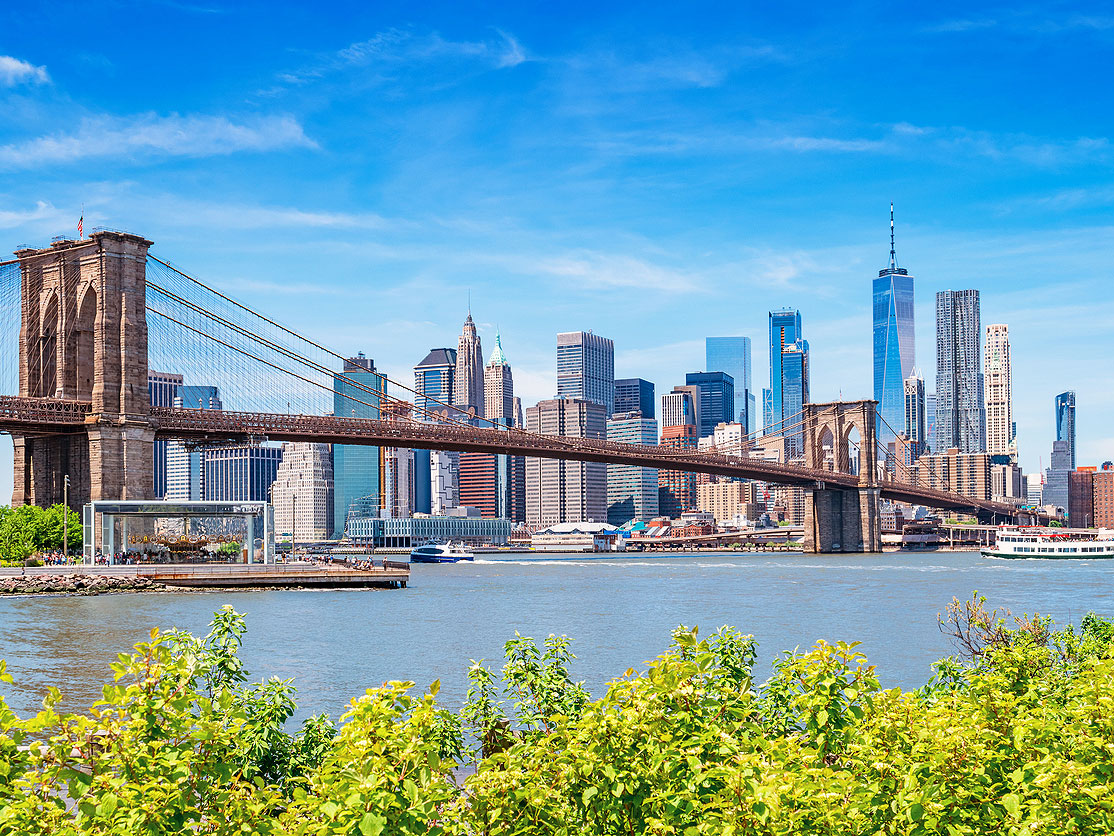
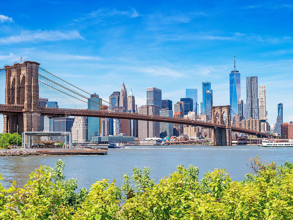
• Prospect Park: This 526-acre greenspace opened in 1867 and cost $9.9 million to build, equal to roughly $205 million today. Prospect Park quickly became a beloved spot for picnickers, as it was illegal to picnic in Manhattan’s Central Park in the 19th century. • Brooklyn Bridge: Spanning the East River to Manhattan, this 5,989-foot-long bridge became the world’s first steel suspension bridge upon its opening in 1883. Today, strolling or biking across the bridge is one of the quintessential Brooklyn experiences. • Coney Island: Stroll along the boardwalk of this historic oceanside neighborhood and entertainment district while enjoying a classic funnel cake — or, take a ride on the Cyclone, a thrill ride that opened in 1927 and remains the world’s second-steepest wooden roller coaster.
Culinary Highlights
• Defonte’s: Founded in 1922, this beloved local sandwich shop is located in the borough’s Red Hook neighborhood. They’re known for their fried eggplant sandwiches, which have been delighting locals’ tastebuds for over a century. • Steve’s Authentic Key Lime Pie: Also located in Red Hook along the New York Harbor, this shop founded by a Florida native is known for its fresh mini pies, as well as the chocolate-covered variety that’s served on a stick. • Ugly Baby: Think you can handle spice? You might want to think again. The menu items at this authentic Thai restaurant in the Carroll Gardens neighborhood are packed with heat. Thankfully, the restaurant also offers an extensive beer menu to give your taste buds a break between bites.
Other Attractions
• Brooklyn Academy of Music: Established in 1861, this Brooklyn institution is the oldest performing arts center in the U.S. You can enjoy classical musical performances, impressive dance routines, and acclaimed films throughout the year. • Brooklyn Public Library: The borough’s expansive public library was founded in 1896, two years before New York City as we know it today was created. It’s the longest-standing public library system in the Big Apple. • Brooklyn Botanic Garden: Founded in 1910 as a means for conserving local flora, the Brooklyn Botanic Garden has since expanded to incorporate many Japanese elements, including the Japanese Hill and Pond Garden, plus a vast bonsai collection. You won’t find scenery like this anywhere else in the city.
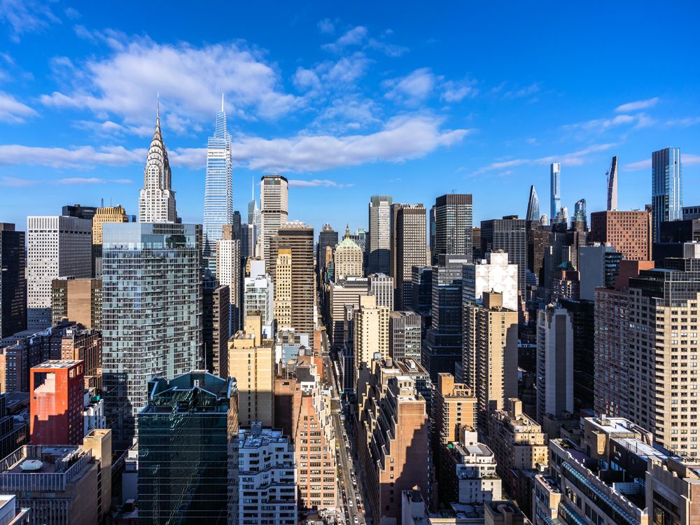
Manhattan is New York City’s smallest borough by area, totalling only 23 square miles of land. But what really separates Manhattan from other boroughs is its population density — it’s home to 1.63 million people and is also the most densely populated county in the U.S.
Major Landmarks
• Empire State Building: Made famous by the 1933 film King Kong, this art deco marvel is among the most recognizable landmarks in the city. It was the tallest building in the world from 1931 until 1971, when it was overtaken by the World Trade Center. • One World Trade Center: This 1,776-foot-tall skyscraper is the tallest building in the Western Hemisphere, and it exemplifies the city’s ability to overcome tragedy. The observation deck — which offers 360-degree views of the city and nearby states — is a must-visit. • Broadway: Manhattan’s Theater District spans an area from around 41st Street to 52nd Street, between Sixth and Eighth Avenues. The list of shows is ever-changing, though it’s also seen some incredibly lengthy runs over the years — The Phantom of the Opera was performed a staggering 13,981 times at Broadway’s Majestic Theatre between 1988 and 2023.
Culinary Highlights
• Chinatown: Manhattan has one of the planet’s most vibrant culinary scenes, making it impossible to narrow down a list. But Chinatown is a worthy place to start: Located along Canal Street in southern Manhattan, the neighborhood was formed in the 1870s at a time when Chinese immigrants were flocking to the neighborhood. Now, its winding streets are where you can enjoy soup dumplings, roast duck, and other favorites. • Little Italy: Situated just north of Chinatown, Little Italy is a hub for Italian food. Be sure to visit during the Feast of San Gennaro, during which the streets are filled with vendors serving up cannolis, fried zeppoles, and more classics. • Rao’s: Speaking of Italian food, Rao’s is one of the best-known eateries in Manhattan — but good luck getting a table. It’s one of the most exclusive eateries in the city, but even if you can’t score a reservation, you can still enjoy their namesake pasta sauce sold in supermarkets across the country.
Other Attractions
• Grand Central Terminal: This Beaux Arts-style transit hub opened in 1913, and today over 750,000 commuters and tourists pass through it on a daily basis. When you stop by, be sure to look up at the ceiling, which is covered with a marvelous gold and turquoise mural of constellations. • The Met Cloisters: Though the Met’s namesake museum on Fifth Avenue is more famous, don’t overlook the Met Cloisters. Located at the very northern tip of Manhattan, this is America’s only museum dedicated exclusively to Middle Age-era art and architecture. The museum opened its doors in 1938 and features three medieval chapels and several serene gardens found throughout the property. • Hess Triangle: If you’re searching for New York’s quirkier side, then Hess Triangle is worth a visit. This 500-square-inch concrete triangle in Greenwich Village is the smallest piece of private property in the city. Though it serves no real purpose, it exhibits the strange and unique history of the island of Manhattan.
Queens is New York’s largest borough by area, spanning 109 square miles of land and 69 square miles of additional water area. With just over 2.4 million residents who call the borough home, Queens is a melting pot of many immigrant cultures.
Major Landmarks
• JFK and LaGuardiaAirports: Queens is home to both major NYC airports, so you’re likely to be passing through the borough for a portion of your visit. JFK is home to the historic TWA terminal, an architectural landmark designed by Eero Saarinen in 1962. The terminal has been repurposed into an aviation-themed boutique hotel, with many of its original retro features intact. • Citi Field: This baseball stadium opened in 2009 and the home of the beloved baseball underdogs known as the New York Mets. The Mets have played in Queens since 1964 — two years after they began as a baseball franchise — winning two titles in that time. • Arthur Ashe Stadium: Queens is also the site of the U.S. Open tennis tournament, held annually at Arthur Ashe Stadium. The tournament moved to the Flushing neighborhood in 1978, from its previous location in Forest Hills.
Culinary Highlights
• Flushing’s Chinatown: Much like Manhattan has the Chinatown neighborhood, Queens has a prolific Chinese community of its own in Flushing. Here, you’ll find a wide variety of delicious Chinese fare from a variety of styles, including in Sichuan, Hunan, Cantonese, and Fujian. • Temple Canteen: This vegetarian cafeteria serves up some of the most authentic Indian fare in the city. The restaurant is located adjacent to the Ganesh Temple in Flushing, a fascinating structure built from stone that was imported from India. • Greektown: The Astoria neighborhood, located along the East River in the western section of the borough, is home to Greektown, where the streets are lined with restaurants serving up fresh salads, decadent dips, and yummy gyros.
Other Attractions
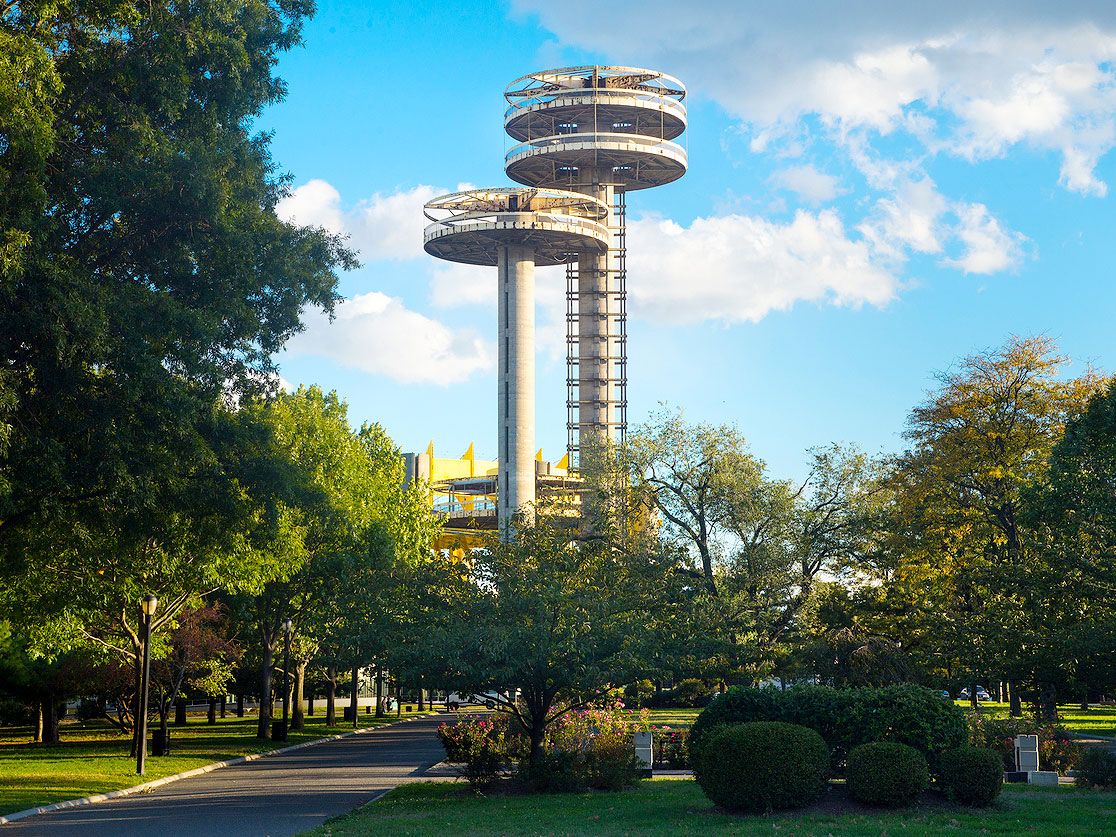
• Louis Armstrong House Museum: In the 1940s, Queens served as a hub of the burgeoning jazz scene. Trumpeter Louis Armstrong lived in the borough for the final three decades of his life, and you can learn more about the musical legend at this fascinating museum. • Flushing Meadows-Corona Park: Now a beautiful and expansive park, Flushing Meadows was the site of the 1964 world’s fair, which introduced concepts like videoconferencing, push-button telephones, and the Ford Mustang automobile. Today, it’s a lovely place to stroll around with the family and enjoy a picnic. • First-Ever Road Paved for Cars: Many historic milestones have occurred in Queens — including the world’s first-ever road paved exclusively for cars. The road was created in 1908 in the Hollis Hills neighborhood, and is now primarily used as a bike path.
Of the five New York City boroughs, Staten Island is by far the least populated, with just under 500,000 of the 8-million-plus people who call the Big Apple home. But despite its comparatively small population, Staten Island is the third-largest borough by land area, covering 59 square miles, with an additional 44 square miles of water area falling within the borough’s limits.
Major Landmarks
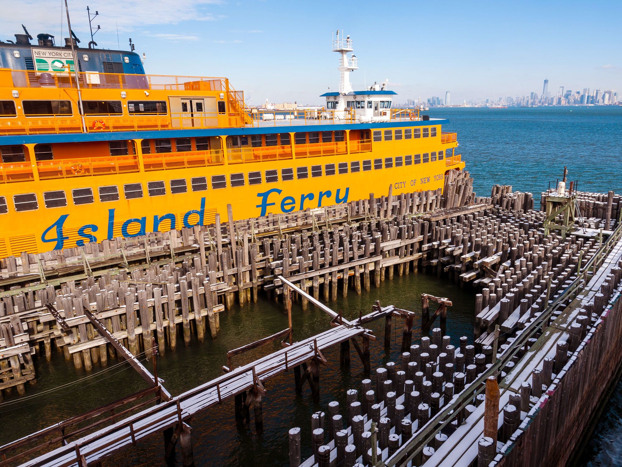
• Staten Island Ferry: No trip to New York City is complete without an excursion aboard the famed Staten Island Ferry. These commuter ships run between Staten Island and Lower Manhattan 24 hours a day, taking passengers along the scenic New York Harbor past the majestic Statue of Liberty. Still not convinced? What if we told you it’s 100% free? • Freshkills Park: This new park — the largest to be developed in NYC in over 100 years — is being built on the site that once served as the world’s largest landfill. When all phases of construction are finally completed in 2036, it will be nearly three times the size of Central Park in Manhattan. • Fort Wadsworth: Occupying 226 acres on the northeastern shore of the borough, this fort dates back to the time of the American Revolution, as it was built in 1779. Today, it’s protected by the National Park Service. Visit to learn more about the history of the fort and the role it played during the fight for American independence.
Culinary Highlights
• Little Sri Lanka: Staten Island has a thriving Sri Lankan population, so it should come as no surprise that the borough is home to some of the most delicious Sri Lankan food in the city. The restaurants are found primarily around the Tompkinsville neighborhood, and Lakruwana is a particularly popular spot. • Denino’s Pizzeria: This Staten Island staple opened as a bar in 1937, but became more famous as a pizzeria in the 1950s. They’re best known for their legendary clam pizza — a thin crust pie topped with handmade mozzarella and plump clams. • Shaw-nae’s House: If you’re looking for some of the best soul food in the city, look no further than Shaw-nae’s House in Stapleton Heights. Be sure to order some of their signature oxtail plus a plate of “sugar daddy wings,” which are said to be a combination of chicken and waffles in both flavor and texture.
Other Attractions
• Sri Lankan Art and Cultural Museum: To go along with their sizable Sri Lankan community, Staten Island is also home to the only museum located outside of Sri Lanka dedicated specifically to the nation’s heritage. • Historic Richmond Town: This themed historical museum features actors and interpreters who discuss what life was like in Staten Island during the 17th and 18th centuries. • Jacques Marchais Museum of Tibetan Art: This unique museum showcases art from Tibet, Mongolia, and China within its stone buildings, which are designed to mimic Buddhist mountain monasteries.
Frequently Asked Questions
• What is the most expensive borough to live in New York City? Manhattan — A 2023 report named the borough not only the most expensive place to live in the city, but also the entire country. The average rent cost $4,300 per unit.
• What is the cheapest borough to live in New York City? Staten Island.
• Which borough has the highest population? Brooklyn — If the borough were its own city, it would be the third-largest city in America.
• Where is the largest park in New York City? The Bronx’s Pelham Bay Park covers 2,764 acres, three times the size of Central Park.
• What is the city’s most diverse neighborhood? Queens — residents speak almost 150 different languages.
• What is the tallest building outside of Manhattan? The Brooklyn Tower stands at 1,066 feet, ranking No. 11 for New York City’s tallest buildings.
• What is the “Sixth Borough” of New York City? Many places that are outside city limits but are culturally or politically aligned with New York claim the nickname the “sixth borough.” But one of the most common so-called “Sixth Boroughs” is, together, the cities of Jersey City and Hoboken, which are located directly across the Hudson River and are a quick ride away on the PATH train from Manhattan.
Advertisement
More from our network
Daily Passport is part of Inbox Studio, an email-first media company. *Indicates a third-party property.
8 Historic City Bridges You Should Cross at Least Once
By
Julia Hammond
Read time: 7 minutes
July 27, 2023
Updated: July 28, 2023
8 Historic City Bridges You Should Cross at Least Once
Architecture •July 27, 2023•Updated: July 28, 2023
By Julia Hammond
Author
Julia Hammond
Julia is a U.K.-based travel writer whose work has been featured in The Independent, The Telegraph, The New Zealand Herald, and Culture Trip, among others. She’s an enthusiastic advocate for independent travel and a passionate geographer who has had the privilege of traveling to more than 130 countries in search of a story.
In cities across the world, bridges span rivers, harbors, and canals to facilitate access that would otherwise require time-consuming ferry crossings or lengthy detours by road. Many of these storied structures have stood for centuries; others have made their mark in a much shorter space of time. Here are eight of the most interesting historic city bridges and the stories behind them.
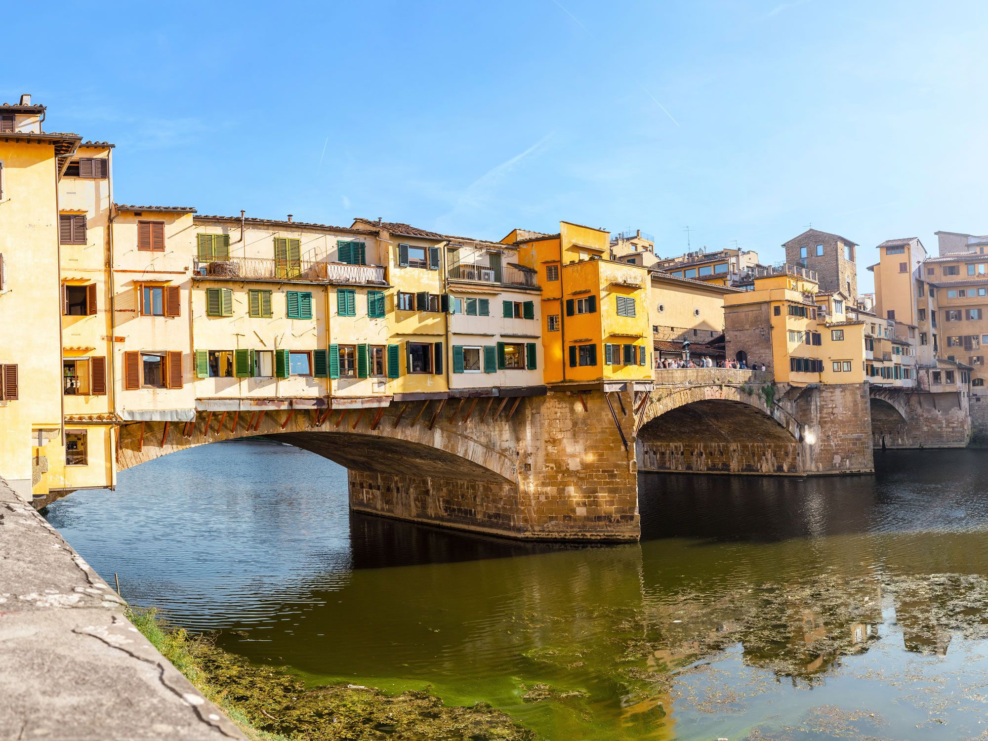
The Ponte Vecchio (Italian for “Old Bridge”) spans Florence’s Arno River as the city’s oldest bridge. A bridge has stood here since Roman times, but the structure you see today dates from 1345. In its early days, the bridge was home to the city’s butchers, which was deemed a good idea at the time because it separated them from other vendors and allowed them to dispose of their scraps of waste meat straight into the water.
However, during the 16th century — partially at the request of influential families such as the Medici — the malodorous trade was relocated. Thus began a tradition of jewelry trading on the Ponte Vecchio, which continues to this day. The jumble of shops on the outer edge of the bridge forms the retrobotteghe (back shops). The reason they are situated on the outer edge of the brige is due to building controls — extending inwards was prohibited, so shopkeepers gained extra space by developing out over the water.
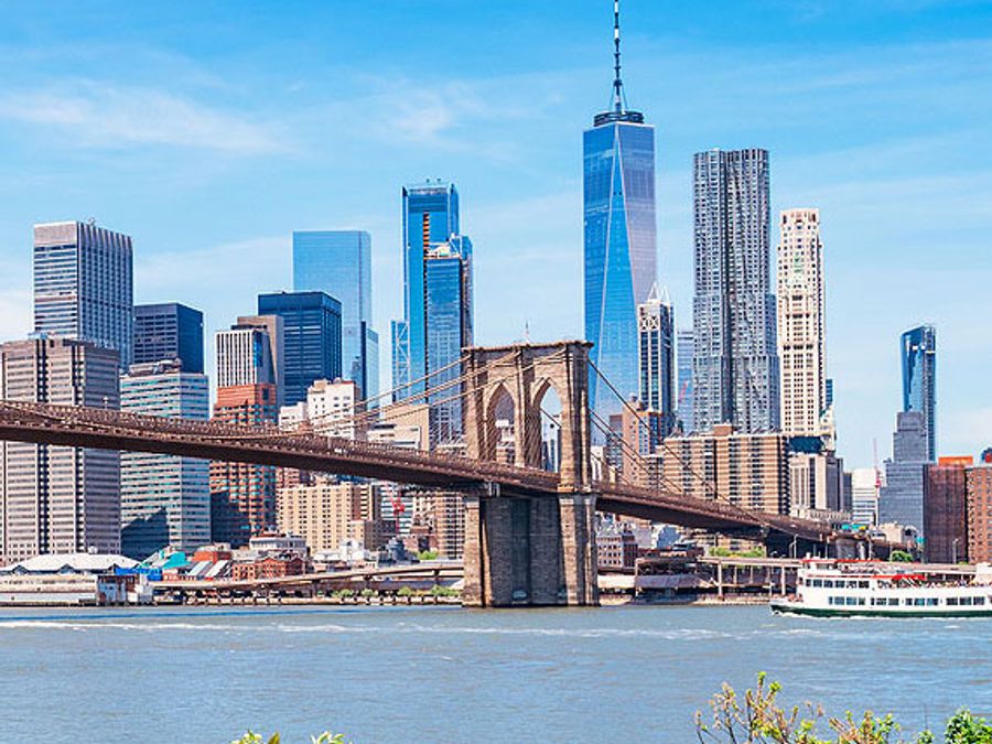
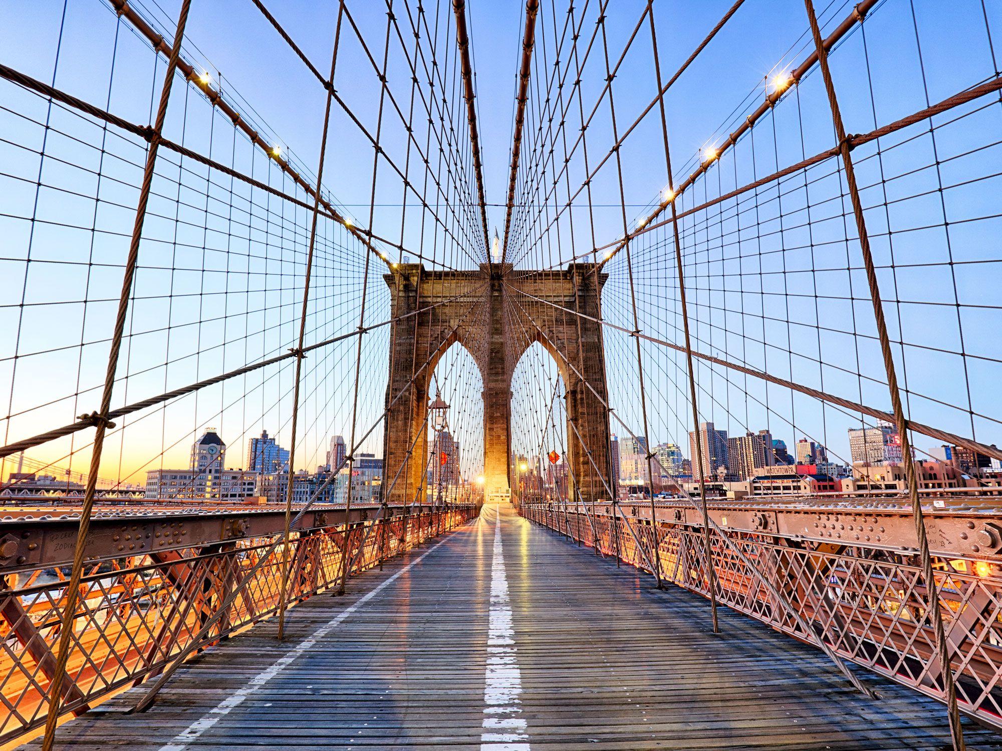
In the first 24 hours after the Brooklyn Bridge’s opening in 1883, an estimated 150,000 people walked across the East River to experience what was then the longest suspension bridge in the world. German-born civil engineer John Augustus Roebling came up with a groundbreaking design that included a 1,600- foot-span from tower to tower. But sadly, Roebling wouldn’t live to see construction begin, let alone end.
Roebling’s son took the reins after his father’s death, but building this bridge was no easy feat. Workers risked their lives to excavate watertight underground chambers called caissons with dynamite and shovels. They backfilled these with concrete and built brick piers up to the water’s surface. Today, the Brooklyn Bridge remains a popular landmark with Big Apple visitors and locals alike — on average more than 116,000 vehicles, 30,000 pedestrians, and 3,000 cyclists cross it every day.
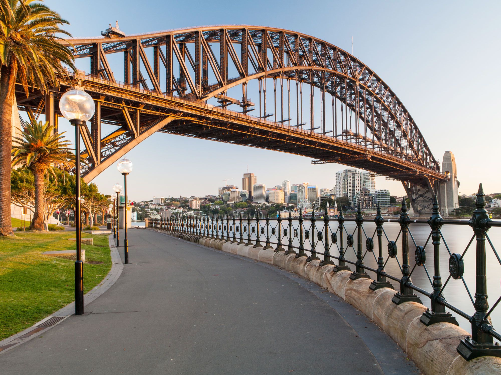
The Sydney Harbour Bridge took eight years to construct, opening in 1932 as the world’s tallest steel arch bridge. Building this Australian icon was a huge undertaking: The project was overseen by Australian engineer John Bradfield, who also had a hand in its design. Nicknamed “the coat hanger” because of its distinctive shape, the Harbour Bridge was partly inspired by New York’s Hell Gate Bridge. It also bears a close resemblance to the Tyne Bridge in northern England. This is no coincidence — the same firm built both structures leading many locals to believe the smaller British bridge was a trial run for its larger cousin.
Much of the steel used in the construction of the Sydney Harbour Bridge was shipped in pre-formed sections from England, and more than 6 million rivets hold it together. Together with the Opera House, it’s one of the city’s most recognizable sights. If you don’t have a fear for heights, one of the most thrilling ways to experience the Sydney Harbour Bridge is to harness up and climb it.
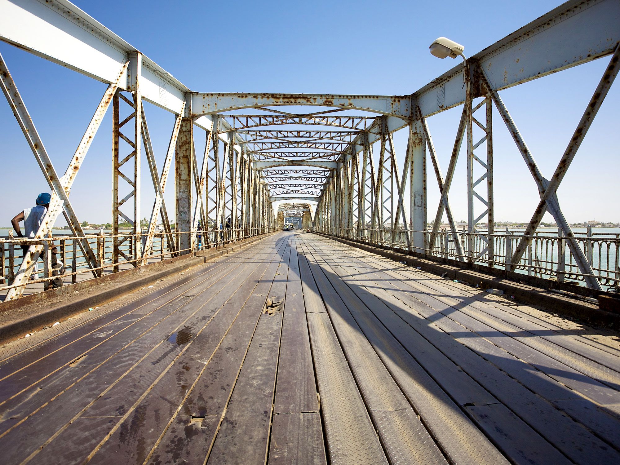
When Saint-Louis was under French colonial rule, Governor Louis Faidherbe saw the need for a bridge linking this coastal northwestern Senegalese island city to the mainland. At one point, a floating pontoon bridge was installed, but a more effective solution was needed, and the Pont Faidherbe was finished in 1897. Some sources say that Gustave Eiffel was responsible for the bridge’s design; although Eiffel’s company pitched for the job, the bridge was designed by Nouguier, Kessler et Cie. It was helmed by French civil engineer Émile Nouguier, who worked with Eiffel until 1893.
Regardless of who oversaw its construction, Pont Faidherbe is an impressive project. The bridge itself measures 1,663 feet across, with a section that is able to pivot to facilitate the passage of ships too large to pass underneath. Today, both the city and its bridge comprise one of Senegal’s seven UNESCO World Heritage Sites.
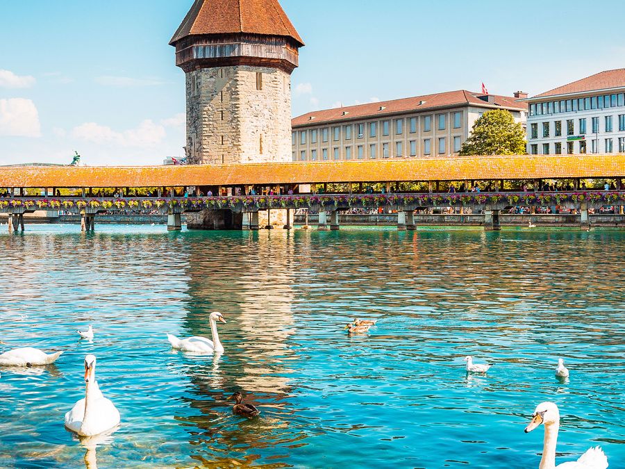
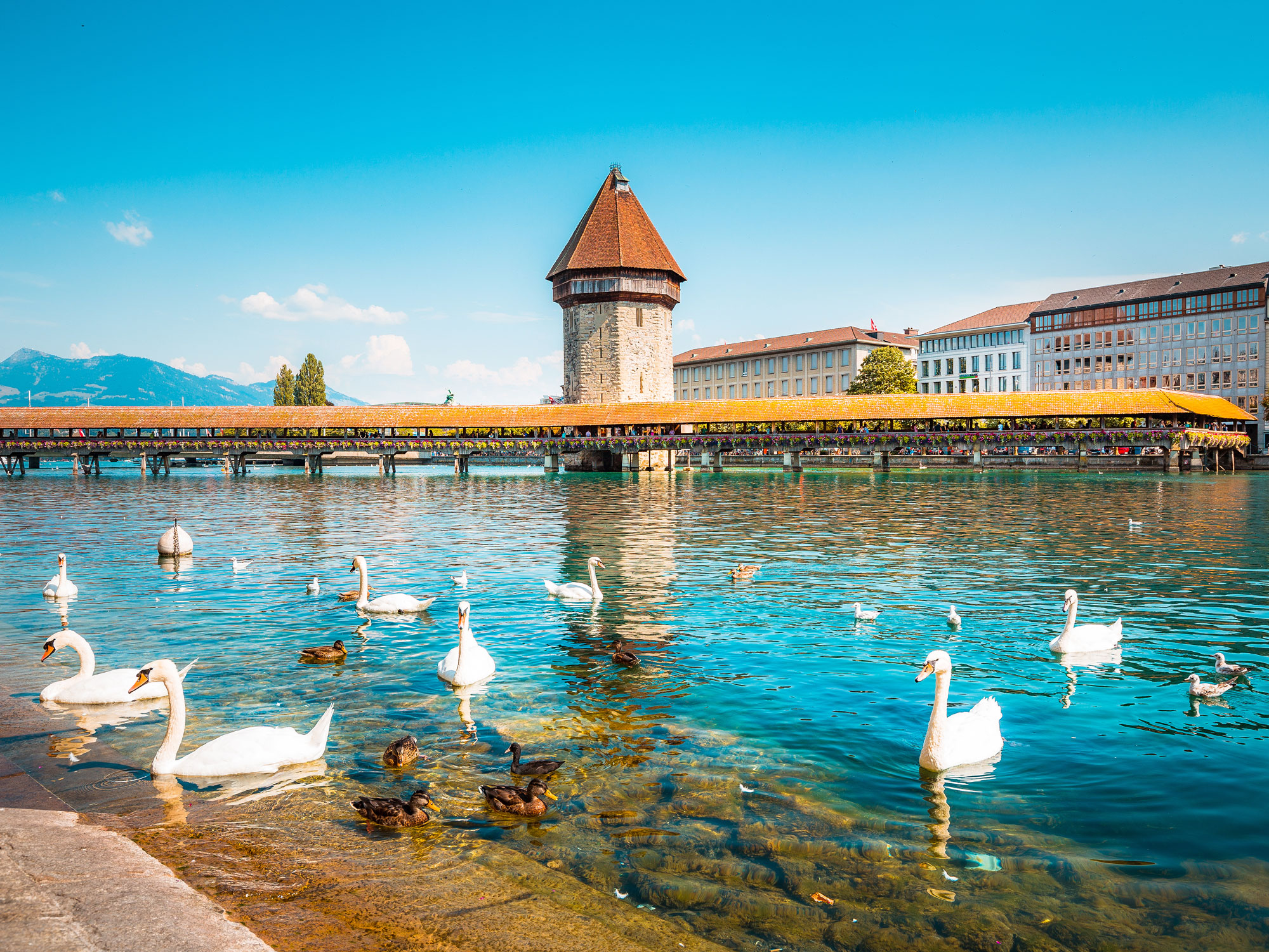
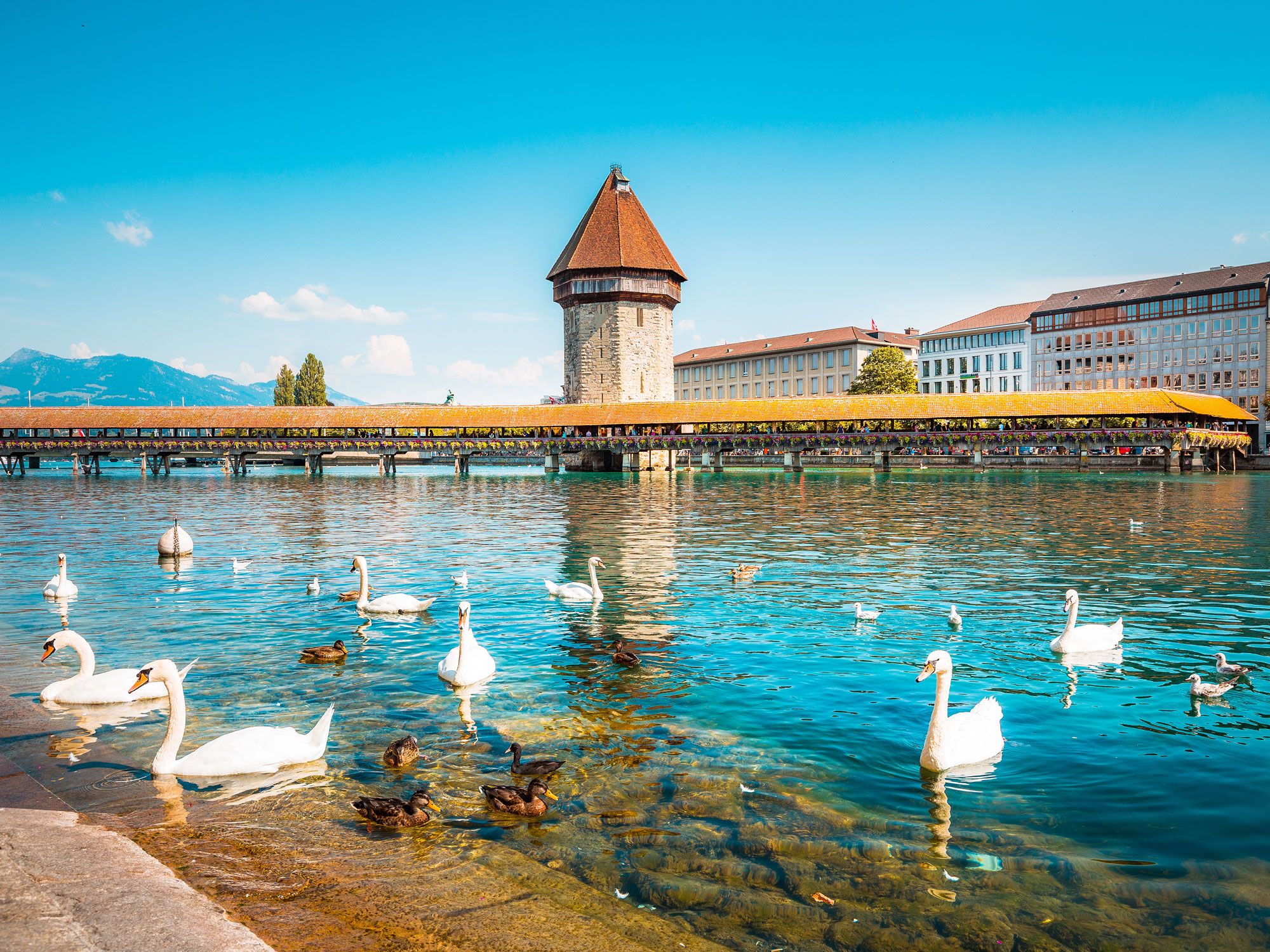
Lucerne’s famed Kapellbrücke (Chapel Bridge) gets its name from St. Peter’s Chapel, which stands along the Reuss River at the northern end of this historic landmark. Kapellbrücke is the oldest wooden covered bridge in Europe and also the world’s oldest truss bridge. Its history dates back to around 1367, when it was constructed as part of the town’s defenses.
One of the most distinctive features of the Kapellbrücke is the octagonal wasserturm (water tower), which is actually slightly older than the bridge itself. The Kapellbrücke is also well-known for its 17th-century paintings that depict scenes from the city’s past. In 1993, a devastating fire broke out on the bridge, which caused extensive damage to the structure and many of those paintings. Fortunately, the bridge (and around 30 of those 147 works of art) were restored the following year.
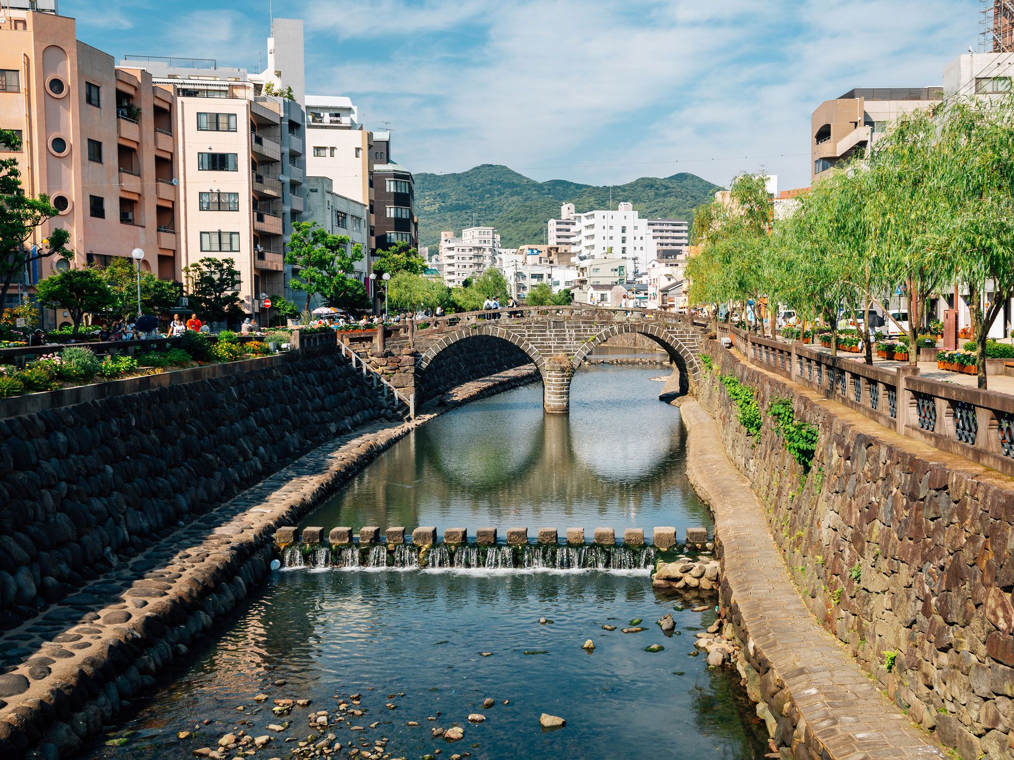
The Meganebashi Bridge, one of the oldest stone bridges in Japan, crosses the Nakashima River in Nagasaki, a port city on the island of Kyushu in southeast Japan. The original structure was built in 1634 by a Chinese monk named Mokusunyoujo; however, disaster struck just 13 years later when the bridge was washed away. Its replacement opened in 1648, but the bridge was badly damaged again by floods in 1982. This time, almost all the original stones were able to be salvaged and reused, so most of the stonework you see today is authentic.
Visitors often comment on the bridge’s unusual shape — when the two arches reflect in the water, the bridge resembles a pair of glasses, giving it the popular name Spectacles Bridge. It’s also become a tradition to come here to make a wish for eternal love. Twenty heart shaped stones can be found in the embankment walls close to the bridge; the more of them you can see, the more likely it is that your wish will come true.
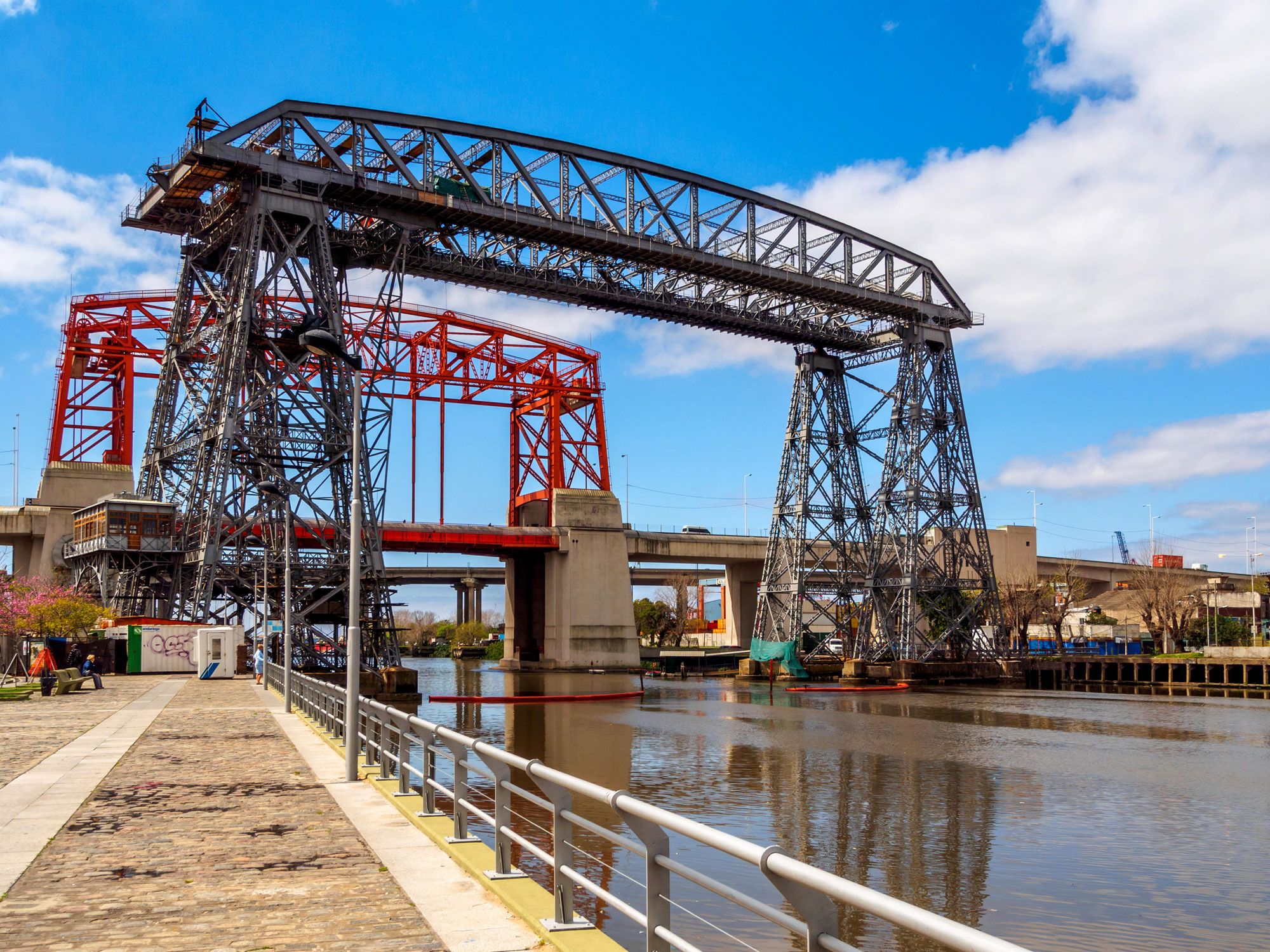
The full name for this bridge is the Puente Transbordador Nicolás Avellaneda, though Porteños (the nickname given to residents of Buenos Aires) usually shorten it to Puente Transbordador. Opened in 1914, the transporter bridge (a now-rare type of movable bridge that carries a segment of roadway across a river) crosses the Riachuelo River (also known as the Matanza River) and links the working class La Boca district of Buenos Aires with the port city of Avellaneda across the water.
A gondola was hung from the span to carry passengers and freight suspended over the water. The bridge stands right alongside a newer bridge, the similarly named Puente Nicolás Avellaneda, which was built in 1940 as a vertical lift bridge. After this, the original Puente Transbordador bridge became obsolete and was taken out of use. However, it was never demolished. In 1999, it was awarded National Historical Monument status, and in 2017, following significant restoration work, it was reopened to pedestrians.
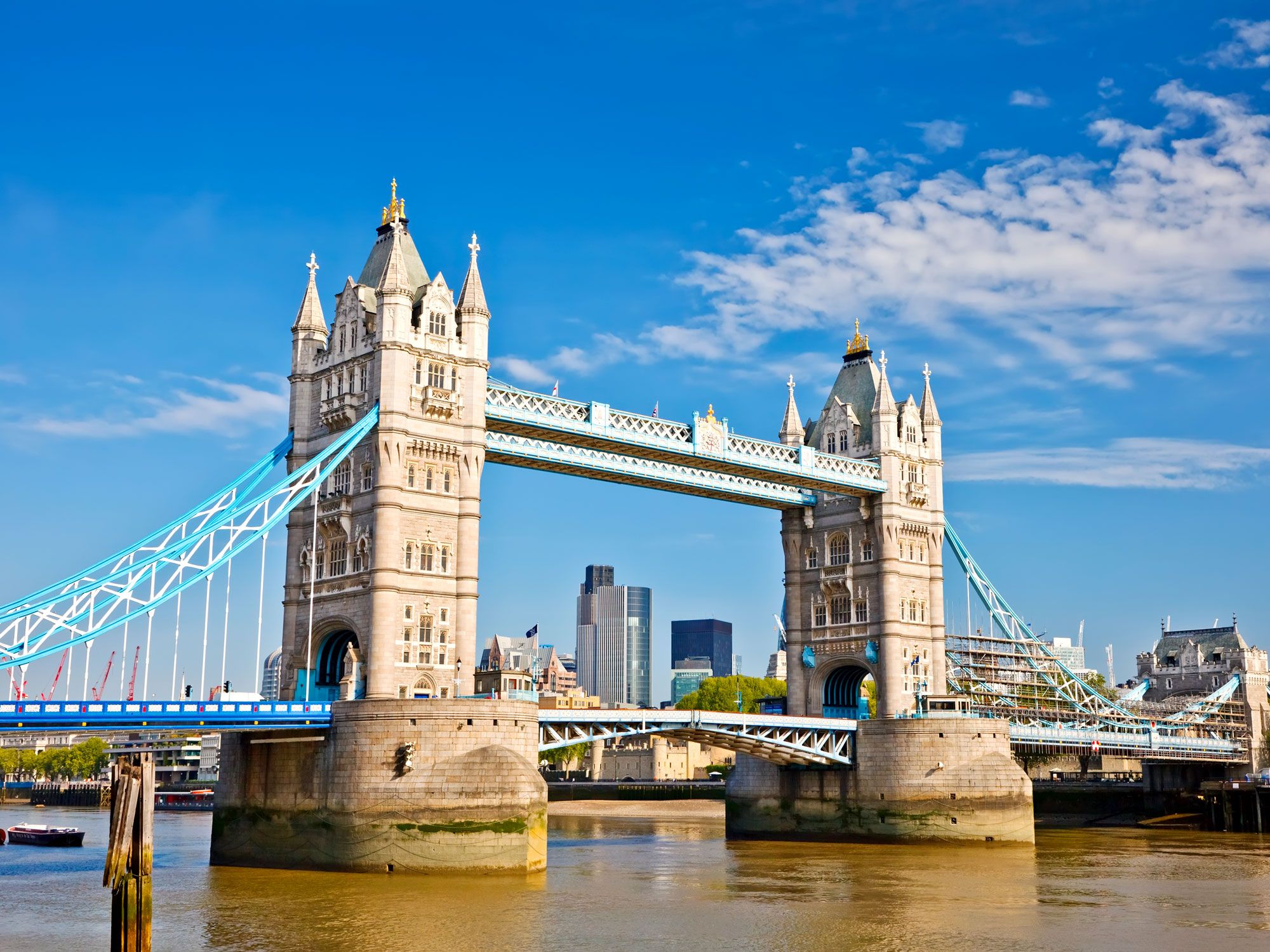
London’s Tower Bridge is a late 19th-century double-leaf bascule (a bridge with a pivoting section that is raised and lowered) which crosses the Thames River at the much older Tower of London. The steel structure, clad in Cornish granite and Portland stone, was originally powered by steam and later replaced by electrified hydraulics. Vessels with a mast or superstructure greater than 30 feet tall, which wish to enter or leave the Upper Pool of London, need to pre-arrange a bridge lift. The Tower Bridge lifts its span an average of 800 times each year, and times are published online. Traffic is held while this occurs, but pedestrians can access the bridge’s glass-floored walkway above.
Advertisement
More from our network
Daily Passport is part of Inbox Studio, an email-first media company. *Indicates a third-party property.
The Fascinating Histories of 6 Fairy-Tale European Castles
By
Fiona Mokry
Read time: 5 minutes
July 20, 2023
Updated: July 25, 2023
The Fascinating Histories of 6 Fairy-Tale European Castles
Architecture •July 20, 2023•Updated: July 25, 2023
By Fiona Mokry
Author
Fiona Mokry
Fiona has spent her career exploring the world and working in the travel industry, turning her lifelong passion into a profession. From planning custom trips to sharing stories as a travel writer for publications such as The Discoverer, she’s all about helping others experience the world in a deeper, more meaningful way.
Europe is a treasure trove of castles that appear straight out of a fairy tale — ones that have even inspired Walt Disney himself. From rise-from-the-ashes comeback tales to surprising histories and elaborate designs, European castles tick all the boxes for travelers interested in history, architecture, and culture. Discover six of Europe’s most famous castles and the compelling stories behind their façades.
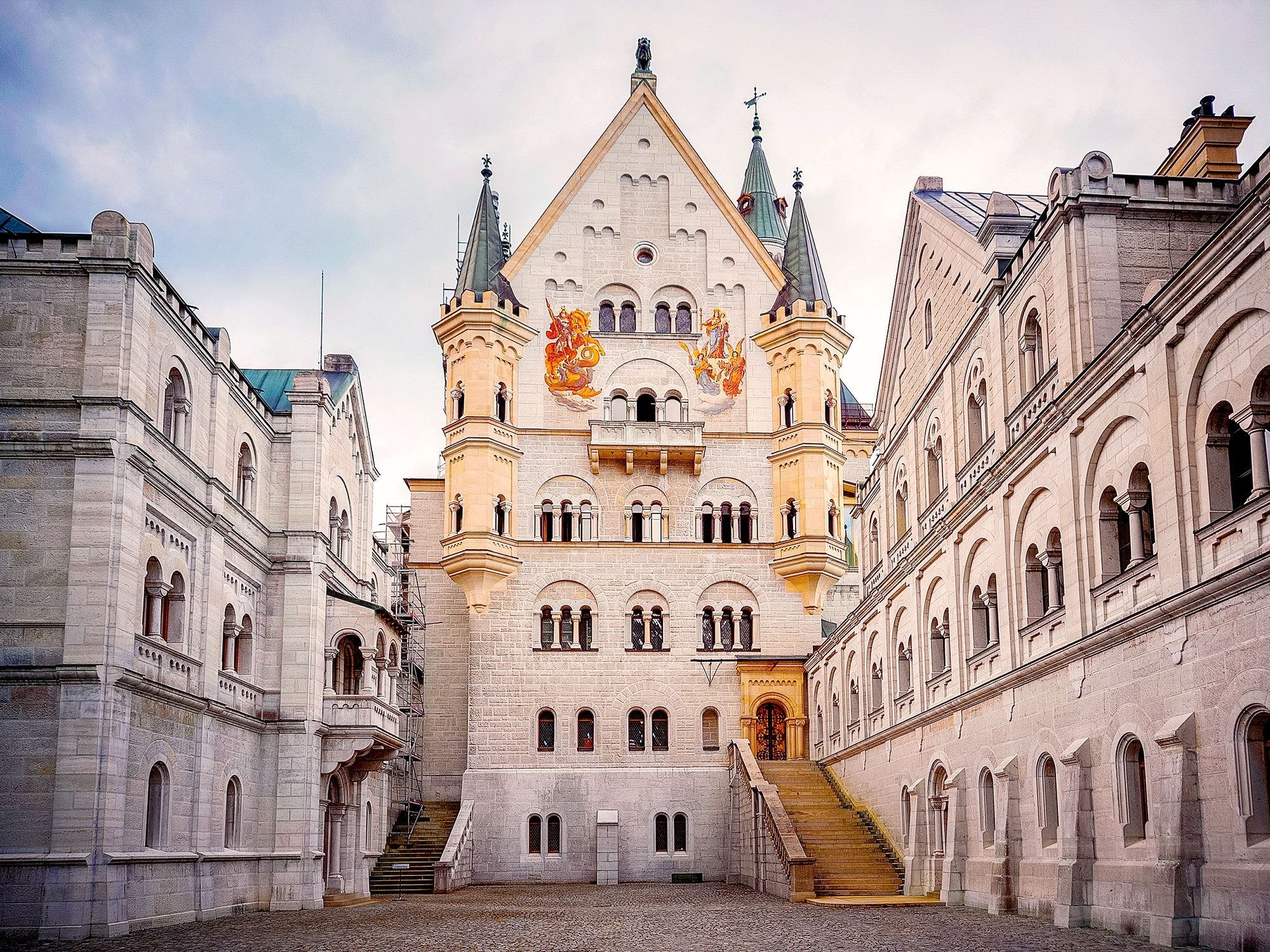
Having famously inspired the design of Disneyland’s Cinderella castle, this German showstopper has drawn attention since even before it was finished in 1892. Neuschwanstein Castle, commissioned by King Ludwig II, was predicted to take three years to build, but it ultimately took 24 to complete construction. Workers ran into difficulties with its cliffside location, the scope of the project, and the monarch’s changing demands. Sadly, the king never saw his masterpiece completed before his death in 1886.
To reconcile the massive debt Ludwig II accumulated during the castle’s construction, local authorities opened Neuschwanstein as a museum to recoup the losses — just seven weeks after he died. Neuschwanstein possessed advanced technology for its time — such as hot and cold water, a central air system, and telephones — but concerted efforts are required today to keep the castle in tip-top shape (and from toppling off its cliffside locale).
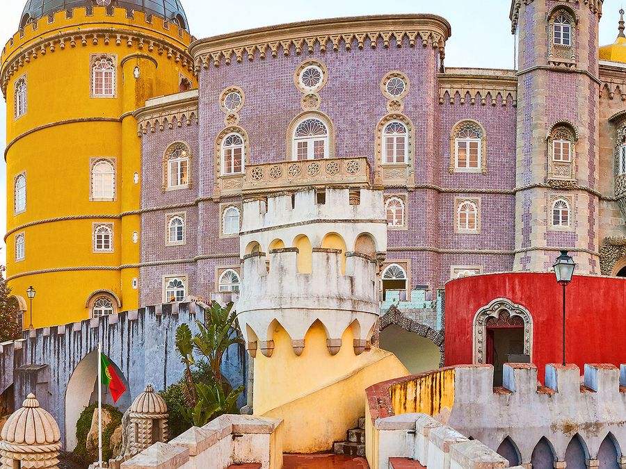
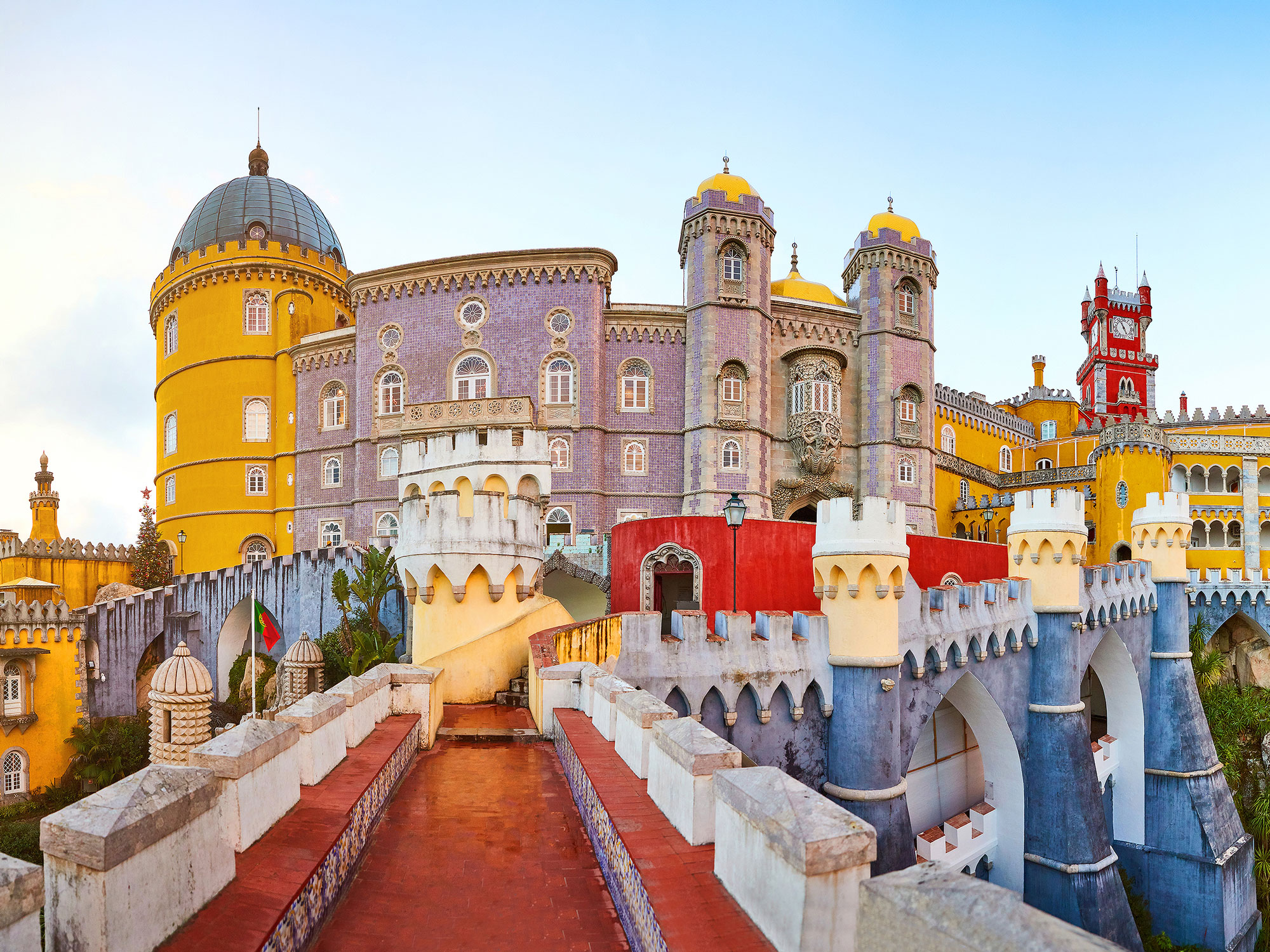
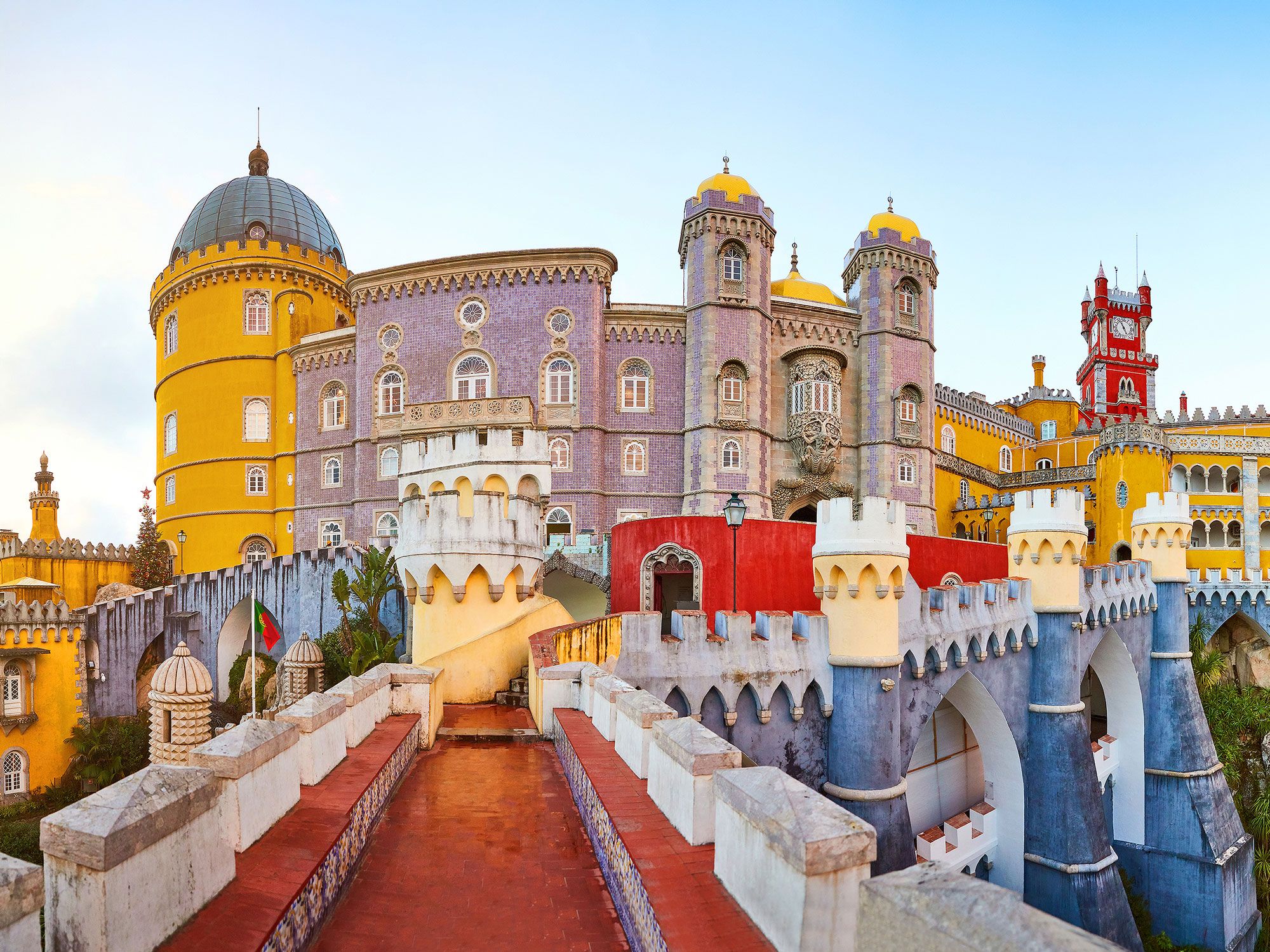
Sintra has become one of Portugal’s most popular tourist destinations, thanks to a generous smattering of whimsical castles built amongst its scenic hills. With so many castles to admire, standing out in Sintra takes effort, and commanding attention with its bright yellow and red exterior and Romanticist architecture is the Pena Palace. The palace, which sits atop a 1,500-foot-high hill, the second-highest in the area, is even visible from Lisbon, located 16 miles away.
The palace was originally a chapel constructed in the Middle Ages after a report that the Virgin Mary had appeared on the hill. The chapel was devastated in an 18th-century earthquake, and it didn’t reach its current grandeur until King Ferdinand inherited and transformed the property in 1838. Not to be outdone, the surrounding gardens — which extend for over 200 acres — host a collection of international plant species and are considered some of the most beautiful in Europe.
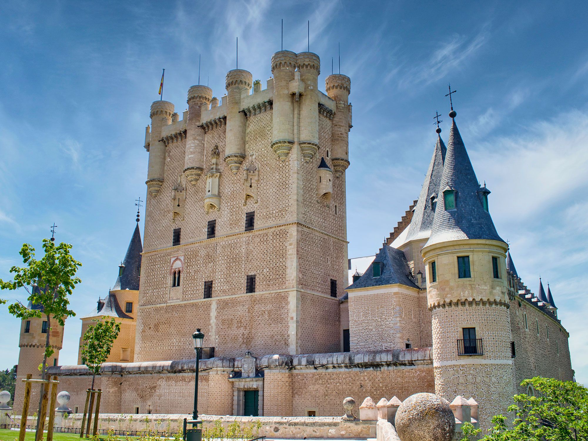
The storied history of this medieval castle in Segovia, Spain, is told through its eclectic architectural style, to which many monarchs have contributed. Perched atop a craggy cliff, the Alcázar of Segovia was built in the 12th century as a fortified palace for the Kingdom of Castile, but the structure has served many purposes throughout its lifetime. Not only was it used as a royal palace for centuries, but it was also a prison, House of Parliament, artillery college, military academy, film set, and today, a museum.
Aesthetically built to look like a bow of a ship, its towers and spires are part of what inspired Walt Disney’s iconic castle logo. Part of a UNESCO World Heritage Site, the Alcázar is a colorful blend of Christian and Moorish architecture featuring ornate ceilings, azulejos, and carved archways.
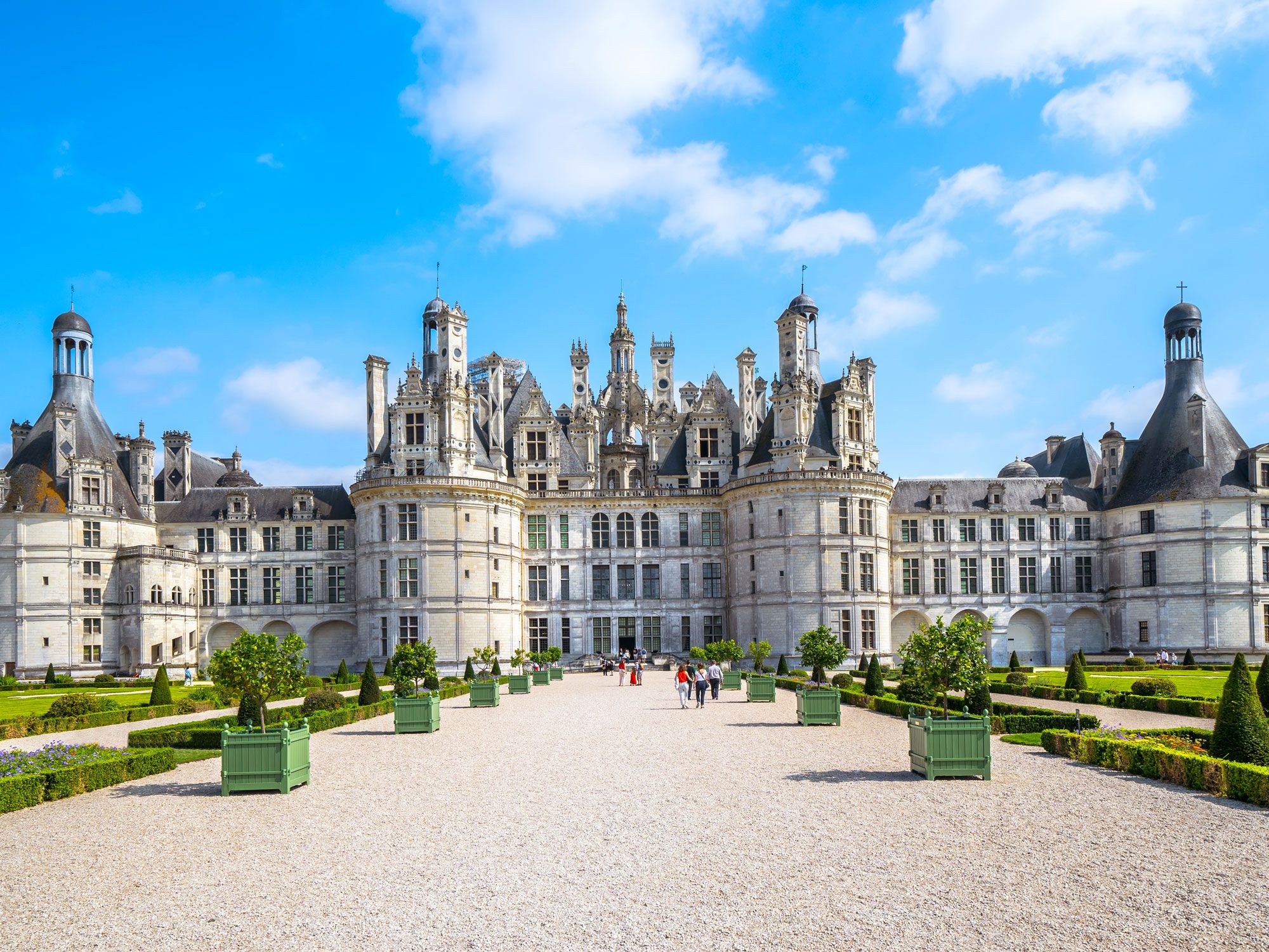
This imposing chateau — built by King Francis I in 1519 — is the largest in Loire Valley and remains one of its most splendid architectural wonders. The castle and its connecting grounds sprawl over 33,300 acres — roughly encompassing the same area as inner Paris — and houses 440 rooms, 282 fireplaces, and 84 staircases. The double helix staircase located in the core of the structure is particularly noteworthy, designed so the king would never run into his servants on the stairs.
Though great efforts were taken to ensure the Château de Chambord dazzled its visitors, the purpose of its construction was primarily as a hunting lodge, and not for defense like most Renaissance castles. Though King Francis I was known to show off his palace to visiting royals and ambassadors, he only used the castle as a temporary residence during hunting season, reportedly only spending a total of 72 days there.
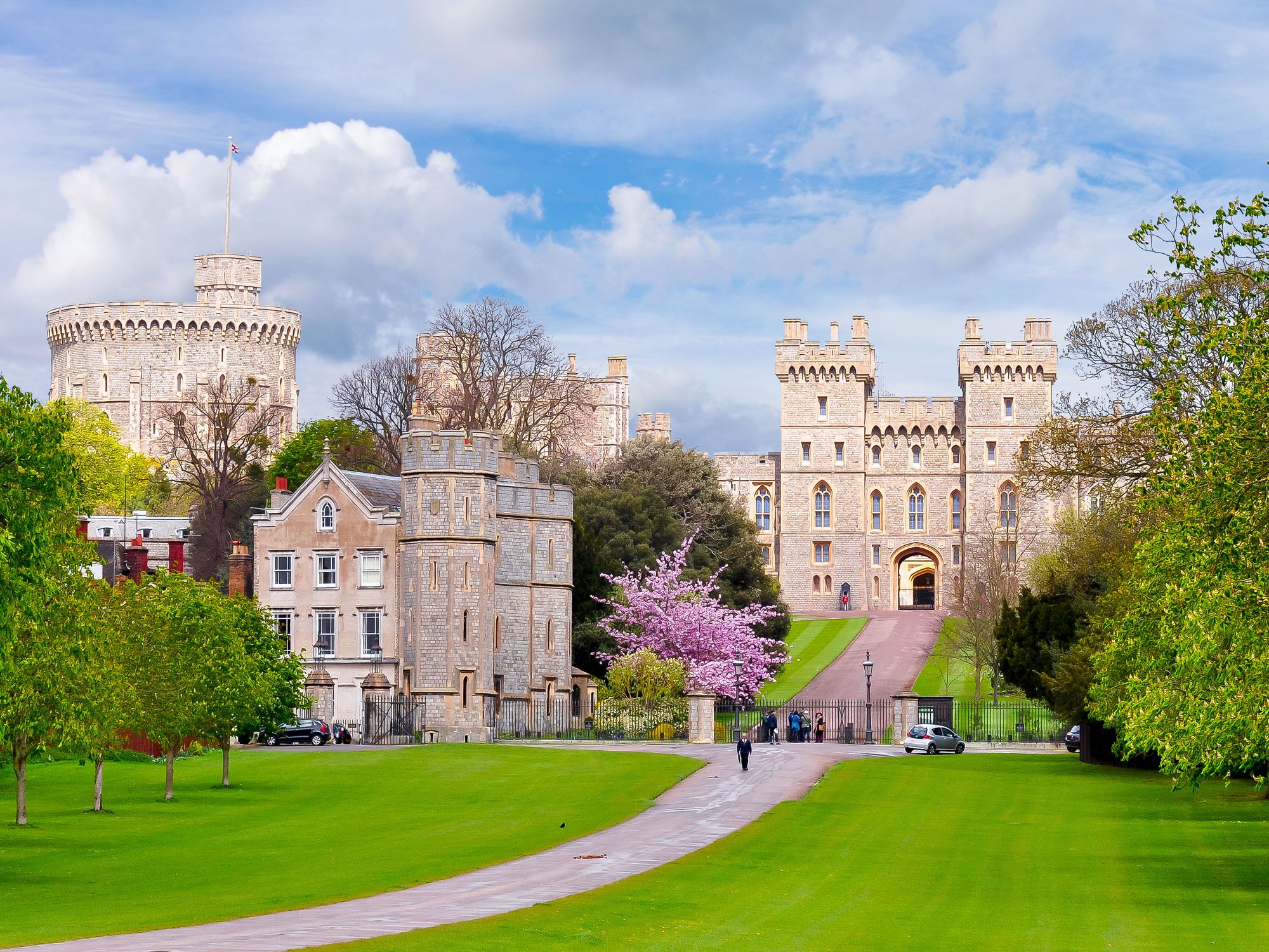
As the oldest and largest inhabited castle in the world, England’s Windsor Castle has housed British royalty since the 11th century. Today, the palace serves as the official residence to the monarch and another 150 people who work there. The grandiose palace walls are built to impress, but it’s what’s on the inside that’s remarkable — 300 fireplaces, 400 historic clocks, 1,000 rooms, and an extensive art collection. Perhaps the most impressive room, however, is St. George’s Chapel, which houses the tombs of 10 British monarchs. And there’s one unexpected room that Queen Elizabeth II spent the night in during a bomb scare at Windsor: the dungeon!
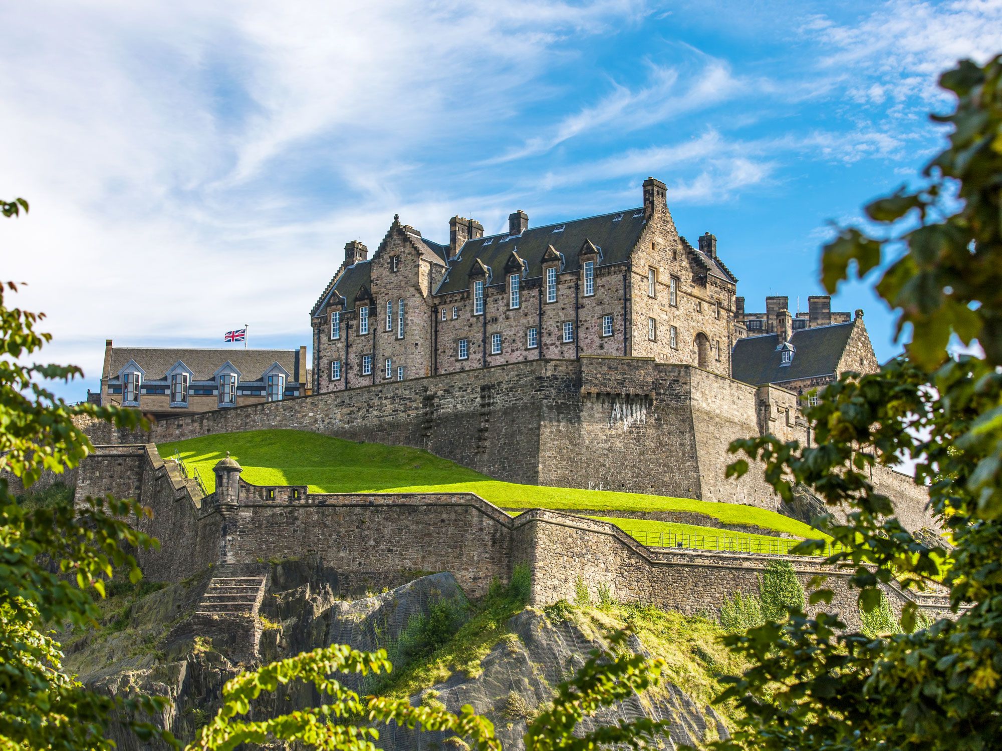
One of Scotland’s most famous landmarks, Edinburgh Castle sits high atop an emerald green hill and dominates the capital’s skyline. But what many visitors may not know is that the castle’s hilly perch is actually a dormant volcano, known as Castle Rock.
With buildings dating to the 11th century, Edinburgh Castle has quite the tumultuous history, witnessing the invasion of hostile forces a whopping 23 times to make it the most-besieged castle in Europe. Despite that fact, the castle managed to keep a few things under wraps, including a hidden tower built by King David II that later served as an ideal hiding spot for the Crown Jewels of Scotland — which were forgotten about for over a century, until they were rediscovered in 1818.
Advertisement
More from our network
Daily Passport is part of Inbox Studio, an email-first media company. *Indicates a third-party property.
Architecture •July 20, 2023•Updated: December 18, 2024
By Daily Passport Team
Author
Daily Passport Team
Daily Passport writers have been seen in publications such as National Geographic, Food & Wine, CBC, Condé Nast Traveler, and Business Insider. They're passionate about uncovering unique destinations and sharing expert tips with curious travelers.
Many religious monuments and places of worship around the world have one thing in common — bigger is better. From opulent European cathedrals to sprawling mosques in the Middle East and colossal gilded Buddha statues in Asia, these are 20 of the largest religious buildings in the world and the fascinating histories behind them.
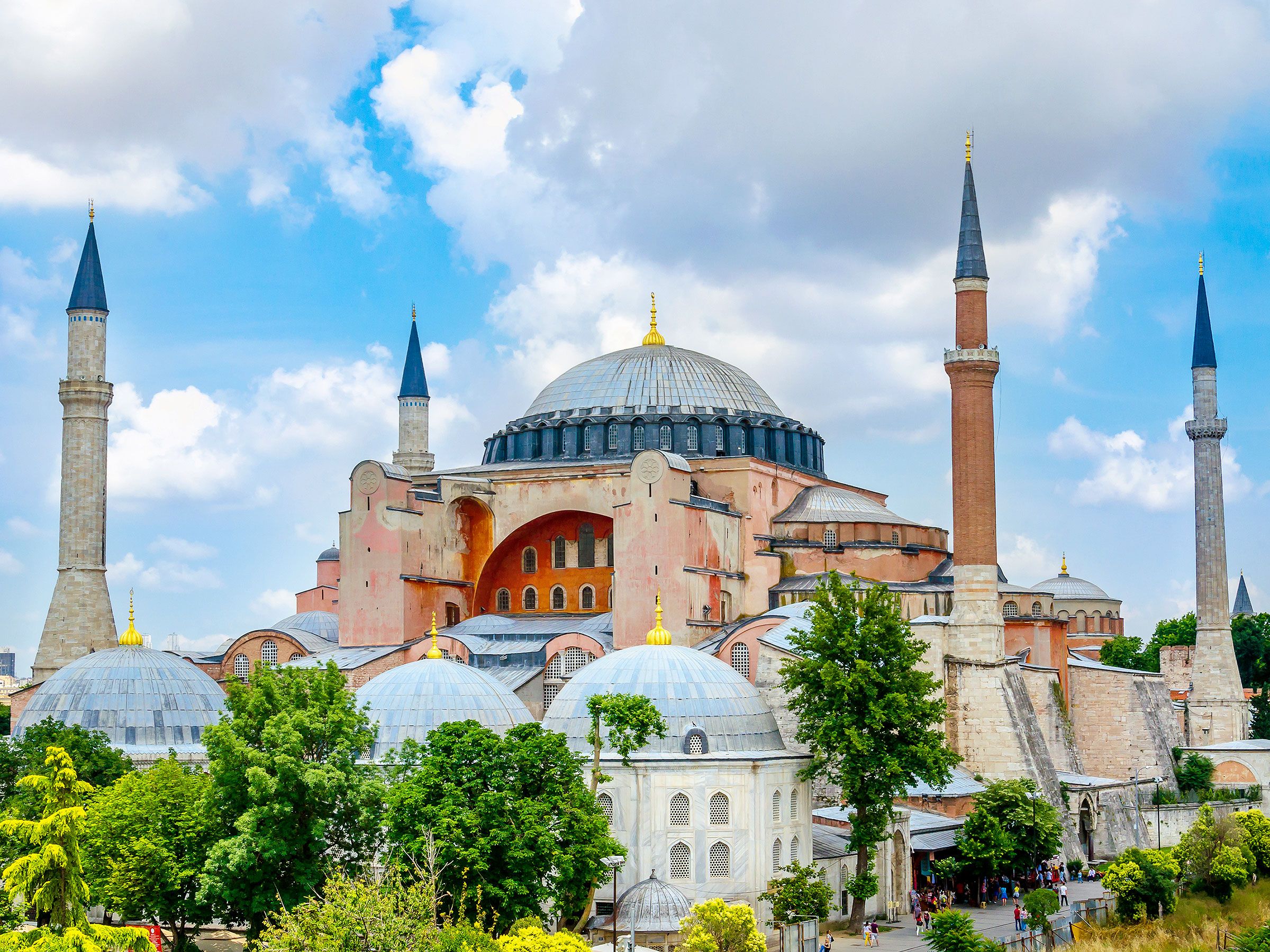
Few religious buildings have lived such a fascinating history as Istanbul’s Hagia Sophia. This architectural wonder was first constructed by the Byzantines in the sixth century as a Christian church. When the Ottomans conquered Constantinople in 1453, they converted it into a mosque. In 1934 it was turned into a museum, and again a mosque in 2020.
The enormous building is arguably the finest known example of Byzantine architecture — inside are 104 columns brought from the Temple of Artemis in Greece, while outside, four minarets and a 108-foot-wide dome dominate the skyline of Istanbul’s Old City.
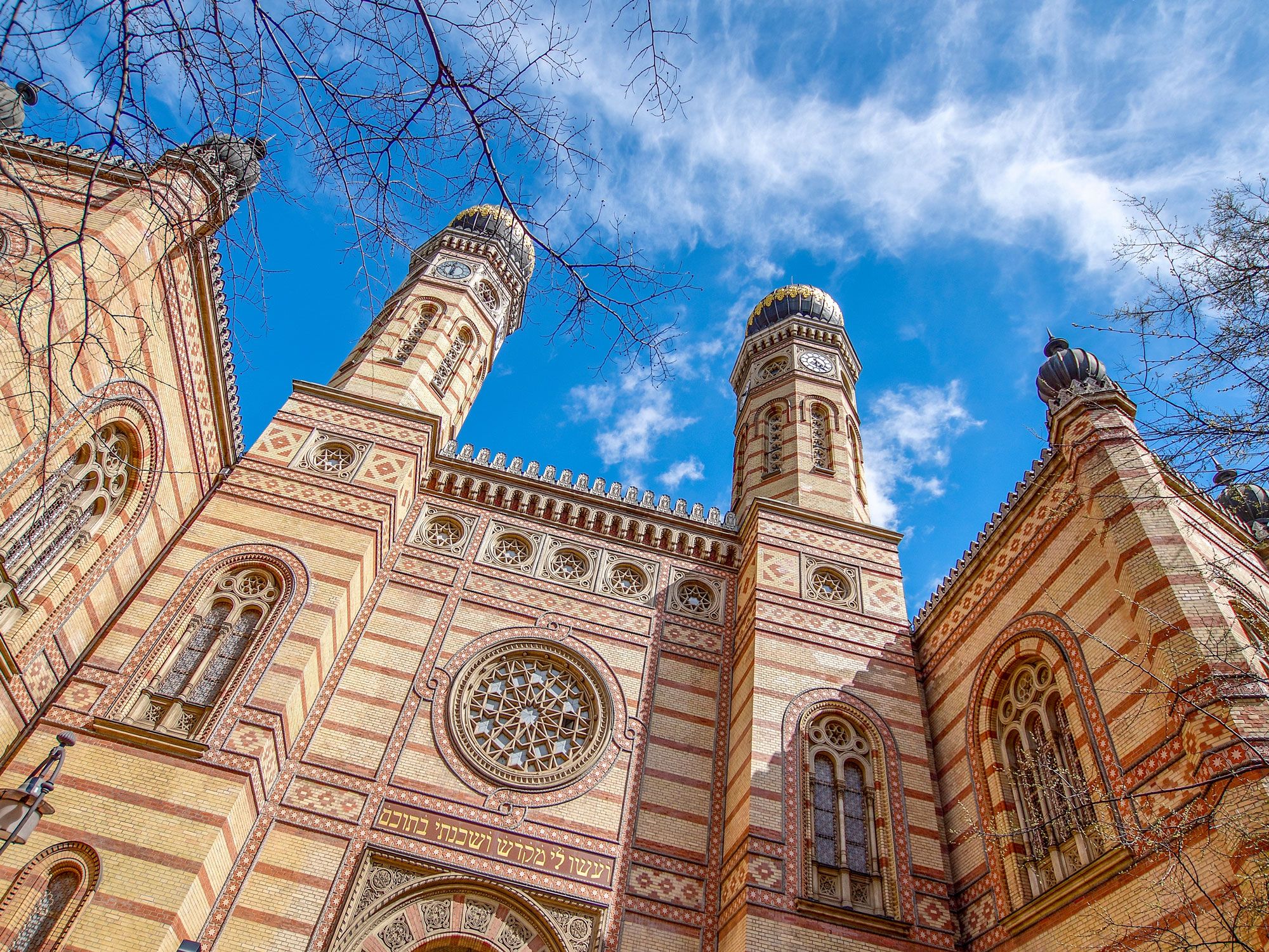
Tucked into the inner city district of the Pest side of Budapest is Europe’s largest synagogue. The Dohány Street Synagogue has a capacity of almost 3,000 worshipers and was designed by Austrian architect Ludwig Forster. The ornate building blends elements of the Moorish, Byzantine, Romantic, and Gothic styles — bright red and gold leaf geometric patterns beautify the lavish interior, as do a 5,000-pipe organ and a large rose window emblazoned with a Star of David.
Outside, twin 143-foot-tall polygonal towers topped with onion domes flank the entrance. The larger synagogue complex includes the fascinating Hungarian Jewish Museum and Archives, a Jewish cemetery, and the Raoul Wallenberg Holocaust Memorial Park.
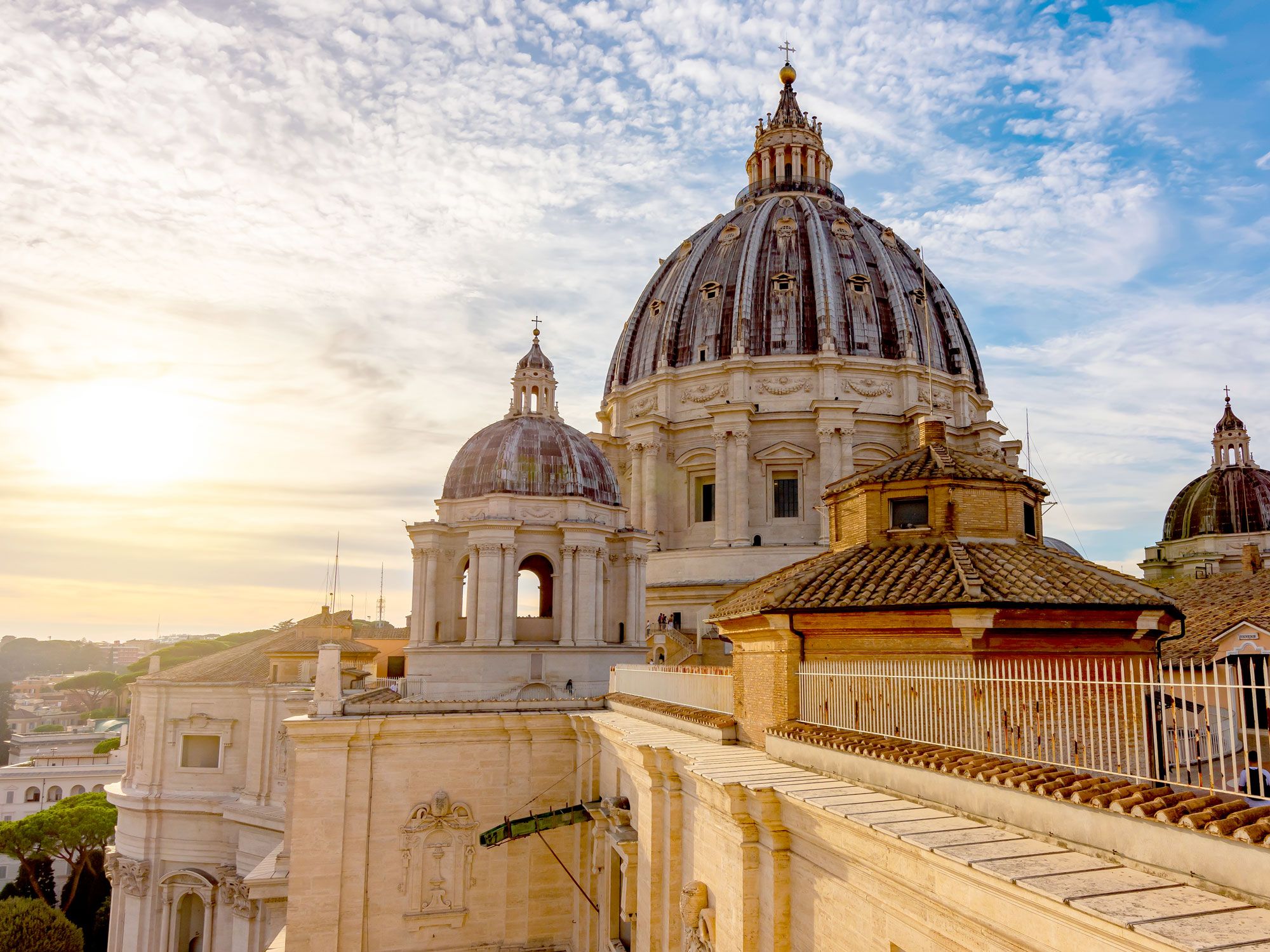
The centerpiece of Vatican City, St. Peter’s Basilica is the world’s largest church building, after Basilica of Our Lady of Peace in Yamoussoukro, Côte d’Ivoire. Regarded as the holiest of all Roman Catholic shrines, said to be where St. Peter is buried, it can accommodate up to 20,000 worshippers at one time.
Construction of the cathedral began in 1506 and continued for 120 years. It features the work of esteemed artists and architects of the Renaissance, such as Bernini, Maderno, and Michelangelo. St. Peter’s Basilica stores several extraordinary art pieces, including Michelangelo’s Pietá, which portrays Mary holding Jesus after the Crucifixion. The basilica’s 138-foot-wide dome was a model for the domes at St. Paul’s Cathedral in London, and the United States Capitol in Washington, D.C.
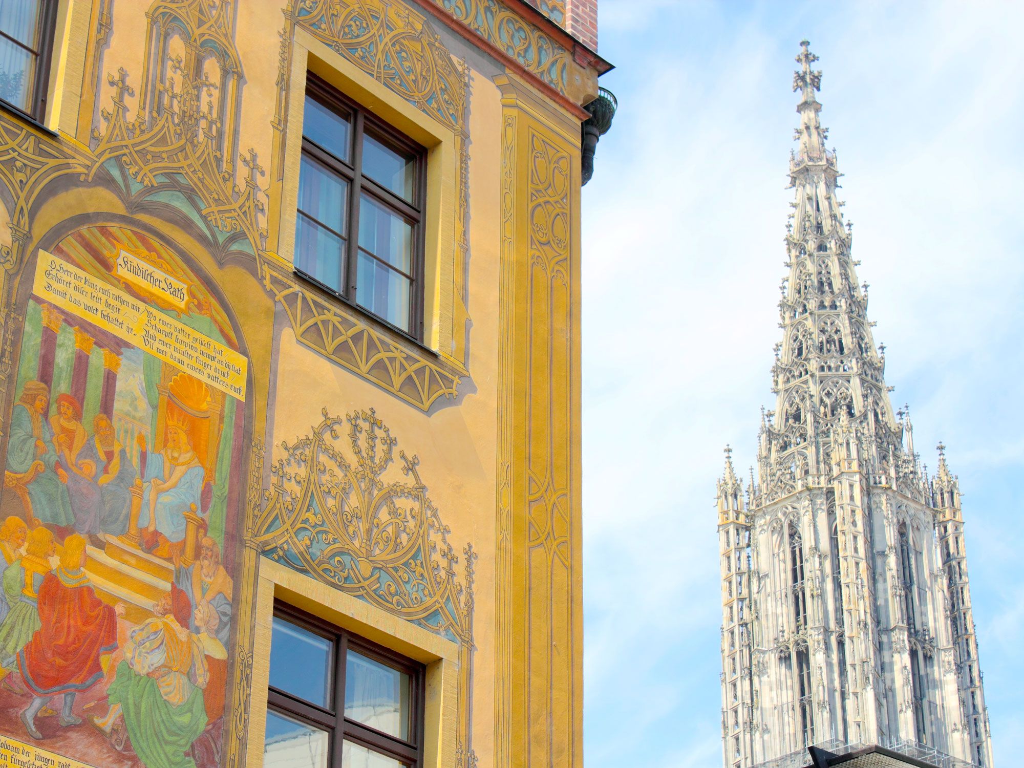
Ulm Minster may seem humble when compared with the other biggest church buildings in the world, but it holds one distinct honor: the world’s tallest steeple. The 528-foot-structure soars above the main entrance of the Gothic landmark and dominates the skyline of Ulm, a city in southern Germany. A 768-step staircase leads up through the steeple to a viewing platform, where visitors can see over the city’s medieval city rooftops, the Danube River, and the Alps in the distance.
Like many of Europe’s emblematic churches and cathedrals, Ulm Minster took several centuries — in this case, five — to complete. Work started in 1377 and was eventually finished in 1890. Incredibly, the church escaped undamaged during a World War II air raid.
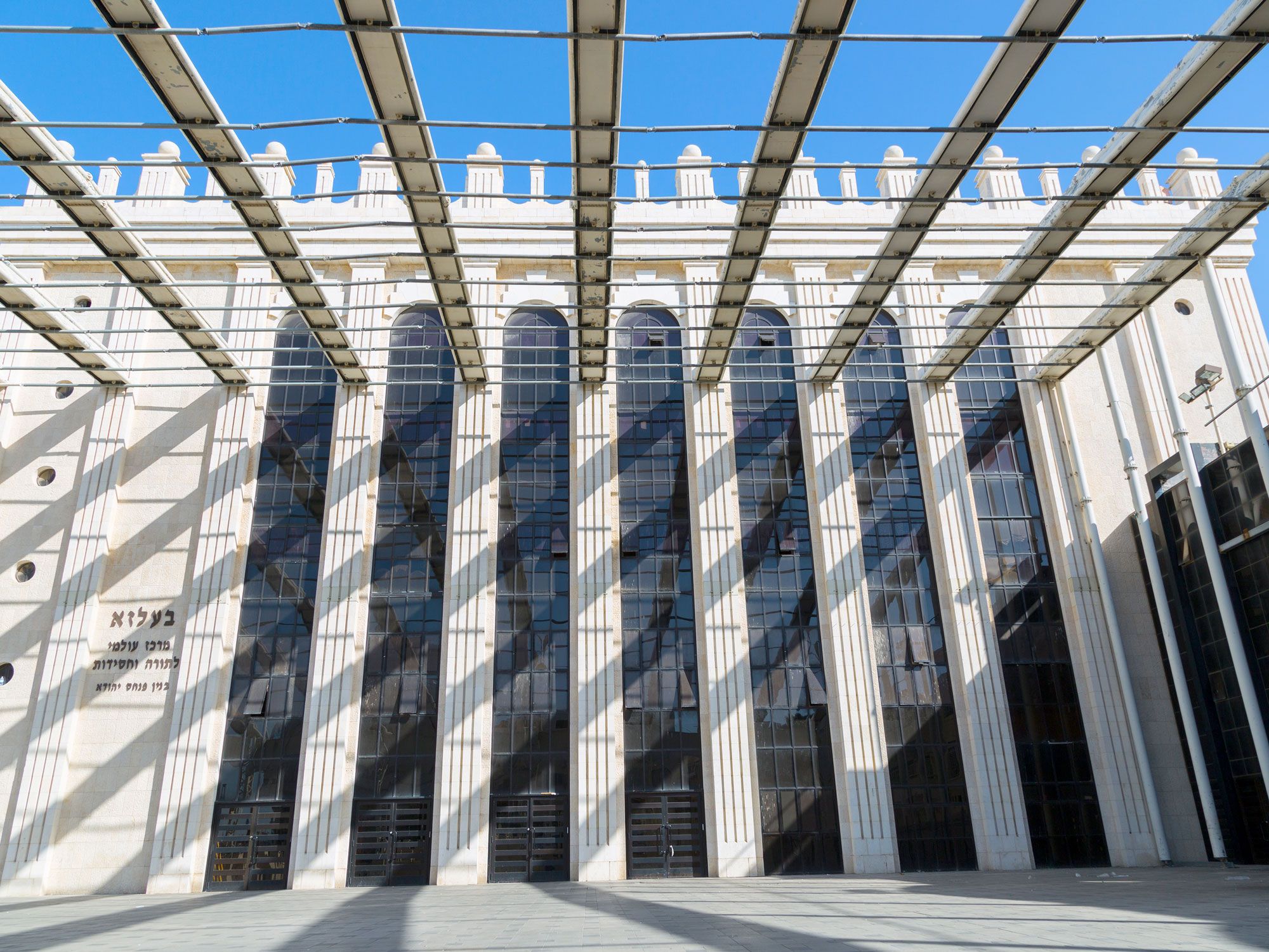
Inaugurated in 2000 after 15 years of construction, the Belz Great Synagogue is the largest synagogue in Israel — or anywhere in the world. The grandiose central sanctuary can hold more than 6,000 worshippers. The massive scale of the synagogue was deliberate, built to replicate a synagogue located in the Ukrainian town of Belz that was destroyed during World War II.
Some say that the temple also bears resemblance to one built thousands of years ago by Herod the Great on Temple Mount, the holiest site in Judaism. The sanctuary of Belz Great Synagogue dazzles with nine chandeliers, each made with 200,000 pieces of Czech crystal, and features a wooden ark capable of holding up to 70 Torah scrolls.
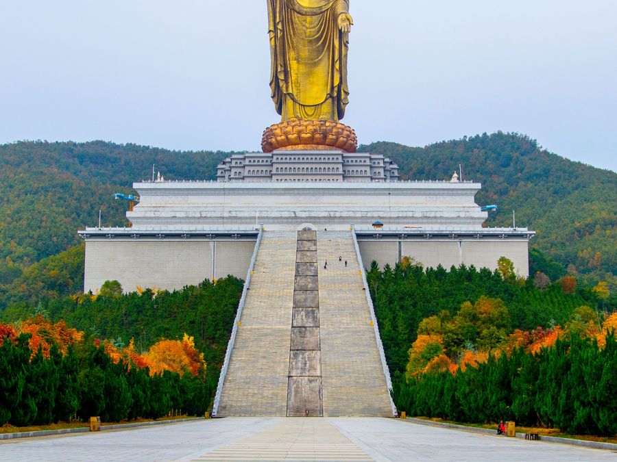
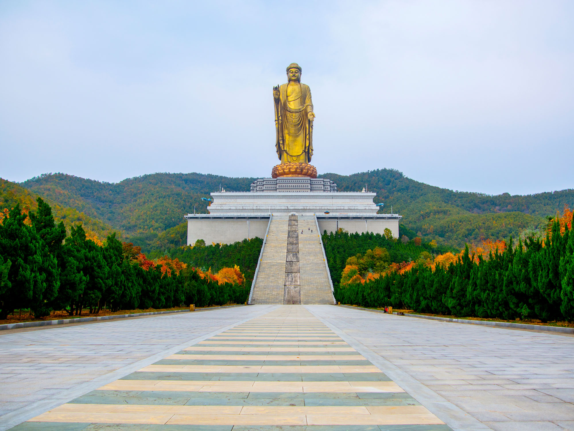
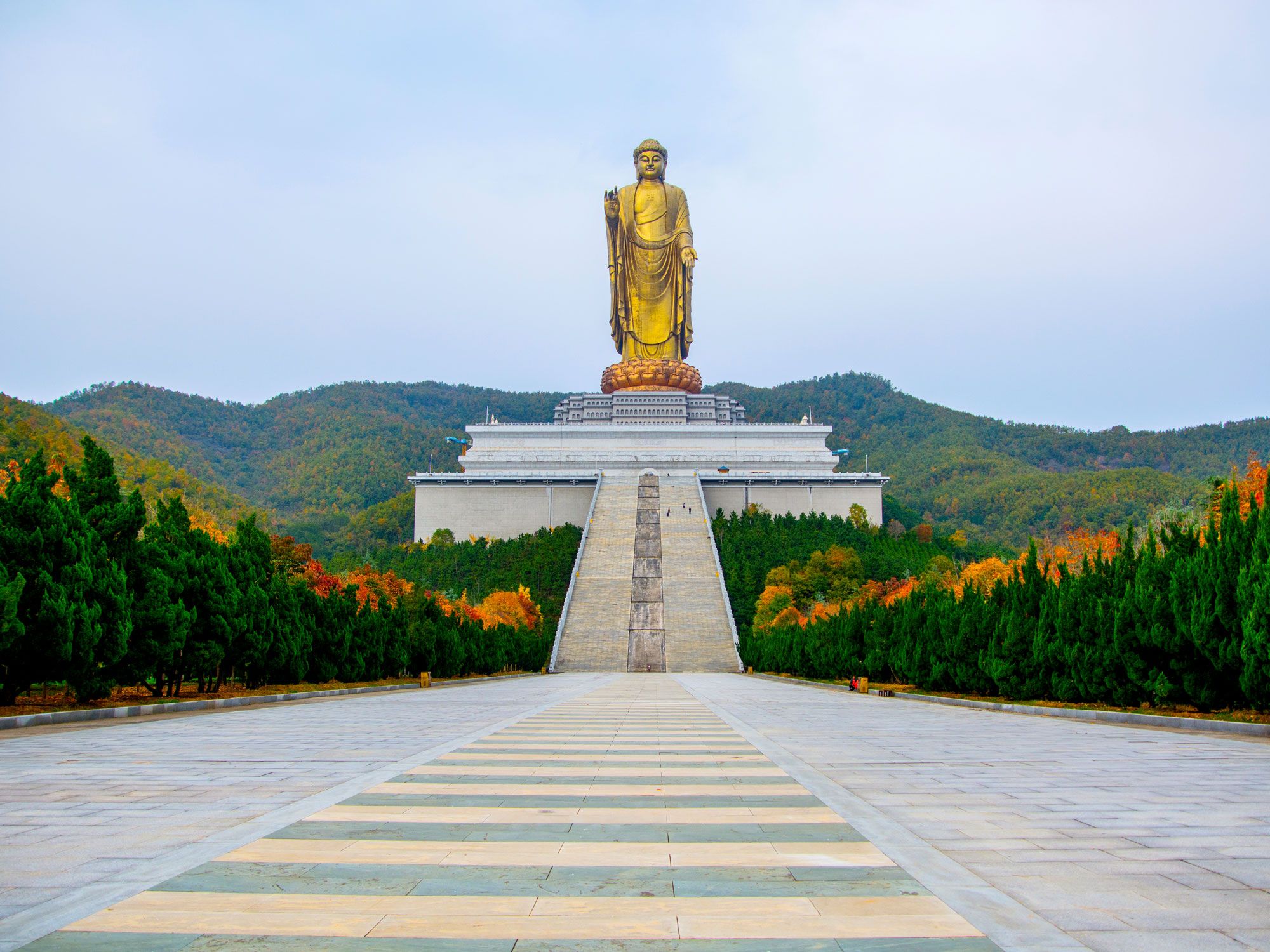
An imposing yet solemn figure against a backdrop of forest-clad hills in China’s Henan province, the 420-foot-tall Spring Temple Buddha is the world’s tallest religious statue. When the statue was built in 2008, after 11 years of construction, it was the world’s tallest statue overall, but India’s Statue of Unity overtook it in 2018.
The golden Spring Temple Buddha portrays Vairocana, the celestial Buddha, standing on a lotus flower throne. Below the main structure are two pedestals, which extend the landmark’s total height to 682 feet. Leading to the Buddha’s feet are two staircases, each divided into 12 flights of 365 steps to represent the months and days of the year.
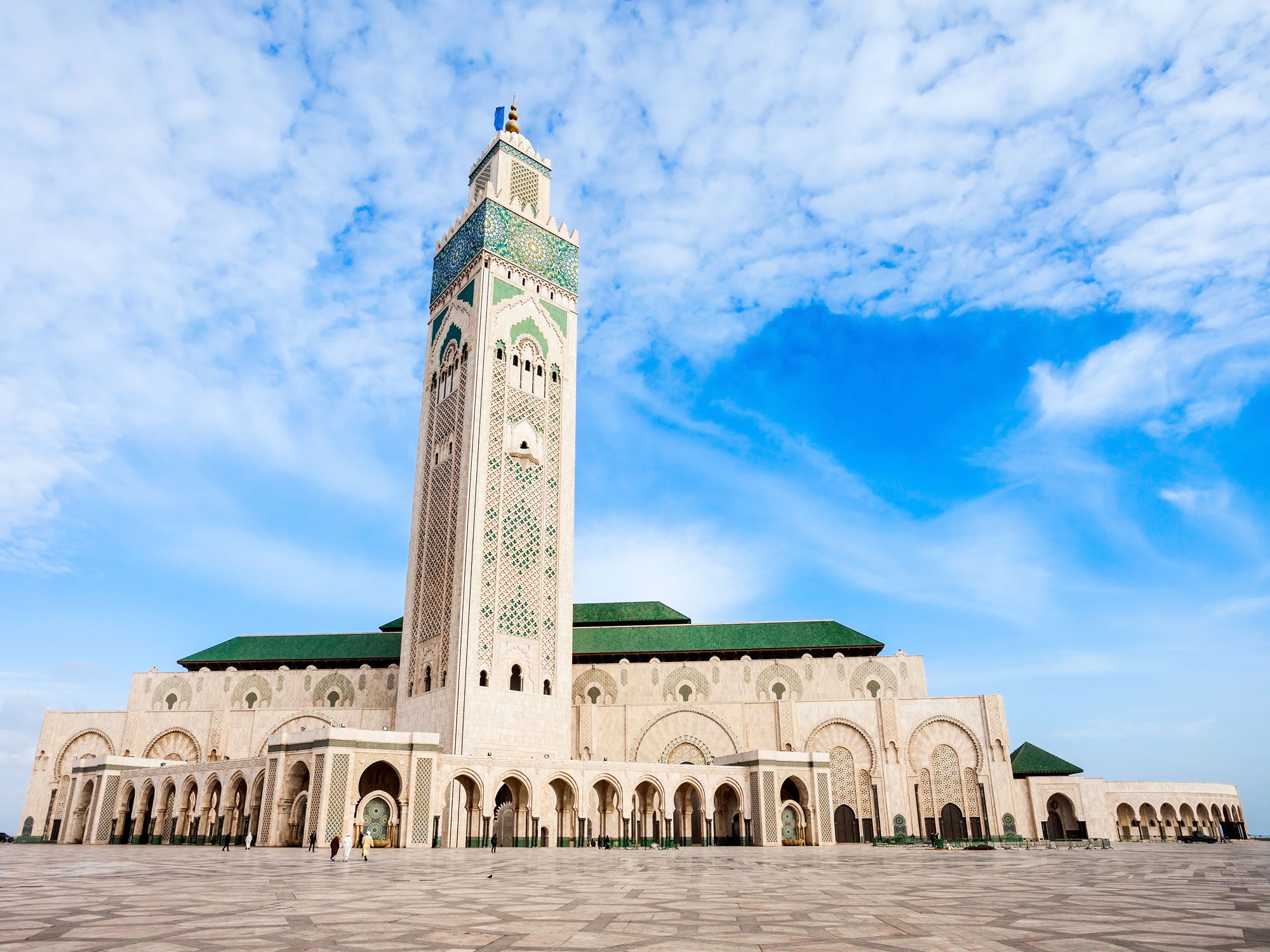
The most prominent landmark on Casablanca’s waterfront is the ornate Hassan II Mosque, completed in 1993. With capacity for more than 100,000 worshippers, it is the second-largest mosque in Africa. But perhaps more impressively, its 689-foot minaret is the one of the tallest on the planet, towering almost like a lighthouse over the Atlantic Ocean.
The impetus for construction of the mosque came from King Hassan II, who was concerned by Casablanca’s lack of historical monuments and desired a proper burial place for his predecessor on the throne, King Mohammed V, who died in 1961. The king employed thousands of artists and craftspeople to etch intricate designs on cedar wood and granite imported from all over Morocco. The seafront location is a reference to a verse in the Quran that says that Allah’s throne is above the water.
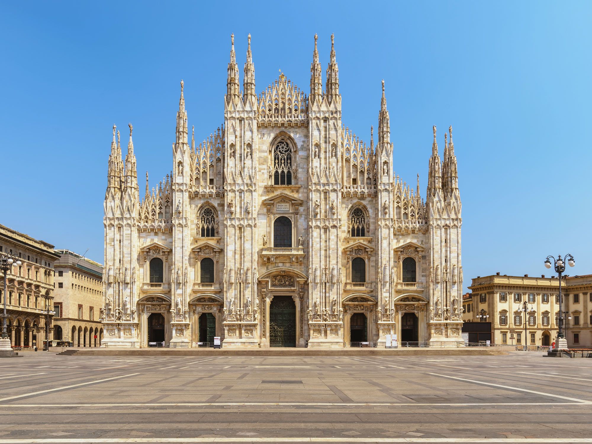
Adorned with a collection of 135 spires, one of which stands a staggering 357 feet tall, Milan Cathedral (Duomo di Milano) is one of the world’s finest examples of Gothic architecture. The largest church in Italy and second-largest in Europe, it took more than 70 architects almost 600 years to erect this enduring landmark.
Construction began in 1386, using pink-hued marble extracted from quarries in nearby Candoglia and transported to the city via a network of purpose-built canals. The exterior of Milan Cathedral boasts a collection of 3,400 statues. Perched atop the tallest spire is the famous gold statue of Mary called the Madonnina.
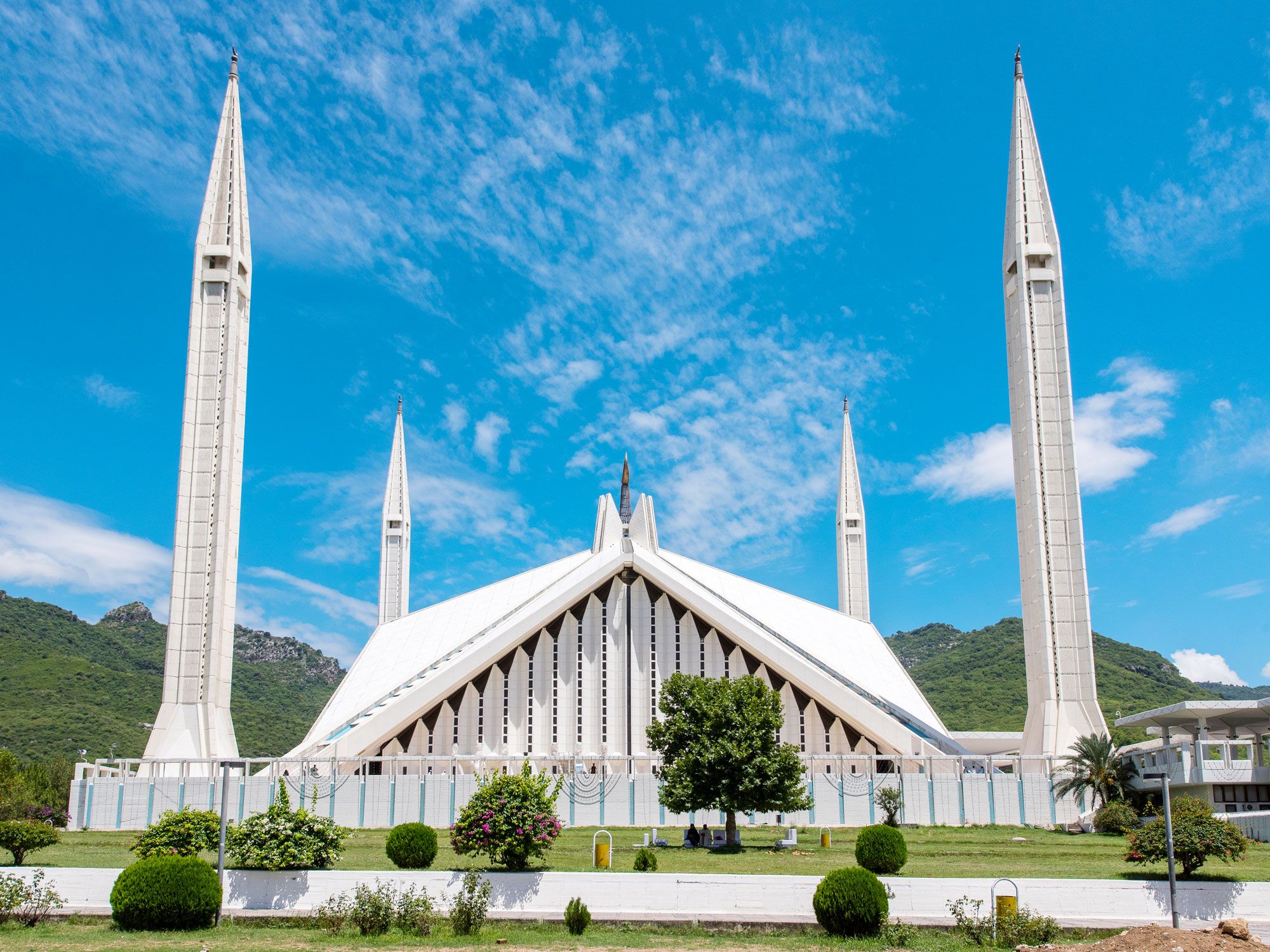
Despite being located in Pakistan’s capital city and considered the country’s national mosque, the Faisal Mosque was named after the late King Faisal bin Abdul-Aziz of Saudi Arabia, who funded the project. Constructed in 1976, the main hall, courtyard, and porticoes of the mosque can host around 300,000 worshippers.
While the size of this Muslim landmark is indeed notable, what’s even more striking is the modern, almost alien-like exterior design devoid of the traditional mosque dome. Instead, it resembles an inverted Bedouin tent and is flanked on all four corners by 260-foot-tall minarets. There’s even an urban myth that the CIA wanted to inspect the minarets because they believed them to be missiles.
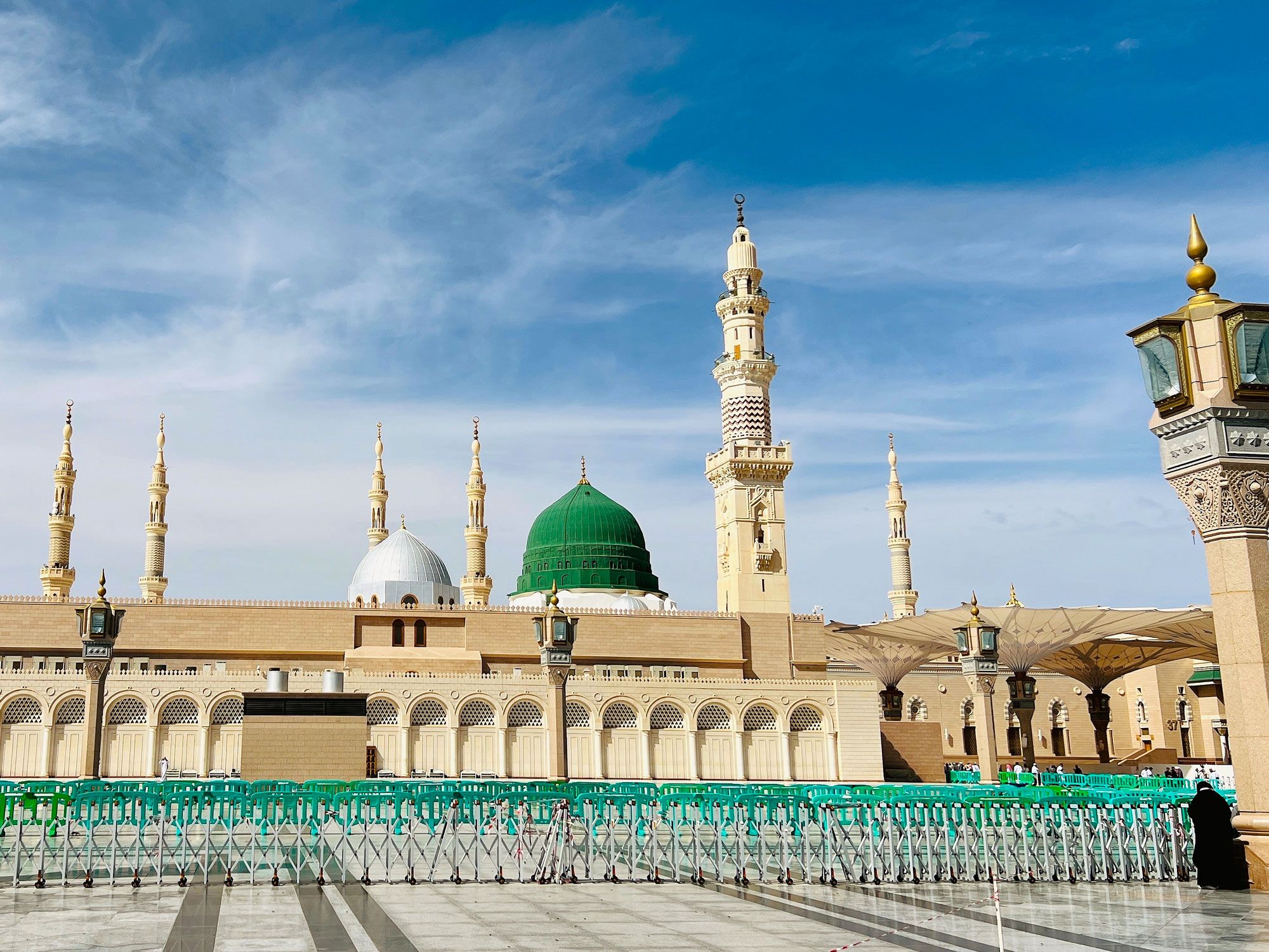
The Prophet’s Mosque (also known as Al-Masjid al-Nabawi) holds immense religious and historical value for Muslims. According to Islamic scripture, the Prophet Muhammad himself built the mosque in 622 CE. Today’s building is a two-tiered rectangular structure that houses both the tomb of the prophet and an area on which his humble family home once stood. Decorating the flat roof of the mosque are 24 raised domes, which can be moved to create an additional prayer area during peak times. An estimated 1 million Muslim devotees visit the mosque for the annual pilgrimage.
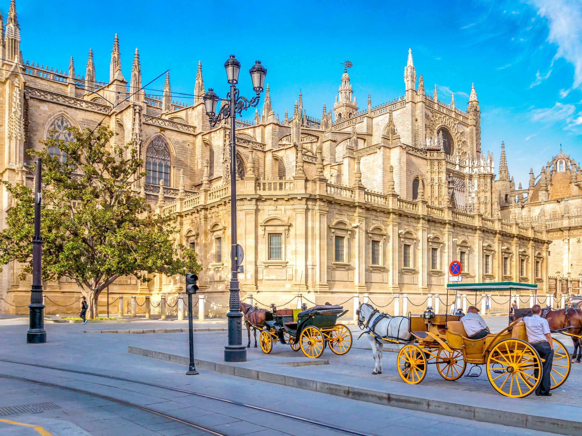
Covering a whopping 124,000 square feet, Seville Cathedral is a Gothic-style cathedral that stands on the site of a former mosque. Upon its completion in 1506, it overtook Istanbul’s Hagia Sophia as the world’s largest cathedral; today it is the third-largest cathedral in Europe. City leaders ordered the building of the cathedral (officially named Cathedral of Saint Mary of the See) to showcase the wealth of Seville that emerged after the Reconquista years and the expansion of Christianity throughout the Iberian Peninsula.
The cathedral features the impressive 343-foot-tall Giralda bell tower and a 66-foot-high altar piece, which is decorated with 45 wood panels that depict the life of Jesus and Mary. Seville Cathedral is also the final resting place of explorer Christopher Columbus.
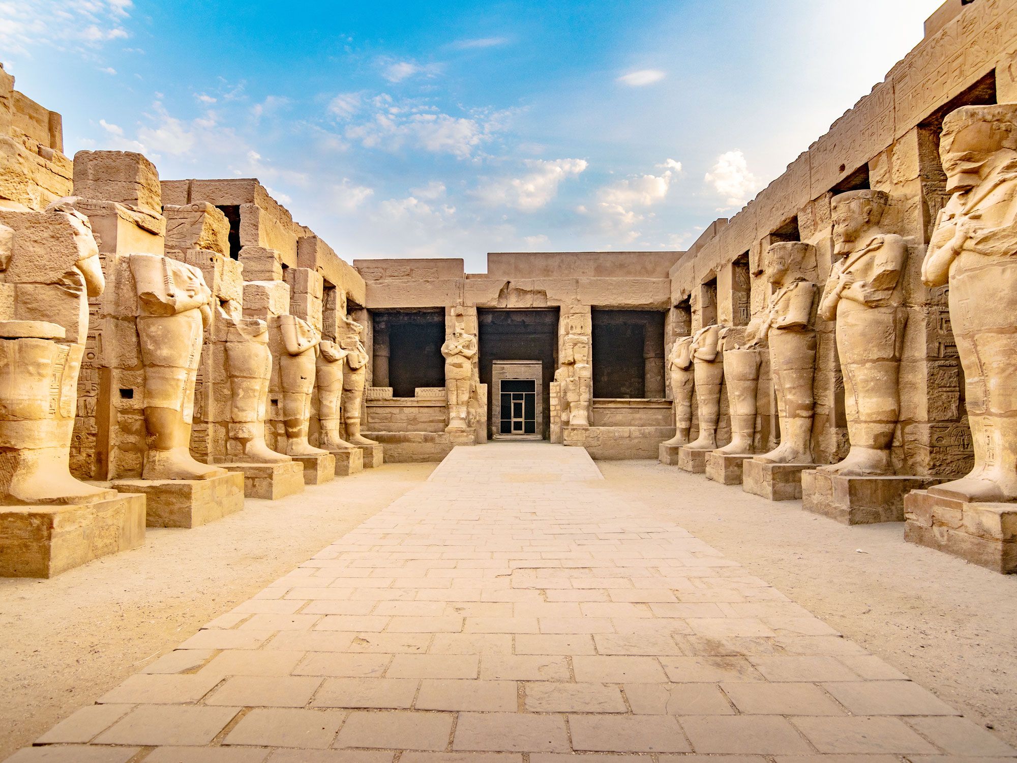
Construction of the Karnak Temples began some 4,000 years ago, when Thebes, a city on the east bank of the Nile River where modern-day Luxor is located, was chosen as the site of the new Egyptian capital. Occupying more than 200 acres, the temples showcase the achievements of great Egyptian architects and rulers, such as Intef II, Hatshepsut, and Thutmose III.
One of the most impressive areas of the temples is the Great Hypostyle Hall, which has 134 columns, each 72 feet tall and carved with hieroglyphics. You may even recognize the hall from the James Bond movieThe Spy Who Loved Me.
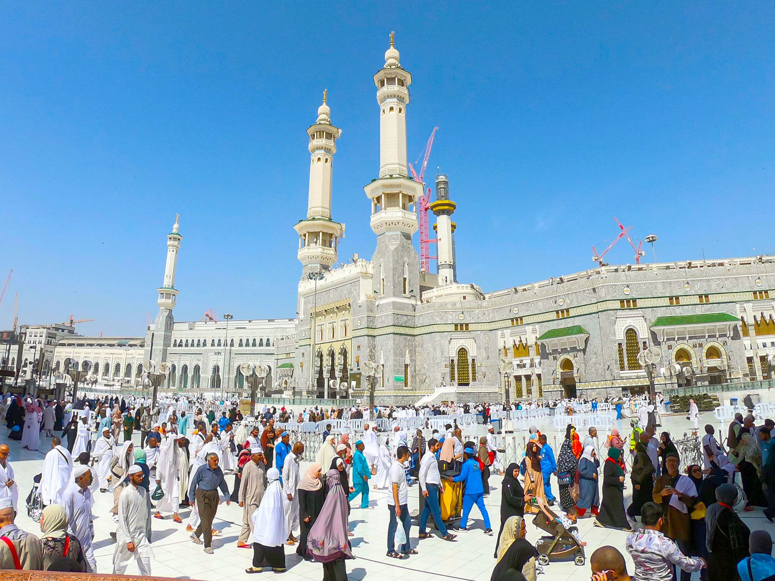
A visit to the Great Mosque of Mecca (aka Masjid Al-Haram) is also a rite of passage for many Muslims. A cube-shaped building at its center, the Kaaba, is the holiest shrine in Islam — on any given day, droves of worshippers come to visit it. Other significant areas of the Great Mosque are the sacred Zamzan Well, from which pilgrims drink holy water, and the Station of Abraham, a small square stone associated with the building of the Kaaba.
First recorded as a Muslim structure in 638 CE, the mosque has undergone several major renovations since the 1500s that were commissioned by caliphs, sultans, and Saudi rulers. At present, it is undergoing an expansion that will increase the capacity to over 2 million worshippers.
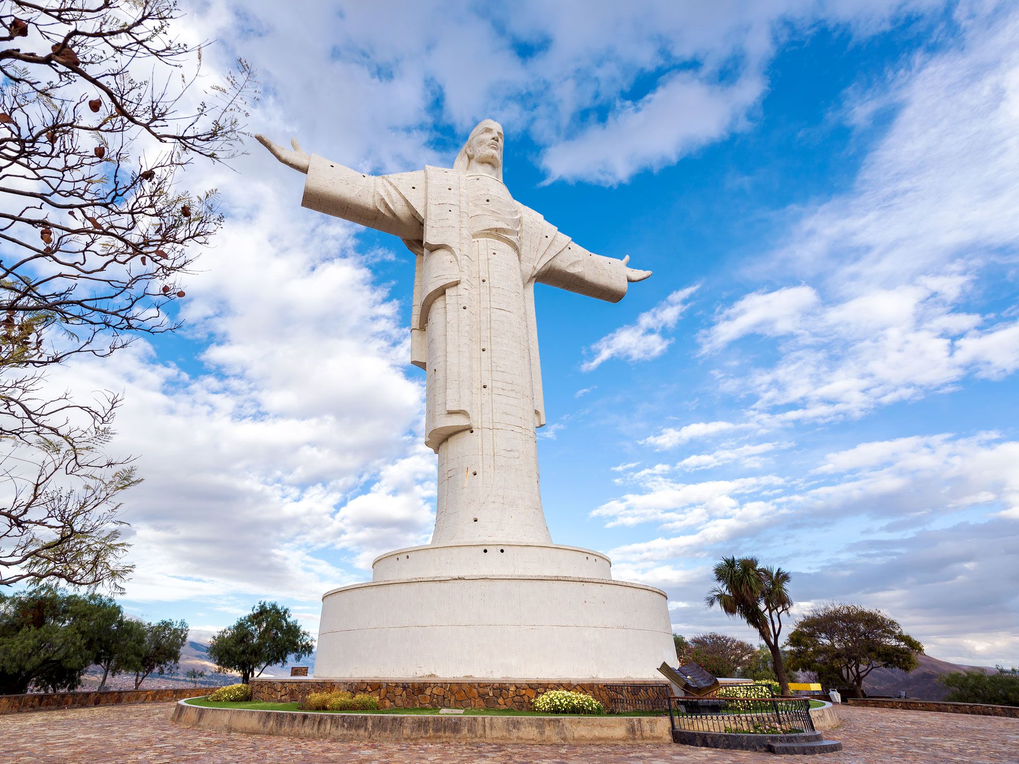
The Christ the Redeemer statue in Rio de Janeiro, Brazil, might be the more famous monument to Jesus, but neighboring Bolivia boasts one that is even bigger. Cristo de la Concordia lords 869 feet over the town of Cochabamba, and the statue itself is a symbolic 108 feet tall, which equates to 33 meters — one for every year of Jesus’s life. What gives Bolivia’s statue the edge over Rio’s revered Redeemer is an extra 1.5 feet of stylishly quaffed hair. Built between 1987 and 1994, Cristo de la Concordia is a popular tourist attraction accessible via cable car or a 1,250-step staircase.
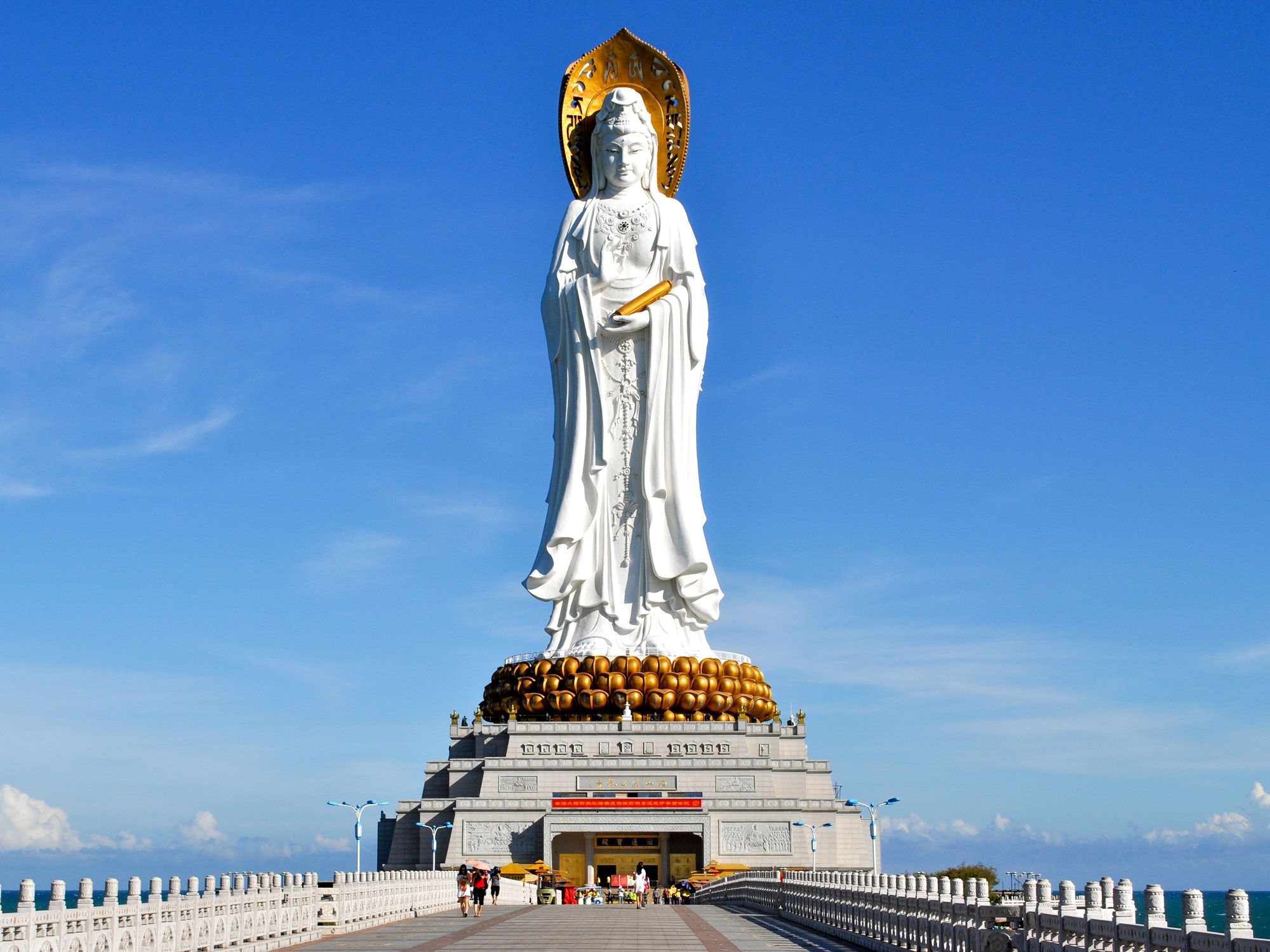
The celestial Guanyin of Nanshan statue rises 354 above a small island in the South China Sea, just off the coast of Sanya in the island province of Hainan. Accessible via a causeway, the whitewashed three-faceted statue depicts the Buddhist bodhisattva Guanyin, and each of the statue’s faces has an individual pose.
The Guanyin facing inland holds a sutra (Buddhist scripture) and makes the vitarka sign with her right hand, which symbolizes teaching, growth, and awakening. Two other deities face the sea, one holding prayer beads and another other with a lotus flower. The statue forms part of the Nanshan Temple, a complex home to replica temples from the Tang dynasty.
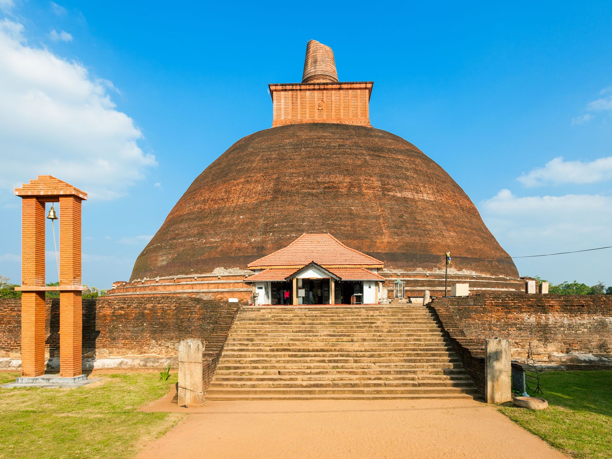
Jetavanaramaya is an ancient Buddhist stupa (a dome-shaped shrine for meditation) located within the ruins of the Jetavana monastery. When erected at the beginning of the fourth century, the 400-foot-tall stupa was among the world’s tallest structures — only two of the Pyramids of Giza were taller.
It’s no longer the tallest stupa, but with a base area covering more than 2.5 million square feet, it is the largest when measured by volume. An estimated 93 million bricks were used to build Jetavanaramaya, and the foundations are embedded 28 feet into the ground. The stupa belongs to one of the Buddhism world’s most significant shrines and can house an estimated 10,000 monks.
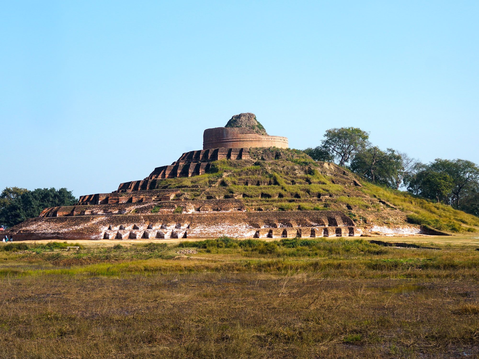
Located amidst tranquil surroundings in northeastern India and partly overgrown by vegetation, this multitiered Buddhist monument is also one of the largest stupas in the world, rising 104 feet tall with a circumference of approximately 400 feet. The original structure dates back to the third century BCE, although what is seen today was likely built between 200 and 750 CE.
Kesaria Stupa is closely associated with the final days of Buddha, who had announced his attainment of nirvana upon departing from Vaishali for Kesaria. The Licchavi clan followed Buddha to the town and erected the stupa in his memory. Excavations in 1998 uncovered arrowheads, Islamic coins, and ruined idols, among other artifacts.
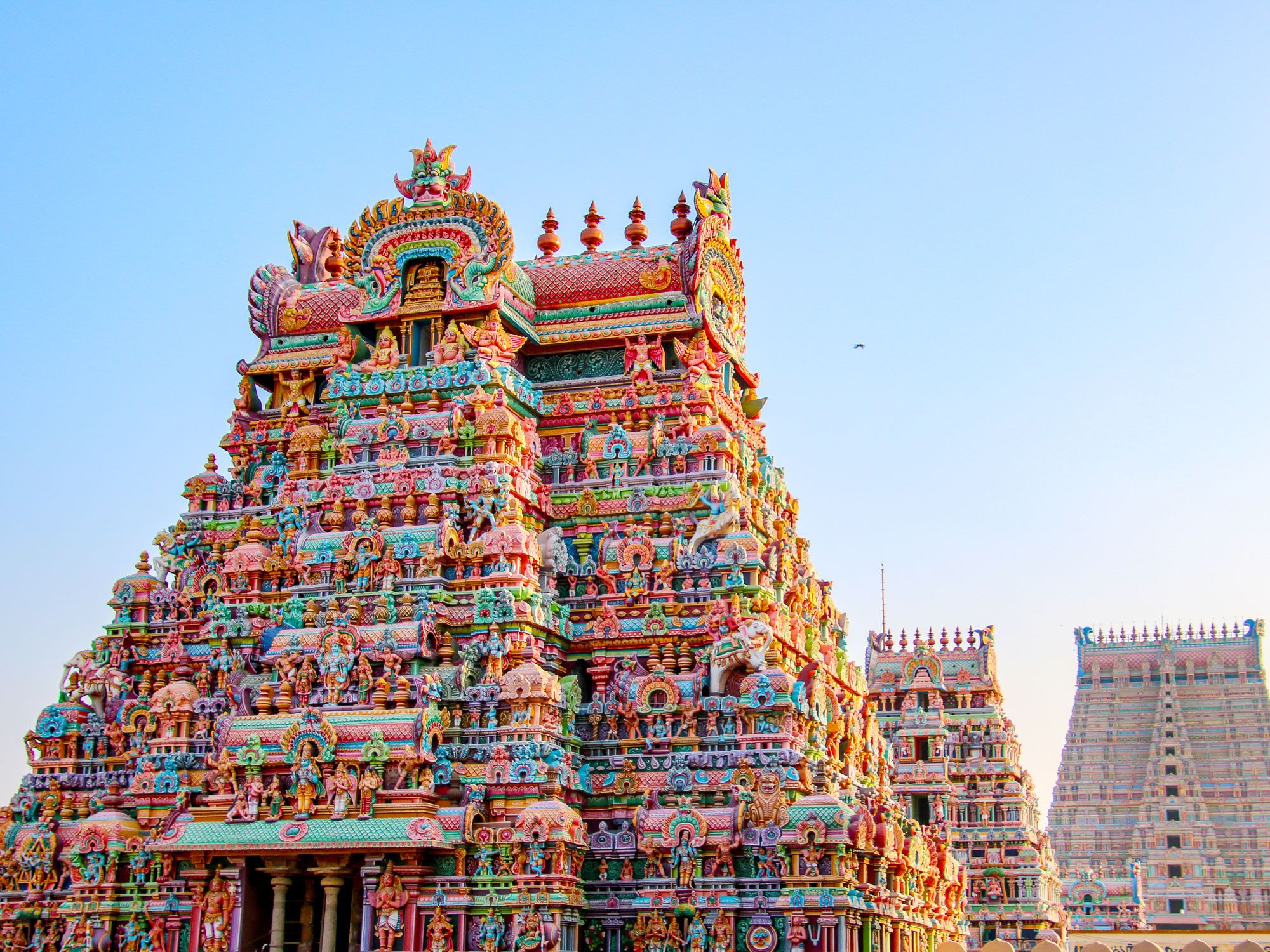
Sri Ranganathaswamy is the largest Hindu temple in India, covering 156 acres in Tiruchirappalli, a city in the Indian state of Tamil Nadu. The temple is dedicated to Lord Ranganatha and is considered the holiest of the 108 Divya Desams (Vishnu temples) mentioned in an ancient collection of Tamil verses.
The architecture is classic Dravidian, which is a colorful style that originated in South India. The sprawling complex also features 21 ornamental gopurams (tower gateways), the tallest of which is 240 feet. Each December, hundreds of thousands of pilgrims attend the 21-day Vaikunta Ekadasi festival at the site.
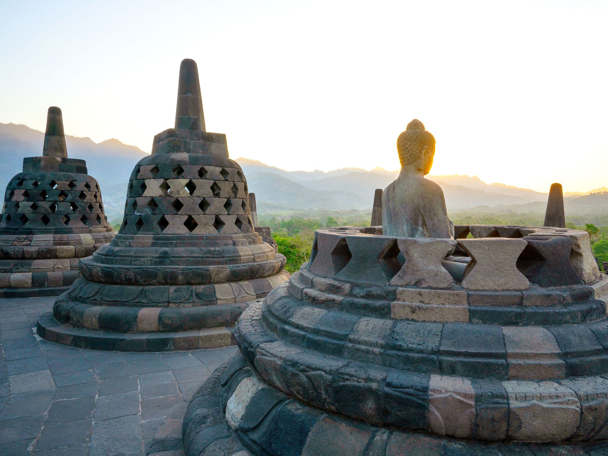
Set on a majestic hill and surrounded by lush jungle is Borobudur Temple, which lays claim to being the largest Buddhist temple ever built. This UNESCO World Heritage Site took 75 years to construct and was unveiled in 825 CE. It has a surface area of approximately 26,000 square feet and is designed in three tiers: a pyramidal base, a core of three circular platforms, and a crowning stupa.
Other notable aspects are a collection of 72 smaller stupas and over 2,500 bas reliefs. Borobudur was abandoned and overgrown with jungle sometime between the 10th and 15th centuries, but it was rediscovered in the 19th century by Thomas Stamford Raffles, the British ruler of Java at the time, and restored in the 1970s.
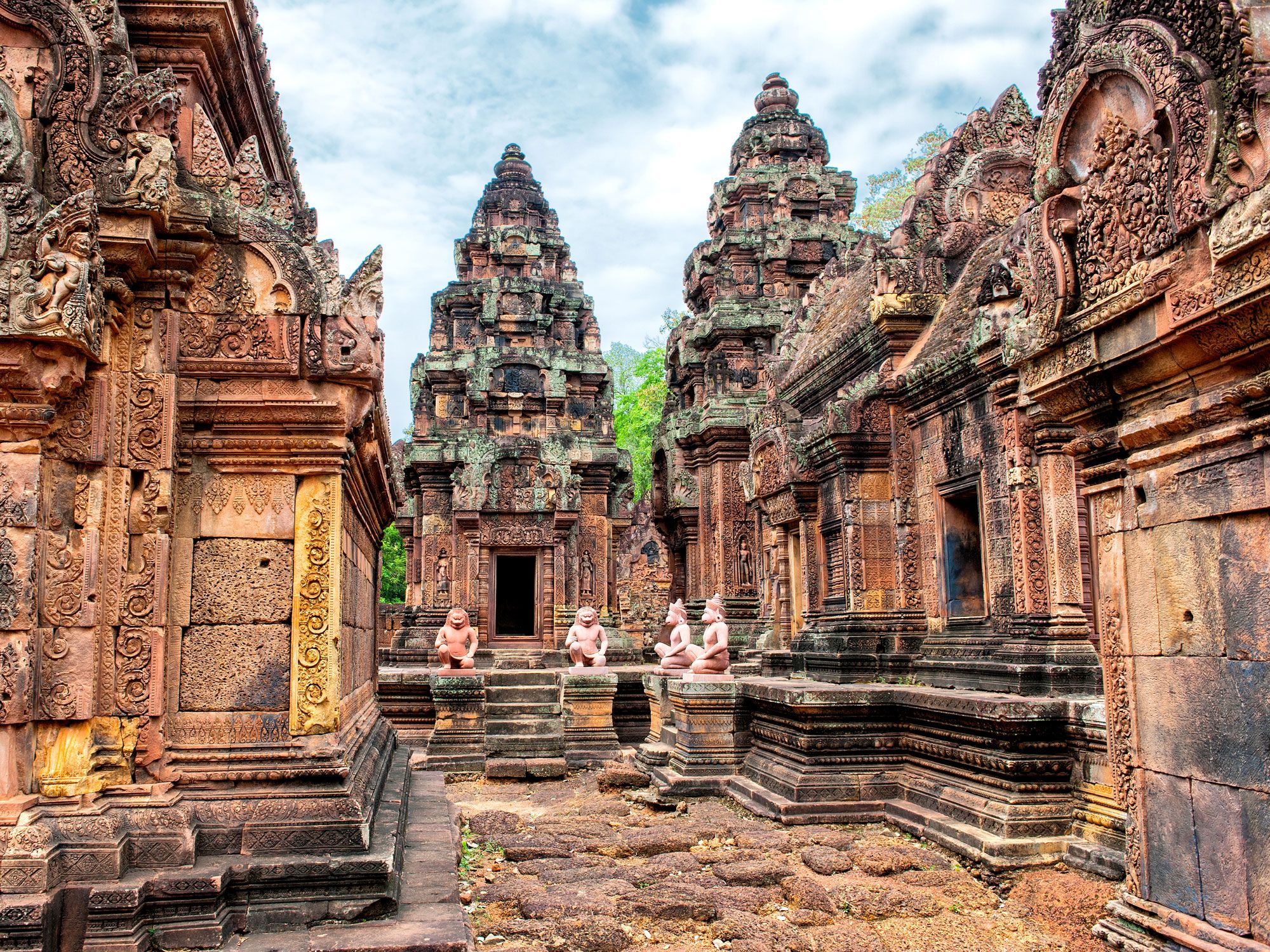
Sprawling across a vast area of over 400 acres in northern Cambodia, the Angkor Wat temple complex is the world’s largest religious structure. Erected by the Khmer Empire in the 12th century, this awe-inspiring monument began as a Hindu temple and was later converted into a Buddhist place of worship.
The temple design is an architectural portrayal of Mount Meru, which is the center of the Hindu universe. The five towers represent the five peaks of the mountain, and the surrounding moat and defensive wall symbolize the oceans and mountain ranges. How colossal is Angkor Wat? It’s so large that many of its features are visible from space.
Advertisement
More from our network
Daily Passport is part of Inbox Studio, an email-first media company. *Indicates a third-party property.
Daily Passport writers have been seen in publications such as National Geographic, Food & Wine, CBC, Condé Nast Traveler, and Business Insider. They're passionate about uncovering unique destinations and sharing expert tips with curious travelers.
In the wake of the Industrial Revolution, rapidly growing cities faced a newfound problem. Their streets — built wide enough for modest horse and carriage traffic — were now jammed to a standstill with public buses and private carts, trolleys and streetcars, delivery carts, pedestrians, and eventually automobiles. So, tunnels were dug beneath the streets — and subways were born. Wondering which cities were the first to build subways? The following 10 cities are home to the world’s oldest metro systems.
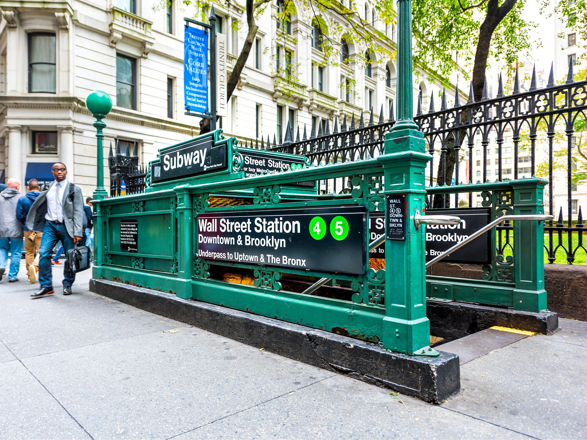
Service on the New York City subway began on October 27, 1904. Back then, the city’s subways were privately owned and constructed, and companies raced to dominate the emerging market. The independent lines eventually linked to one another so passengers could transfer between them, and the city finally stepped forward and unified the system in the 1940s. But there remains one lingering difference between the systems: The tunnels and trains that run on the IRT lines (which are the numbered subway lines today) are narrower than those of the rest of the system (the lettered lines).
Today, there are 36 subway lines criss-crossing the Big Apple. They run on 248 miles of track and provide transportation for more than 4 million people each day, making it the largest transit system in North America.
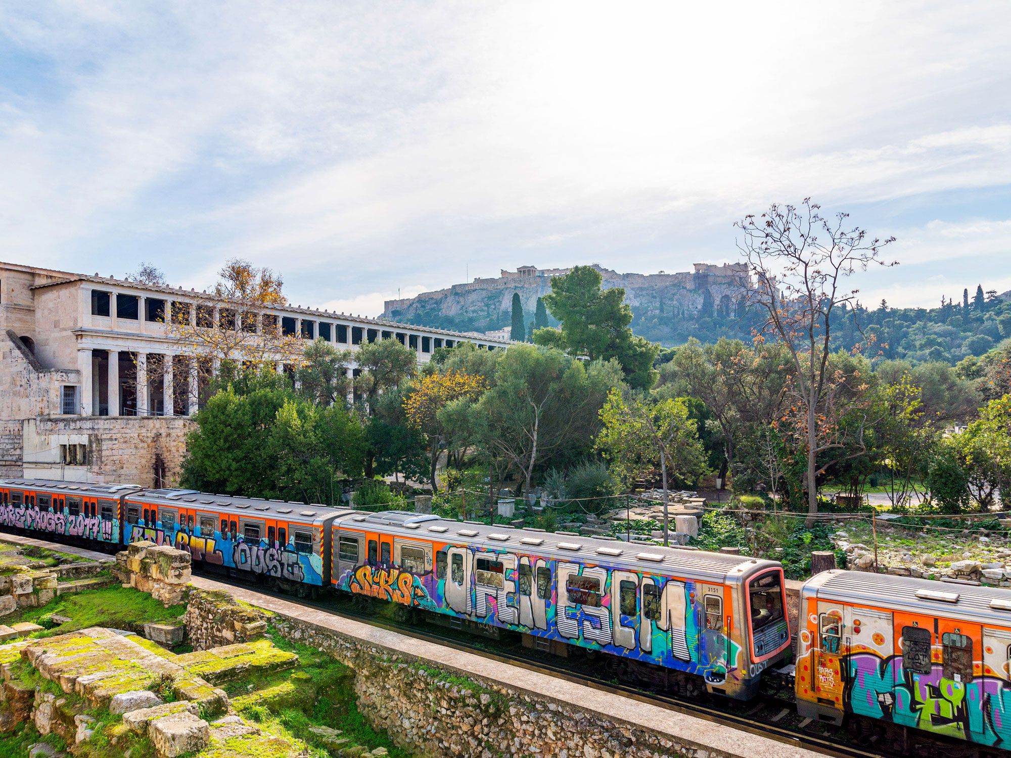
While Athens’ original metro line dates to 1869, the underground tracks were originally laid for conventional steam locomotive service. The tracks were electrified in September 1904, from which time it was considered a rapid transit system.
As crews continue to dig additional tunnels to modernize and augment the Athens subway system, their shovels strike more here than they do elsewhere — like second-century Roman baths, Byzantine mosaics, ancient obsidian knife blades, burial sites, and massive stone-carved storage urns. The authorities have accepted that the tunneling process takes longer in Athens, so they plan around the antiquities: For a 1992 dig, teams of archaeologists started months before construction crews and then labored alongside the workers, cataloging artifacts as they were unearthed.
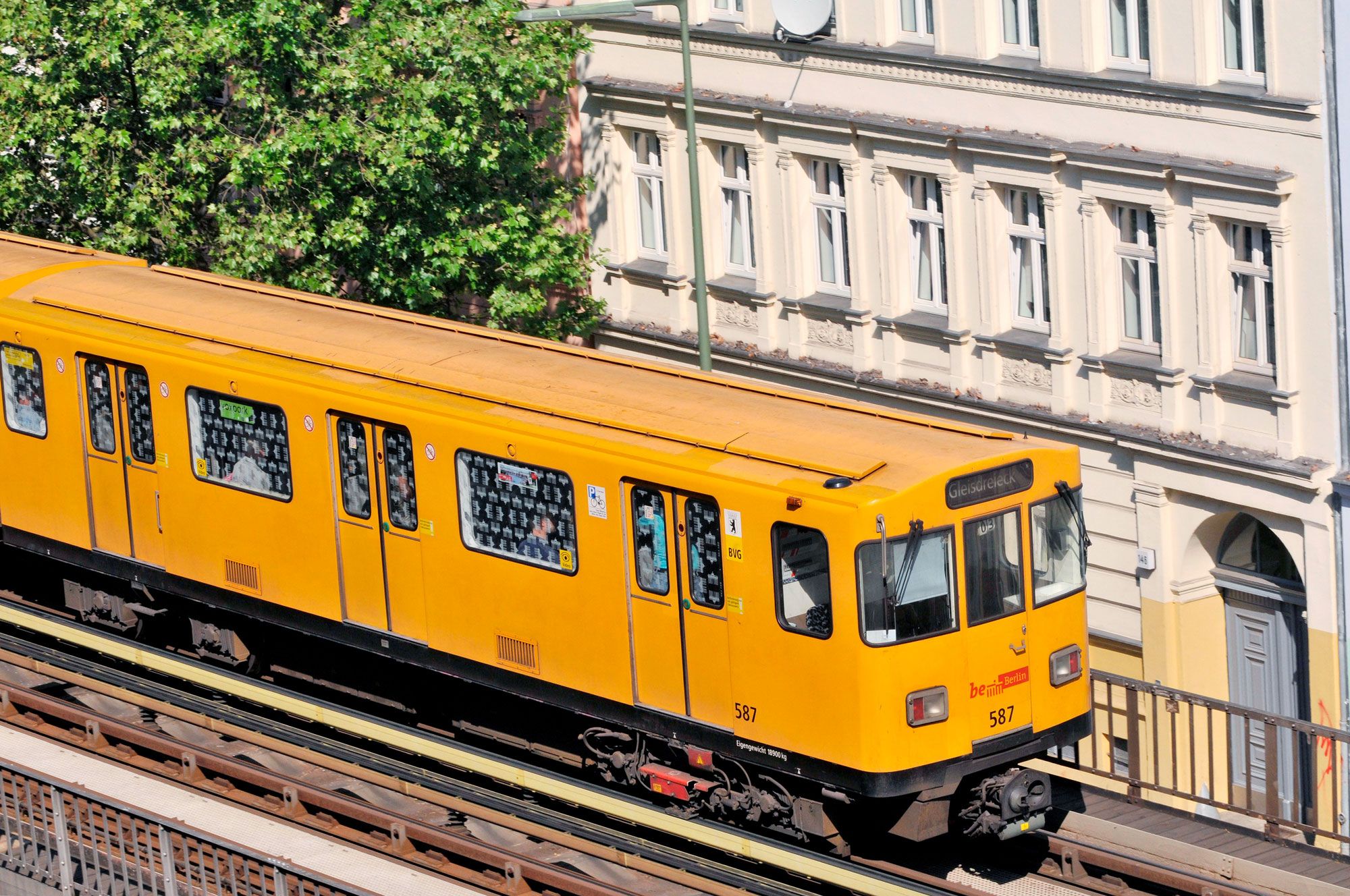
In the late 1800s, Berlin undertook the construction of a two-pronged mass transit system: an elevated electric train, the Hochbahn, and an underground electric train, the Untergrundbahn (shortened to U-Bahn). The terminal station of the oldest section of the U-Bahn, Warschauer Brücke on the northern side of the Spree River, was closed from 1961 to 1995 because it was beyond the Berlin Wall in East Germany. It was renovated and reopened to passengers in 1995 as the Warschauer Strasse station. The station now also serves as the starting point for the Berlin Wall Trail. The modern U-Bahn carries 530 million passengers each year through its 173 stations.
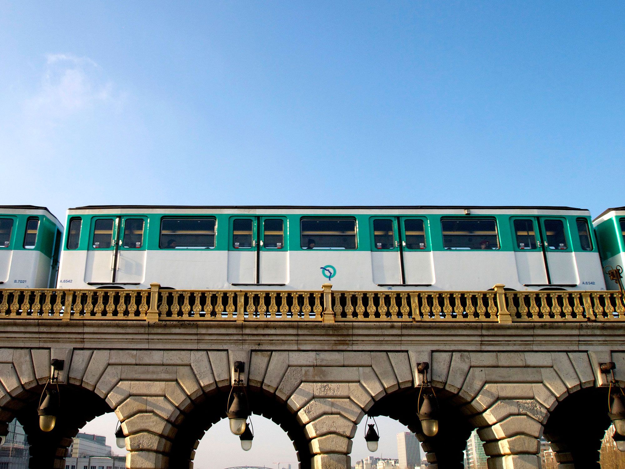
The dawn of the 20th century in Paris brought a chain of exciting events: the Summer Olympics (the first in which women competed and the first held outside of Greece); a world’s fair called the Exposition Universelle, where inventions like the X-ray and the diesel engine were unveiled; and an upgrade to the Eiffel Tower with electric lights. Another auspicious event was the 1900 opening of the first portion of the city’s Metro, between Porte Maillot and Porte de Vincennes.
The extensive and reliable subway system now stretches 140 miles, with upwards of 1.5 billion passengers each year. Eighty-six of the station entrances are still adorned by the curvy Art Nouveau-style cupolas introduced in 1900 and emblazoned with the word “Métropolitain.”
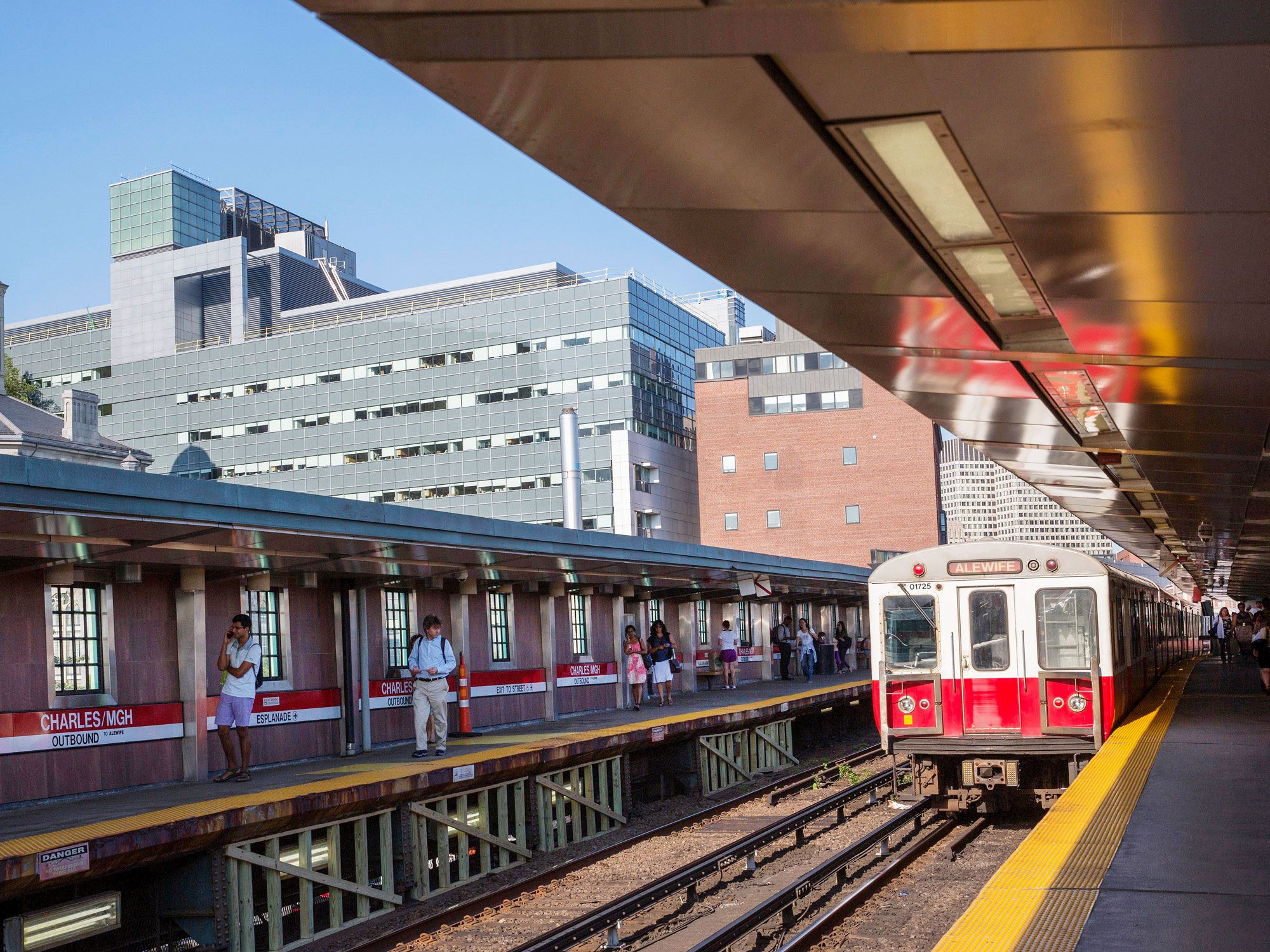
North America finally got its first subway in 1897. Sure, Chicagoans had been riding the “L” for a few years prior, but the Massachusetts Bay Transit Authority decided to excavate a tunnel to divert electric streetcars underground, allowing them to pass under a congested stretch of Tremont Street.
While the tunnel was being dug, workers uncovered the graves of 90 people, who had been buried in a section of the Central Burying Ground that had been blithely paved over by a road project in 1836. The bodies were reinterred in the cemetery, and digging continued. The original four-track tunnel segment on Tremont Street, now registered as a National Historic Landmark, is still one of the busiest sections of the system, which is called the “T.”
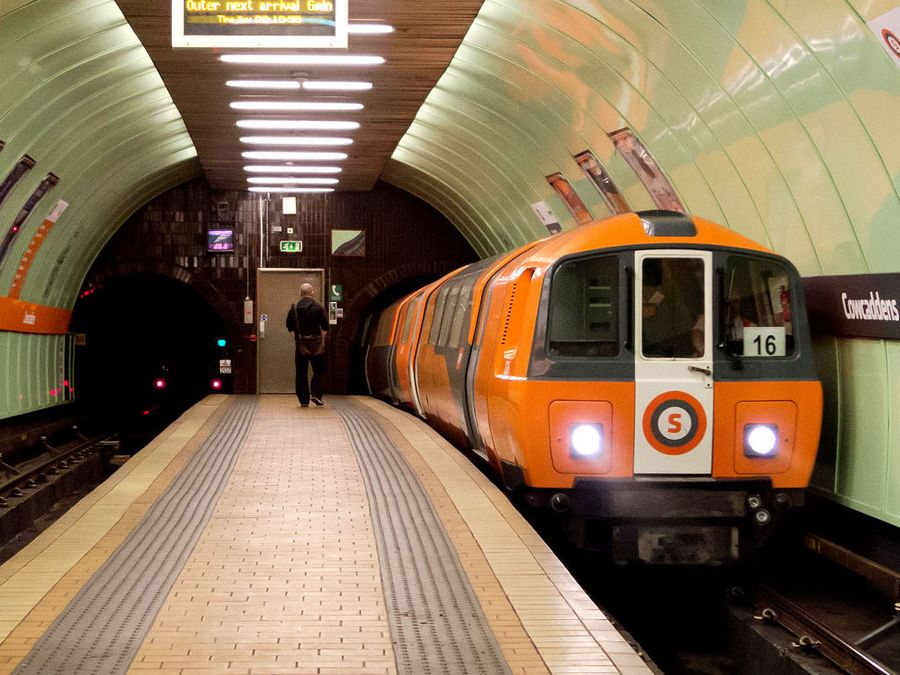
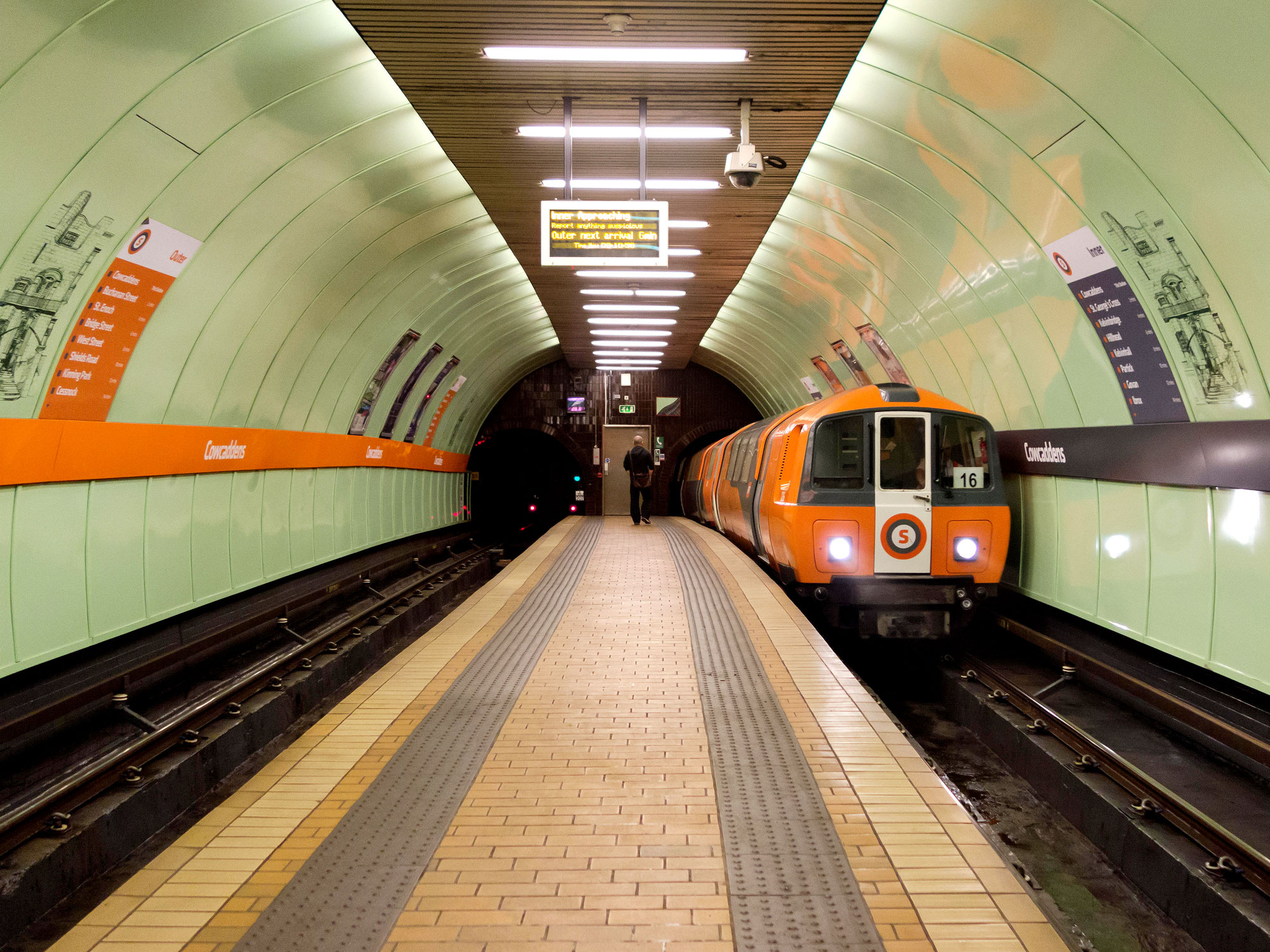
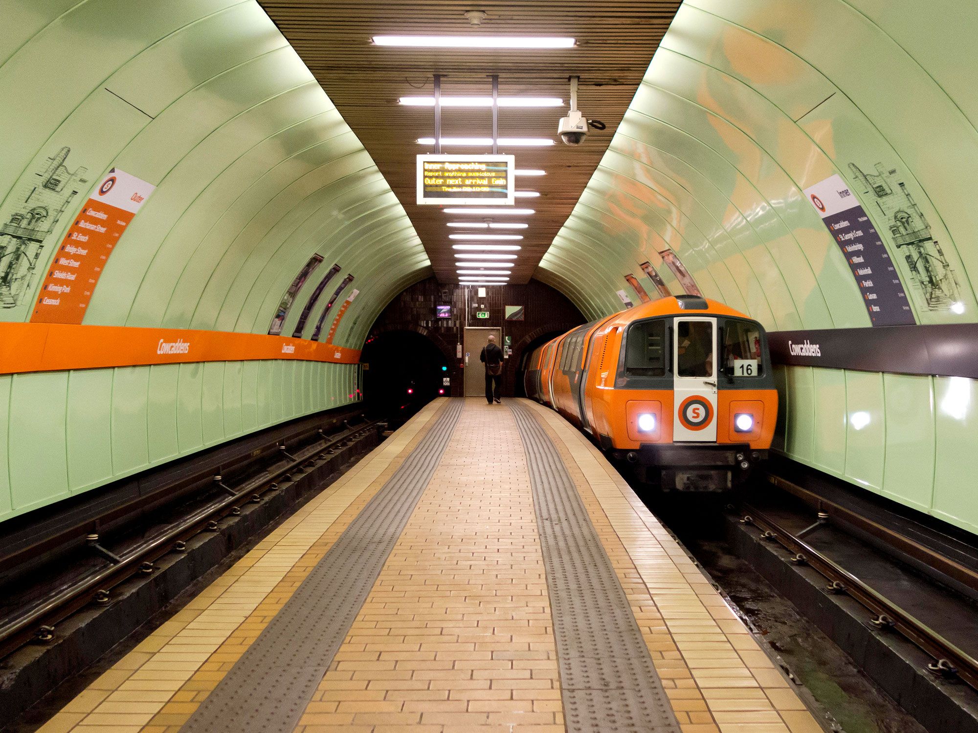
The Glasgow subway system is nicknamed the “Clockwork Orange” (after Anthony Burgess’ 1962 novel) for its vividly painted railstock and single, circular loop under the city. The system’s sole line stretches just 6.5 miles long, but it is intersected by several above-ground commuter rail lines. The 11-station subway opened on December 14, 1896, initially as a steam-powered, cable-hauled system, before electrification in the 1930s. The system, which serves a relatively small area of Glasgow, has been the subject of debate over the years, as several expansions have been proposed but have never materialized.
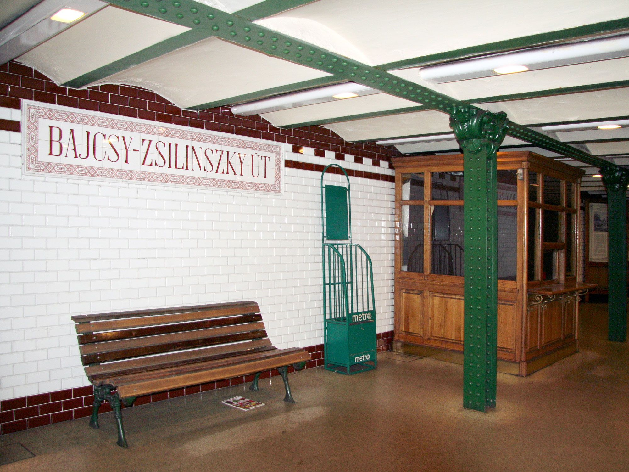
The Budapest metro system, which opened in May 1896, is notable for being only 8.8 feet beneath the street. The subway, the oldest electrified system in Europe, was first constructed as part of the city’s millennial celebration. That original 2.3-mile section, Line 1, is still in use today. Building the shallow tunnel was done relatively quickly over 21 months by digging a trench down the street, then bricking up the open channel and paving back over the top.
The Budapest metro has expanded several times over its history, including a project undertaken on Line 2 during the 1950s, which includes a Cold War-era secret bunker with a tunnel leading to the Hungarian Parliament Building.
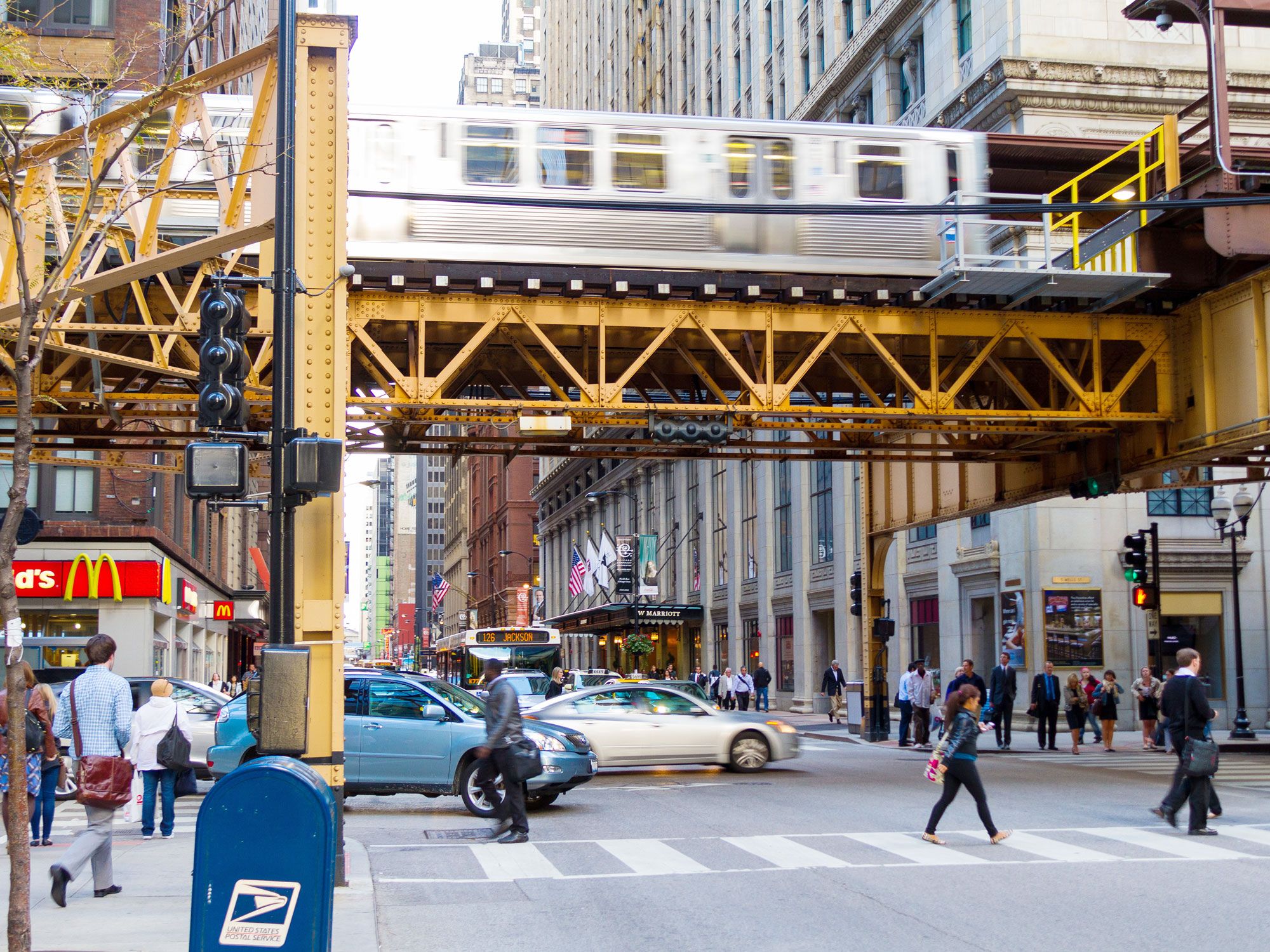
Unlike the mostly underground trains on this list, the modern public transit system adopted in Chicago was originally a train line running along elevated tracks, which were cheaper and easier to build without disruption. Though it now includes underground portions, the “L” (short for “elevated”) took its first run in June 1892: a steam-powered, 3.6-mile trip along today’s Green Line between 39th Street and Congress Street stations.
Rapid modernization of the city — thanks in part to the successful 1893 Columbian World’s Exposition — led to expansion of the elevated tracks and a project to convert the entire system from steam to electric third-rail power (an invention introduced at the fair). The current “L” system, which still runs on third-rail technology both on elevated tracks and underground, is 224 miles long and carries an average of more than 420,000 passengers per day.
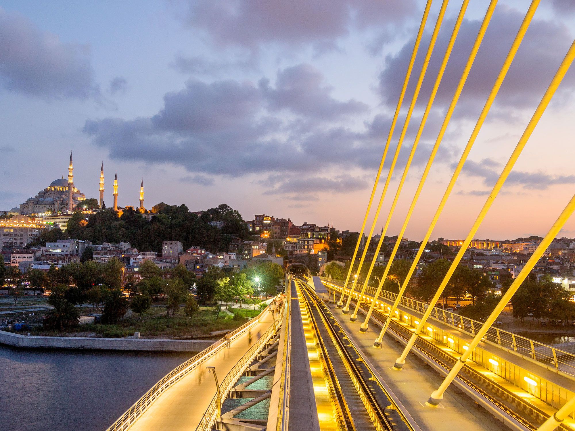
The world’s second-oldest metro was built as part of Istanbul’s wide-reaching public transportation network, which also included ferries and above-ground trams. The first section of the subway, known as the Tünel, was proposed to the Ottoman government by a visiting French engineer named Eugène-Henri Gavand. He suggested that a tunnel be cut beneath the steep slope between Galata, at the Bosphorus River, and the Beyoğlu district.
That tunnel is a narrow, 1,820-foot long tube containing two sets of tracks. Originally, two wooden two-car trains operated in opposition in the tunnel, one coming and the other going at the same time. The trains were powered by a stationary steam engine that moved them via a single continuous belt, so that the acceleration of the downhill train counterbalanced the effort of the train climbing the hill. The engine was changed over to electricity in 1971, and the Tünel is still in use today.
1. London, England
Photo credit: Richard Baker/ In Pictures via Getty Images
Year opened: 1863
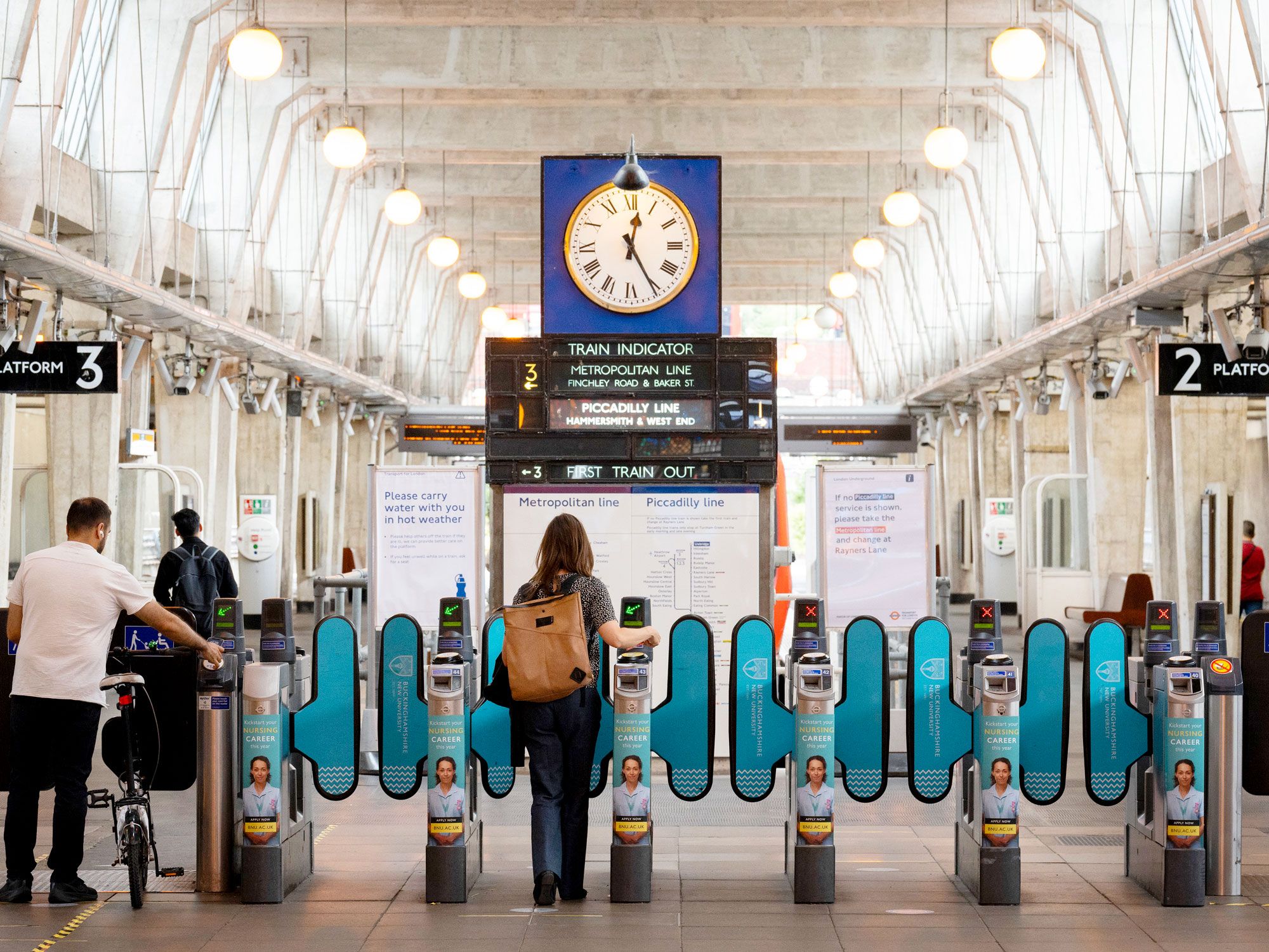
Today, up to 5 million passengers use the London Underground (affectionately known as “the Tube”) each day, but the system was originally intended as a way to move goods and livestock as much as to transport humans. January 1863 marked the opening of the six original stations that make up the stretch of the Metropolitan line, from Paddington to Farringdon Street.
Additional lines, dug deeper below the surface, didn’t open until after the turn of the 20th century, when the reliability of electric trains and elevators adequately reassured investors to fund the project. The original 1863 stations and tunnels are still in use today, a small but busy part of the 250-mile, 272-station system.
Beyond Stonehenge: 8 Stunning Stone Circles to Discover
By
Daily Passport Team
Read time: 6 minutes
July 20, 2023
Updated: July 25, 2023
Beyond Stonehenge: 8 Stunning Stone Circles to Discover
Culture •July 20, 2023•Updated: July 25, 2023
By Daily Passport Team
Author
Daily Passport Team
Daily Passport writers have been seen in publications such as National Geographic, Food & Wine, CBC, Condé Nast Traveler, and Business Insider. They're passionate about uncovering unique destinations and sharing expert tips with curious travelers.
England’s Stonehenge has long held the crown of the world’s most famous stone circle, but it’s just one of over 1,000 located in the British Isles alone. Around the world, prehistoric stone circles are shrouded in mystery and legend, having intrigued the humans who came after them for millennia. Some were created as ceremonial grounds, while others were used as astronomical tools and burial sites. For some, scientists can only guess about their purpose. From the remote islands of Scotland to Senegal, discover nine fascinating stone circles.
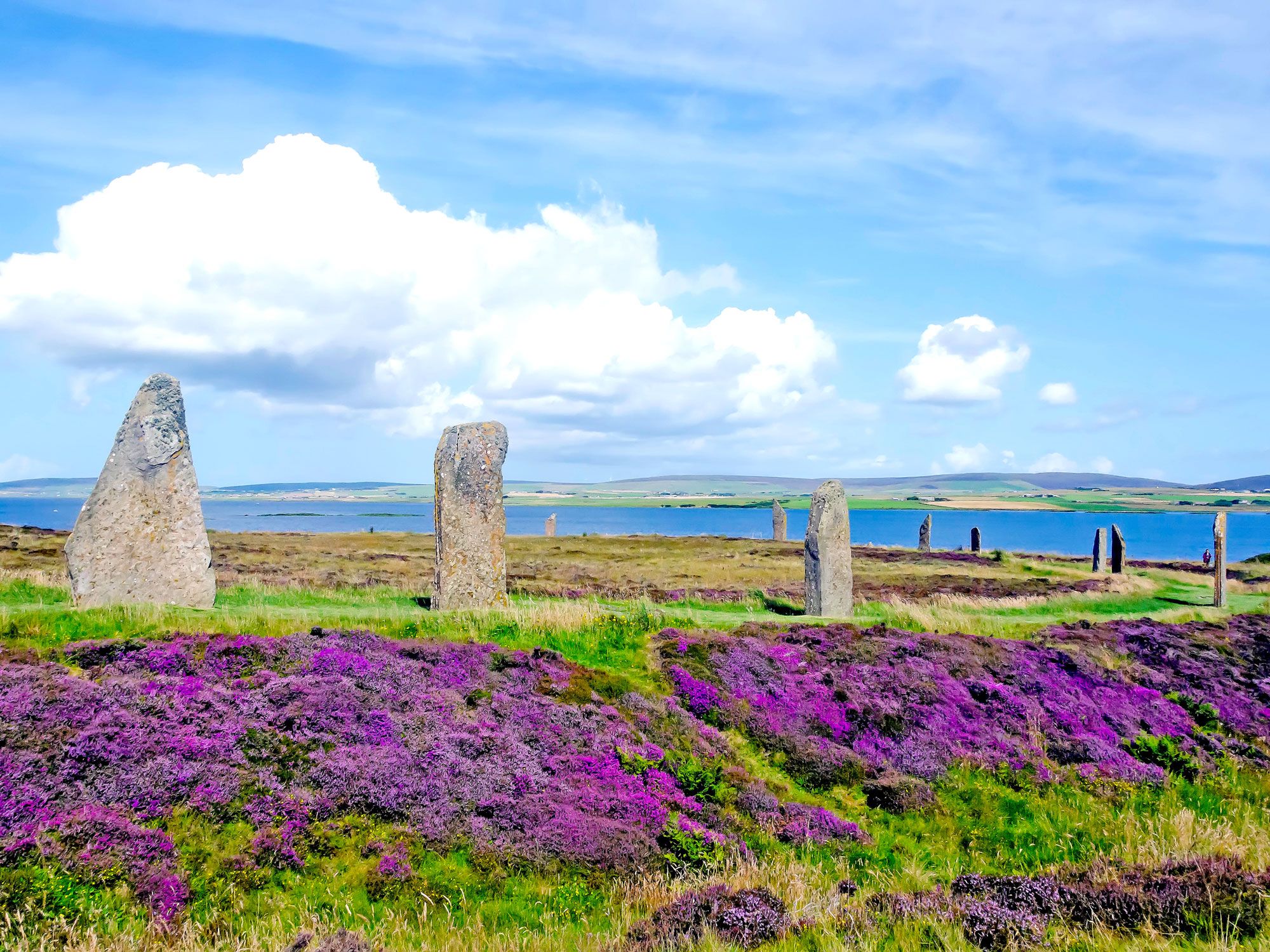
Located 10 miles north of mainland Scotland, the Orkney Islands are home to Britain’s third-largest stone circle. The Ring of Brodgar stands on an isthmus surrounded by emerald green pastures and vast brackish lochs. It dates back to around 2500 to 2000 BCE and once featured 60 stones — 27 of which survive today — encompassed by a rock-carved ditch. Archaeologists believe the site was either a religious shrine or a place to observe the equinox and solstice. The circle forms part of a collection of prehistoric monuments known as the Heart of Neolithic Orkney UNESCO World Heritage Site.
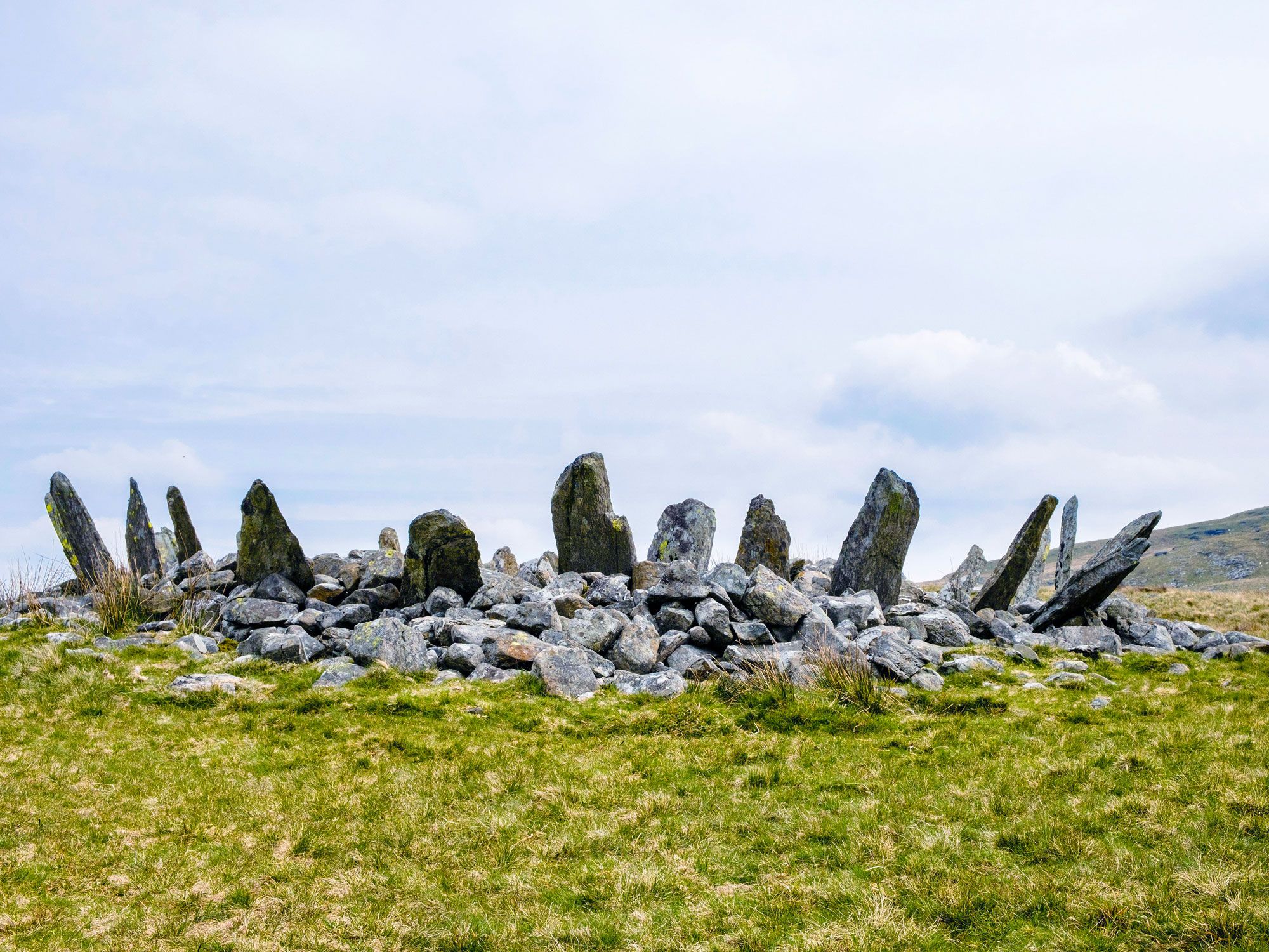
Perched on a hillside in the remote moorlands of northwestern Wales is Bryn Cader Faner. The site has drawn similarities to a crown of thorns and a wall of spears with its 15 jagged stone pillars, each six feet tall, that lean outwards. In the center of the circle is a 28-foot-wide, three-foot-tall cairn burial mound. Though it is unclear who built the site, when erected around 3000 BCE, the circle is thought to have possessed up to 30 standing stones. Unfortunately, several of them were removed when the British Army chose the site for shooting drills prior to World War II and treasure seekers left a hole in the cairn in the 1800s when looking for remains.
Calanais Standing Stones – Isle of Lewis, Scotland
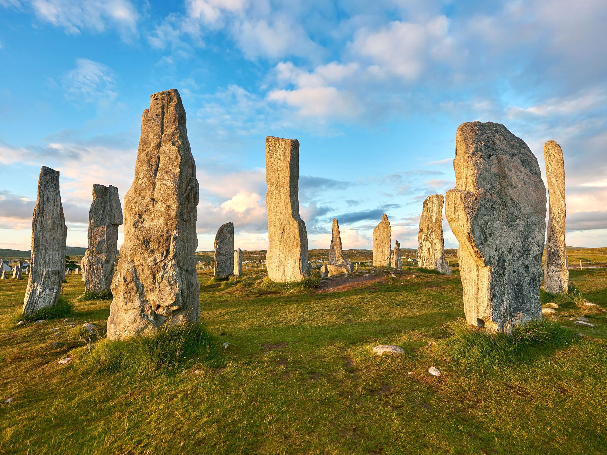
Erected approximately 5,000 years ago, the Calanais (or Callanish) Standing Stones predate Stonehenge by around 2,000 years. The 12-foot-tall monoliths are laid out to form a central circle with rows stretching outwards to create a cruciform pattern. Nobody knows who built the circle or why they did so, but common belief is that it was an astronomical observatory that was used until around 800 BCE. The stones are aligned with the sun and moon paths at varying stages of the solar circle. Like other sites on this list, Calanais has inspired many folkloric tales. One suggests that the stones are giants that were petrified by a saint who thought that they were evil spirits.
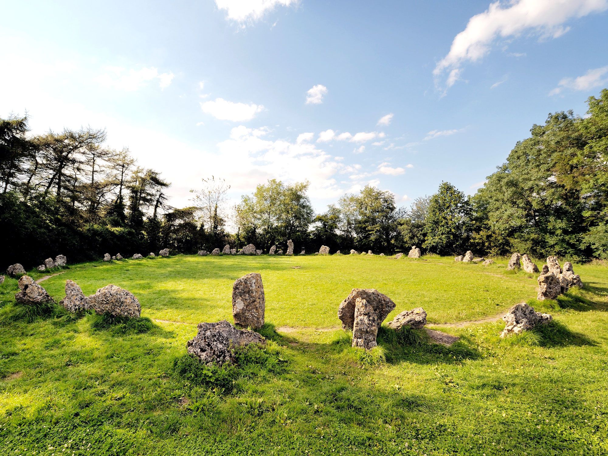
The Rollright Stones are a group of megalithic monuments made from Jurassic-era limestone, set at the northern edge of the Cotswold Hills. The complex is split into three areas that date to different eras of the Neolithic period and the Bronze Age. The Whispering Knights (3800-3500 BCE) consist of four upright stones and one that has fallen. It’s the oldest part of the complex and regarded as one of Britain’s earliest funerary monuments.
Some 70 weather-worn stones make up the King’s Men (2500 BCE) ceremonial circle, but according to local lore, it’s impossible for one to count the stones three times and end up with the same number. The King Stone (1500 BCE) is a solitary stone erected as a memorial to a Saxon burial ground. Legend states that the stones are a petrified king and his army that were tricked by a wicked witch.
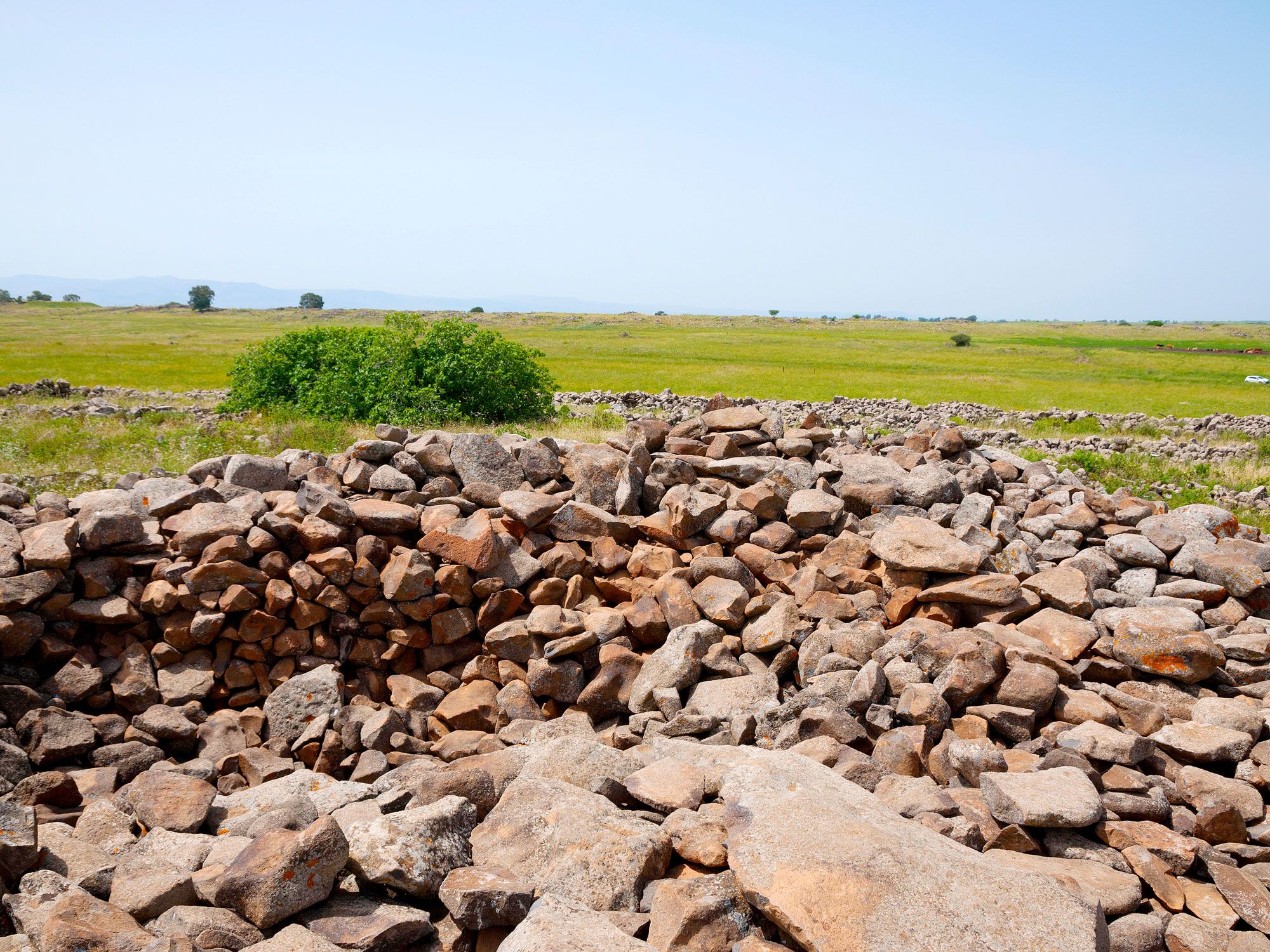
Set at the heart of a plateau peppered with dolmens (megalithic single-chamber tombs) is a series of stone circles called Rujm el-Hiri. The monument features five concentric circles that get progressively thinner from the outside in. An estimated 40,000 tons of basalt rocks were used to arrange the circles, the largest of which reaches about eight feet in height. They surround a 15-foot-tall central mound that once functioned as a burial site.
Theories about the purpose of the site range from it being a ritual center to a celestial calendar, dakhma funerary tower, or observatory. Its age is also a subject of debate, with some dating it to the early Bronze Age (3000-2700 BCE) and others to around 3800 to 3540 BCE.
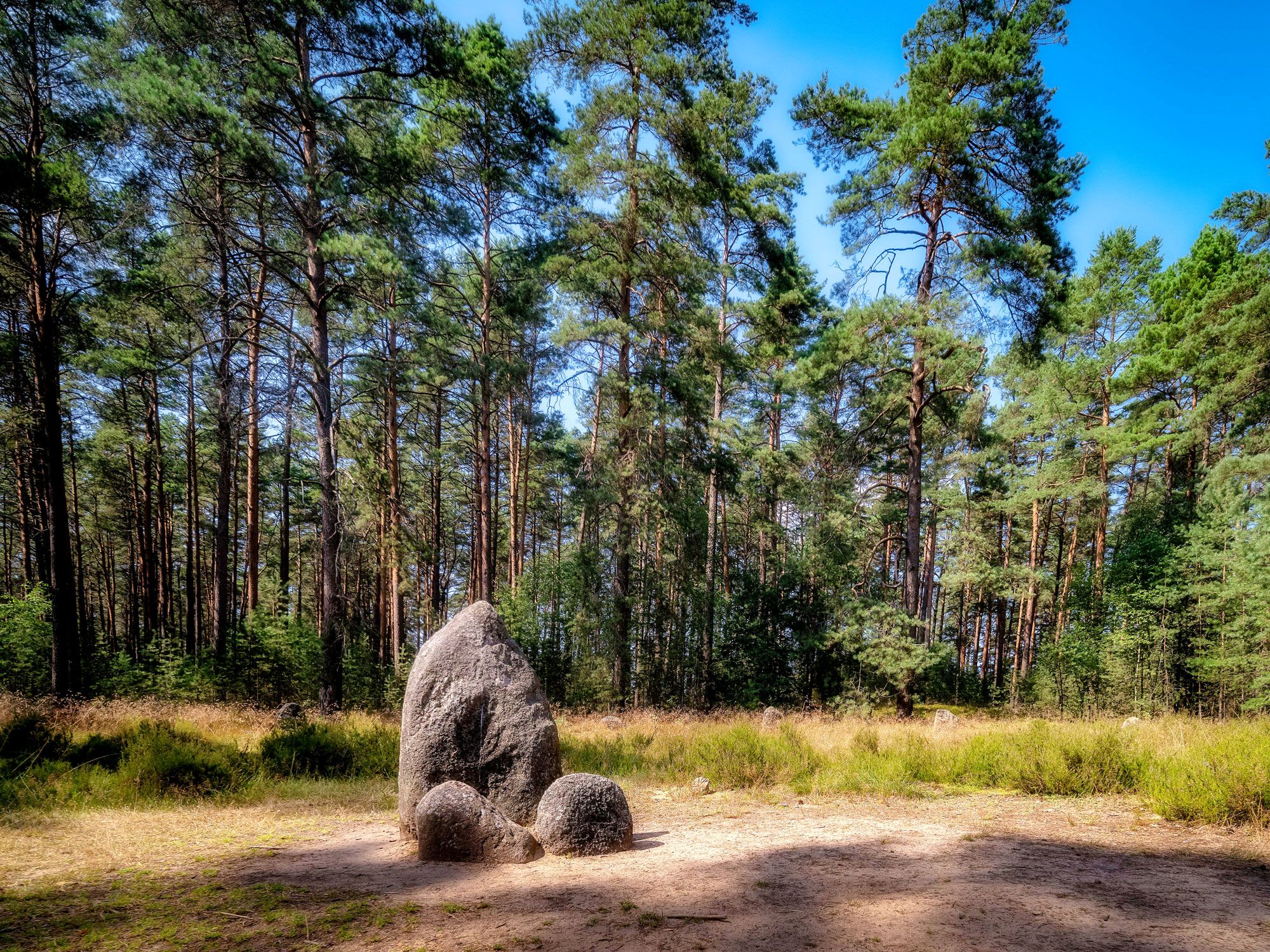
Nestled amid a forest in northern Poland, the Stone Circles at Odry is one of the largest megalithic complexes in Europe. This Iron Age site consists of 10 complete and two incomplete circles, each made up of 16 to 29 upright stones. In the center of most of the circles are either one or two larger monoliths. Excavations have found 602 barrows (burial mounds) that contain the skeletons of one to three humans each.
The Odry circles have close ties to the Wielbark culture. This ancient culture was established by the Goths and Gepids of Scandinavia and flourished in the historic Pomerania region of Poland and eastern Germany. Other Polish stone circles, such as those in Grzybnica, Leśno, and Węsiory, are also associated with the Goths.
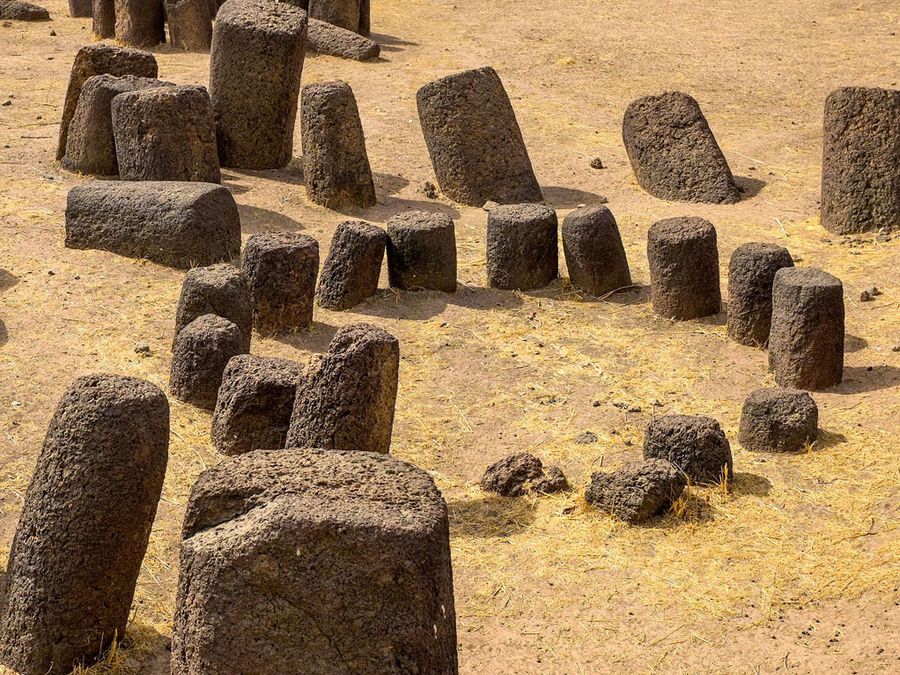
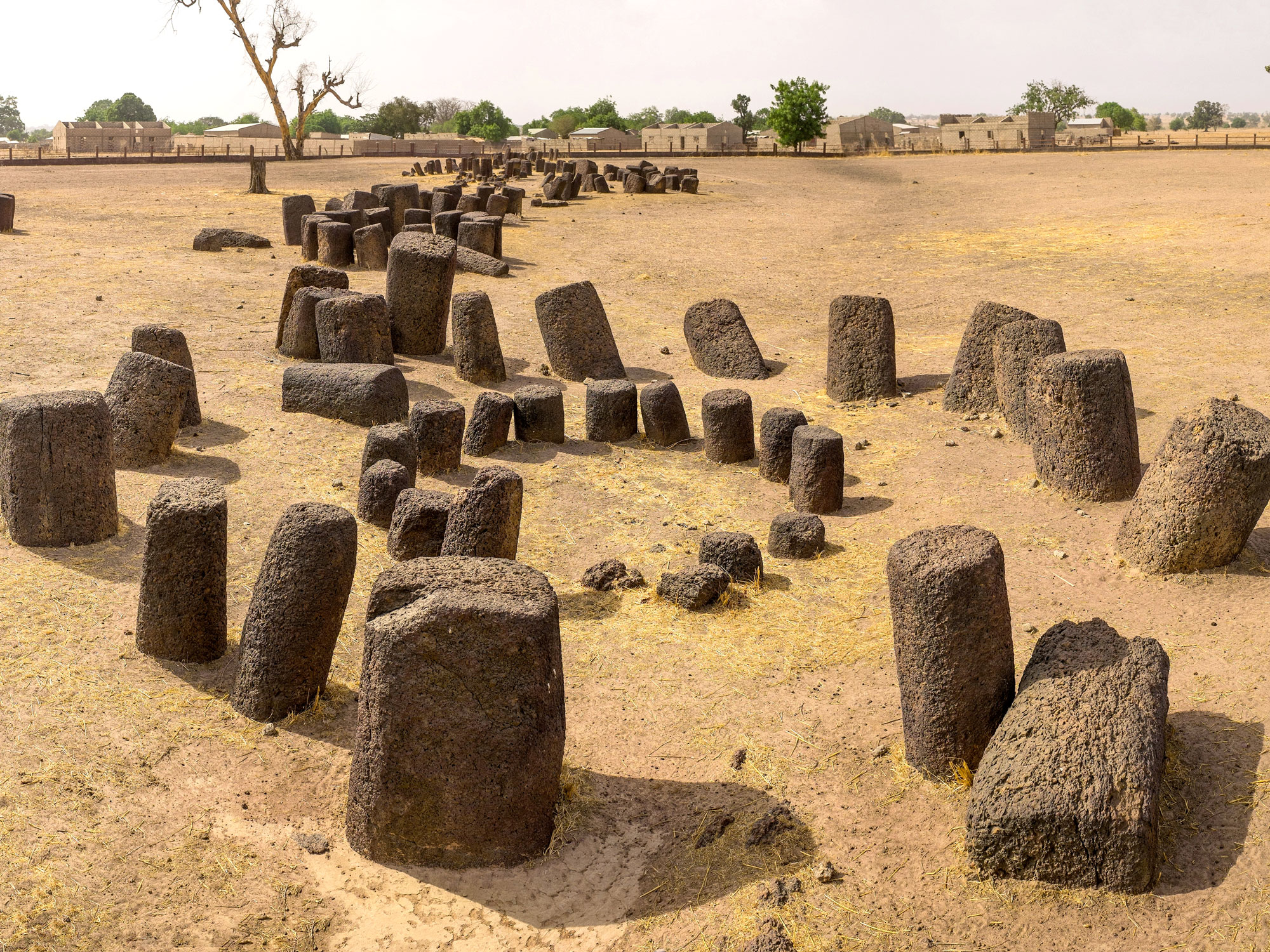
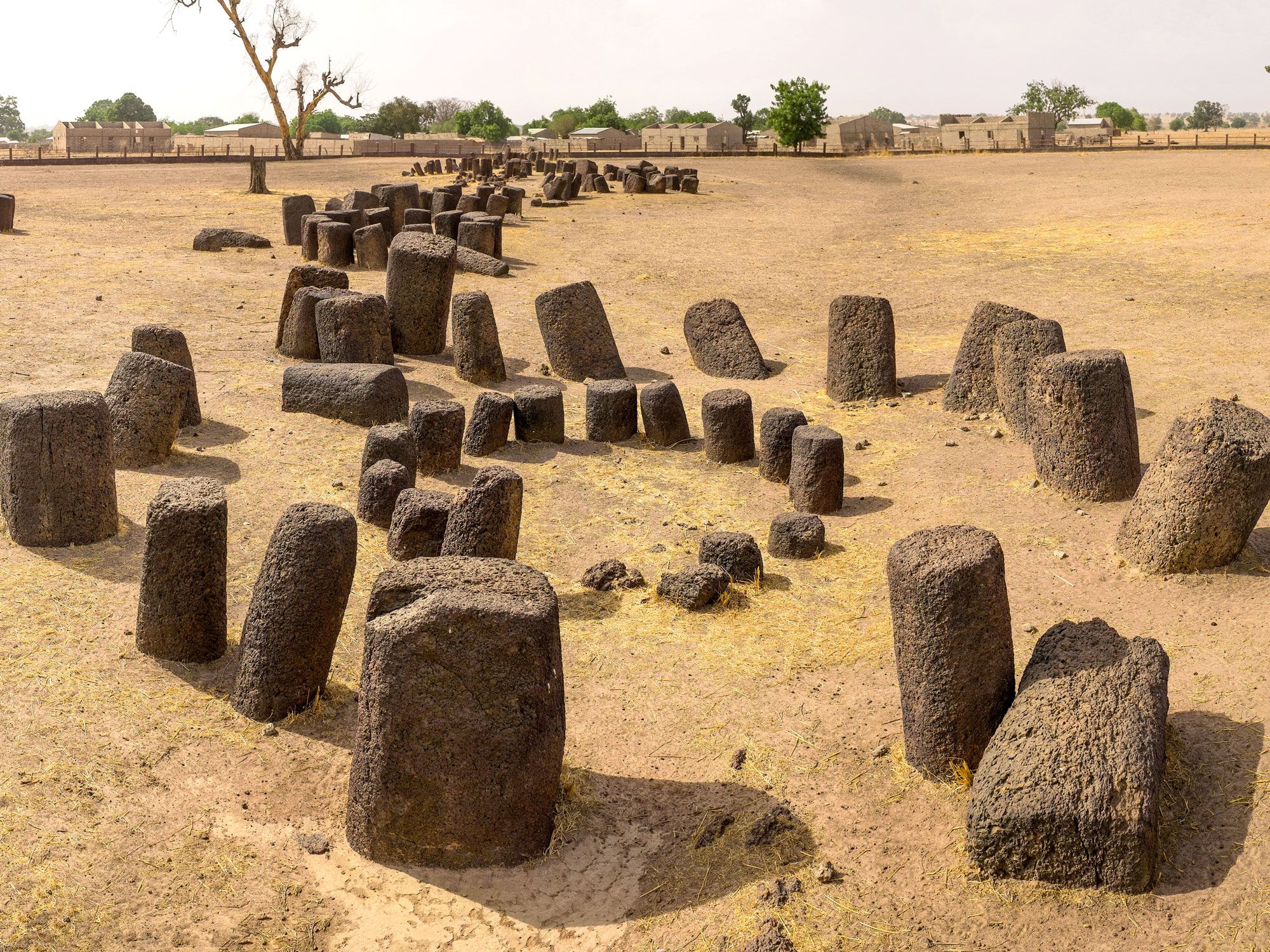
Spread across a vast area in southern Senegal and northern-central The Gambia is the UNESCO-listed Stone Circles of Senegambia. The site consists of four groups of megaliths that collectively form the world’s largest concentration of stone circles. In total, the Senegambia area has over 1,000 circles, almost 29,000 monoliths, and large numbers of tumuli burial mounds. The largest of the four sites is Senegal’s Sine Ngayène. It features 52 stone circles and 1,102 carved stones that were erected in stages between 700 and 1350 CE. Archaeologists have also unearthed the remains of houses and iron melting sites that date to the same period. Less than a mile away is the quarry from which the stones were carved.
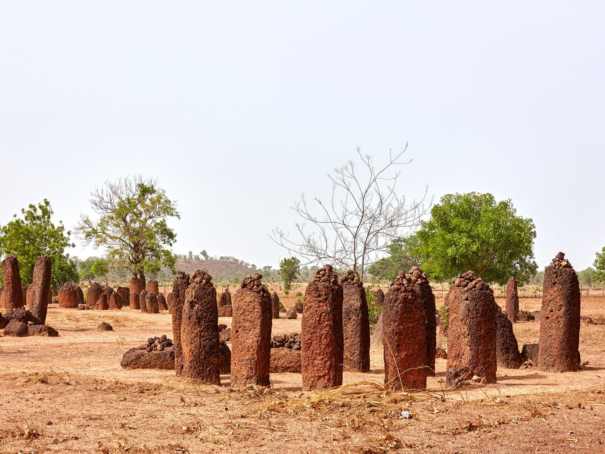
The Wassu Stone Circles comprise another remarkable area of the larger Stone Circles of Senegambia complex. This 11-circle site sits at the edge of Wassu, a town situated on a bend of the Gambia River. The stones are the tallest in the Senegambia region and rise as high as 7.5 feet. It’s likely that these laterite rock megaliths were first quarried and then carved with primitive tools.
Like many other stone circles on this list, mystery surrounds the origin and purpose of Wassu. However, unearthed pottery, funerary ornaments, and human relics suggest it was once occupied by an organized and prosperous civilization. It’s also been said that the circles are the burial tombs of ancient kings. Today, locals leave stones and vegetables at the circles as good luck offerings.
Advertisement
More from our network
Daily Passport is part of Inbox Studio, an email-first media company. *Indicates a third-party property.
Jersey is a travel and lifestyle writer whose work has appeared in publications such as Condé Nast Traveler, Business Insider, and Bust. When she’s not exploring her adopted home state of Maine, she’s likely planning her next big trip.
Feeling stressed out? You might just need some peace and quiet. According to the Hearing Health Foundation, noise triggers a stress response in the brain. And since 83% of Americans live in urban populations, noise pollution from modern-day city life is unavoidable. Fortunately, the following eight locations are backed by Science as being some of the quietest places in the U.S.
Olympic National Park is home to the Hoh Rainforest, said to be the quietest place in the country according to acoustic ecologist Gordon Hempton. While collecting sound data in the park, Hempton was able to precisely locate the rainforest’s quietest spot. Dubbed the “One Square Inch of Silence,” this unique location is a two-hour hike from the visitor center and is virtually free from any noise pollution created by humans.
Averaging 140 inches of rain annually, the greater Hoh Rainforest is a lush and tranquil oasis, carpeted with moss, ferns, and coniferous and deciduous trees. Through various hiking trails and a designated campground situated in an old-growth forest, visitors will learn that the rainforest’s rhythms are far from silent, but they are certainly serene.
Named by Outside as one of the quietest parks in the U.S., Glacier National Park contains over a million acres of rugged mountains, glacial streams, hiking trails, and campsites. Situated along the border of Canada, the park has less air traffic than other remote areas, which leads to a more serene experience in the wilderness.
In the summer months, the park’s most popular sites — such as Going to the Sun Road and Lake McDonald — are often subject to minor noise pollution. To experience the park’s quietest spots, plan a visit to North Fork Valley, accessible via a dirt road, or hike into one of Glacier’s 65 backcountry wilderness campsites.
According to a national acoustic study, southwestern Texas is one of the quietest regions in the U.S. Located on the northern end of the Chihuahuan Desert, Big Bend is home to dramatic limestone canyons, pitch-black skies, and stunning cacti blooms. Best of all, the remote region provides an endless expanse free from noise pollution.
To explore the region, visitors can take their pick between Big Bend National Park and Big Bend Ranch State Park. Both parks are geographically diverse. The national park is home to hot springs, 100 miles of the Rio Grande, and natural water holes like Ernst Tinaja. Meanwhile, Big Bend Ranch State Park is slightly more remote and houses Madrid and Mexicano Falls, the state’s second and third-highest waterfalls, respectively.
Probably the only noise you’ll hear in Boundary Waters Canoe Area Wilderness is the lonesome call of the common loon, Minnesota’s state bird. Another extremely quiet location highlighted by acoustic ecologist Gordon Hempton, this wilderness area is situated in the remote Superior National Forest of northern Minnesota, and contains over a million acres of land and water wilderness.
Home to 1,200 miles of canoe routes and 2,000 campsites, the Boundary Waters is primarily accessible by boat. For a relaxed itinerary, paddlers should plan a visit to Sea Gull Lake for a few days of camping and fishing. Then, head back to civilization with a trip to the nearby town of Grand Marais for a range of eats and eclectic art.
With background noises lower than 20 decibels, Great Sand Dunes National Park is about three times as quiet as the average city. Besides its namesake sand dunes, this southern Colorado park’s diverse landscape also includes grasslands, alpine lakes, forests, and tundra.
Popular park activities include sandboarding and sand sledding down the eponymous dunes. Nearby, Medano Creek flows around the base of the dunes and creates a wide natural beach in the Rocky Mountains. For overnight stays, numerous campsites are available throughout the park for visitors to experience a quiet evening beneath a blanket of stars.
Running 147 miles along the lower 48’s northernmost coastline, Maine’s Bold Coast is one of the quietest locations in New England. Accessible via the Bold Coast Scenic Highway — a section of Route 1 that travels from Milbridge, Maine, to the Canadian border — this remote region of the U.S. contains miles of granite shoreline, coastal wilderness, and blueberry barrens.
Numerous hikes dot the coastline, including the Cutler Coast Preserve, a remote section of Maine wilderness that provides access to backcountry campsites. Another popular site is Quoddy Head State Park, home to a historic lighthouse on the easternmost point of the continental United States. Nearby, the small town of Lubec is downright bustling by Downeast standards, but it’s small and quaint to most visitors — with zero traffic lights or shopping malls.
Located on the island of Maui, Haleakalā National Park is the third location on this list named by acoustic ecologist Gordon Hempton. (Notably, Hempton refuses to reveal his other nine chosen locations, asserting anonymity is crucial to the protection of these places.) Home to ancient volcanic landscapes, lush rainforest, and stunning coastline, Haleakalā is akin to a scene from a postcard.
Hiking trails abound throughout the park, allowing visitors to access Hawaii’s ancient rock craters, including Kawilinau, the floor of a volcanic pit. Visitors can also make reservations to watch the sunset from Haleakalā’s summit at 10,000 feet above sea level and then stay to watch the stars come out.
According to Science, Yellowstone National Park remains as quiet as the U.S. was before European colonization. But since the park attracted 3.29 million visitors in 2022 alone, the crowds at Yellowstone are likely to cause noise pollution, especially at popular sites like Old Faithful.
For a more relaxed experience, consider visiting Yellowstone in autumn or winter, when the park is notably quieter. Fall hiking is also an excellent time to see wildlife, and it’s the best season for fishing for trout. And while many facilities are closed in the winter, Old Faithful Snow Lodge remains open, as do several warming huts for travelers cross-country skiing or snowshoeing through the park’s serenely quiet landscape.
Advertisement
More from our network
Daily Passport is part of Inbox Studio, an email-first media company. *Indicates a third-party property.
Bennett is a New York City-based staff writer for Daily Passport. He previously contributed to television programs such as the Late Show With David Letterman, as well as digital publications like the Onion. Bennett has traveled to 48 U.S. states and all 30 Major League Baseball stadiums.
While many of us may know Japan as the “Land of the Rising Sun,” the story behind that nickname is less often discussed. But it’s not just Japan that can claim a fascinating nickname — from the “Land of Poets” to the “Rainbow Nation,” countries all around the world are known by playful monikers that tie into centuries of history, geography, and culture. Here are the backstories behind 12 interesting country nicknames.
Monaco is the world’s second-smallest country by area, covering a total land area of just over 0.77 square miles. But despite its small size, the country attracts individuals with big pockets. Nicknamed the “Billionaire’s Playground,” Monaco is home to roughly 40,000 residents. Of those people, over 27,000 have a net worth in excess of $1 million USD, according to a 2022 report, and 208 of them have a worth in excess of $30 million. While there are technically only three billionaires living in Monaco, it is still the country with the highest number of billionaires per capita.
Part of Monaco’s wealthy reputation comes from its thriving casino industry, which has operated since the 1860s. Perhaps no casino is more famous than the Monte Carlo Casino, which opened in 1865. Interestingly, Monegasque citizens are actually prohibited from gambling at local casinos, but in exchange, they’re not required to pay any income tax. Monaco is also home to the world’s most expensive real estate — according to a 2023 Knight Frank Wealth Report, $1 million USD only gets you an average of 183 square feet of living space.
Minnesota may be known as the “Land of 10,000 Lakes,” but across the Atlantic, Finland has earned a similar distinction. The nickname “Land of a Thousand Lakes” is actually selling Finland short, as there are around 187,000 lakes in the country, responsible for around 10% of the country’s total area. These lakes likely formed about 10,000 years ago due to glacial melt throughout the region.
The largest lake in Finland is Lake Saimaa, with an area of 443 square miles. This size also makes it the fourth-largest freshwater lake on the European continent. It’s part of the larger region of Saimaa, often known as the Finnish lake district, made up of 120 lakes and totaling an area of 1,690 square miles. Local salmon call the lakes home, as does an endangered species of ringed seal. The lakes are also used by the Finnish people as essential transportation routes, and several large hydroelectric stations provide power to the whole country.
The nickname “Land of the Rising Sun” primarily refers to Japan’s geographic location, as it’s among the first countries to see sunlight on any given day. Prior to the seventh century, Japan was known as Wa, a name that, when written, implied “insignificance” in nearby China. In an effort to send a message to Chinese rulers during the seventh century, Japan adopted the new name Nippon, a word that translates to “the sun’s origin” in Japanese.
Japan’s association with the sun only grew throughout the following centuries. When Marco Polo visited China in the 13th century, Chinese locals informed Polo of a land called Ji-pang — meaning “sun’s origin” in regional dialect — located to the east in the direction that the sun rose. These terms were westernized in the years that followed, ultimately resulting in Japan’s “Land of the Rising Sun” nickname that we know today. Japan’s national flag even features a depiction of the sun.
Archbishop Desmond Tutu first used the term “Rainbow Nation” to describe South Africa in 1994. It was in that same year that the country held its first multiracial national elections, resulting in the presidency of anti-apartheid candidate Nelson Mandela. While apartheid-era South Africa was deeply segregated, Tutu coined “Rainbow Nation” to describe his future vision for the country as a whole — he hoped that people of all ethnicities would thrive together and work to support one another’s best interests in the post-apartheid era.
Upon taking office, Mandela embraced the “Rainbow Nation” nickname, stating in his inaugural address, “We enter into a covenant that we shall build the society in which all South Africans, both black and white, will be able to walk tall, without any fear in their hearts, assured of their inalienable right to human dignity — a rainbow nation at peace with itself and the world.” This hopeful nickname persists today as a call for racial unity not just in South Africa, but around the globe.
Singapore – “Lion City”
Credit: Sean3810/ iStock Editorial via Getty Images Plus
Singapore’s nickname is derived from the Malay words singa pura, which translate to “lion city.” It dates to an ancient legend in which Prince Sang Nila Utama landed on the shores of what is now Singapore in 1299. The prince thought he saw a lion when he arrived, so he decided to name his new kingdom Singapura.
The lion’s head was proclaimed an official national symbol of this city-state in 1986 to represent leading principles of Singapore: courage, excellence, and strength. The mythical “merlion” — with the head of a lion and the body of a fish — is also considered to be the national mascot of Singapore. A merlion statue was unveiled in the city in 1972 along the Singapore River.
Despite its comparatively small population of around 19.5 million residents, around half that of California alone, Chile has produced a disproportionately large number of legendary poets. In fact, two such individuals won the Nobel Prize for Literature: Gabriela Mistral in 1945 and Pablo Neruda in 1971. Mistral — the first Latin American to receive the Nobel Prize in Literature — was known for her inspiring poetry collections including Desolación (“Despair”) and Ternura (“Tenderness”), while Neruda earned the Nobel Prize “for a poetry that with the action of an elemental force brings alive a continent’s destiny and dreams.”
However, it’s not just Nobel laureates who make up Chile’s rich poetry tradition — individuals such as Nicanor Parra perfected the literary art form as well, solidifying this South American nation as the true “Land of Poets.”
Ireland – “Emerald Isle”
Credit: Anthony Murphy / 500px/ 500Px Plus via Getty Images
As you might expect, Ireland’s “Emerald Isle” nickname refers to the lush green landscape that the island nation is known for. The moniker was coined in a 1795 poem by William Drennan titled “When Erin First Rose,” in which Ireland was referred to as “the em’rald of Europe.” Drennan also wrote, “Let no feeling of vengeance presume to defile / The cause of, or men of, the Emerald Isle,” thus forever immortalizing the nickname in conjunction with Ireland.
It wasn’t always the case, however, that Ireland was associated with the color emerald or green. In fact, Ireland was originally more closely intertwined with shades of blue. This correlation dates to the time of St. Patrick, who is considered the patron saint of the island. Early depictions of St. Patrick from a 13th-century French manuscript show him clad in a blue robe. In 1541, King Henry VIII declared himself to be king of Ireland and presented the Irish Kingdom with a new coat of arms featuring a dark blue background. And, in 1783, King George III established the Order of St. Patrick in Ireland, whose members wore blue outfits. It was only during the Irish Rebellion of 1798 that the Irish adopted the color green as a symbol of national pride, replacing the blue emblems that had been imposed on the country by the British.
The story behind Iceland’s nickname is tied to the unique geological terrain of this Nordic nation. Iceland is known as the “Land of Fire and Ice” due to its combination of violent volcanoes and glistening glaciers that can be found throughout the country. This reputation as a meeting point of fire and ice dates back to when Iceland was first explored, as early 16th-century maps included elements such as polar bears floating on icebergs depicted alongside erupting fires elsewhere.
Today, around 269 glaciers cover approximately 11% of Iceland. Those glaciers are accompanied by over 100 Icelandic volcanoes, many of which are still active. All told, the Icelandic terrain exemplifies the extremes of hot and cold, making its “Land of Fire and Ice” nickname extremely appropriate.
Comoros, located off the coast of Mozambique in East Africa, is an archipelagic nation made of four islands. When visiting, you’ll probably notice a delightful scent emanating through the air, earning Comoros the nickname “the Perfume Isles.” These welcoming odors are due to the abundance of flowers on the islands.
One of the most prominent flowers grown in Comoros is the ylang ylang flower. The scent of this flower is so highly regarded that it’s become an important ingredient in the Chanel No. 5 perfume. Comoros is also the second-largest producer of vanilla in the world, after nearby Madagascar. So, home bakers can likely Comoros for the delicious smell wafting through their kitchens, too.
The nickname “Graveyard of Empires” refers to the historic difficulty that many nations have endured in attempting to conquer the area that makes up modern-day Afghanistan. While the historic region was successfully conquered by powerful rulers such as the Mongol Empire, many others have struggled to lay siege to Afghanistan. Great empires such as the Mughals came up short against the local Safavids in the 17th century, and even the British failed in their attempt to conquer Afghanistan during the First Anglo-Afghan War in 1842.
From 1979 to 1988, the Soviet occupation of Afghanistan proved to be a disastrous waste of resources for the U.S.S.R., with some claiming that the failed war contributed to the Soviet Union’s downfall shortly thereafter. Even the United States struggled to achieve their diplomatic goals in their 21st-century occupation of Afghanistan, as the “Graveyard of Empires” nickname remains relevant in modern times.
“Land of the Thunder Dragon” sounds like a mythical place from Game of Thrones, but it’s also the very real nickname of Bhutan. One of the world’s highest countries, Bhutan is situated in the Himalayas mountain range, north of eastern India. For years, Bhutan remained isolated, before opening itself up to tourism in the 1970s. Locals refer to the country as “Druk Yul,” which is Bhutanese for “Land of the Thunder Dragon.”
There are several aspects of Bhutanese culture that contribute to this nickname. First, the region is known for its powerful thunderstorms, which legend once said to be fire coming from a dragon. The “Druk,” or dragon, is also an important figure in Bhutanese mythology, and is now regarded as a national symbol and the focal point of Bhutan’s national flag.
The Mediterranean is known for its indulgent and desirable food products, and Malta is no exception. This tiny island nation is heralded for its rich history of beekeeping, which dates back to the time of the ancient Greeks. The region was referred to in Greek as Melitē, a term translating to “honey sweet.”
As sea levels rose and segmented Malta from nearby Sicily, this “Land of Honey” became home to an endemic species of honey bee known as Apis mellifera ruttneri. These Maltese honey bees produced incredibly pure and delicious honey, though their population was decimated in 1992, thus necessitating the importation of non-Maltese bees. However, the Maltese honey bee remains the dominant bee species found on the island of Malta — and so the “Land of Honey” nickname remains relevant as ever.
Advertisement
More from our network
Daily Passport is part of Inbox Studio, an email-first media company. *Indicates a third-party property.