
Post Banner Image
History

Where Do U.S. Presidents Like To Vacation?
By Daily Passport Team
Read time: 7 minutes
August 3, 2023
Updated: June 26, 2025

Where Do U.S. Presidents Like To Vacation?

By Daily Passport Team
Author
Daily Passport Team
Daily Passport writers have been seen in publications such as National Geographic, Food & Wine, CBC, Condé Nast Traveler, and Business Insider. They're passionate about uncovering unique destinations and sharing expert tips with curious travelers.

As anyone who’s watched The West Wing can tell you, there’s a lot on your plate when you’re the U.S. President. And yes, even Commanders-in-Chief need a little R&R sometimes. But where do you choose as a vacation spot when you hold the highest office in the land? From a seaside resort on the Jersey shore to a ski resort in Colorado, here are 10 destinations that bear the presidential seal of approval.

Hotel Colorado – Glenwood Springs, Colorado
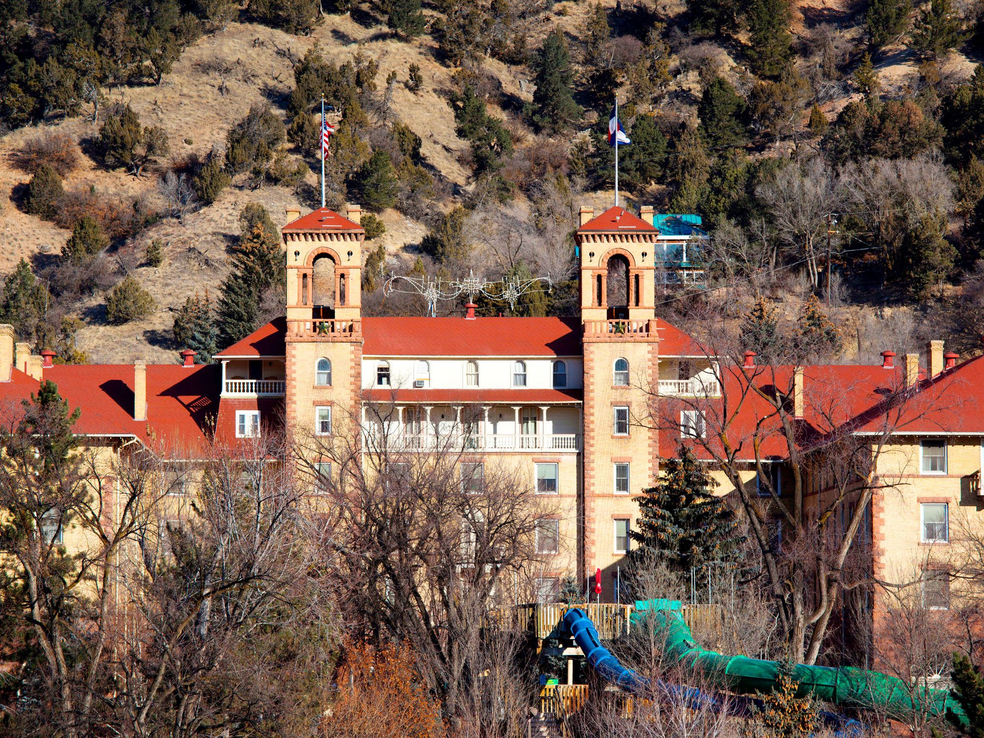
Hotel Colorado surrounded by mountains in Glenwood Springs, Colorado
Photo credit: Danita Delimont/ Alamy Stock Photo

Long before President Ford hit the slopes in Vail, another American president made Colorado a preferred vacation destination. Outdoorsman Theodore “Teddy” Roosevelt visited Colorado seven times during his 1901-1908 tenure as the nation’s 26th president. His longest stay was at the Hotel Colorado in Glenwood Springs, where the rough-and-tumble Republican brought friends and associates on a six-week trip to hunt bears.

The Medici-inspired hotel was the “Grand Dame of the Rockies,” hosting royalty and celebrities who came for the crisp mountain air and the healing waters of the town’s hot springs. Following extended visits by Roosevelt and his successor, President William Howard Taft, the hotel earned the nickname “Little White House of the West.”

Camp David – Frederick County, Maryland
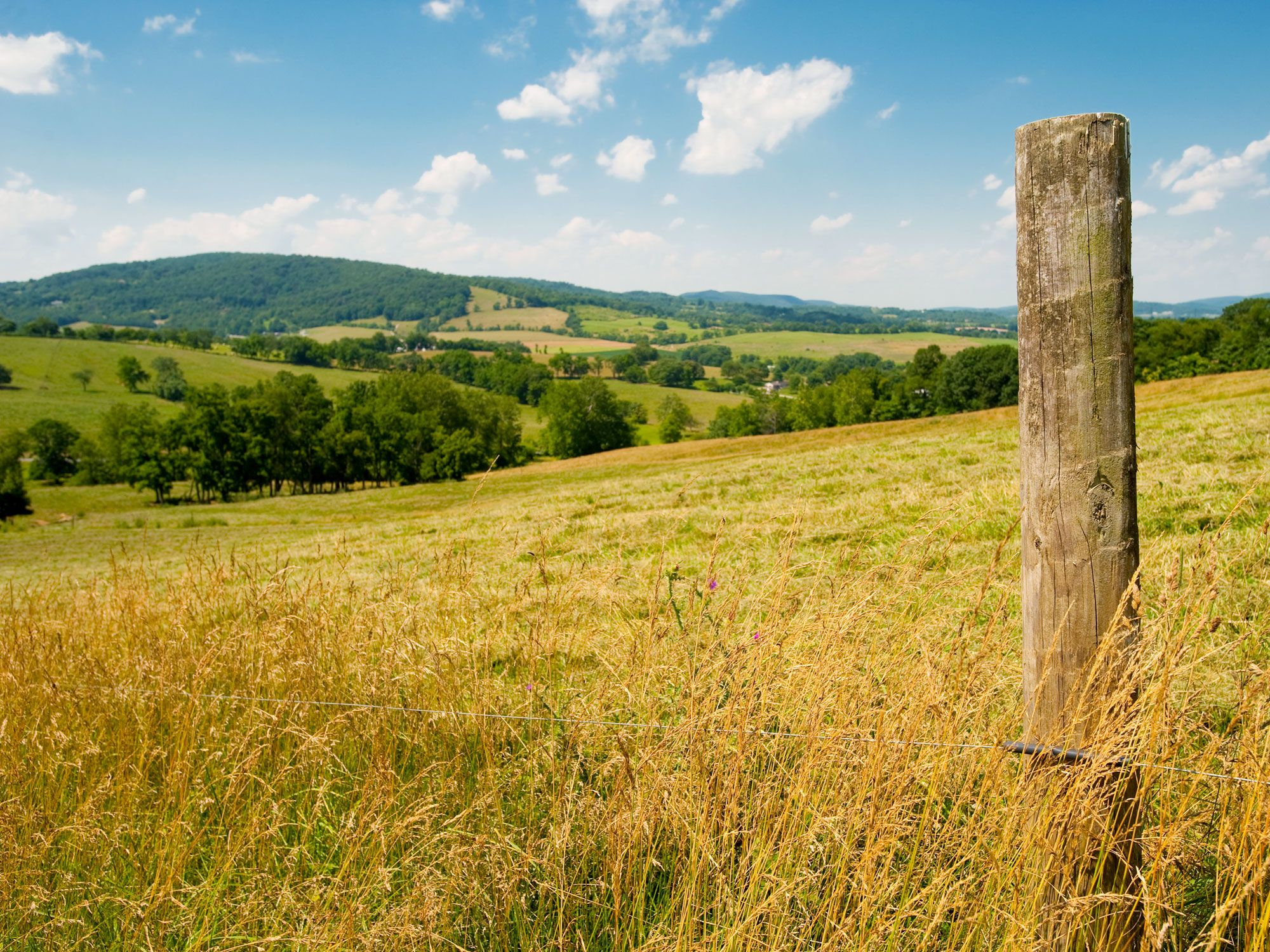
Fence post on grassy hill at Camp David
Photo credit: Edwin Remsberg/ Alamy Stock Photo

About 60 miles northwest of Washington, D.C., is the official “country home” of the sitting U.S. President. Camp David was initially dubbed “Shangri-La” by its first resident, President Franklin D. Roosevelt, who modeled the main house after his vacation home in Warm Springs, Georgia. The famously plain-spoken President Dwight D. Eisenhower found the name “a little too fancy,” and renamed the 200-acre property in Maryland’s Catoctin Mountain Park in honor of his grandson, David.

The grounds include 11 residence cabins as well as a swimming pool, bowling alley, skeet shooting range, and helipad. Numerous foreign leaders have been entertained at Camp David, including the Soviet Union’s Premier Nikita Khrushchev during the height of the Cold War.

State Game Lodge – Custer, South Dakota
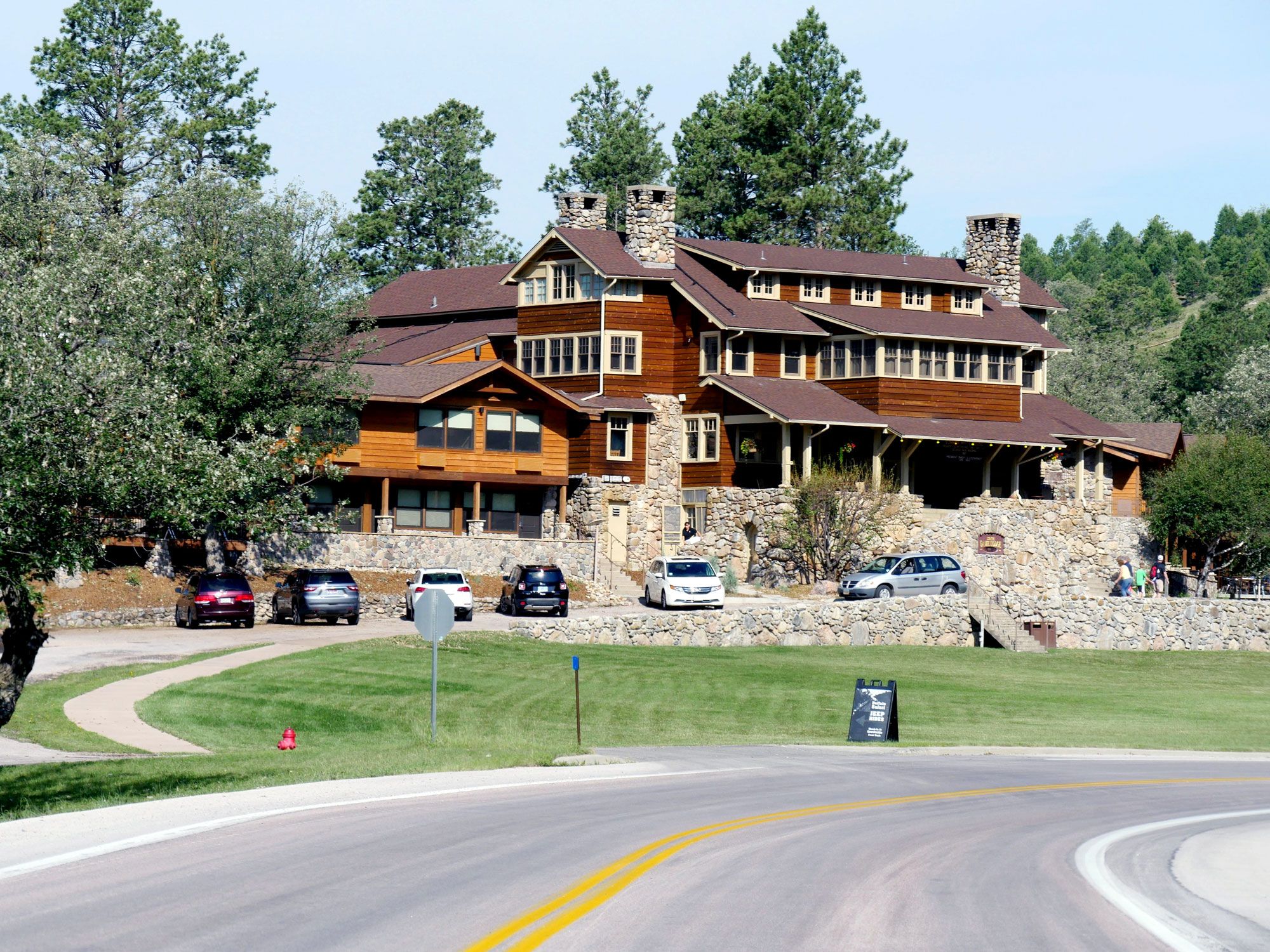
Exterior of State Game Lodge in Custer, South Dakota
Photo credit: RaksyBH/ Alamy Stock Photo

In 1927, the West was expanding and vacationers were hitting the road in newfangled automobiles when Calvin Coolidge, America’s 30th President, decided to see the booming region and escape the muggy summer weather of D.C. Initially planning on a three-week stay in the Black Hills of South Dakota, the President and his family liked the State Game Lodge in the small town of Custer so much that they extended their visit for three months — a huge boon for the state’s fledgling tourism attractions.

In addition to fishing and horseback riding, Coolidge officially dedicated the inaugural work on the nearby carving of Mount Rushmore, and declared that he would not seek another term in 1928. He wasn’t the only American President to succumb to the area’s charms; President Dwight D. Eisenhower also stayed at the lodge for three days in 1953. Want to see the area’s majesty for yourself? Book a room or specialty cabin at the lodge and don’t skip the popular Buffalo Safari Jeep Tour.

Congress Hall – Cape May, New Jersey
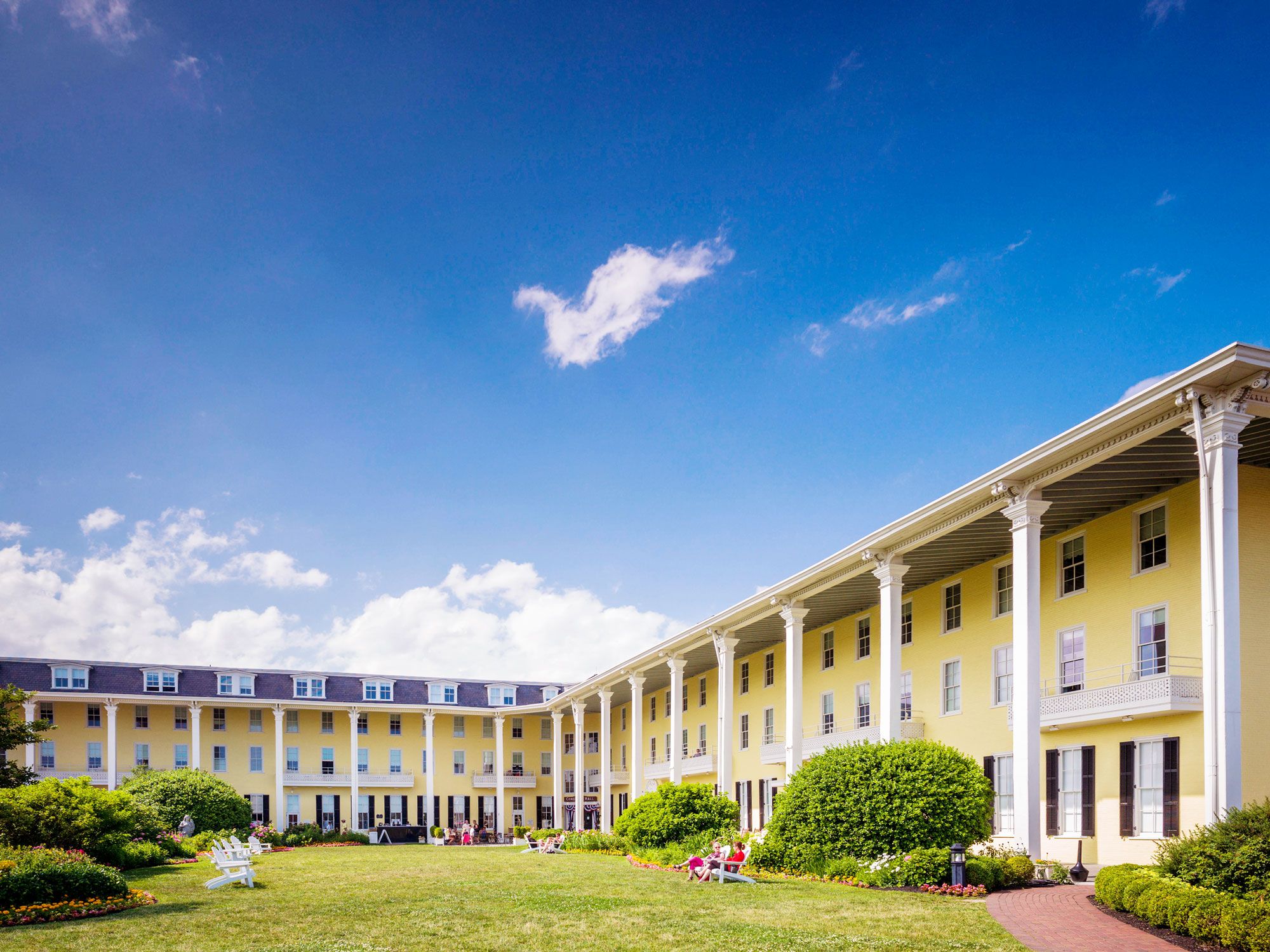
Bright yellow facade of Congress Hall in Cape May, New Jersey
Photo credit: mauritius images GmbH/ Alamy Stock Photo

Built in 1816 in the heart of Victorian Cape May, Congress Hall claims to be “America’s First Seaside Resort” and has been a favorite vacation spot for U.S. Presidents throughout many administrations. President Benjamin Harrison made the hotel his official “Summer White House,” and Presidents Franklin Pierce, James Buchanan, and Ulysses S. Grant vacationed here, conducting business in the classic estate and smoking cigars on the Grand Lawn. Located right across the street from the Atlantic Ocean, Congress Hall is less than 200 miles from the nation’s capital and routinely earns a spot on various “best hotels” lists on the Eastern Seaboard.

Lincoln’s Cottage – Washington, D.C.
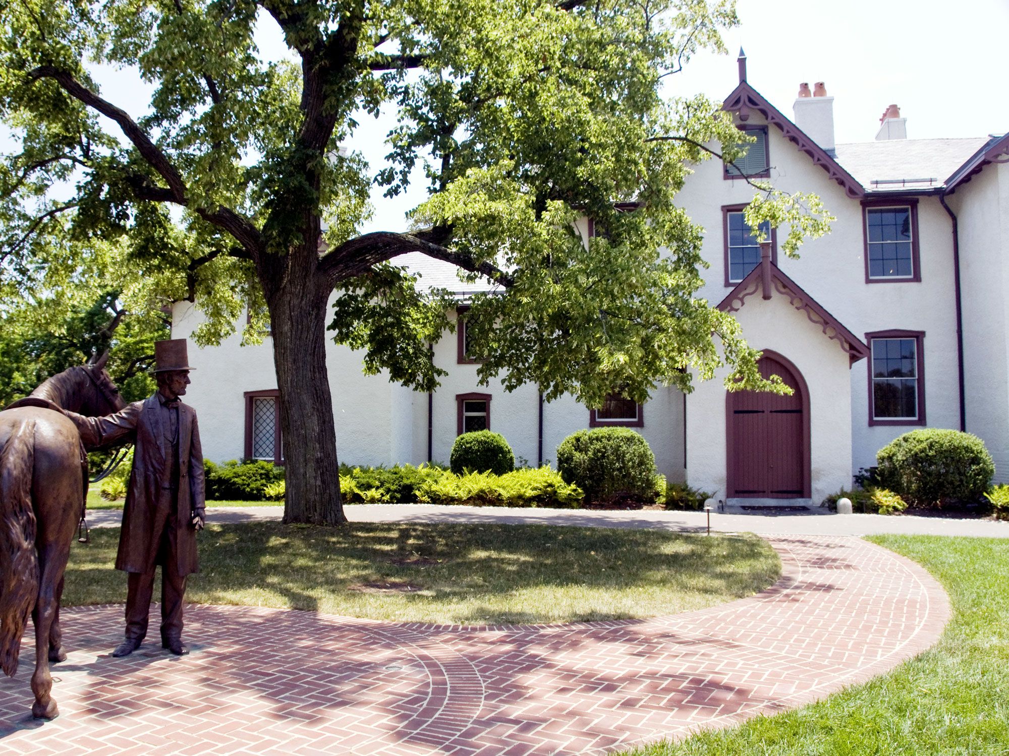
Image of Lincoln's Cottage in Washington, D.C.
Photo credit: Dennis K. Johnson/ Alamy Stock Photo 

Much closer to the office (just three miles from the White House) is President Abraham Lincoln’s summer retreat — a 34-room, Gothic Revival-style “cottage” that was originally a home for elderly and wounded soldiers. The President commuted by horseback to the White House (surviving a sniper’s assassination attempt) but also worked on legislation at the hilltop home, including the Emancipation Proclamation. Today, President Lincoln’s Cottage is a historic site and museum dedicated to Honest Abe’s life and legacy, with galleries and extensive exhibits that focus on decision-making, dialogue, and social justice.

Martha’s Vineyard – Massachusetts
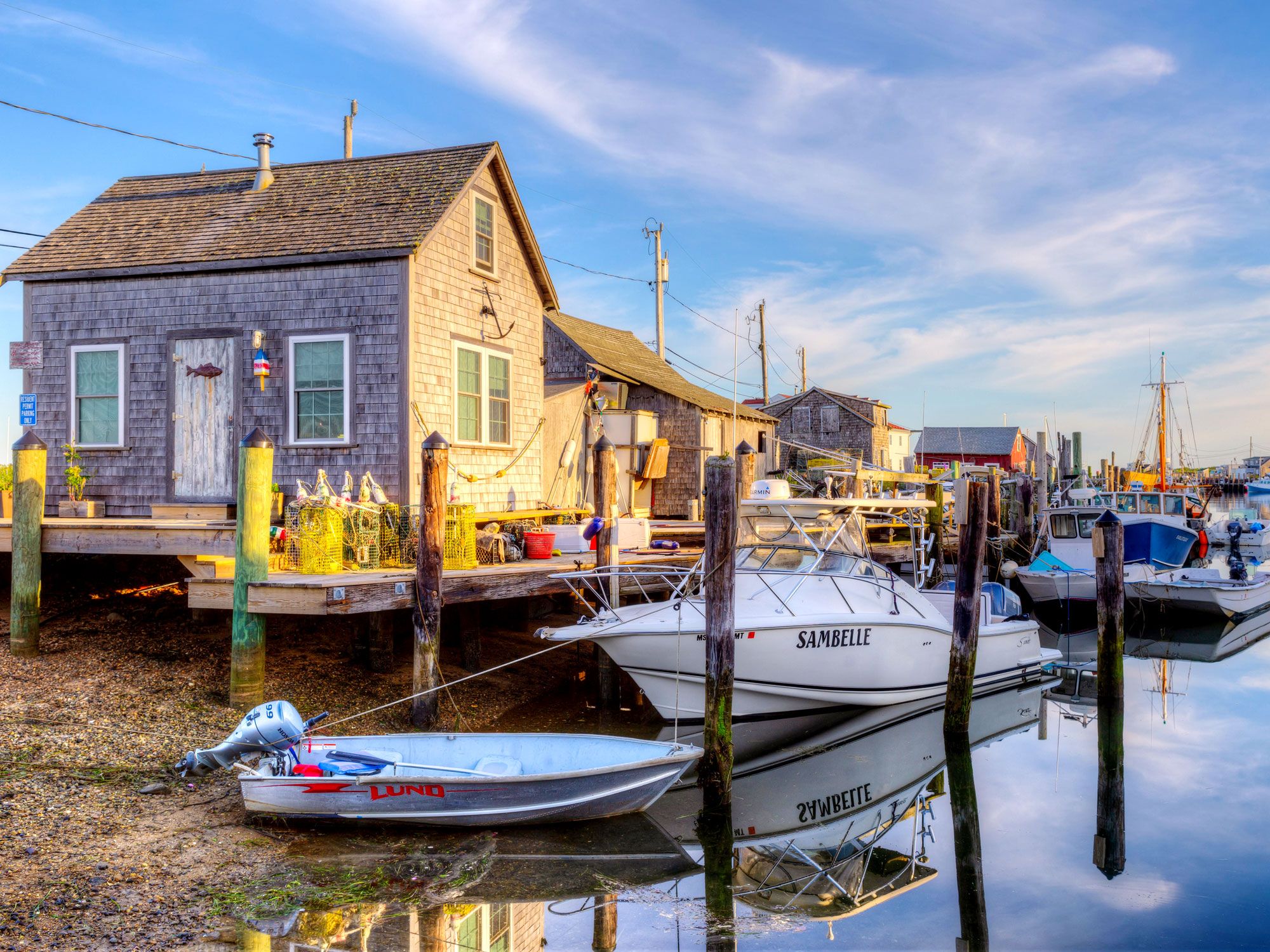
Boats docked in harbor on Martha's Vineyard, Massachusetts
Photo credit: Clarence Holmes Photography/ Alamy Stock Photo

This charming (and expensive) island just south of Cape Cod is used to hosting U.S. Presidents: President Ulysses S. Grant arrived in the summer of 1874, enjoying fireworks and fishing, and the parade of POTUSes hasn’t stopped since. President Bill Clinton and President Barack Obama have both vacationed frequently in private houses — playing golf, browsing bookstores, and making ice cream runs just like other island regulars. And the private Kennedy family compound in Hyannis Port is only an hour (by ferry) away.

Little White House – Key West, Florida
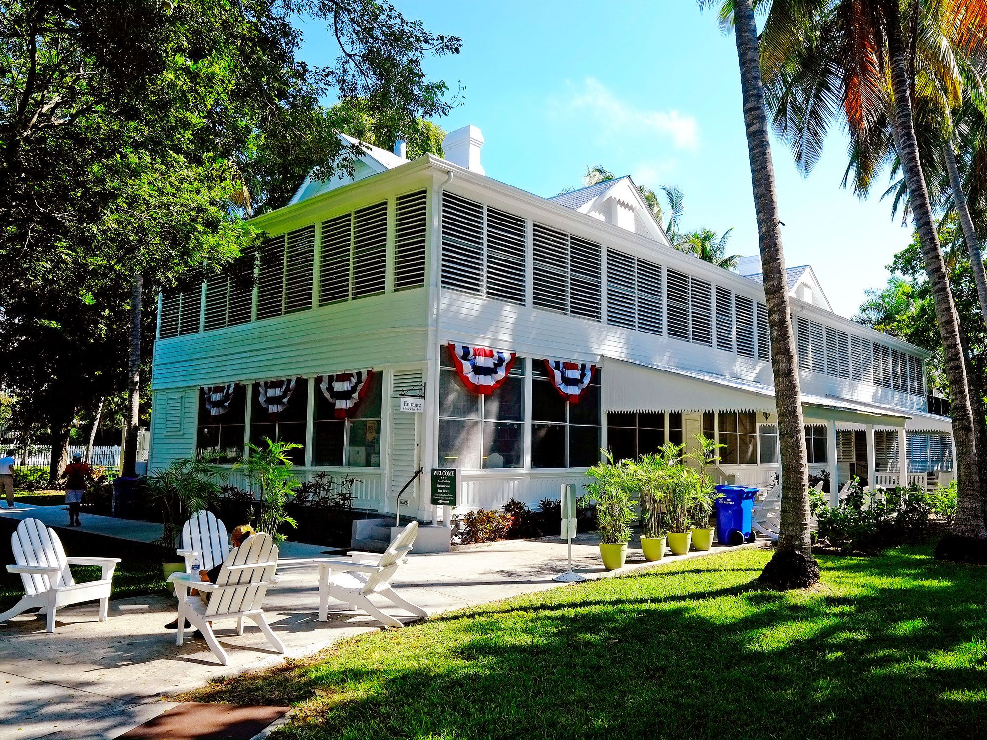
Image of the Little White House in Key West, Florida
Photo credit: Dennis MacDonald/ Alamy Stock Photo

A naval officer residence at the end of the Overseas Highway was a welcome escape for President Harry S. Truman, who spent no less than 175 days during 11 working vacations at his “Little White House” in Key West’s Old Town. The structure built in 1890 saw many critical developments during Truman’s presidency, including the development of the Marshall Plan to rebuild post-WWII Europe and deliberations over the fate of Palestine.

Subsequent Presidents including Eisenhower, Kennedy, and Clinton also visited the home. Turned over to the State of Florida in 1987, the Little White House is now a state historic site and museum. If you take the guided tour, you’ll see Truman’s famous desk sign proclaiming, “The Buck Stops Here.”

Rapidan Camp – Madison County, Virginia
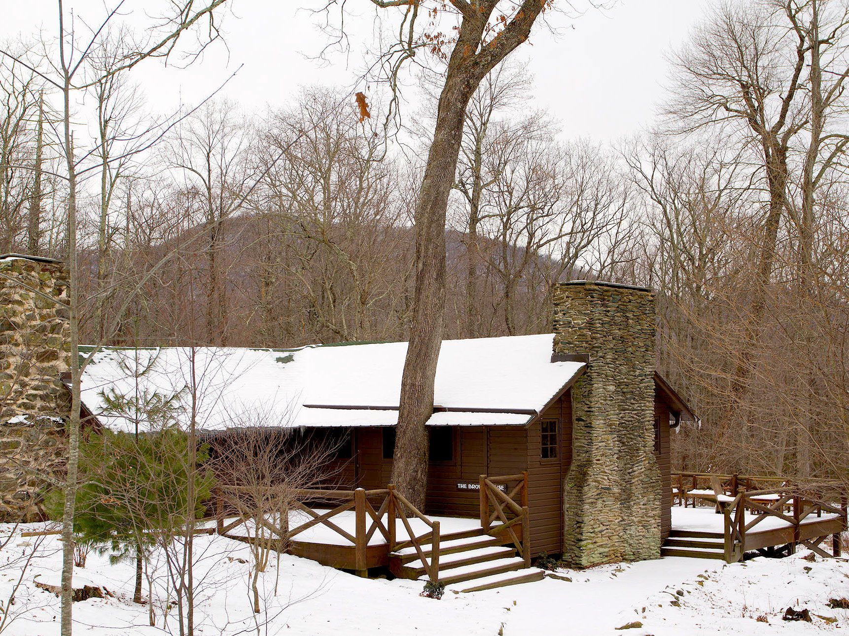
Snowy Rapidan Camp in Madison County, Virginia
Photo credit: Nature and Science/ Alamy Stock Photo

In 1929, President Herbert Hoover and his wife Lou Henry bought and designed this rustic retreat in what is now part of Shenandoah National Park in Virginia. Where two springs join to form the Rapidan River, engineers struggled to create 13 separate structures connected by a series of bridges and paths. The First Couple entertained a host of celebrities in the log cabins, including Charles Lindbergh, Will Rogers, and Thomas Edison in addition to Cabinet members and family and foreign dignitaries such as British Prime Minister Ramsay MacDonald.

Although the Hoovers donated the property hoping it would be used by future heads of state, the remote location and rustic accommodations were not appealing to President Franklin D. Roosevelt. All but three of the original structures were demolished by the National Park Service in 1959.

Western White House – Vail, Colorado
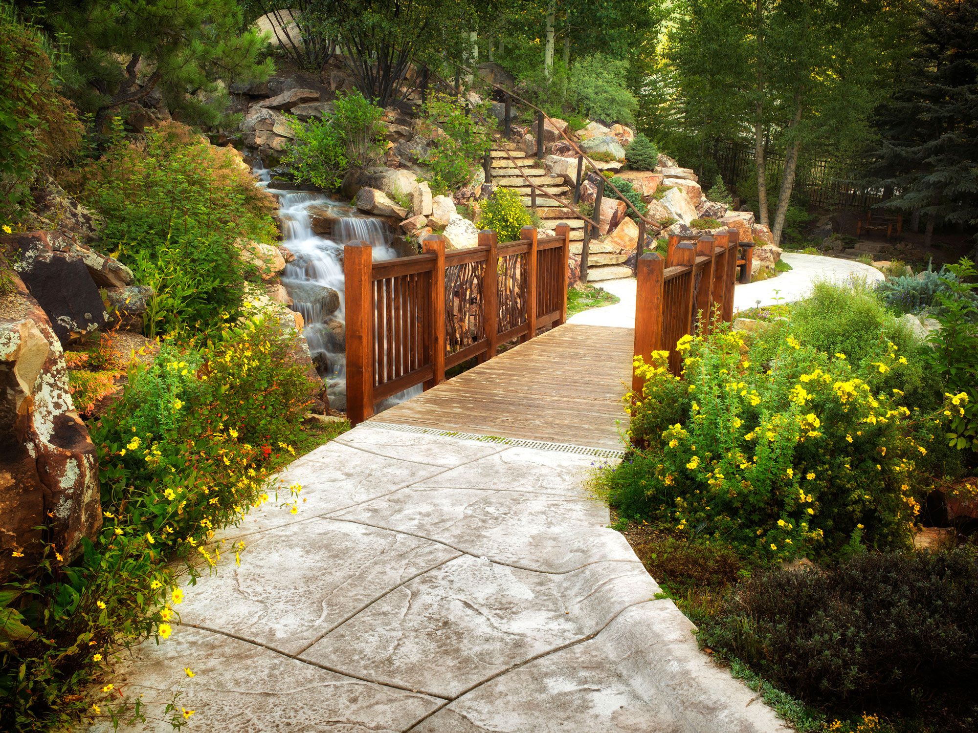
Steps leading to "Western White House" in Vail, Colorado
Photo credit: Dennis Frates/ Alamy Stock Photo

Both President Gerald Ford and his wife Betty were avid skiers, so they bought a condo in the developing resort village of Vail in 1970, long before Congressman Ford was chosen to be the vice president (who would later take office when President Richard Nixon resigned). As commander-in-chief, Ford often returned to Vail, bringing along a group of Secret Service agents who could keep up with him on the slopes.

After leaving the White House, the Fords retired to a luxurious home in the nearby enclave of Beaver Creek. Today, the couple is memorialized in Vail with the Gerald R. Ford Amphitheater and the Betty Ford Alpine Garden, the highest botanical garden in the United States.

Bedford Springs Resort – Bedford Springs, Pennsylvania
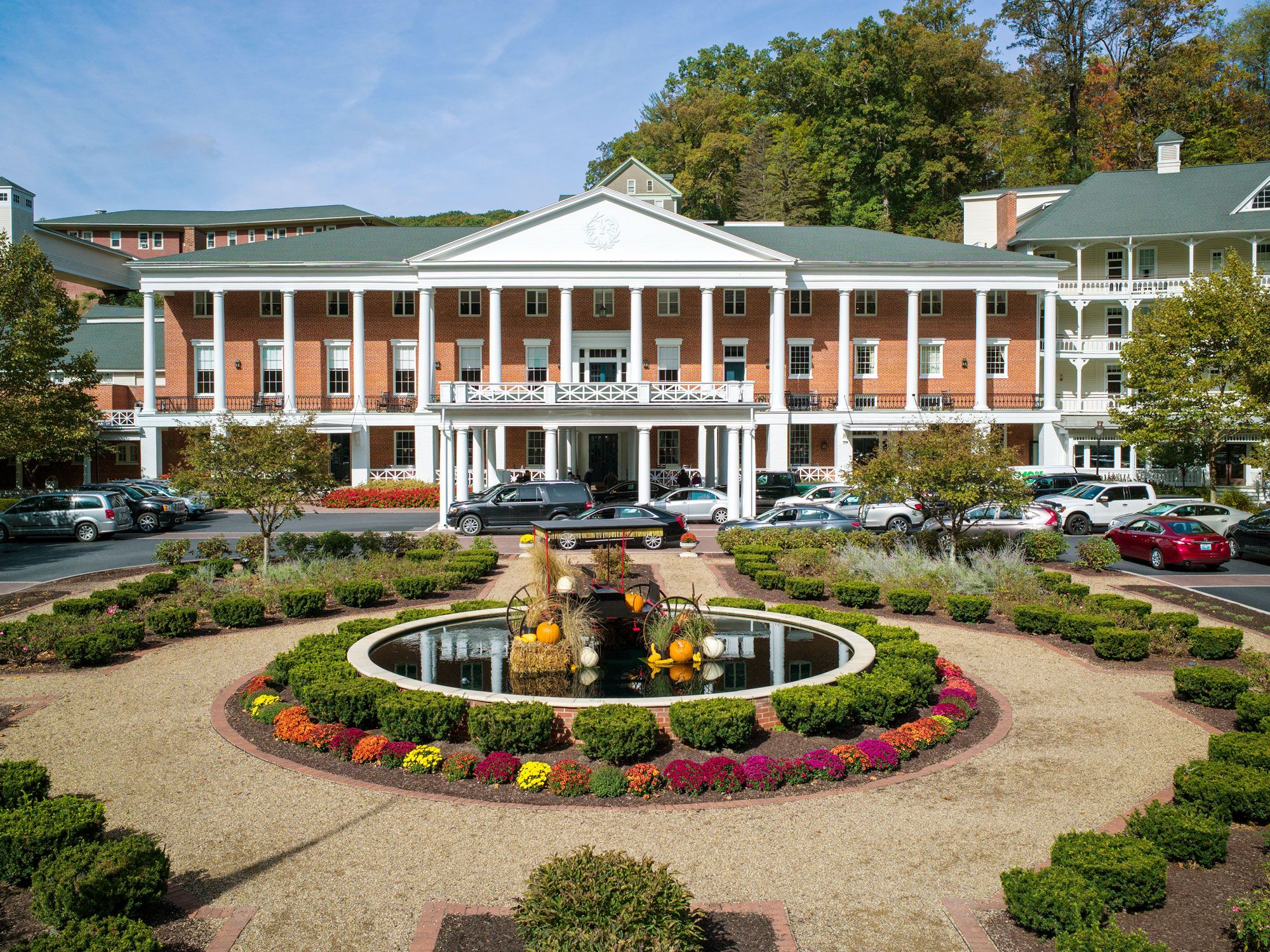
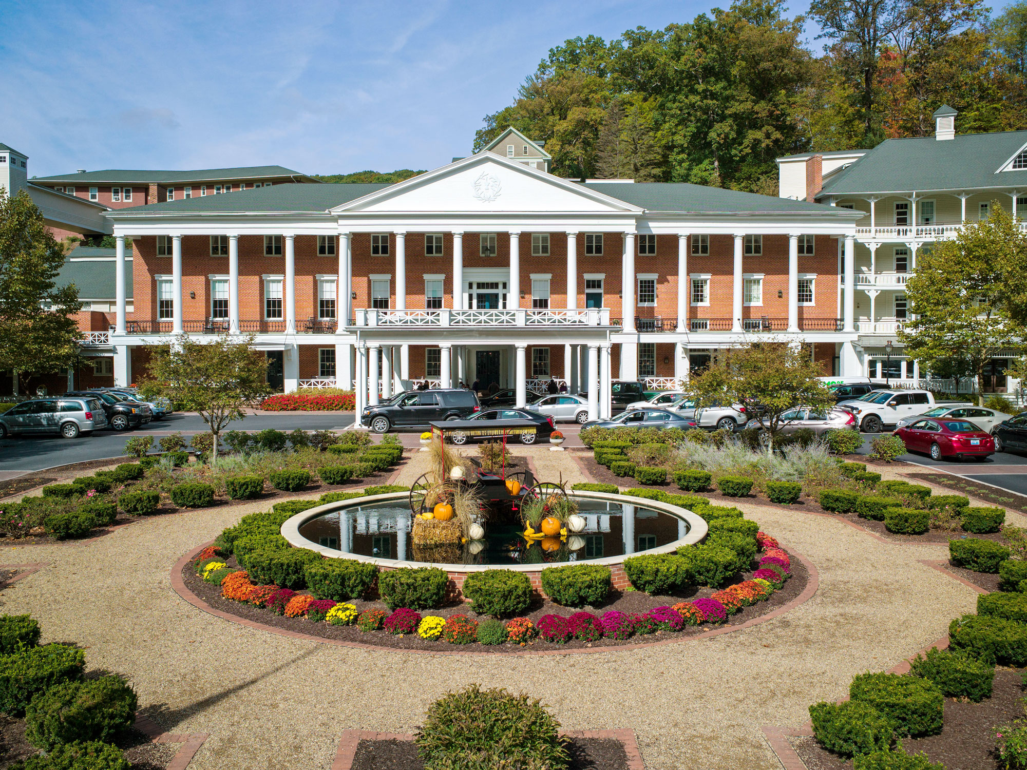
Fountain and gardens in front of Bedford Springs Resort
Photo credit: H. Mark Weidman Photography/ Alamy Stock Photo

Mineral-rich hot springs in the Allegheny Mountains have lured a succession of commanders-in-chief to Pennsylvania’s exclusive Bedford Springs Resort. In 1821, President James Buchanan made his first visit, and would return for 40 summers. The resort served as the 15th President’s “Summer White House” during his term in the 1800s, and Buchanan received the first transatlantic cable in the hotel’s lobby in 1858.

Other U.S. Presidents who have made themselves at home at the luxurious hotel (which had one of the nation’s first indoor swimming pools as well as one of the earliest golf courses) include former Presidents Andrew Jackson, John Tyler, James K. Polk, Zachary Taylor, James Garfield, and William H. Taft.

Post Banner Image
Architecture

These Are 10 of the World’s Weirdest Statues

By Daily Passport Team
Read time: 8 minutes
August 2, 2023
Updated: January 16, 2025

These Are 10 of the World’s Weirdest Statues

By Daily Passport Team
Author
Daily Passport Team
Daily Passport writers have been seen in publications such as National Geographic, Food & Wine, CBC, Condé Nast Traveler, and Business Insider. They're passionate about uncovering unique destinations and sharing expert tips with curious travelers.

Iconic statues — from Christ the Redeemer in Rio de Janeiro to China’s Spring Temple Buddha and New York City’s Statue of Liberty — are famous for their elegant, artfully sculpted designs. But some statues buck that trend. Think: metal chickens, lumpy rockets, or a teetering stack of sailing ships. Discover 10 of the world’s weirdest statues, monuments, and fountains you never knew existed.

Hand of the Desert – Atacama Desert, Chile

Image of Hand of the Desert statue in the Atacama Desert of Chile
Photo credit: Kseniya Ragozina  Alamy Stock Photo

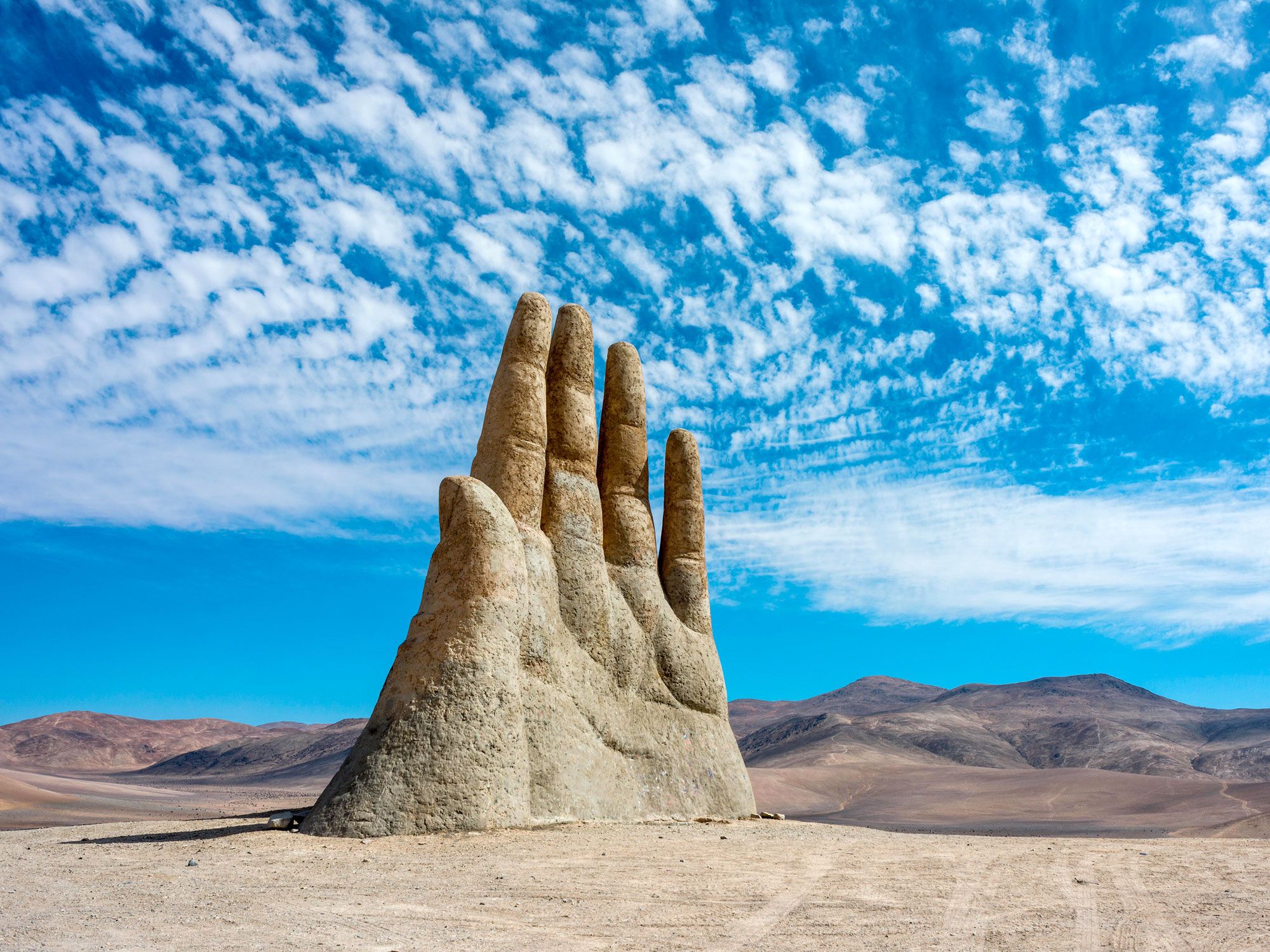
In 1992, out in Chile’s vast and desolate Atacama Desert, Santiago sculptor Mario Irarrázabal installed a striking sculpture of a left hand rising from the sand. The massive, 36-foot-tall sculpture, constructed of iron and cement, reminds some viewers of the Percy Bysshe Shelley poem “Ozymandias,” which tells the tale of a fallen monumental statue of an arrogant king lying in pieces in a desert.

The statue, commissioned by the nearby mining town of Antofagasta, has a mate — thousands of miles away in the Uruguayan coastal resort town of Punta del Este, a giant right hand by the sculptor rises from the beach, a “Monument to the Drowned.”

Man Hanging Out – Prague, Czechia

"Man Hanging Out" statue dangling over streets of Prague, Czechia
Photo credit: Manfred Gottschalk/ Alamy Stock Photo/

Frequently the motivation for concerned calls to the Prague police, this dangling sculpture of Sigmund Freud can be easily mistaken for a person in danger. And maybe that initial startle that viewers feel is the point of the sculpture by David Černý, a popular Prague visual and performance artist. Critics have said that the work was created to question the outsized role of intellectualism in the 20th century and to possibly portray Freud’s fear of his own death.

The sculpture depicts Freud, who was born in the Czech Republic, hanging onto a pole by one hand, above the cobbled streets of the city’s Old Town. When it was installed in 1996, “Man Hanging Out” proved so popular that the artist was invited to display the work at museums and art fairs around the world. Now it has returned to Prague and has a permanent midair home.

Floralis Generica – Buenos Aires, Argentina

Person walking by flower-shaped "Floralis Generica" statue in Buenos Aires, Argentina
Photo credit: Frank Nowikowski/ Alamy Stock Photo

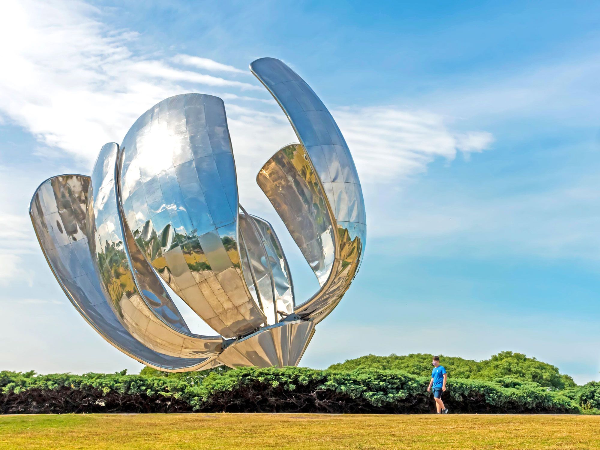
In a reflecting pool in United Nations Park in Buenos Aires’s Recoleta neighborhood, a 75-foot-tall mechanical flower made of stainless steel and aluminum opens and closes with the sun. The immense sculpture, which has a diameter of 131 feet when opened, was a gift of famed Argentinian architect Eduardo Catalano in 2002, designed by him to honor his beloved hometown.

Every morning at 8 a.m., photocells on the sculpture react to the sunlight and set off a hydraulic system that slowly opens six enormous shiny petals. The petals reflect and refract the city skyline, the sky, and the pool in which it stands, making it a popular addition to the city’s numerous public artworks. At sunset, the petals close back up, but the interior glows with colored light through the night. In its relatively short lifespan, “Floralis Generica” has become one of the most iconic symbols of Buenos Aires.

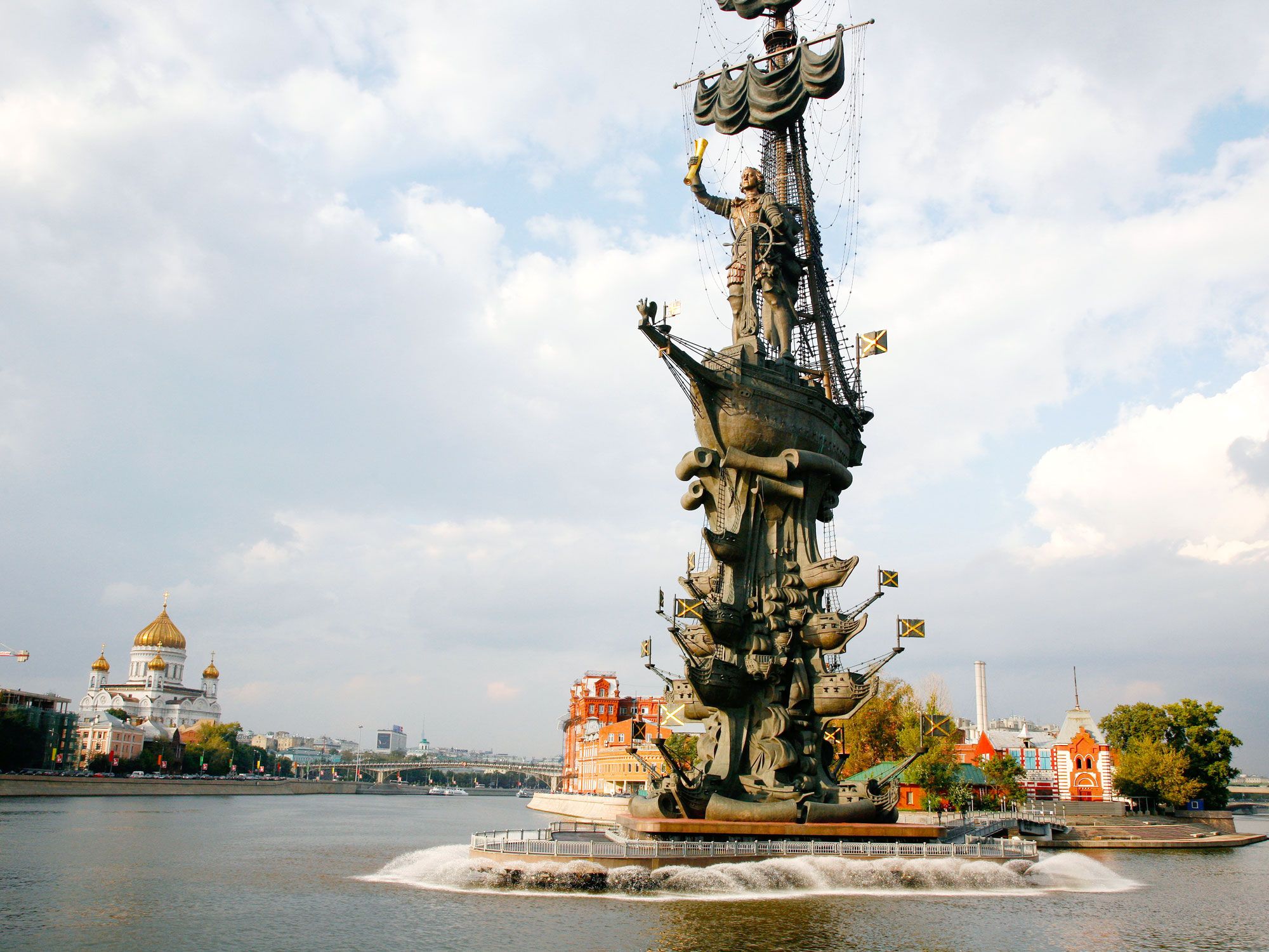
Peter the Great Statue – Moscow, Russia

"Peter the Great" statue on the banks of the Moskva River in Moscow, Russia
Photo credit: Yadid Levy/ Alamy Stock Photo

This massive statue of Peter the Great standing on the deck of a ship, which itself rests on top of a column made of several ships, was originally modeled as a memorial to honor the 500th anniversary of the first voyage of Christopher Columbus. Allegedly, the artist Zurab Tsereteli could not find a taker for a Columbus statue, so he substituted Peter the Great for the Spanish explorer and got his patron, the then-mayor of Moscow, to commission the work for a spot on the banks of the Moskva River.

Moscow’s citizens are noisy in their disapproval, which is multifaceted. First, the ungainly sculpture, which tops off at a whopping 322 feet tall (the Statue of Liberty is 305 feet with its base), blocks the view of a beautiful and historic section of the Moscow skyline. Second, Peter the Great is not considered a favorite among Muscovites: The “great” emperor disliked the city so much he moved the capital to St. Petersburg. After the mayor left office, Moscow quickly offered the statue to St. Petersburg, which politely declined the offer.

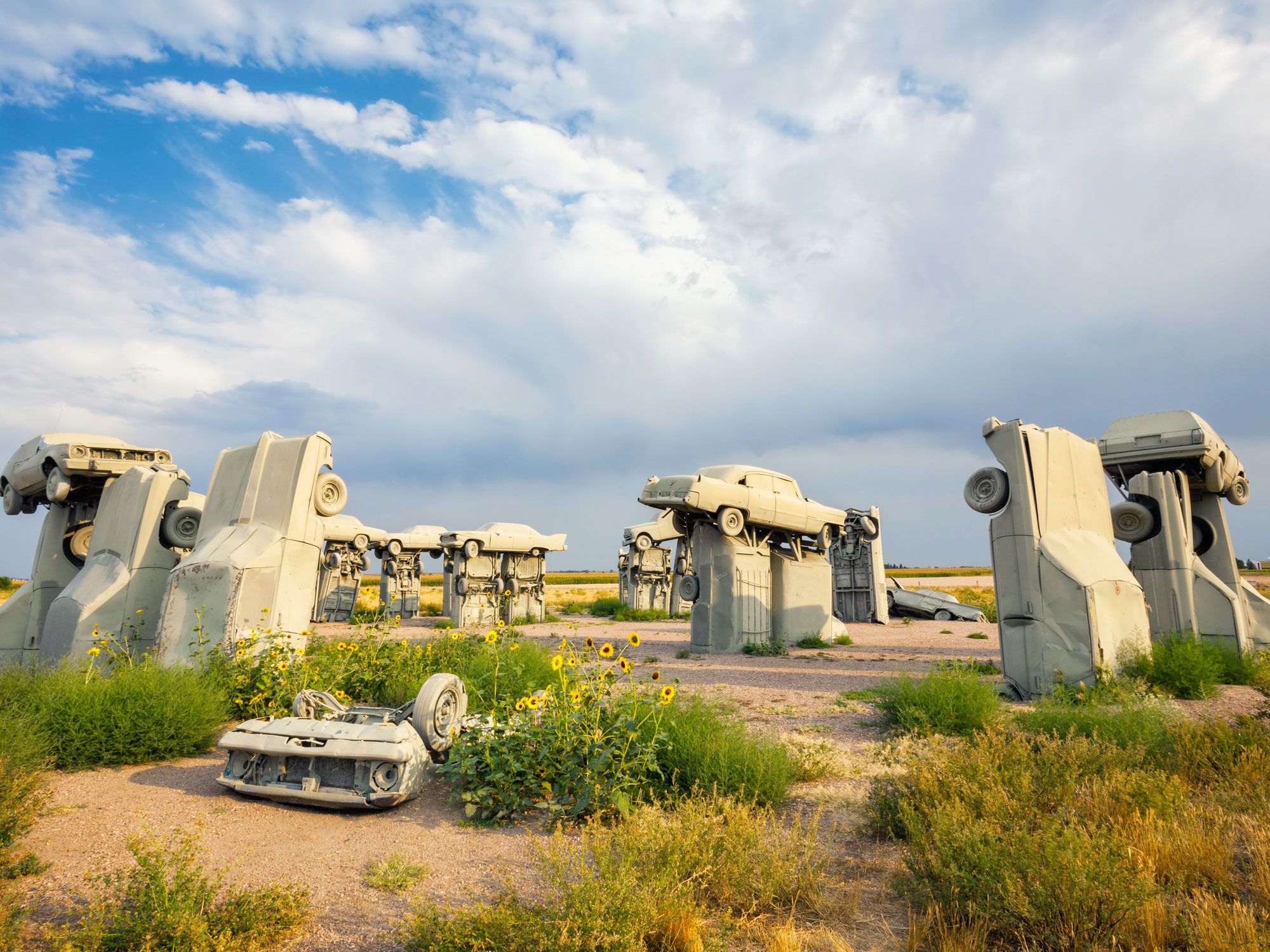
Carhenge – Alliance, Nebraska

Image of Carhenge statue in Nebraska
Photo credit: Bryan Mullennix World View/ Alamy Stock Photo

When Nebraska-born geologist Jim Reinders noticed that the proportions of the car models of the 1950s and 1960s were roughly on the same scale as the stones that make up England’s Stonehenge, he began to stockpile vintage cars with an artistic purpose. In 1987, Reinders erected a replica of Stonehenge, constructed from 38 cars, some upended with others balanced atop, like the dolmens of the original prehistoric site, and arranged them in an incomplete circle with the same 96-foot diameter. The vehicles were painted a flat grey to resemble stones (and to stop rust), but there’s no denying that the raw materials used in the sculpture were originally cars.

During the 2017 solar eclipse, the totality of the eclipse passed over Alliance, Nebraska, and Reinders’s installation. A group of over 4,000 observers, including the state governor, assembled at Carhenge to watch.

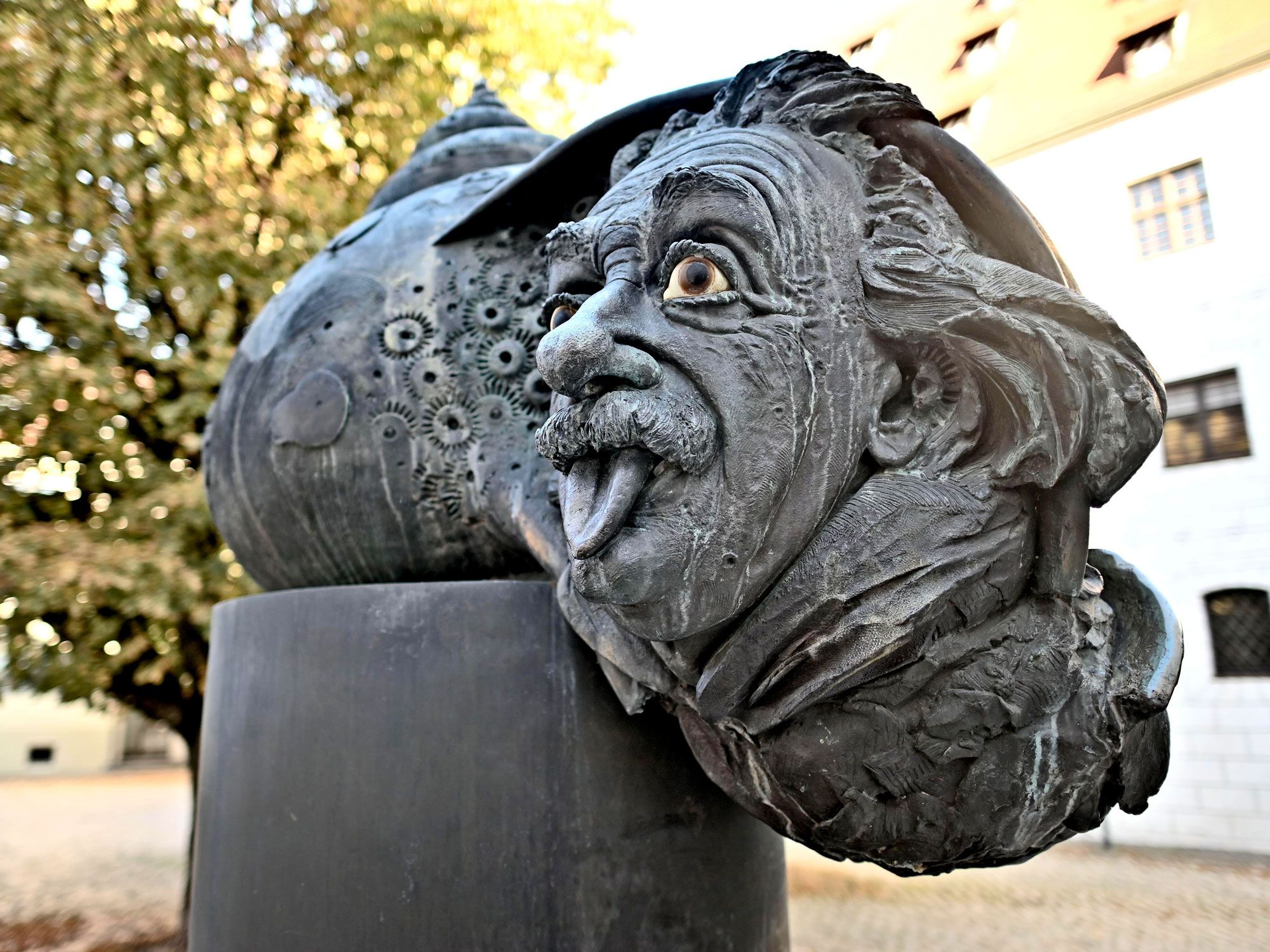
Einstein Fountain – Ulm, Germany

Close-up image of the Einstein Fountain in Ulm, Germany
Photo credit: ightspruch/ Alamy Stock Photo

Imagine Albert Einstein’s wild-haired head cast in bronze and tucked into the sideways shell of a snail, which itself forms the top of a rocket, from whose bottom shoots out a fountain of water. Get the idea? We’ll admit, we don’t quite either. The city of Ulm, Germany, where Einstein was born in 1879 and lived for one year, erected this fountain in 1984 to honor the physicist. This chaotic creation, conceived by Jürgen Goertz, combines the man-made technology of the rocket and the perfect natural engineering of the snail shell, with the head of a genius, to somehow represent or honor his work.

Other easier-to-understand monuments to the charismatic physicist include a statue outside of the National Academy of Science in Washington D.C., a cast bronze bust at Princeton University in New Jersey, where he taught, and a lifesize bronze statue in the Griffith Observatory in Los Angeles.

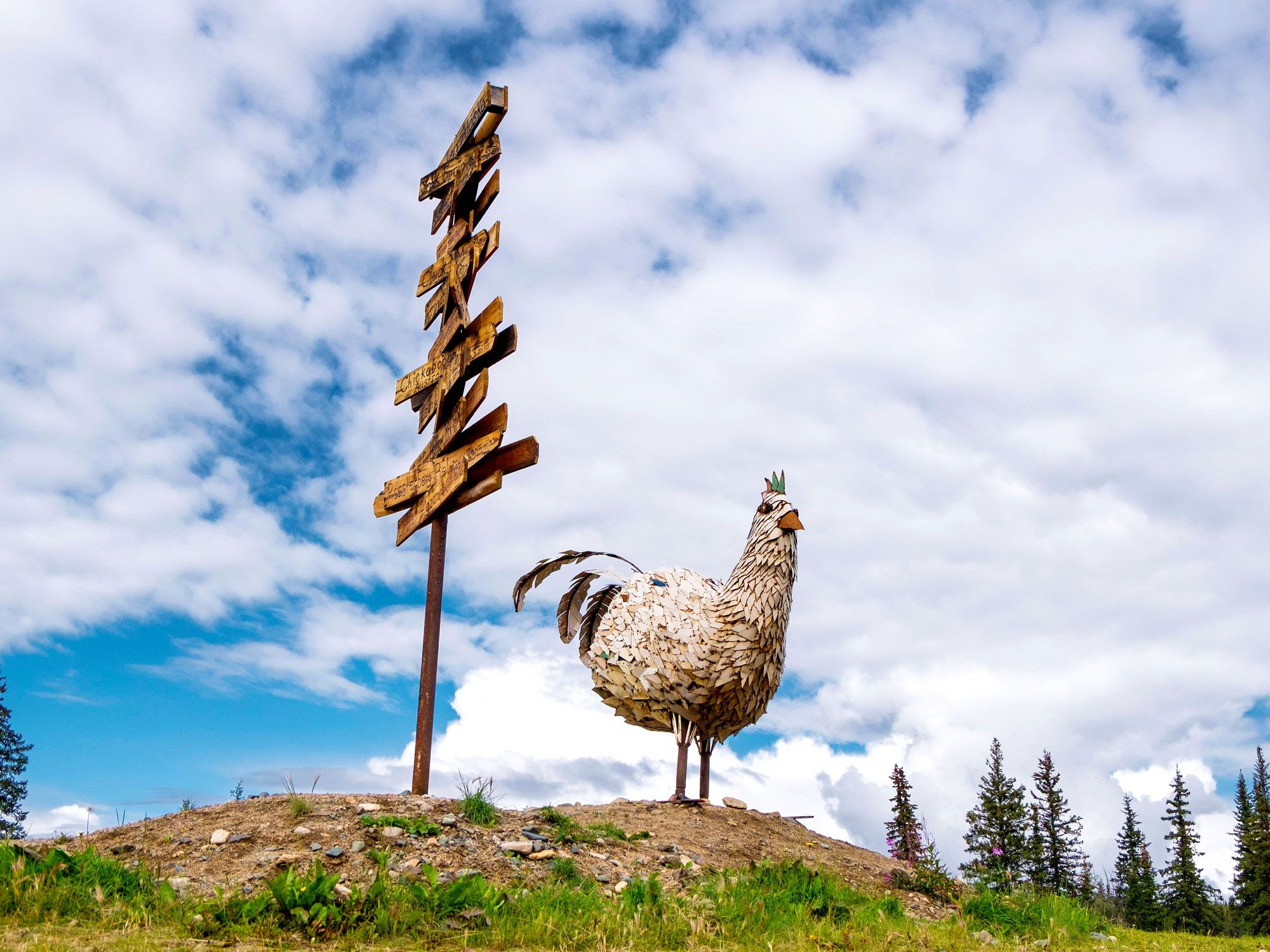
Mr. Eggee, the Chicken – Chicken, Alaska

Metal chicken statue in Chicken, Alaska
Photo credit: James Talalay/ Alamy Stock Photo

Just as you can see the namesake animals of Buffalo, New York, and Elk, Michigan, all over town on business signs and sports jerseys, a town named Chicken would surely inspire some chicken-flavored memorabilia. The tiny gold-mining town of Chicken, Alaska, near the border of Canada’s Yukon Territory, does, in fact, sport a few chicken depictions.

The most prominent, “Mr. Eggee,” was made to celebrate the annual Chickenstock music festival in 2011. Designed and constructed by a high school welding teacher (and music fan) with his shop class, the 12-foot-tall metal chicken has a basic skeletal frame adorned with metal feathers cut out of old school lockers. Transported 600 miles from the school in coastal Homer to Chicken, the sculpture now stands on the hill above the Chicken Gold Camp, an RV park.

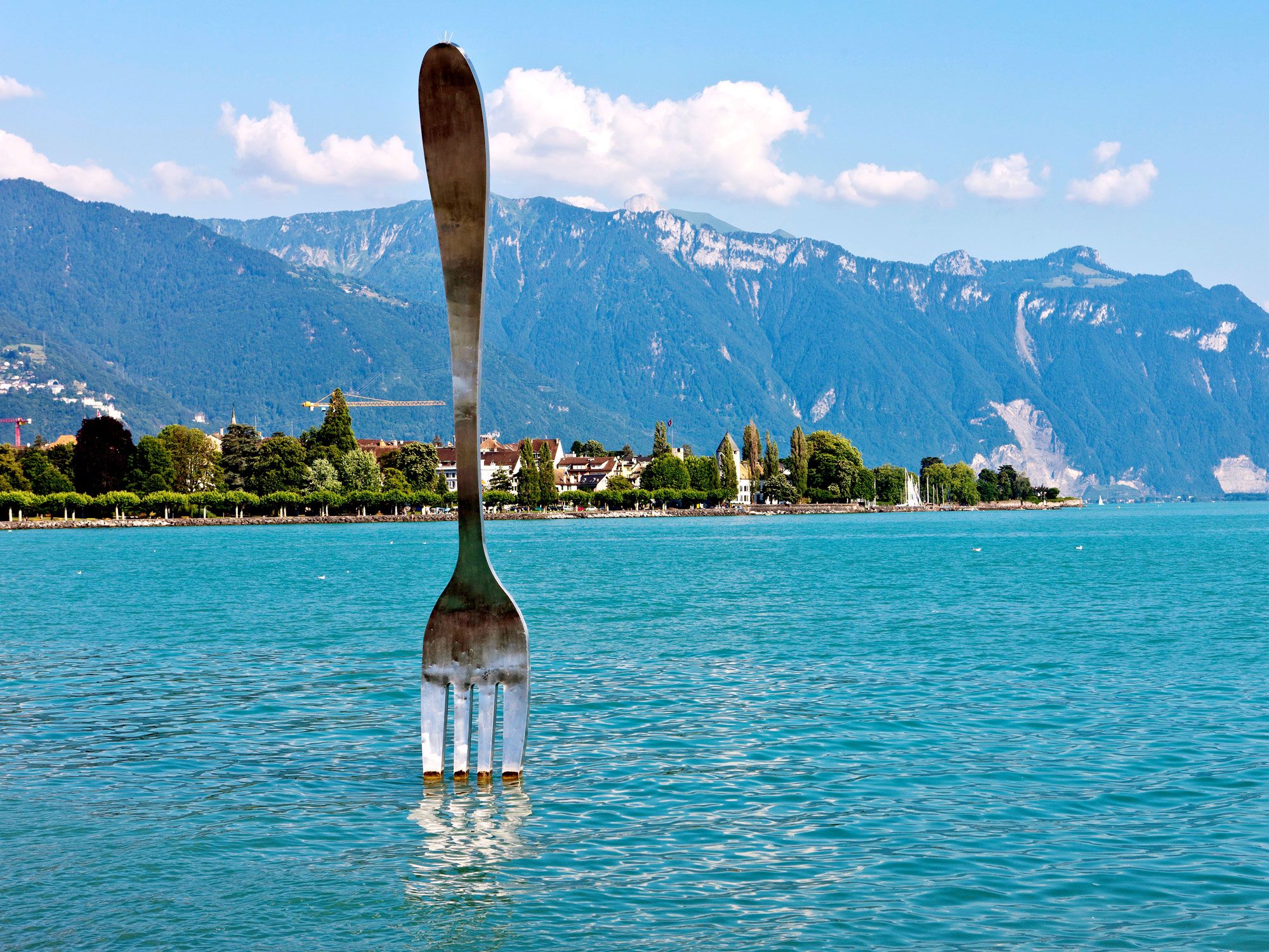
La Fourchette – Vevey, Switzerland

Giant fork statue of "La Fourchette" poking out of Lake Geneva in Vevey, Switzerland
Photo credit: imageBROKER.com GmbH & Co. KG/ Alamy Stock Photo

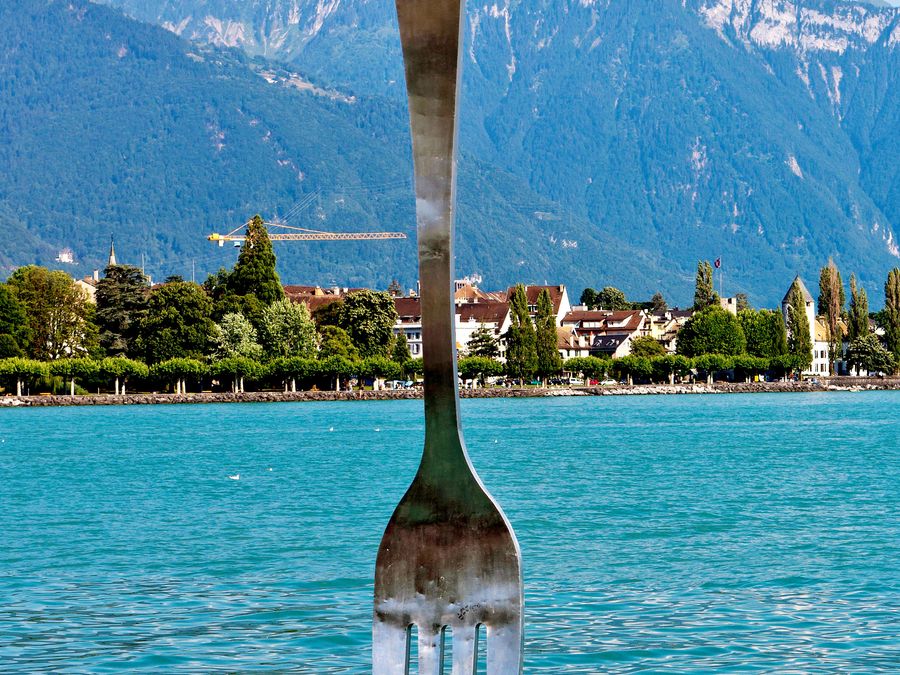
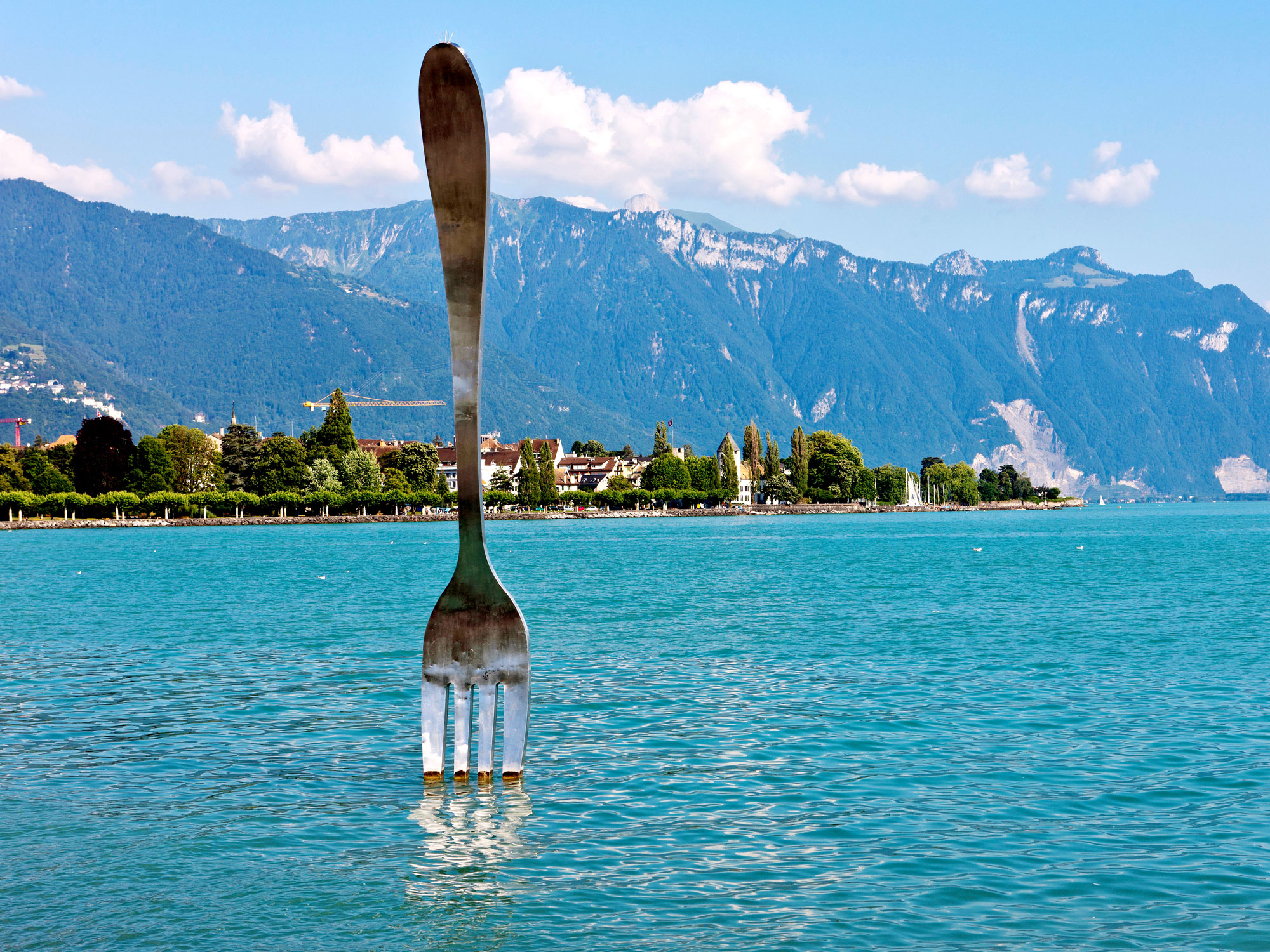
A 26-foot-tall stainless steel fork sculpture was stuck, tines down, in Lake Geneva in 1995 to commemorate the tenth anniversary of Alimentarium, a food-themed museum in Vevey, Switzerland. After a year, when the anniversary had passed, the immense fork — the work of Swiss artists Jean-Pierre Zaugg and Georges Favre — was plucked out of the lake. It was moved to mark the grounds of a Swiss factory that manufactures cutlery.

But during its tenure in the picturesque lake, the fork became a favorite landmark for the people of Vevey, and they wanted it back. Finally, the fork fans won. In 2007 it was brought back to become a permanent installation in the water off Vevey. Its mate, a giant spoon, is mounted on the side of the museum, not far from another notable statue, this one depicting former Vevey resident Charlie Chaplin.

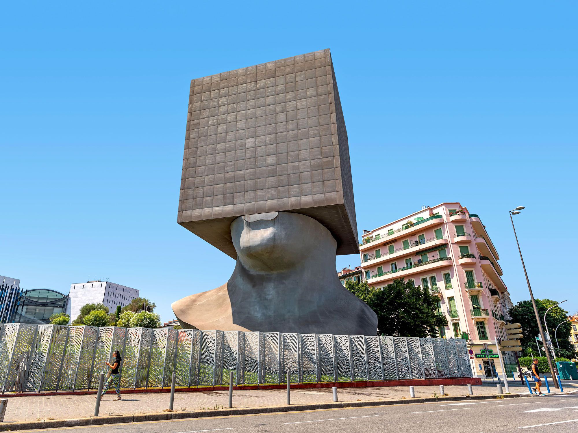
La Tête Carrée Library – Nice, France

Image of La Tête Carrée (The Square Head) library in Nice, France
Photo credit: Rostislav Glinsky/ Alamy Stock Photo

French sculptor Sacha Sosno (born Alexandre Joseph Sosnowsky) liked to mask or create voids in recognizable representations — a rectangular hole in the middle of a realistically sculpted torso, for instance, or the head, hoofs and tail of a galloping horse, its body replaced by a monolithic bronze block. Sosno called this the art of obliteration, believing that by withholding part of an image meant that the viewer would be forced to use their imagination to complete the work.

One image that Sosno returned to time and again was a human bust with the upper part of the head replaced by a block. In 2002, an 85-foot-tall architectural version of this image, La Tête Carrée (the Square Head), was constructed in the artist’s home city of Nice, France, to house seven floors of offices of the Louis Nucéra municipal library. The interior of the library offices are visible at night through perforations in the exterior sheath of aluminum on the building-sculpture.

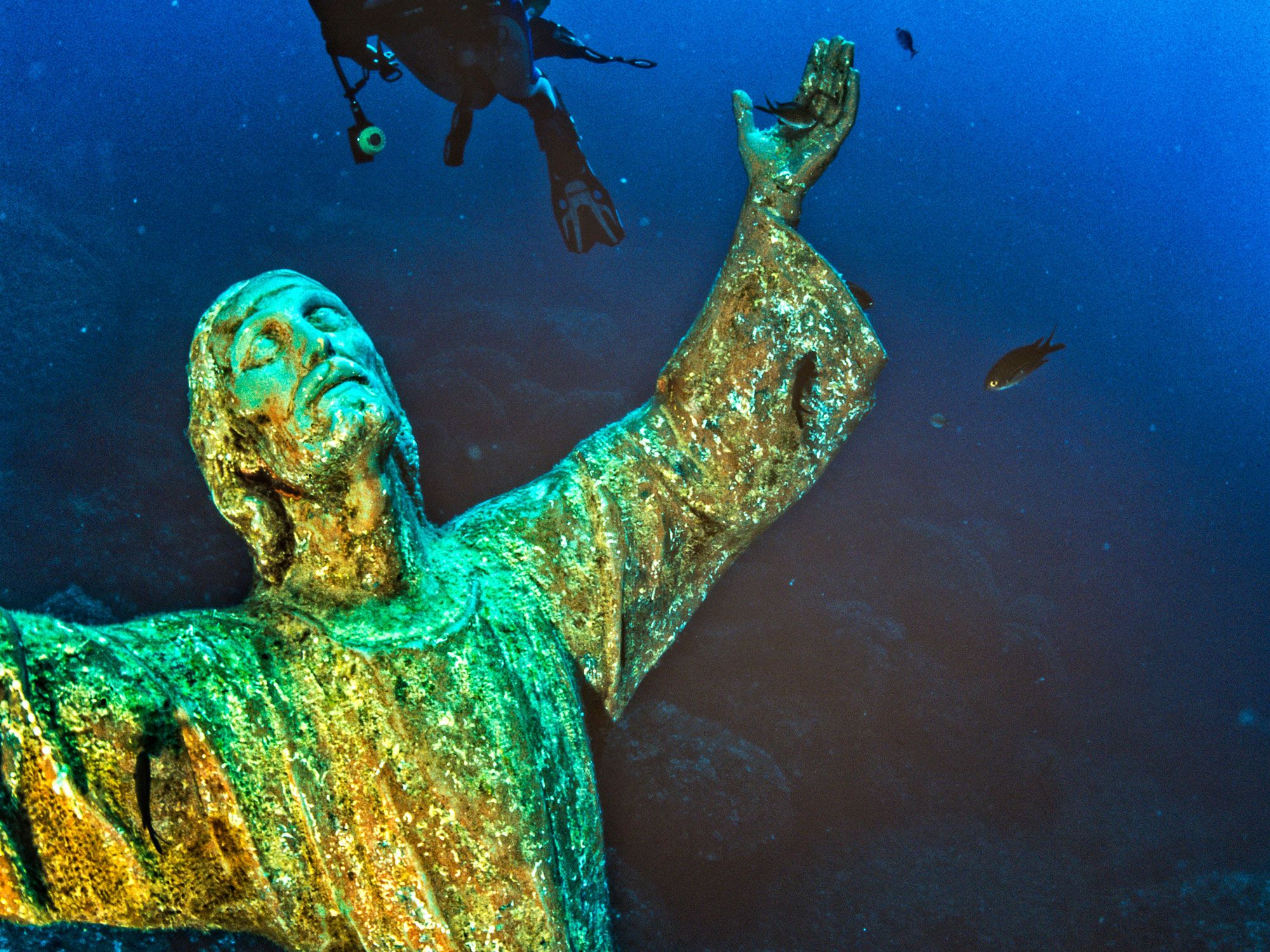
Christ of the Abyss – San Fruttuoso, Italy

Underwater statue of "Christ of the Abyss" off the Italian Riviera
Photo credit: Realy Easy Star/Adriano Penco/ Alamy Stock Photo

Christ of the Abyss was erected in 1954 in the waters off San Fruttuoso, Italy, on the Italian Riviera. The statue sits on the floor of the bay at a depth of almost 60 feet, near the site where an Italian diver died. Every year, on the last Sunday of July, a torch-lit mass is celebrated on the beach nearby to honor those who’ve died at sea. After the mass, divers secure floral crowns at the base of the underwater statue.

When one of the statue’s hands was knocked off by a boat anchor, the bronze statue was hauled to dry ground for repairs and restoration in 2003. The 8.5-foot-tall statue was recast several times, and replicas can be visited at underwater sculpture parks in the Florida Keys and off the coast of Grenada. A dry-land version is kept near the dive site at the church at the San Fruttuoso Abbey.

Post Banner Image
History

7 Fascinating Places for History Buffs to Visit in the Southern U.S.

By K.C. Dermody
Read time: 6 minutes
August 2, 2023
Updated: August 3, 2023

7 Fascinating Places for History Buffs to Visit in the Southern U.S.

By K.C. Dermody

The Southern U.S. has a unique and unmistakable identity, with distinctive customs, musical styles, and varied cuisine. That’s also true of the region’s rich and interesting history, marked by early European colonial settlements, the Civil War, and the institution of slavery. The region’s intriguing and often complicated past can be explored in many ways, but these seven historical monuments are some of the best you’ll find in the South.

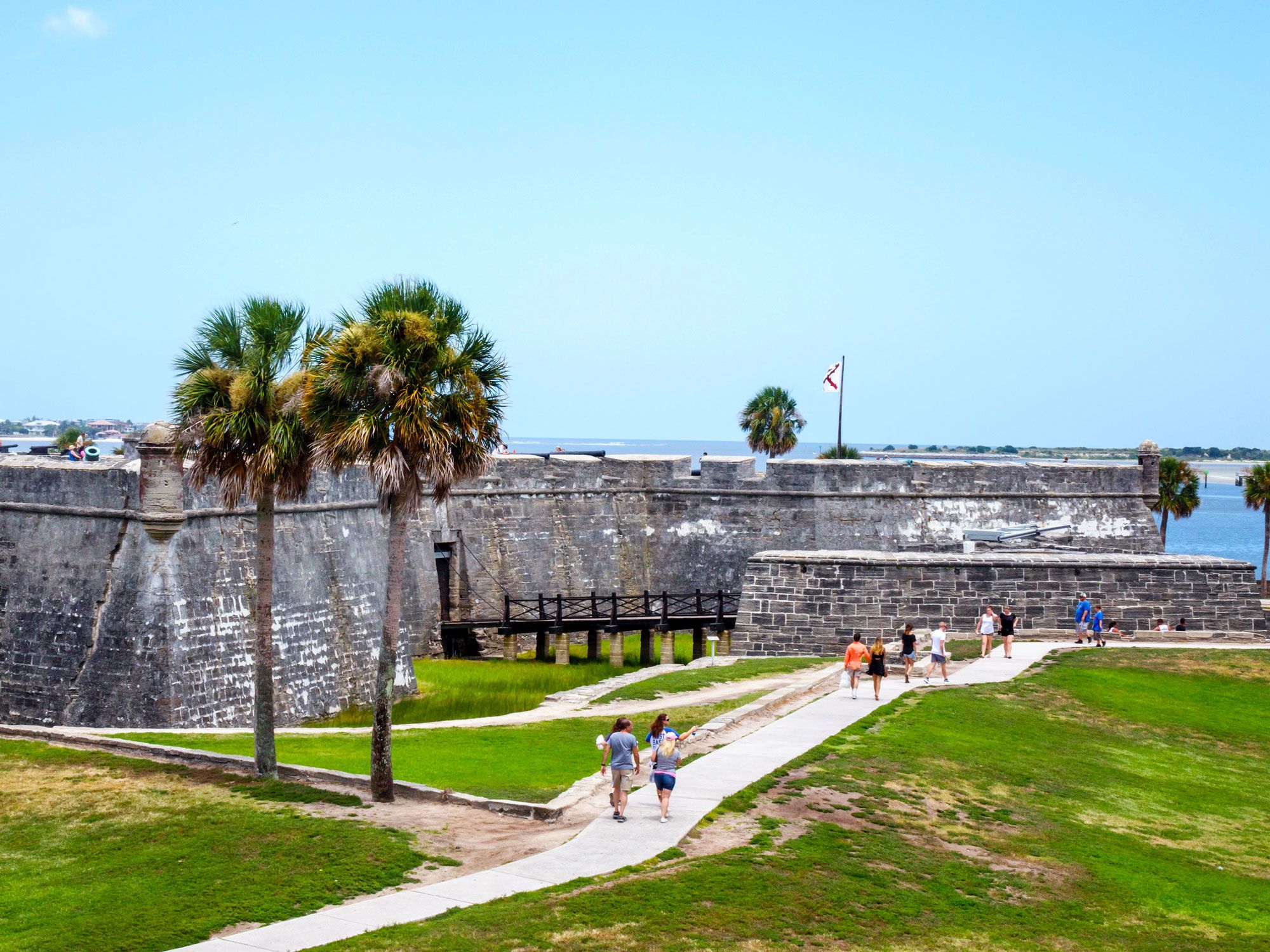
Castillo de San Marcos National Monument – St. Augustine, Florida

Visitors exploring Castillo de San Marcos National Monument
Photo credit: Jeffrey Isaac Greenberg 2+/ Alamy Stock Photo

Castillo de San Marcos was built by the Spanish between 1672 and 1695 to protect St. Augustine, the oldest permanent European settlement in the U.S. As the oldest masonry fort in the continental U.S., it also played a key role in the Civil and Spanish-American Wars and was used as a military prison. Made from coquina shells quarried nearby, some of its ocean-facing walls are 19 feet thick, which helped to protect the fort against cannon firing. In 1924, the site was declared a national monument.

Today, visitors can climb the 50 steps to the fort’s upper level for a magnificent view of historic St. Augustine and Matanzas Bay, as well as get a look inside the Bell Tower and Sentry Box. From the lower level barracks, visitors can see the prison, sleeping quarters, storage rooms, and chapel. Historic weapon demonstrations given by volunteers and staff dressed as British and Spanish soldiers take place several times a day on the top deck of the fort.

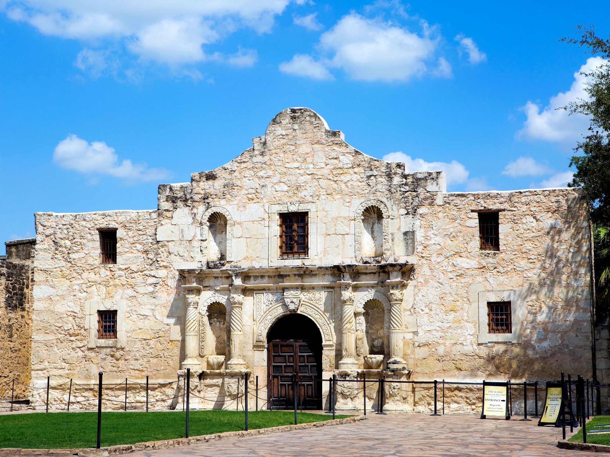
The Alamo – San Antonio, Texas

Image of the Alamo in San Antonio, Texas
Photo credit: Steven Frame/ Alamy Stock Photo

One of the first Spanish missions built in Texas in 1716, the Alamo attracts more than 2.5 million visitors each year. It was originally constructed as a learning center to re-educate Native Americans after their conversion to Catholicism, but it’s best known for the 1836 Battle of the Alamo — where Mexican forces surrendered to the Texan Army during the Texas Revolution. Some of the most famous figures to defend the Alamo included Davy Crockett, James Bowie, and William B. Travis, who were joined by around 200 others. 

While many of the Alamo’s original buildings are no longer standing, the Long Barrack has managed to survive as the oldest structure on the site, dating back to its origins as the Mission San Antonio de Valero. Today, it houses a museum that details the history of Texas with a variety of interesting artifacts. The central element of the complex is the mission church, with its instantly recognizable colonial façade. One of the most photographed monuments in Texas, the two-story building is where most members of the Texan garrison withdrew during the infamous battle, and where they made their final heroic last stand. 

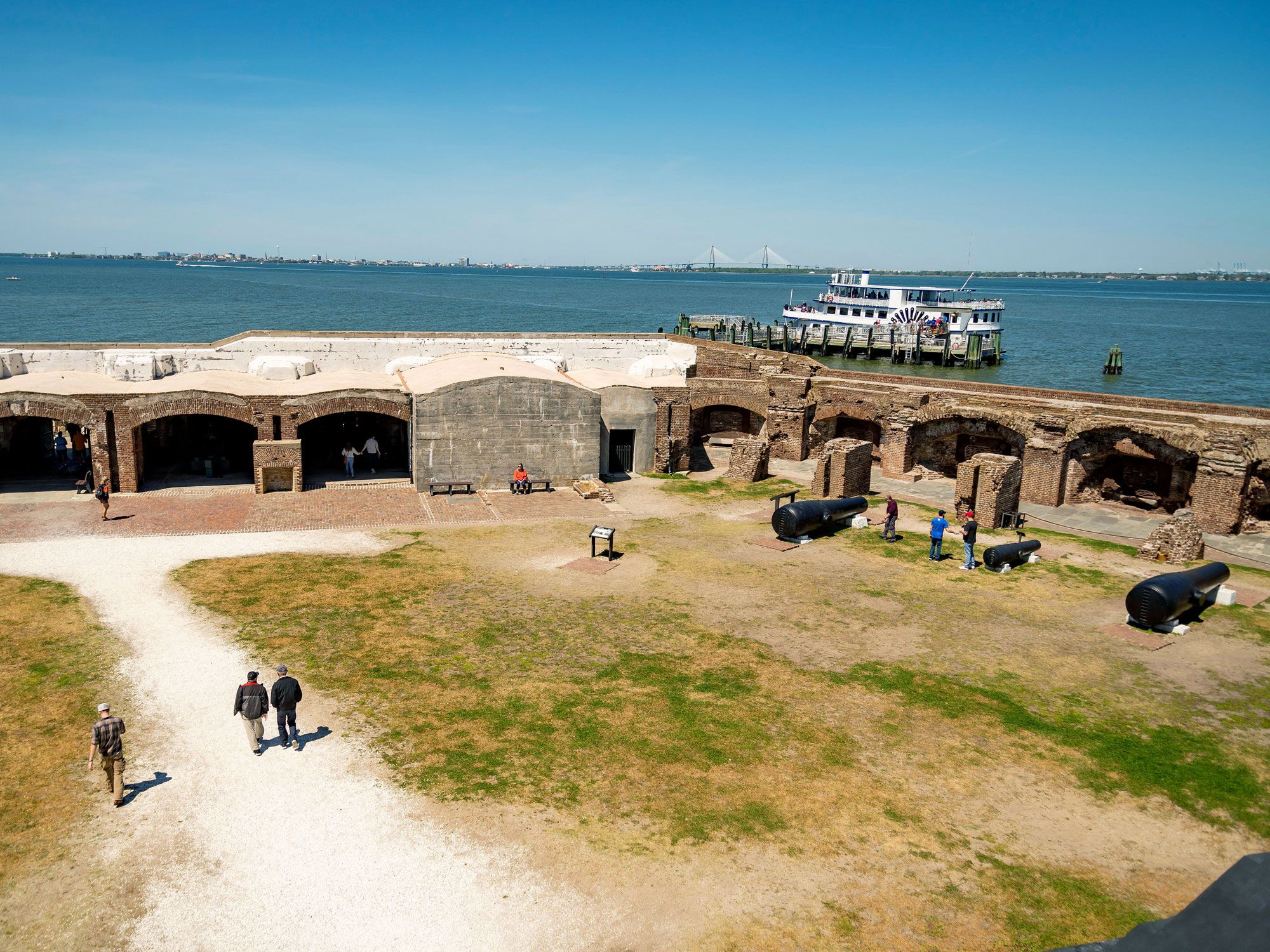
Fort Sumter National Monument – Charleston, South Carolina

Visitors exploring Fort Sumter National Monument in Charleston, South Carolina
Photo credit: Enrico Della Pietra/ Alamy Stock Photo

Part of Fort Sumter and Fort Moultrie National Historical Park, Fort Sumter was built in 1812 on an artificial island in the middle of Charleston Harbor to protect the city from invaders. The sea fort is best known as the site of the first shots of the Civil War. On April 12, 1861, Confederate forces first fired upon Federal troops, and less than 34 hours later, the Union forces surrendered. 

Visitors to the fort today arrive via ferry, departing from the Fort Sumter Visitor Center at Liberty Square on Gadsden’s Wharf in downtown Charleston. The park rangers offer 10-minute programs detailing the fort’s role in American history. Those who arrive on the first ferry can assist them in raising the U.S. flag over the fort and those on the last ferry leaving can help lower the flag and fold the colors.

Vicksburg National Military Park – Vicksburg, Mississippi

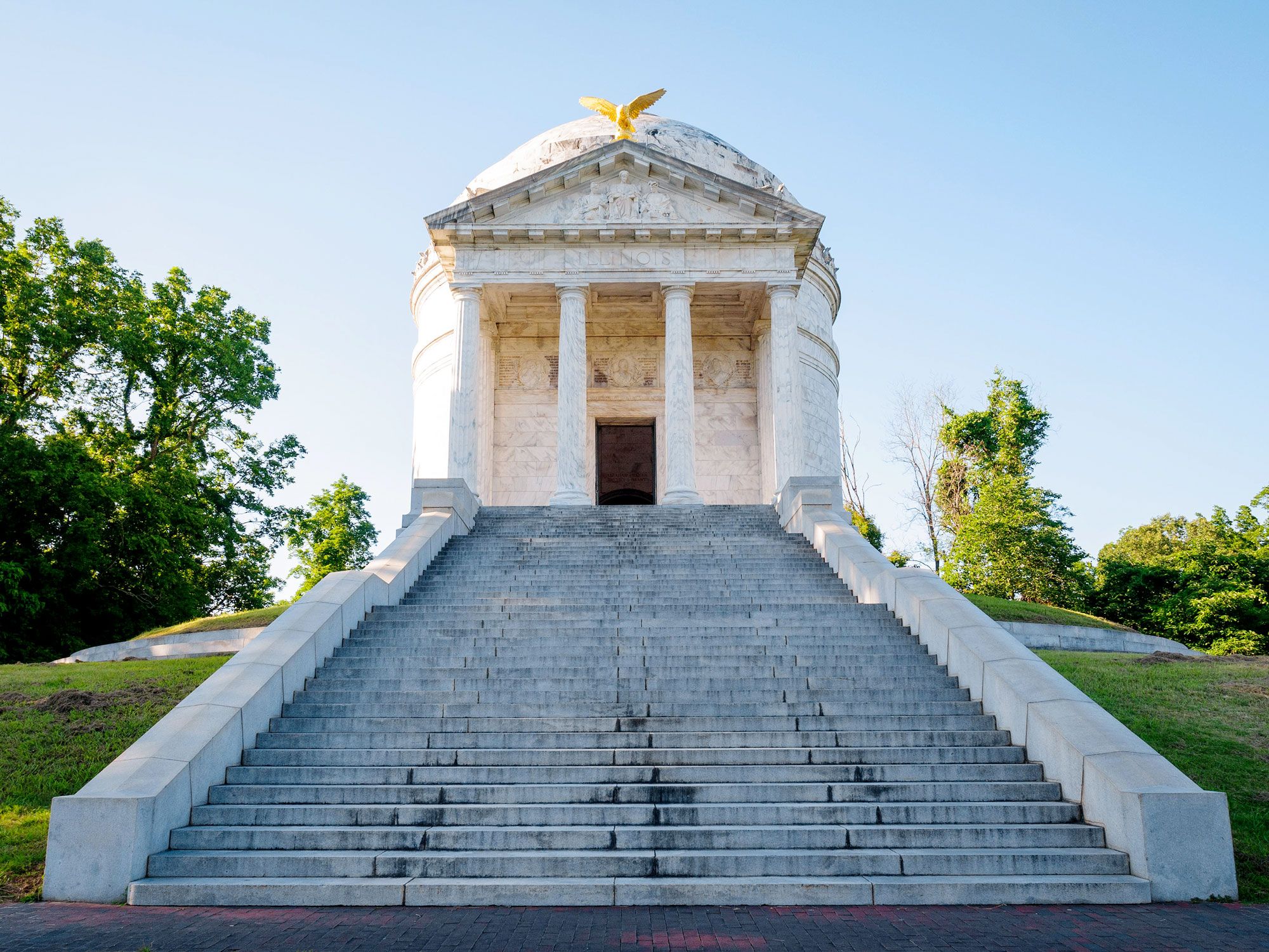
Steps leading to domed building in Vicksburg National Military Park
Photo credit: Zachary Frank/ Alamy Stock Photo

Vicksburg National Military Park commemorates the Battle of Vicksburg and the soldiers who gave their lives during this pivotal event of the Civil War. Following a 47-day siege, General John C. Pemberton surrendered the city on July 4, 1863, giving the Union control of the Mississippi River. It was a critical supply line and part of the Union’s successful plan to cut off all trade to the Confederacy.

Today, the national military park includes the Vicksburg National Cemetery, where 18,000 soldiers are buried (two-thirds of which have never been identified), along with more than 1,300 historical markers and monuments. An outdoor display includes a cannon and fortification exhibit, while the visitor center plays a short film on the park’s history.

Oak Alley Plantation – Vacherie, Louisiana

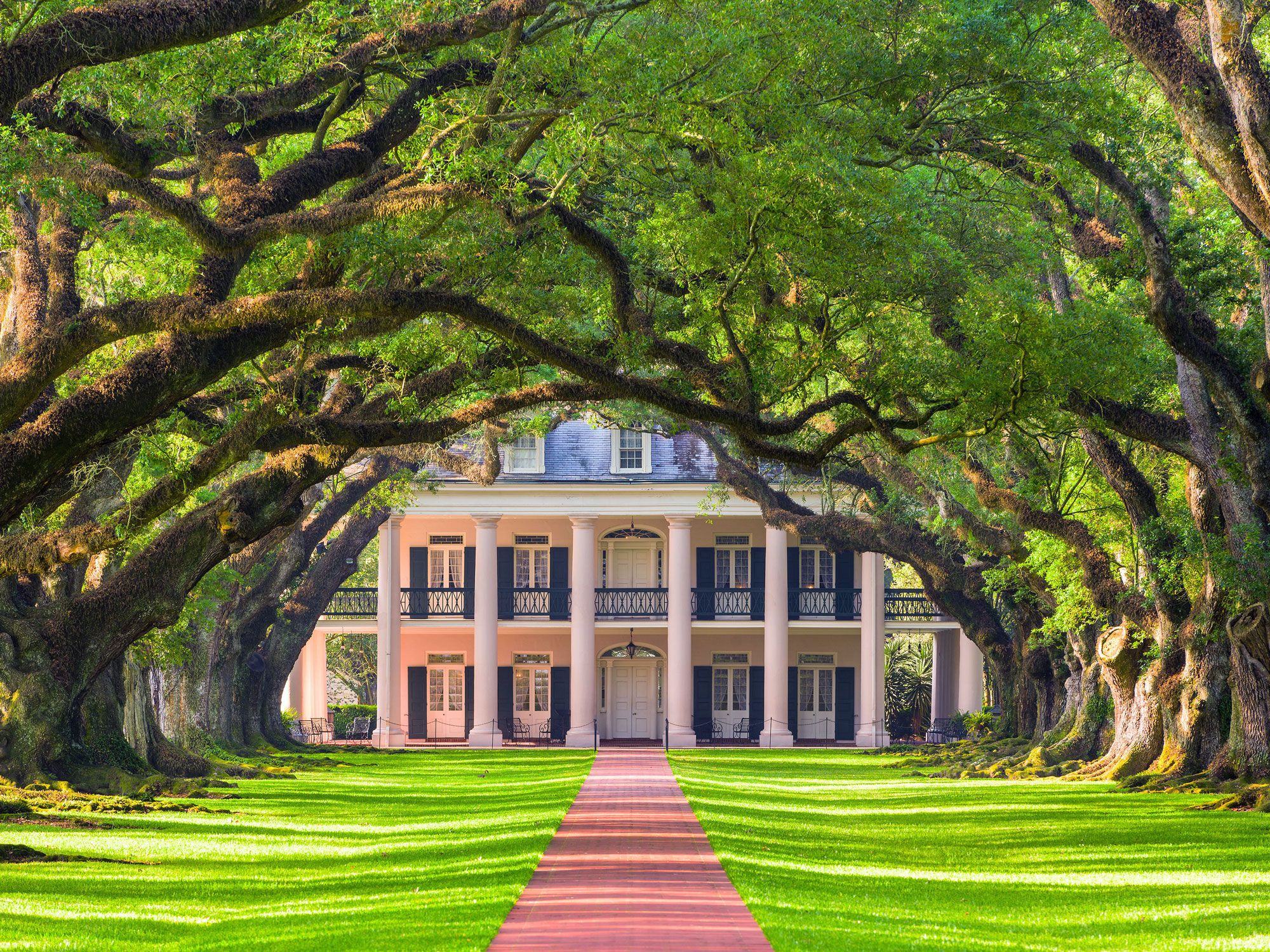
Canopy of oak trees leading to Oak Alley Plantation
Photo credit: Sean Pavone/ Alamy Stock Photo

Located outside of New Orleans, Oak Alley Plantation is named for its quarter-mile-long entrance that features a magnificent canopy of 28 centuries-old oak trees, each named after the plantation’s various owners. Many come just to capture a photo of the picturesque alley, but there’s also a restored historic plantation home, the quarters used for the plantation’s enslaved peoples, a sugar mill, barns, and 1,200 acres of farmland to explore. 

Visitors can experience the National Historic Landmark via a tour, led by guides in period dress. The Greek Revival mansion was built in 1837 in a perfect square with a colonnade of 28 Doric columns on all four sides, corresponding to the alley’s 28 trees. The tours detail the tragic stories of the many men and women who were forced into slavery on the plantation.

Old Fort Jackson – Savannah, Georgia

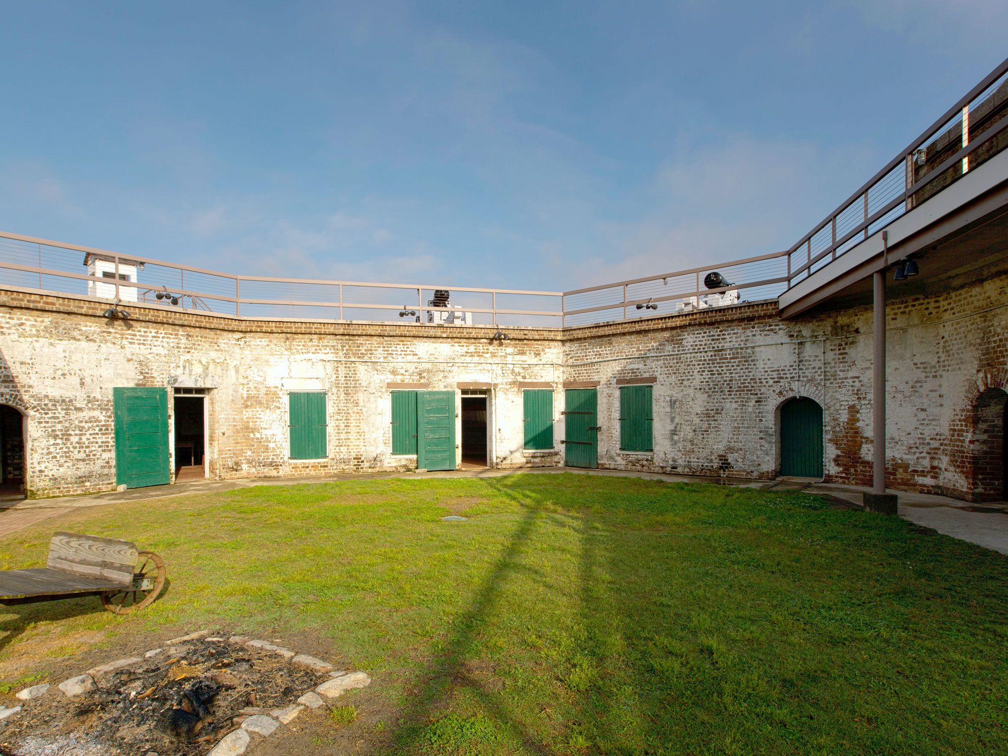
Image of Old Fort Jackson in Savannah, Georgia
Photo credit: JCPhoto/ Alamy Stock Photo

Savannah is one of the most picturesque and historic cities in the South. That is particularly evident in the city’s Old Fort Jackson, a National Historic Landmark and the oldest surviving brick fortification in Georgia. Set along the Savannah River, the fort was built in 1808 and helped protect the city during the War of 1812. It was also used as a Confederate headquarters during the Civil War for local defense. 

Visitors can witness cannon firings twice daily (at 10 a.m. and 2 p.m.) in the spring and summer months. Two powder magazines and most of the casemates are open to the public, containing displays of tools and weapons used at the fort, along with artifacts from the CSS Georgia, a Confederate ship that now lies at the river bottom just a few hundred feet away. Tours with guides dressed in traditional period garb revealing the stories of soldiers who fought at this historic site. 

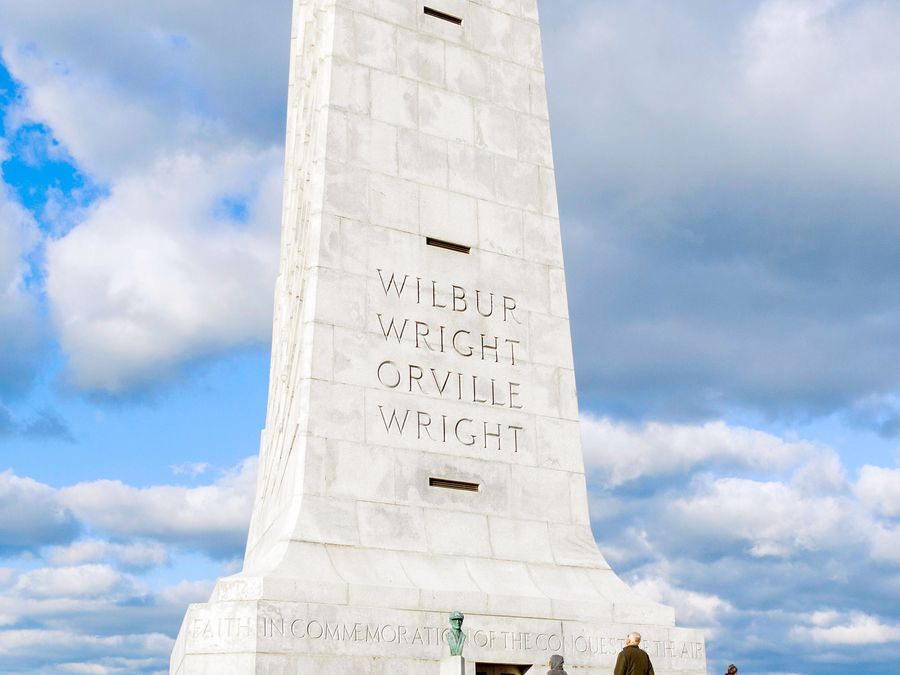
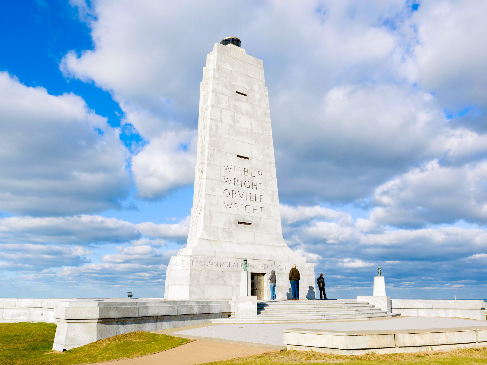
Wright Brothers National Memorial – Kill Devil Hills, North Carolina

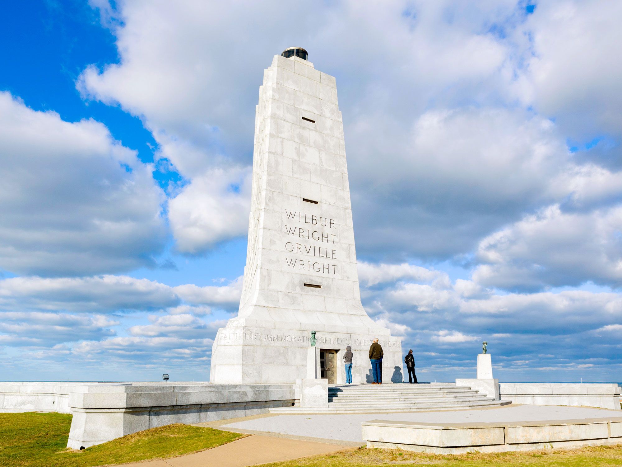
Tall white statue dedicated to the Wright Brothers at Wright Brothers national Memorial in North Carolina
Photo credit: Ian Dagnall/ Alamy Stock Photo

In the early 1900s, these sand dunes along the Atlantic — in what is now the town of Kill Devil Hills — attracted the attention of Orville and Wilbur Wright. With some of the dunes reaching over 100 feet in height and the winds typically remaining steady, it was an ideal spot for the famous brothers to experiment with their gliders. After flying the gliders, the pair built the Wright Flyer, a powered plane, and on December 17, 1903, Orville created aviation history with its first flight. In 1932, the Wright Brothers National Memorial was officially dedicated, drawing a thousand spectators, including Orville and Wilbur themselves. 

In addition to the granite monument, today’s visitors can also see a sculpture that was dedicated in 2003. Made of bronze and steel, it reenacts the historic first flight, with Orville piloting as Wilbur runs alongside while the witnesses who assisted are cheering them on.

Post Banner Image
Outdoors

The 10 Most-Visited U.S. National Parks

By Bradley O'Neill
Read time: 6 minutes
August 2, 2023
Updated: October 7, 2024

The 10 Most-Visited U.S. National Parks

By Bradley O'Neill

National parks provide a gateway to some of the most unique, serene, and awe-inspiring landscapes across the United States. Beloved for their recreational opportunities that range from camping to climbing and scenic road trips, national parks offer an educational glimpse into millions of years of natural and human history. In 2022, the National Park Service reported a staggering 312 million recreational visits. Find out which parks made it into the list of top 10 most visited U.S. national parks. 

10. Glacier National Park – Montana (2.908 Million Visitors) 

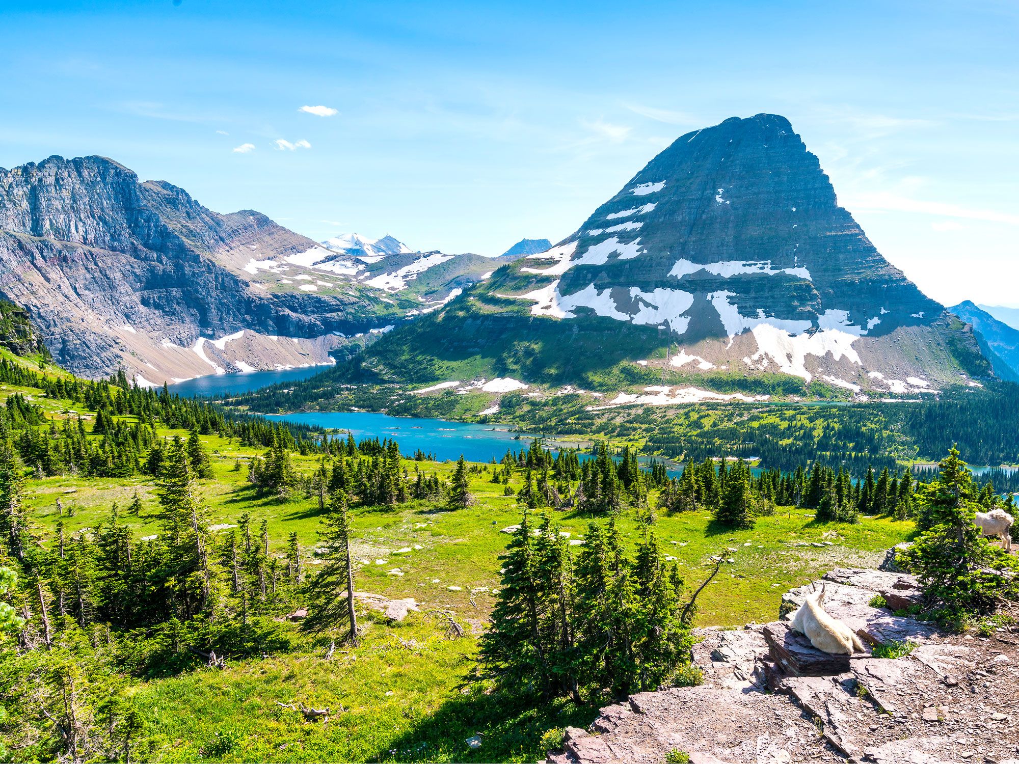
River meandering through mountainous landscape of Glacier National Park
Photo credit: Checubus/ Shutterstock

Some call it the “Crown of the Continent,” while others say that it’s the “Backbone of the World.” Whichever nickname you prefer, Glacier National Park is a breathtaking wilderness of rugged peaks, ancient forests, and some 700 lakes (131 of which are named). Boasting 700 miles of trails, including the iconic Grinnell Glacier Trail and Highline Trail, this Montana gem is a paradise for outdoor pursuits. Those who prefer more relaxed adventures can take in all the majestic scenery via the Going-to-the-Sun Road. Don’t miss the summertime Native America Speaks program, which features talks from members of Blackfeet Nation and Confederated Salish and Kootenai Tribes. 

9. Cuyahoga Valley National Park – Ohio (2.913 Million Visitors)

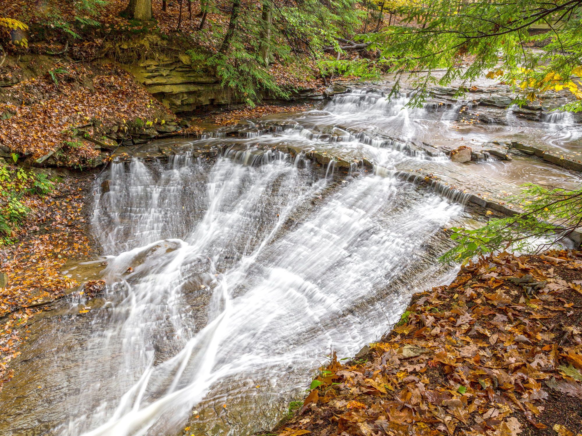
Image of waterfall in Cuyahoga Valley National Park
Photo credit: Kenneth Keifer/ Shutterstock

Perched between Cleveland and Akron, Cuyahoga Valley National Park boasts a fascinating blend of natural wonders and cultural heritage within its 33,000 acres of undulating hills and dense forests. More than 125 miles of hiking trails wind alongside the Cuyahoga River and lead to picturesque waterfalls and rock formations that date back millennia. Visitors can hop aboard the Cuyahoga Valley Scenic Railroad, a two-hour vintage railcar journey amid stunning countryside and past urban landscapes. Winter sports enthusiasts can also carve up powder pistes at the Boston Mills/Brandywine ski area. 

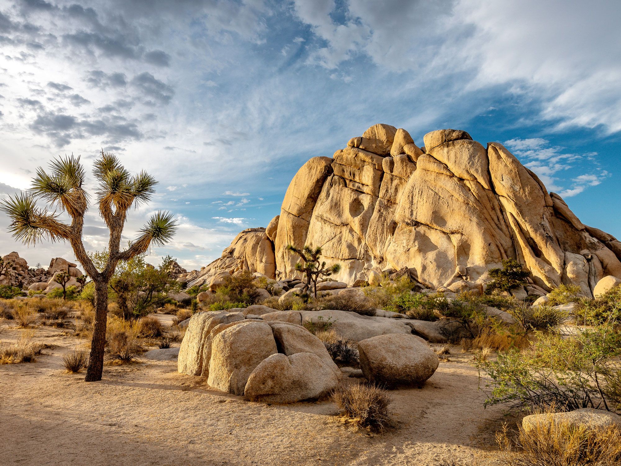
8. Joshua Tree National Park – California (3.06 Million Visitors)

Joshua tree and desert landscape with rock formations in Joshua Tree National Park
Photo credit: AndrePagaPhoto/ Shutterstock

Southern California’s Joshua Tree National Park is a place where curious flora and fauna (including the park’s namesake spiny trees) thrive in an area carved by strong winds and sporadic rainstorms. Famed for its sheer canyons and enormous boulders, the park is a haven for both novice and experienced climbers. Those who would rather keep their feet on the ground can explore dozens of desert trails, or lie down and enjoy stargazing in one of the country’s darkest regions. Overnight campers can pick from nine campgrounds in addition to wild backcountry spots. Early March to early May is a great time to visit, when species such as brittlebush and desert dandelion contribute to a mesmerizing wildflower bloom

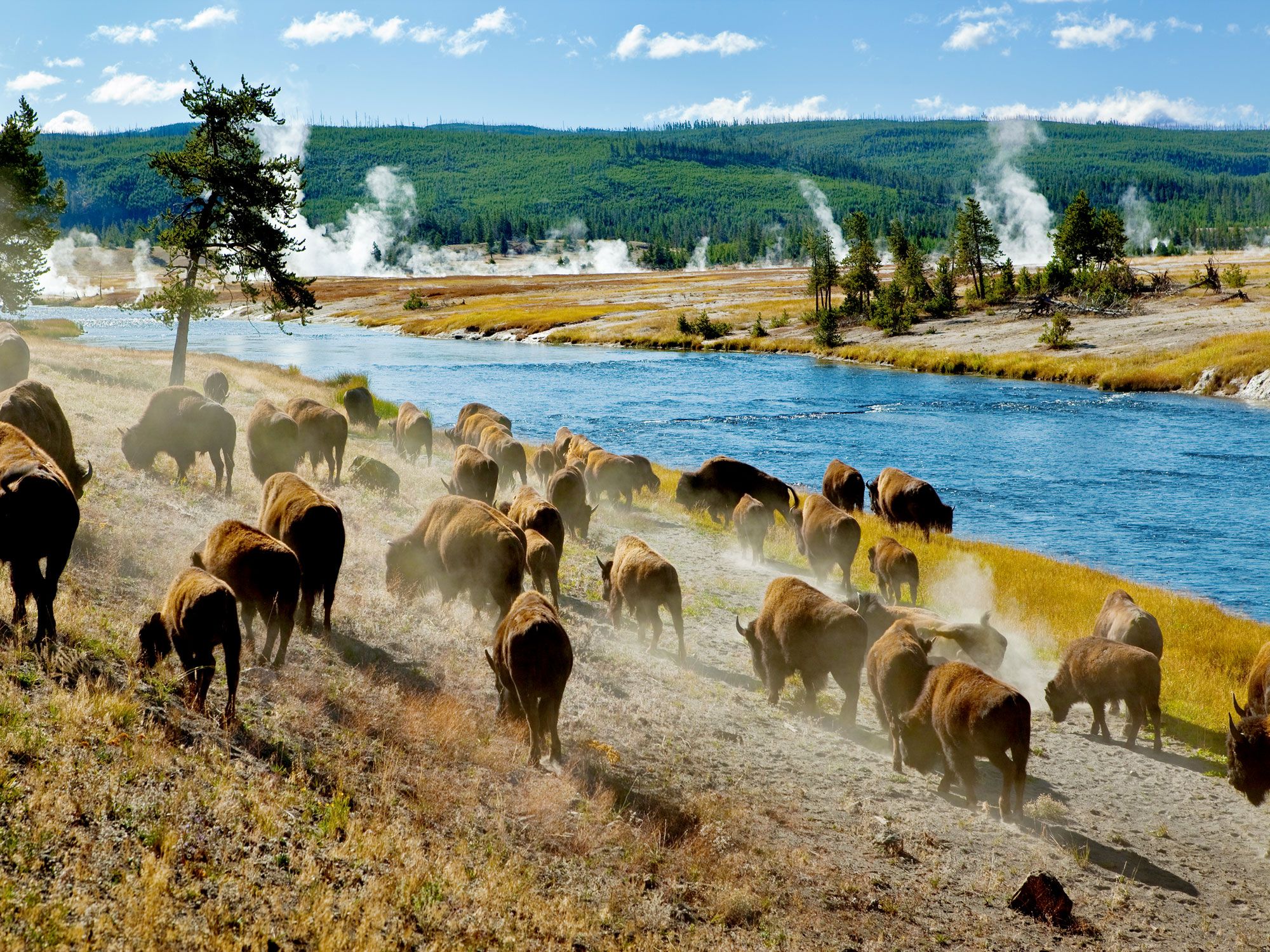
7. Yellowstone National Park – Idaho, Montana, and Wyoming (3.29 Million Visitors)

Herd of bison next to river and thermal springs in Yellowstone National Park
Photo credit: YegoroV/ Shutterstock

Considering it was established as the world’s first national park in 1872, it’s probably unsurprising that Yellowstone National Park remains among the most visited parks in the U.S. today. In fact, few sights within the National Park System are as emblematic as Yellowstone’s Old Faithful geyser and Grand Prismatic Spring. When you aren’t marveling at the bubbling hot springs, Yellowstone offers diverse landscapes that range from verdant forest to winding rivers and mountains. The park provides a natural habitat for bison, coyotes, grizzly bears, and wolves, in addition to 150 nesting birds. If hiking off the beaten track is on the agenda, don’t miss the Lone Star Geyser Trail or North Rim Trail. The latter travels into the heart of Yellowtone’s very own Grand Canyon. 

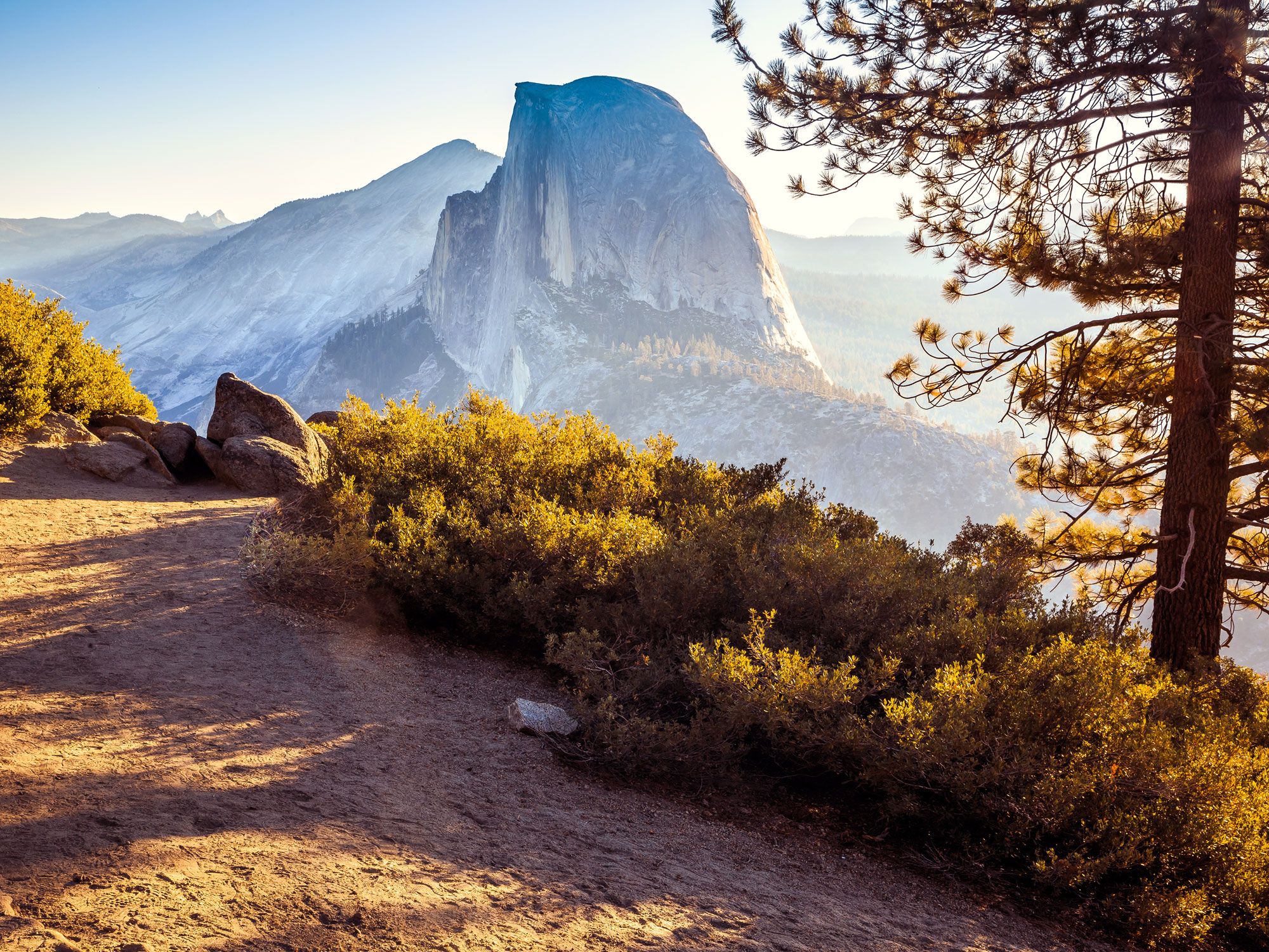
6. Yosemite National Park – California (3.67 Million Visitors)

Vista of Half Dome granite rock formation in the distance in Yosemite National Park
Photo credit: Stephen Moehle/ Shutterstock

Although Yellowstone was officially the first national park, the lands that make up Yosemite National Park received federal protection eight years earlier, under President Abraham Lincoln in 1864. This incredibly biodiverse area spreads across around 750,000 acres in California’s Sierra Nevada mountains, where snowfall from towering peaks creates magnificent waterfalls that flow down cliffs into rivers and meadows. Scenic overlooks, including Tunnel View and Glacier Point, promise postcard-worthy shots of the park’s star attractions, which include the El Capitan and Half Dome granite rock formations, as well as Yosemite Falls. With such jaw-dropping beauty, the park famously inspired Isaac McClellan, Wallace Bruce, and other revered poets. 

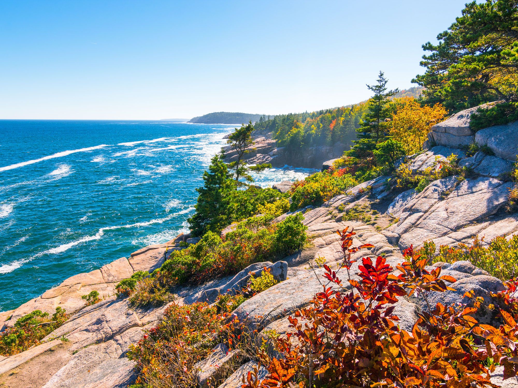
5. Acadia National Park – Maine (3.97 Million Visitors)

Rocky shoreline of Acadia National Park
Photo credit: Eric Urquhart/ Shutterstock

Nestled upon a series of islands along Maine’s Atlantic coastline, Acadia National Park packs a whole lot into its relatively small 47,000 acres. And with 150 miles of trails, 78 miles of motor and carriage roads, and 60 miles of shoreline, there are plenty of ways to discover this New England marvel — established in 1919 as the first national park east of the Mississippi River. Much of the park occupies the eastern half of Mount Desert Island. Among its highlights are birding and stargazing on Cadillac Mountain, as well as summertime swimming at Echo Lake Beach. Obtain a deeper appreciation for the park, its people, and its wildlife by visiting Hulls Cove Visitor Center and Sieur de Monts Nature Center.

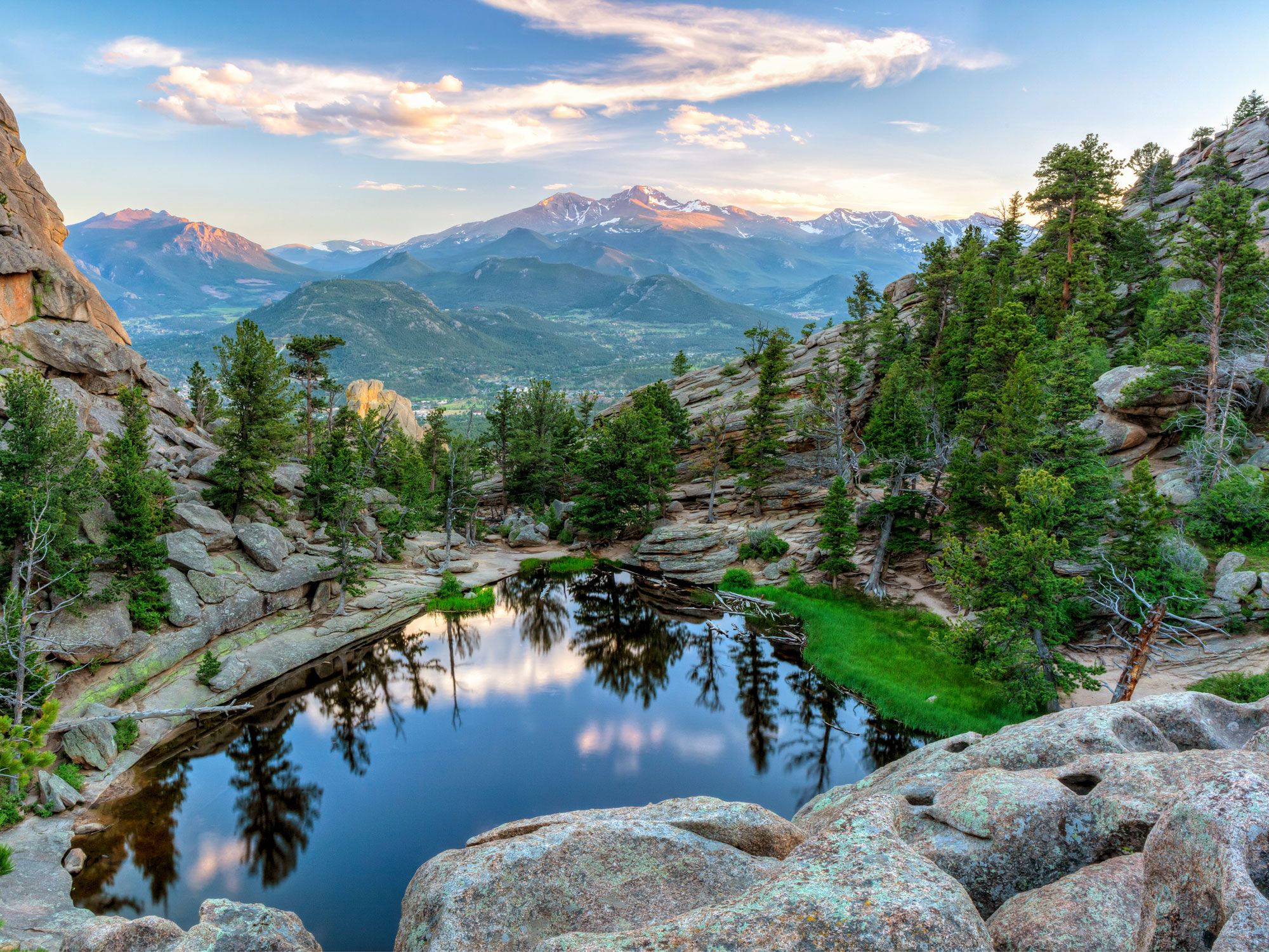
4. Rocky Mountain National Park – Colorado (4.3 Million Visitors)

Small alpine lake in Rocky Mountain National Park
Photo credit: Colin D. Young/ Shutterstock

Home to lush meadows, glacial lakes, and cloud-busting mountains, Rocky Mountain National Park is a region of extremes. This is one of the highest national parks in the country, home to the Continental Divide and some 77 peaks rising above 12,000 feet. It’s not all about the mountains, though — the park’s montane ecosystem features varied wildlife, including bighorn sheep, elk, moose, and 280 bird species. The park also has a vast museum collection that consists of over 33,000 cultural artifacts and 294 works of art. To see everything on one visit is near impossible, but a trip along the 48-mile Trail Ridge Road uncovers many of the park’s highlights and leaves visitors craving more.

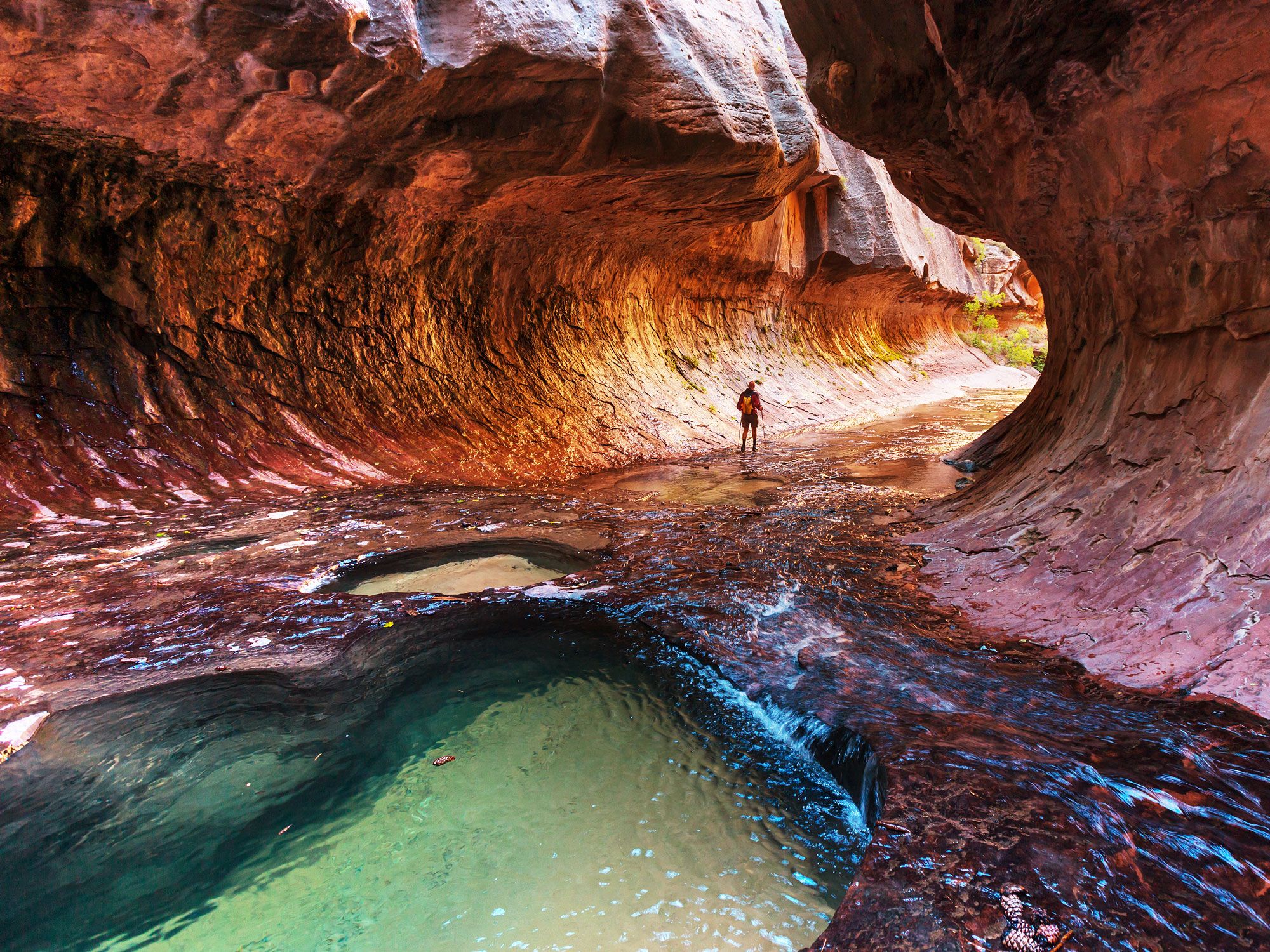
3. Zion National Park – Utah (4.69 Million Visitors)

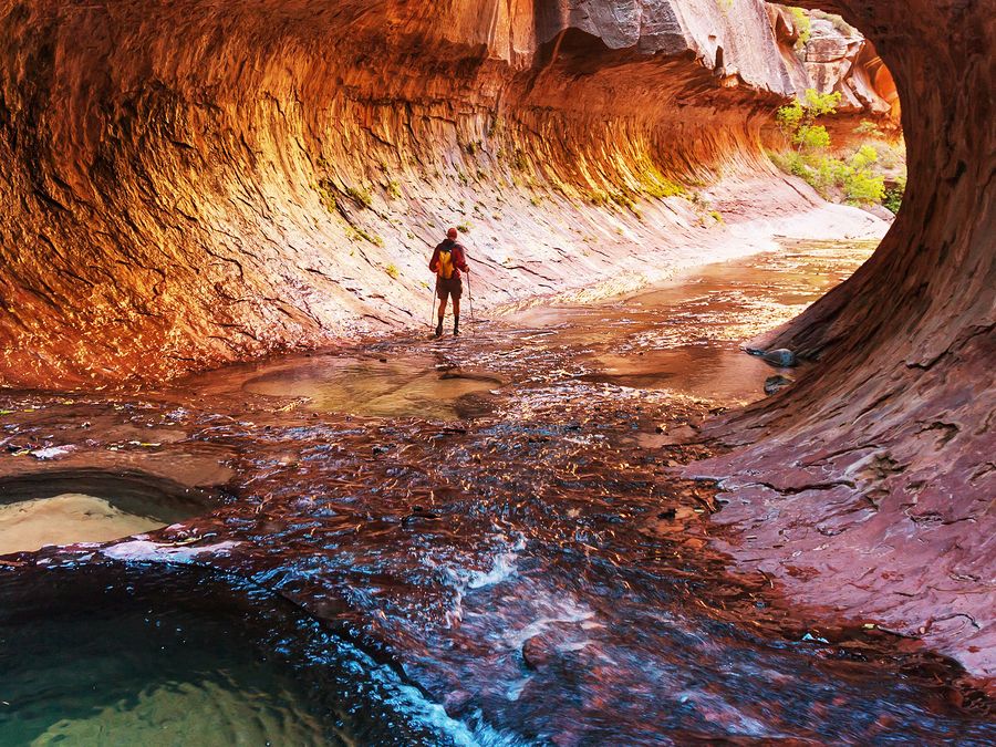
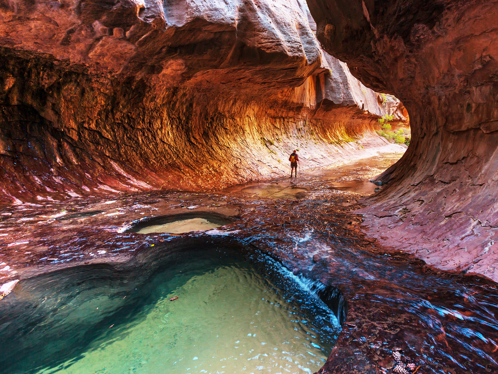
Hiker in tubular cave in Zion National Park
Photo credit: Galyna Andrushko/ Shutterstock

A jaw-dropping expanse of multicolored canyons and vertical red cliffs in southwest Utah, Zion National Park is a dreamland for hikers. And no visit is complete without reaching the Angels Landing overlook. It requires an adventurous 2.2-mile trek via switchbacks to the top, but the views are well-worth the effort. When the sun is blaring down, hikers can cool off in the waist-high waters of the Zion Canyon. Also not to be missed is the park’s collection of ancient Anasazi petroglyphs that adorn a cliff edge above the Santa Clara River. To aid in the park’s preservation, an eco-friendly shuttle service helps to reduce car traffic. 

2. Grand Canyon National Park – Arizona (4.73 Million Visitors)

View of the Grand Canyon and Colorado River in Grand Canyon National Park
Photo credit: sumikophoto/ Shutterstock

The country’s second-most visited park is home to one of the 7 Natural Wonders of the World. Measuring 277 miles long and up to 18 miles wide, the Grand Canyon has been carved progressively over millions of years by the meandering Colorado River. Arguably the world’s most famous canyon, it is located almost entirely within Grand Canyon National Park, which was established in 1919. The park is loosely divided into two sections: the South Rim (open year-round) and North Rim (open in summertime only). You can explore its 1.2 million acres on foot, by bike, or adrenaline-inducing river rafting trips. Popular areas include the South Kaibab Trail, Rim Trail, and Grand Canyon Skywalk. The Tusayan Pueblo Museum features millennia-old artifacts that showcase ancient human traditions. 

1. Great Smoky Mountains National Park – North Carolina and Tennessee (12.94 Million Visitors)

View of Great Smoky Mountains National Park
Photo credit: anthony heflin/ Shutterstock

With more annual recreational visits than Grand Canyon and Zion combined, Great Smoky Mountains National Park is far and away the most-visited park in the National Park System. This 522,419-acre wilderness showcases both centuries of Appalachian culture and natural beauty sculpted over millions of years. It features 850 miles of hiking trails, 70 of which are part of the famed Appalachian Trail. The park is also home to fascinating geological wonders, historic homesteads, free-roaming black bears, and the Cherokees’ sacred mountain, Clingmans Dome. Part of the reason the park is so popular is due to its excellent infrastructure and accessibility from major population centers. In addition to several campgrounds, lodging is available at busy park towns like Bryson City, Cherokee, and Gatlinburg. The park is also free, so visitors can just lace up their walking shoes and stroll right in. 

Post Banner Image
Outdoors

Where to Experience the World’s Most Unusual Weather Phenomena

By Bradley O'Neill
Read time: 5 minutes
August 2, 2023
Updated: February 4, 2026

Where to Experience the World’s Most Unusual Weather Phenomena

By Bradley O'Neill
Author
Bradley O'Neill
Bradley is an English travel writer who’s wandered through 50-plus countries and lived on four continents while chasing waves, the perfect pint, and family adventures. Bradley's work has appeared in publications such as Skyscanner and Matador Network, and he now splits his time between Buenos Aires and Uruguay.

Earth is an ever-changing planet. A major contributor to both seasonal and permanent changes to Earth’s atmosphere is the weather, and its ability to conjure up unexpected conditions and situations piques the interest of scientists and adventurers alike. From impossibly long wave-like clouds chased by glider pilots to magnified shadows seemingly cast in midair, these six places boast some of the most unusual weather phenomena on the planet. 

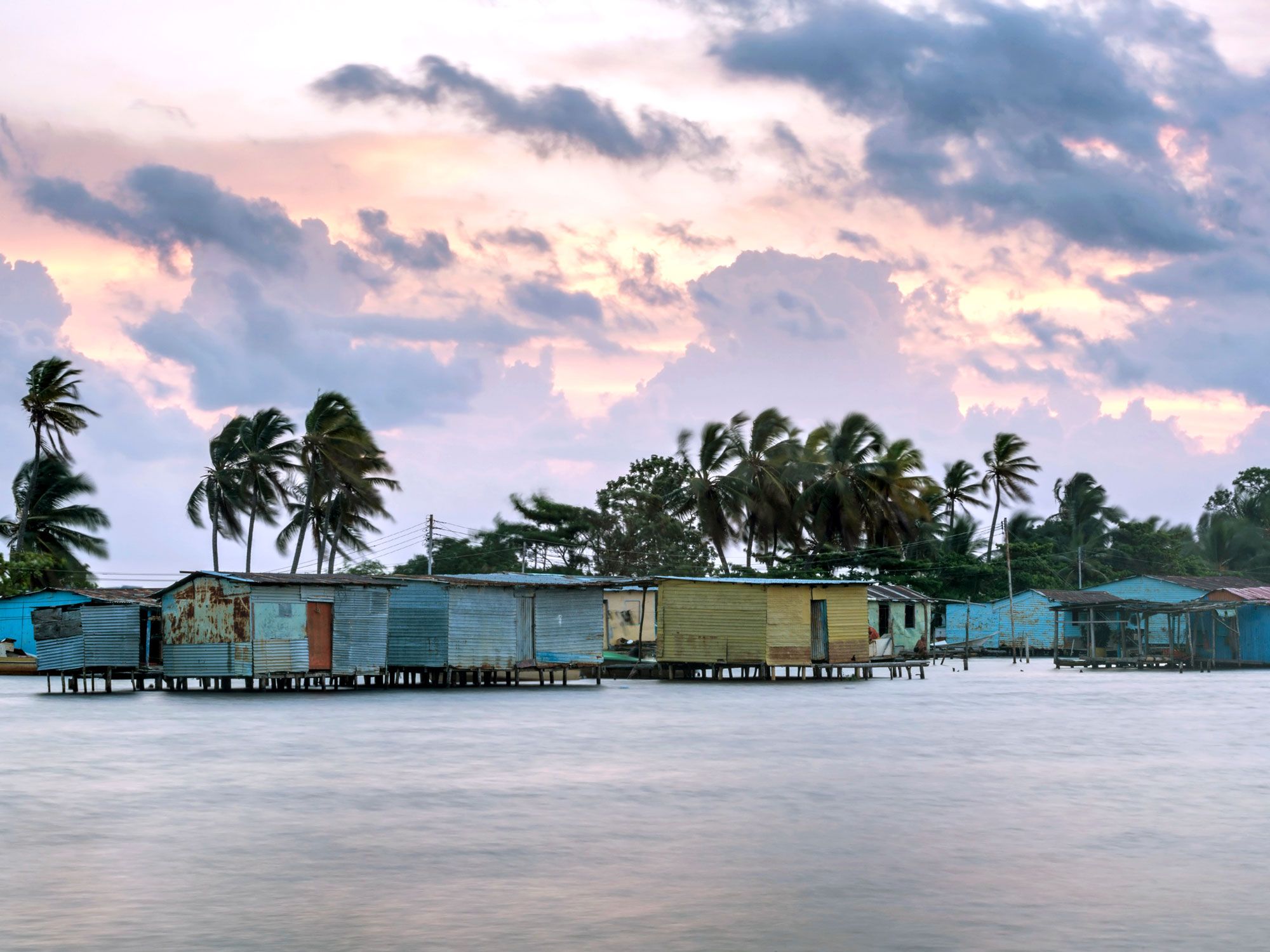
Lake Maracaibo – Venezuela

Homes built over Lake Maracaibo in Venezuela
Photo credit: sunsinger/ Shutterstock

The old saying goes that “lightning never strikes twice in the same place,” but this Venezuelan lake tends to debunk that theory. Between 140 to 160 nights each year, lighting strikes up to 280 times per hour at the spot where the Catatumbo River empties into Lake Maracaibo. Called the Relámpago del Catatumbo (Catatumbo Lightning), the phenomenon is believed to produce more ozone than anywhere else on the planet. 

Though scientists aren’t exactly sure what causes it, one theory behind the event is that methane gas rises from bogs around the lake and interacts with storm clouds from the Andes mountains. Another suggests it’s caused by a low-lying Caribbean air current. Visible from 250 miles away, the lighting thwarted nighttime raids on the city of Maracaibo by Sir Francis Drake in 1595 and again in 1923 by a Spanish fleet at the end of the Venezuelan War of Independence.

Harz Mountains – Germany

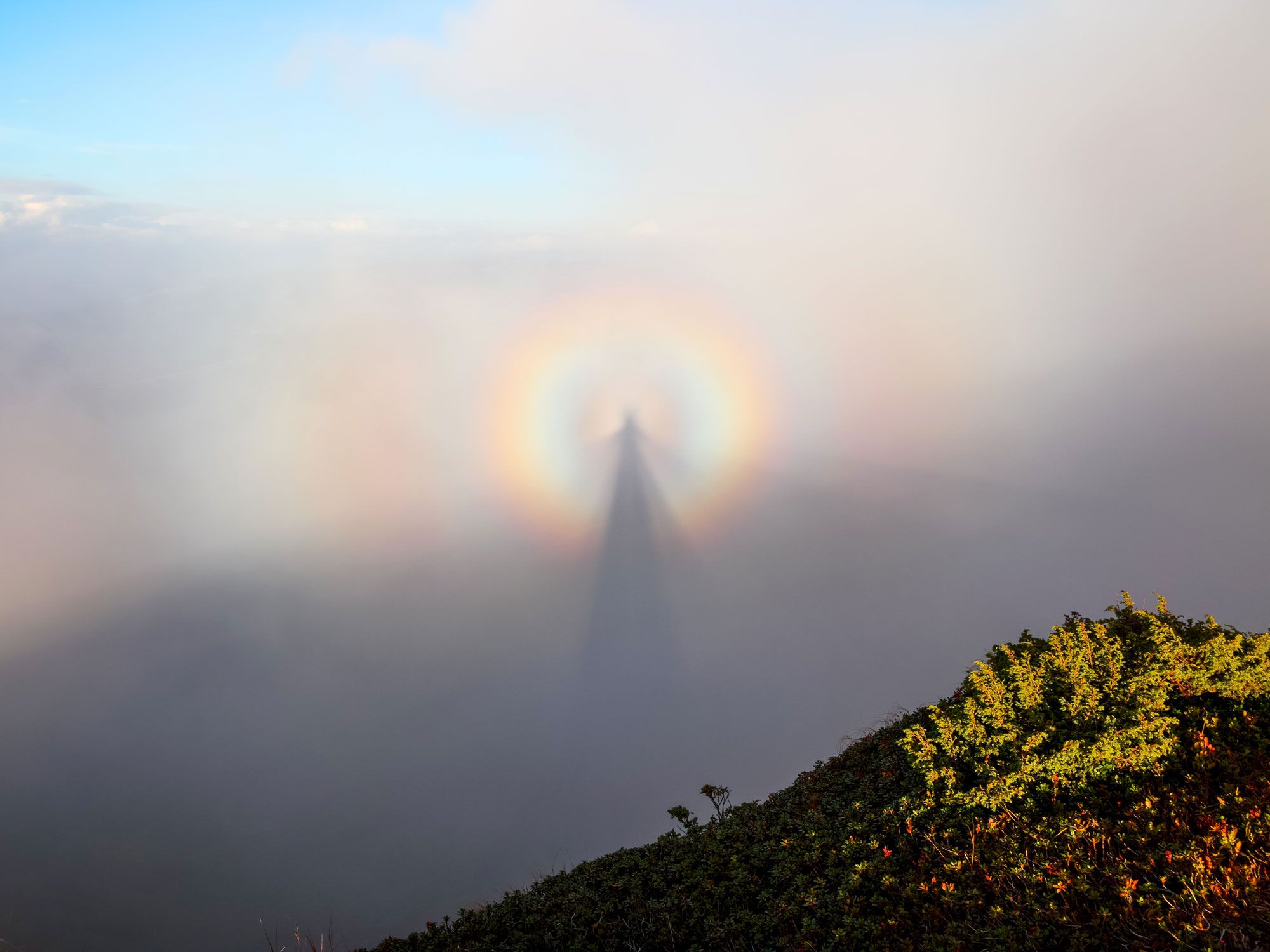
Image of the Brocken Spectre glory in the Harz Mountains of Germany
Photo credit: Vitalii_Mamchuk/ Shutterstock

A glory is an optical phenomenon typically observed at high altitudes, and the Brocken Spectre is a type of glory that creates a huge, magnified shadow of a person surrounded by a rainbow-like halo of light. It happens when sunlight is diffracted and reflected by water drops in clouds or layers of fog. To experience this mystical event on land, you need to be located at a high vantage point, such as a mountaintop, have the sun behind you, and be able to look down into clouds or foggy conditions. 

The Brocken Spectre takes its name from the 3,744-foot-tall Brocken peak, located in the Harz mountain range of northern Germany — one of the best places to see this phenomenon. With the peak shrouded in mist for much of the year, when the spectre appears, it often seems enormous. This is, in fact, an optical illusion most likely caused by the mist obscuring common reference points. Johann Silberschlag, a German Lutheran natural scientist, documented the phenomenon in 1780, and it has folkloric associations with the legend of evil spirits and witches

Litla Dímun – Faroe Islands

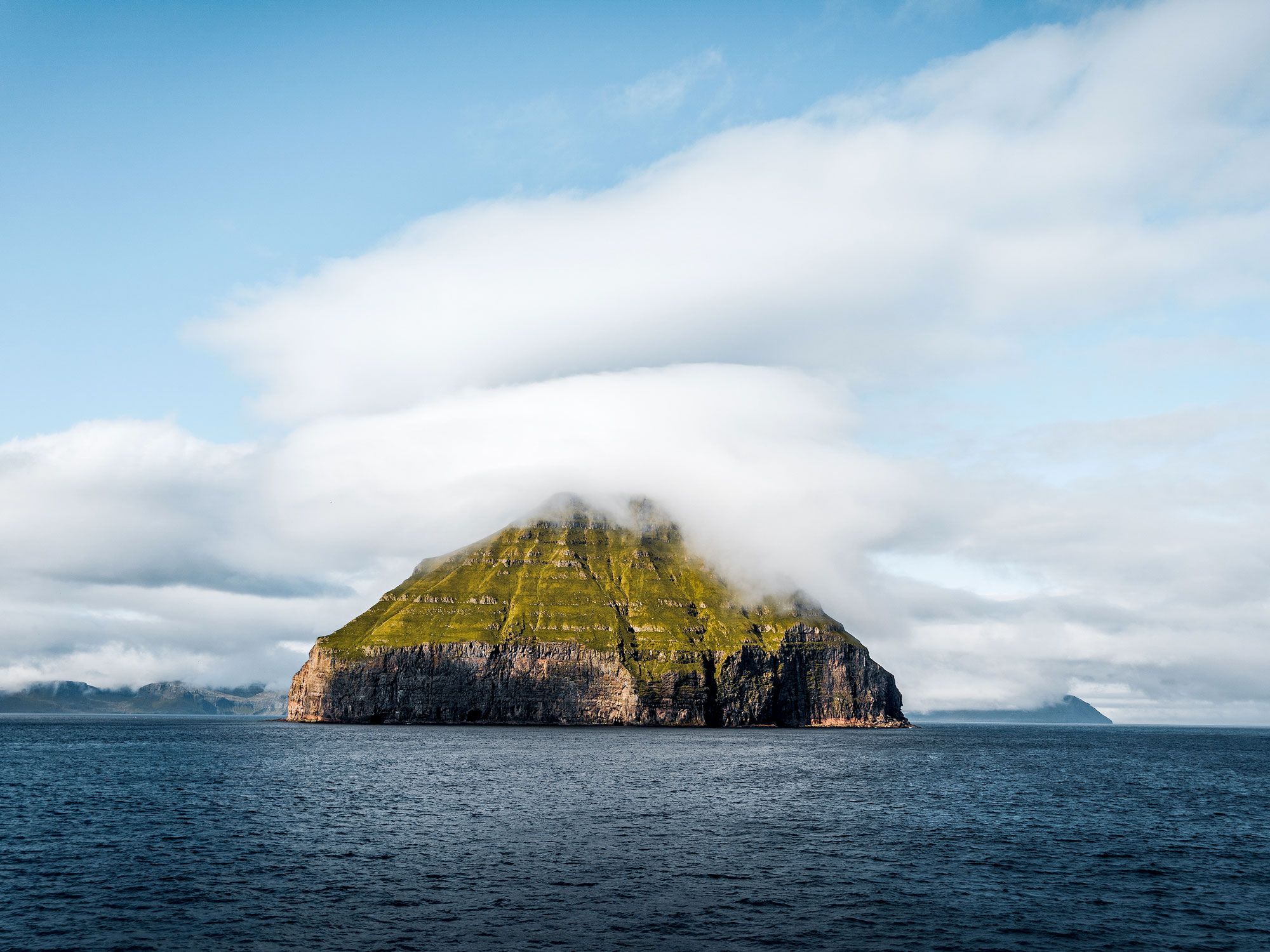
Cloud forming over Litla Dímun in the Faroe Islands
Photo credit: Mathias Berlin/ Shutterstock

Uninhabited and covering less than 250 acres, Litla Dímun is the smallest of the 18 principal islands of the Faroe Islands, a Danish archipelago between Iceland and Norway in the North Atlantic. Despite the island’s tiny size and relatively low maximum elevation of 1,358 feet, this verdant landmark possesses the unique ability to influence the surrounding atmosphere. 

On almost any given day, a lenticular cloud — so called for its similarity to a lens — sits atop the islet. From various angles, it can resemble a fluffy blanket, a hat, or even a UFO. These types of clouds continually reform over the same place as a result of new air rising up and over a landmass. Litla Dímun is visible from the village shorelines of Halba and Sandvik, on the island of Suðuroy. In addition to its quirky cloud, the island is home to a colony of sheep famed for producing some of the world’s most prized sheep meat. 

Yoro – Honduras

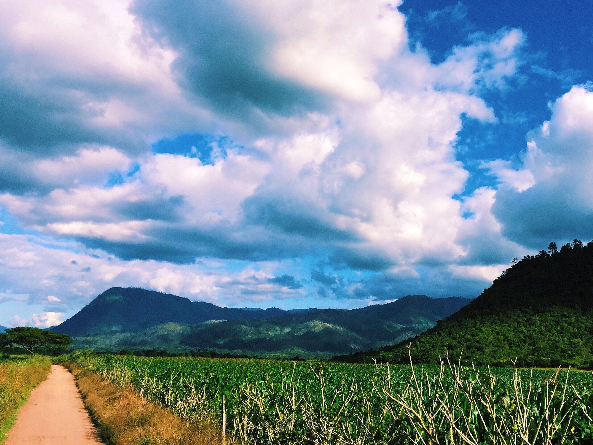
Image of fields and mountains in Yoro, Honduras
Photo credit: Chary Liz/ Shutterstock

You’ve heard of the expression “raining cats and dogs” to describe heavy rainfall, but it’s unlikely that you’ve ever witnessed something like it in real life. However, there’s a place in northern-central Honduras where residents gather for an annual celebration of fish falling out of the sky. Around the months of May and June, large storm systems sweep through the town of Yoro, and when the rains have passed, the streets become swarmed with hundreds of live, flapping fish. 

Many locals associate the Lluvia de Peces (“Rain of Fish”) with religious folklore. It’s said that, in the mid-1800s, a priest prayed for sustenance for the starving people. His prayers were answered with the miracle of raining fish. Scientific theories imply that the fish come from underground rivers, or are removed from their natural habitats by the power of the storms. 

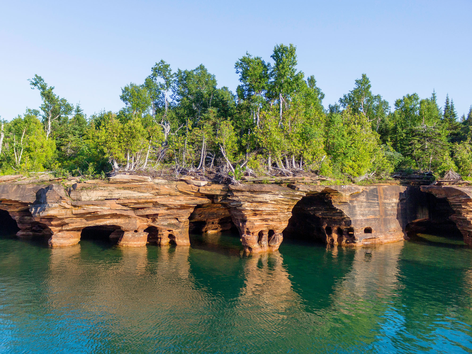
Apostle Islands National Lakeshore – Wisconsin

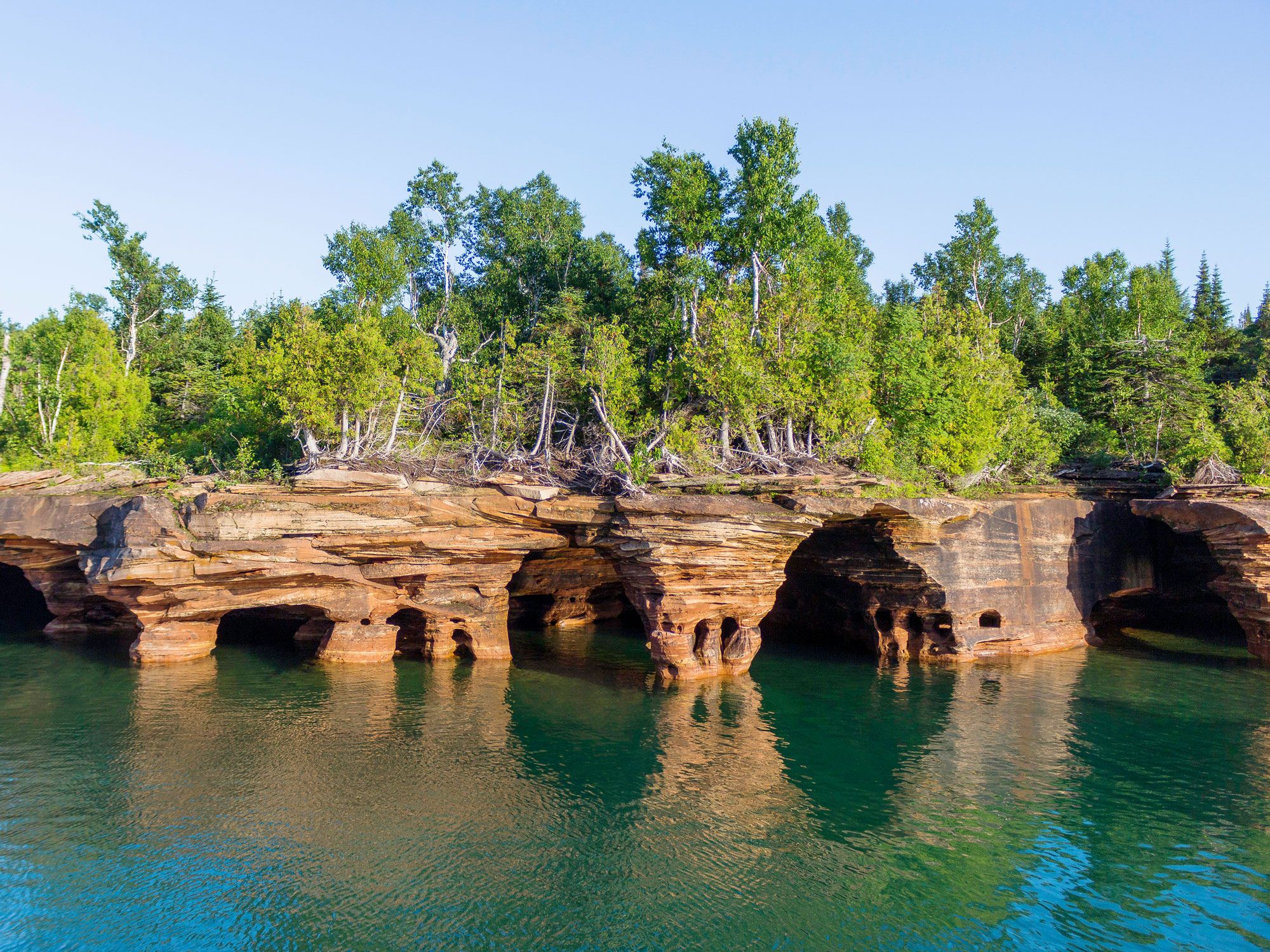
Cave formations along Apostle Islands National Lakeshore in Wisconsin
Photo credit: Gottography/ Shutterstock

Apostle Islands National Lakeshore, set around the eastern shoreline of Lake Superior, boasts a dramatic landscape that’s been sculpted over centuries by waves and continual freezing and thawing. One of its biggest lures are the Mainland Ice Caves, a collection of ethereal caves that change from chamber to chamber and from one day to the next. They occur when the lake freezes over and the water that drips from the rocks turns into needle-like icicles. 

Visitors can explore the caves by hiking on the iced-over lake and even crawling inside to peer through glass-like floors. The temporal nature of the caves makes it impossible to predict how long they will stick around for every year — a slight increase in temperature or strong winds is enough to make them disappear overnight.

Gulf of Carpentaria – Australia

Long clouds over the Gulf of Carpentaria in Australia at sunset
Photo credit: Paul Fauntleroy/ Shutterstock

Head Down Under to Australia’s North Queensland region to observe one of the world’s most extraordinary meteorological phenomena: the Morning Glory cloud. During the months of September and October, this rare type of cloud appears like a never-ending tube above the settlement of Burketown. As its name suggests, the cloud is typically visible in the morning, and forms when cool ocean temperatures collide with warm land temperatures. It can measure around 620 miles long, be situated between 0.62 and 1.24 miles above ground, and move at 37 mph. 

Warm updrafts pushing through the clouds generate ideal conditions for glider pilots, who search for the sweet spots before switching off their engines and cruising at one with nature. The clouds have important cultural connections, too, with the Gangalidda peoples believing that it’s the creation of Walalu, the rainbow serpent deity.
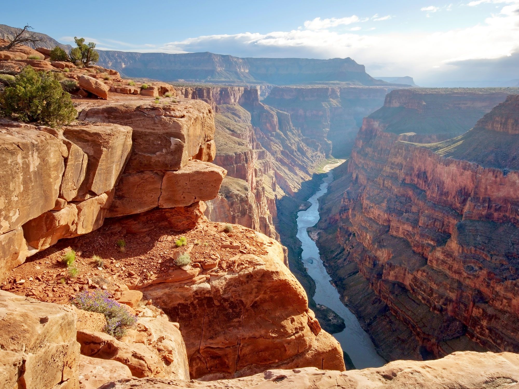
Post Banner Image
Culture

6 Quirky Roadside Attractions To Visit on Your Next Road Trip

By Fiona Mokry
Read time: 5 minutes
July 27, 2023
Updated: November 14, 2024

6 Quirky Roadside Attractions To Visit on Your Next Road Trip

By Fiona Mokry
Author
Fiona Mokry
Fiona has spent her career exploring the world and working in the travel industry, turning her lifelong passion into a profession. From planning custom trips to sharing stories as a travel writer for publications such as The Discoverer, she’s all about helping others experience the world in a deeper, more meaningful way.
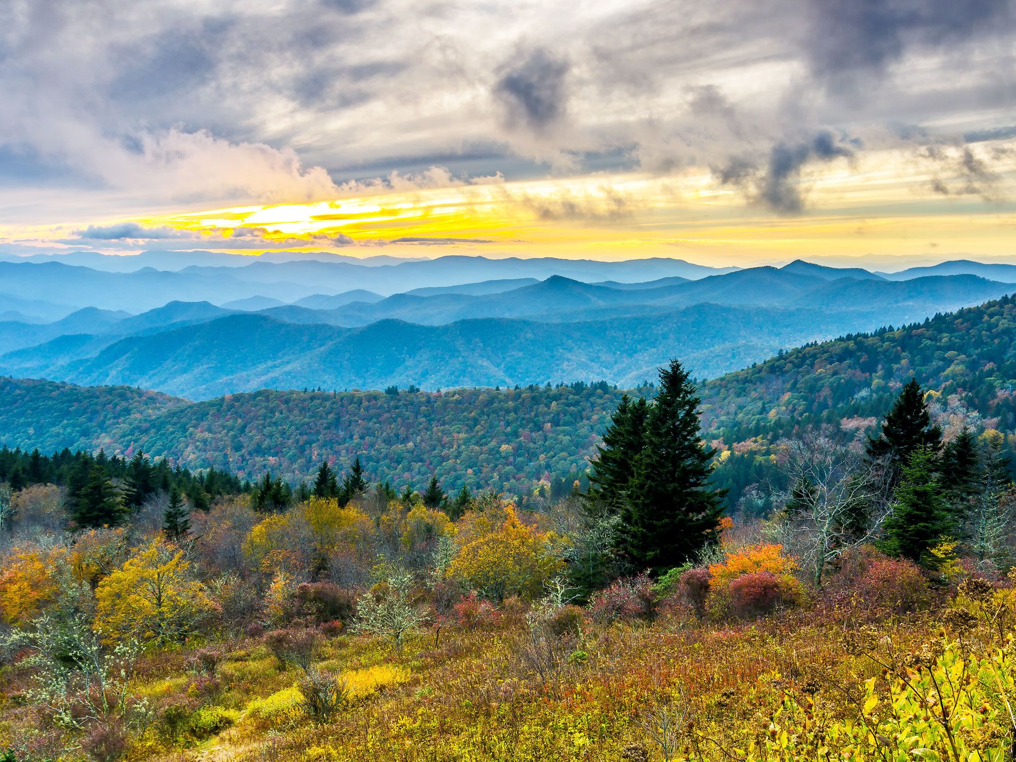
Besides hot dogs and baseball, what’s more quintessentially American than a quirky roadside attraction? While each state has roadside attractions with their own unusual claims to fame, there are a select few roadside attractions across the country that are well-worth the detour. Check out six of the most interesting roadside attractions you shouldn’t miss on your next U.S. road trip.
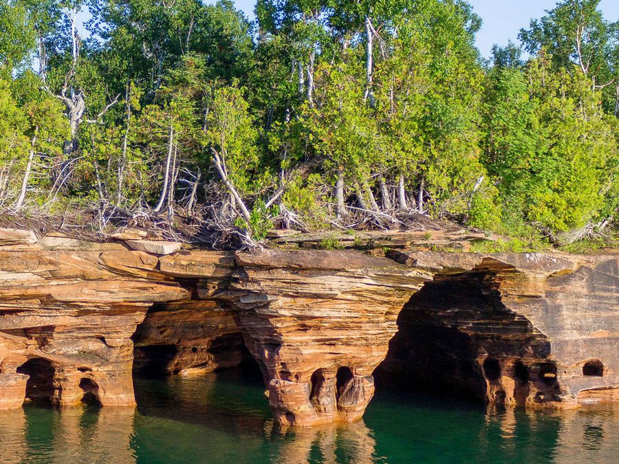
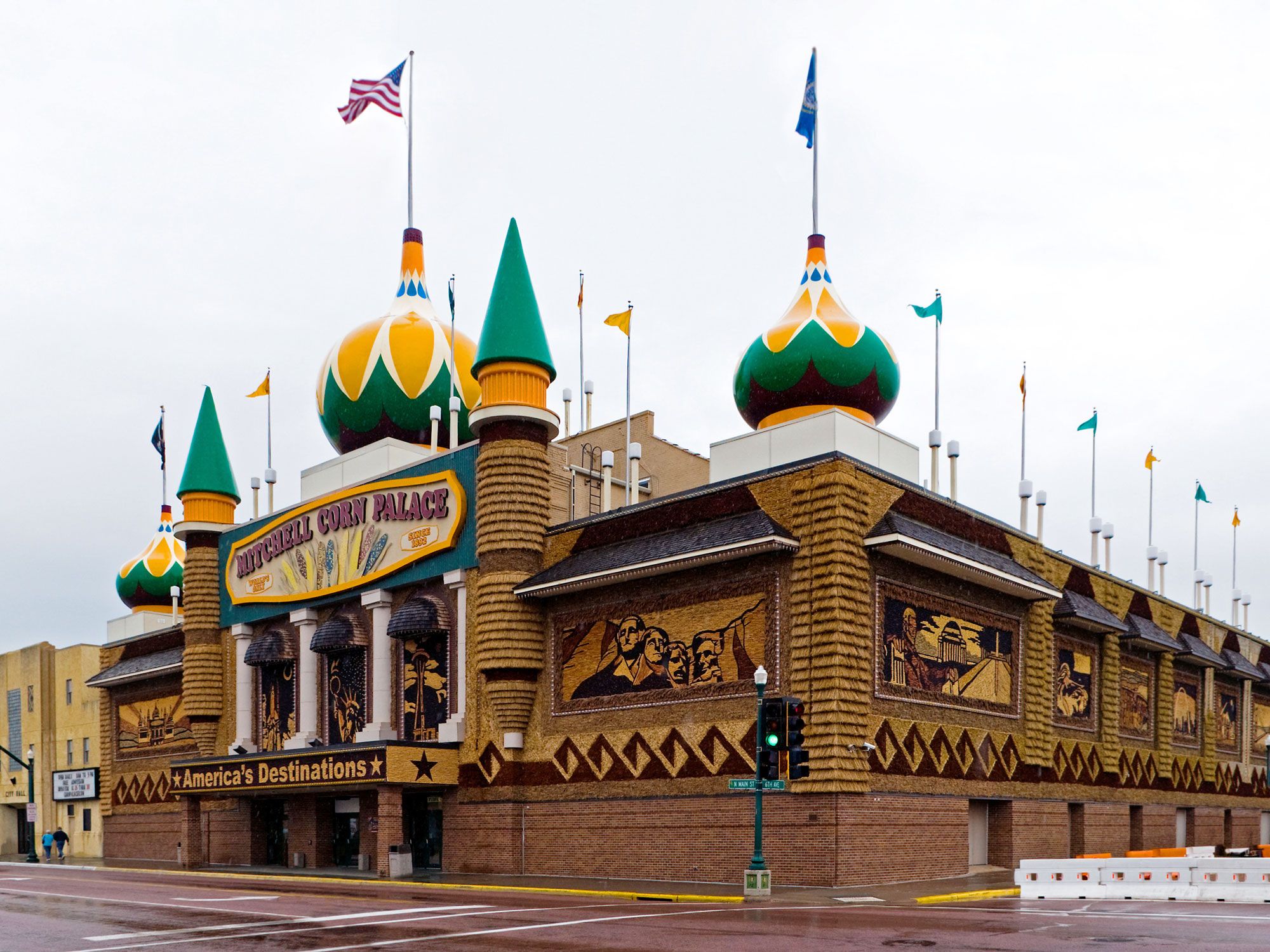
The World’s Only Corn Palace – Mitchell, South Dakota

Image of the World's Only Corn Palace in Mitchell, South Dakota
Photo credit: Ken Howard/ Alamy Stock Photo

Sure, there aren’t any other corn palaces in the running, but that doesn’t mean South Dakota’s claim to fame is any less a-maize-ing. Originally built in 1892 to celebrate the state’s agricultural excellence, the World’s Only Corn Palace now attracts approximately 500,000 tourists every year. Industrial exhibits, dances, shows, rodeos, and farmers markets are part of the attraction, but the sole reason many visitors make the detour off Highway 90 in Mitchell is to ogle the larger-than-life murals adorning the outside of the building, which are made entirely from halved corn cobs. Each year, digital media and design students from Dakota Wesleyan University add new murals, requiring hundreds of thousands of corn cobs to complete. 

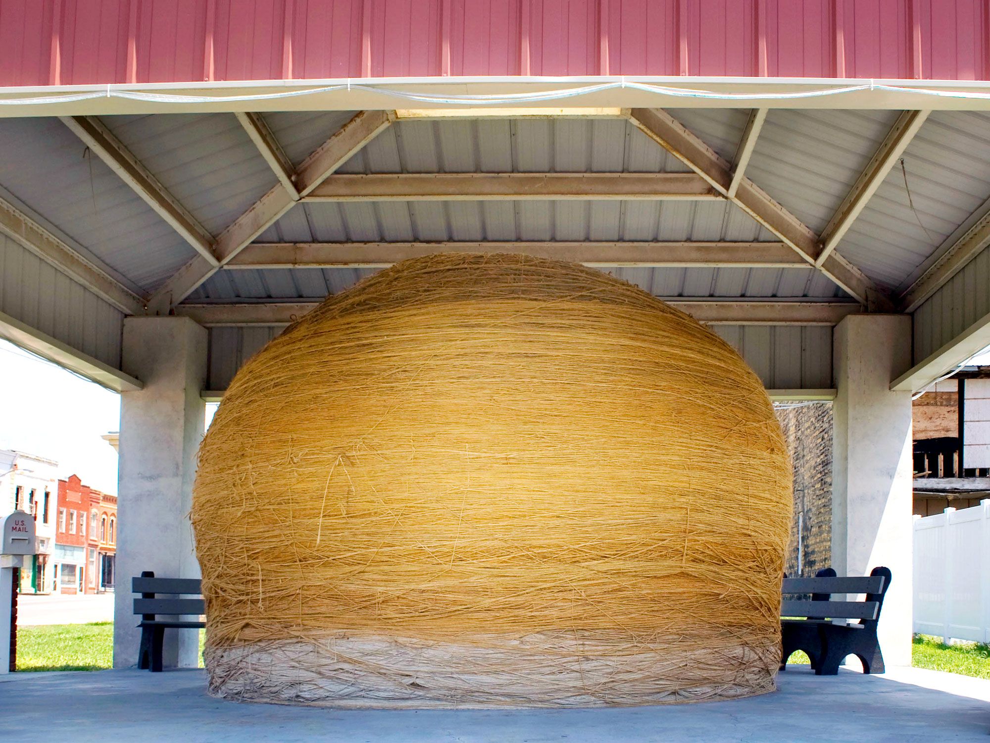
Largest Ball of Twine – Cawker, Kansas

Image of the Largest Ball of Twine in Cawker, Kansas
Photo credit: Franck Fotos/ Alamy Stock Photo

It may seem hard to believe, but there are several balls of twine contending for the title of America’s largest. Although there are subtle differences in their claims (such as the heaviest ball of twine or the largest built by a single person), most agree that it’s the twine ball in Cawker, Kansas, that claims first prize — with a circumference exceeding 40 feet (and still growing). 

In 1953, local resident Frank Stoeber began winding twine into a ball, and four years later, he had crafted an 11-foot-diameter ball with 1.6 million feet of twine that weighed 5,000 pounds. These days, the Cawker City Community Club is the official caretaker of the ball, hosting an annual twine-a-thon to encourage the continued growth of the locally famous attraction. Today, the ball — found off Highway 24, about 230 miles west of Kansas City — weighs a whopping 17,320 pounds.   

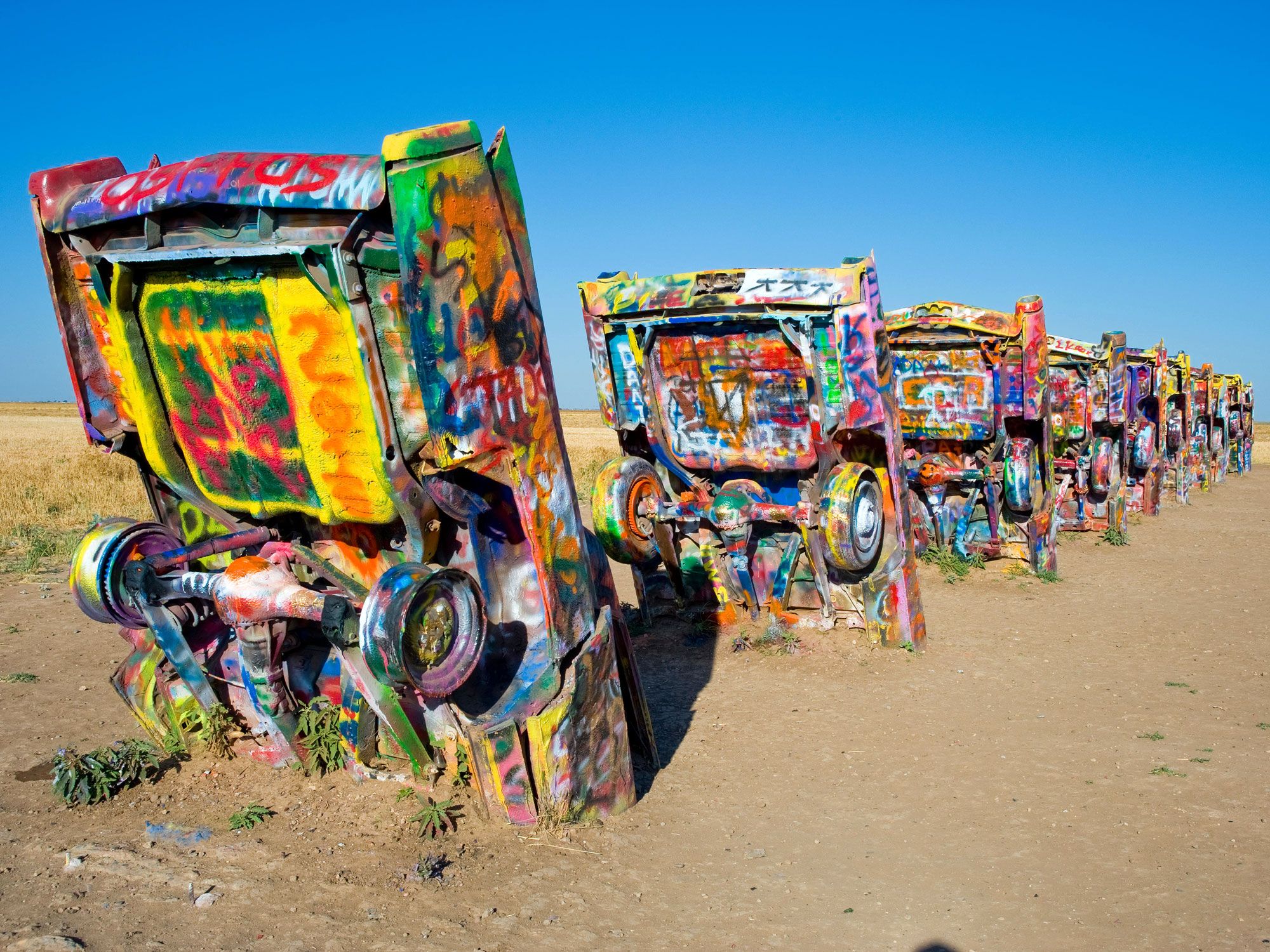
Cadillac Ranch – Amarillo, Texas

Grafitti-covered cars half-buried in desert at Cadillac Ranch in Texas
Photo credit: Hugh Hargrave/ Alamy Stock Photo

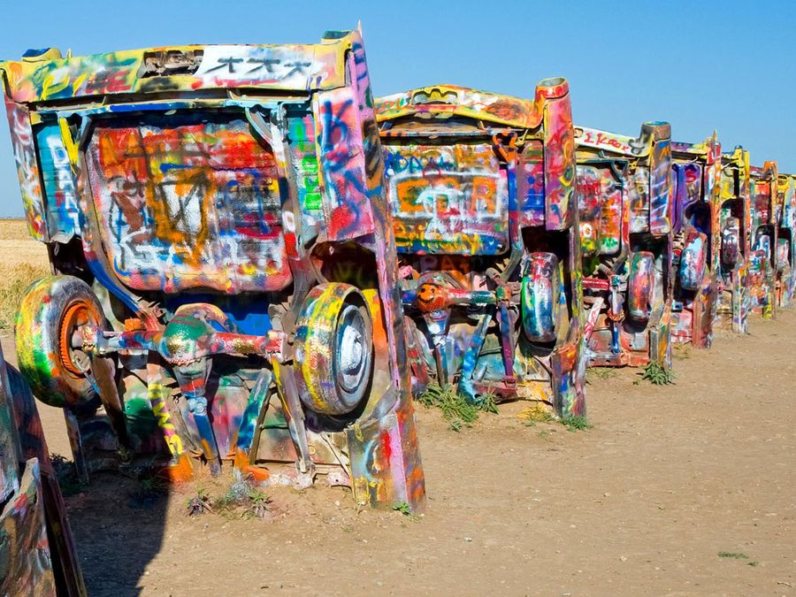
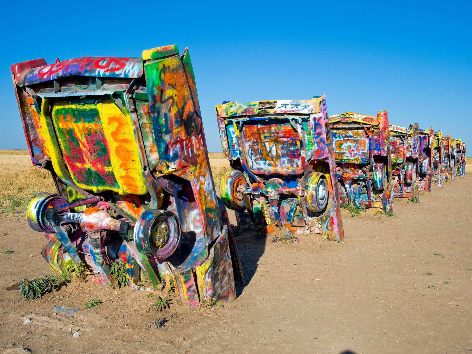
A short detour off Interstate 40 west of Amarillo, Cadillac Ranch is a colorful art installation created in 1974 by a group of bohemian artists from San Francisco known as Ant Farm. Backed by millionaire Stanley Marsh, the artists drove 10 Cadillacs off the side of the dusty highway (which follows the historic Route 66) and partially buried them nose down in the sand at a 60-degree angle (matching the sides of Egypt’s Great Pyramid of Giza). 

The purpose of the unique display was to showcase the evolution of the Cadillac’s tail fin — and perhaps simply to bewilder anyone who came across them. Over time, visitors took it upon themselves to “decorate” the Cadillacs with graffiti, designs, and murals — making Cadillac Ranch one of the most dynamic roadside attractions in the country. 

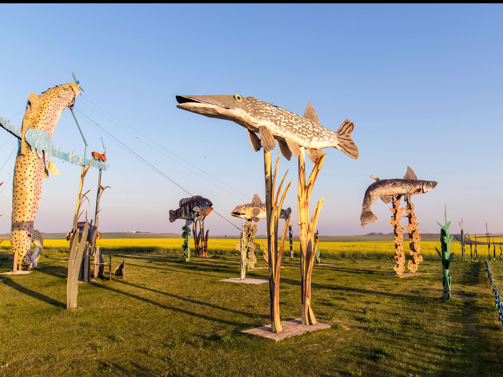
Enchanted Highway – Regent, North Dakota 

Metal sculptures along the Enchanted Highway of North Dakota
Photo credit: Danita Delimont/ Alamy Stock Photo

To check out this North Dakota roadside attraction, you don’t even need to leave your car — in fact, you don’t even need to stop driving. Composed of seven larger-than-life scrap-metal sculptures, the Enchanted Highway begins at Exit 72 on Interstate 94 and ends 32 miles later. Sculptor Gary Greff is the mastermind behind the project, an undertaking that began in the late 1980s and aimed to attract tourists to Regent. 

Prior to conception, Greff didn’t know how to mold metal, and took it upon himself to learn how to weld. His creations are mostly nature-inspired and include  Pheasants on the Prairie, Deer Crossing, and Grasshoppers in the Field. Sadly, his efforts did not keep the local school from closing, but it has put his hometown on the map as the town with the world’s largest scrap-metal sculpture, the 110-foot-tall, 154-foot-wide, and 157,659-pound Geese in Flight

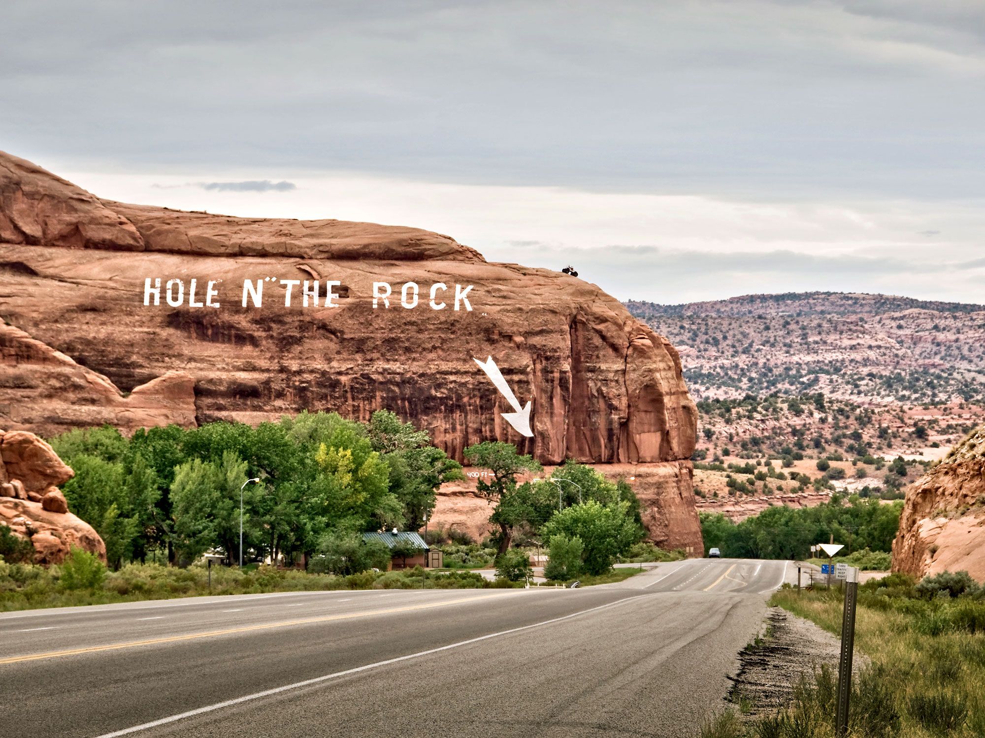
Hole in the Rock – Moab, Utah

Sign painted on mountain indicating Hole in the Rock roadside attraction in Utah
Photo credit: Delphotos/ Alamy Stock Photo

Moab attracts plenty of mountain bikers and hikers with its challenging terrain and epic views of natural arches, but you don’t have to be an adrenaline junkie to get your kicks in this small southwestern Utah town. The Hole in the Rock shows off the desert’s most impressive human-made attraction, located off U.S. Route 191 — a 5,000-square-foot home carved entirely into a giant orange rock. 

Built by the Christensen family in the 1940s with the help of volunteers, the project took 12 years to finish and required excavating 50,000 cubic feet of sandstone. The end result yielded a 14-room home complete with a fireplace, 65-foot chimney, an oversized concrete bathtub, and even a sculpture of President Franklin D. Roosevelt out front. When the patriarch of the family, Albert, died in 1957, his wife, Gladys, opened a gift shop below their home to sell her rock jewelry. Eventually, she began letting people tour her home, and today, the Hole in the Rock attracts roughly 500 visitors per day with a 12-minute tour of the quirky yet cozy family abode.

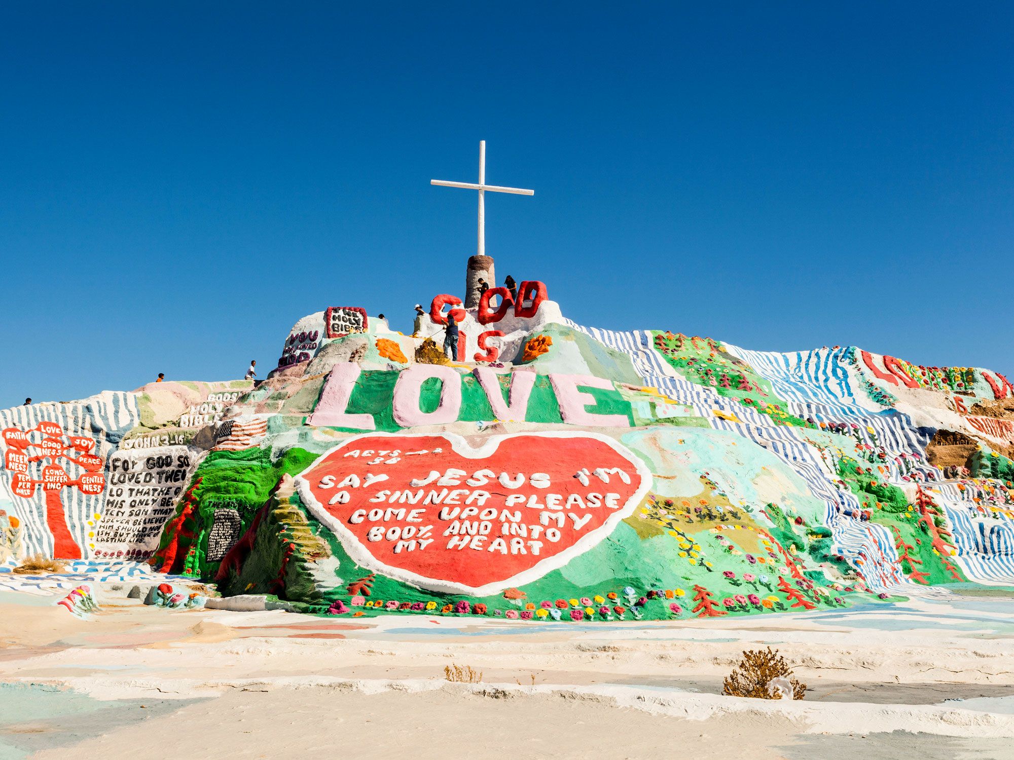
Salvation Mountain – Imperial County, California

Image of Salvation Mountain art installation in California
Photo credit: Design Pics Inc/ Alamy Stock Photo

Located in Southern California’s Sonoran Desert, just east of the Salton Sea and less than a mile from the art commune of Slab City, Salvation Mountain is a hillside art installation that artist Leonard Knight created over the course of three decades as a religious tribute. “Love Jesus and keep it simple” was Knight’s guiding philosophy for his masterpiece, a 50-foot-high and 150-foot-wide adobe clay rock covered with bright paint, biblical references, and religious scriptures. While religion and nature scenes are prevalent throughout the piece, love is the uniting theme. Visitors are welcome to explore the mountain but must stay on the “yellow brick road” which leads to the top. From there, a sprawling view over the desert and nearby town awaits.

Post Banner Image
Outdoors

5 Breathtaking Canyons Around the World

By Cynthia Barnes
Read time: 3 minutes
July 27, 2023
Updated: July 27, 2023

5 Breathtaking Canyons Around the World

By Cynthia Barnes
Author
Cynthia Barnes
Cynthia kicked around the world for a while before landing in Colorado. Her work has appeared in Food & Wine, the Boston Globe, and National Geographic, among others. She loves dives — both scuba and bars — baseball, the Oxford comma, and live music.

Sometimes called gullies, gulches, or gorges, canyons capture the imagination as few places can. These narrow, steep-sided valleys may be formed by the movement of rivers, glaciers, weathering and erosion, the uplift of tectonic plates, or even powerful undersea currents — but the mysterious landscapes create their own air of secrecy and suspense. The word “canyon” comes from the Spanish cañon, meaning “tube” or “pipe,” and canyons are found on every continent. Here are five spectacular canyons to visit.

Antelope Canyon – Arizona

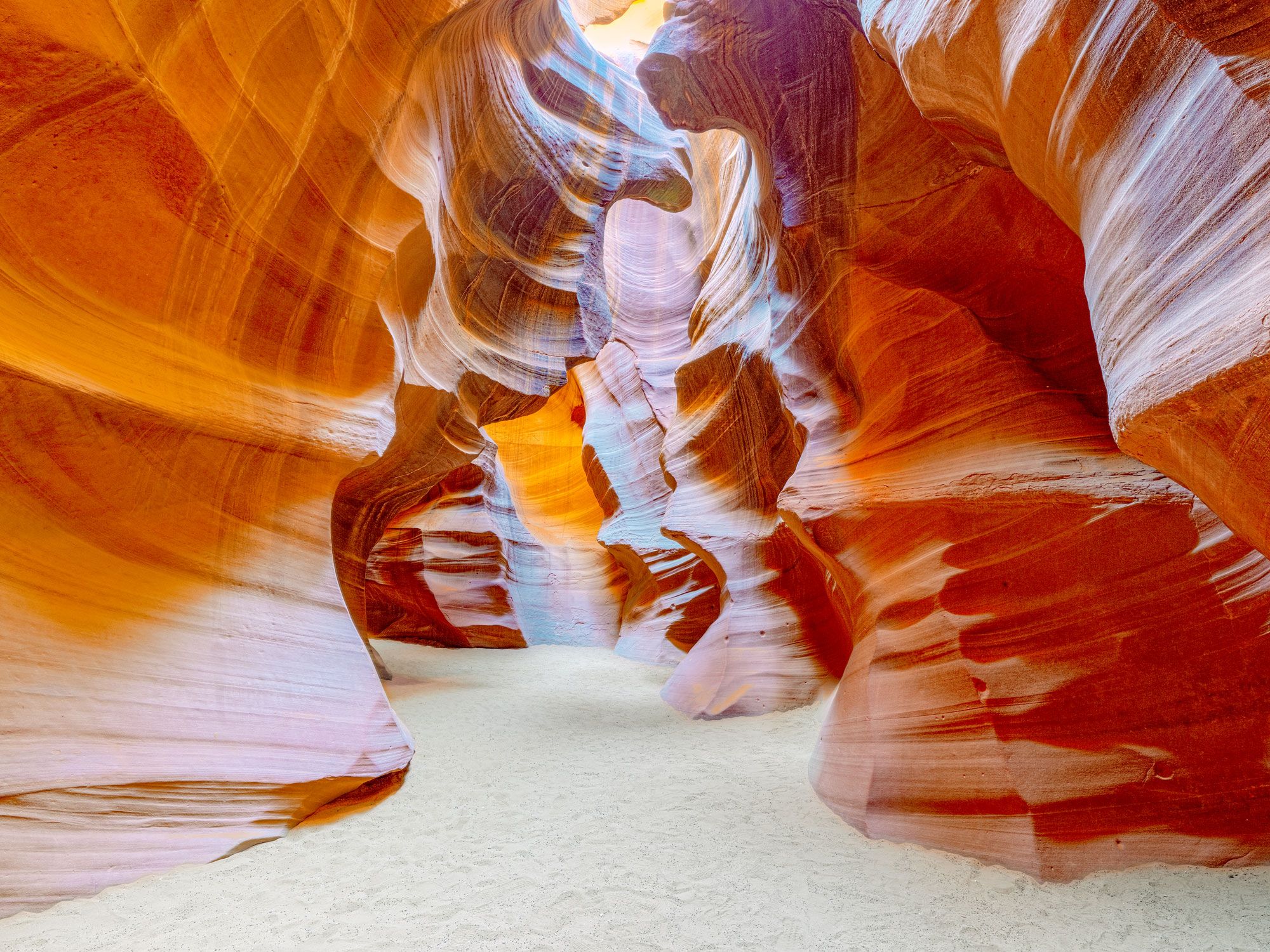
Image of curvy walls of Antelope Canyon in Arizona
Photo credit: V_E/ Shutterstock

The majority of canyons are formed by the slow but steady flow of rivers, but slot canyons are a dramatic departure from the norm. Deep and narrow, these eroded abysses are the result of torrential monsoon rains that send water rushing violently through soft rock. In the Navajo Nation, near the border between Arizona and Utah, Antelope Canyon is a photographer’s dream, where undulating crevasses in shades of orange and purple are illuminated by golden beams of sun. 

While the hike to the Upper Canyon is fairly accessible, the Lower Canyon is especially challenging. Entry to both is controlled by permits, and access is restricted to tours led by authorized Navajo guides. Any slot canyon can be subject to potentially fatal flash floods, as waters from far away storms gather velocity in the narrow spaces, so visitors should always check weather forecasts and hike carefully.

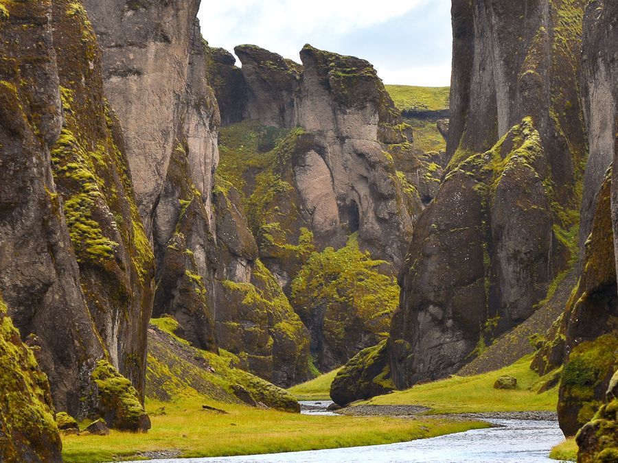
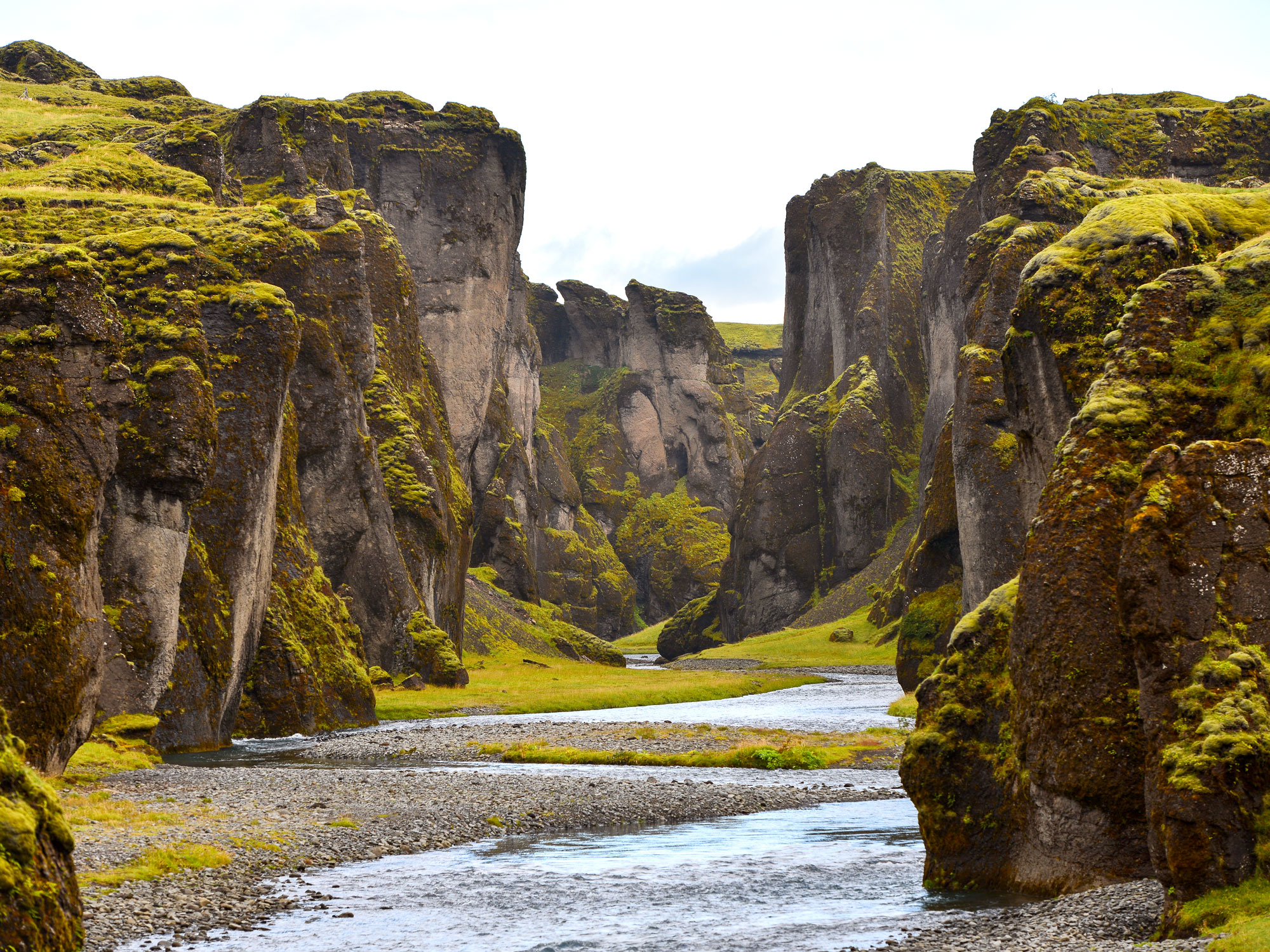
Fjaðrárgljúfur Canyon – Iceland

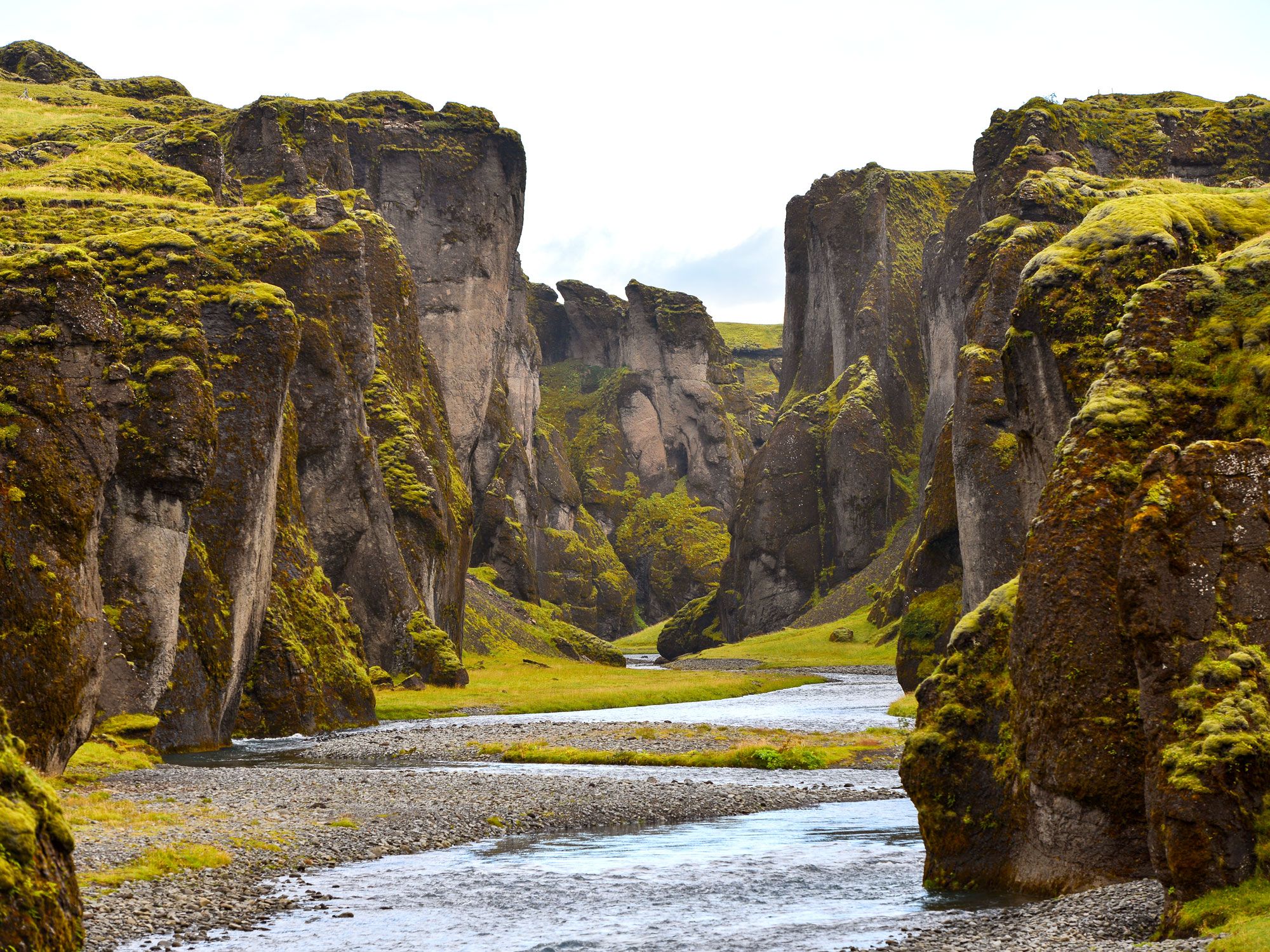
River flowing between verdant walls of Fjaðrárgljúfur Canyon in Iceland
Photo credit: Pedro Carrilho/ Shutterstock

One of the planet’s most majestic — and most difficult to pronounce — canyons can be found along Iceland’s famed Ring Road, near the equally multisyllabic village of Kirkjubæjarklaustur. Fjaðrárgljúfur (meaning “Feather River Canyon”) was formed about 10,000 years ago. Runoff from receding glaciers deposited soft sediments that eventually filled up a lake, which was then in turn eroded by the glacial river. The canyon is an easy 2.5-mile up-and-back hike along the rim, with gorgeous views of the emerald cliffs set off by the blue of the serpentine river curling about 330 feet below. 

Kali Gandaki Canyon – Nepal

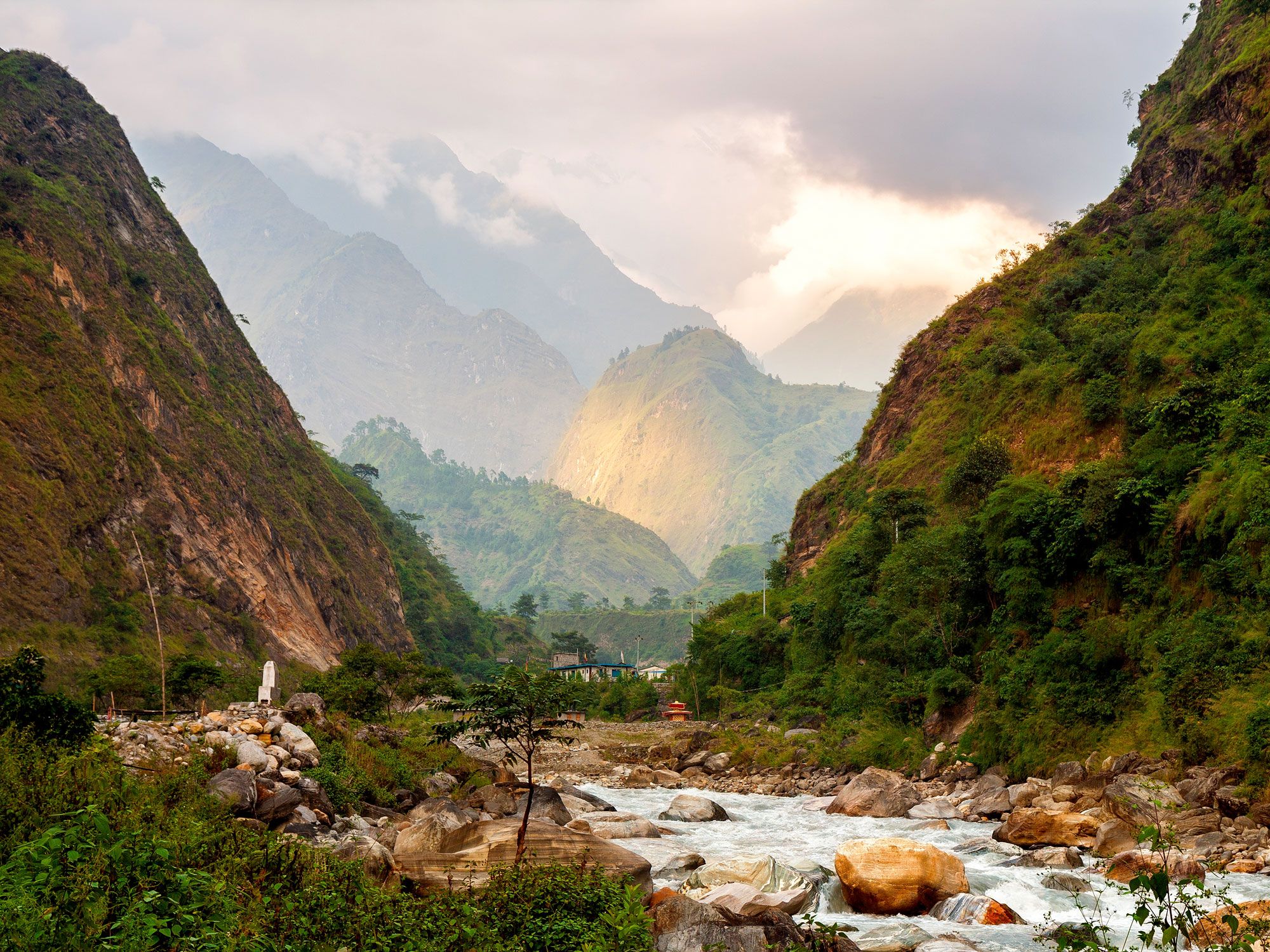
River flowing through verdant Kali Gandaki Canyon, Nepal
Photo credit: Yulia_B/ Shutterstock

The Himalayas are home to the highest mountains on the planet, and also to some of the world’s deepest gorges. In Nepal’s remote Mustang District, the gorge carved by the Kali Gandaki River passes between the Himalayan mountains of Dhaulagiri and Annapurna, both of which top out at over 26,000 feet. The gorge — which was historically used as a trade route between India and Tibet — bottoms out at a whopping 18,278 feet lower than Annapurna. But in neighboring Tibet, the deepest point of the (narrower) Yarlung Tsangpo Canyon reaches 19,714 feet — which, by many accounts, makes it the world’s deepest gorge.

Motlatse Canyon – South Africa

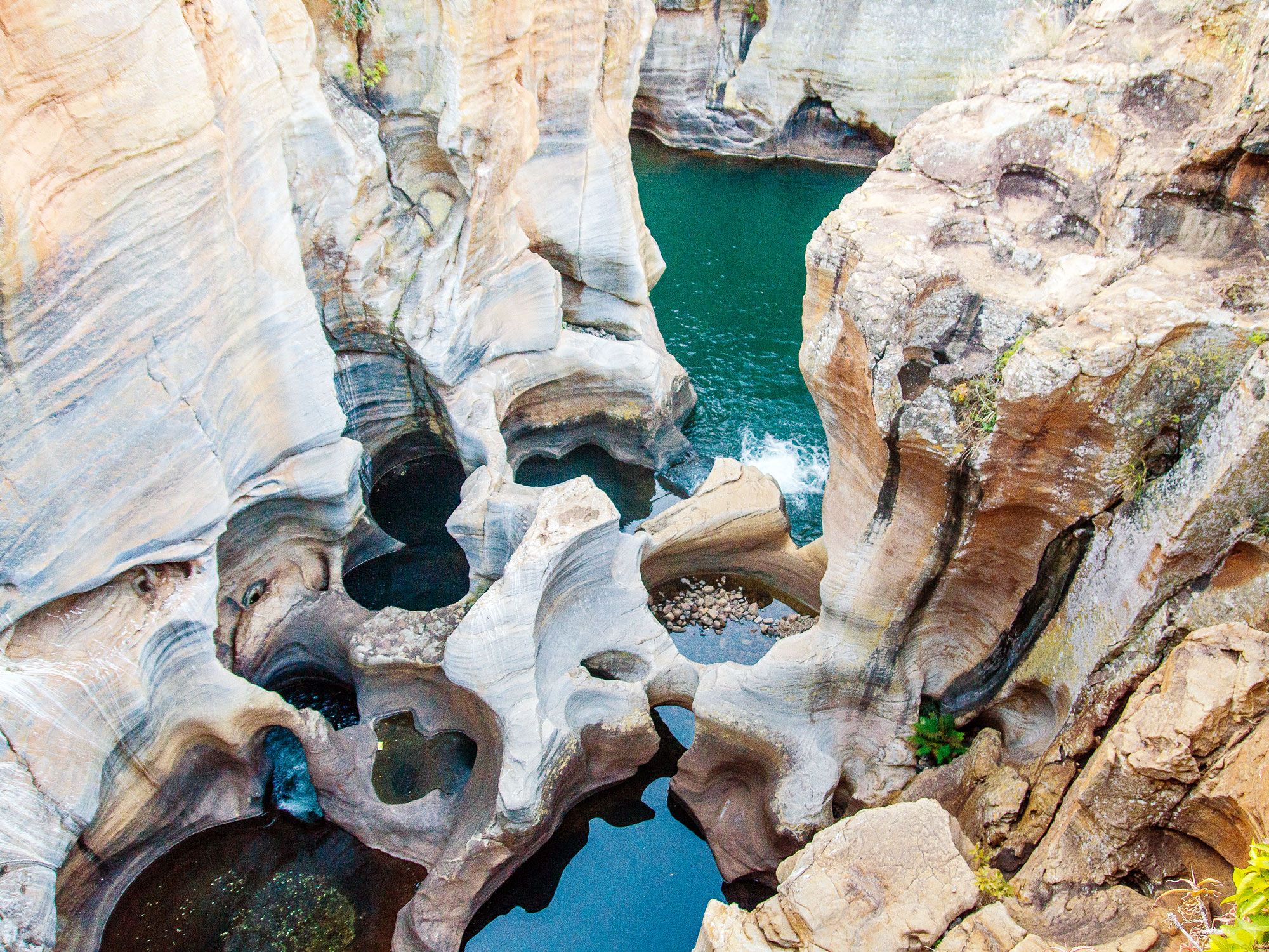
View down into natural rock pools in South Africa's Motlatse Canyon
Photo credit: Nejah Shutterstock

Some 200 million years ago, Madagascar and Antarctica tore themselves away from the ancient supercontinent of Gondwanaland, leaving the southern tip of Africa on its own, surrounded on three sides by ocean. Also known as Blyde River Canyon, the 31-mile Motlatse Canyon stretches along the lip of the great escarpment that was formed when the ragged edge of the continent sloped down to the sea. The glorious nature reserve now protecting the geologic wonder and surrounding areas is a paradise for outdoor enthusiasts, with rafting, bird-watching, hot air ballooning, and hikes to stunning waterfalls.

Verdon Gorge – France

Image of pathway overlooking Verdon Gorge in France
Photo credit: boivin nicolas/ Shutterstock

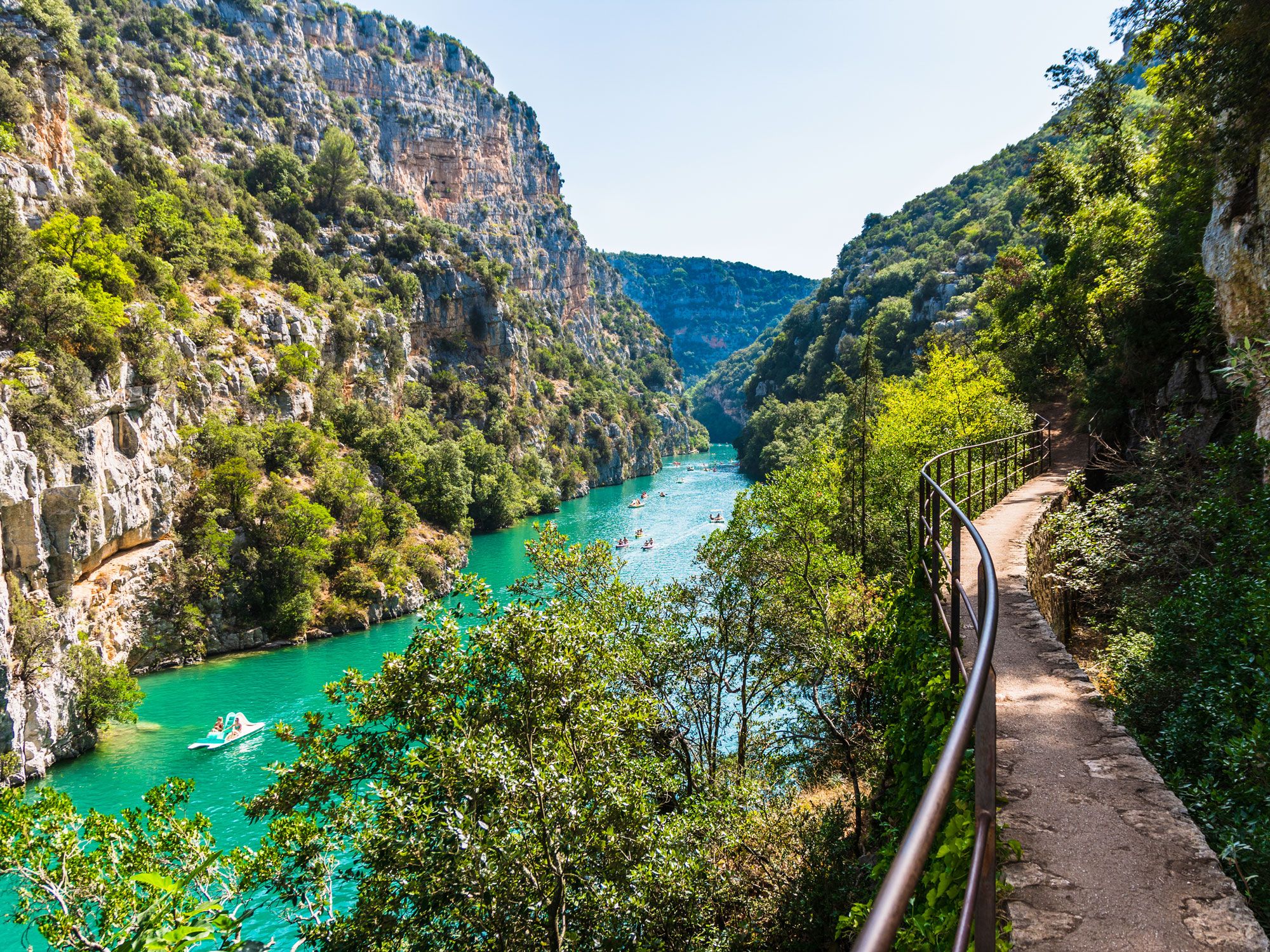
Rafters, rock climbers, and — more recently — highliners flock to the turquoise waters and sheer white limestone cliffs of this stunning canyon. Winding 15 miles through the Alpine foothills in southern France, the Verdon Gorge is one of Europe’s largest canyons. About half a mile above the river, at the top of the gorge, visitors will find quaint villages and excellent restaurants dotting the twisting roads that line both sides of the crevasse. Only a two-hour drive from the fabled French Riviera, the gorge (and the manmade Lac de Sainte-Croix, where the Verdon River ends) are scenic throughout the year, but especially delightful during the summer months.

Post Banner Image
Culture

The Best U.S. National Monuments to Add to Your Bucket List

By Daily Passport Team
Read time: 12 minutes
July 27, 2023
Updated: July 27, 2023

The Best U.S. National Monuments to Add to Your Bucket List

By Daily Passport Team
Author
Daily Passport Team
Daily Passport writers have been seen in publications such as National Geographic, Food & Wine, CBC, Condé Nast Traveler, and Business Insider. They're passionate about uncovering unique destinations and sharing expert tips with curious travelers.

You’re surely familiar with the 63 national parks in the National Park System — from Yellowstone and Yosemite to Grand Canyon and Great Smoky Mountains — but how well do you know the country’s 132 national monuments (and counting)? Similar to our national parks, these indelible landmarks protect and preserve historic sites and natural wonders from coast to coast, from New York’s Statue of Liberty to Hawaii’s Papahānaumokuākea marine area. Don’t know where to start? We think these 16 national monuments should be at the top of your travel wish list.

Devils Tower National Monument – Wyoming

Road leading to Devils Tower National Monument in Wyoming at sunset
Photo credit: anthony heflin/ Shutterstock

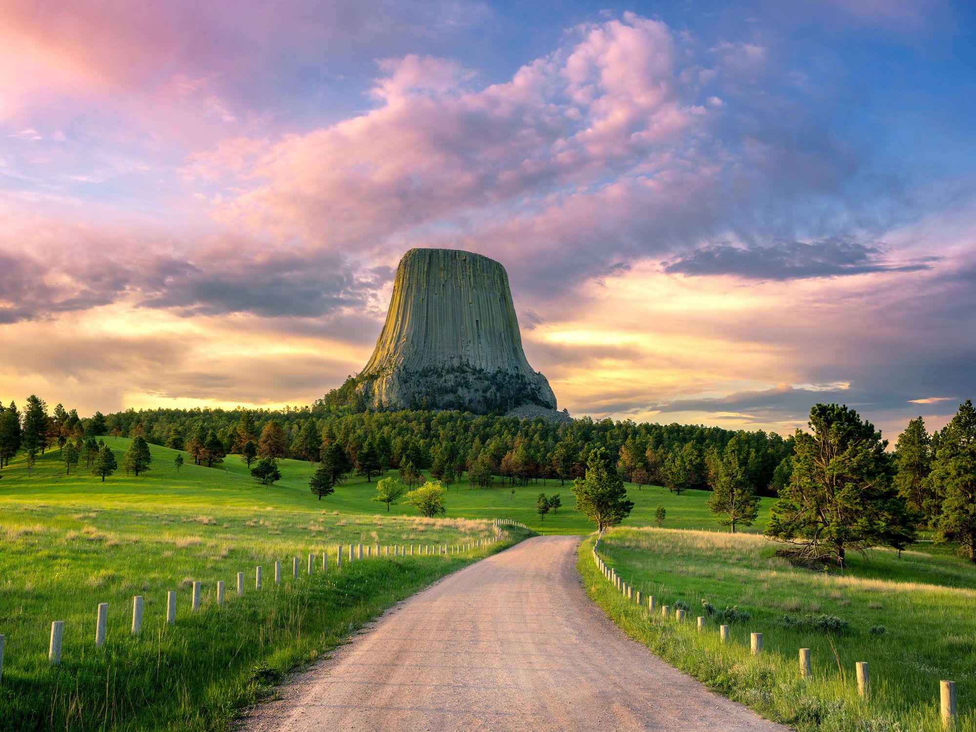
Devils Tower was the first site in the United States to be formally recognized as a national monument in 1906. This spectacular butte is the largest example of columnar jointing in the world, rising 265 feet above the surrounding Wyoming landscape. There are many theories as to how Devils Monument formed, but many geologists believe the tower, which is composed of igneous rock, is made of magma that cooled underground and was exposed over time by erosion.

The site has long held spiritual significance to Native Americans, particularly the Cheyenne, Kiowa, and Lakota peoples, who called the butte Mato Tipila, meaning “Bear Lodge.” Today, the tower is also a popular rock-climbing destination, attracting hundreds of enthusiasts each year. In an attempt to limit crowding, seasonal bans on climbing close to nesting sites ensure peregrine and prairie falcons don’t abandon their eggs or chicks.

Giant Sequoia National Monument – California

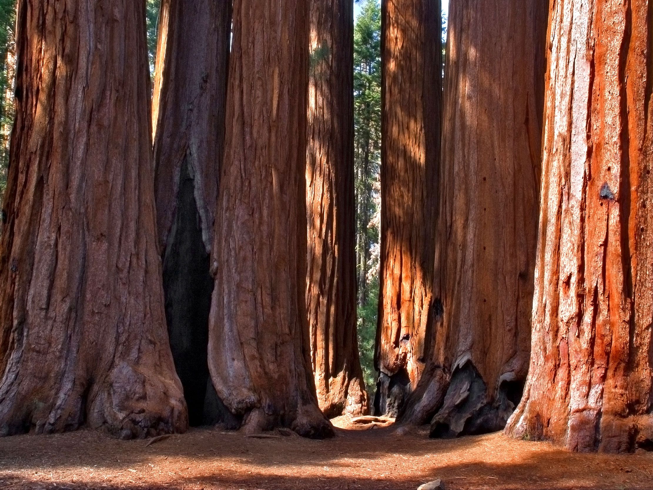
Giant sequoia trees in California's Giant Sequoia National Monument
Photo credit: kavram/ Shutterstock

The giant sequoia is the world’s largest tree, typically reaching 250 feet tall and measuring over 20 feet in diameter. Some of the biggest specimens have a girth of around 35 feet — imagine six people lying on the ground head to toe and you can picture just how wide that is! The only place giant sequoias grow naturally is in California, where you’ll find the massive trunks in an area west of the Sierra Nevada mountains.

Giant Sequoia National Monument comprises two sections — the northern end and southern end — each featuring multiple groves. Boole Tree, located in Converse Basin, is one of the largest trees on NPS-administered land and survived the widespread logging which took place in the 1890s. Today, the many trails and campgrounds close to the national monument make this a popular vacation spot.

Fort Matanzas and Castillo de San Marcos National Monuments – Florida

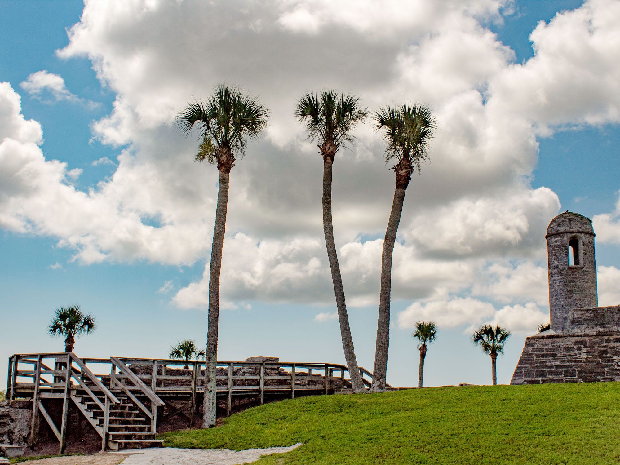
Image of palm trees and Castillo de San Marcos National Monument in Florida
Photo credit: Laura Liz Photography/ Shutterstock

The Spanish built Fort Matanzas close to the city of St. Augustine to guard Matanzas Inlet. They began construction on the fort in 1740 and completed it in just two years — a laborious undertaking involving the hard work of many enslaved peoples and convicts from Cuba, who used a building material known as coquina, a soft limestone made of broken shells. But the fort was barely used. In fact, the cannons were fired just once, at the British. The Spanish Empire began to decline and the fort was largely ignored. By the time Fort Matanzas came under U.S. control in 1821, it was in pretty bad shape and was left to decay into a ruin currently maintained by the National Park Service.

Another national monument, Castillo de San Marcos, is located 14 miles to the north and predates Fort Matanzas. The Spanish began its construction in 1672, making it the oldest masonry fort in the continental U.S. The Spanish decided the fort was necessary when a raid led by British privateer Robert Searles damaged the existing fort and destroyed St. Augustine. Over the years, Castillo de San Marcos changed hands several times before earning its official designation as a national monument in 1924.

Pullman National Monument – Illinois

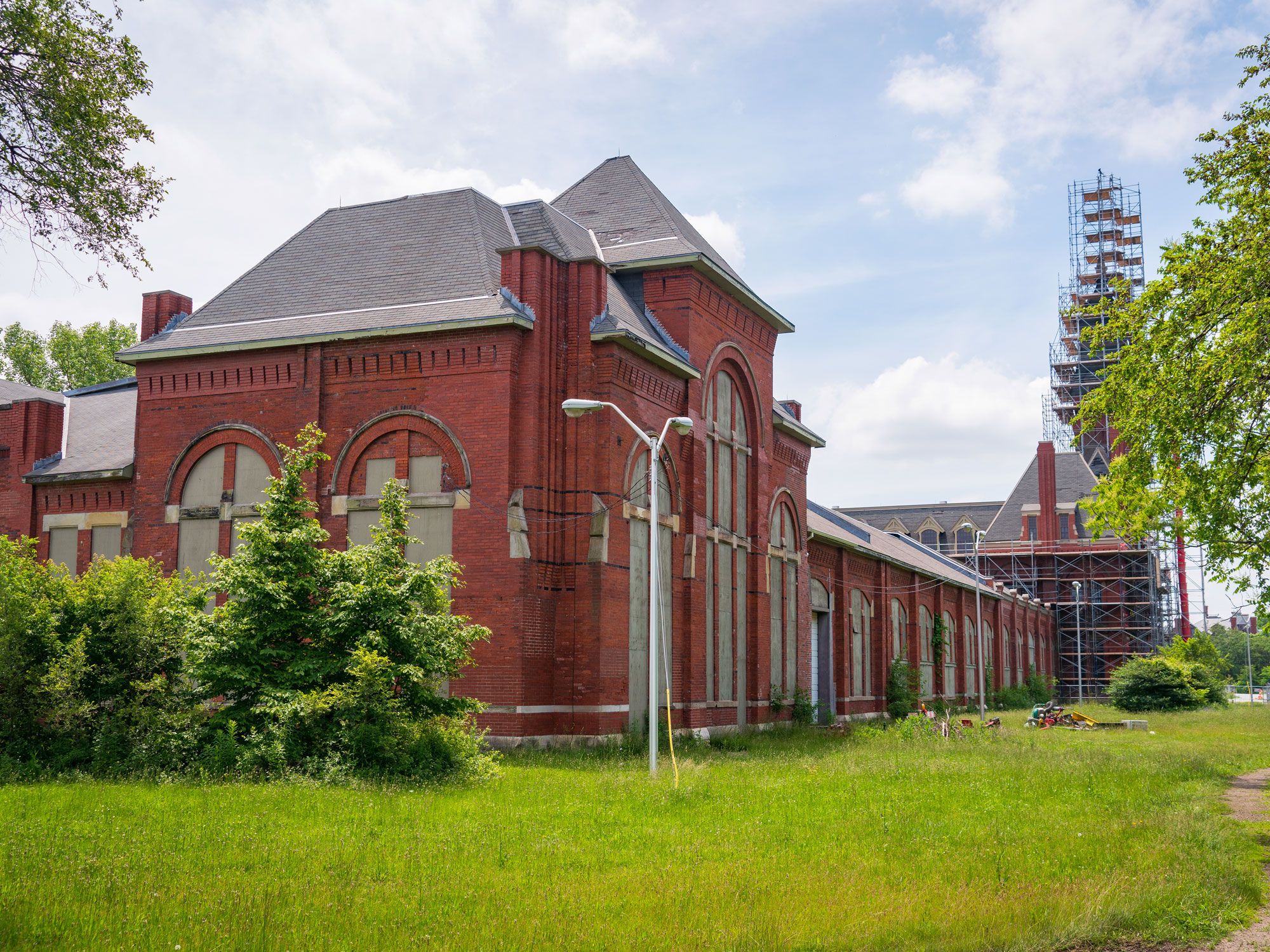
Image of Pullman National Monument in Illinois
Photo credit: Zack Frank/ Shutterstock

Pullman National Monument is the earliest planned industrial community in the U.S. When it was built from 1879 to 1884, it fell just outside Chicago city limits. The community was named after engineer George Pullman, who earned his place in history building sleeping cars during the railroad boom in the late 19th century. He saw an opportunity to create modern homes for his employees: each home featured toilets, lighting, and ventilation, while executive homes even boasted heating. The rent wasn’t cheap, but it was a nice place to live if your wage could cover it. It was certainly a step up from the overcrowded housing workers could expect to afford in Chicago.

Critics of Pullman have noted that when the fortunes of the railroad industry declined in the 1890s, he reduced wages but kept rents at the same price. This decision resulted in the infamous Pullman Strike of 1894, which not only tarnished the company’s reputation but also changed American labor practices. Self-guided and ranger-led tours lead visitors through the many historic buildings, such as the Hotel Florence where Pullman stayed when he visited his factory.

Waco Mammoth National Monument – Texas

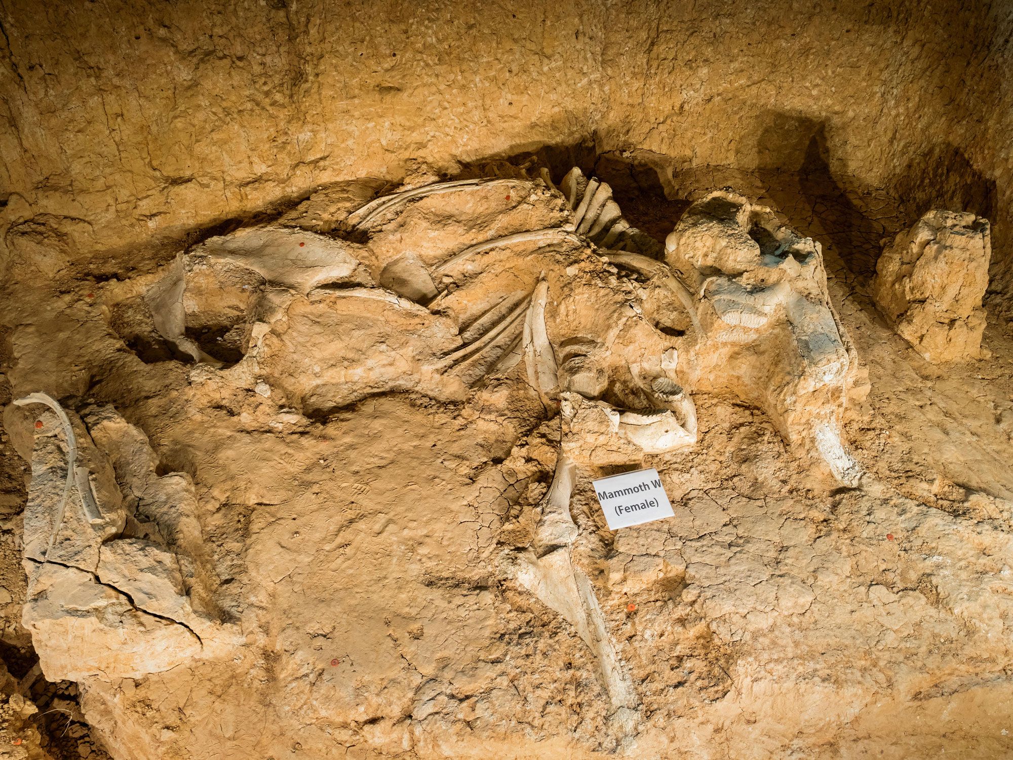
Partially buried fossils at Waco Mammoth National Monument in Texas
Photo credit: Arpad Benedek/ Alamy Stock Photo

Tens of thousands of years ago, Columbian mammoths roamed across the grasslands covering present-day Texas. Similar to woolly mammoths but less hairy, the 10-ton mammoths grew up to 13 feet tall with tusks up to 14 feet long. These great beasts became extinct around 11,700 years ago. So it was a pretty special moment when a large bone was uncovered in a ravine in 1978, and scientists identified it as the femur of a mammoth.

Further excavation uncovered the fossilized remains of a herd of 16 of these Ice Age giants who probably perished together in a flash flood. Since those initial finds, evidence of a further six mammoths have been discovered, along with other creatures dating from the same era. Visitors can enter a climate-controlled Dig Shelter at Waco Mammoth National Monument to view those that haven’t been moved; the rest are on display at the Mayborn Museum Complex at Baylor University.
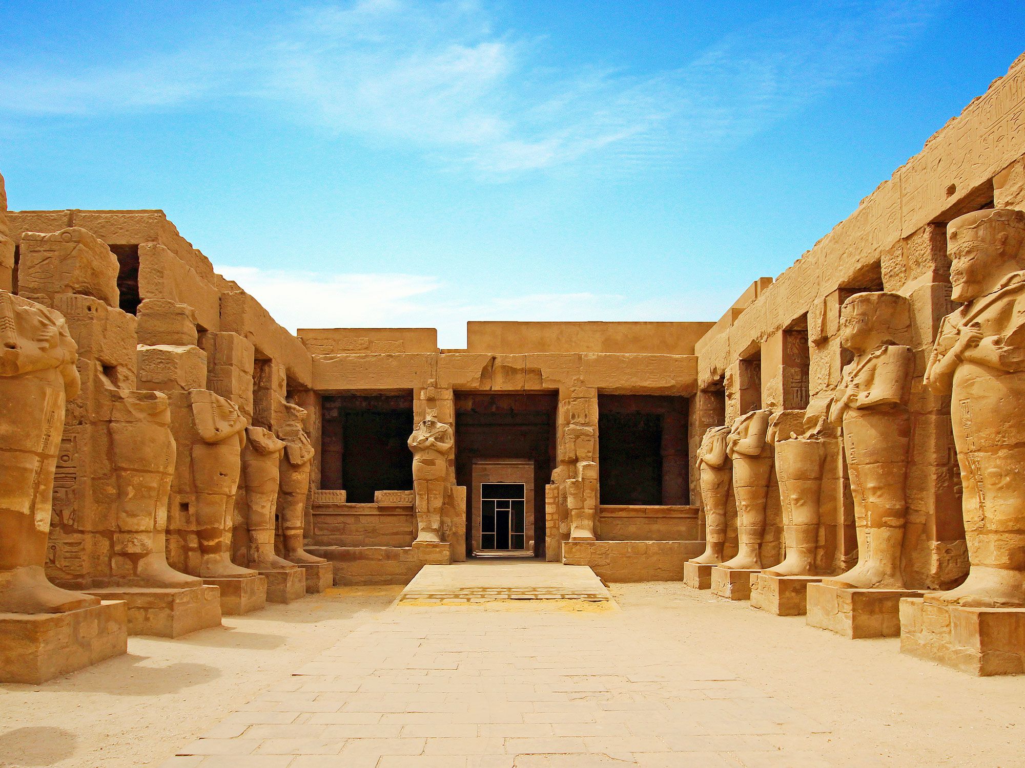
Pipestone National Monument – Minnesota

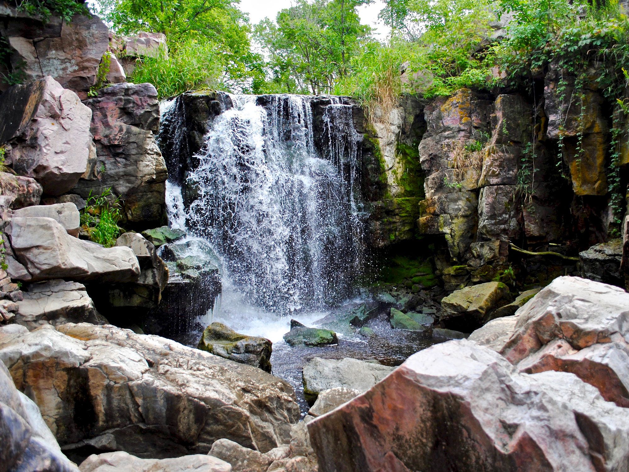
Waterfall at Pipestone National Monument in Minnesota
Photo credit: EWY Media/ Shutterstock

Minnesota pipestone, a stone also known as catlinite, has great cultural significance to the Indigenous peoples of the Great Plains, particularly the Dakota, Lakota, and Sioux tribes. They use the stone to make ceremonial pipes, which have religious and civic importance and are often used to seal a treaty. Accordingly, Pipestone National Monument in southwestern Minnesota is a sacred site to Native Americans; they are the only ones permitted to quarry the red stone.
Demonstrations of pipe making take place in summer so that visitors can see the process for themselves. The techniques involved have been passed down from generation to generation, and visitors can read about the important tradition at the visitor center or take a self-guided tour to see the quarries.  Not just a celebration of the precious stone and its history,, the monument also chronicles the history of the tallgrass prairie ecosystem, which has been restored and currently supports a small herd of bison.

Admiralty Island National Monument – Alaska

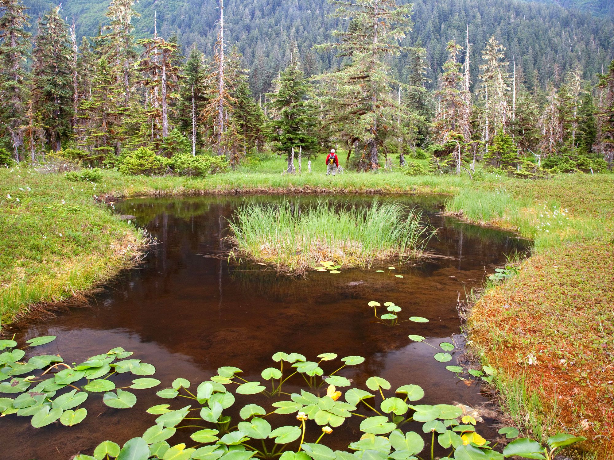
Pond surrounded by grass and forest at Alaska's Admiralty Island National Monument
Photo credit: Don Paulson/ Alamy Stock Photo

The Indigenous Tlingit peoples call Admiralty Island Kootznoowoo. It means “fortress of the bears,” and the name is no accident, as the island houses a population of around 1,500 brown bears — one of the highest concentrations of these bears in the world. One of the best places to see them is at the Pack Creek Bear Sanctuary, for which you’ll need a permit. Brown bears are frequent visitors to this part of the island in summer, lured by the promise of plump, pink salmon and an abundance of clams. Watch them from the mouth of Pack Creek or hike inland to climb the Observation Tower for a bird’s eye view. It’s easy to add a day trip to your Alaska itinerary: just book a seat on a float plane from Juneau and you’ll be there in 30 minutes.

Bears Ears National Monument – Utah

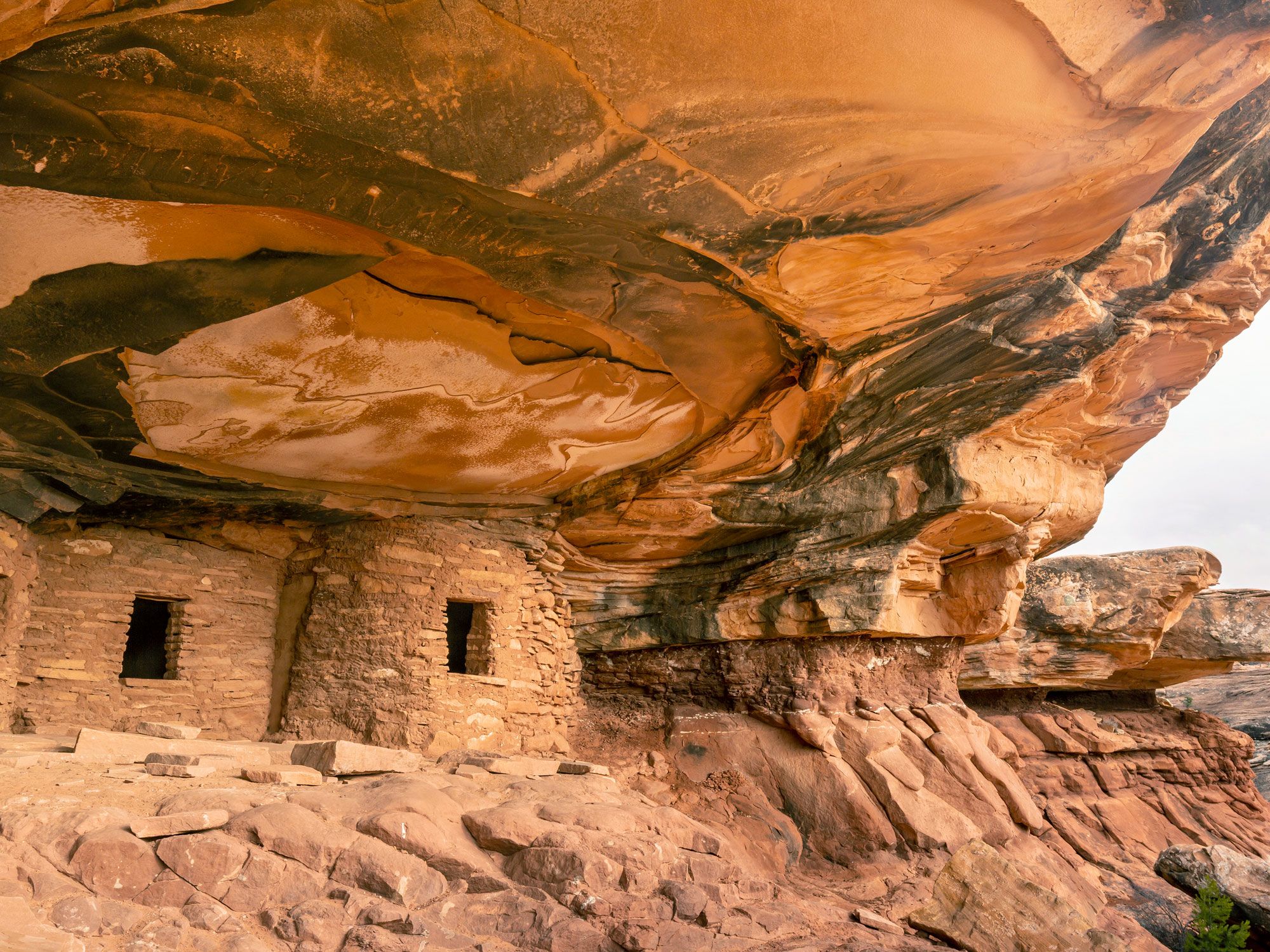
Cliff dwellings of Bears Ears National Monument in Utah
Photo credit: Colin D. Young/ Shutterstock

Bears Ears National Monument takes its name from two sandstone buttes that dominate the landscape. Native American tribes consider it a sacred and spiritual place. Sandstone cliffs line a valley enclosing Indian Creek Canyon. Nearby, you’ll find North Six-Shooter Peak and South Six-Shooter Peak, plus Lavender Mesa and Bridger Jack Mesa. Scattered throughout the area are around 100,000 archaeological sites. They include cliff dwellings and petroglyphs that are thousands of years old. People also come to this national monument to hike, bike, and climb. Scenic drives lead to overlooks that open up impressive panoramas, such as the one at Upper Arch Canyon, and of course, the Bears Ears buttes themselves.

Dinosaur National Monument – Colorado

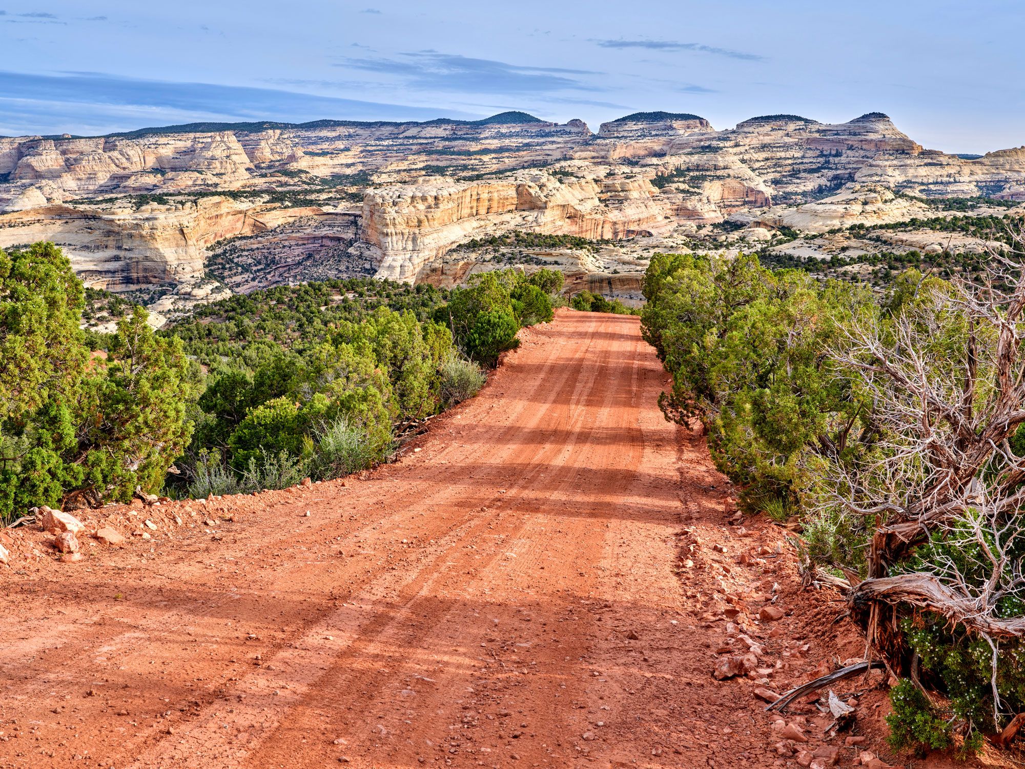
Empty dirt road leading to striated rocks in Dinosaur National Monument in Colorado
Photo credit: marekuliasz/ Shutterstock

Straddling the Colorado-Utah border, Dinosaur National Monument was originally designated to preserve the Dinosaur Quarry. Thousands of dinosaur fossils have been uncovered here, representing species such as stegosaurus, diplodocus, and allosaurus. In the refurbished Quarry Exhibit Hall, visitors can view a wall crammed with approximately 1,500 dinosaur bones. But there’s plenty more to see. The surrounding area is wild and beautiful. Visitors can explore the area’s canyon and mountain trails — some of which lead to meadows strewn with wildflowers. Dark skies are ideal for stargazing, and adventurers can go whitewater rafting while history buffs will be delighted by the ancient rock art.

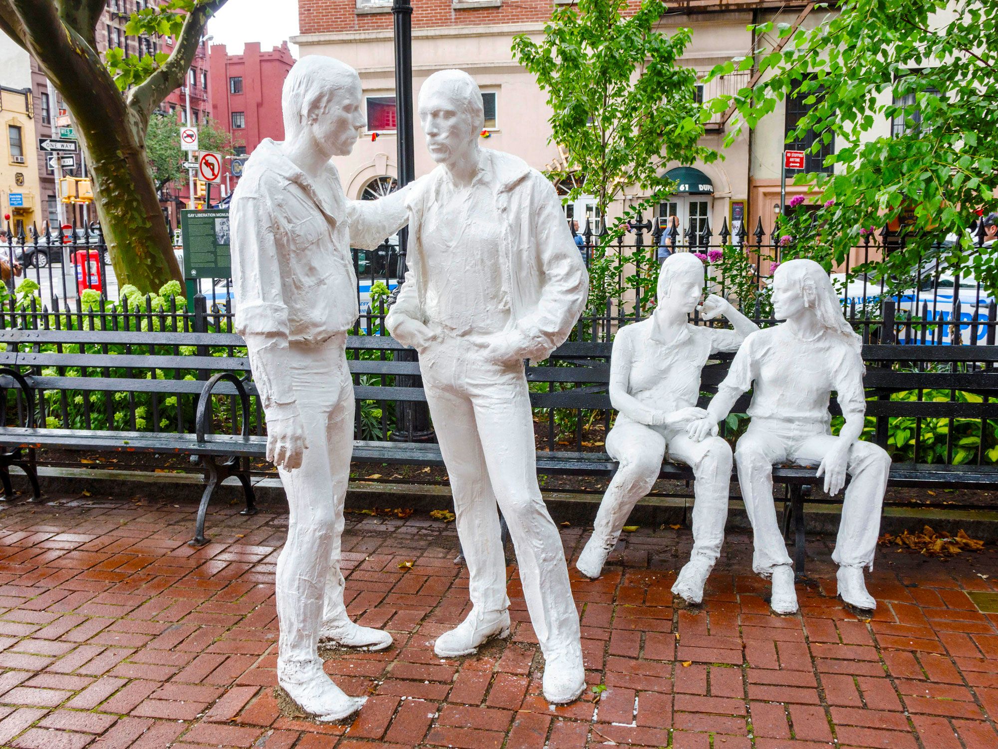
Stonewall National Monument – New York

Commemorative statues at Stonewall National Monument in New York City
Photo credit: Jeffrey Isaac Greenberg 10+/ Alamy Stock Photo

To understand the significance of Stonewall National Monument in New York City’s Greenwich Village, you have to go back to June 28, 1969. On that day, a police raid on the Stonewall Inn marked a turning point in the gay liberation movement and became a milestone moment for LGBTQ+ civil rights. Resistance to the actions of the police sparked rioting and demonstrations across the street in Christopher Park. But it also gave members of the LGBTQ+ community a voice and encouraged them to fight more openly for change.

Today, the Stonewall Inn is not just a national monument; it continues to be a thriving entertainment venue that opens its doors for music, dancing, and drinking. It is, its patrons will tell you, the place where Pride began and the place where Pride lives on, officially designated as a U.S. national monument on June 24, 2016.

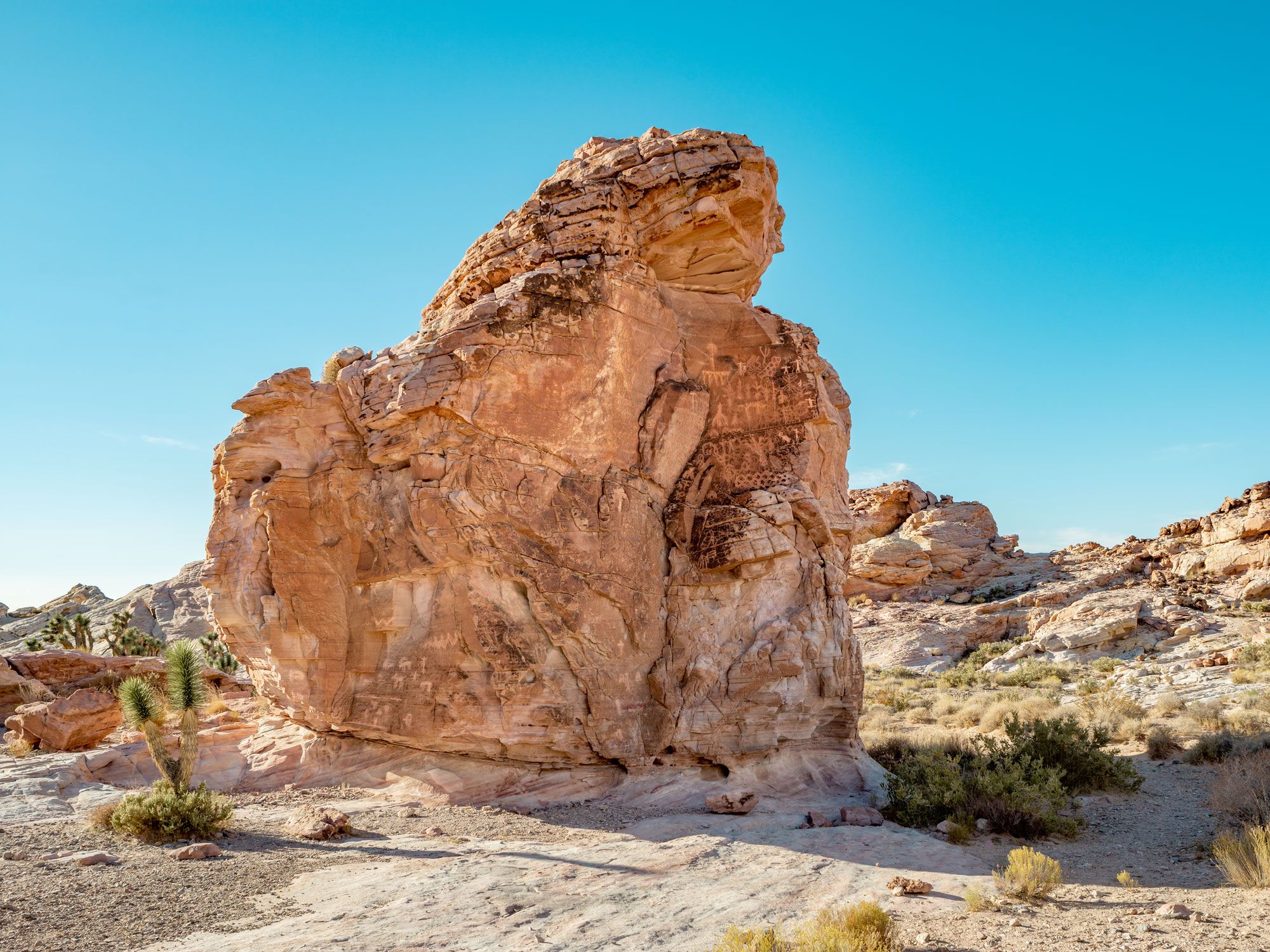
Gold Butte National Monument – Nevada

Desert rock formation at Nevada's Gold Butte National Monument
Photo credit: Dominic Gentilcore PhD/ Shutterstock

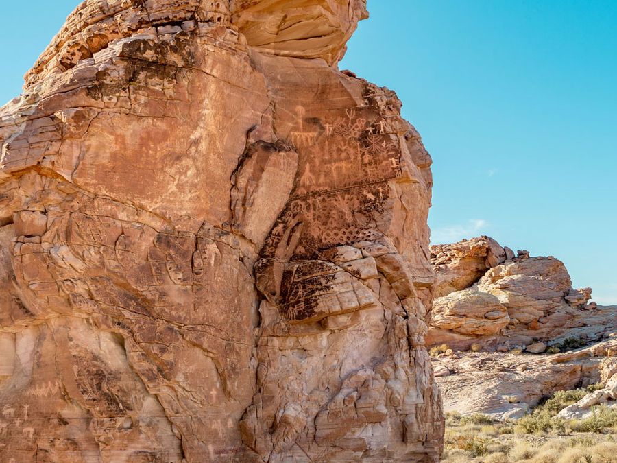
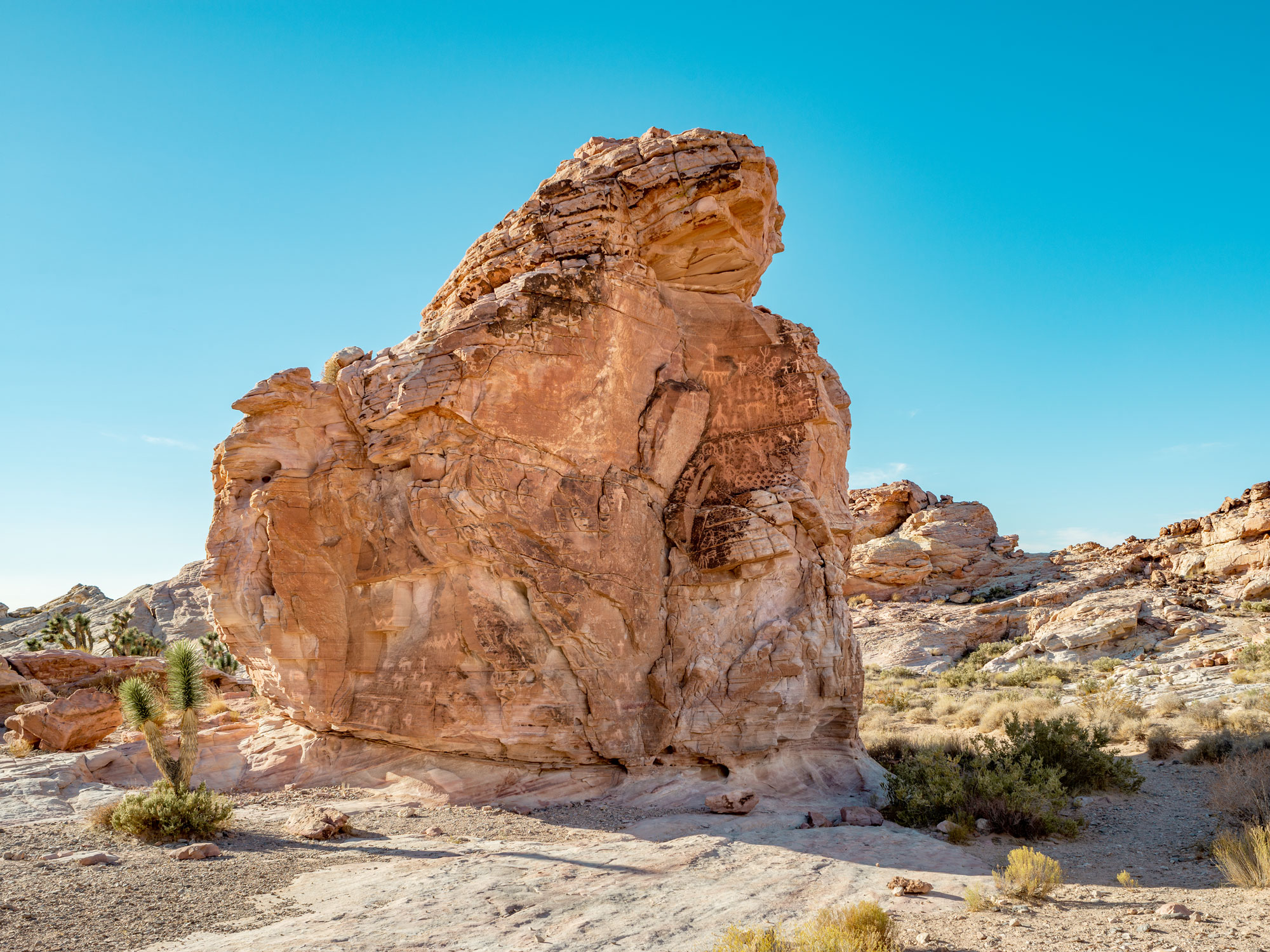
Designated in 2016, Gold Butte National Monument is one of the newest national monuments in the country. Home to bighorn sheep and mountain lions, the monument draws visitors keen to admire its magnificent desert scenery, ancient petroglyphs, and a ghost town littered with abandoned mine shafts. It’s hard to believe that it’s less than a three-hour drive from Las Vegas, though the lack of paved roads when you get there means you’ll want to travel in a high-clearance 4×4.

Some of the rock formations are spectacular, sculpted over the years by the wind into intricate shapes. Don’t miss a sinkhole known as Devil’s Throat, which is best admired from a safe distance, and the red rocks of Little Finland. Newspaper Rock also boasts many fascinating petroglyphs, though the one that will leave you scratching your head is an image of a falling man.

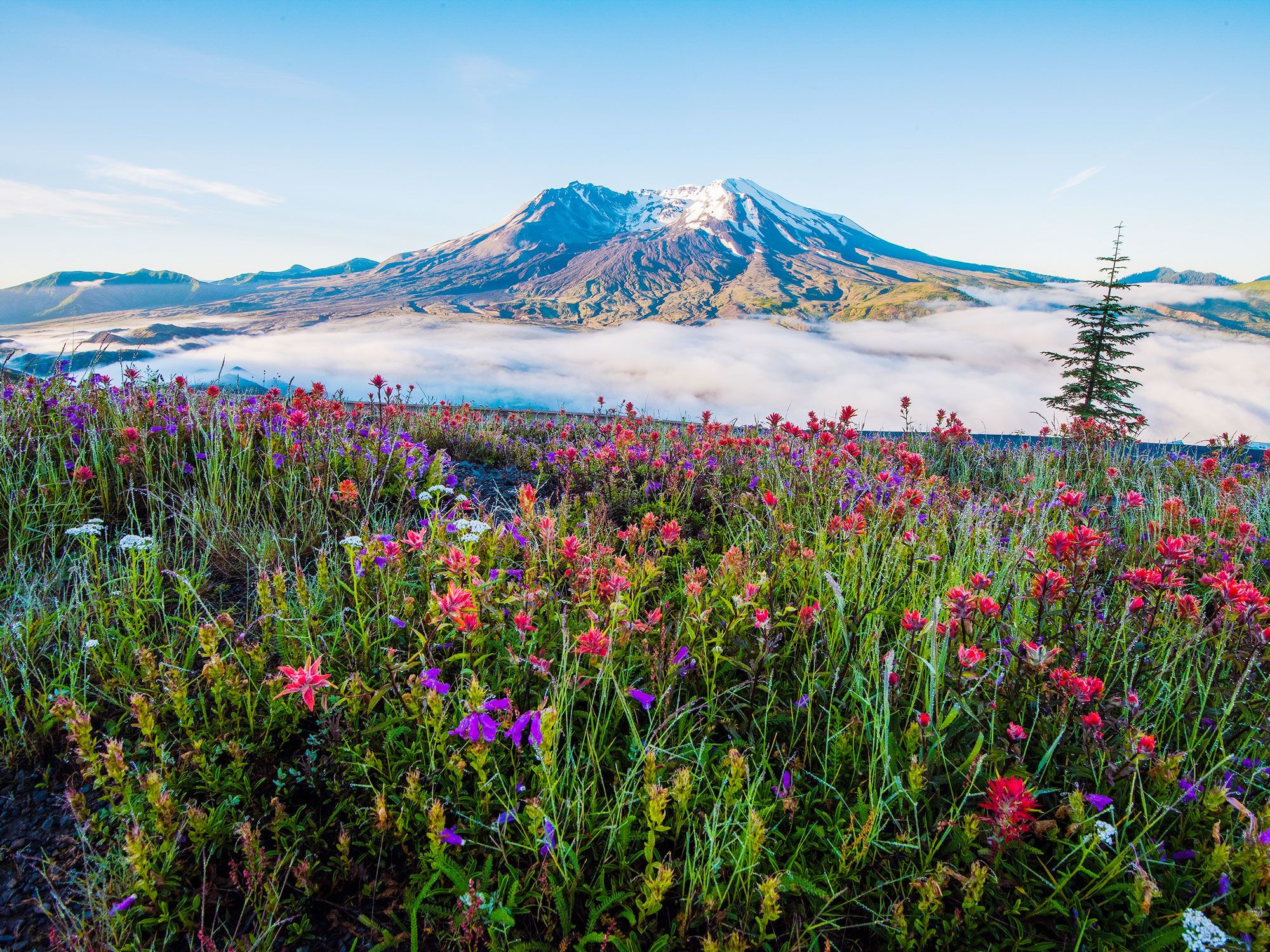
Mount St. Helens Volcanic National Monument – Washington

View of Mount St. Helens across flowers
Photo credit: Dene’ Miles/ Shutterstock

Two years after the dramatic 1980 eruption, the Mount St. Helens Volcanic National Monument was established. Preserving the area gives scientists the opportunity to study the ongoing effects of the cataclysmic event and see how nature regenerates without human interference. That doesn’t mean people have to stay away, however. Activities such as hiking, fishing, snow-shoeing, and camping are all encouraged, although you’ll need a permit if you plan to stray above 4,800 feet to climb to the volcano’s summit. One of the highlights is the chance to explore the Ape Cave Lava Tube, the third-longest lava tube in North America, which can be accessed with a guide.

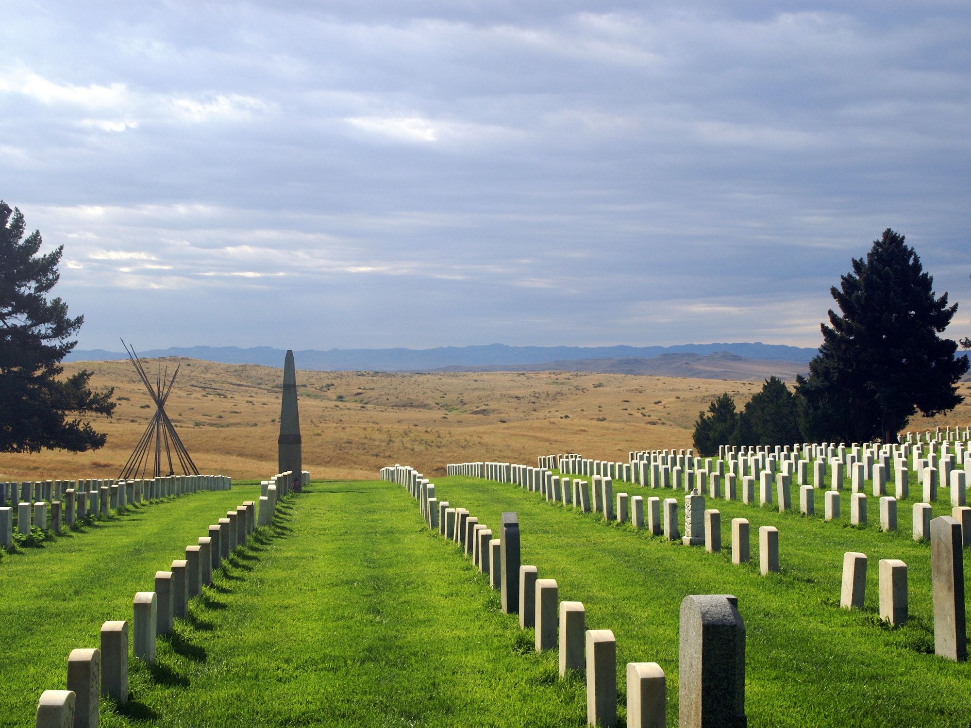
Little Bighorn Battlefield National Monument – Montana

Tombstones at Little Bighorn Battlefield National Monument in Montana
Photo credit: G Seeger/ Shutterstock

Little Bighorn Battlefield National Monument is a memorial to those who lost their lives on June 25-26, 1876. It was then that Lieutenant Colonel George Armstrong Custer led the Seventh Cavalry Regiment into battle against the Lakota Sioux and Cheyenne tribes, led by Sitting Bull. They hoped to take advantage of the element of surprise but found themselves outnumbered and up against warriors who fought bravely to defend their way of life. But although the Native American forces won the battle, Custer’s fate galvanized public opinion and it would have devastating long-term consequences for the Lakota Sioux and Cheyenne people.

Within a year, the U.S. government annexed their land and established reservations. Over a century later, the monument was renamed to honor losses on both sides and present a more balanced account of what happened. The visitor center and museum recounts the events and consequences of the battle and also provides an insight into the lives of the Plains Indians at that time.

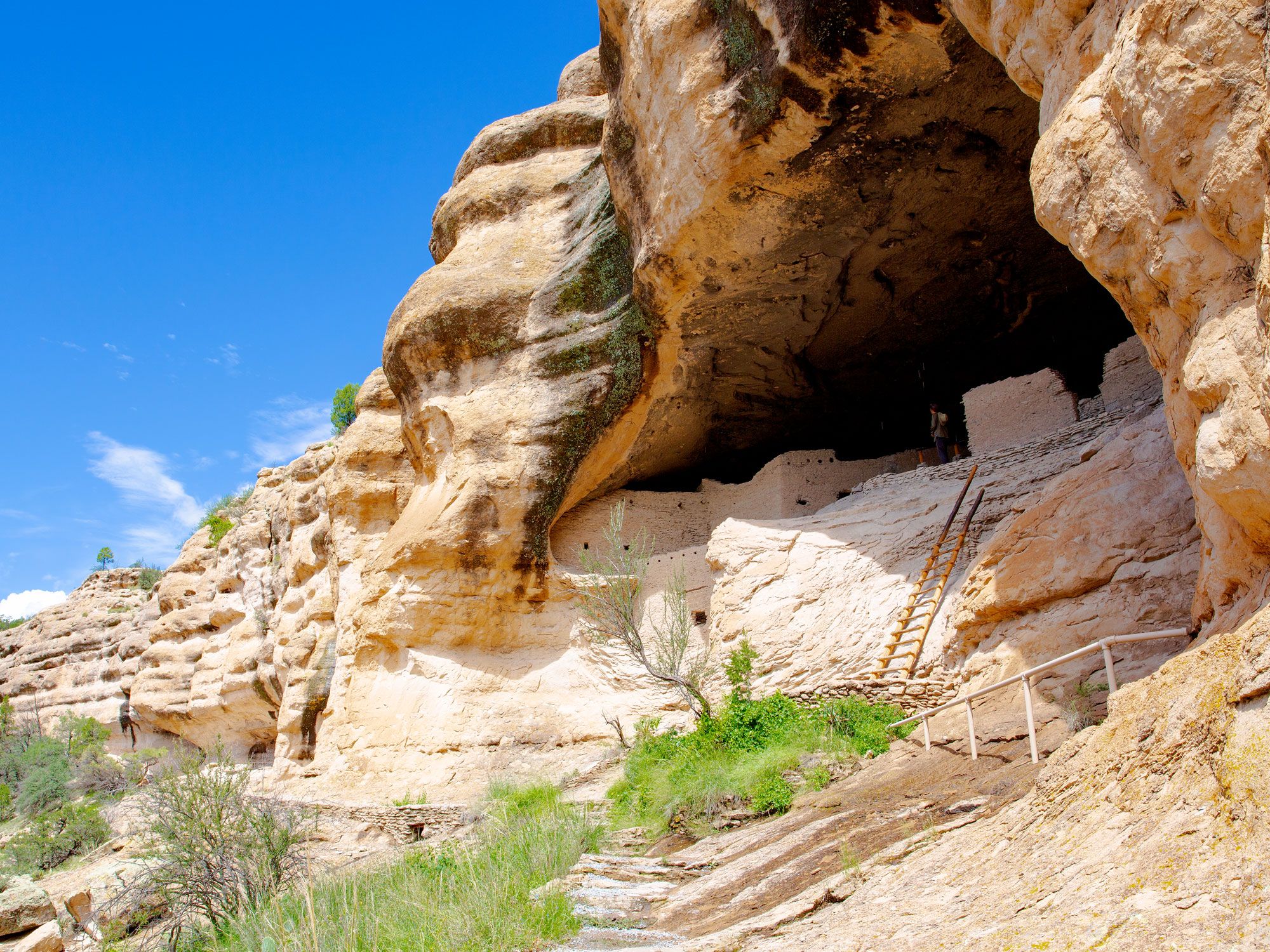
Gila Cliff Dwellings National Monument – New Mexico

Looking up at the cliff dwellings of Gila Cliff Dwellings National Monument in New Mexico
Photo credit: Traveller70/ Shutterstock

Gila Cliff Dwellings National Monument has a history dating back hundreds, probably thousands, of years. Historians believe that the Mogollon Indigenous people made their home in the caves beside the Gila River for about 20 years in the late 1200s, piecing together a timeline based on items recovered from the site such as fragments of pottery and a bracelet.

Today’s day-trippers can step inside the caves and imagine what life might have been like. Many combine their visit to the dwellings with a dip in one of the local hot springs. The nearest is Lightfeather Hot Spring, which lies within walking distance of the visitor center. However, many choose to walk the six-mile trail to Jordan Hot Spring. Hikers have to cross and recross the Gila River, but a soak in the crystal-clear pool in a delightful natural setting is considered well worth it.

Harriet Tubman Underground Railroad National Historic Park – Maryland

Historic building at Harriet Tubman Underground Railroad National Historic Park in Maryland
Photo credit: Zack Frank/ Shutterstock

Harriet Tubman was born into slavery in 1822 as Araminta Ross. She managed to escape in 1849, traveling to Philadelphia, but she returned to Maryland over and over again. In all, she made 13 rescue missions to rescue enslaved peoples using the Underground Railroad. She smuggled them using the network of secret routes, enlisting the help of fellow antislavery activists and safe houses.

She took her charges, known as “passengers,” as far as the Northeast and into Canada. As one of the best known of the Underground Railroad “conductors,” Tubman is the focus of the Harriet Tubman Underground Railroad National Historic Park, previously the Harriet Tubman Underground Railroad National Monument.

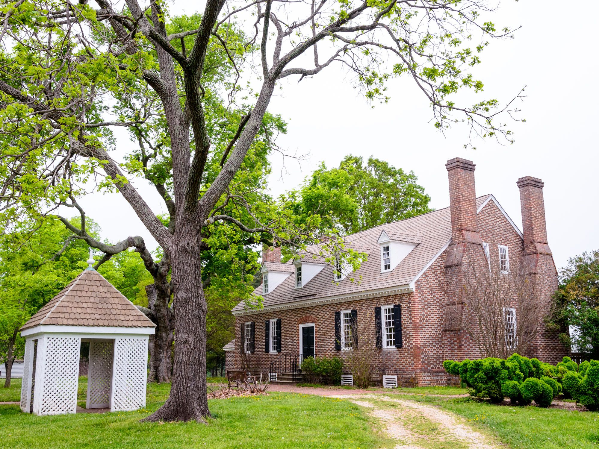
George Washington Birthplace National Monument – Virginia

Image of colonial brick home at George Washington Birthplace National Monument in Virginia
Photo credit: Zack Frank/ Shutterstock

John Washington, the great-grandfather of first U.S. President George Washington, first established a tobacco plantation in Westmoreland County, Virginia, in the middle of the 17th century. George himself was born in the plantation house in 1732. He lived there for a few years and then again as a teenager. However, the house you see today wasn’t built until 1931. Since no one knows for sure what the original property looked like (it burned down on Christmas Day in 1779), this is the best guess reflecting the architectural style at the time.

Visitors can stroll through the house and grounds, which contain farm buildings, trees, and formal gardens, as well as wheat and tobacco crops to create a sense of what Washington might have seen as a boy. Also on the grounds, you’ll see a marble obelisk, which is a replica of the one in Washington, D.C., though it’s a tenth of the size.

Post Banner Image
Outdoors

8 Important Wetlands You Should Know About 

By Daily Passport Team
Read time: 5 minutes
July 27, 2023
Updated: May 8, 2024

8 Important Wetlands You Should Know About 

By Daily Passport Team
Author
Daily Passport Team
Daily Passport writers have been seen in publications such as National Geographic, Food & Wine, CBC, Condé Nast Traveler, and Business Insider. They're passionate about uncovering unique destinations and sharing expert tips with curious travelers.

Wetlands are found on every continent except Antarctica. They provide critical habitats for wildlife and flood protection to fragile coastal ecosystems by soaking up excess water. Although wetlands (alternatively called bogs, bayous, swamps, or marshes) cover less than 8% of the Earth’s land, it’s estimated that they retain almost a third of the world’s carbon. Below, journey to eight of Earth’s most important wetlands. 

The Pantanal – Brazil, Paraguay, and Bolivia

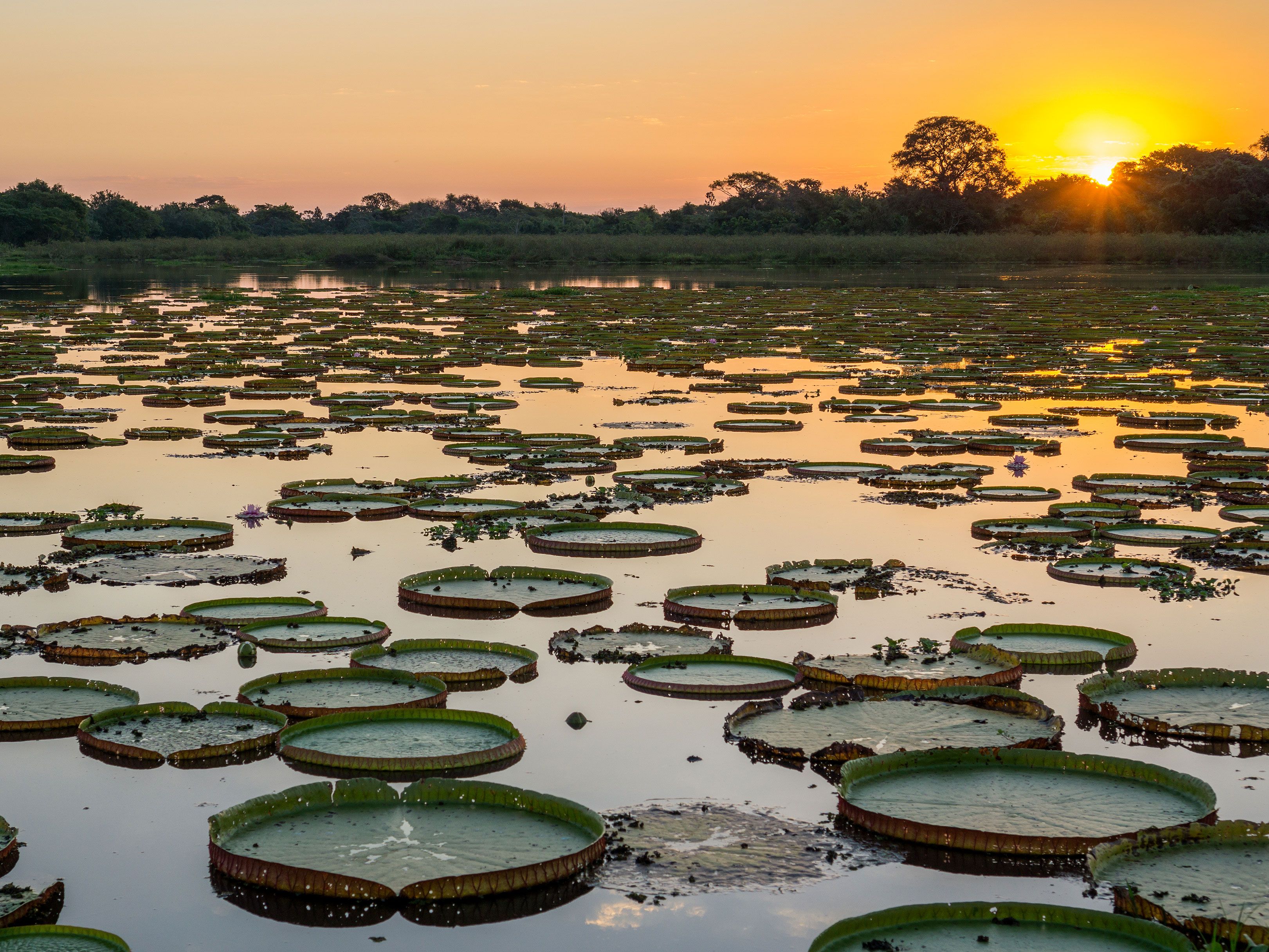
Image of the Pantanal wetlands at sunset
Photo credit: FCG/ Shutterstock

Brilliant blue hyacinth macaws — the world’s longest parrot — are among the many birds screeching above the largest tropical wetland on Earth. Covering more than 70,000 square miles in three South American countries, the Pantanal is roughly the size of Washington state. Nearly 5,000 species of plants and animals call the Pantanal home — giving it the highest concentration of wildlife on the continent — along with 270 communities of Indigenous peoples.

Saturated with torrential rains, the Pantanal’s enormous basin fills every year, draining slowly into the Paraguay River. The drainage results in pools filled with snails and fish, which draw in birds such as storks, egrets, and spoonbills, as well as bigger species including capuchin monkeys, jaguars, piranha, and green anacondas — the largest snakes on Earth. Unfortunately, this vital ecosystem is also endangered: Global warming and encroaching agriculture are shaving away its edges and threatening fresh water, oxygen and the habitat of its important animals.

The Great Dismal Swamp – North Carolina and Virginia

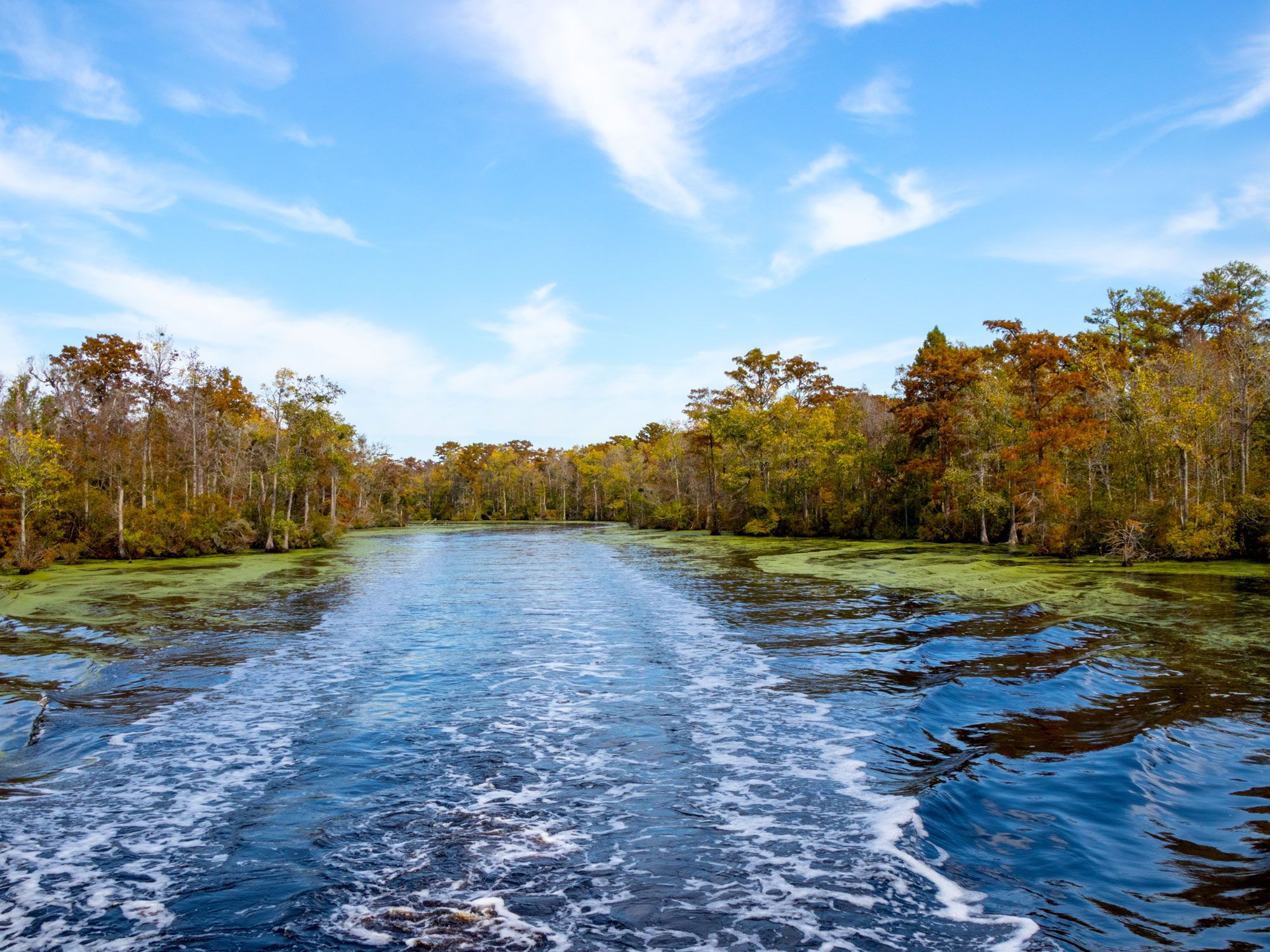
Open waters of the Great Dismal Swamp in North Carolina and Virginia
Photo credit: Lynda McFaul/ Shutterstock

Once covering more than 1 million acres, the Great Dismal Swamp is the geologic remainder of a vast sea. The land formed when the continental shelf experienced a sudden settling and the swamp began to be forested at the end of the last Ice Age about 11,700 years ago. President George Washington was an early investor in a company attempting to drain the swamp to harvest its lumber and use the land for farming. The murky swamp also became a refuge for African Americans seeking freedom from enslavement, as the area’s impenetrable forest, venomous snakes, and dangerous wildlife provided cover from bounty hunters and law enforcement.

By the 1970s, about 90% of the swamp had been destroyed, but 112,000 acres remained, protected as a federal wildlife refuge. Today, the panthers and wolves are gone, but visitors can still see bears, foxes, alligators, butterflies, and more than 200 species of bird. Four-hour “swamp safari” tours are conducted by Suffolk County Tourism; don’t forget your mosquito repellent!

Asmat Swamp – Indonesia

Boat docked in Asmat Swamp of Indonesia
Photo credit:  Syifa Rizka Yolanda/ Alamy Stock Photo

On the southern coast of Papua New Guinea lies the largest alluvial swamp in the world, meaning it contains large deposits of silt, clay, sand, and gravel. Named after the Indigenous peoples of the area, the Asmat is one of the most isolated areas in the world. The Arafura Sea nourishes the coast with 15-foot tide swells, and rivers cross a densely vegetated swamp roughly the size of Belgium. Mangroves nurture fish and crabs, and 15-foot-long crocodiles sun on riverbanks. The Asmat tribe are fierce warriors, and their exploits are celebrated in fantastically detailed wooden carvings.

The Everglades – Florida

Traditional airboat docked in the Everglades of Florida
Photo credit: GagliardiPhotography/ Shutterstock

Often described as a “river of grass,” Florida’s Everglades National Park covers 1.5 million protected acres — about half of its original size. As the third-largest national park in the Lower 48, the Everglades is a rich biosphere of water and wildlife only an hour’s drive from the bustle of Miami.

The wetlands are home to a large number of endangered or threatened species, including panthers, alligators, and manatees — said to have inspired sailors’ tales of mermaids. The Seminole and Miccosukee tribes fished and hunted among the grasses choking the slow-moving brackish waters, and many still call the region home. Shallow-drafting airboats are a popular way to see the Everglades, as are kayaking and canoeing excursions.

Okavango Delta – Botswana

Elephants in the Okavango Delta of Botswana
Photo credit: kavram/ Shutterstock

Most river deltas empty into an ocean, but in Botswana, the world’s largest inland delta flows out onto flat and grassy plains which swell to three times their usual size during the rainy season between March. The Okavango Delta covers almost 6,000 miles in the desert and forms an irresistible oasis for wildlife and for the humans who have settled in the area for at least 100,000 years, including the famed “Bushmen of the Kalahari.”

More than 4,000 rock paintings can be found at Tsodilo Hill, an official UNESCO World Heritage Site, depicting wildlife and hunting scenes. The Okavango is home to a wide variety of animals, including elephants, giraffes, hippos, zebras, and wildebeest.

Atchafalaya Basin – Louisiana

Cranes perched on foliage in the Atchafalaya Basin of Louisiana
Photo credit: Xiu Yu Photography/ Shutterstock

The name “Atchafalaya” comes from a Choctaw phrase meaning “long river,” and the tribe held sway over this fertile region of southern Louisiana for over 2,000 years — fishing, growing corn, and weaving intricate baskets from the wild cane reeds that grow in abundance. Larger than the state of Rhode Island, the swamp is home to more than 270 bird species, including wood storks, spoonbills, osprey, and bald eagles, as well as Louisiana black bears and thousands of American alligators.

About 15,000 acres of the hardwood forests and brackish salt marshes are preserved as the Atchafalaya National Wildlife Refuge. The French-speaking Acadians who migrated from Canada embraced these remote bayous, and the basin is the pride of Cajun Country.

Mesopotamian Marshes – Iraq and Iran

Traditional structures lining the Mesopotamian Marshes
Photo credit: Caesar Al-Abbasi/ Shutterstock

The “Cradle of Civilization,” the “Garden of Eden” — whatever you choose to call it, many of the most important developments in human history sprung from this deltaic plain of the Euphrates, Tigris, and Karun rivers in eastern Iraq and southwestern Iran, a land once called Mesopotamia.

The Marsh Arabs are believed to be the descendants of ancient Sumerians and have occupied these wetlands for 5,000 years — fishing, raising water buffalo, and cultivating rice. The marshes, now a UNESCO World Heritage Site, consist of shallow freshwater lakes, swamps, and seasonally inundated plains and are a critical wintering habitat for migratory birds.

Great Vasyugan Mire – Russia

Image of the Great Vasyugan Mire in Russia
Photo credit: Denis Koryakin/ Shutterstock

The words “Siberia” and “swamp” seem like they would never appear in the same sentence, but the Great Vasyugan Mire, covering almost 14,000 acres (an area 20% larger than Switzerland), is surprisingly lush despite an average winter temperature of -4.9 degrees Fahrenheit. As the largest swamp system in the Northern Hemisphere, the Vasyugan is still growing.

Under consideration as a UNESCO World Heritage Site, Vasyugan is composed of 800,000 lakes, numerous small rivers and springs, and temporary canals that rise and fall seasonally. A major reservoir of fresh water, the mire is a crucial habitat for bears, lynxes, reindeer, and sable (a small carnivorous mammal similar to a marmot or weasel), as well as many species of bird and fish.

Post Banner Image
History

16 of Africa’s Most Fascinating Ancient Landmarks

By Daily Passport Team
Read time: 11 minutes
July 27, 2023
Updated: August 3, 2023

16 of Africa’s Most Fascinating Ancient Landmarks

By Daily Passport Team
Author
Daily Passport Team
Daily Passport writers have been seen in publications such as National Geographic, Food & Wine, CBC, Condé Nast Traveler, and Business Insider. They're passionate about uncovering unique destinations and sharing expert tips with curious travelers.

Earth’s second-largest continent is chock full of landmarks that date back thousands, and in some cases, millions of years that reveal fascinating human history. From abandoned palaces of long-forgotten kingdoms to ruins of Roman civilizations, these are 16 ancient landmarks in Africa to add to your bucket list. 

Pyramids of Giza – Egypt

The Great Sphinx and Egypt's Pyramid of Giza in the background
Photo credit: Nort/ Shutterstock

Perhaps the most iconic ancient landmarks in Africa, the Pyramids of Giza are also among the greatest mysteries on the planet. The three pyramids at Giza were built during the Old Kingdom of Egypt more than 4,500 years ago. The largest pyramid was erected for Pharaoh Khufu around 2550 BCE — originally standing about 481 feet tall, it was built using 2.3 million blocks of stone, each weighing between 2.5 and 15 tons. The second pyramid, with a sphinx in front of it, was built for Khufu’s son, Pharaoh Khafre, around 2520 BCE, while the third was created for Pharaoh Menkaure around 2490 BCE.

Experts remain baffled as to how the ancient Egyptians built the structures with the resources available to them at the time. However, the fact that the builders of the pyramids lived in a temporary city nearby with a well-developed infrastructure has led Zahi Hawass of Egypt’s Supreme Council of Antiquities to suggest that perhaps Egypt was built around the pyramids, which contradicts the belief that the Egyptians settled the area first and then built the pyramids.

Valley of the Kings – Egypt

Tomb in Valley of the Kings, Luxor City, Egypt
Photo credit: EvrenKalinbacak/ Shutterstock

Ancient Egyptians believed that in order to enter the next world after death, bodies needed to be mummified to preserve the eternal soul, while underground mausoleums needed to be stocked with both treasures and the essentials, such as furniture, jewelry, wine, beer, and clothing — including underwear. The most famous series of tombs is the Valley of the Kings, which has 63 tombs, including those of pharaohs such as Tutankhamun, Seti I, and Ramses II, hailing from the time of the New Kingdom from 1539 to 1075 BCE.

Located on the west side of the Nile in what was once the ancient city of Thebes (present-day Luxor), the area attracts 1.5 million visitors a year, making preservation a major priority — especially since the Valley of Kings became a UNESCO World Heritage Site in 1979. The World Monuments Fund has been hard at work to create safer public access with railings, signs, and lighting to ensure the thousands who visit each day do not cause damage to the ancient landmarks.

Karnak Temple – Egypt

Ruins of Karnak Temple in Egypt
Photo credit: Zbigniew Guzowski/ Shutterstock

While the Luxor Temple might be the best-known Egyptian temple since it bears the name of the city, the Karnak Temple, which is less than two miles to the north on the east side of the Nile, often leaves more of an impression due to its sheer size and scope. Once ancient Egypt’s largest and most essential religious complex, the Karnak Temple was built over the course of more than 1,000 years from the 12th to 20th dynasties, stretching from 2080 to 1640 BCE.

Some of the complex’s main highlights are the rows of sphinxes (which at one time stretched to the Luxor Temple) and the Temple of Amun-Ra, where the god Amun-Ra lived with his wife, Mut, and son, Khonsu. Of note is the temple’s 54,000-square-foot hypostyle hall with 134 columns towering as high as 70 feet, each carved with stories involving Pharaoh Seti I.

Archaeological Site of Volubilis – Morocco

Ruins of Archaeological Site of Volubilis in Morocco
Photo credit: Leonid Andronov/ Shutterstock

Located about 20 miles north of central Meknes on a fertile plain is one of Morocco’s most impressive archaeological ruins: the ancient city of Volubilis. Founded in the third century BCE and believed to have been the Mauritanian capital, the Berber city grew into an essential Roman Empire outpost. It has also been occupied by Phoenicians, Carthaginians, Latin Christians, Muslims, and the Idrisid Dynasty.

While Volubilis was once a thriving metropolis, the area has been abandoned for about a thousand years. Because of that, as well as the remote location, the ruins offer an “important level of authenticity,” according to UNESCO. Among the relics are olive presses, thermal baths, and mosaic homes, as well as the marble Triumphal Arches. And now there’s new life atop many of the columns, as many storks have settled among the ruins.

Archaeological Site of Carthage – Tunisia

Ruins of Archaeological Site of Carthage in Tunisia
Photo credit: Michal Hlavica/ Shutterstock

Perched on a promontory in a suburb of the city of Tunis are the remains of the ancient city of Carthage, founded by the Phoenicians of Tyre in 814 BCE. The city’s strategic location on the coast made it possible for civilians to monitor ships traveling between Sicily and Tunisia in the Mediterranean, and it wasn’t long before Carthage developed into a major trading empire.

In 264 BCE, the first of three Punic Wars broke out between Carthage and Rome — ending in a 146 BCE victory by the Romans in which Carthage was destroyed. In 122 BCE, the Roman Senate sent Gaius Gracchus and Marcus Fulvius Flaccus to build a new colony on the site, but it wasn’t until Julius Caesar later sent landless citizens, and Augustus established the Roman province of Africa Proconsularis there that the area began to thrive again — before then declining in the mid-third century. Today, the Archaeological Site of Carthage contains ruins of the Byrsa acropolis, Punic ports, Antonin baths, Malaga cisterns, an amphitheater, and numerous necropolises.

Kano City Walls – Nigeria

Ancient mud-brick city walls of Kano, Nigeria
Photo credit: Eye Ubiquitous/ Alamy Stock Photo

First settled in the 10th century as Dala Hill, this ancient civilization soon grew into Kano, now Nigeria’s second-most populated city. To protect its people, an earthen wall was built around the perimeter of the city as a security measure, along with over a dozen gates. King Sakri Gijimasu laid the foundation from 1095 to 1134,and the walls were eventually completed in the 14th century.

Though the city of Kano was originally intended for 50,000 people, it is home to 3.6 million people today and has far outgrown the walls. In recent years, the lack of maintenance of the wall, which stands 11.5 feet tall and 3.3 feet thick, has threatened its legacy. Within the walls, you’ll find Kurmi Market, one of West Africa’s oldest markets, as well as Emir’s Palace, which was built in the 1400s.

El Jem Amphitheatre – Tunisia

Image of El Jem Amphitheatre in Tunisia
Photo credit: kolaytor/ Shutterstock

If the architecture of the massive amphitheater in the village of El Jem is familiar, it’s because it was built in 238 CE during Imperial Rome. The freestanding structure of stone blocks without any foundation — measuring 485 feet across one axis and 400 across the other — is seemingly modeled after Rome’s Colosseum. With a capacity of 35,000, El Jem Amphitheatre is also believed to be the third-largest amphitheater ever built, after the Colosseum and one in Capua, Italy.

Another reason the amphitheater stands out compared to other African monuments is that it was built on completely flat land, held up by the support of its arches — a major factor that helped it earn its spot on the UNESCO World Heritage Site list in 1979 and distinguishes it from other structures on the continent that are built into hillsides.

Laas Geel – Somaliland

Ancient rock paintings of Las Geel in Somaliland
Photo credit: yuzu2020/ Shutterstock

The paintings on cave walls in the Somaliland Badlands are believed to be between 5,000 and 10,000 years old — yet they were only discovered in 2002 by a team of French researchers, who also located lithic tools around the site. A large portion of the art at Las Geel, also spelled Las Gaal, mostly depicts cows, including cattle slaughters, while other identifiable animals include monkeys, antelopes, and giraffes. What makes the cave paintings so remarkable are their vivid shades of violet, red, brown, yellow, black, and white.

Spread across 20 rock shelters on a road between the cities of Hargeisa and Berbera, the ancient relics remain unprotected because of a political battle over Somilaland not being recognized as an independent state. Visitors can obtain the required permits to visit at most hotels in Hargeisa.

Archaeological Sites of the Island of Meroë – Sudan

Ruins of Archaeological Sites of the Island of Meroë in Sudan
Photo credit: mbrand85/ Shutterstock

Situated between the Nile and Atbara rivers is a group of about 200 pyramids, a relic of the Meritoc Kingdom that oversaw the area for over 900 years. Smaller than the pyramids in Egypt and featuring narrower bases and steeper sides, many of the pyramids on Meroë are tombs of the rulers of the time, built between 2,700 and 2,300 years ago.

Meroë was the center of the Kush Kingdom (also spelled Cush), which ruled from the eighth century to the fourth century BCE. Other ruins on the site include palaces, temples, and industrial scenes — displaying both the power and wealth of the region.

Ancient City of Aksum – Ethiopia

Ruins of Ancient City of Aksum in Ethiopia
Photo credit: Anton_Ivanov/ Shutterstock

As the most powerful state between Persia and the Byzantine Empire, the Kingdom of Aksum, which ruled from the first to the eighth century, was the center of ancient Ethiopia. It was a civilization so pivotal to shaping Earth’s history that it was deemed one of the greatest kingdoms on Earth alongside Babylon, Persia, Rome, and China, according to the Persian prophet Mani.

Located about 100 miles southwest of the Red Sea, on the Tigray Plateau in northern Ethiopia, the area’s ruins, including many monolithic obelisks, are proof of the Aksumite wealth. The tallest standing obelisk is more than 75 feet tall, while the largest fallen obelisk stretches nearly 108 feet in length. In the area, you’ll also find stone tablets, stelae, tombs, and a palace that dates back to the sixth and seventh centuries CE — all of which helped earn the ancient city of Aksum its UNESCO designation in 1980.

Olduvai Gorge – Tanzania

Image of Olduvai Gorge in Tanzania
Photo credit: Yakov Oskanov/ Shutterstock

The Ngorongoro Conservation Area in Tanzania spans from the Serengeti plains to the Great Rift Valley, encompassing savannas, forests, and plains, as well as the world’s largest caldera, Ngorongo Crater. But it’s the Olduvai Gorge that stands out as one of the greatest paleoanthropological sites in the area.

The 30-mile-long, 295-foot-deep ravine bears deposits stretching back four million years, with fossils of more than 60 members of the human lineage called hominins, including fossilized footprints that are 3.6 million years old. According to UNESCO, “the overall landscape of the area is seen to have the potential to reveal much more evidence concerning the rise of anatomically modern humans, modern behavior and human ecology.”

Great Zimbabwe National Monument – Zimbabwe

Stone walls of Great Zimbabwe National Monument
Photo credit: bmszealand/ Shutterstock

With stone relics spread across about 200 acres, the Great Zimbabwe National Monument is all that’s left of the city that was home to the lost civilization of Shona between the 11th and 15th centuries — making it one of the largest ruins in both Zimbabwe and Mozambique.

Once home to over 10,000 people, the area is separated into three sections. The Hill Ruins are believed to have been the acropolis of the royal city, while the ellipsis-shaped Great Enclosure has living quarters, community space, and a cone tower. The Valley Ruins, in contrast, date back to only the 19th century, with brick and stone homes — some even featuring chevron and checkered wall decorations!

Archaeological Site of Leptis Magna – Libya

Ruins of Archaeological Site of Leptis Magna in Libya
Photo credit: Hussain Warraich/ Shutterstock

Believed to have been founded as early as the seventh century BCE by either the Phoenicians of Tyre or Sidion, the seafront city of Leptis Magna was settled by Carthaginians toward the end of the sixth century BCE. It was later expanded by Roman Emperor Septimius Sevrus, who ruled from 193 to 211, and is now described by UNESCO as “one of the most beautiful cities of the Roman Empire, with its imposing public monuments, harbor, marketplace, storehouses, shops, and residential districts.”By the middle of the fourth century, Leptis Magna was mostly abandoned. It then got caught in the crosshairs of war and civil unrest, which still exists to this day. The remains are some of the world’s best relics of Roman architecture.

Lalibela Rock-Hewn Churches – Ethiopia

Image of below-ground Lalibela Rock-Hewn Churches in Ethiopia
Photo credit: evenfh/ Shutterstock

In the mountains of northern Ethiopia are 11 medieval churches carved into rock. After Muslims halted Christian pilgrimages to the Holy Land, King Gebre Mequel Lalibela set out to create a “New Jerusalem” in the 12th century, building a series of cave churches that are still a pilgrimage site for members of the Ethiopian Orthodox Church.

The square and rectangular-shaped churches are divided into two groups: five on the northern side and five on the southern side, with a single church, Bete Giyorgis, to the west of the southern cluster. Narrow pathways connect all 11 sites, as well as tombs and catacombs. But most impressively, each of the 11 churches was carved from a single block of stone. It’s no wonder that Ethiopian Orthodox Christians believe the churches were carved by angels!

Royal Palaces of Abomey – Benin

Image of Royal Palaces of Abomey in Benin
Photo credit: Homo Cosmicos/ Shutterstock

Twelve kings ruled the Kingdom of Abomey in present-day Benin from 1625 to 1900, each building their own palace within the same space — some next to each other and some on top of each other. After all, the founder of Abomey, King Wegbaja, once said, “The kingdom shall always be made greater.”

At the Royal Palaces of Abomey, there are 10 palaces within the 116-acre space, all following certain patterns of three courtyards and similar wall enclosures. Now abandoned, King Ghézo and King Glélé’s palaces have become the home of the Historical Museum of Abomey, which serves as a reminder of the vanished kingdom.

Djingareyber Mosque – Mali

Mud-brick walls of Djingareyber Mosque in Mali
Photo credit: LE PICTORIUM/ Alamy Stock Photo

Locals believe that if the mosques in Timbuktu are destroyed, the world will end. That includes the city’s three greatest mosques — Sankore, Sidi Yahia, and Djingareyber — which are now part of the University of Timbuktu.

Construction on Djingareyber began when Sultan Mansa Musa returned from his pilgrimage to Mecca in 1327. It was later expanded by Imam Al Aquib from 1570 to 1583. Although the mosque is made of mud, straw, and wood, the structure has withstood hardships over 800 years. The main minaret continues to tower above Timbuktu as the city’s most iconic landmark.