


Which States Have the Highest and Lowest Elevations?
Which States Have the Highest and Lowest Elevations?

From the Rocky Mountains soaring high over Colorado to the lowland bayous of Louisiana, the average elevation of each state varies widely, reflecting America’s geographical diversity. These state measurements include the high points, the low points, and everything in between — ranging from an average of just 60 feet to 6,800 feet. Interestingly, the states with the most extreme elevations — Alaska’s Mount Denali at 20,310 feet above sea level and California’s Badwater Basin at 282 feet below sea level — didn’t even make this list. Read on to see which states have the top five highest and top five lowest average elevations.
Highest Average Elevations
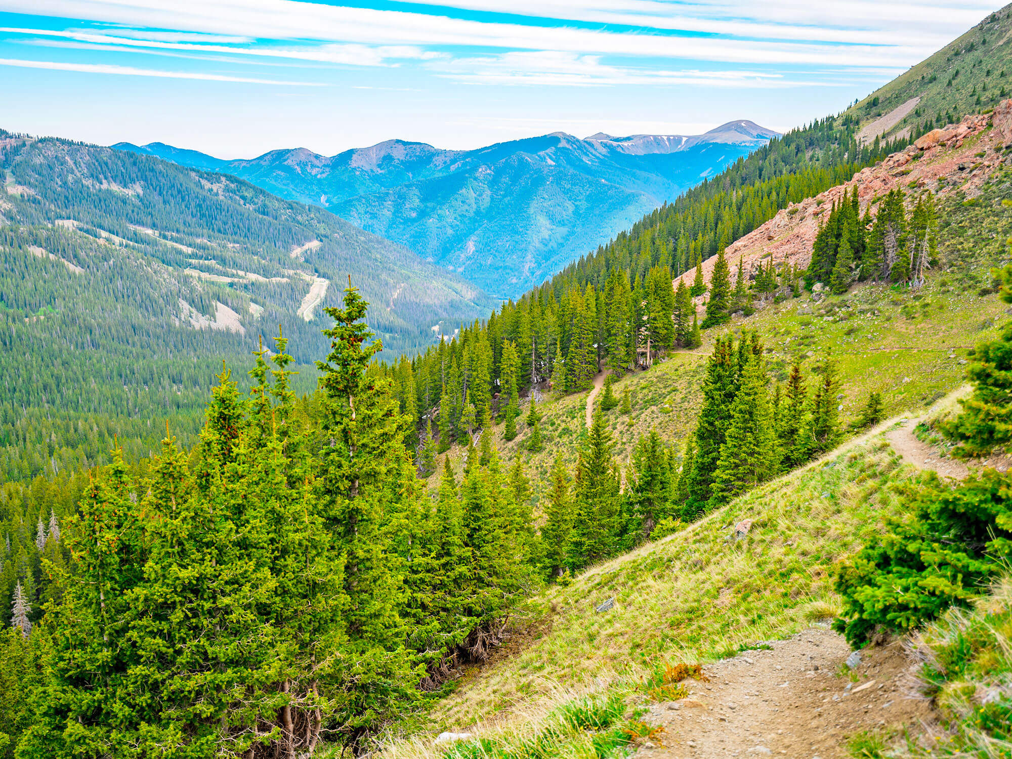
5. Nevada – 5,500 Feet

Highest elevation: 13,140 feet
Lowest elevation: 479 feet
Nevada’s consistently high elevation is thanks to the state’s location on a plateau called the Nevadaplano. This means much of Nevada rests between 2,000 and 6,000 feet above sea level, enough to bring up its average elevation to 5,500 feet. Its highest point is Boundary Peak, a challenging summit located on the edge of the California-Nevada border in the White Mountain range. Nevada’s lowest elevation stands at 479 feet along the Colorado River, which forms its border with Arizona for 12 miles.
4. New Mexico – 5,700 Feet

Highest elevation: 13,161 feet
Lowest elevation: 2,842 feet
Home to both high plateaus and mountain ranges, as well as low canyons and valleys, New Mexico features a diverse topography. But overall, the state has a lofty average elevation of 5,700 feet. Its highest point is Wheeler Peak, near Taos Pueblo, located in the Sangre de Cristo Mountain Range in the southernmost section of the Rockies. The high-altitude trail to reach this alpine summit begins in Taos Ski Valley before traveling through miles of wilderness. New Mexico’s lowest point is Red Bluff Reservoir, a popular fishing destination located on a dam in the Pecos River.
3. Utah – 6,100 Feet

Highest elevation: 13,528 feet
Lowest elevation: 2,000 feet
Utah’s high average elevation of 6,100 feet is boosted by part of the state being located on the Colorado Plateau. As a result, Utah’s largest city, Salt Lake City, sits at 4,225 feet above sea level, while nearby Park City is located at 7,000 feet. The plateau also includes the Uintas, a towering mountain range that contains King’s Peak, Utah’s highest summit. In the state’s opposite corner, the lowest point of elevation is the Beaver Dam Wash, a desert landscape that contains the likes of creosote bush, bighorn sheep, and Joshua trees.
2. Wyoming – 6,700 Feet

Highest elevation: 13,804 feet
Lowest elevation: 3,099 feet
With 109 mountain ranges and 2,471 named mountains, Wyoming has an average elevation of 6,700 feet. However, the state’s most iconic peak, Grand Teton, is not its highest. Located deep in the Wind River Range, Gannett Peak is taller than Grand Teton by a mere 29 feet. As one of the more difficult climbs that Wyoming has to offer, accessing Gannet Peak requires a long approach, technical climbing, and pricey equipment. The state’s lowest point is the Belle Fourche River, a tributary of the Cheyenne River that translates to “beautiful fork” in French.
1. Colorado – 6,800 Feet

Highest elevation: 14,433 feet
Lowest elevation: 3,315 feet
With 58 mountains over 14,000 feet, it’s no surprise that Colorado has the highest average elevation in the country (6,800 feet). For locals, “bagging a fourteener” is a rite of passage, some of whom make a goal of climbing as many as possible. Mount Elbert is the tallest of these formidable peaks. Despite being the second-highest peak in the contiguous United States, Mount Elbert’s summit is considered one of the easier fourteeners to climb. Colorado’s lowest point is the Arikaree River, which flows through Yuma Country before crossing into Kansas.
Lowest Average Elevations
5. Rhode Island – 200 Feet

Highest elevation: 812 feet
Lowest elevation: Sea level
Above all else, Rhode Island’s geography stands out for being diminutive. Not only is it the smallest state in the country at 1,214 square miles, but it also has one of the lowest mean elevations — just 200 feet. The state’s lowest point is at sea level, found along the Ocean State’s 400 miles of Atlantic coastline. Rhode Island’s highest point, meanwhile, is Jerimoth Hill, located in the state’s hillier western region. Climbing 812 feet and marked by two geological markers, the highpoint is easily accessed via a short trail through the woods.
4. District of Columbia – 150 Feet

Highest elevation: 410 feet
Lowest elevation: 1 foot
While not technically a state, the District of Columbia is notable for its low average elevation. It’s a common misconception that our nation’s capital was built on a swamp. In reality, Washington, D.C., was built on the banks of the Potomac River, on mostly flat land that sloped between a few other waterways. The highest elevation in the District of Columbia stands at 410 feet at Fort Reno, strategically built during the Civil War to guard against the Confederate Army. Its lowest elevation is the Potomac River, which flows for 400 miles from West Virginia to the Chesapeake Bay. The river demarcates the border between Maryland and the District of Columbia.
2. Florida – 100 Feet (Tie)

Highest elevation: 345 feet
Lowest elevation: Sea level
With access to both the Atlantic Ocean and the Gulf of Mexico, Florida has a whopping 8,436 miles of coastline to explore. Despite a peak elevation of 345 feet (which can be found on Britton Hill in Walton), Florida is tied with Louisiana as having the second-lowest average elevation in the country. Still, with miles of pristine beaches, coastal waters, and plenty of palm trees, residents of the Sunshine State don’t seem to care about its lack of hills. But if you do want to experience the state’s highest elevation, it’s accessible via an easy half-mile trail through a forested path.
2. Louisiana – 100 Feet (Tie)

Highest elevation: 535 feet
Lowest elevation: -8 feet
One of Louisiana’s biggest and most popular cities, New Orleans, contributes to its low average elevation of just 100 feet. Built on a swamp, and sitting eight feet below sea level, the city’s loose soil, rising sea levels, and poor city drainage contribute to its negative elevation. Even though experts predict New Orleans will continue to shrink an inch every three years, fortunately, the rest of the state isn’t underwater. Farther north, Driskill Mountain is the highest summit in the state, rising to 535 feet.
1. Delaware – 60 Feet

Highest elevation: 448 feet
Lowest elevation: Sea level
Home to 381 miles of shoreline, the coastal state of Delaware has the lowest mean elevation in the country, measuring 60 feet above sea level. However, the state isn’t completely flat. Ebright Azimuth, Delaware’s highest point, has a summit of 448 feet. Marked by a sign on Ebright Road, the state’s highest point can be accessed by car, followed by a short walk on foot. Even though it’s not a tall summit, it is a popular spot with “Highpointers,” a group of people who seek to reach the highest point in every state.
More from our network
Daily Passport is part of Inbox Studio, an email-first media company. *Indicates a third-party property.


