Post Banner Image
Culture

The Best Places Around the World To Visit for Halloween
By Nicole Villeneuve
Read time: 6 minutes
September 26, 2023
Updated: October 9, 2025

The Best Places Around the World To Visit for Halloween

By Nicole Villeneuve
Author
Nicole Villeneuve
Nicole is a writer and researcher with over 15 years of experience seeking out arts, culture, and lifestyle stories in places like remote northern Quebec and the unforgettable streets of Amsterdam. Her work has also appeared in PureWow, Brit + Co, AUX TV, and CBC.

Halloween may be known for costumes and candy, but the holiday originated as an ancient Celtic harvest festival. On the night of October 31 — the night before the new year according to the Celtic calendar — lines between the living and the dead were blurred. Ghosts and spirits were thought to roam the earth, and the occasion was marked by bonfires and costumes designed to scare away evil forces. While these ancient traditions have evolved into more lighthearted activities such as jack-o’-lanterns, haunted houses, and trick-or-treating, the supernatural spirit of the holiday remains. That’s particularly true in these eight cities around the world, which honor the Halloween spirit in unique ways. 

Transylvania, Romania
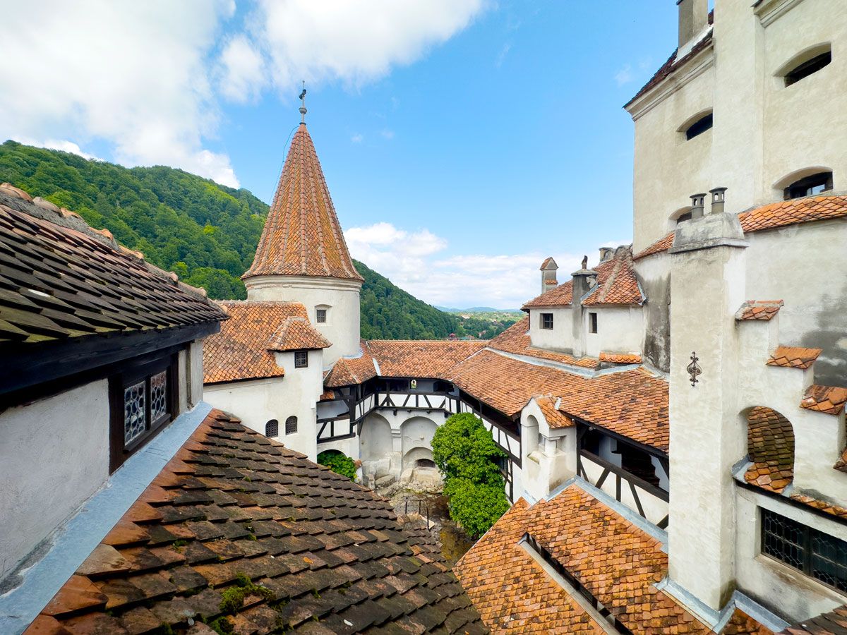
Traditional architecture of Transylvania, Romania
Photo credit: eucyln/ iStock

The Transylvania region of central Romania is renowned for its rich history and stunning landscapes, but its associations with vampire lore make it a required destination for Halloween enthusiasts. Bram Stoker found inspiration for his famous 1897 novel Dracula in the historical Romanian military figure Vlad the Impaler (also known as Vlad III or Vlad Dracula), and the author designated the real-life Bran Castle as the monster’s home. On Halloween, Bran Castle — now widely known as Dracula’s Castle — hosts tours of the storied hallways and dungeons, after which guests can feast on traditional Romanian food and dance the night away.

Transylvania is not solely defined by its vampire legends, though — the region’s storybook medieval towns, fortified castles, and mist-shrouded forests contribute to its eerie atmosphere, especially during the Halloween season.

Anoka, Minnesota
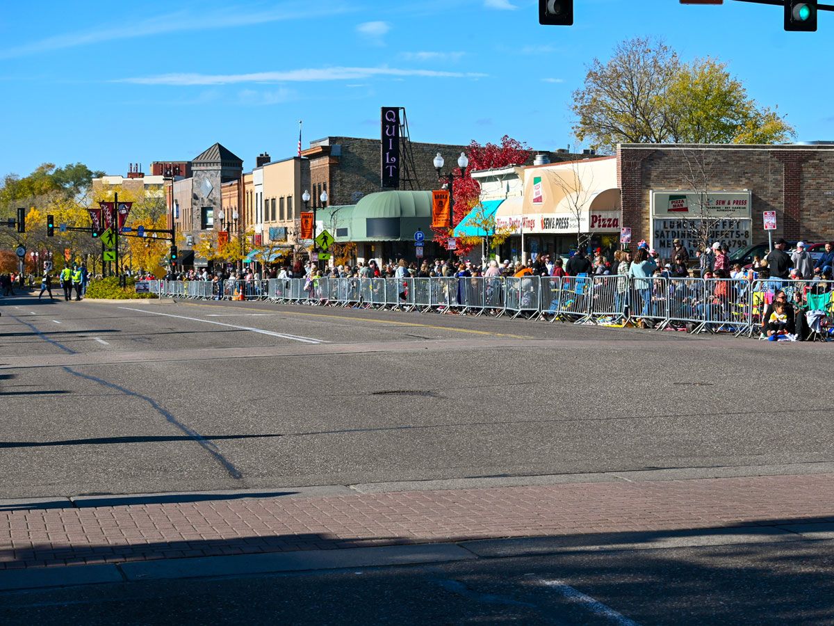
Spectators lined up for parade in Anoka, Minnesota
Photo credit: Jeff Wallager/ iStock

This small Minnesota city is known as the Halloween Capital of the World — and with good reason. Anoka was the first U.S. city to host an organized Halloween celebration. On November 1, 1919, the residents of Anoka awoke to find cows roaming through main streets and outhouses turned upside down — the aftermath of Halloween pranks orchestrated by local youths. In an effort to prevent similar destruction in the future, the community rallied together the following year to organize an official celebration.

The event has since grown to take over the entire month of October, with parades, haunted houses, movie nights, and more festivities. In 1937, Congress officially declared Anoka as the Halloween Capital of the World, and residents wear the title proudly to this day.

Mexico City, Mexico
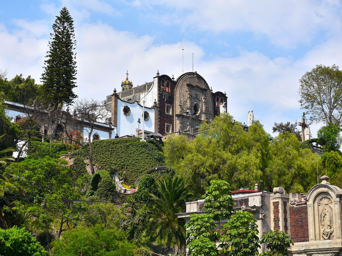
Ivy-covered walls and church on hilltop in Mexico City, Mexico
Photo credit: Anne Czichos/ iStock

Halloween isn’t a traditional Mexican holiday, but Mexico City has embraced the spooky spirit, blending ancient traditions with contemporary celebrations. One of the biggest seasonal draws is the celebration of Día de los Muertos (Day of the Dead). From late October to early November, the city — along with much of Latin America — comes alive with colorful ofrendas (altars) and marigold-adorned cemeteries, where families honor and evoke their deceased loved ones. 

A familiar sight during Día de Los Muertos is la catrina, a traditional skull painted with decorative makeup. The skull has become an emblem of the festival and of Mexican traditions and beliefs surrounding death and the afterlife — that it is to be honored instead of feared. Other historic neighborhoods, such as Xochimilco, offer their own eerie attractions — as its name suggests, the Island of the Dolls is covered in decaying dolls. 

New Orleans, Louisiana
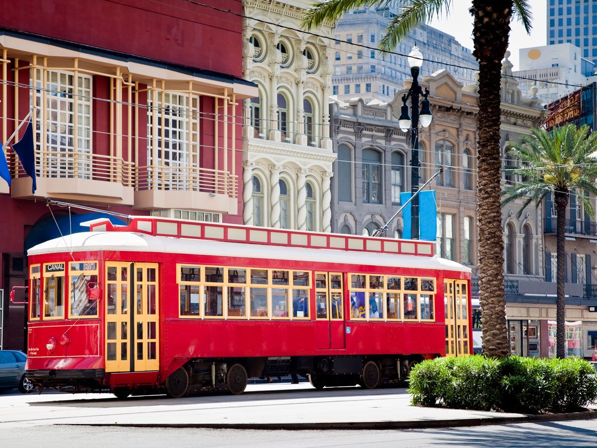
Red-painted streetcar in New Orleans, Louisiana
Photo credit: drnadig/ iStock

New Orleans has earned a reputation as one of America’s most haunted cities due to its rich — and often tragic — history. Among the many reported ghostly encounters, the spirit of Marie Laveau (aka the Voodoo Queen) might be the most famous. Visitors have claimed to witness her apparition wandering the streets of the French Quarter, while others swear they can feel her physical presence around her tomb in St. Louis Cemetery No. 1.

The Big Easy’s distinctive above-ground graves create a uniquely eerie atmosphere, and while they’re popular tourist destinations throughout the year, Halloween is when they truly shine. The city also hosts costume parades and parties, a Voodoo festival, haunted tours, and elaborately decorated homes.

Edinburgh, Scotland
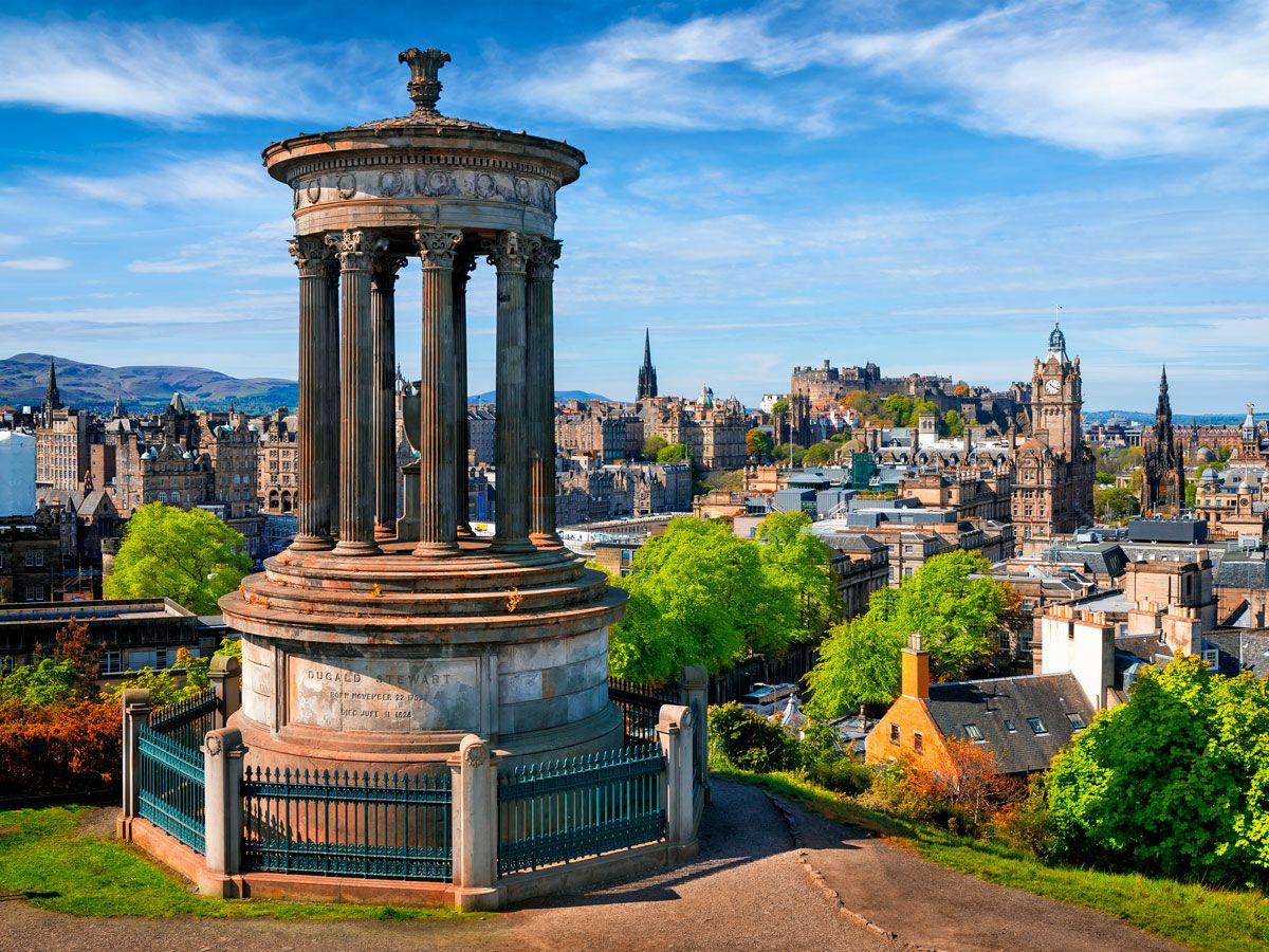
Monument on hilltop overlooking Edinburgh, Scotland
Photo credit: ewg3D/ iStock

With a past marked by bloody battles, witch hunts, and other sinister tales, Edinburgh’s ancient streets are a major draw for Halloween lovers. The iconic Edinburgh Castle is considered the country’s most haunted place to visit. The castle was originally built in the 12th century as a military fortress, and alleged sights have included ghosts that still haunt its ancient underground dungeons, a missing piper, a phantom dog, and a headless drummer roaming the grounds. 

The Samhuinn Fire Festival is also held in the Scottish capital on October 31, celebrating ancient Celtic traditions with fire, performances, drumming, and costumes of mythical creatures and deities. The Halloween spirit is strong along the city’s famous Royal Mile, too, a historic street filled with narrow alleyways (known as “closes”) and haunted underground chambers.

London, England
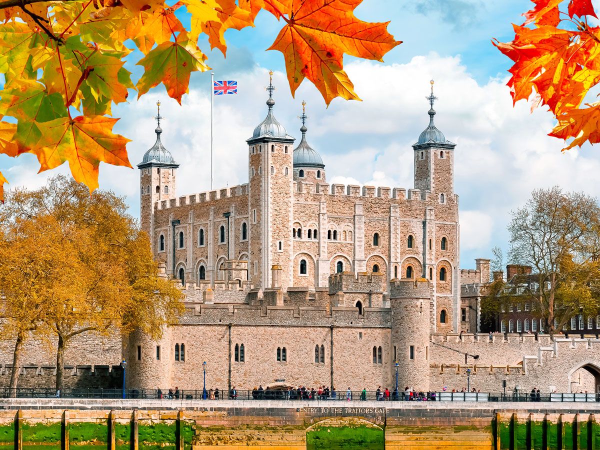
Tower of London framed by autumn leaves
Photo credit: ewg3D/ iStock

England’s capital is home to plenty of haunted historical sites, one of the most famous being the Tower of London. The fortress’s grim history of royal beheadings, including those of Anne Boleyn and Lady Jane Grey, contribute to its enduring tales of paranormal activity. On Halloween, the Tower plays into its past by decorating the grounds and hosting an immersive haunted house.

One of the world’s most haunted theaters is also in London, and during Halloween, the venue offers late-night tours. Over the years, actors and staff at the Theatre Royal Drury Lane (nicknamed “the Lane”) have experienced encounters with a mysterious figure they’ve dubbed the Man in Gray. Wearing a powdered wig, a gray coat, and a distinctive hat, he is said to walk back and forth across the theater’s balcony before disappearing into the wall. 

Boyne Valley, Ireland
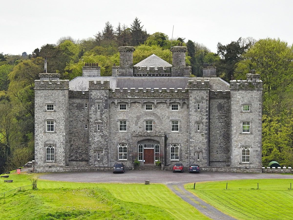
Castle in Boyne Valley, Ireland
Photo credit: Derick Hudson/ iStock

What better place to visit for Halloween than the place where it all began? Halloween originated over 2,000 years ago as a pagan Celtic festival that celebrated the end-of-summer harvest with fires, dancing, and costumes. The Boyne Valley region is home to the megalithic tombs of Newgrange, Knowth, and Dowth — which are believed to have also served as solar calendars. On the autumnal equinox, the sun aligns with the passage of Newgrange, illuminating its inner chamber in a stunning spectacle that highlights the mystical nature of the season. 

Boyne Valley celebrates its Halloween heritage with yearly festivals and events, including the spooky Spirits of Meath. The county’s Púca Festival features live comedy and podcast events, performances from world-renowned musicians, and tours of some of the area’s significant historical sites. 

Salem, Massachusetts
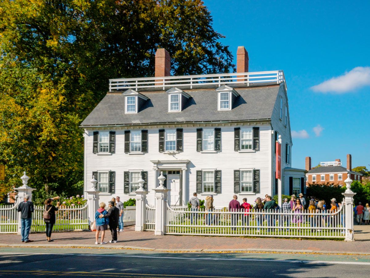
Colonial house in Salem, Massachusetts
Photo credit: HABesen/ iStock

Salem is infamous for its 1692 witch trials, and the Massachusetts city leans into its history when Halloween rolls around. Fueled by superstition and hysteria, the trials resulted in the tragic hangings of 19 people accused of witchcraft. But today, the people of Salem — as well as more than 100,000 visitors —  honor this dark chapter of American history with a month full of festivities.

By early October, Salem is decked out and ready for the Haunted Happenings Grand Parade, which features elaborate costumes, floats, and live music. The city’s historical landmarks — such as the Salem Witch Trials Memorial and the House of the Seven Gables, whose original owner was accused of witchcraft and executed — offer immersive experiences that explore the history of their hallowed grounds.

Post Banner Image
History

How 10 Iconic U.S. Landmarks Got Their Names

By Daily Passport Team
Read time: 6 minutes
September 22, 2023
Updated: September 22, 2023

How 10 Iconic U.S. Landmarks Got Their Names

By Daily Passport Team
Author
Daily Passport Team
Daily Passport writers have been seen in publications such as National Geographic, Food & Wine, CBC, Condé Nast Traveler, and Business Insider. They're passionate about uncovering unique destinations and sharing expert tips with curious travelers.

Often, the stories behind the names of America’s most famous landmarks are just as fascinating as the sites themselves — because not every name is as straightforward as the Lincoln Memorial or the Washington Monument. From the surprising figure who inspired the name of Mount Rushmore to the original, full name of the Statue of Liberty, discover the stories behind the names of 10 iconic U.S. landmarks.

Alcatraz Island – San Francisco, California

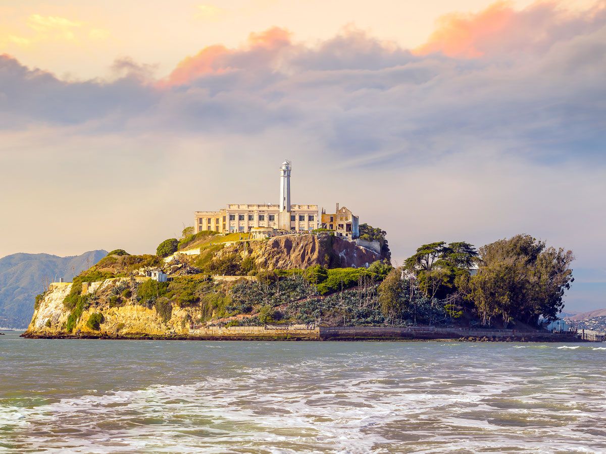
View of Alcatraz Island across the San Francisco Bay
Photo credit: f11photo/ Shutterstock

Alcatraz Island didn’t always hold the most infamous prison in the United States. In 1775, when the Spanish explorer Juan Manuel de Ayala first sailed into San Francisco, he named the three islands Isla de Los Alcatraces. Over time, the name was shortened to Alcatraz, which translates to “pelican” or “strange bird.” After the island became the site for the country’s most isolated federal prison years later, it earned the nickname “The Rock” due to its remote location in San Francisco Bay and for the way the island juts prominently out of the water.

Mount Rushmore – Black Hills, South Dakota

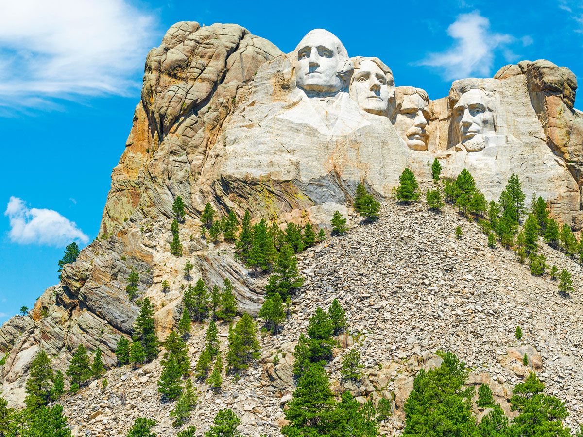
The rock-carved presidential faces of Mount Rushmore
Photo credit: Sébastien Lecocq/ Alamy Stock Photo

The iconic mountain that bears the giant stone faces of four U.S. Presidents is named after a lawyer from New York. In 1884, Charles E. Rushmore was sent to the Black Hills in South Dakota to secure land for tin mining (on lands considered sacred by the Lakota Sioux). He spent many weeks exploring the area with guides, and at one point, he inquired as to the name of an impressive peak nearby. Since the mountain had no name, a prospector with him replied, “We will name it now, and name it Rushmore Peak.” From then on, it was referred to as Rushmore Peak, Rushmore Mountain, or Rushmore Rock. When the national memorial was finished in 1927, it officially became known as Mount Rushmore.

White House – Washington, D.C.

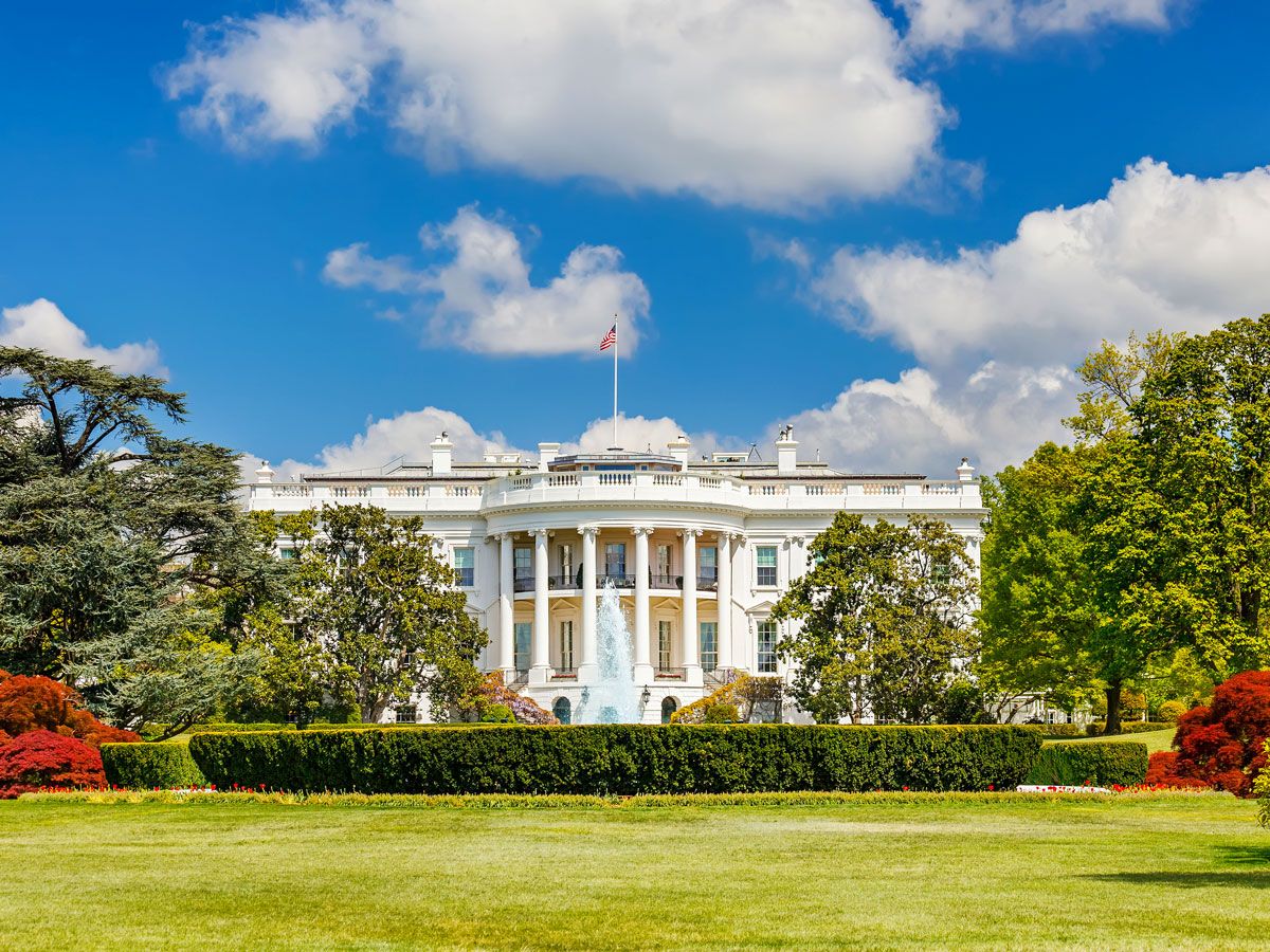
Image of the White House across the White House Lawn in Washington, D.C.
Photo credit: Sergey Borisov/ Alamy Stock Photo

Although it may seem obvious as to why the presidential mansion is referred to as the White House, there’s more to the story than the paint color. Before President Theodore Roosevelt began calling his residence the White House in 1901, it was more often referred to as the “President’s House” or the “Executive Mansion.” However, since the homes of U.S. governors were also called executive mansions, Roosevelt named his home the “White House” in order to distinguish it above all others. The house’s color resulted from a lime-based whitewash that was applied in 1798 to protect the exterior from cracking.

Cloud Gate – Chicago, Illinois

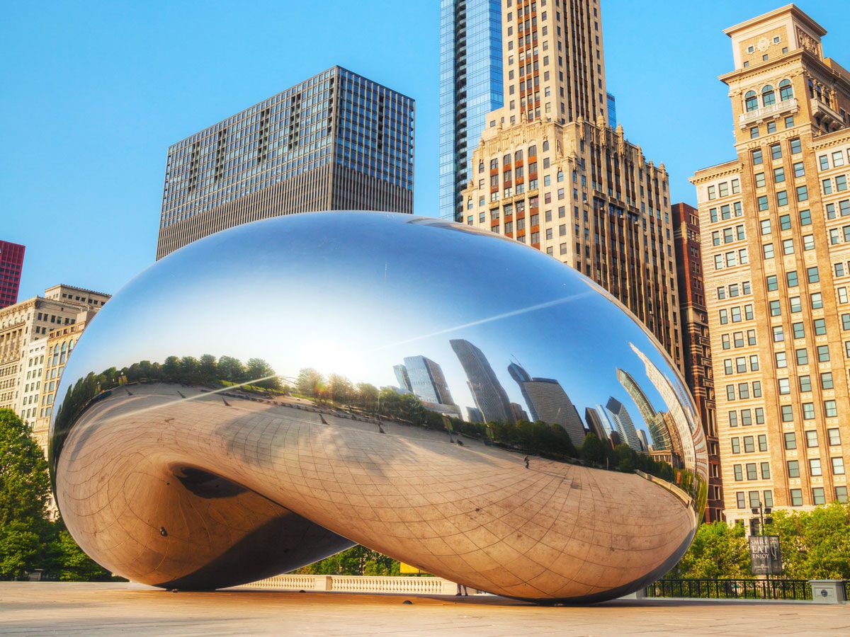
Reflective bean-shaped Cloud Gate sculpture in downtown Chicago
Photo credit: Andriy Kravchenko/ Alamy Stock Photo

Although it’s most commonly called “The Bean,” in reference to its distinctive shape, the actual name of Chicago’s most famous sculpture is Cloud Gate. It was unveiled in Millennium Park in 2006 and has since become one of the city’s most popular attractions. Designed by British sculptor Anish Kapoor, Cloud Gate remains his most famous work to date. Although the piece is magnificent, the name is deceptively simple: Kapoor chose Cloud Gate for the clouds that can be seen in the sculpture’s reflective surface and for the way the curved underside serves as a gate to the park.

Devils Tower – Black Hills, Wyoming

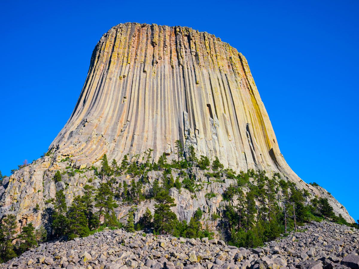
Image of Devils Tower rock formation in Wyoming
Photo credit: JWCohen/ Shutterstock

Devils Tower is an impressive rock formation that stands 867 feet high above the Black Hills of northeastern Wyoming and is considered sacred by Indigenous cultures. When settlers first arrived in this part of the country, the rock was labeled on maps as “Bear Lodge,” a translation for the common Lakota name Mato Tipila. However, the name changed when Colonel Richard Irving Dodge led a geology and mapmaking expedition to the site. Dodge wrote that the Indigenous people called the place “bad god’s tower,” which eventually led to the adoption of the name Devils Tower. However, this is believed to be a bad translation, as no records have ever shown that Native Americans considered the tower to be associated with evil spirits.

Statue of Liberty – New York, New York

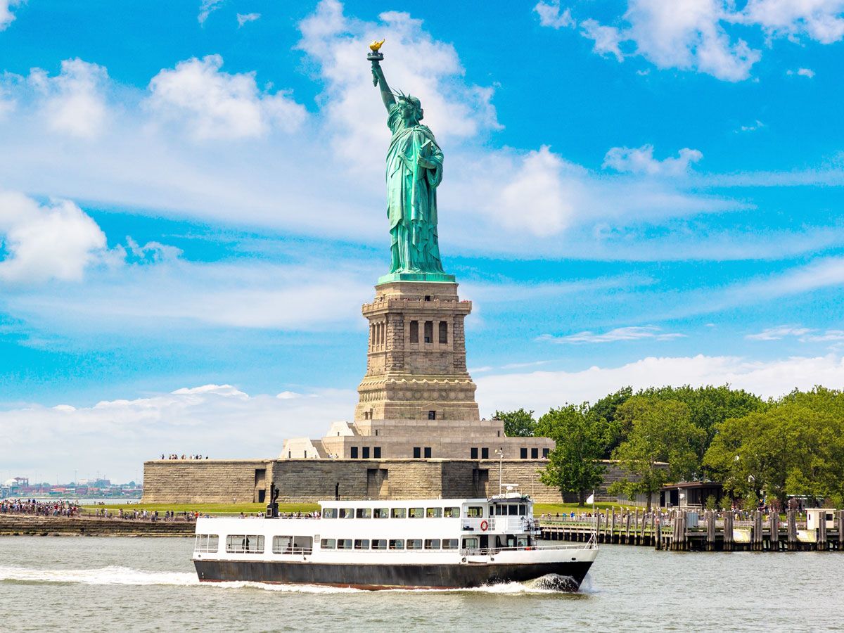
Boat cruising past Statue of Liberty in New York Harbor
Photo credit: Sergii Figurnyi/ Shutterstock

The Statue of Liberty has long stood as a symbol of freedom and hope for U.S. residents and newcomers, but when first built, Lady Liberty went by a different name. Designed by the French sculptor Frederic-Auguste Bartholdi and gifted from France to the U.S. in honor of the centennial celebration, the Statue of Liberty was originally entitled “Liberty Enlightening the World.” The 305-foot statue was unveiled on Liberty Island in New York’s Upper Bay on October 28, 1886, but eventually the statue’s lengthy title was dropped in favor of the simpler “Statue of Liberty.”

Golden Gate Bridge – San Francisco, California

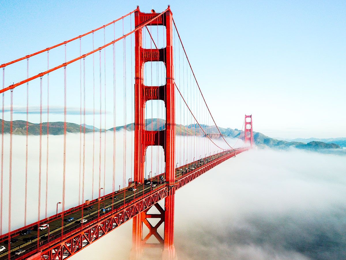
The Golden Gate Bridge above the fog in San Francisco, California
Photo credit: titipongpwl/ Shutterstock

Easily San Francisco’s most recognizable landmark, the Golden Gate Bridge is named not for its reddish-orange hue but rather for the body of water it crosses, the Golden Gate Strait. The mile-wide strait, which connects San Francisco Bay and the Pacific Ocean, was named in 1846, a few years before the California Gold Rush. It was at this time that the explorer John C. Fremont came across the strait and recalled the Golden Horn of the Bosporus in Constantinople (now Istanbul). He named the strait the “Golden Gate,” translated from the Greek word Chrysopyla, in honor of another body of water halfway around the world.

Hoover Dam – Arizona/Nevada

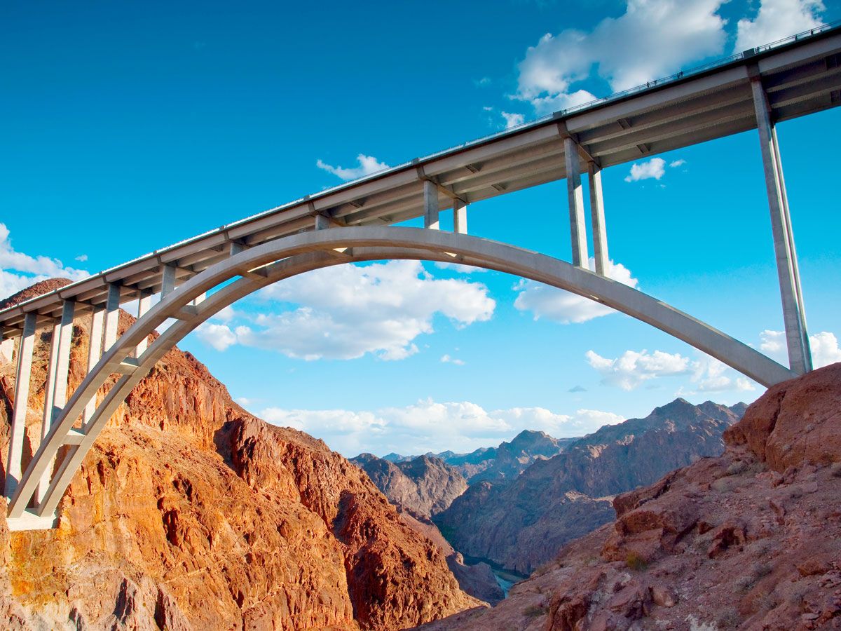
Looking up at roadway bridge over the Hoover Dam
Photo credit: Darren J. Bradley/ Shutterstock

Before it was officially declared the Hoover Dam, this marvel of modern engineering went by a few different monikers. Originally, it was known as the Boulder Canyon Project, which changed to the Black Canyon Project when the location was moved. It was then referred to as the Boulder Dam on legislation, and many assumed that to be the official name until the Secretary of Interior declared it the Hoover Dam in honor of the acting president, Herbert Hoover. The new name was controversial since Hoover was incredibly unpopular at the time due to the Great Depression. It wasn’t until 12 years later that it formally became the Hoover Dam, after a House Resolution passed to certify the name.

Old Faithful – Yellowstone National Park, Wyoming

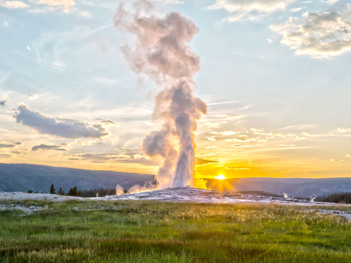
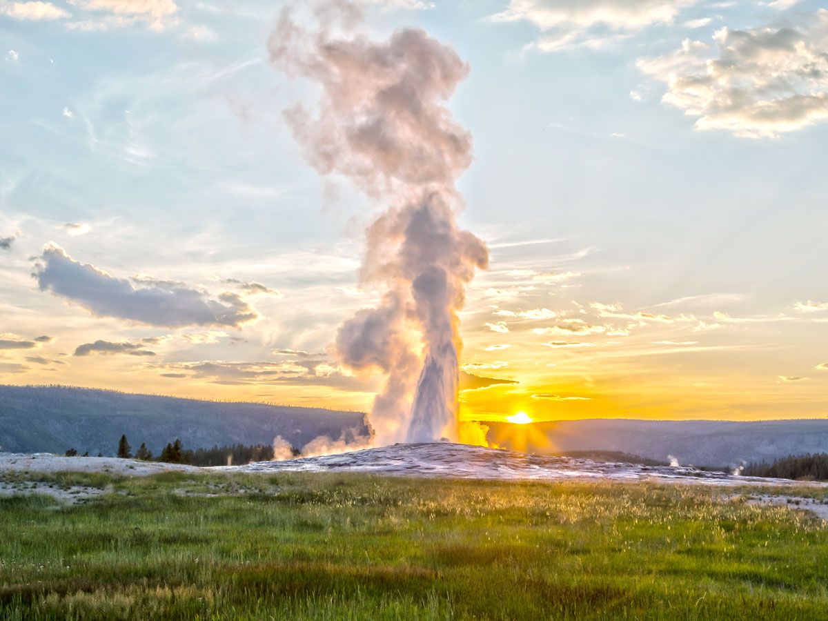
Old Faithful Geyser erupting at sunrise in Yellowstone National Park
Photo credit: Susanne Pommer/ Shutterstock

Located in America’s first national park, Yellowstone, Old Faithful draws around 4 million visitors annually. The powerful geyser was named by the members of the Washburn Expedition of 1870, who discovered that it erupted with reliable regularity. It was the first geyser to be given a title in the park, and the nickname stuck — today, the geyser still erupts every 91 minutes. As for Yellowstone National Park itself, it was named for the Yellowstone River, which runs through the park and flows into Yellowstone Lake. The Yellowstone River’s first incantation was Mi tse a-da-zi, which translates to “Yellow Rock River” in the language of the Minnetaree people.
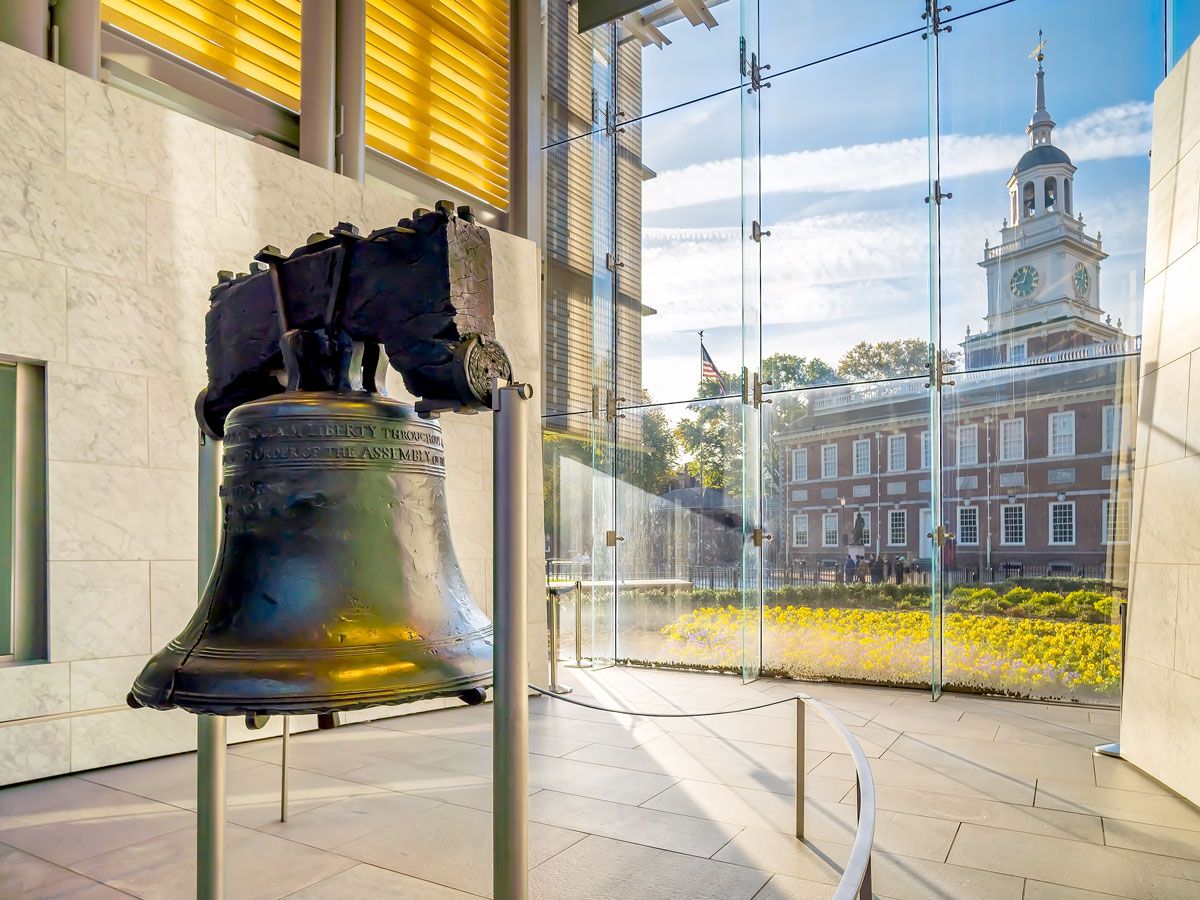
Liberty Bell – Philadelphia, Pennsylvania 

Image of the Liberty Bell in Philadelphia, Pennsylvania
Photo credit: f11photo/ Shutterstock

Although the famously cracked bell is widely known as a symbol of independence, Liberty Bell wasn’t always its name. After it was cast in London and hung in Philadelphia’s State House, it was originally referred to as the “State House Bell.” It was rung on July 8, 1776, to celebrate the first public reading of the Declaration of Independence, and it later became a powerful symbol of the anti-slavery movement in the 1830s. With an inscription bearing the motto, “Proclaim liberty throughout all the land unto all the inhabitants thereof,” the iconic landmark represented the ideal of freedom to the abolitionists who coined the name Liberty Bell.

Post Banner Image
Culture

5 Under-the-Radar International Wine Regions to Visit

By Cynthia Barnes
Read time: 3 minutes
September 22, 2023
Updated: September 22, 2023

5 Under-the-Radar International Wine Regions to Visit

By Cynthia Barnes
Author
Cynthia Barnes
Cynthia kicked around the world for a while before landing in Colorado. Her work has appeared in Food & Wine, the Boston Globe, and National Geographic, among others. She loves dives — both scuba and bars — baseball, the Oxford comma, and live music.

Bordeaux. Burgundy. Chianti. These names are world-famous for a reason — the centuries-old vineyards in these regions produce some of the most revered wines in the world. But that popularity can present a challenge when it’s time to plan a wine getaway. And while you won’t find any vineyards in Antarctica, the rest of the world is rich in wine-producing regions that offer fine vintages with fewer crowds. If you’re seeking the festive pop of a cork or the taste of unique terroir at an off-the-beaten path destination, here are five lesser-known and underrated international wine regions to explore. 
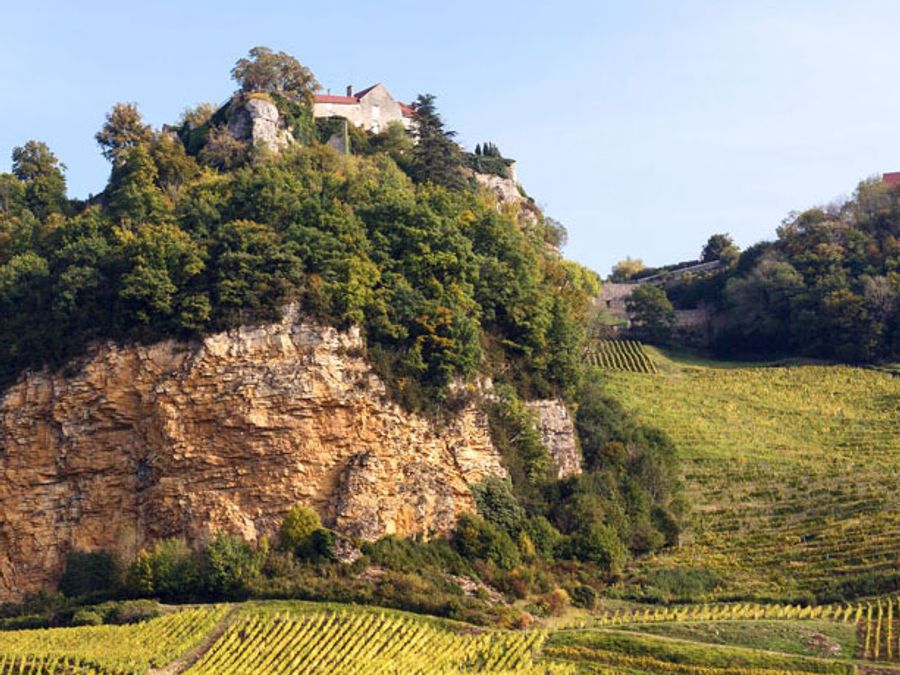
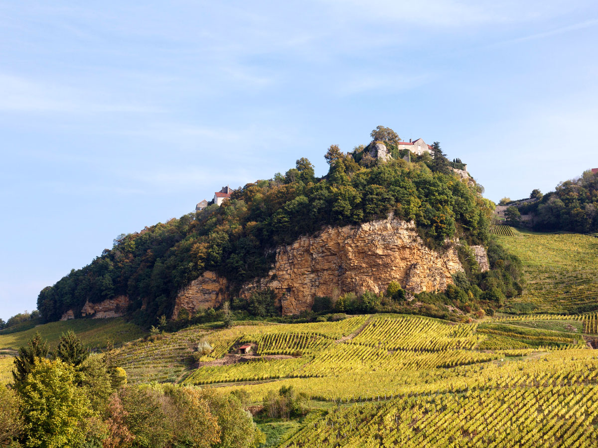
Jura – France

Vineyards covering rolling hills with house on hilltop in Jura, France
Photo credit: PearlBucknall/ Alamy Stock Photo

Often called “France’s best-kept wine secret,” the Jura region is a favorite among in-the-know wine aficionados. Sandwiched between better-known Burgundy and the Swiss border, these cool mountains produce quirky and memorable wines that are often difficult to source in the United States. Savagnin is an under-the-radar local grape, and a technique known as sous-voile (under the veil) produces an oxidized wine known as Vin Jaune. Aged for six years, it has a nutty character that pairs well with Jura’s distinctive local cheese.

Canary Islands – Spain

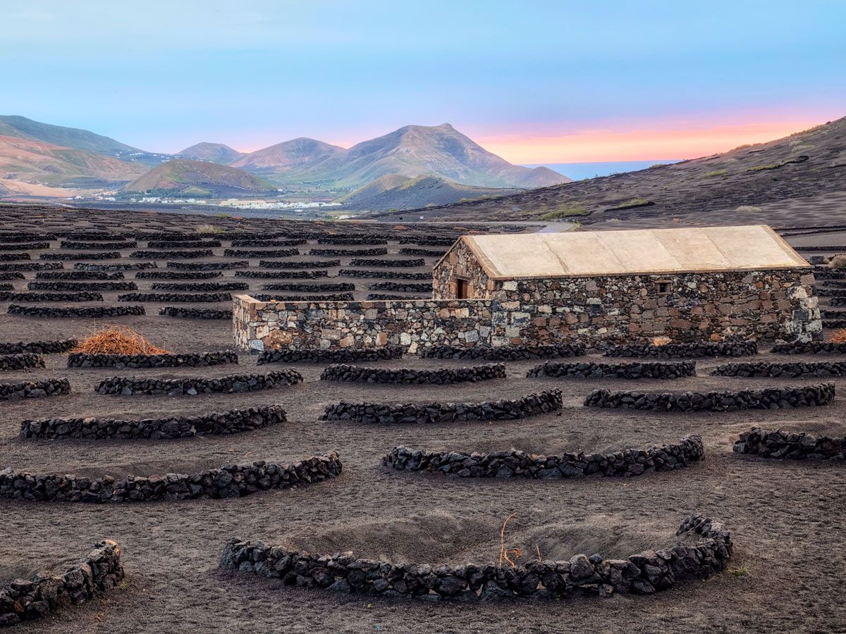
Barren vineyard in the Canary Islands with mountains and sea in the distance
Photo credit: Joana Kruse/ Alamy Stock Photo

Tenerife is the largest and most popular of the Canary Islands, where wine has been produced since the Spaniards colonized the archipelago in the 15th century. Lying 60 miles off the coast of Morocco in the Atlantic Ocean, the Canary Islands escaped the phylloxera insect scourge, which affected many Old World vines in the 19th century, and so they contain some of the few remaining ungrafted vitis vinifera (common grape) vines in the world. There are 20 recognized unique grape varieties produced on the island, including Marmajuelo, a rarely cultivated white wine. Tenerife’s beautiful climate and mineral-rich volcanic soil is beautifully expressed in wines made from popular grapes like Listán Negro and Malvasia.

Okanagan Valley – Canada

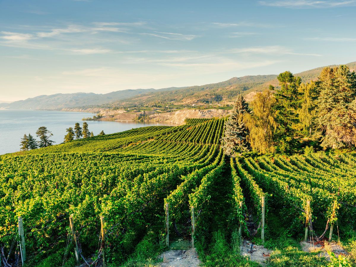
Rows of grape vines in British Columbia's Okanagan Valley
Photo credit: ronnybas/ Alamy Stock Photo

British Columbia’s Okanagan Valley has both stunning scenery and a stunningly diverse range of climates — from cool, green hills to the country’s only desert. This diversity nurtures an equally wide variety of grapes, and Okanagan’s relatively fledgling wine industry is attracting attention from connoisseurs around the globe. The valley has almost 200 wineries, along with many creative restaurants. In the north, try a distinctive cool-climate Riesling from Tantalus Vineyards. Then head south for bold, Bordeaux-comparable reds like the Gamay Noir from Desert Hills Estate Winery.

Lombardy – Italy

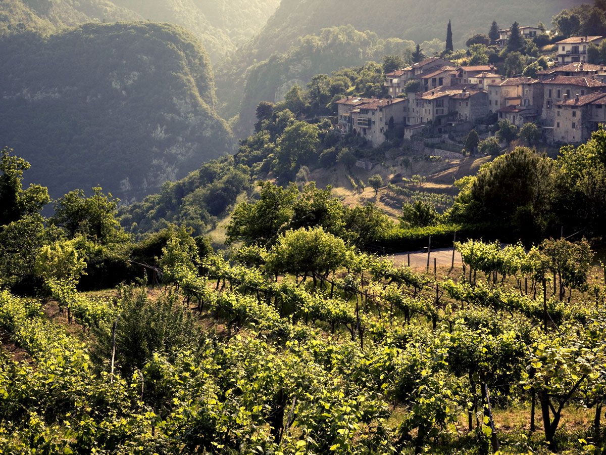
Vineyard and hillside homes in Lombardy, Italy
Photo credit: Jon Arnold Images Ltd/ Alamy Stock Photo

With its light golden hue and crisp elegant bubbles, Champagne is perhaps the most celebrated beverage in the world. And though the name Champagne is protected by an AOC (Appellation d’Origine Contrôlée, a controlled designation of origin) and is specific to the Champagne region of France, magnificent sparkling wines made with the same method (méthode Champenoise) can be found in many wine-producing regions. 

In the center of northern Italy — not far from the fashion capital of Milan — lies the region of Lombardy, Italy’s answer to Champagne. In the province of Brescia, Italian winemakers craft Franciacorta, a celebratory sparkling wine fermented from Chardonnay, Pinot Noir, and Pinot Blanc grapes. Effervescent and sunny, it is similar to Champagne in perhaps every category except price. The small region has more than 100 wineries, but Guido Berlucchi, where the wine was created, is a must-visit.

Maldonado – Uruguay

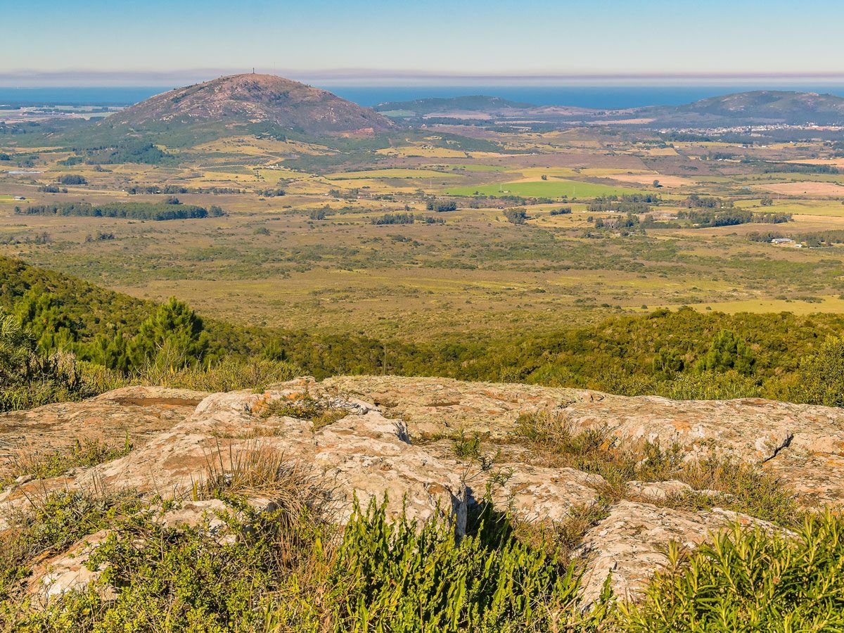
View of the Maldonado wine region in Uruguay from hilltop
Photo credit: DFLC Prints/ Shutterstock

South America is no stranger to good wine — Argentina’s robust reds are legendary and Chile boasts an enviable range of terroirs — but the up-and-comer in the Southern Hemisphere is definitely Uruguay. Located north of the resort town of Punta del Este along the Atlantic Ocean, the fast-growing Maldonado wine region is producing an interesting selection of high-quality red, white, and sparkling wines at affordable prices. Seek out wines with a Vino de Calidad Preferente (VСP) designation, which are made using only cultivated grape varietals, including Tannat, a grape which originally hails from Basque Country.

Post Banner Image
Outdoors

Where Are the World’s Oldest Forests?

By Bennett Kleinman
Read time: 6 minutes
September 22, 2023
Updated: September 22, 2023

Where Are the World’s Oldest Forests?

By Bennett Kleinman
Author
Bennett Kleinman
Bennett is a New York City-based staff writer for Daily Passport. He previously contributed to television programs such as the Late Show With David Letterman, as well as digital publications like the Onion. Bennett has traveled to 48 U.S. states and all 30 Major League Baseball stadiums.

Much like Earth’s mountain ranges and oceans, many of the planet’s forests date back millions of years. From the coasts of eastern Australia to the jungles of South America, these ancient and verdant woodlands offer a fascinating glimpse into Earth’s geological history. Forests are also known for their diverse ecosystems, containing some of the most unique and stunning animal and plant life found anywhere in the world. Whether you’re a nature lover looking to explore or simply curious about how the planet has evolved over time, here’s a look at six of the world’s oldest forests.

6. Réunion Island – France

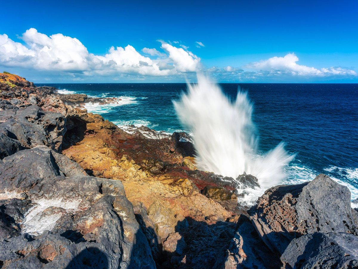
Waves crashing off the coast of Réunion Island
Photo credit: EndémikImages/ Alamy Stock Photo

The forests of Réunion Island formed in the wake of volcanic activity that created this island, located about 585 miles east of Madagascar, around 3 million years ago. Réunion Island National Park is known for massive volcanic craters located throughout the park grounds, but the park’s forests are equally spectacular — with many endemic species of both flora and fauna that make these woodlands extremely unique.

Some of these species include 40 types of birds, five types of bats, several giant turtles, and around 380 types of vascular plants. Réunion Island contains both cloud forests and subtropical rainforests, where you’re bound to encounter a green bourbon gecko or even a bird of prey known as the Réunion harrier. The coloration of the forests include tints of red that are more rare elsewhere, reflecting the island’s history of volcanic activity.

5. Hyrcanian Forests – Azerbaijan and Iran

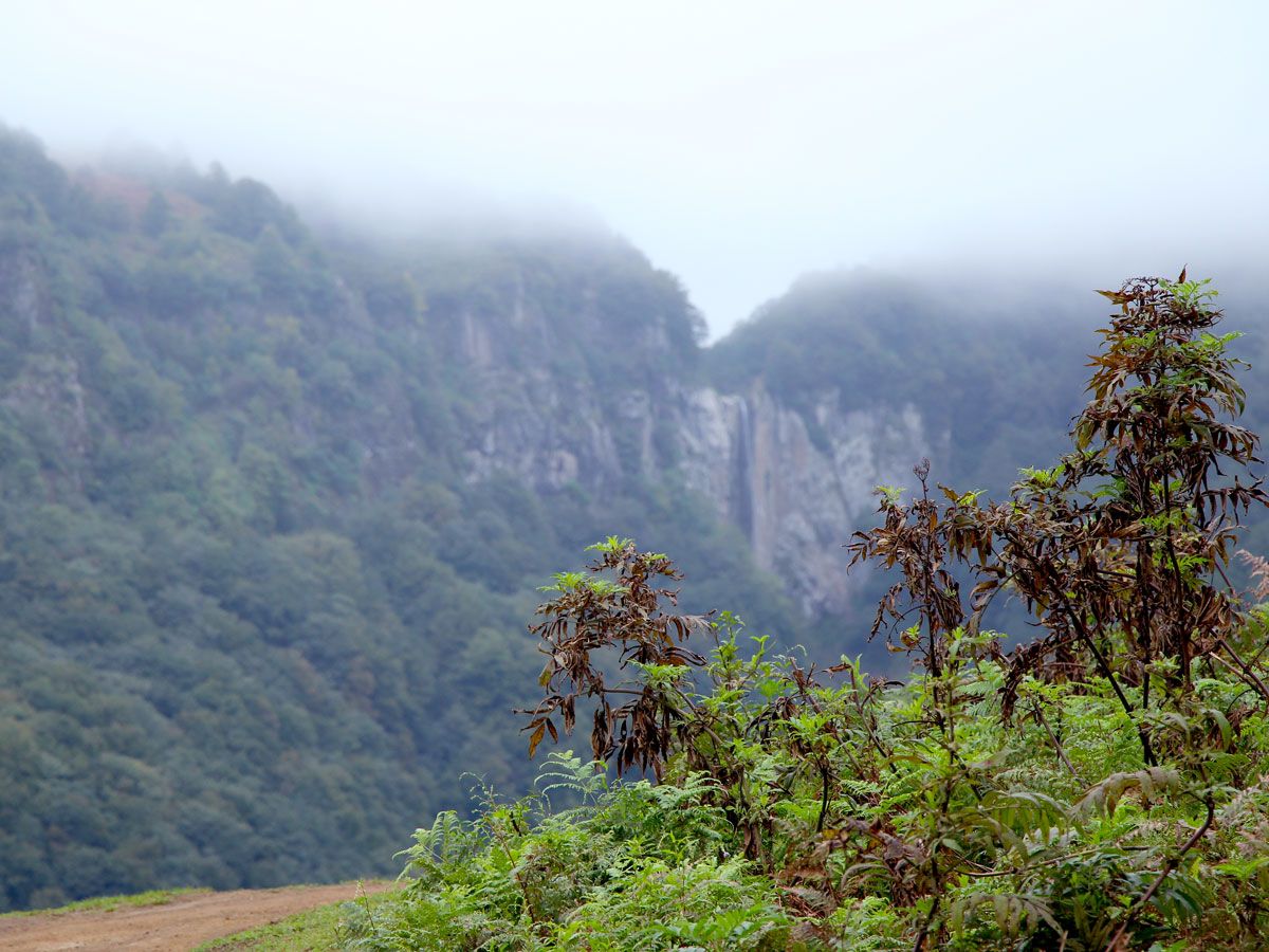
Fog-shrouded Hyrcanian forests of western Asia
Photo credit: Neda Aghaei – Hich Studio/ Shutterstock

The Hyrcanian forests of western Asia extend for 528 miles along the southern border of the Caspian Sea. Located in parts of Iran and Azerbaijan, these broad-leaved woodlands date back between 25 and 50 million years, and, remarkably, they survived amid colder temperatures of the Quaternary glaciation that occurred 2.58 million years ago. Temperatures rose in the wake of that time period, allowing for the expansion of the Hyrcanian forests. Today, these forests contain 44% of Iran’s vascular plants (with over 3,200 documented), despite only covering 7% of the country as a whole.

The region is known for its biodiverse animal life — the forests contain some 180 species of birds and 58 types of mammals, such as the Persian leopard and Persian wild goat. There are also wolves roaming the Hyrcanian region, which is apt considering the name of this forest derives from a term for “wolf’s land.” While many other Asian and European forests perished during previous ice ages, the survival of the Hyrcanian forests is what makes these ancient woodlands truly special.

4. Amazon Rainforest – South America

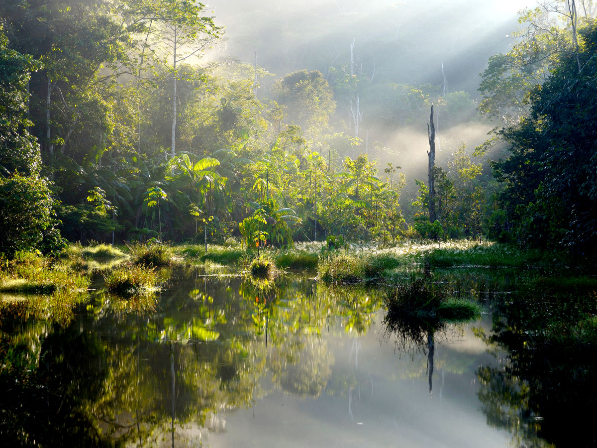
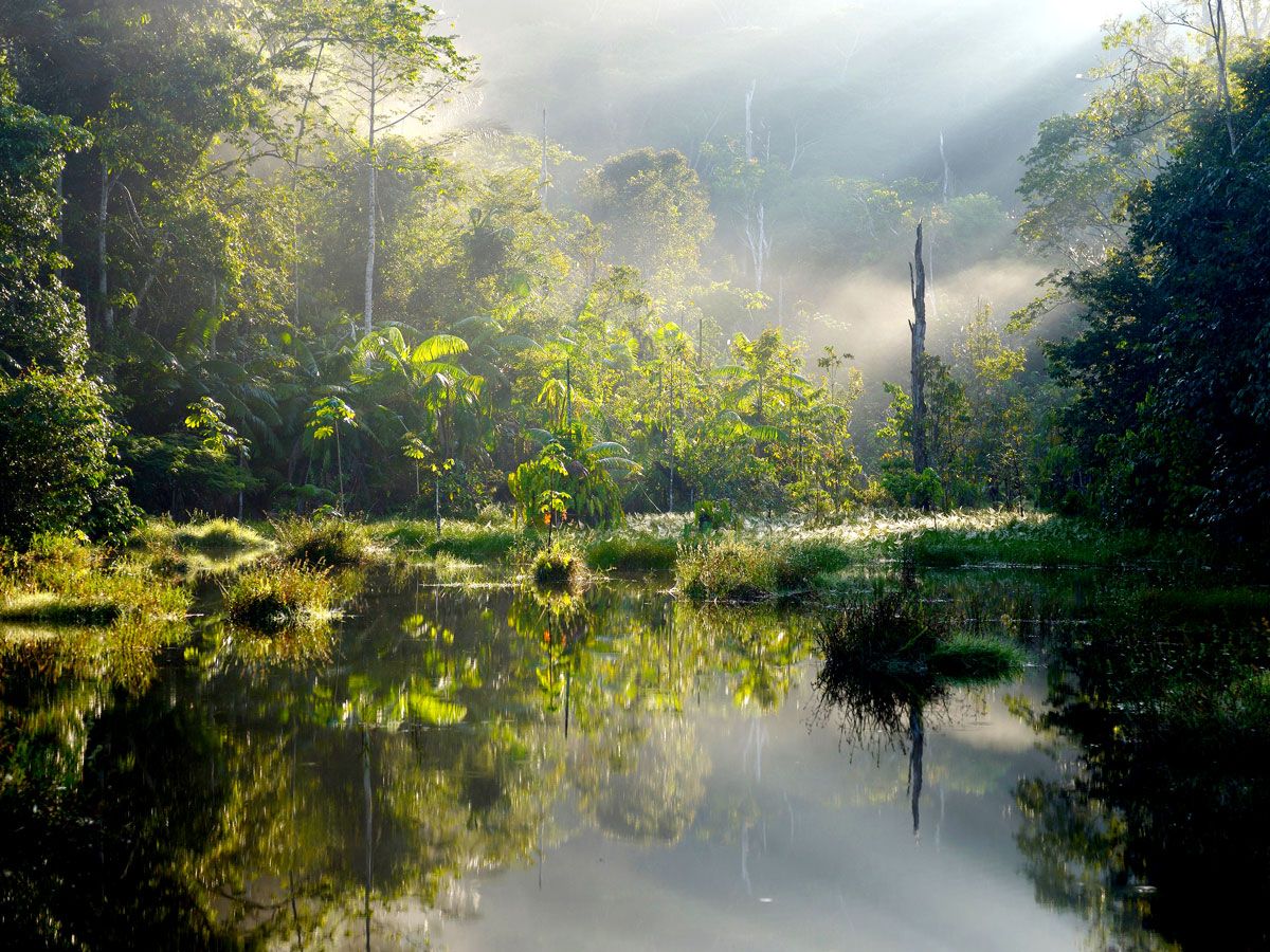
Sun shining through trees of the Amazon Rainforest
Photo credit: imageBROKER.com GmbH & Co. KG/ Alamy Stock Photo

The Amazon Rainforest covers a whopping 2.72 million square miles of South American terrain. That not only makes it the world’s biggest rainforest, but it is also larger than the next two biggest rainforests combined. The Amazon’s vast size is matched by its incredible age, with plant life dating back 55 million years. More than 390 billion trees are located in the Amazon, including 16,000 distinct species — a number roughly equivalent to 10% of all known tree species on the planet. These trees and the other rich vegetation of the Amazon produce approximately 20% of the world’s total oxygen through photosynthetic processes.

Though the Amazon sits in parts of nine different countries, around two-thirds of the forest is located in Brazil. Here, you can find a wide variety of animal life, including 3,000 fish species, 1,300 birds, and over 2.5 million individual insect species. The Amazon is also home to an estimated 400 to 500 Indigenous tribes, many of which have never interacted with the outside world due to the forest’s breadth, inaccessibility, and density. Just how dense? In some parts of the Amazon, only 1% of sunlight permeates the canopies all the way down to the jungle floor.

3. Taman Negara – Malaysia

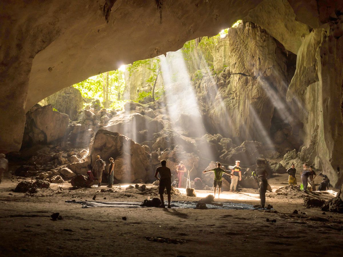
People in sunlight-filled cave in Taman Negara, Malaysia
Photo credit: Julian Peters/ Alamy Stock Photo

Taman Negara is a 130-million-year old tropical rainforest located in Peninsular Malaysia. Originally named after King George V, the rainforest was established as a national park in 1938, though its name was later changed to Taman Negara (the literal translation of “national park” in the Malay language). In addition to its ancient forests, the park also contains the highest mountain in Peninsular Malaysia — 7,175-foot-tall Mount Tahan — and serves as an important habitat for many animal species.

Within Taman Negara, you’re likely to find nearly 500 species of birds, 150,000 species of insects, and over 100 species of serpents crawling along the jungle floor. Rarer animals that roam these woodlands include elephants, tigers, and Sumatran rhinoceroses. The park is also home to at least 280 different types of trees, including the local Tualang tree, as well as other species known as Merbay, Meranti Tembaga, and Damar Hitam Siput. Visitors can take a stroll along the longest canopy walkway in the world, composed of 10 bridges spanning over 1,600 feet in length. The rainforest also contains a spectacular cave walk through Gua Telinga, providing a fascinating look at an underground river tunnel.

2. Borneo Lowland Rainforests – Indonesia, Malaysia, and Brunei

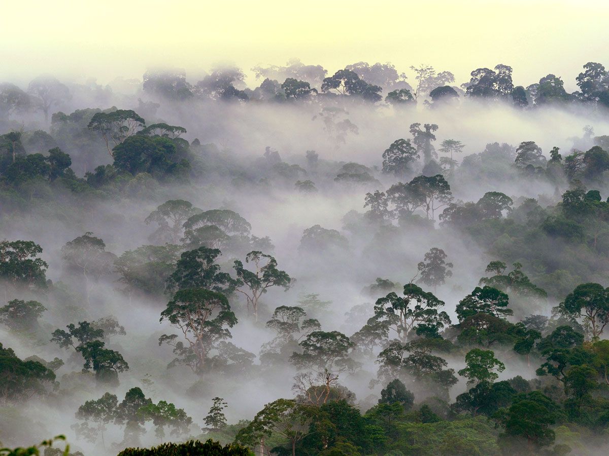
Aerial view of fog hugging treetops in Borneo Lowland Rainforests
Photo credit: Rolf Nussbaumer Photography/ Alamy Stock Photo

The Borneo Lowland Rainforests are located on their namesake Pacific island, which is shared between the nations of Indonesia, Malaysia, and Brunei. These forests formed as far back as 130 million years ago, and they contain a staggering 15,000 plant species and 3,000 individual tree types, not to mention 221 land mammal species and 420 types of birds. Pygmy elephants, clouded leopards, and orangutans are some of the many animals that roam these jungles. The forest also contains 155 endemic plant species, including an exceedingly rare flower known as Rafflesia arnoldii. This Indonesian national flower is ominously known as the corpse flower due to the pungent odor it emits. However, its size is what makes this flower truly special — it reaches average lengths of three feet across and weighs up to 15 pounds.

The forest — along with the island of Borneo as a whole — was once connected to the nearby islands of Java and Sumatra as one giant landmass. Borneo was later separated after sea levels rose in the wake of the Pleistocene glacial period around 12,000 years ago. This led to the development of Borneo’s unique ecology which is still present today. The rainforests experience over 150 inches of rainfall annually, adding to their incredible lushness.

1. Daintree Rainforest – Australia

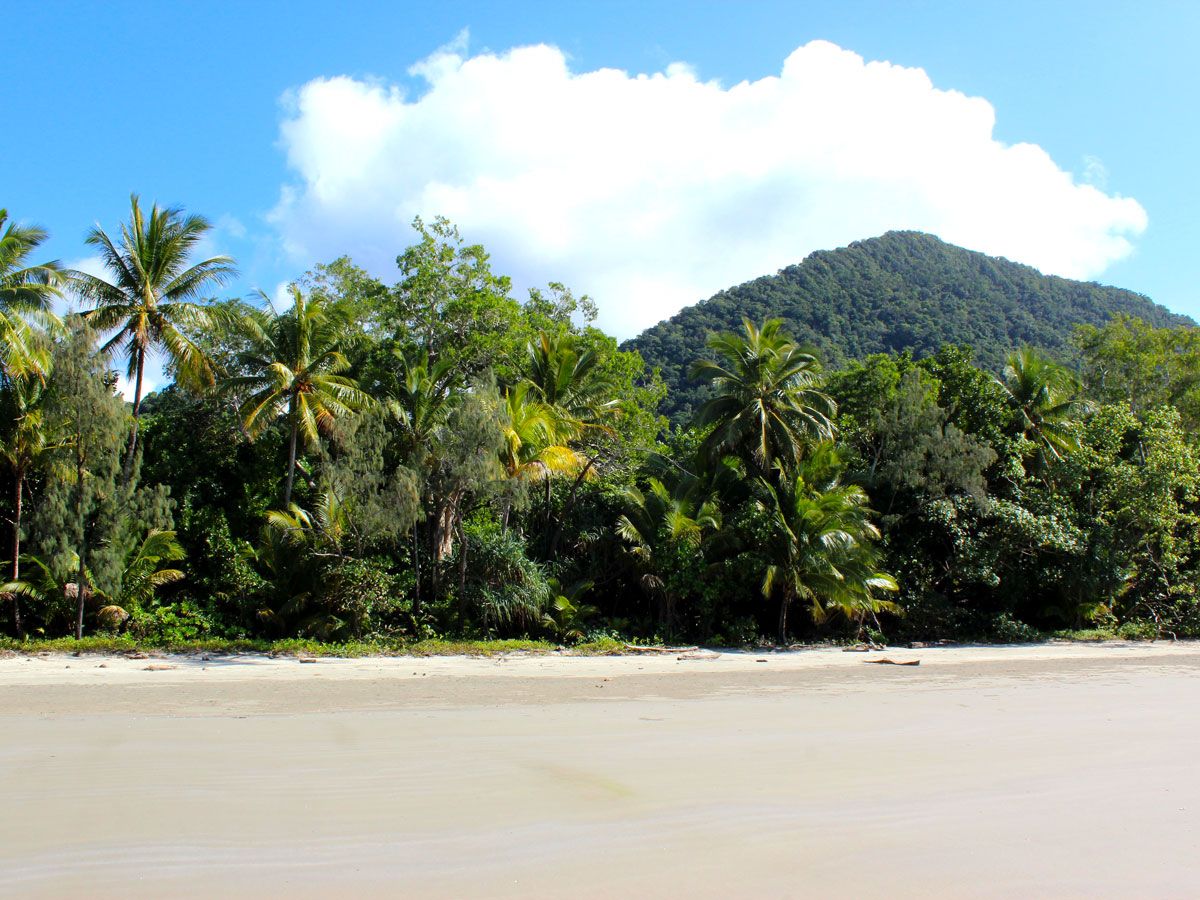
Coastal waters, white sands, and the Daintree Rainforest in Australia
Photo credit: Emily Francis/ Alamy Stock Photo

Famed naturalist Sir David Attenborough once referred to the Daintree Rainforest as “the most extraordinary place on Earth.” Plants have been growing here for over 180 million years, making the Daintree the world’s oldest tropical rainforest. The expanse covers around 460 square miles along the Pacific coast of Queensland, Australia’s northeasternmost state, and contains 3,000 species of plants — 395 of which are listed as endangered or threatened. The Daintree is also home to over 12,000 types of insects, as well as 28% of the frogs, 34% of the mammals, and 40% of the birds that are native to Australia.

The forest was named after Richard Daintree, a geologist who conducted a photographic survey of Queensland in the late 1860s. Since these early studies, the Daintree has only grown in popularity, now welcoming around 400,000 annual visitors. One of the most popular sights is Cape Tribulation, where two UNESCO World Heritage Sites converge: the Wet Tropics Rainforest and the Great Barrier Reef. This spot, among many others, is popular for hiking, snorkeling, and other nature activities.

Post Banner Image
Culture

The World’s Most Unusual Post Offices, From Mountaintops to the Ocean Floor

By Daily Passport Team
Read time: 7 minutes
September 22, 2023
Updated: September 22, 2023

The World’s Most Unusual Post Offices, From Mountaintops to the Ocean Floor

By Daily Passport Team
Author
Daily Passport Team
Daily Passport writers have been seen in publications such as National Geographic, Food & Wine, CBC, Condé Nast Traveler, and Business Insider. They're passionate about uncovering unique destinations and sharing expert tips with curious travelers.

Sometimes, there’s no substitute for old-fashioned snail mail. While we don’t often think twice about going to the post office, there are a select few post offices around the world that defy convention. From the top of a mountain to the ocean floor, here are nine of the coolest places around the world to send mail.

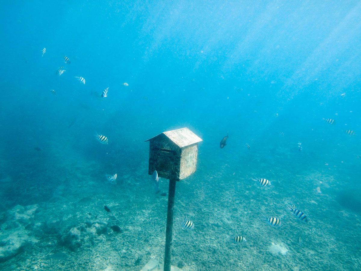
Underwater Post Office – Hideaway Island, Vanuatu

Fish swimming around underwater mailbox off Hideaway Island, Vanuatu
Photo credit: paul abbitt rml/ Alamy Stock Photo

The world’s only official underwater post office is located in Vanuatu, an archipelago nation composed of 83 islands in the South Pacific. Located nine feet underwater near Hideaway Island, the functioning post office opened in 2003 and has been a delight for snorkelers and divers alike ever since.

If you want to send mail from Vanuatu’s Underwater Post Office, there are waterproof postcards available for purchase at gift shops on land. Instead of stamping the postcard with ink, the underwater clerk will use an embossed cancellation device to approve mail. And yes, a postal clerk is available to receive your underwater mail — a flag will be raised above water to indicate the employee is present and you can dive down to mail your letter. Outside of office hours, there is also a postal box available for sending postcards, which are guaranteed to be delivered domestically and internationally.

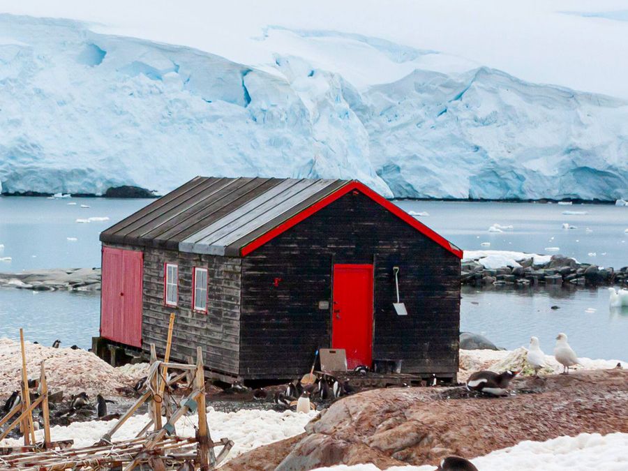
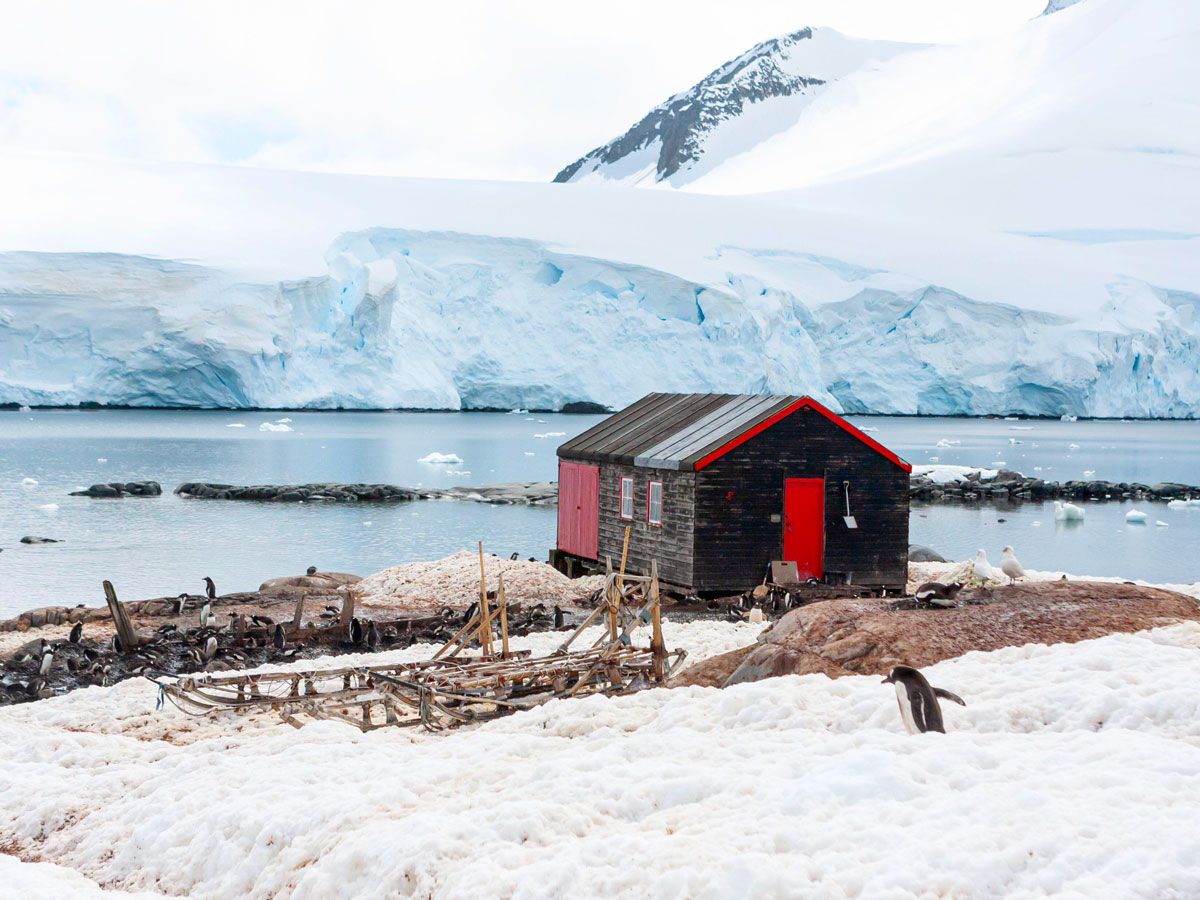
Penguin Post Office – Port Lockroy, Antarctica

Penguin in the snow next to Penguin Post Office in Antarctica
Photo credit: Miriam Newitt/ Alamy Stock Photo

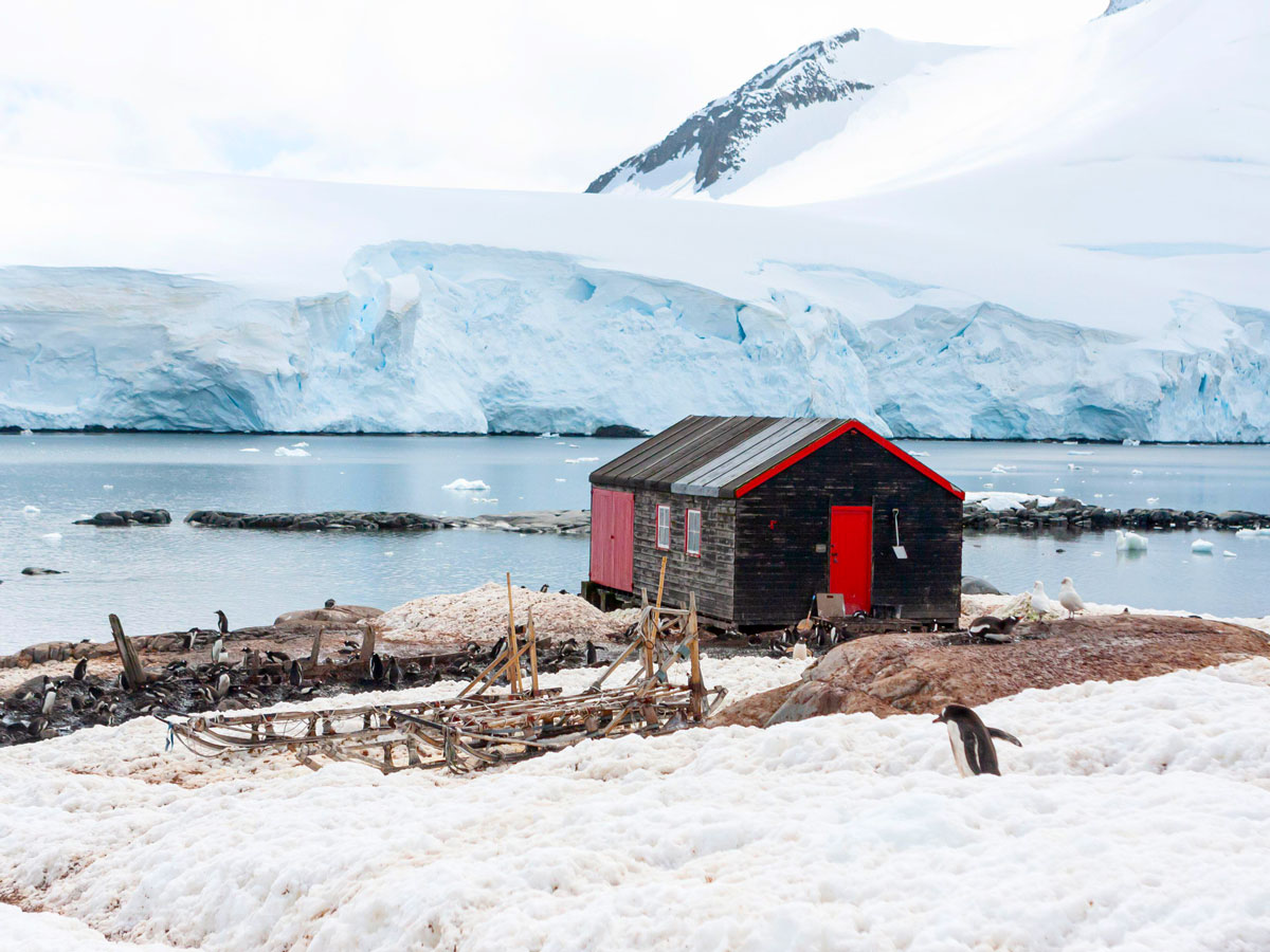
The Penguin Post Office in Port Lockroy, Antarctica, is the southernmost post office in the world. Located 7,000 miles south of Argentina on Goudier Island, the post office is named for the colony of gentoo penguins, which are often found on the premises. In addition to the 3,000 penguins who inhabit the island, other notable residents include five postal clerks who manage the small post office.

As a one-time port for whaling fleets, Port Lockroy also contains a small historical museum and a gift shop, but the Penguin Post Office remains the most popular spot. With 70,000 postcards dispersed around the world from Port Lockroy annually, this unique post office continues to draw people who are interested in sending a letter from the end of the Earth.

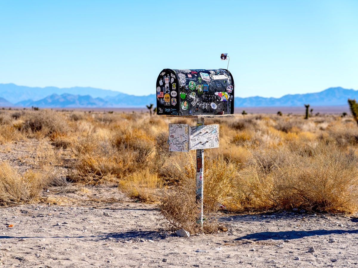
Black Mailbox – Route 375, Nevada

Image of the sticker-covered Black Mailbox in the Nevada Desert
Photo credit: BrianPIrwin/ iStock

Located on the edge of Area 51, the Black Mailbox is a famous extraterrestrial landmark in the Nevada desert. Before the Black Mailbox became a landmark, however, it was just an average mailbox belonging to a local rancher named Steve Medlin. It wasn’t until Bob Lazar, a former Area 51 employee, began to use the mailbox as a congregation site for “believers,” that the unassuming P.O. box began to gain fame.

Located along Nevada State Route 375, also known as the Extraterrestrial Highway, a stretch of road that claims many UFO sightings, the mailbox’s location eventually became a nuisance for Medlin. Unhappy with the consistent tampering of his USPS-issued mailbox, he moved it off the highway and closer to his ranch. Much to Medlin’s chagrin, the Black Mailbox continued to be a pilgrimage for UFO enthusiasts. As a result, the rancher eventually added a second mailbox marked “Alien” for visitors — many of whom leave a dollar inside.

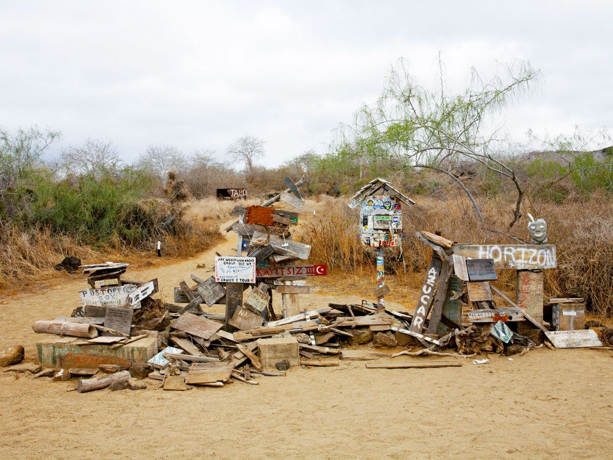
Post Office Bay – Floreana Island, Ecuador

Image of makeshift mailboxes along Post Office Bay on Floreana Island, Ecuador
Photo credit: Carolyn Jenkins/ Alamy Stock Photo

Located off the coast of Ecuador, Post Office Bay has long been the unofficial post office of the Galápagos Islands. The bay’s history of sending letters began when whalers became homesick after months at sea. The men started leaving letters for friends and family on Floreana Island, which were then carried back to the U.K. or the U.S. by ships departing from the region. With all the letters coming and going from Floreana Island, the whalers began calling it Post Office Bay.

This moniker remains fitting today. Visitors to the Galápagos can leave letters at Floreana Island’s unofficial post office. Using an honor system, travelers are permitted to take letters from the post office with the intent of delivery. While some letters are stamped and can be mailed, traditionally the letters are supposed to be hand-delivered, in order to relay the fascinating tale of where they came from.

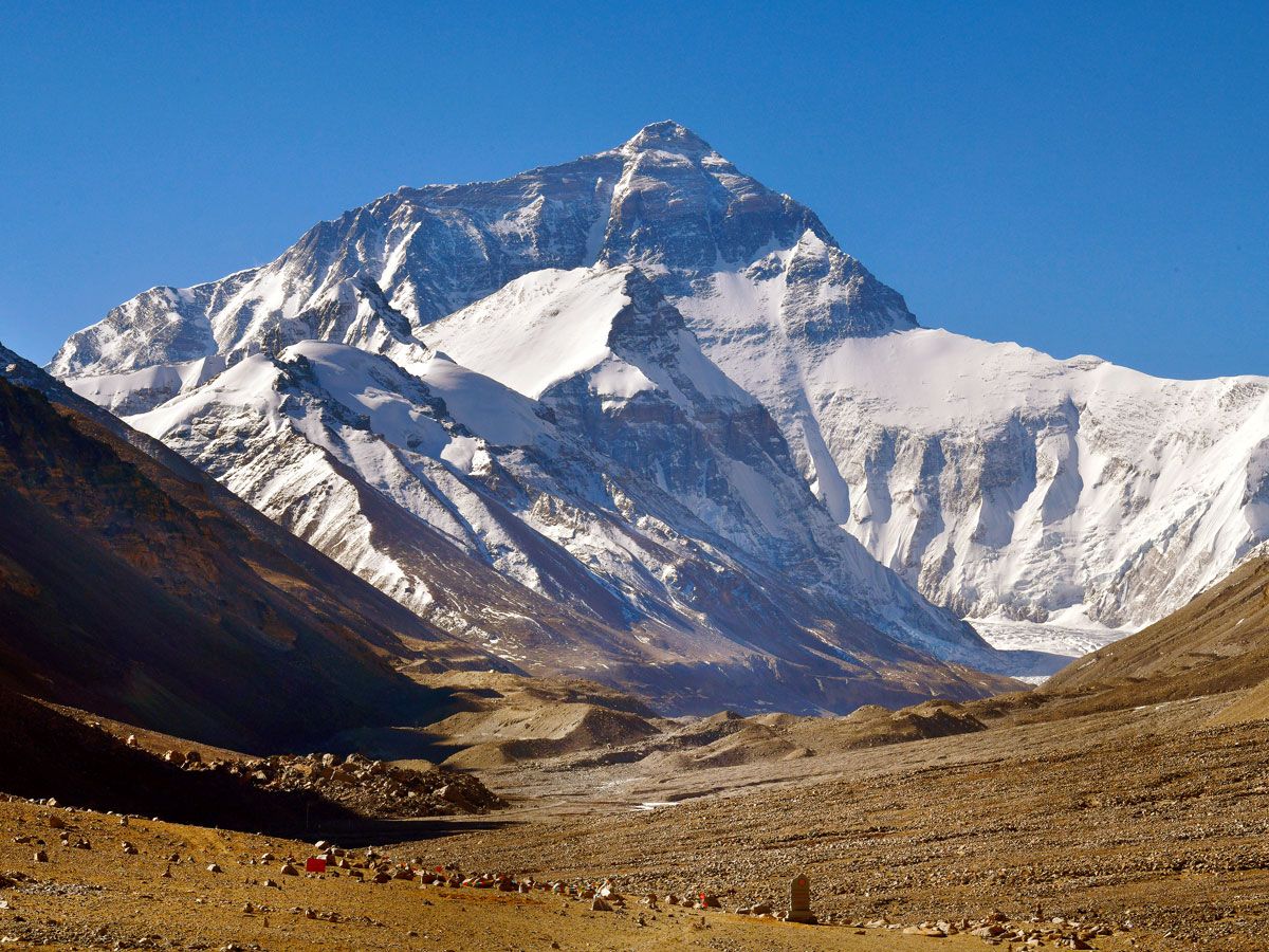
Tibetan Paradise Post Office – Mount Everest, Tibet

Image of snow-capped Mount Everest
Photo credit: oversnap/ iStock

Located 17,388 feet above sea level, Tibetan Paradise Post Office is the world’s highest post office. Originally called the China Post Space Office when it was established in 2001, the post office can be found at the base camp of Mount Everest. Originally housed in a military tent, the building has since been renovated to include exhibits on local culture, meteorology, and ecology. It also offers free drinking water and rest services for visitors.

Operating during the mountain’s peak climbing season, the post office is open from April to August, from 10 a.m. to 6 p.m. daily. However, the post office’s unusual location means that postage is more costly than it is at sea level. If you’re sending mail from Mount Everest, you can expect to spend around $2 USD to send a postcard from Tibet to North America.

Juliet’s Mailbox – Verona, Italy

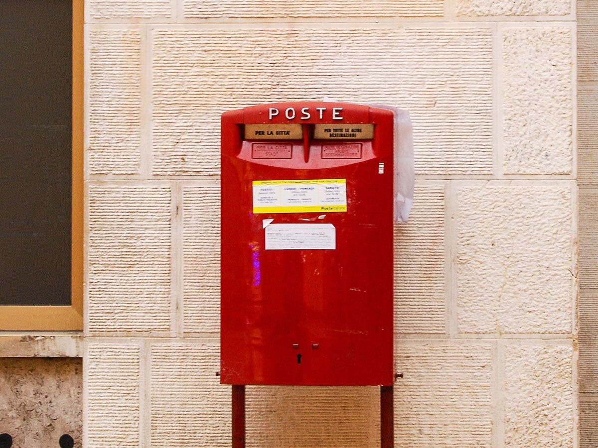
Image of Juliet's Mailbox painted red in Verona, Italy
Photo credit: AS/ Alamy Stock Photo

However fictional Romeo and Juliet may be, the two lovebirds are alive and well in the Italian village of Verona. Thousands of letters have been addressed to “Juliet, Verona” for years, with visitors making the pilgrimage to the “town of love” to see where Shakespeare’s star-crossed lovers originated. The trend took off in the 1930s when a man who guarded Juliet’s tomb — an empty sarcophagus purported to be the site of the last scene in the tragedy —  began collecting and answering letters addressed to Juliet.

These letters eventually led to the creation of the “Juliet Club,” with thousands of letters to Juliet being answered by volunteers. Known as the “Secretaries of Juliet,” these volunteers answer letters from all over the world in several languages, an act that served as the inspiration for the romance film Letters to Juliet (2010). If you’d like to send a note to Juliet yourself, letters can be mailed, emailed, or delivered by hand to Juliet’s Mailbox in Verona.

Ochopee Post Office – Ochopee, Florida

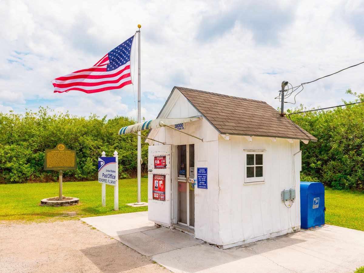
Tiny Ochopee Post Office in Ochopee, Florida
Photo credit: Allard Schager/ Alamy Stock Photo

The smallest United States Post Office can be found on the edge of the Everglades in Ochopee, Florida. As an old shed that once stored irritation materials on a tomato farm, the building was converted into a post office in 1953, after a fire destroyed the local general store. A mere 56 square feet in total, the office has enough room for a single clerk to serve a town of 11 people.

Located between Miami and Naples, the Ochopee Post Office attracts plenty of visitors who want to see the pint-sized post office for themselves. They can use the office’s pre-stamped postcards to send international and domestic mail from the 34141 zip code. A word of warning — alligators are common in Ochopee, and can often be spotted in the parking lot, so be careful.

J.W. Westcott Mailboat – Detroit, Michigan

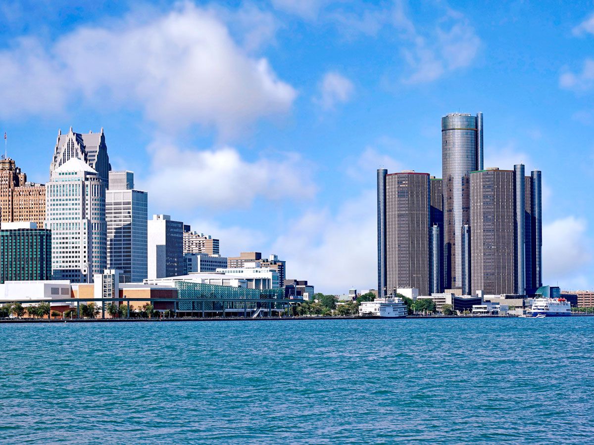
Detroit skyline seen across river
Photo credit: peterspiro/ iStock

The J.W. Westcott mailboat services the Great Lakes marine community, and has done so for nearly 150 years. Fist captained by a seaworthy entrepreneur named John Ward Westcott, the mailboat originated in 1874 when Wescott implemented the “mail in a pail” system on the docks of Detroit. In lieu of a P.O. box, a pail was tied to a string and hoisted over the side of passing vessels, allowing crewmen to send and receive letters without setting foot ashore.

The system was so popular that the J.W. Westcott mailboat became the first official United States Postal Service Mailboat and the first boat with a non-military zip code – 48222. Today, J.W. Westcott still operates out of Detroit, delivering mail and other goods to maritime vessels. In addition to the USPS mail, the company also delivers food and transports crew members from the ship to the shore.

Hoolehua Post Office – Hoolehua, Hawaii

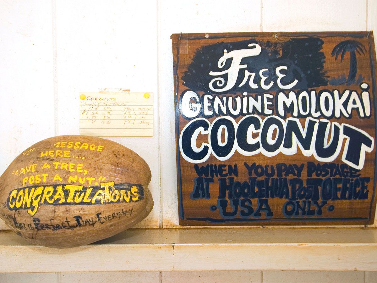
Coconut at Hoolehua Post Office in Hawaii
Photo credit: John Elk III/ Alamy Stock Photo

Located on Moloka’i, one of the least visited Hawaiian Islands, Hoolehua Post Office sees more coconuts sent than handwritten letters. In 1991, the post office started an initiative that allowed visitors to send coconuts to friends and family on the mainland. Fourteen years later, after facing severe budget cuts, Postmaster Gary Lam expanded the program as a way to increase post office traffic. The marketing ploy worked, with “Postanut” (Post-a-Nut) becoming a trend on the island.

Today, postal employees in Hoolehua mail over 3,000 coconuts a year, accounting for nearly half of the post office’s revenue. To assist with the demand, and in order to be out of federal jurisdiction, an island local named Teri Waros installed a Postanut store across the street. Embossed and painted coconuts can be purchased at the shop before they receive an agricultural stamp at the post office to be shipped worldwide.

Post Banner Image
History

6 Countries That Have Relocated Their Capitals

By Daily Passport Team
Read time: 5 minutes
September 22, 2023
Updated: September 22, 2023

6 Countries That Have Relocated Their Capitals

By Daily Passport Team
Author
Daily Passport Team
Daily Passport writers have been seen in publications such as National Geographic, Food & Wine, CBC, Condé Nast Traveler, and Business Insider. They're passionate about uncovering unique destinations and sharing expert tips with curious travelers.

As the seat of government, capital cities are filled with history and significance, and they are often seen as a symbolic representation of a country itself. So it’s not often that countries change their capitals, and when they do, they have a compelling reason to do so — whether it be a more centralized location, the need for newer infrastructure, or political motivations. Other times, a newly independent country chooses an interim capital while plans are established for a permanent seat of government. From Brazil to the United States, discover why the following six countries have relocated their capitals. 

Brazil

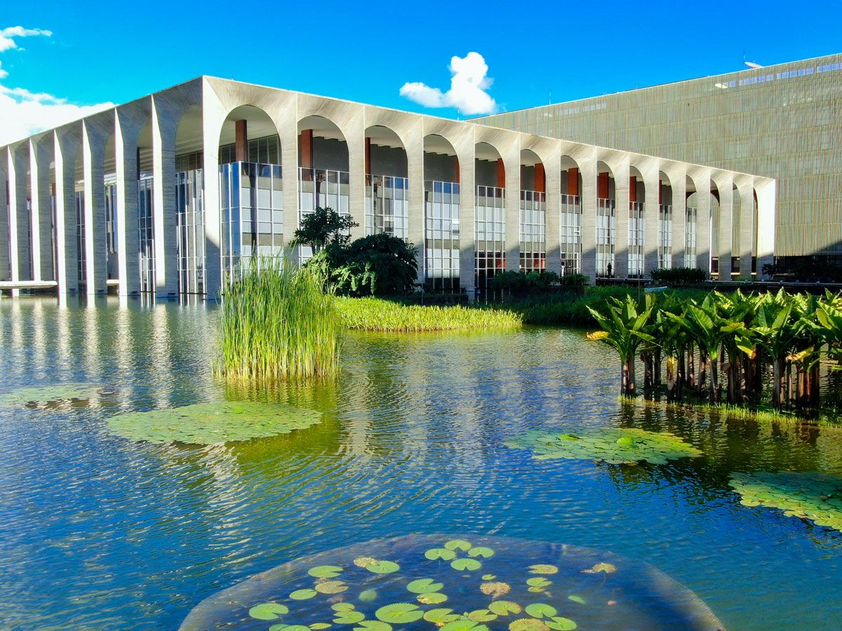
Itamaraty Palace in Brasília, Brazil
Photo credit: Flyme Drones/ Shutterstock

As the cultural hub of Brazil, the sprawling coastal city of Rio de Janeiro was the nation’s official capital for nearly 200 years. Unfortunately, it was also crowded, with congested roadways that made it difficult to travel to the administrative buildings spread across the city. This issue was amended in 1960 when the country officially relocated the capital to Brasília — a city that was designed specifically for its purpose as the governing seat. Engineers, architects, and city planners worked together to create a capital city that was beautiful to visit and effortless to navigate, with numbered blocks and divided sectors for hotels, embassies, and banks. The capital of Brasília is such an achievement of modern architecture that it was named a UNESCO World Heritage Site in 2007.

Myanmar

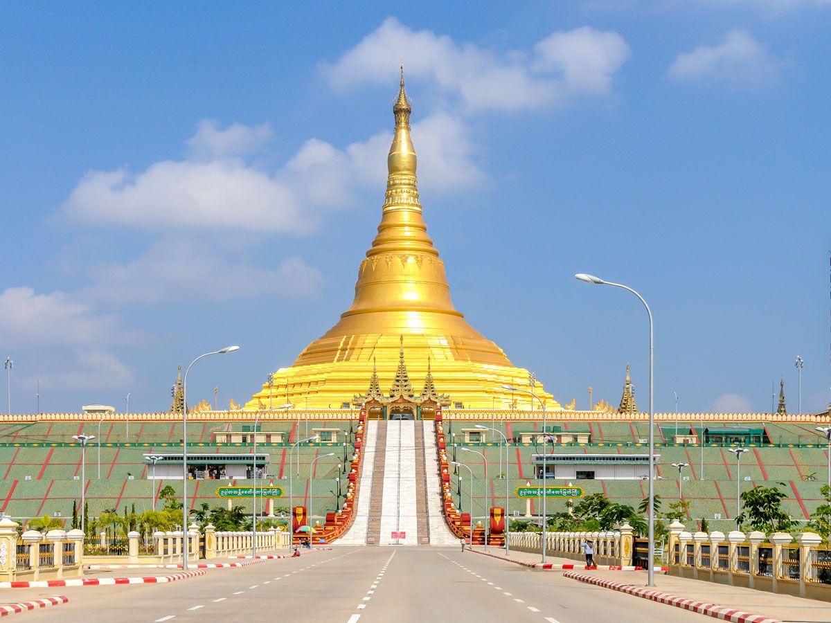
Roadway leading to golden Uppatasanti Pagoda in Naypyidaw, Myanmar
Photo credit: milosk50/ Shutterstock

Rangoon (also known as Yangon) was the capital of Myanmar (also known as Burma) for over 50 years — from the time the independent country was established in 1948 until the mid-aughts. But on November 6, 2005, something strange occurred. The country’s military rulers decided to switch the seat of the government with no explanation. Government employees and civil servants had to suddenly move 200 miles from Rangoon to Pyinmana, a town primarily known for its logging and sugarcane refinery. The town of Pyinmana was renamed Naypyidaw, which remains the capital to this day, and is described by many as a ghost town. Purportedly, nearly a million people live in the city’s capital, but with empty highways and city streets, some believe that number to be false.

Kazakhstan

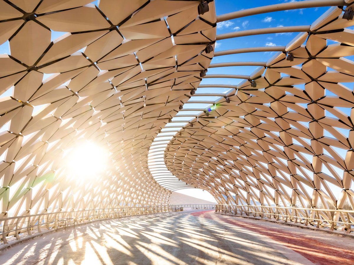
Interior of Atyrau Bridge in Astana, Kazakhstan
Photo credit: Dmitry Naumov/ Alamy Stock Photo

From 1929 to 1991, Almaty was the capital of the Kazakh Soviet Socialist Republic. Once Kazakhstan gained independence from the Soviet Union, this southeastern city remained the capital for six more years. In 1997, the decision was made to move the capital elsewhere; Astana was unveiled as the new capital of Kazakhstan one year later. Officials revealed that they believed Almaty’s earthquake-prone location to be too volatile for a capital city, although President Nursultan Nazarbayev revealed that he hoped the move would stimulate the northern region’s economic wealth. Astana literally translates to the word “capital,” which was a fitting name, until it was changed to Nursultan in 2019, after Kazakhstan’s first president, who remained in office for 19 years.

Nigeria

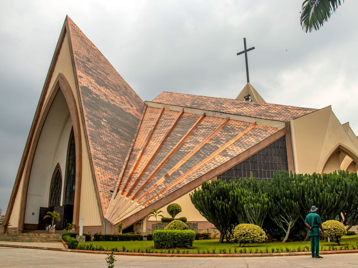
The National Christian Centre in Abuja, Nigeria
Photo credit: Miroslav Pavicevic/ Alamy Stock Photo

Before 1991, the coastal metropolis of Lagos, Nigeria’s largest city, had long been the country’s capital. It was first declared the capital in 1914 when Nigeria was under British rule, and it remained so after Nigeria’s independence in 1960. Over time, however, government officials found it unsuitable as a capital city, particularly because Lagos was hot, crowded, and filled with political upheaval. As a result, government officials began developing a new capital north of Lagos during the 1980s. This city was called Abuja, and in addition to being in a more centralized location, it was located in neutral territory in regards to the country’s various religious and ethnic groups. The open land also provided abundant room for expansion. Abuja was officially named the new capital of Nigeria on December 12, 1991, although a few government offices remain in the original capital city of Lagos.

Bolivia

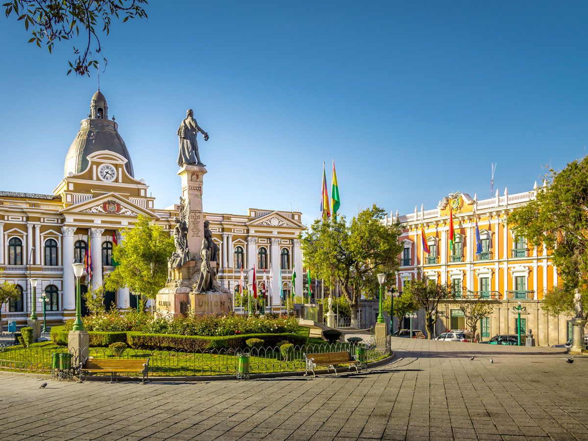
Plaza Murillo and Bolivian Palace of Government in La Paz, Bolivia
Photo credit: Diego Grandi/ Shutterstock

When Bolivia became independent in 1825, Sucre was named the country’s official capital city. Named for the revolutionary leader Antonio José de Sucre, the city was chosen due to its proximity to silver mines, which was the country’s chief industry at the time. However, when the mines dried up in the late 1800s, all the workers moved to the city of La Paz, located 250 miles to the north. As it was closer to the tin mines, La Paz’s economic importance grew, and it eventually became the seat for the executive and legislative branches of the government. Despite this, Sucre remains the seat for the government’s judicial branch and the official capital, even though La Paz is the country’s de facto capital.

United States

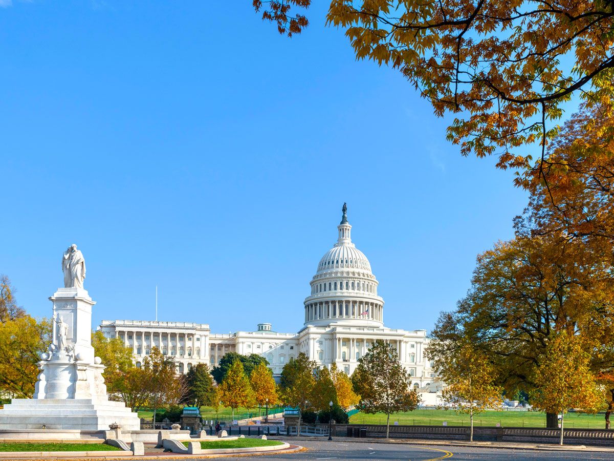
Image of the Capitol Building and statue in Washington, D.C.
Photo credit: Ian Dagnall/ Alamy Stock Photo

Everyone knows Washington, D.C., to be the capital of the United States, but that wasn’t always the case. The first U.S. capital was New York City, and it was there that President George Washington took office in 1789. A year later, Philadelphia was chosen as the nation’s interim capital from 1790 until 1800, while Washington, D.C., was being built. The precise location of Washington, D.C., was chosen by President Washington himself — he staked out a spot along on the Potomac River, and the land was ceded from both Maryland and Virginia. However, the general location of the nation’s capital was a compromise between two well-known nemeses — Alexander Hamilton and Thomas Jefferson. The deal resulted in Hamilton getting the federal government to take on debts from the Revolutionary War. At the same time, Jefferson negotiated a southern capital city, which was a more convenient location to Monticello, his plantation home in Virginia.

Post Banner Image
Geography

What Are the World’s Largest Islands?

By Julia Hammond
Read time: 5 minutes
September 18, 2023
Updated: September 18, 2023

What Are the World’s Largest Islands?

By Julia Hammond
Author
Julia Hammond
Julia is a U.K.-based travel writer whose work has been featured in The Independent, The Telegraph, The New Zealand Herald, and Culture Trip, among others. She’s an enthusiastic advocate for independent travel and a passionate geographer who has had the privilege of traveling to more than 130 countries in search of a story.

Geographers define an island as a mass of land that is both entirely surrounded by water and smaller than a continent. As Australia is the world’s smallest continent, measuring about 3 million square miles, it can’t be classified as an island. There are an estimated 900,000 official islands on the planet. While some countries share an island, such as Hispaniola (split between the Dominican Republic and Haiti), others have one or more all to themselves. Let’s take a look at the world’s nine largest islands.

9. Great Britain

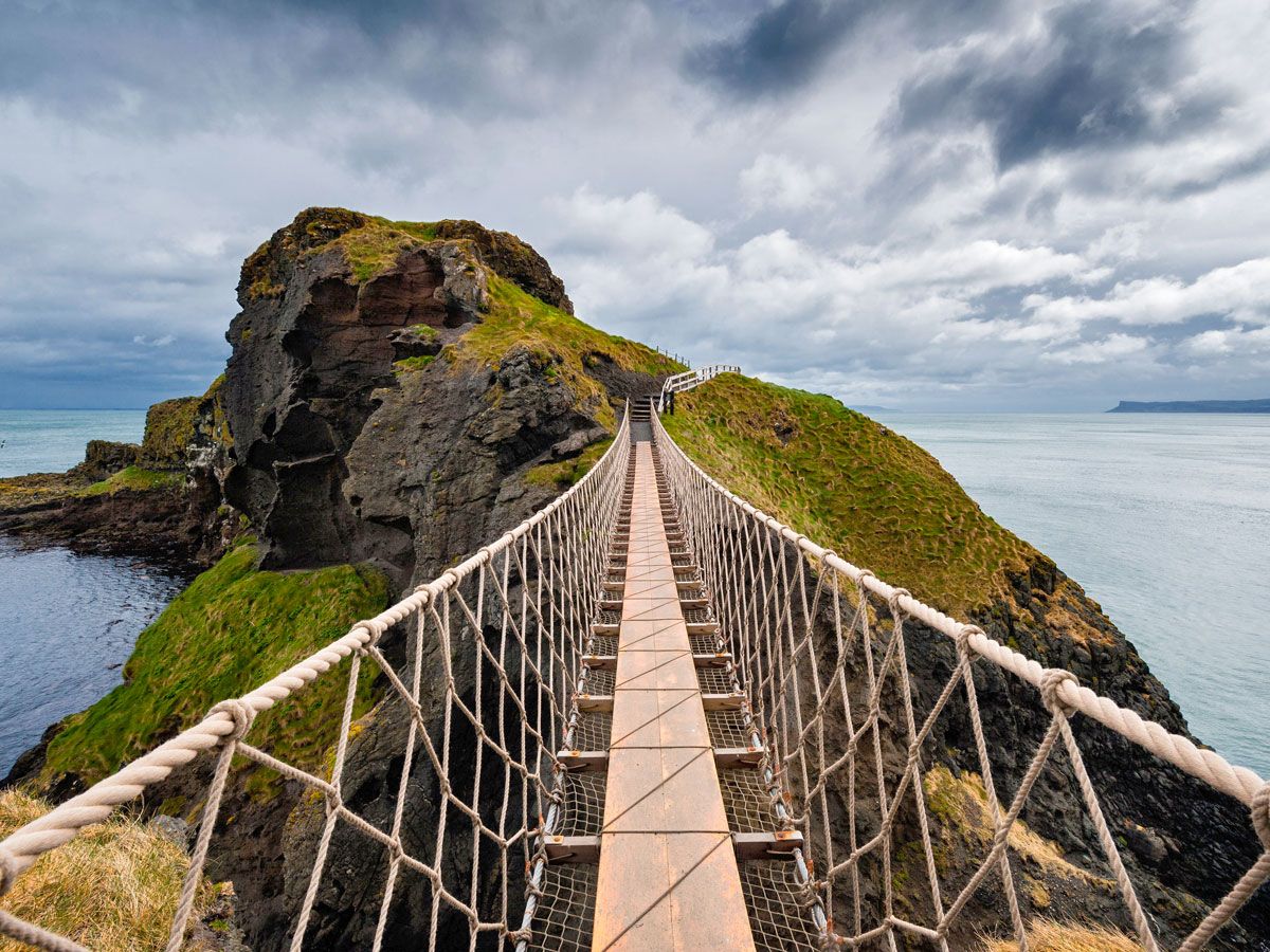
Pedestrian suspension bridge on rocky coastline of Great Britain
Photo credit: Clearview/ Alamy Stock Photo

Great Britain, the United Kingdom’s largest island, measures 80,823 square miles, making it the ninth-largest island on the planet. The U.K. is formed of four nations: England, Scotland, Wales, and Northern Ireland. Though the name Great Britain is often used interchangeably with the U.K., it actually contains only three of its nations — Northern Ireland is part of the island of Ireland, which is considerably smaller at 32,595 square miles. The British Isles have an even broader scope, incorporating 6,000 smaller islands. These include the Isle of Man and the Channel Islands. Both are Crown Dependencies, meaning that they are self-governing, with their own legislative assemblies and separate administrative, fiscal, and legal systems.

8. Victoria Island

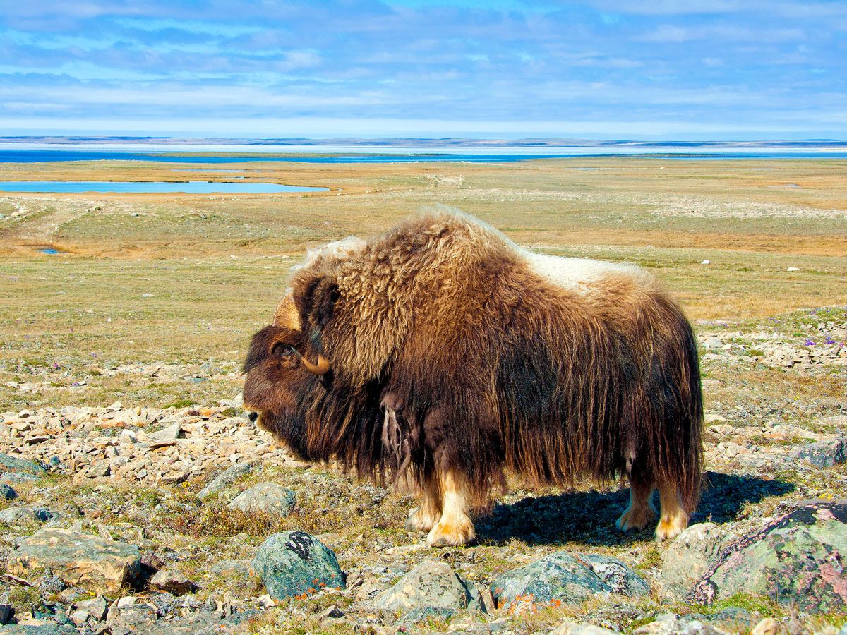
Muskoxen bull grazing on Canada's Victoria Island
Photo credit: All Canada Photos/ Alamy Stock Photo

Located in Canada’s Arctic Archipelago, Victoria Island boasts an area of 83,896 square miles. The island — named for Queen Victoria of Britain — is split between Nunavut and the Northwest Territories. Very few people live here thanks to its remote northerly location and harsh climate. The two largest settlements include Iqaluktutiaq (Cambridge Bay) in Nunavut and Ulukhaktok in the Northwest Territories. Together, their permanent population numbers around 2,100 people. Victoria Island covers slightly more area than Canada’s third-largest island, Ellesmere, also in the Arctic Archipelago and the tenth-biggest on the planet at 75,767 square miles.

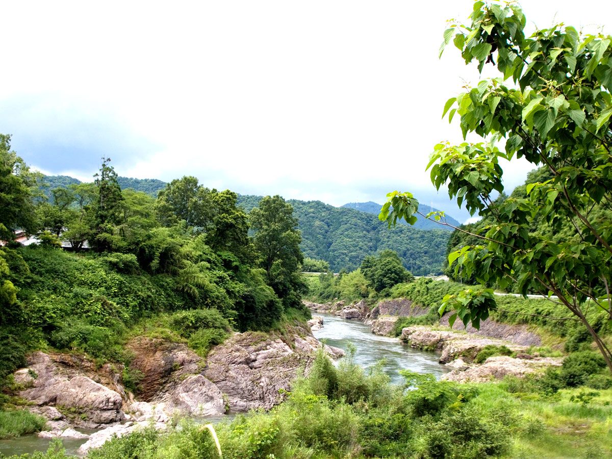
7. Honshu

River running through lush landscape of Japan's Honshu island
Photo credit: Philimages/ Alamy Stock Photo

The island of Honshu is the largest of Japan’s 14,125 islands. Indeed, with an area of 87,992 square miles, Honshu is huge compared to most of the other Japanese islands. The centrally located and densely populated island is home to Tokyo, Japan’s capital and the largest city on the planet, with over 40 million people living in its metropolitan area. A mountainous spine runs along Honshu; it is home to Mount Fuji and also the Japanese Alps. Honshu is also home to the former Japanese capitals of Kyoto and Nara, as well as important commercial and industrial hubs such as Osaka and Nagoya.

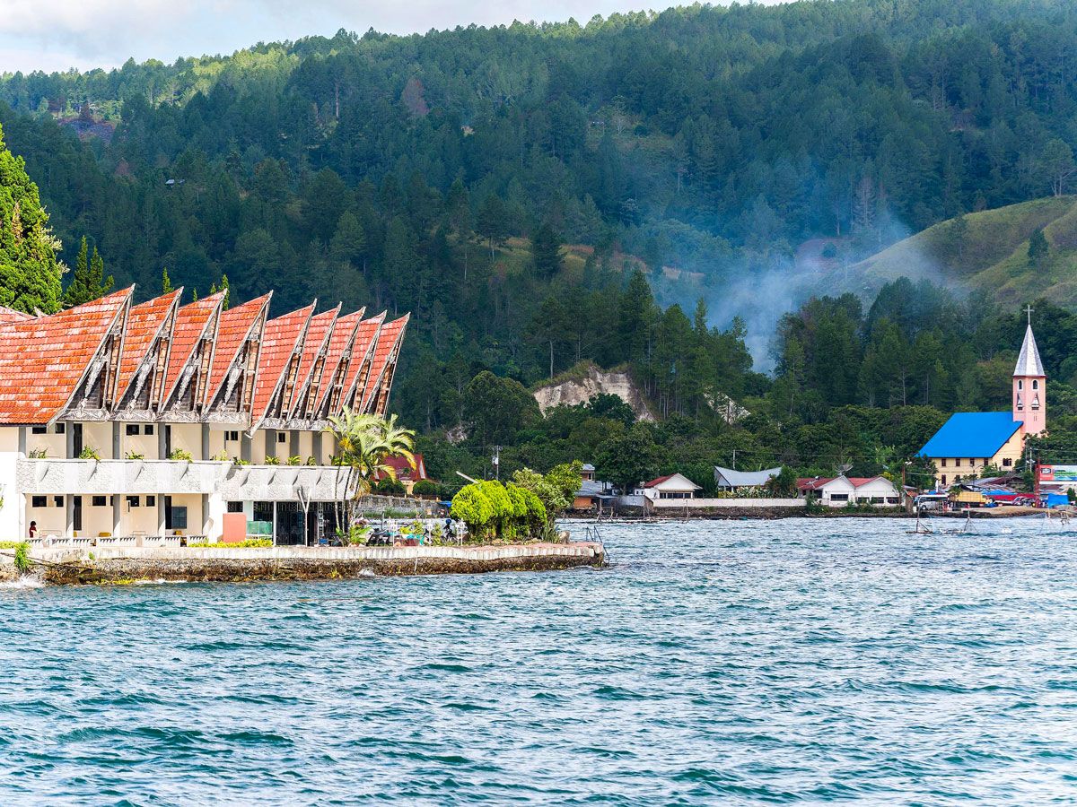
6. Sumatra

Houses on Sumatra Island
Photo credit: Shanti Hesse/ Alamy Stock Photo

Covering 171,069 square miles, Sumatra is the second-largest of the Greater Sunda Islands, a group of four islands in the Malay Archipelago (the largest group of islands in the world). The island’s landscape features a mix of active volcanoes, lush rainforest, beaches, and Southeast Asia’s largest lake, Danau Toba. A slew of national parks, some of them UNESCO-listed, are home to significant populations of wildlife such as elephants, tigers, and orangutans. The island is also ethnically and culturally diverse. In the north, Aceh is largely settled by Muslim communities. Christian Batak speakers can be found in the highlands, while the Minangkabau form the majority in West Sumatra.. 

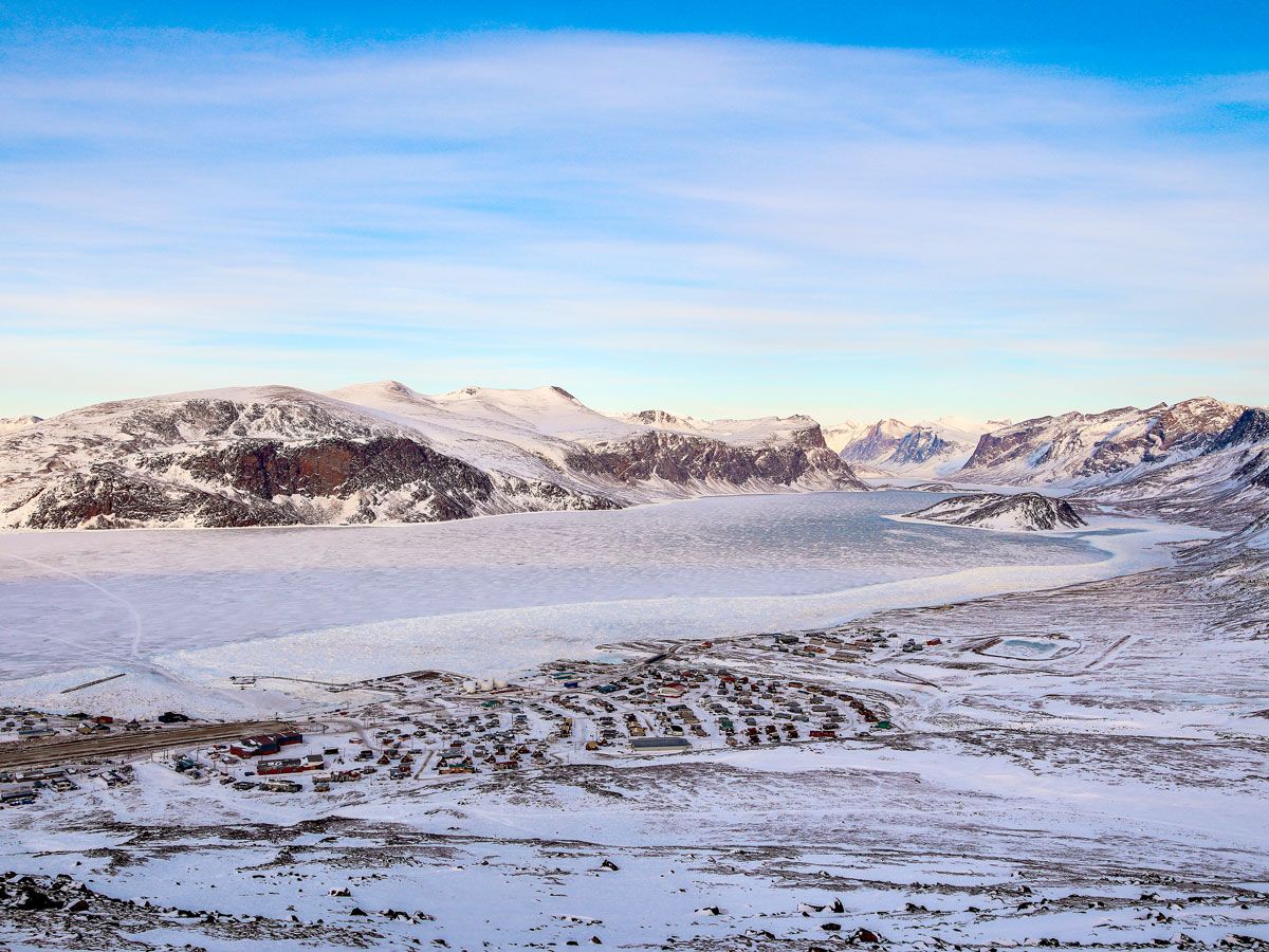
5. Baffin Island

Snow-covered landscape of Baffin Island in Canada, seen from above
Photo credit: Ryan Gemmola/ Alamy Stock Photo

At 195,928 square miles in size, Canada’s Baffin Island can be found in the northern reaches of the territory of Nunavut. Like Victoria Island, it’s sparsely inhabited, with just 11,000 people calling the island home, although human presence on the island dates back more than three millennia. Until a recent drop in the 1990s, the island’s population of caribou had vastly outnumbered the island’s people. The majority of the population is Inuit and lives in the island’s capital city of Iqaluit, which was founded in 1942. During World War II it served as a refueling point for American aircraft heading to Europe. 

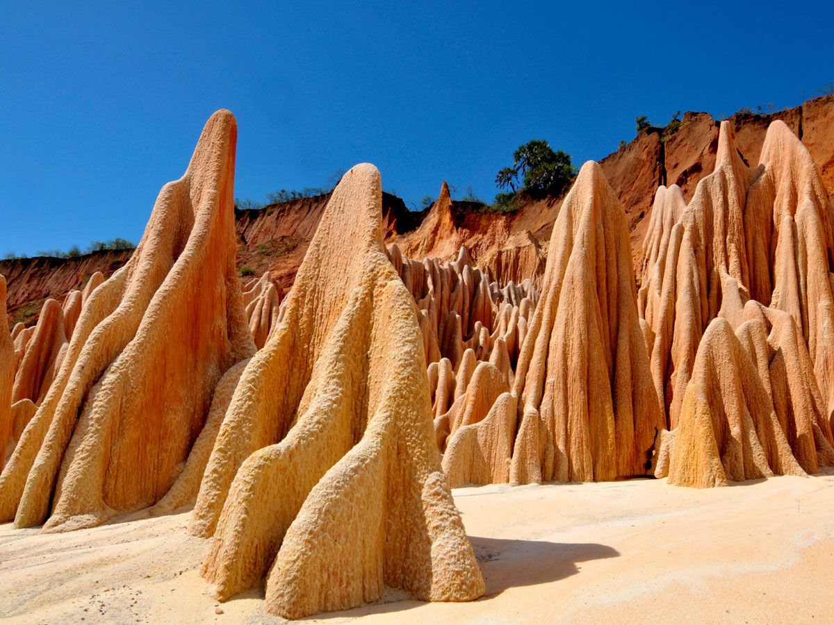
4. Madgascar

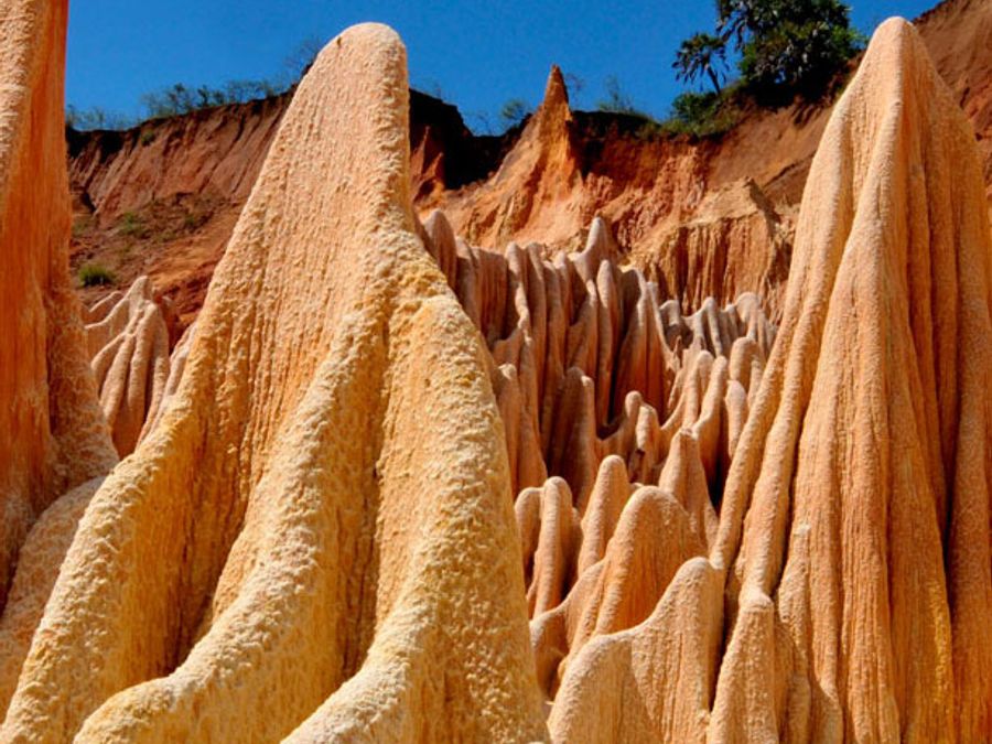
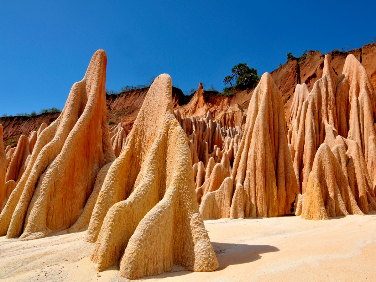
Sandstone formations on island of Madgascar
Photo credit: imageBROKER.com GmbH & Co. KG/ Alamy Stock Photo

The next largest island on our list is biodiverse Madagascar, the fourth-largest on the planet. Most famous for its ring-tailed lemurs and its baobab trees, Madagascar has a broad spectrum of habitats encompassing spiny thicket, mangroves, and forested mountain slopes. Its climate is ideal for growing vanilla. The 224,533-square-mile island — a little smaller than Texas — lies off the coast of southeastern Africa in the Indian Ocean. It detached from mainland Africa around 165 million years ago. This left a legacy of unique flora and fauna: An estimated 95% of Madagascar’s reptiles, 92% of its mammals and 89% of its plants can only be found here. Some of these are critically endangered, such as the silky sifaka (a type of lemur) and the ploughshare tortoise. 

3. Borneo

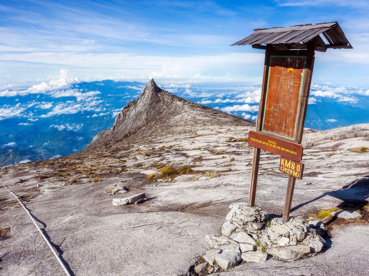
Sign on mountaintop on island of Borneo
Photo credit: R.M. Nunes/ Alamy Stock Photo

The world’s third-largest island, Borneo is located in Southeast Asia’s Malay Archipelago and covers an area of 292,000 square miles. Like Sumatra, the island is part of the Greater Sundas Island Group. The Indonesian region of Kalimantan covers approximately 73% of Borneo’s area; the rest is split between East Malaysia and the tiny nation of Brunei. Borneo is known for its biodiversity, beautiful beaches, and vast swathes of jungle. Wildlife species such as the proboscis monkey and the Borneo pygmy elephant can only be seen on this island. The Malaysian city of Kota Kinabalu serves as the island’s gateway for visitors. 

2. New Guinea

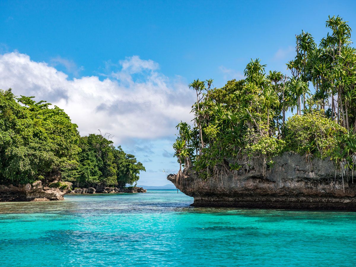
Palm tree-covered island landscape of New Guinea
Photo credit: Ron van der Stappen/ Shutterstock

Split between the nations of Indonesia and Papua New Guinea, this 303,381-square-mile island just north of Australia has been home to humans for more than 40,000 years and was colonized at various times by the British, Dutch, and Germans. Today, the western side of New Guinea belongs to Indonesia, and the eastern half comprises the independent country Papua New Guinea. Most of the island is mountainous and covered in rainforests. The island is rich in both plant life and wildlife, particularly reptiles, marsupials, and birds, both flightless and tropical. Among the highlights is the world’s largest butterfly, the Queen Alexandra birdwing (also known as the birdwing butterfly) — its wingspan can reach nearly a foot wide.  

1. Greenland

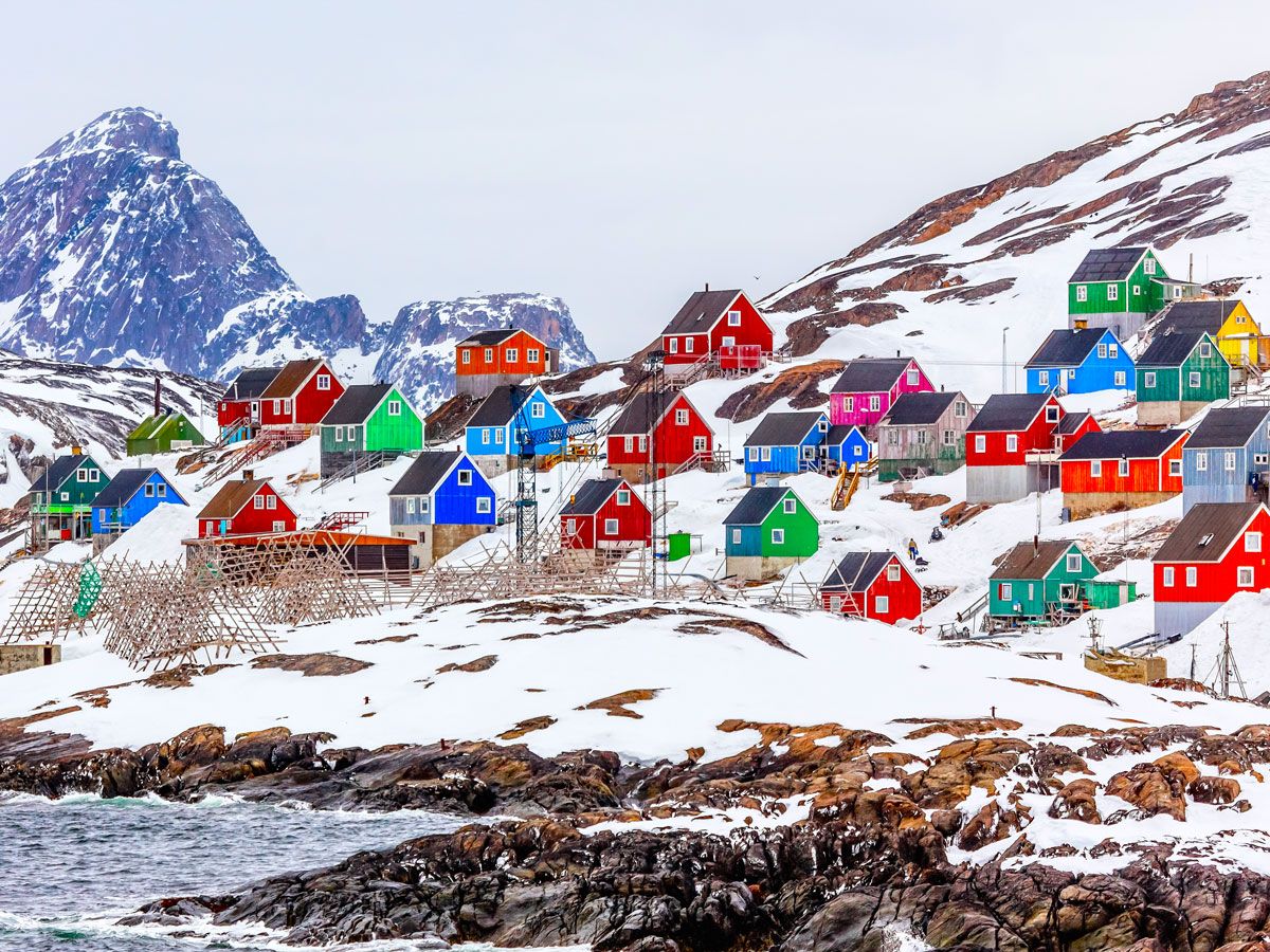
Colorful homes on snowy coastline of Greenland
Photo credit: Vadim_N/ Shutterstock

With an area of 836,330 square miles, Greenland is by far the world’s largest island. Greenland is an autonomous territory of the Kingdom of Denmark but was granted home rule in 1979 and has had its own parliament since then. With a permanent ice sheet that covers 75% of the country, and a population of just under 60,000 people, Greenland is the least densely populated territory in the world. The primary industry is fishing, which accounts for 90% of the island’s exports.  

Post Banner Image
History

Beneath the Streets of Paris: Discovering a Hidden World of Catacombs

By Nicole Villeneuve
Read time: 6 minutes
September 18, 2023
Updated: September 18, 2023

Beneath the Streets of Paris: Discovering a Hidden World of Catacombs

By Nicole Villeneuve
Author
Nicole Villeneuve
Nicole is a writer and researcher with over 15 years of experience seeking out arts, culture, and lifestyle stories in places like remote northern Quebec and the unforgettable streets of Amsterdam. Her work has also appeared in PureWow, Brit + Co, AUX TV, and CBC.

Though many visitors to Paris are drawn to iconic landmarks such as the Eiffel Tower and the Louvre, beneath the city’s bustling streets lies a hidden world that holds important pieces of the city’s past. The Catacombs of Paris — originally quarries dating back to the Roman era — are an extensive network of tunnels beneath the city that became a solution to Paris’ overcrowded cemeteries in the 18th century, housing the remains of some 6 million Parisians. Over the years, this unique underground site played a part in the French Revolution and World War II, served as a link in the food chain, and today, has become a secret playground for the adventurous. Discover the fascinating history of one of the City of Light’s most unique attractions with this in-depth guide to the Catacombs of Paris.

When the Catacombs Were Quarries

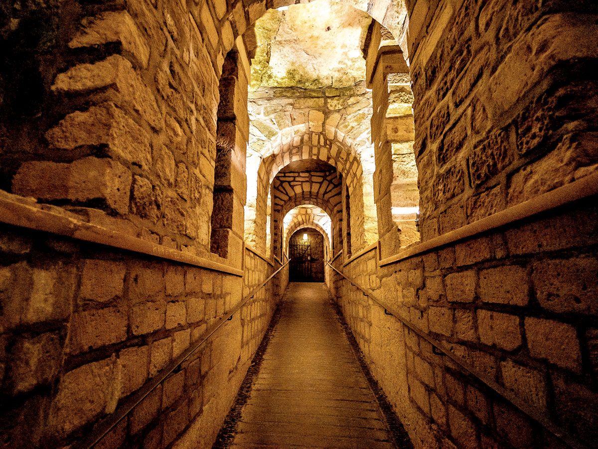
Underground walkway inside Catacombs of Paris
Photo credit: Samantha Ohlsen/ Alamy Stock Photo

Approximately 45 million years ago, the site of modern-day Paris was submerged underwater, leaving sediment that, over time, turned to limestone. When Romans occupied the banks of the Seine River and founded the settlement of Lutetia around 52 BCE, they dug open-pit quarries and used the rock for monuments and other structures. Over time, these quarries were abandoned — but not forever.

By the Middle Ages, Paris was expanding, and its development once again relied heavily on the limestone from the quarries. By that time, they snaked far underground in networks that totaled over 200 miles of subterranean tunnels. As the city continued to grow, mining moved to the outskirts. The Paris mines, abandoned once again, began to pose structural risks to the urban landscape.

In December 1774, a stretch of street almost 1,000 feet long collapsed, taking homes and buildings with it. To stabilize the hollow grounds and save more of the city from sinking, King Louis XVI hired architect Charles Axel Guillaumot to inspect, map, and stabilize the quarries. Ceilings were raised, walls were reinforced, and even more tunnels were dug to connect the existing networks. It was a major undertaking, but Guillaumot and his team’s work underneath the city streets was far from finished.

Solving a Cemetary Crisis

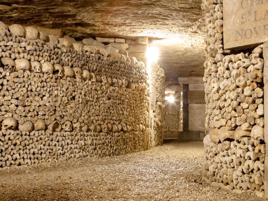
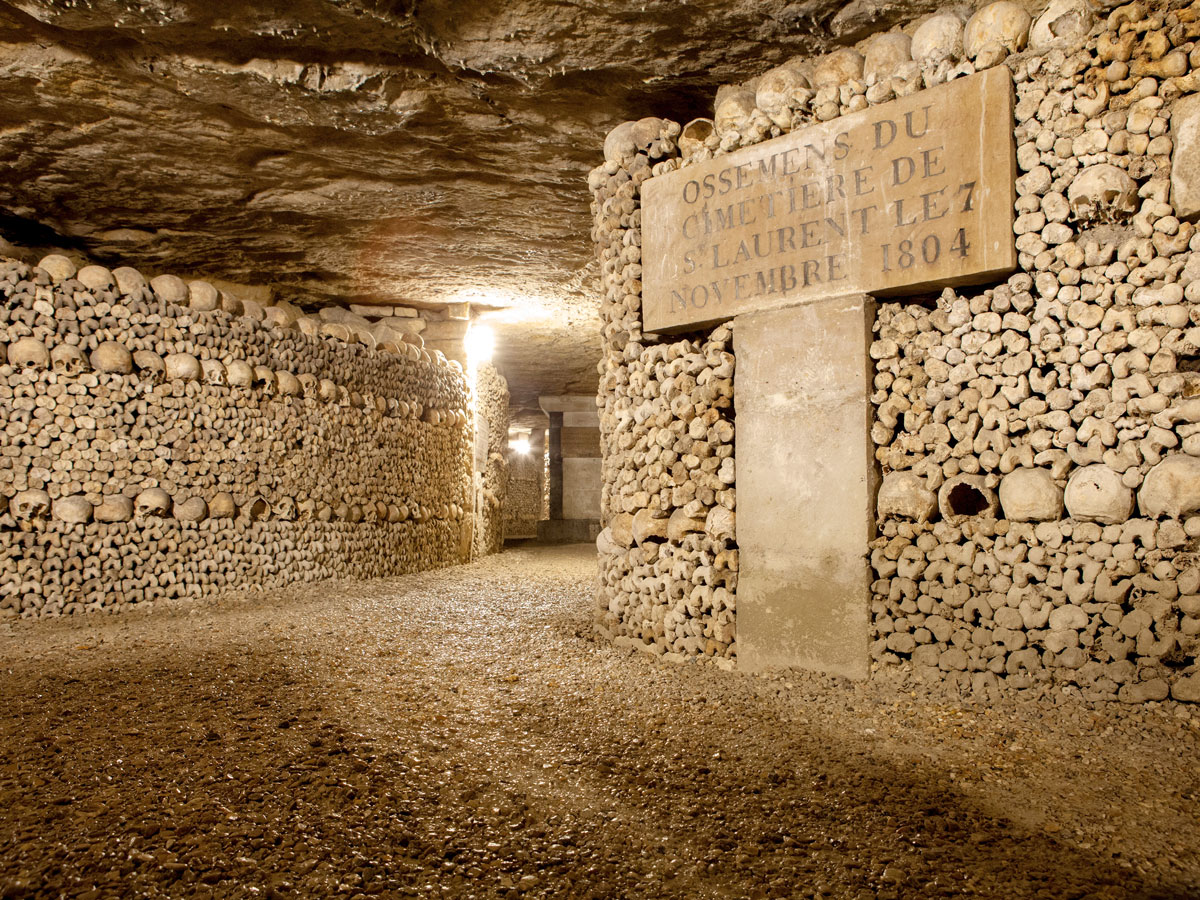
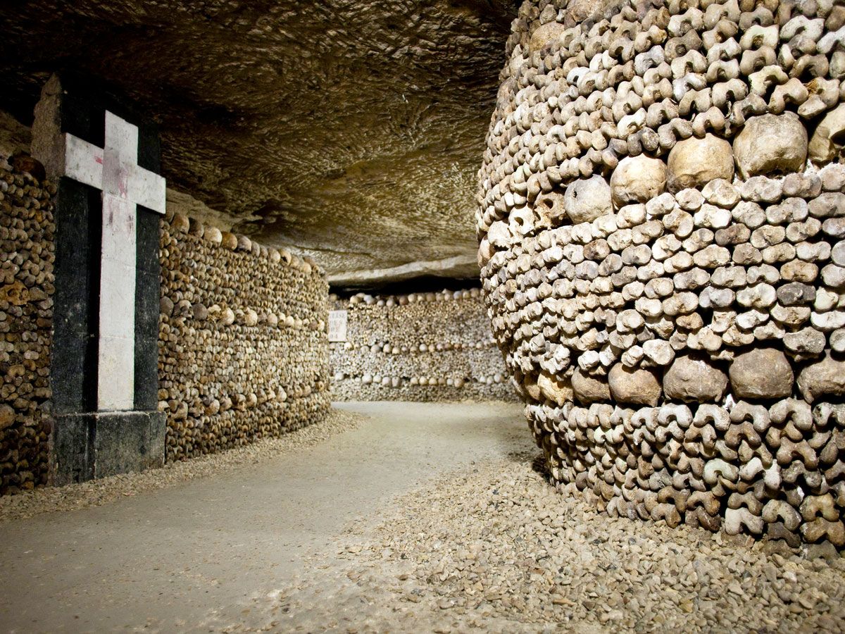
Remains inside Catacombs of Paris
Photo credit: Roger Coulam/ Alamy Stock Photo

By the mid-1700s, the Les Halles neighborhood of Paris faced a particularly disturbing issue. The largest cemetery in the city — the nearby Holy Innocents cemetery (also known as Saints Innocents) — had run out of space for the deceased. Overcrowded and often shallow graves caused corpses to resurface, exposing the living to not only unwelcome sights and smells but also the potential spread of disease. 

In 1763, King Louis XV attempted to slow the overcrowding by banning burials within the city. However, resistance from the Catholic Church hindered any further progress in dealing with the growing public health problem. The issue lingered for years before coming to a head in 1780. After heavy spring rains destroyed a portion of a wall around Les Innocents, decomposing corpses spilled onto nearby properties. King Louis XVI closed the cemetery for good — it was now crucial that the city find a solution. 

Remains Go Subterranean

Remains inside Catacombs of Paris
Photo credit: BonkersAboutPictures/ Alamy Stock Photo

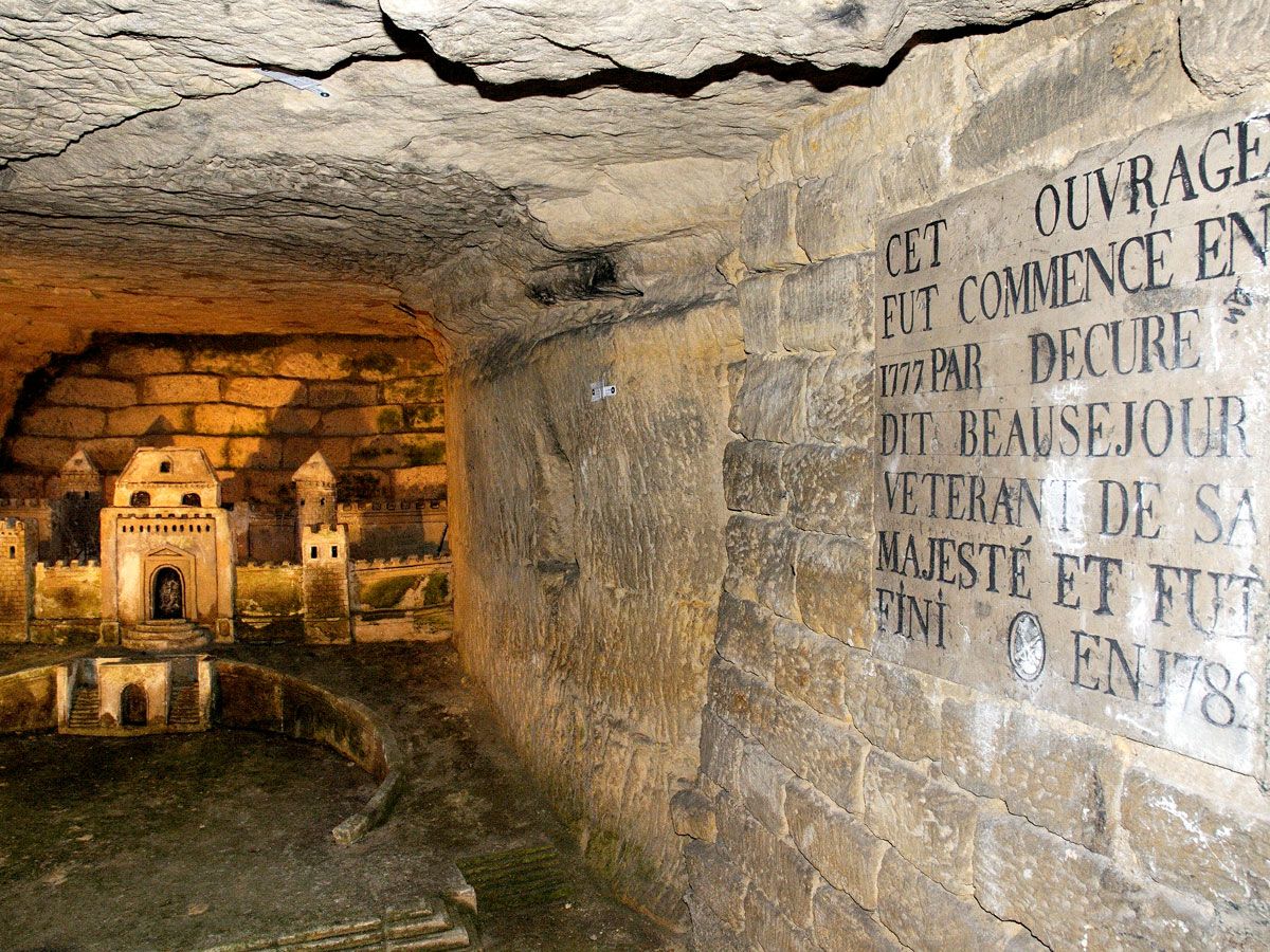
In the wake of the cemetery crisis, the city decided to rehome its former residents’ remains in the empty underground quarries. Beginning in 1785, the bones from Holy Innocents’ tombs, mass graves, and charnel house were moved through a mine shaft in the Tombe-Issoire region to the new ossuaries located 65 feet underground. The remains were transported discreetly, primarily at night, to avoid public outcry and further church opposition. 

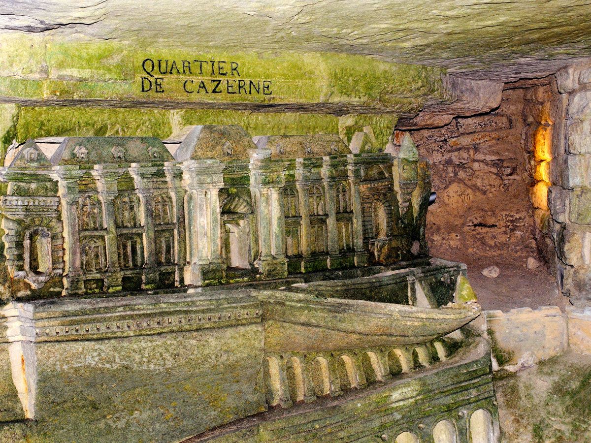
The process of transferring remains from various cemeteries continued over the following years. They were deposited by wagon into quarry wells, and quarry workers loosely organized them within the underground galleries. (Later, under the leadership of Paris mine inspector Héricart de Thury, they were rearranged into the artful displays seen today.) During the French Revolution, bodies were even buried directly underground. The transfers from the city’s cemeteries continued throughout the 1800s; remains ceased being moved into the ossuaries in 1860.

Though the new underground graveyard was formally dubbed the Paris Municipal Ossuary in 1786, the site adopted its now-iconic name shortly after, drawing inspiration from the Roman catacombs. In total, the remains of 6 to 7 million individuals were methodically moved to their final resting place in the Catacombs of Paris. 

Stories, Secrets, and Secondary Uses

Signage in underground tunnel inside Catacombs of Paris
Photo credit: ColsTravel/ Alamy Stock Photo

For at least as long as the Catacombs have been open to the public, the site has been the subject of mystery and intrigue. Over the years, myths and legends about secret societies, talking walls, and missing people have circulated, contributing to the allure of this eerie historical site.

One enduring tale involves the fairly recent discovery of a video camera. In 2010, the device was found with footage from the 1990s of a man who became lost while wandering through the tunnels.  Another legend suggests that a man named Philibert Aspairt haunts the Catacombs. In 1793, he was working as a hospital doorman during the French Revolution when he allegedly disappeared into the catacombs without a trace. 

The mazes of tunnels have also been a hiding spot for the French Resistance during World War II, a brewery, a mushroom farm, a Hollywood movie set, and the site of illegal dinner parties, concerts, and film screenings. In 2015, vacation home rental company Airbnb even offered a Halloween night stay in the ossuary. 

How to Visit the Catacombs Today

Exhibit in Catacombs of Paris
Photo credit: ColsTravel/ Alamy Stock Photo

While the Catacombs of Paris initially opened to the public in 1809 by appointment only, today they’re one of the most popular tourist attractions in the city, welcoming over 500,000 visitors every year. Tickets can only be purchased online, up to seven days in advance and by reserving a specific time slot. 

The entrance to the Catacombs can be found in a small, green building at Place Denfert-Rochereau. To start, you’ll descend 131 steps, then proceed with a 15-minute walk to the ossuary. As you make your way through the dimly lit, narrow hall, you’ll be able to see street names, sculptures, and historical information, before finally making it to the remains, which are artfully arranged into several sections of awe-inspiring skeleton sculptures. The tour lasts about an hour, after which you’ll walk back up 112 stairs to resurface on Avenue René-Coty. 

The Catacombs are kept at a constant temperature of 57 degrees Fahrenheit. It is recommended to dress in light layers that can be carried easily if need be (there is no coat check). Due to the small, dark, and damp nature of the space, the Catacombs are not wheelchair accessible and are not recommended for people with motor ability constraints, cardiac or respiratory issues, or for pregnant individuals. Children under 13 must be accompanied by an adult, and no strollers can be taken in. 

And of course, touching the bones is expressly forbidden. They’re not only fragile — but they are also human remains, not decorations, and warrant respect and care. Indeed, the Catacombs and its inhabitants are a testament to the history and geology of Paris and a reminder of the transience of life. A visit should be on every tourist’s agenda. 

Post Banner Image
Architecture

Have You Visited These Incredibly Tiny Buildings and Landmarks?

By Julia Hammond
Read time: 5 minutes
September 18, 2023
Updated: May 28, 2024

Have You Visited These Incredibly Tiny Buildings and Landmarks?

By Julia Hammond
Author
Julia Hammond
Julia is a U.K.-based travel writer whose work has been featured in The Independent, The Telegraph, The New Zealand Herald, and Culture Trip, among others. She’s an enthusiastic advocate for independent travel and a passionate geographer who has had the privilege of traveling to more than 130 countries in search of a story.

Many of us are fascinated by the world in miniature, which helps explain the enduring appeal of tiny tourist attractions such as Mini Europe in Brussels, Belgium, and Tobu World Square in Nikko, Japan. But there are also many examples of small-scale buildings and landmarks that have appeared organically, developed for residential or commercial purposes. Love a bite-sized building? Here are five of the best incredibly tiny buildings and landmarks that you should seek out on your travels.

Great Britain’s Smallest House – Conwy, Wales

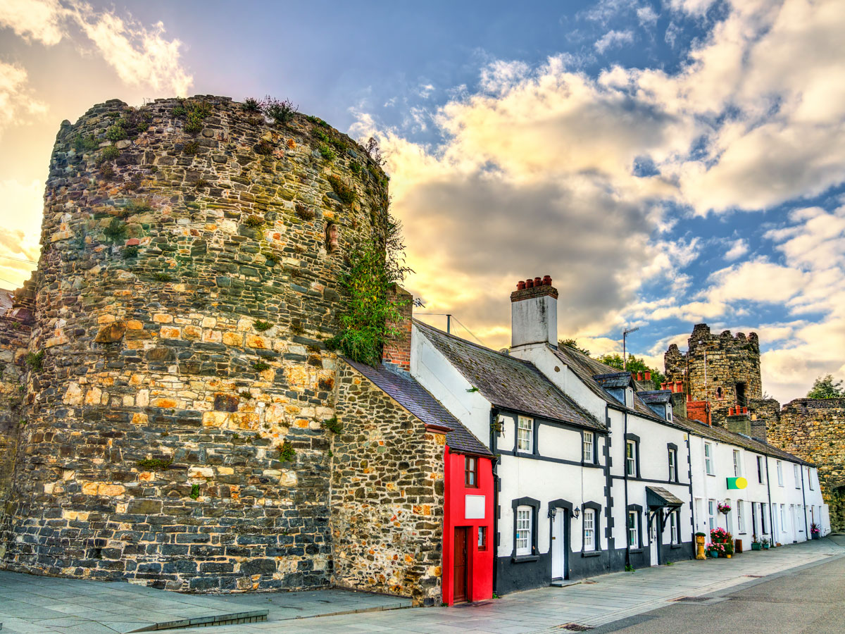
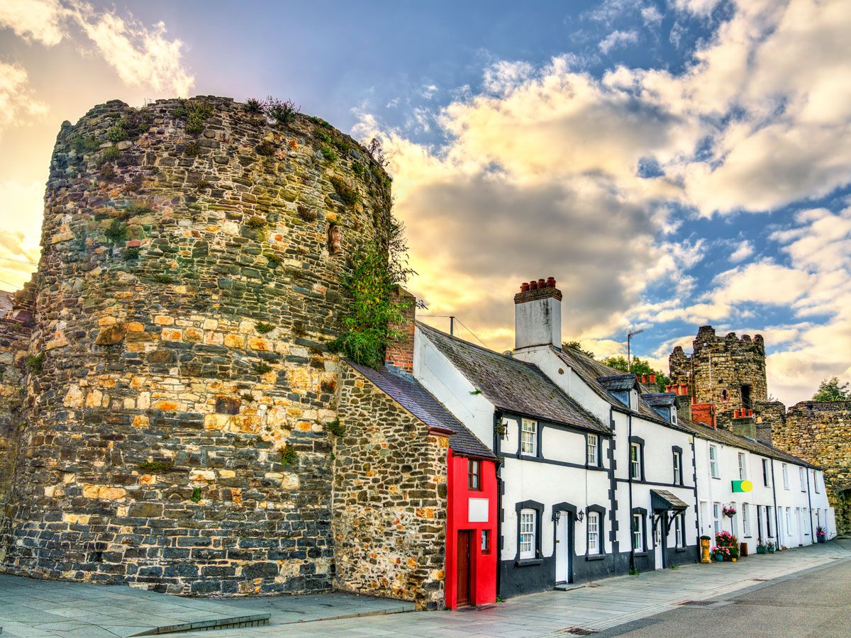
Image of Great Britain's Smallest House, painted bright red and tucked between stone wall and other row homes
Photo credit: Leonid Andronov/ Shutterstock

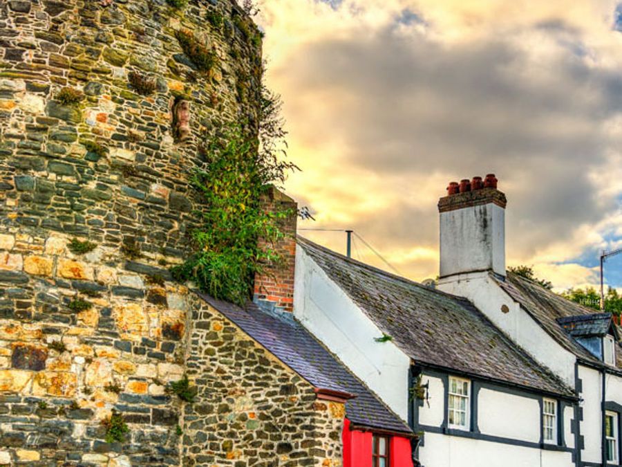
Though it only measures 72 inches across, 122 inches high, and 120 inches deep, the Smallest House in Great Britain is hard to miss. Painted bright red, it sits on the quayside at 10 Lower Gate Street in the historic town of Conwy, Wales. The cozy abode has room for a single bed, a fireplace, and a coal bunker. Its original 16th-century owner saw an opportunity presented by a small gap between two existing rows of cottages and filled it in.  

The house had a succession of residents until 1881, when a fisherman named Robert Jones (who, incredibly, was 6 feet, 3 inches tall) became its last inhabitant. It was declared unfit for human habitation in 1900, but Jones wasn’t going to give up “the Smalls,” as it was affectionately known, without a fight. After a long campaign to save it, the Guinness Book of World Records officially recognized it as Britain’s Smallest House. It remains in the same family to this day, operating as a social history museum.

Washington Mini Monument – Washington, D.C.

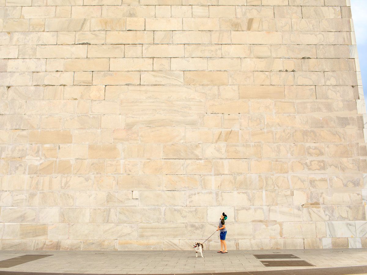
Person walking dog next to Washington Monument in Washington, D.C.
Photo credit: Danielle W Press/ Shutterstock

Tucked out of sight and buried beneath a manhole cover near the real Washington Monument is the Washington Mini Monument. Forty-four times smaller than the real thing, the tiny replica served an important purpose during construction of the Washington Monument, as a benchmark for surveyors keeping an eye on its structural integrity. The replica stands just 12.5 feet tall, compared to the 555-foot Washington Monument, which was once the tallest building in the world after its completion in 1888. 

If you’re wondering what the Mini Monument is doing underground, it’s because it stands on what was once ground level. The hill we see today took shape a few years afterwards, so landscapers encased the obelisk within a brick well and covered it over. It was revealed to the public for the first time in 2019.

Canada’s Smallest Library – Cardigan, Prince Edward Island

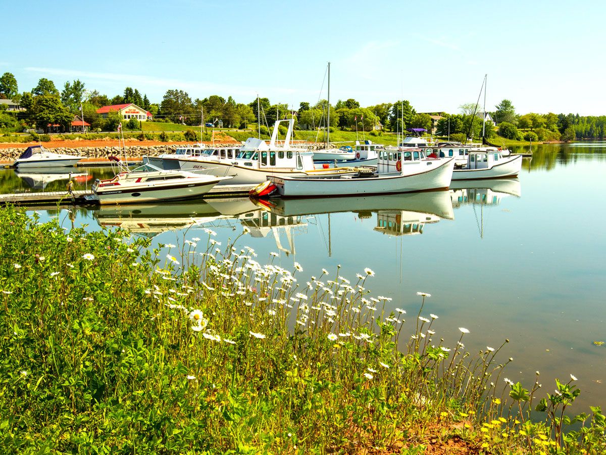
Boats in marina on Canada's Prince Edward Island
Photo credit: All Canada Photos/ Alamy Stock Photo

Despite its diminutive size, Canada’s smallest library — located in the small fishing village of Cardigan on Prince Edward Island — attracts a steady stream of tourist traffic. Established by a local resident named John MacDonald, this fully functional literary landmark measures just 11.5 feet across. Somehow, it manages to squeeze in a collection of around 1,800 books, which visitors can borrow on an honor system. Alternatively, an annual membership costs just $5 CAD. Though it’s not recognized by Guinness World Records, a similar organization, the World Record Academy, considers it the smallest library in the world.  

Little Prince Statue – Chisinau, Moldova

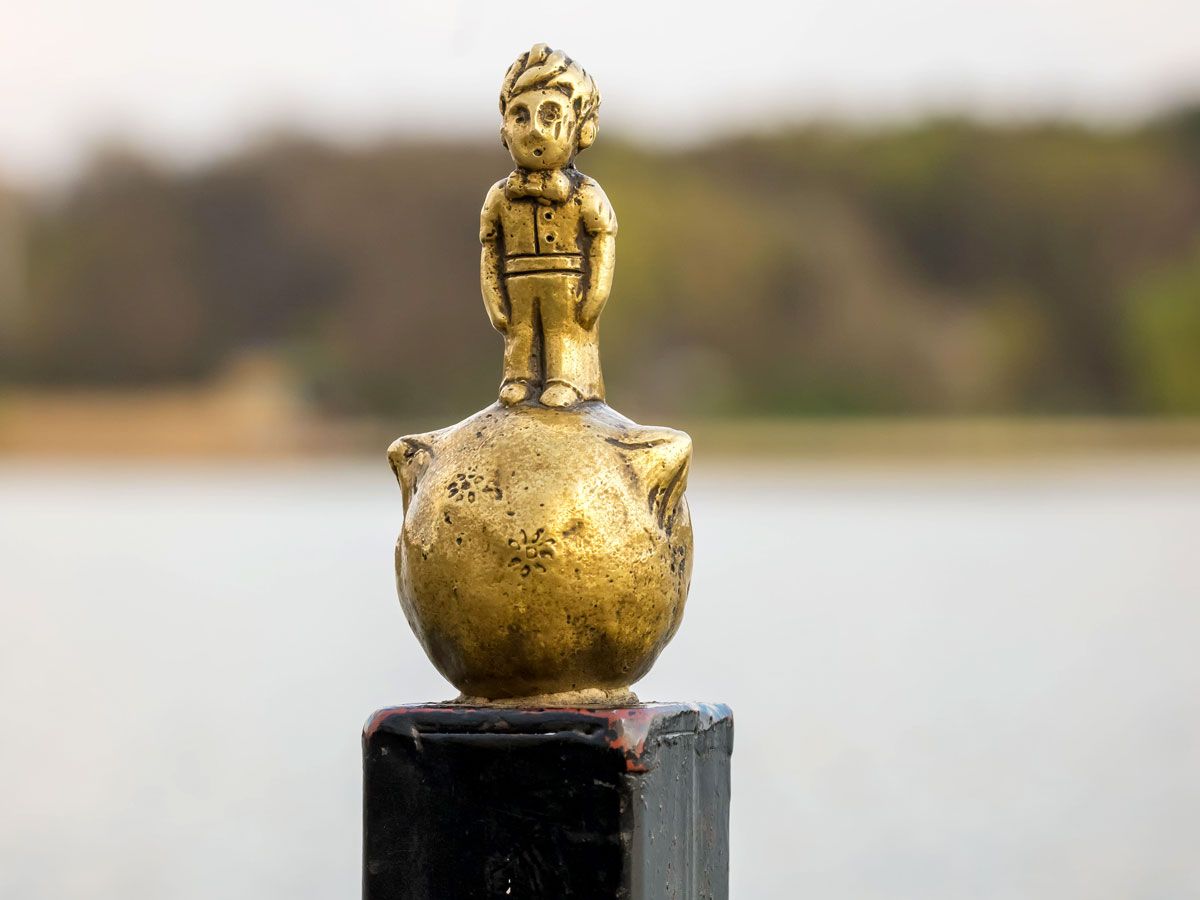
Close-up view of the Little Prince Statue in Chisinau, Moldova
Photo credit: Aliaksandr Mazurkevich/ Alamy Stock Photo

If you thought Copenhagen’s Little Mermaid was small, then you might want to manage your expectations when visiting the Little Prince Statue in Chisinau, Moldova. Standing about 4.5 inches tall, it’s the smallest statue in the city. The statue depicts a character created in the early 1940s by French writer and aviator Antoine de Saint-Exupéry in his children’s book of the same name. 

In the story, a pilot crashes in the desert and encounters the Little Prince, who tells him to follow his heart to discover life’s true meaning. Moldovan artist Igor Udushlivy, who was captivated by the tale, noticed the similarity between the iron balls that topped the fence surrounding the lake in Valea Morilor Park and the planets illustrated in the story. Inspired, he created an art installation that places the Little Prince on top of his home planet, Asteroid B-612. It’s easy to miss if you don’t know to look out for it, but a delightful find if you do.

America’s Smallest Church – Townsend, Georgia

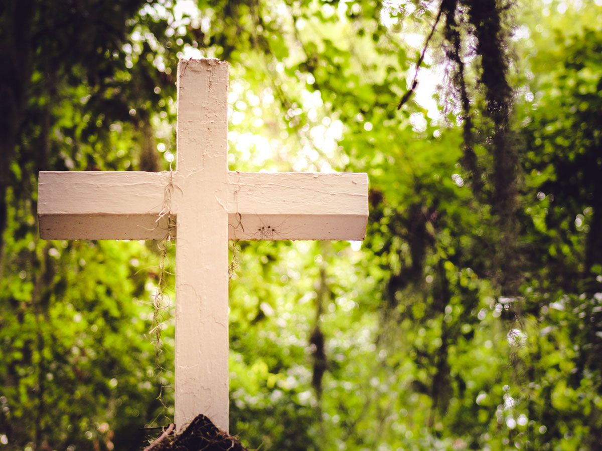
White wooden religious cross in the forest
Photo credit: Mallory Klippel/ Alamy Stock Photo

Billing itself as the smallest church in America, Memory Park Christ’s Chapel is located in Townsend, Georgia, off Interstate 95 and U.S. Route 17 in McIntosh County. A tiny church has stood on this spot since a local grocer named Agnes Harper commissioned it in 1949. The current building, however, is less than a decade old, as it was reconstructed thanks to community fundraising efforts following an arson attack on the original building. Measuring just 10 feet by 15 feet, the church boasts stained glass windows imported from the U.K. Regular non-denominational services are held regularly, and visiting worshippers are welcome at any time. 

However, it’s not the only place to claim the title of America’s smallest church. Another tiny place of worship is the Cross Island Chapel in Oneida, a town located near Syracuse, New York. Built in 1989, this white clapboard building floats on a jetty in the middle of a pond. It seats only two people as its dimensions are just 51 inches by 81 inches. Anyone who can’t fit inside has to remain in a boat, as happened for a 1990 wedding. According to Time magazine, the chapel was only big enough for the happy couple and the minister who married them.

Post Banner Image
Outdoors

Beyond the Parks: 7 National Park Sites to Visit Instead

By Fiona Mokry
Read time: 5 minutes
September 18, 2023
Updated: September 21, 2023

Beyond the Parks: 7 National Park Sites to Visit Instead

By Fiona Mokry
Author
Fiona Mokry
Fiona has spent her career exploring the world and working in the travel industry, turning her lifelong passion into a profession. From planning custom trips to sharing stories as a travel writer for publications such as The Discoverer, she’s all about helping others experience the world in a deeper, more meaningful way.

There are 63 national parks across the U.S., and chances are you can probably name a good number of them — from Yellowstone to Yosemite, Great Smoky Mountains, and Death Valley. But there are also hundreds of other protected areas that fall under the U.S. National Park System, which include National Historic Sites, National Monuments, National Seashores, and National Recreation Areas. If you’re looking to get off the well-traveled national park trail and explore the many other natural and historic preserves in the U.S., start by adding these seven fascinating national park sites (that aren’t national parks) to your travel wish list.

Sleeping Bear Dunes National Lakeshore – Michigan

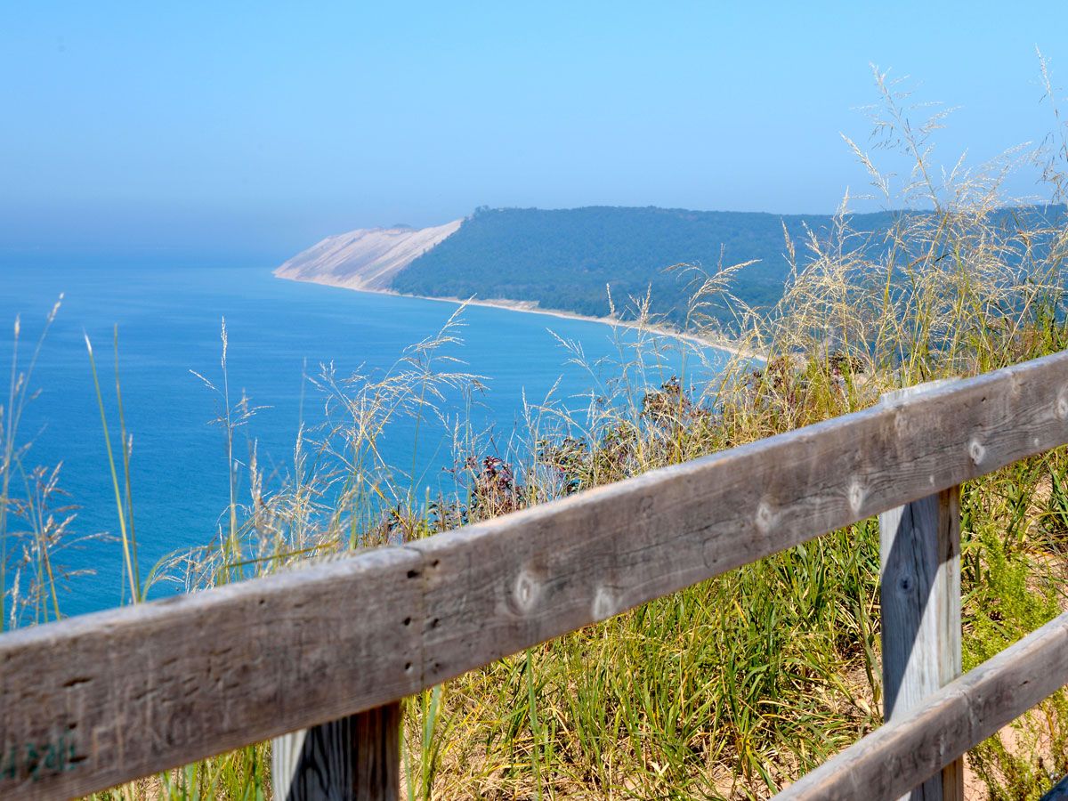
Fenced overlook of the Sleeping Bear Dunes National Lakeshore in Michigan
Photo credit: Marsha Williamson Mohr/ Alamy Stock Photo

One of only three national lakeshores in the country, the 35 miles of Lake Michigan shoreline that make up the Sleeping Bear Dunes National Lakeshore were once relatively undiscovered. While the secret may be out — partly thanks to a 2011 Good Morning America contest that deemed it the “most beautiful place in America” — the park is no less stunning than before, filled with pristine beaches fringed by dense forests, a lighthouse-dotted shoreline, and giant sweeping sand dunes.

The park, established in 1970, gets its name from a particular sand dune that once resembled a sleeping bear and is a sacred landmark for the Anishinaabe peoples. Climbing the dunes, biking and driving the scenic trails, and tubing or kayaking on Lake Michigan are all popular activities for the 1.5 million annual visitors to the national lakeshore. 

Buffalo National River – Arkansas

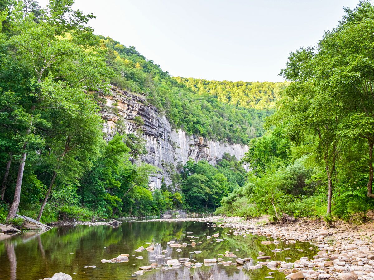
Image of the Buffalo National River
Photo credit: Rachael Martin/ Shutterstock

Cutting through the wild and rugged Ozark Mountains, which cover nearly 50,000 square miles of northern Arkansas and southern Missouri, Buffalo National River was established in 1972 as the country’s first official national river. One of the last remaining undammed rivers in the U.S., the Buffalo National River flows for 135 miles through untouched wilderness that is home to a wide variety of wildlife — including 55 species of mammals, 250 species of birds, and 59 species of fish. The national river offers canoers and kayakers an epic waterscape of churning rapids and calm pools. Hiking is also a big draw, as are the many camping sites found along the river’s banks. 

Chesapeake & Ohio Canal National Historical Park – Maryland

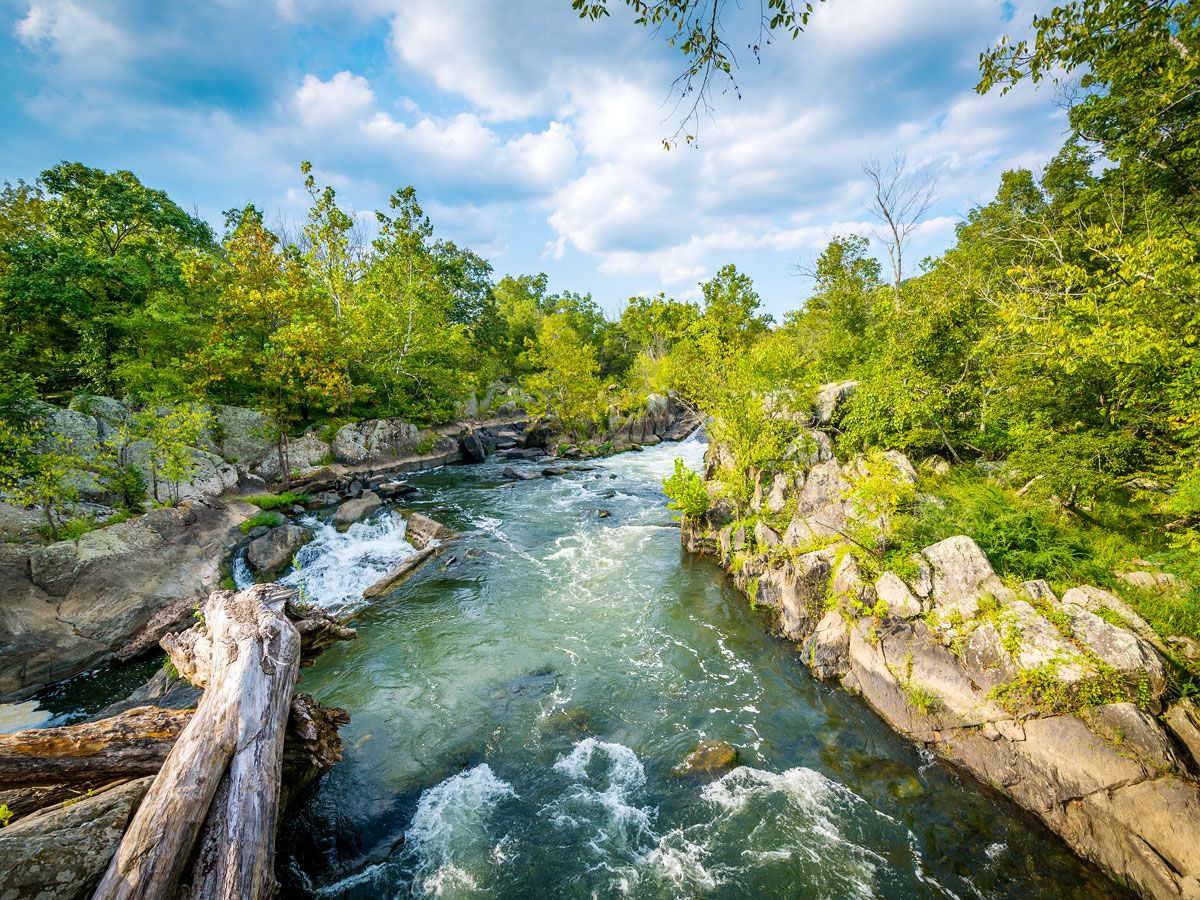
View of the Potomac River in the Chesapeake & Ohio Canal National Historical Park
Photo credit: Jon Bilous/ Shutterstock

The 185-mile Chesapeake & Ohio Canal once served as an important route for transporting coal, lumber, and agricultural products from western Maryland to Washington, D.C., as well as an essential means of transportation for the communities along the Potomac River. Today, remnants of the canal’s significance can still be seen in over 1,000 preserved structures such as lockhouses and aqueducts. A cruise down the meandering waterway is a wonderful way to not only admire the natural scenery of the Potomac River Valley but also delve into the transportation history of the region. Established in 1971, the C&O Canal today is the most visited national historical park in the country, attracting over 4 million visitors annually.

San Antonio Missions National Historical Park – Texas

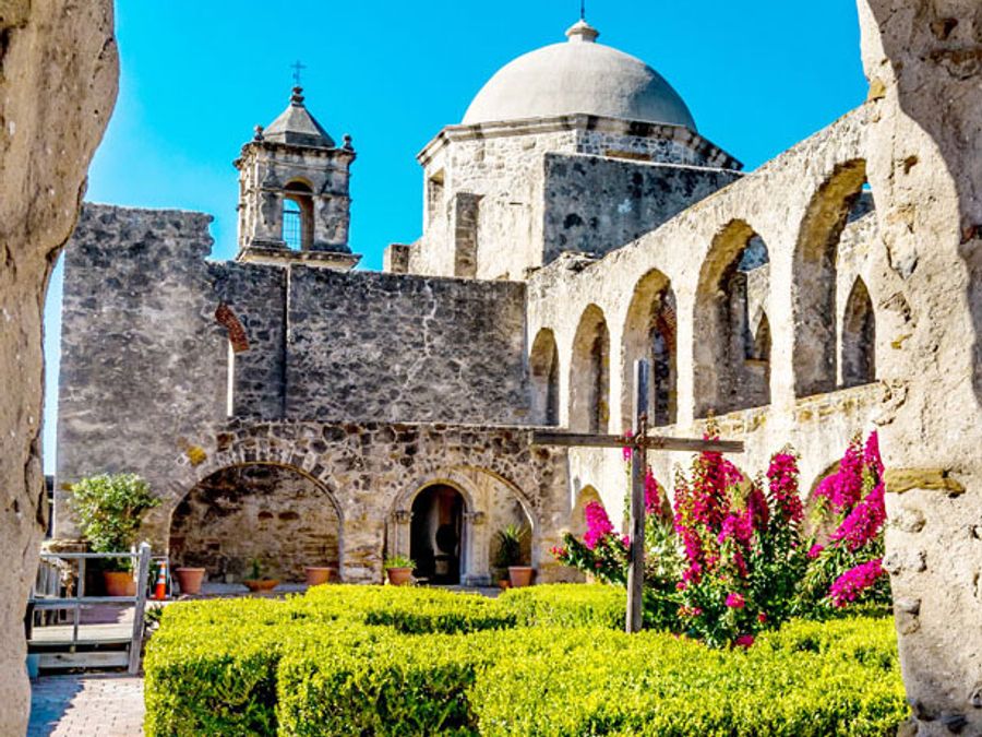
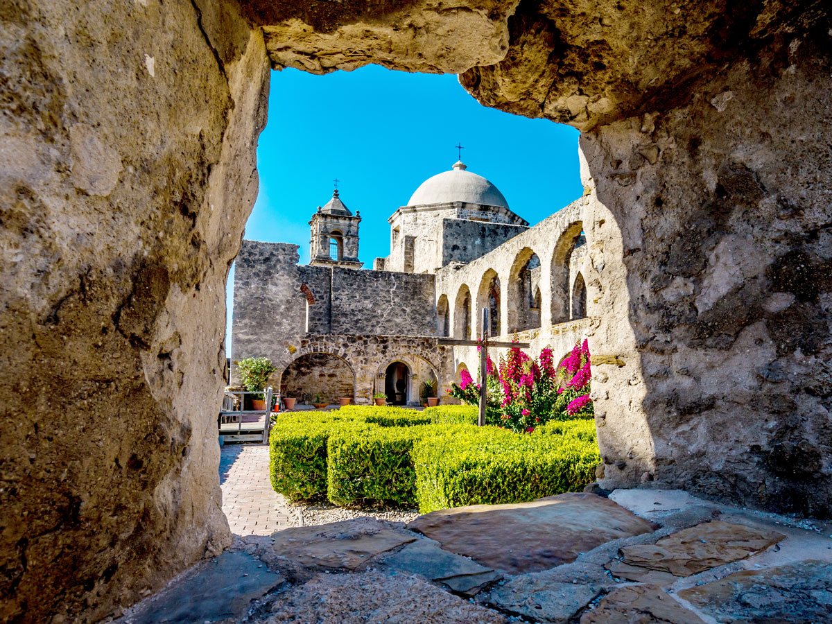
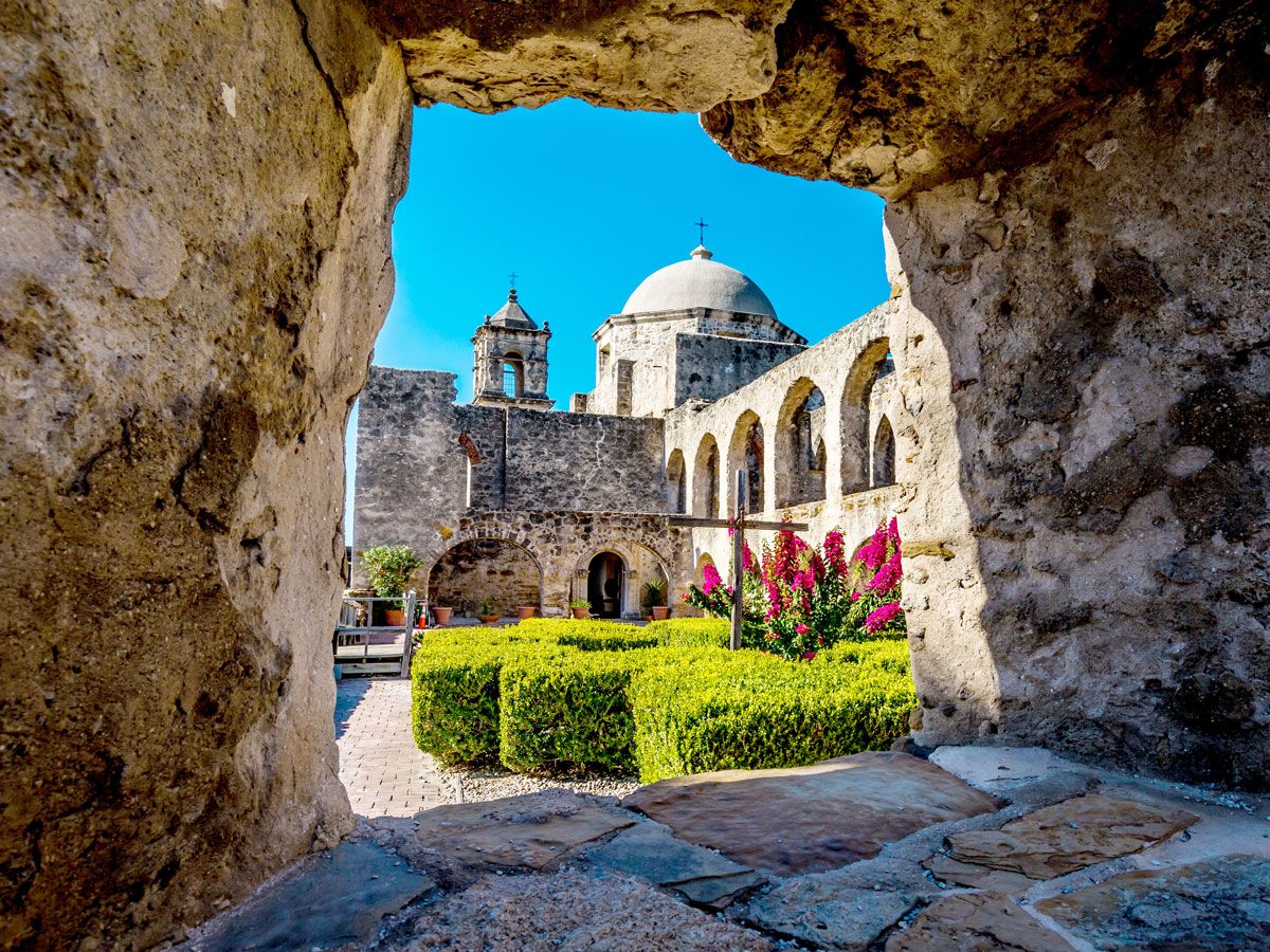
View inside courtyard of the San Antonio Missions
Photo credit: Richard A McMillin/ Shutterstock

History buffs can brush up on early U.S. colonial history at the only UNESCO World Heritage Site in Texas. Although it was more recently inscribed on the UNESCO list in 2015, San Antonio Missions National Historical Park was established in 1983 to preserve four of the original frontier missions built by Spanish settlers in the 17th, 18th, and 19th centuries along the San Antonio River. Here, you can learn about the colonial history of South Texas and how the Indigenous population was Christianized by the settlers. The remains of Missions San José, San Juan, Espada, and Concepción are located within a few miles of one another, and renting a bicycle is a great way to hop from site to site and explore the ruins. 

Gulf Islands National Seashore – Mississippi

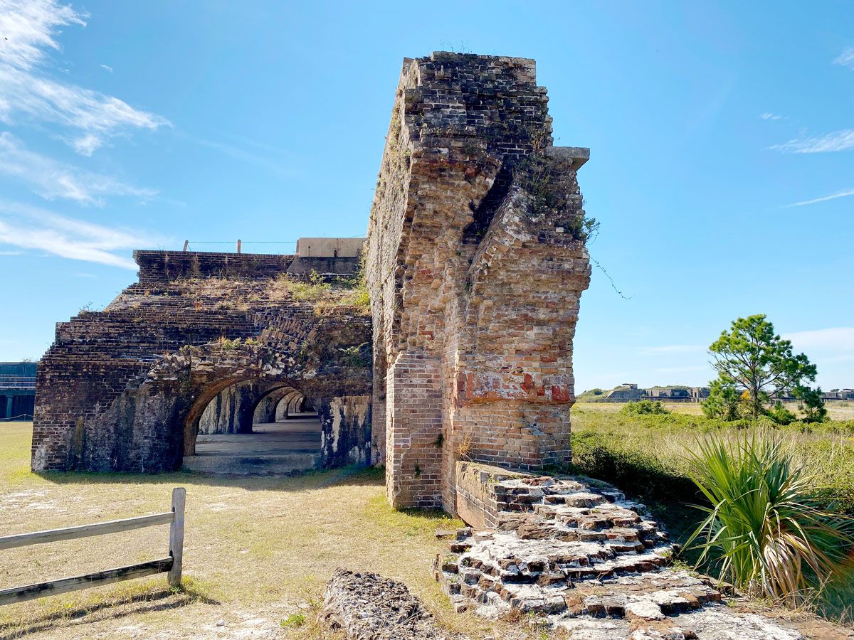
Ruins of stone structure at the Gulf Islands National Seashore in Mississippi
Photo credit: EWY Media/ Shutterstock

Located in the Gulf of Mexico off southern Mississippi and eastern Florida, the Gulf Islands National Seashore comprises a group of seven barrier islands that offer an abundance of natural resources and several sites of historical significance. It is not only the largest national seashore in the National Park System but also the eighth-most visited national park site in the country, attracting 5.7 million visitors in 2022.

Accessible only by boat, the park offers visitors the chance to walk along windswept white-sand beaches, explore nature trails, spot an array of flora and fauna, and see 19th-century fortifications and historic lighthouses. As you might expect, water activities are plentiful, with opportunities to enjoy the warm turquoise waters via scuba diving, snorkeling, swimming, and fishing. 

Klamath Wild and Scenic River – Oregon and California

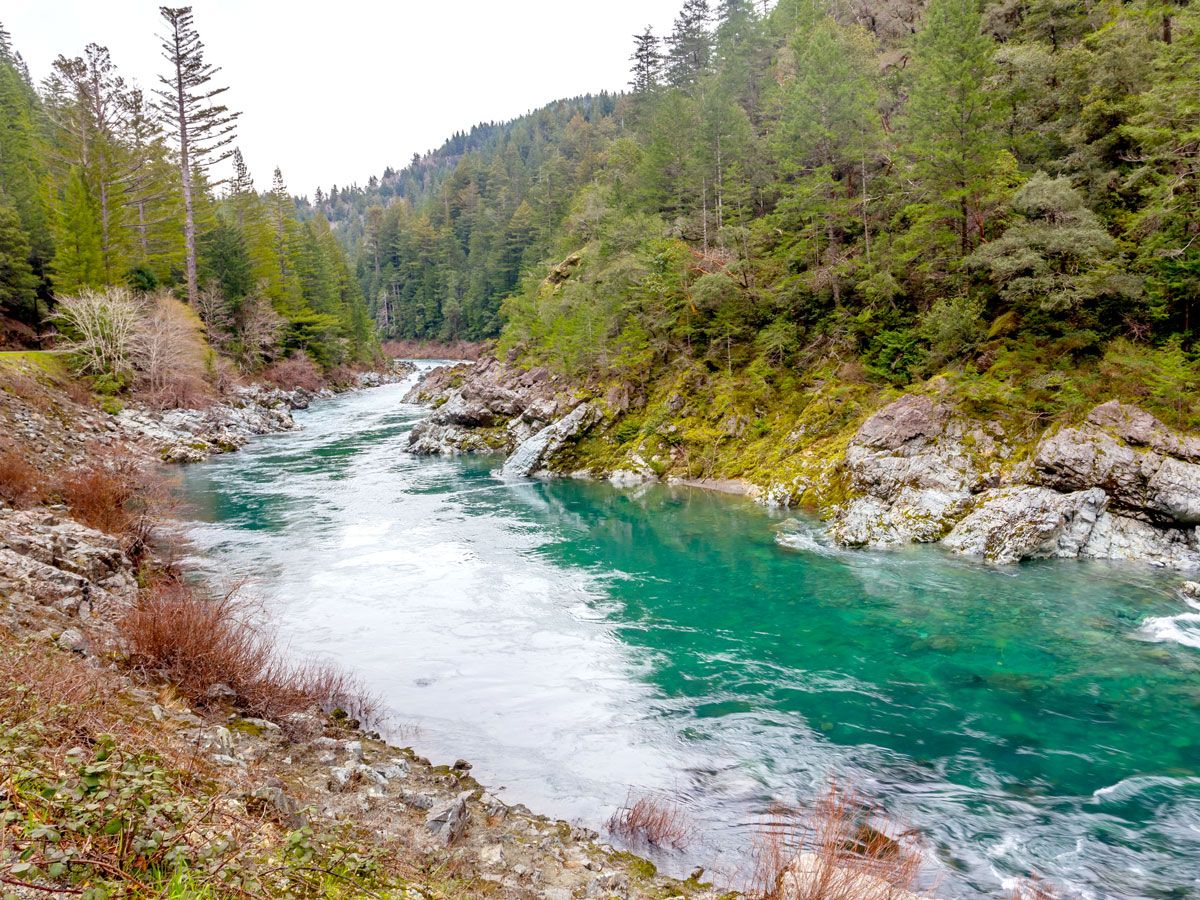
Image of the Klamath River in Oregon
Photo credit: Victoria Ditkovsky/ Shutterstock

Part of the National Wild and Scenic River Program since 1981, the Klamath River flows for 257 miles through Oregon and Northern California. The river is known primarily for its population of salmon, which have long sustained the Indigenous communities who live along the river. The Klamath is home to several important fish species, including chinook salmon, coho salmon, steelhead trout, coastal cutthroat trout, green and white sturgeon, and Pacific lamprey.

Open year-round for recreational use, the national park site attracts visitors with a myriad of recreational opportunities, from camping to fishing, non-motorized boating, white-water rafting on Class II to Class V rapids, swimming, and floating. Hundreds of miles of hiking trails cross the rugged region and offer access to lakes, surrounding peaks, and the famous Pacific Crest Trail. 

Alcatraz Island – California

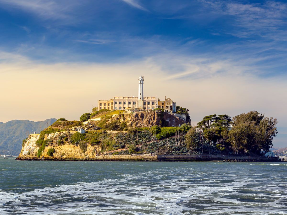
View of Alcatraz Island across San Francisco Bay
Photo credit: f11photo/ Shutterstock

Alcatraz Island has sparked public interest for decades, thanks in part to Hollywood movies — such as The Rock, Murder in the First, and Escape From Alcatraz — that tell captivating tales of convicted felons and daring escapes from this infamous former maximum security prison. But the history of Alcatraz runs much deeper.

When Spanish explorer Juan Manuel de Ayala sailed into San Francisco Bay in 1775, the 22-acre rocky isle, located 1.5 miles off the coast, was a prosperous pelican habitat. The island took its name from the Spanish word alcatraces, which meant pelican or strange bird. It later became the site of California’s first lighthouse in 1854. A military base was erected in 1859 which later served as a residence for military offenders. After defending California from Confederate forces during the Civil War, the island served as a federal prison from 1934 to 1963. In 1973, the island was officially opened for tourism, and today over 1.5 million people visit annually.