Post Banner Image
Geography

The Billionaire’s Playground: 6 Fascinating Facts About Monaco
By Bennett Kleinman
Read time: 5 minutes
May 25, 2023
Updated: July 25, 2023

The Billionaire’s Playground: 6 Fascinating Facts About Monaco

By Bennett Kleinman
Author
Bennett Kleinman
Bennett is a New York City-based staff writer for Daily Passport. He previously contributed to television programs such as the Late Show With David Letterman, as well as digital publications like the Onion. Bennett has traveled to 48 U.S. states and all 30 Major League Baseball stadiums.

Despite being a microstate wedged between Italy and France along the French Riviera, Monaco packs quite a punch as one of the wealthiest nations in the world. From its lavish casinos to world-famous auto races, Monaco has a thriving cultural scene that attracts thousands of high-rolling tourists each year. Here are six fascinating facts you might not know about Monaco.

Monaco Is the World’s Second-Smallest Nation
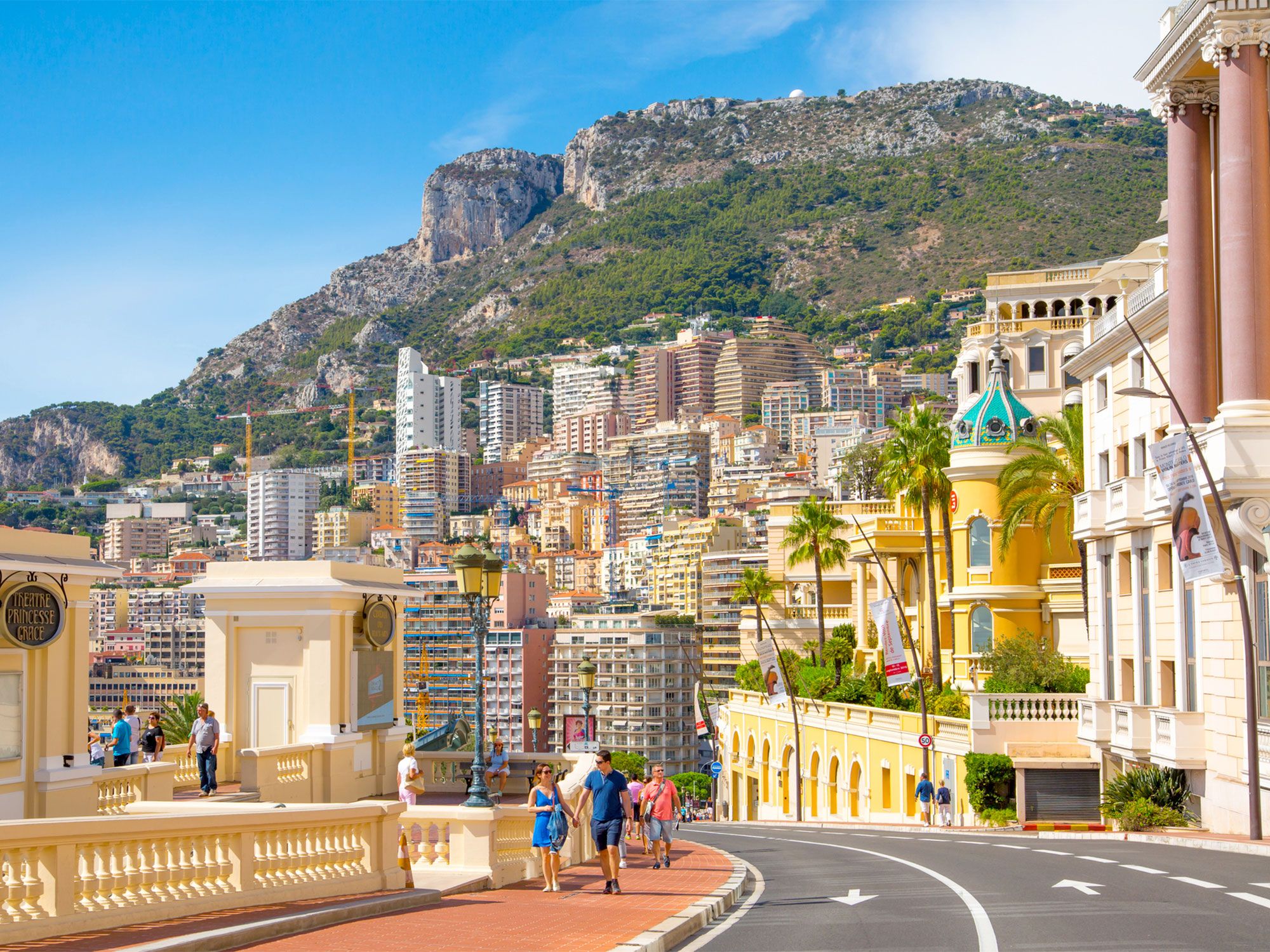
Pedestrians on the steep winding streets of Monaco
Photo credit: IR_Stone/ iStock

Encompassing a total land area of just over 0.77 square miles, Monaco is the second-smallest country on the planet by area, trailing only Vatican City. Monaco’s small area, coupled with its population of around 40,000 residents, makes it the most densely populated sovereign nation in the world. In fact, the only territory with a higher density than Monaco is the Chinese administrative region of Macau. Whereas many other European microstates find themselves landlocked, Monaco does boast a coastline, though it is the world’s shortest at only 2.5 miles in length. Amazingly, the coastline used to be even shorter and has recently expanded due to land reclamation efforts.

Monaco Has the World’s Most Expensive Real Estate
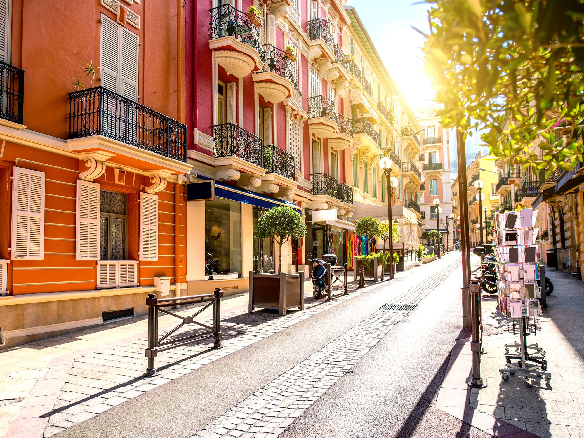
Sun shining through narrow street lined with homes in Monaco
Photo credit: RossHelen/ iStock

Monaco is known as the “billionaire’s playground,” and for good reason. According to the 2023 Knight Frank Wealth Report, Monaco real estate is the most expensive in the world. Here, $1 million USD only affords a mere 183 square feet of space — just half the purchasing power you’d have in New York City. This high financial barrier of entry isn’t a problem for the majority of Monaco’s residents, however, as a 2022 report found that 27,303 of Monaco’s inhabitants had net worths in excess of $1 million USD, with 208 of those ultra-wealthy individuals breaking the $30 million mark. No matter where you turn in Monaco, you’re bound to encounter ostentatious displays of wealth.

Monegasque Citizens Are Prohibited From Gambling
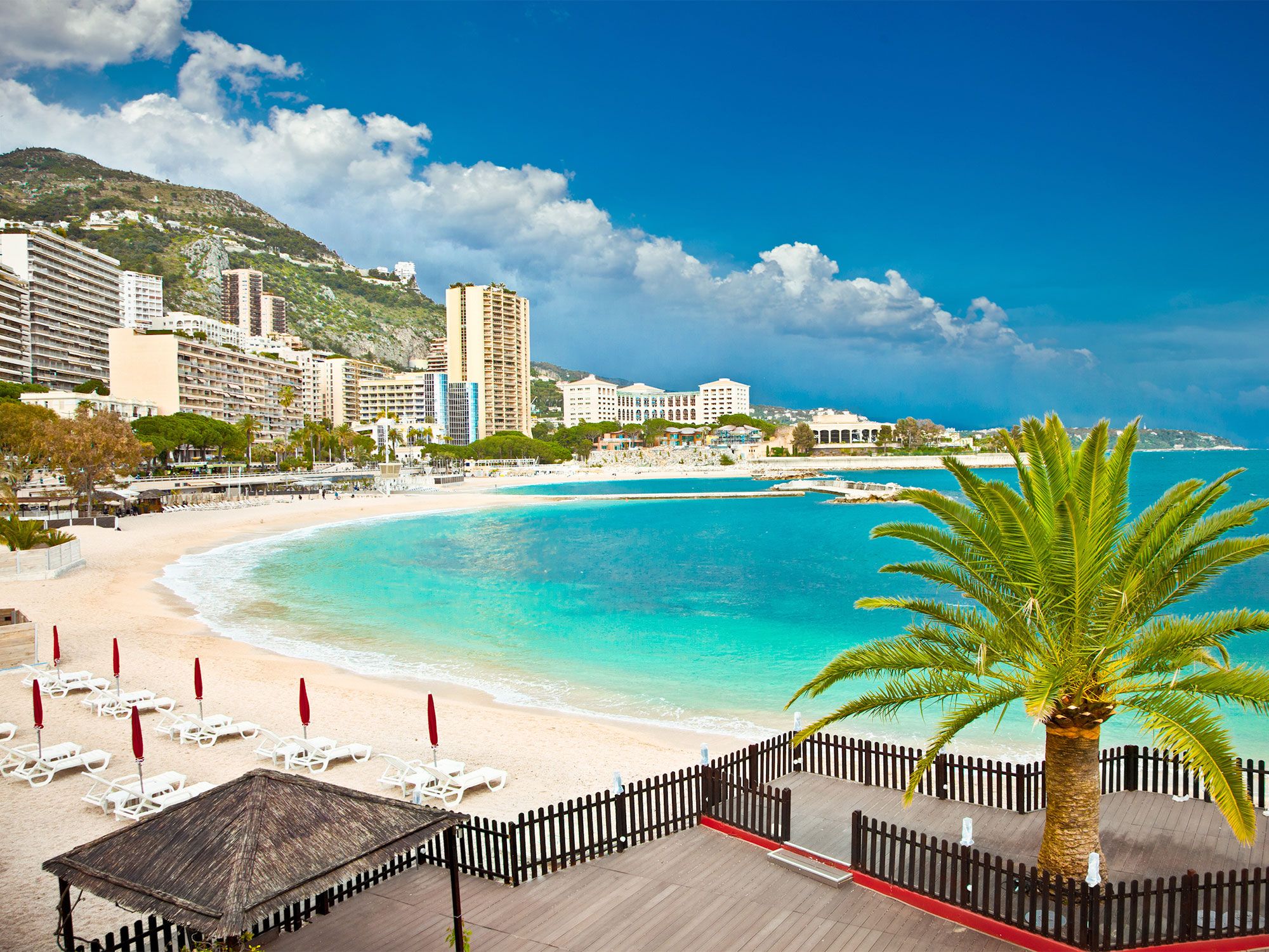
Overview of sandy crescent-shaped beach in Monaco
Photo credit: master2/ iStock

Given the country’s wealth, it makes sense that Monaco has been home to a thriving casino industry since the 1860s. Perhaps no gambling institution is more renowned than the Monte Carlo Casino, which served as a filming location for several films from the James Bond franchise, including 1995’s GoldenEye and 1983’s Never Say Never Again. After Prince Charles III awarded its charter in 1856, the Monte Carlo Casino opened its doors in 1861, and an equally lavish opera house was added in 1878. The casino has been home to several record gambling wins throughout its history, none greater than the $1.092 million that an anonymous Italian gambler scored in a game of roulette in 1974. 

However, none of these gambling victories have been awarded to Monaco residents, who are forbidden to gamble. The rule has been in place since the mid-1800s, when Princess Caroline — consort of Florestan I — oversaw the casino’s development. In an effort to ensure the nation’s residents retained their money, Caroline forbade Monegasque citizens from gambling at local casinos, leaving the industry entirely reliant on tourists and foreigners. In exchange, Monaco residents are exempt from paying income tax.

Actress Grace Kelly Was Princess of Monaco
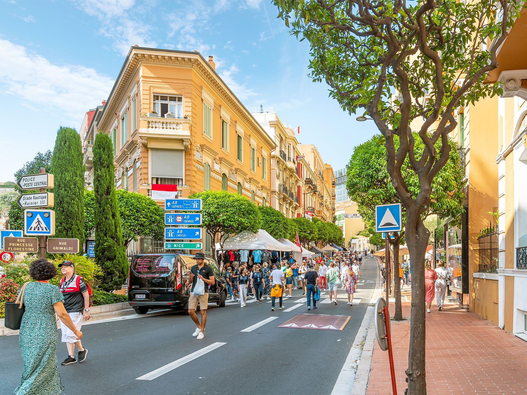
Pedestrians walking on busy street in Monaco
Photo credit: Kirk Fisher/ iStock

Grace Kelly was one of the most famous actresses from Hollywood’s Golden Age, starring in 11 feature films throughout her career — including 1952’s High Noon, 1953’s Mogambo, and 1954’s The Country Girl, the latter of which earned her the Academy Award for Best Actress. Despite Kelly’s thriving acting career, she gave it all up in 1956 to marry Prince Rainier III, a member of Monaco’s long-reigning Grimaldi ruling family. The pair met in 1955 at a photo shoot during the Cannes Film Festival, and Rainier proposed later that year. 

From 1956 until her passing 1982, Kelly remained retired from acting, though she was nearly lured back to Hollywood in 1962 to appear in the Alfred Hitchcock film Marnie. Kelly even agreed to take the part, and a spokesman for the Monaco royal family announced that she would be permitted to act in the film before once again officially retiring from acting. However, Kelly ultimately backed out due to pressure from locals. Outside of lending her narration to a handful of documentaries, the princess never graced the silver screen again, instead focusing on her royal duties.

The Monaco Grand Prix Has the Shortest Track of Any F1 Race
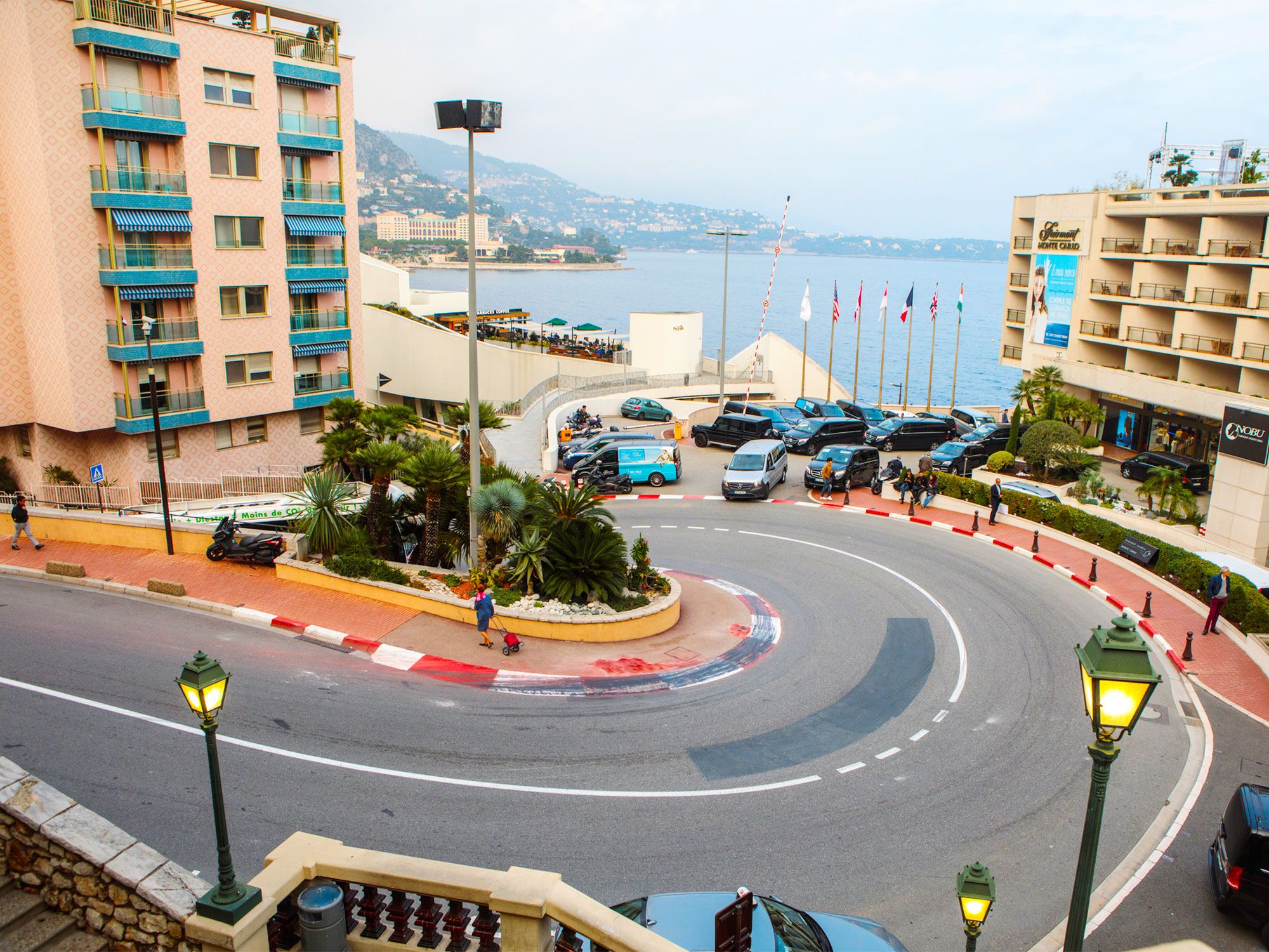
Street with hairpin curves down hill in Monaco, seen from above
Photo credit: Birute/ iStock

First held in 1929, the Monaco Grand Prix was already a fixture on the race calendar when the first modern Formula One World Championship took place in 1950, and it has been held every year since except for in 1955. The prestigious auto race is one of the Triple Crown races of motorsports, along with the Indianapolis 500 and 24 Hours of Le Mans. The Monaco Grand Prix features the shortest track in F1 racing — at just 2.075 miles long, it requires drivers to twist and turn through the city streets and perform nearly 5,000 gear changes over the course of 78 laps.

Of all the individuals to compete in Monaco Grand Prix, no driver has been more successful than Ayrton Senna, whose six wins (once in 1984 and every year from 1989 through 1993) are the most of any driver. The race is a major point of pride for the tiny nation. It requires six weeks to set up and an additional three weeks to remove all of the tires and barriers that line the racetrack.

Monaco Has the World’s Shortest Written Constitution
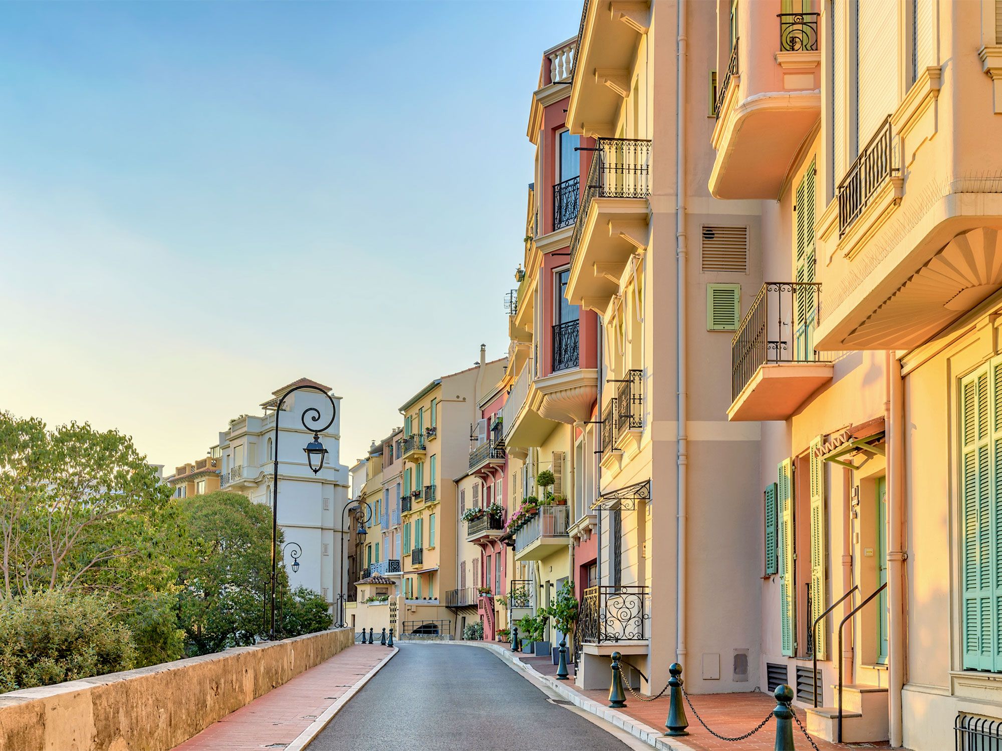
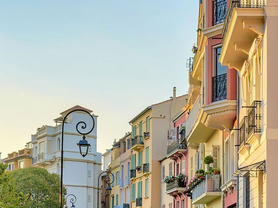
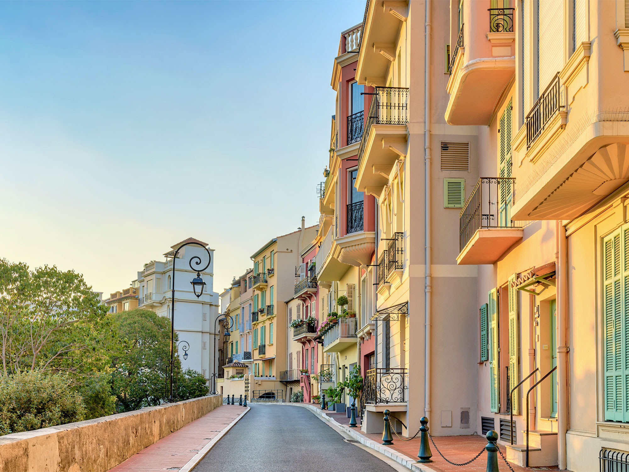
Narrow street in Monaco lined with apartment buildings at sunset
Photo credit: Noppasin Wongchum/ iStock

Since Monaco barely registers on the map, perhaps it’s only fitting that its constitution is equally microscopic, at least compared to other similar documents. Exactly how long is the world’s shortest written constitution? Just eight pages, or 3,184 words, according to the Comparative Constitutions Project. (For reference, the U.S. Constitution is about double that length, at 7,762 words.) Monaco’s current constitution was adopted in 1962, under Prince Rainier III’s reign, and outlines the three branches of government and also states the line of succession to the Monegasque throne. Although the prince of Monaco holds the highest executive power in the land, the minister of state heads the government and is responsible for enforcing the laws established by this diminutive document, as well as guiding a six-member advisory council. 

Post Banner Image
Culture

9 Famous Food Markets Every Foodie Should Visit

By Jersey Griggs
Read time: 5 minutes
May 18, 2023
Updated: October 3, 2025

9 Famous Food Markets Every Foodie Should Visit

By Jersey Griggs
Author
Jersey Griggs
Jersey is a travel and lifestyle writer whose work has appeared in publications such as Condé Nast Traveler, Business Insider, and Bust. When she’s not exploring her adopted home state of Maine, she’s likely planning her next big trip.

Often, the best way to experience a new culture is by eating the local cuisine. But restaurants aren’t the only way to try a country’s essential dishes. Food markets allow travelers to encounter new flavors, sample regional street food specialties, or buy the freshest, local ingredients available. From night markets to floating markets, here are nine international food markets foodies won’t want to miss on their next vacation.

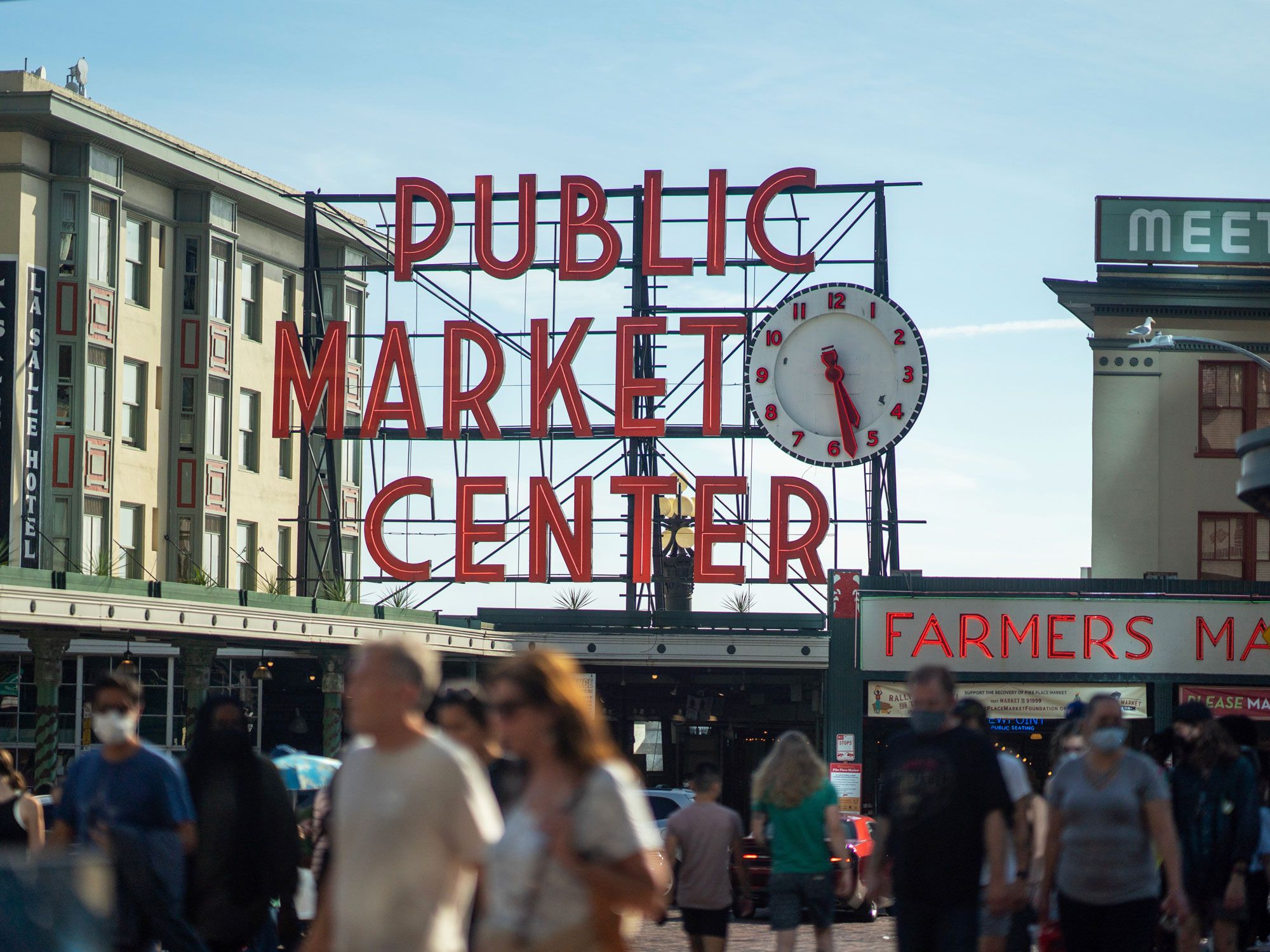
Pike Place Market – Seattle, Washington

People walking under sign for Pike Place Market in Seattle, Washington
Credit: Ricky Han/ Unsplash

What began as a humble Seattle farmer’s market in 1907 has since turned into one of America’s most famous food markets. Located next to Pier 62 in downtown Seattle, Pike Place Market features hundreds of small, independent businesses selling a variety of foods and goods, including fresh produce, locally caught seafood, and handmade crafts. You’ll find everything here from top-rated restaurants with sit-down service to specialty food shops and fishmongers tossing the catch of the day. Coffee lovers can also visit the original location of Starbucks: The coffee chain got its start at Pike Place Market and named its signature blend after the city’s beloved market.

La Boqueria – Barcelona, Spain

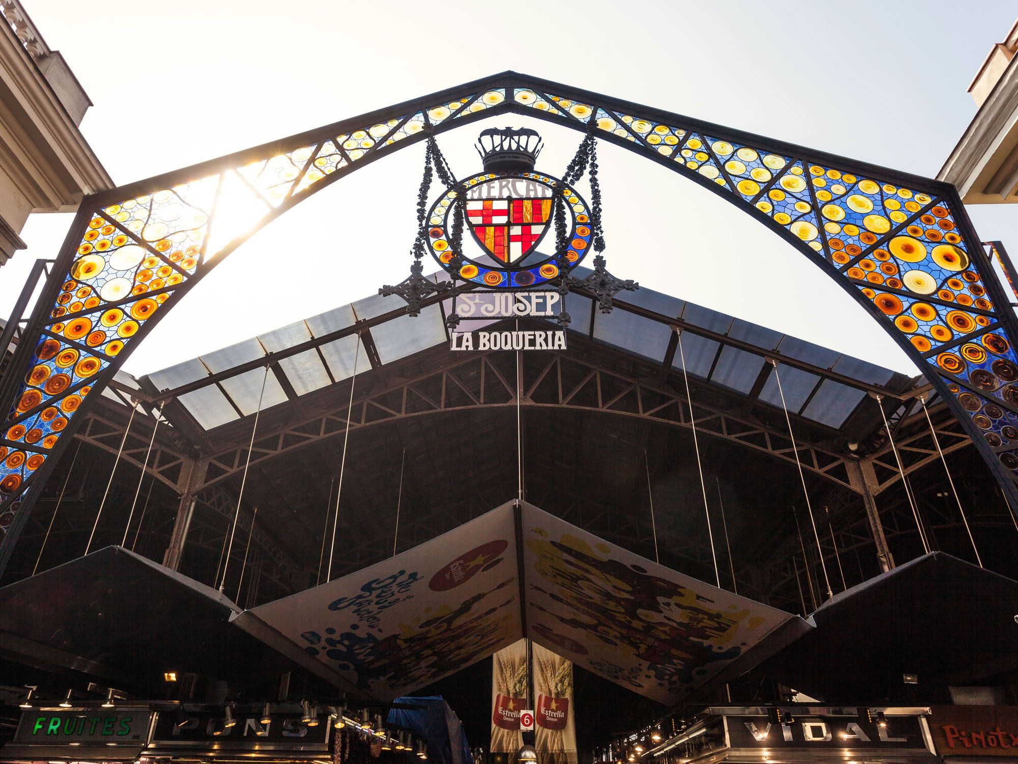
Sign above entrance to La Boqueria market in Barcelona, Spain
Credit: Fotomaton/ Alamy Stock Photo

Situated on bustling La Rambla Boulevard in Barcelona’s city center, La Boqueria is the city’s oldest and most famous food market. Dating back to the 13th century, La Boqueria began as an open-air market and has since transformed into a top-notch foodie destination, where visitors can browse the stalls to purchase local cheeses such as manchego, Spanish olives, and legs of jamón Ibérico (cured ham) — or perhaps a bocadillo de jamón (cured ham sandwich) for lunch on the go. The market also offers a culinary school where foodies can try their hand at Spanish cuisine in a cooking class.

Amphawa Floating Market – Mae Klong River, Thailand

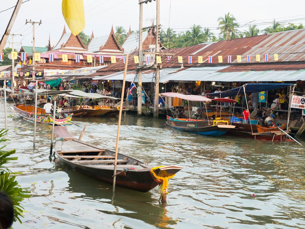
Boats and market stalls of Amphawa Floating Market in Thailand
Credit: Boogich/ iStock

The Amphawa Floating Market is located about 30 miles south of Bangkok on the branching canals of the Mae Klong River. At this unusual market, vendors have sold their goods from longtail boats — traditional wooden vessels used to navigate the region’s famous klongs (canals) — for over a century. Market goers can sample traditional noodle and curry street food dishes, fresh local fruit, grilled seafood such as pla tuu Mae Klong (mackerel), and popular Thai snacks and desserts such as jelly sugar candies. The floating market is open only on weekends, and boat tours often include stops at the many teak storefronts lining the waterways.

Östermalms Saluhall – Stockholm, Sweden

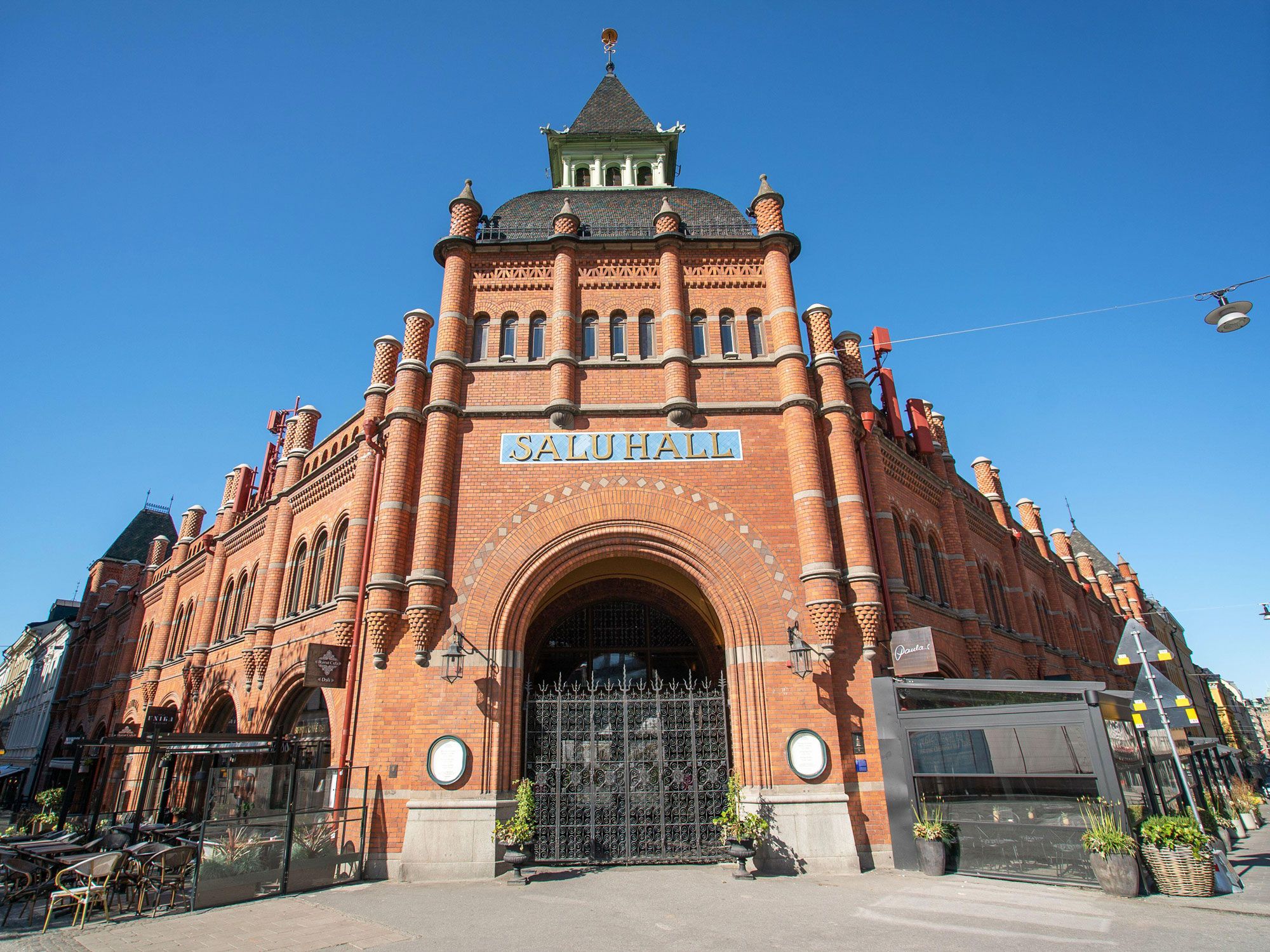
Red brick exterior of Östermalms Saluhal in Stockholm, Sweden
Credit: James Berry/ Alamy Stock Photo

Östermalms Saluhall has been a Stockholm staple since it opened its doors in 1888. The historic market is housed in a striking cathedral-like red brick building in central Stockholm, which was renovated in 2020 — preserving many of the original interior details such as stalls carved from dark lacquered wood. Shoppers are drawn to the market for its delicious array of Swedish pastries, bread, desserts, fresh seafood, and local meats and cheeses. For a sit-down meal, restaurants range from traditional Swedish cafes and seafood eateries to New York pizza and Lebanese cuisine.

The Quadrilatero – Bologna, Italy

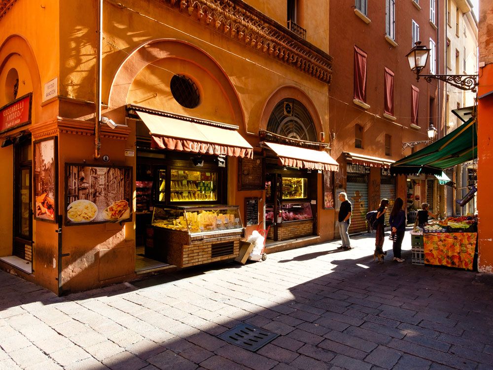
Vendors selling food at the Quadrilatero in Bologna, Italy
Credit: Cividins/ iStock

Lauded by travelers as the best food city in Italy, Bologna certainly lives up to the hype with its oldest food market. Taking up an entire city block, the Quadrilatero dates back to medieval times, when local butchers and bakers would hawk their products along the narrow alleyways. Today, it’s not so different, with cured meat and cheeses, handmade pasta, seafood, and freshly baked bread all for sale to hungry market goers. If you’re feeling peckish, the market also houses plenty of restaurants and cafes for espresso, gelato, or a glass of vino after a long day of shopping.

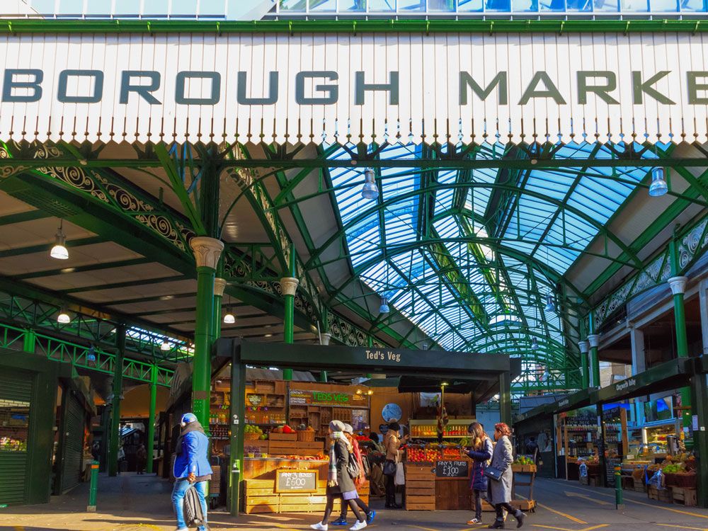
Borough Market – London, England

People browsing food stalls at Borough Market in London, Eengland
Credit: VictorHuang/ iStock

Borough Market is one of London’s most iconic food destinations, with roots dating back to the 13th century. Once a place for traders to sell wholesale items, the Borough has since evolved into the city’s premier sustainable-minded market. With traders selling seasonal fruits and vegetables, traditional cheeses, and locally-produced meat, it would be hard to make a bad meal after shopping at the market. Borough Market also celebrates the city’s diverse culinary influences, with eclectic street food hailing from places such as Greece, Argentina, Iraq, Thailand, and Singapore.

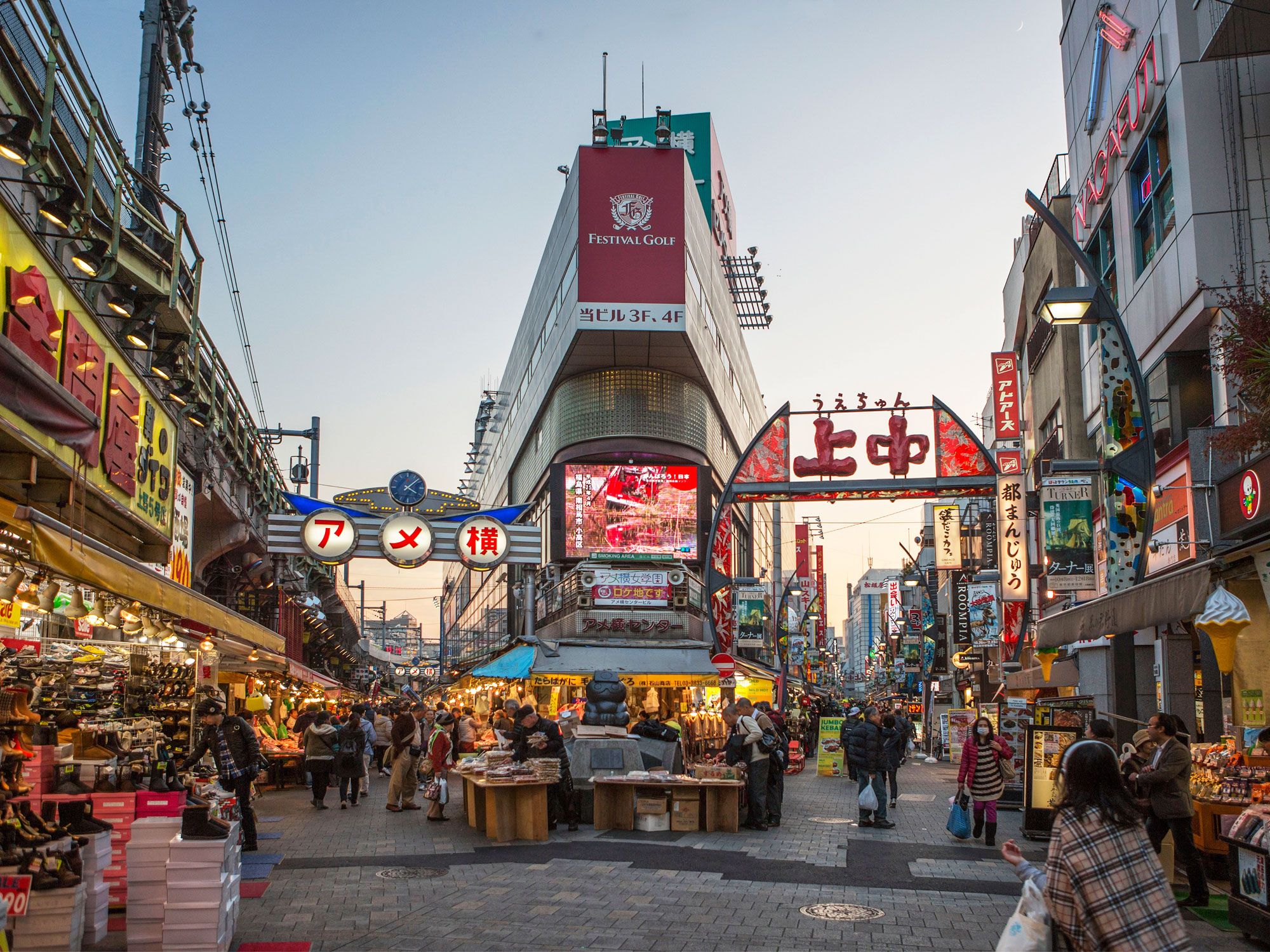
Ameyoko Market – Tokyo, Japan

People walking through Ameyoko Market in Tokyo, Japan, at dusk
Credit: Prisma by Dukas Presseagentur GmbH/ Alamy Stock Photo

Central Tokyo’s Ameyoko Market once functioned as a black market in the aftermath of World War II, when American products were sold illegally on the street. These days, the market is very much above board. Aside from selling candy (ameyoko translates to “candy store alley”), vendors offer traditional spices, matcha-flavored desserts, and succulent regional fruits. The market’s specialty, however, is seafood, with a stunning variety of fresh fish, octopus, and shellfish available to purchase. Adventurous foodies will also want to sample the market’s street food, such as chirashi don (scattered sushi) and takoyaki (octopus dumplings).

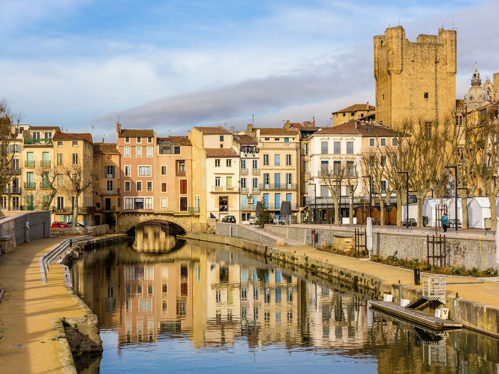
Marché des Halles de Narbonne – Narbonne, France

Canal and buildings in Narbonne, France
Credit: Leonid Andronov/ iStock

With so many enticing food markets throughout France, it’s hard to pick a favorite. But since viewers of French TV channel TF1 voted it the country’s top food market in 2022, Marché des Halles de Narbonne is a great place to start. Located in a spectacular glass and cast-iron pavilion built in 1901 in Narbonne, a town in the south of France, Marché des Halles offers all the expected French staples, including fresh meat from local butchers, artisan cheese, and freshly baked bread and pastries from its 70-plus vendors. High-quality French products like honey, coffee, and wine are also highlights of the market, and several sit-down restaurants, including an oyster bar, are available to refuel after shopping.

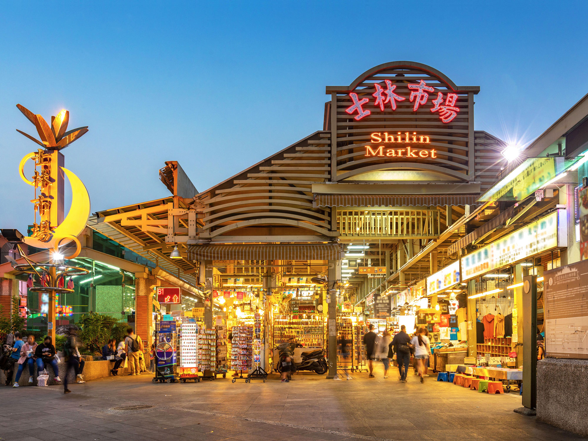
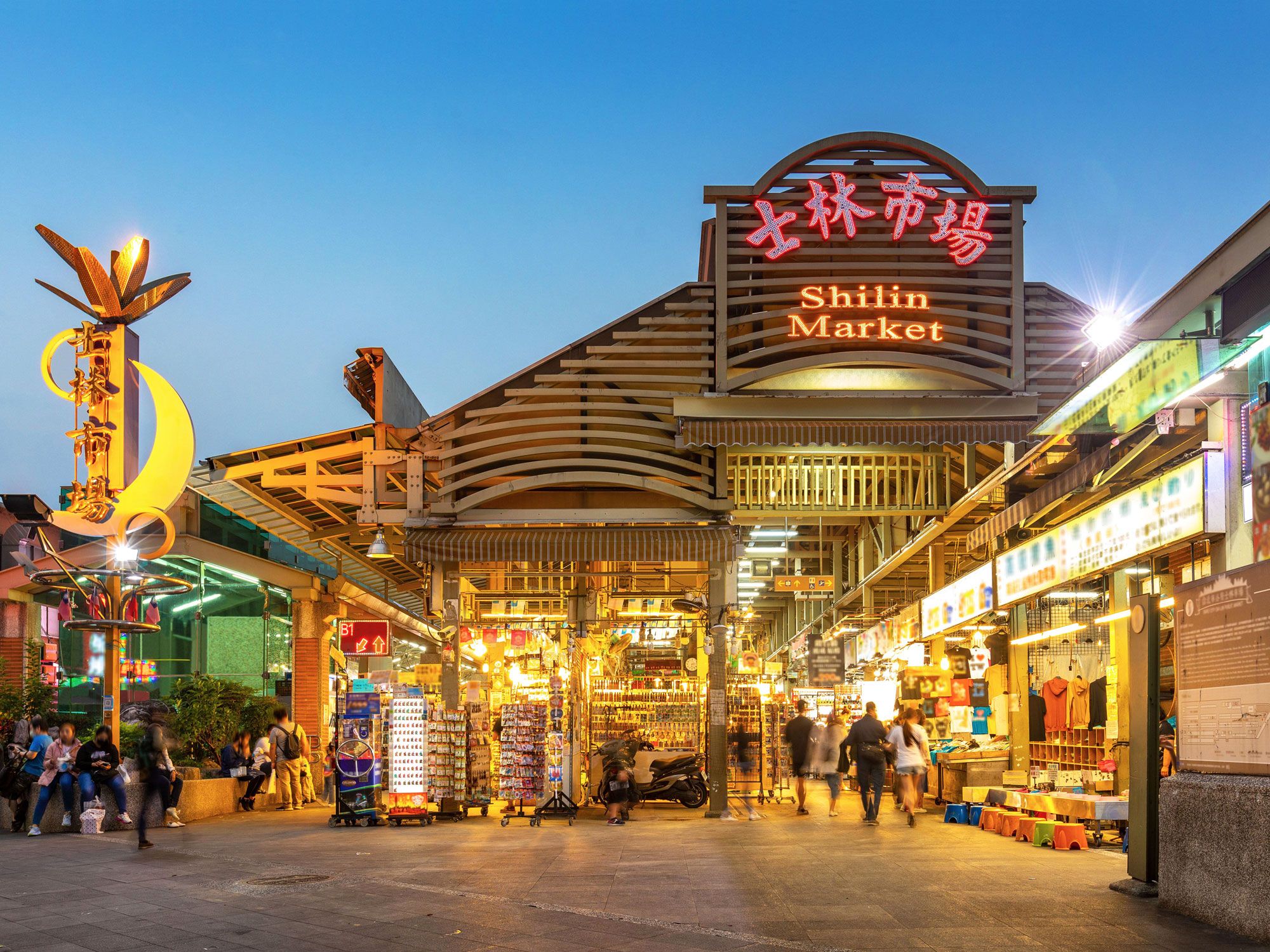
Shilin Night Market – Taipei, Taiwan

Exterior of Shilin Market in Taipei, Taiwan at dusk
Credit: Sean Hsu/ Alamy Stock Photo

The Shilin Night Market comes alive when the sun goes down, turning the famous Taipei district into an eclectic and dizzying experience. With more than 500 stalls, the massive indoor market is a maze of food stands, hand carts, and vendors, with a produce section on the ground floor and a snack market taking up a few city blocks. Most visitors head straight to the food court, which sells an assortment of Taiwanese specialities, including the market’s most famous dish, an oyster omelet. Other popular food and drink offerings include bubble tea, stinky tofu, fried buns, and chicken-fried steak.

Related: Will Noctourism Be 2025’s Hottest Travel Trend?
Post Banner Image
Geography

The 8 Most Densely Populated U.S. States

By Bennett Kleinman
Read time: 5 minutes
May 18, 2023
Updated: July 25, 2023

The 8 Most Densely Populated U.S. States

By Bennett Kleinman
Author
Bennett Kleinman
Bennett is a New York City-based staff writer for Daily Passport. He previously contributed to television programs such as the Late Show With David Letterman, as well as digital publications like the Onion. Bennett has traveled to 48 U.S. states and all 30 Major League Baseball stadiums.

The United States is a massive country, spanning over 3.7 million square miles. However, America’s 335 million residents are far from distributed equally. While regions like the Great Plains are home to vast, open expanses of land, the Northeast and Mid-Atlantic are a much different story, as residents of these regions often find themselves packed inside major cities and towns with comparably small land areas. Below, discover the eight most densely populated U.S. states.

8. Florida

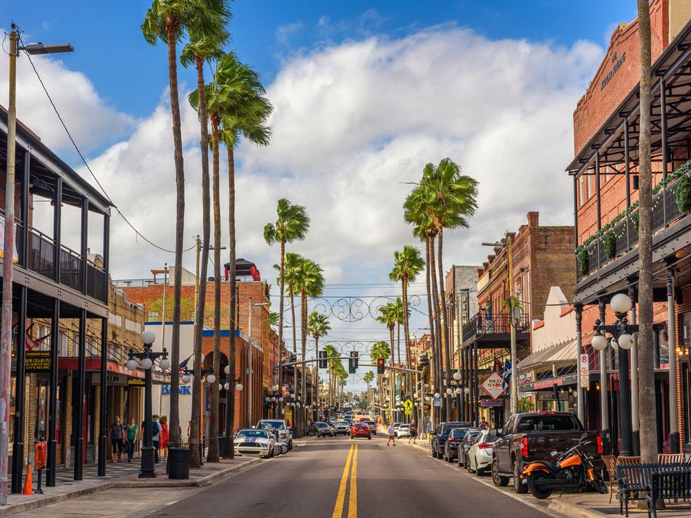
Historic Ybor City neighborhood of Tampa, Florida
Credit: miroslav_1/ iStock

The only Southern state to crack the top eight in the list of most densely populated states, Florida has an average of 401.4 people per square mile. Over 21.5 million Floridians call the state’s 65,758 square miles home, which is an area equivalent in size to about one-third of the country of Spain. Florida’s most populous city is Jacksonville, with 987,960 residents — more than double the population of the next most populous city, Miami. When it comes to density, however, Miami has Jacksonville beat: Miami’s 455,075 residents share an area of just 36 square miles. The most densely populated place in Florida is the 0.79-square-mile city of Sweetwater in Miami-Dade County, with a population density of 25,610 people per square mile.

7. New York

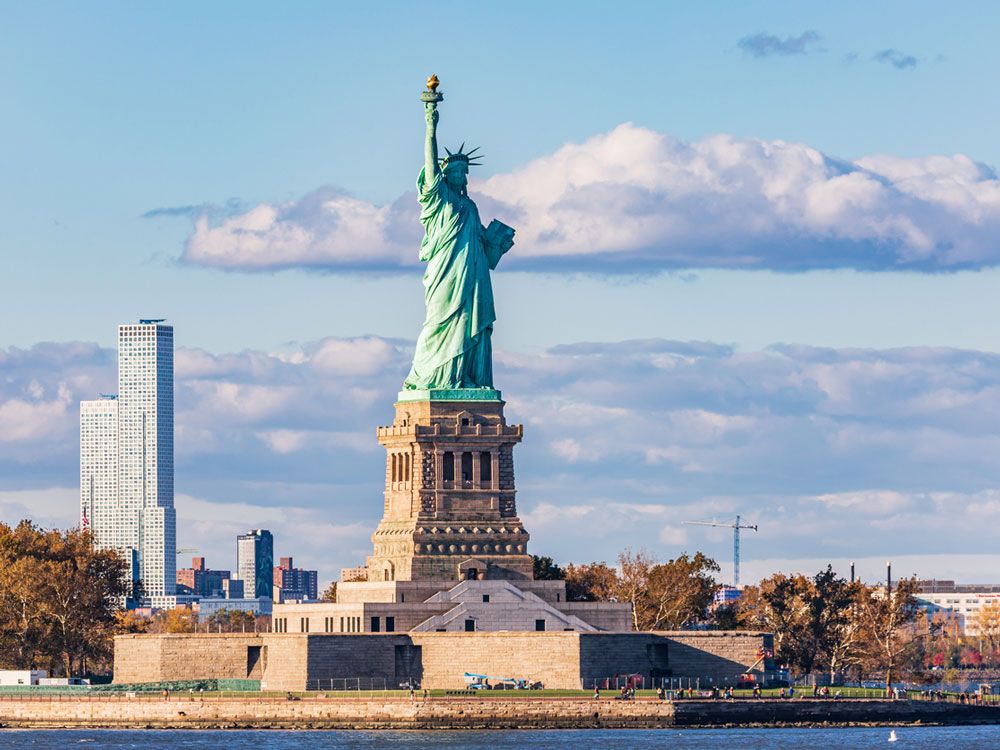
Statue of Liberty in New York Harbor
Credit: Emily_M_Wilson/ iStock

The 27th-largest state in the country, New York covers approximately 54,555 square miles. According to the 2020 Census, New York state’s total population of 20.2 million residents gives the state an average population density of 428.7 people per square mile. On a more localized scale, New York City boasts a staggering population density of 29,938 people per square mile, with nearly 9 million residents spread across just 300.38 square miles. Amazingly, New York does not boast the highest population density in the state —  hat distinction lies with the tiny town of Kaser in Rockland County, near the New Jersey border. The village has a population of just 4,919 people living across 0.17 square miles.

6. Delaware

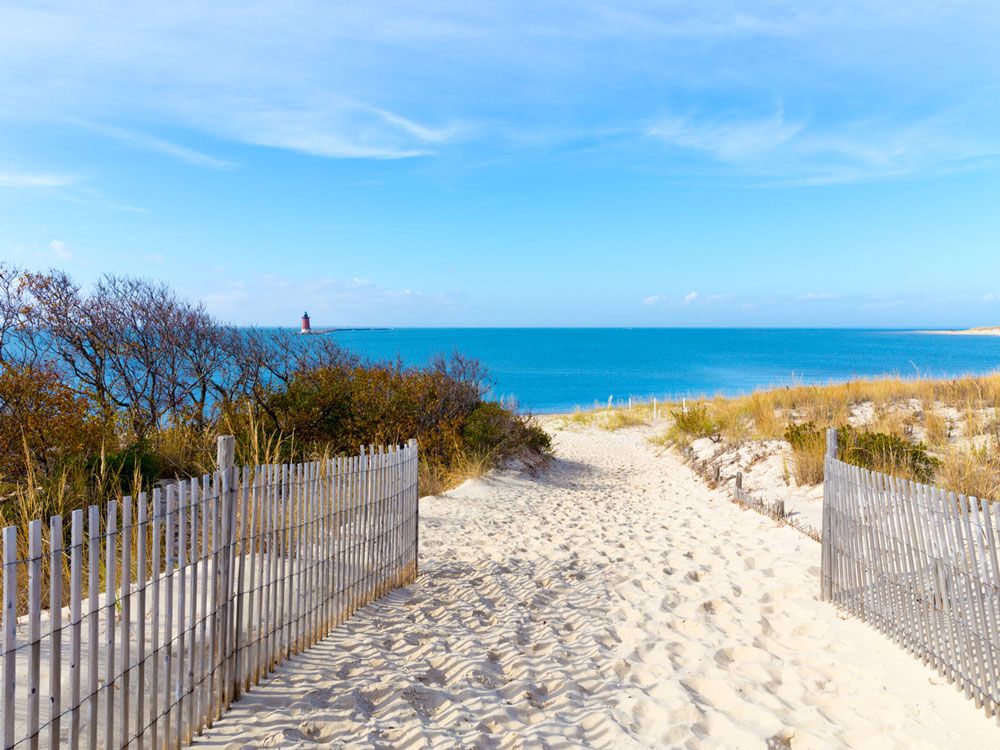
Sandy pathway leading to Delaware beach
Credit: ymn/ iStock

From the 70,913 residents of Wilmington to the 73 people who live in the town of Hartly, Delaware is densely packed from top to bottom. As the first state admitted to the nation and sixth-densest U.S. state, Delaware has an average of 508 people per square mile. About 990,000 Delawarens reside within the state’s 2,489 square miles of area. The town of Bellefonte is where you can find the most tightly packed group of Delaware residents, with 1,234 people across 0.18 square miles. Delaware’s largest city, Wilmington, is next on the list with a population density of 6,503, while the capital city of Dover sits much further down the rankings and only has a population density of 1,707 people per square mile.

5. Maryland

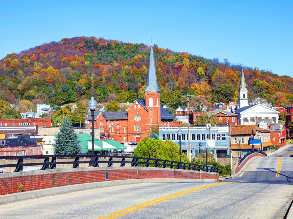
Church and town buildings in Cumberland, Maryland
Credit: DenisTangneyJr/ iStock

With a total area of 12,406 square miles, Maryland is slightly larger than the country of Belgium. Maryland holds fifth place among the most densely populated U.S. states, with a population density of 636.1 people per square mile. While Baltimore is by far Maryland’s largest city in terms of population — with 575,000 residents — Baltimore doesn’t even crack the top 10 in terms of population density for Maryland’s various municipalities. That honor lies with the sparsely populated yet tiny Friendship Heights Village, which has about 5,550 Marylanders across just 0.06 square miles of area. 

4. Connecticut

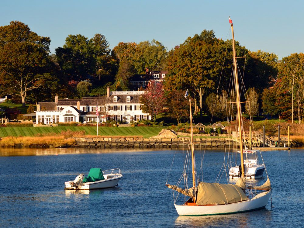
Boats off the coast of Connecticut
Credit: Kirkikis/ iStock

Densely populated states abound in New England. Connecticut ranks as the fourth-densest U.S. state, with 3.6 million residents who make their homes throughout the Constitution State’s 5,543 square miles of area. Connecticut is home to five cities with population numbers in excess of 100,000 — Bridgeport, Stamford, New Haven, Hartford, and Waterbury — and all of them also boast population densities of 3,704 or more people per square mile. Bridgeport, the most populous city on that list, is also the most dense, with its 147,000 residents covering a mere 16.06 square miles of area.

3. Massachusetts

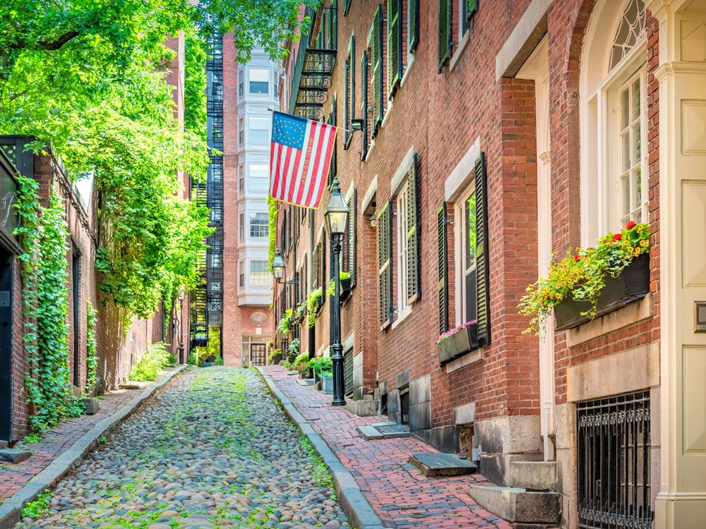
Cobblestone street in Boston, Massachusetts
Credit: benedek/ iStock

Connecticut’s neighbor, Massachusetts, is the third-densest state in America, and it’s also the most populous state in the New England region. Encompassing 10,554 square miles of area, Massachusetts’ population density comes in at 901.2 people per square mile, with the majority of Massachusetts’ 7 million residents found in the capital city of Boston. Those 693,000 Bostonians pack into a mere 48.34 square miles of land area, but Boston is only the eleventh-densest city in Massachusetts with a population density of 14,338 people per square mile. Ahead of Boston on that list includes the comparably denser cities Somerville, Chelsea, Cambridge, and Everett.

2. Rhode Island

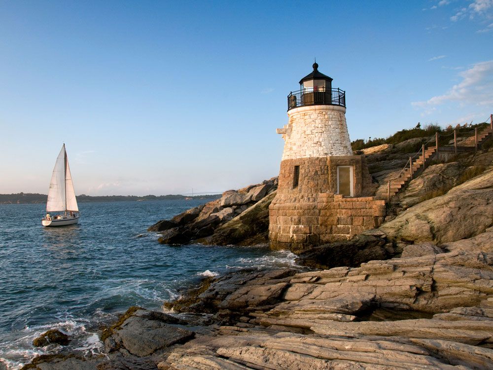
Lighthouse and sailboat on the coast of Rhode Island
Credit: nikon401/ iStock

Despite covering the least amount of total area in the nation, Rhode Island comes in second on the list of most densely populated states with 1,061 people per square mile. Over 1.1 million Rhode Islanders reside within the Ocean State’s 1,214 square miles of area. Rhode Island’s largest city and capital, Providence, is home to about 195,000 of those residents, giving the city the second-highest density measure in the state. Coming in ahead of Providence among Rhode Island municipalities is the town of Central Falls, which is the eighth-largest city statewide in terms of population (with 23,500 residents). However, it only covers 1.2 square miles of area, equating to a population density of nearly double Providence’s.

1. New Jersey

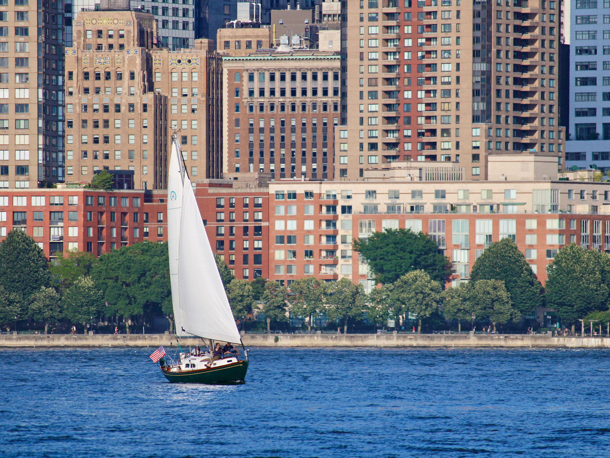
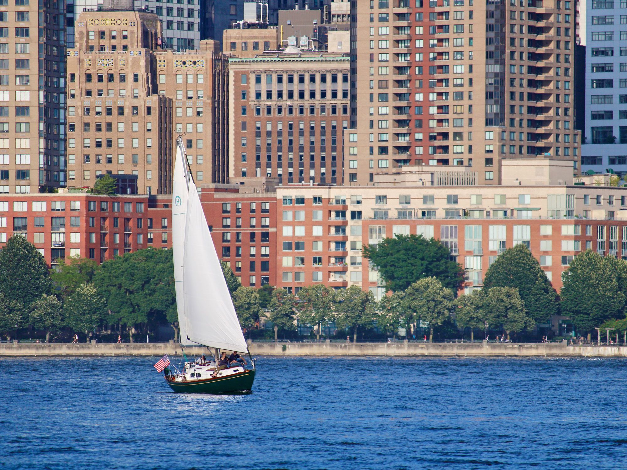
Sailboat with city buildings in background
Credit: Manoj Kulkarni/ Pexels

Of the 50 U.S. states, none is more densely packed than the Garden State. Highly populated New Jersey was the third state admitted to the Union and is currently the fourth-smallest state by area, spanning 8,722 square miles. Packed within New Jersey’s narrow borders are an estimated 9.3 million residents according to the 2020 U.S. Census, whose data from that year puts their overall population density at a whopping 1,263.0, the highest rank anywhere in the nation. Some of New Jersey’s major population centers include Newark, with a current population of 322,000, and Jersey City, with 306,000 residents. Neither are considered to be the most densely populated community in New Jersey, however. That honor goes to the town of Guttenberg, with about 12,300 residents across just 0.19 square miles of area.

Post Banner Image
Culture

Get Your Kicks at These Interesting Landmarks Along Historic Route 66

By K.C. Dermody
Read time: 6 minutes
May 18, 2023
Updated: July 25, 2023

Get Your Kicks at These Interesting Landmarks Along Historic Route 66

By K.C. Dermody

Route 66 is the stuff of legends. Completed in 1938, it was the first all-weather highway between Chicago and Los Angeles. Stretching some 2,400 miles, Route 66 became popular thanks to clever advertising by the U.S. 66 Highway Association, which called it the “shortest, best, and most scenic route from Chicago through St. Louis to Los Angeles.” The roadway soon cemented its place in popular culture, inspiring the likes of author John Steinbeck (who dubbed it “the Mother Road”) and the classic 1946 song “Get Your Kicks on Route 66.” Today, those who traverse the preserved sections of the historic route can look forward to all kinds of interesting attractions along the way, from kitschy roadside museums to retro motels, bizarre art installations, and stunning national parks.

Route 66 Association Hall of Fame and Museum – Pontiac, Illinois

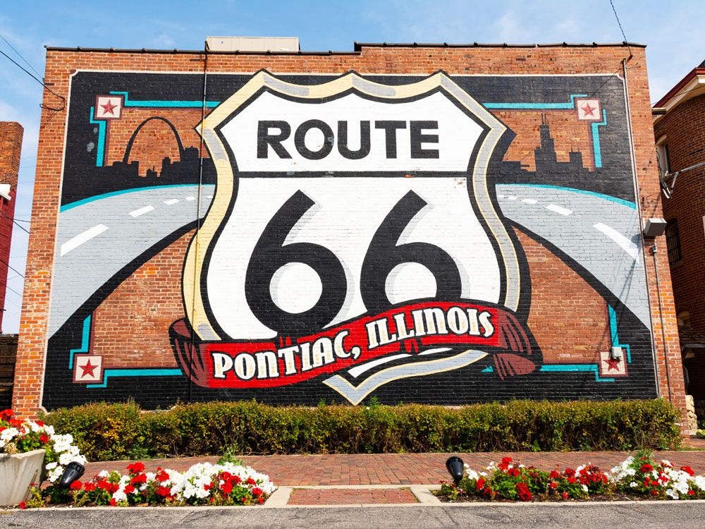
Mural for Route 66 in Pontiac, Illinois
Credit: EJ_Rodriquez/ iStock

After kicking off your epic Route 66 road trip in Chicago, your first stop should be the Route 66 Association Hall of Fame and Museum, about 90 minutes into your drive. On display are thousands of memorabilia items related to the route’s glory days and exhibits educating visitors about its important place in U.S. history. The museum is open seven days a week, and ticket proceeds go towards Route 66 preservation efforts in Illinois. On the back wall of the museum is the Route 66 Shield Mural, where many park their cars to capture a photo before heading back out on the road. Don’t miss the chance to explore the rest of the colorful collection of murals in this charming town before you do so.

Gateway Arch National Park – St. Louis, Missouri

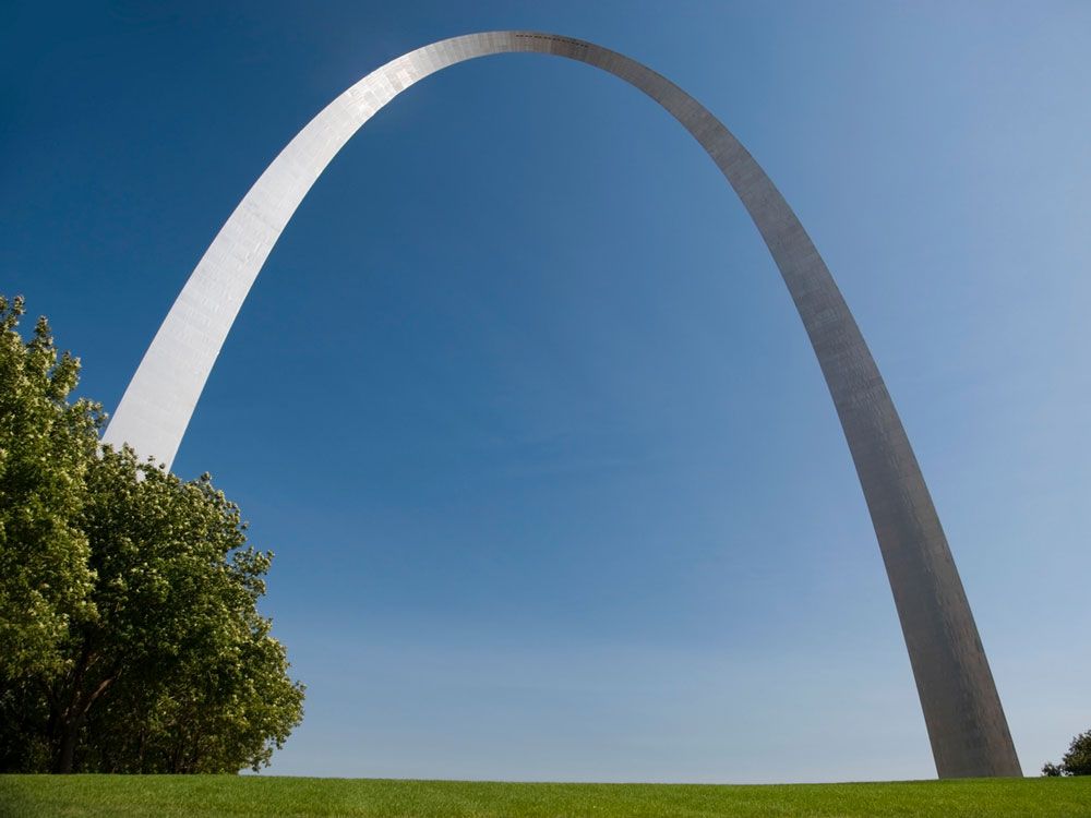
View of Gateway Arch in St. Louis, Missouri, from street level
Credit: PeterPhoto/ iStock

One of just two national parks along the historic Route 66, Gateway Arch National Park not only features the iconic Gateway Arch, but it is also the smallest national park in the country, covering just 91 acres. Take the unique tram 630 feet to the top of the country’s tallest monument for a bird’s-eye view of St. Louis, and learn more about its history at the on-site museum. The exhibits trace the story of pioneers, explorers, and Native Americans who helped build the country while celebrating America’s pioneering spirit. 

Meramec Caverns – Sullivan, Missouri

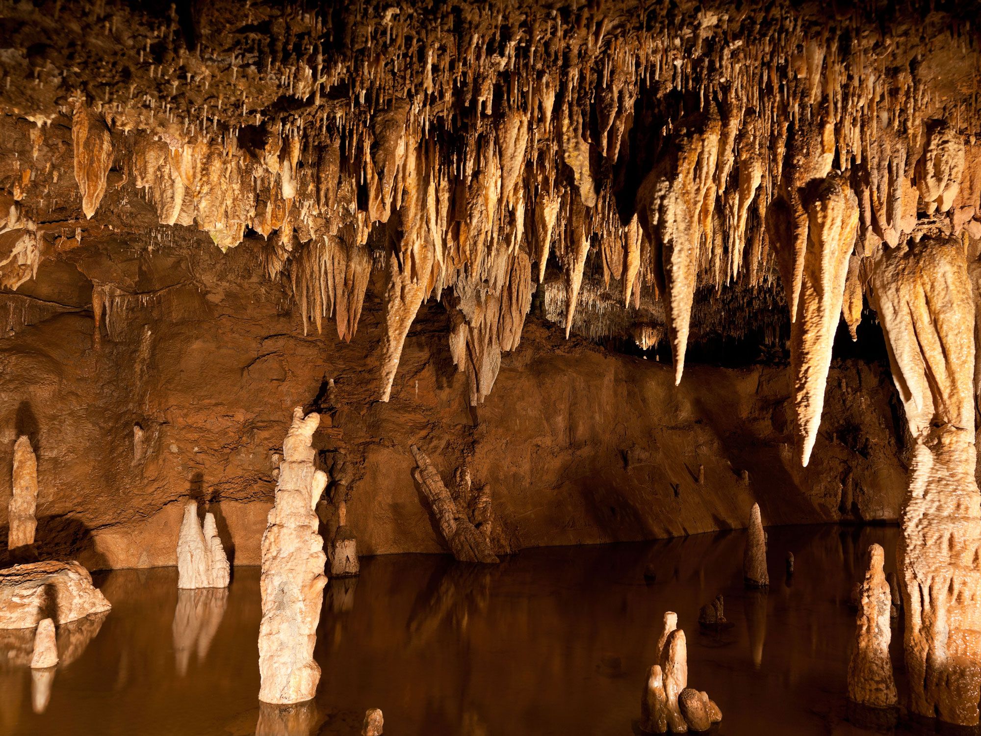
View inside Meramec Caverns in Missouri
Credit: Brandon Alms/ Alamy Stock Photo

The breaktaking Meramec Caverns have been attracting Route 66 travelers for over 80 years, ever since the property’s former owner Lester Benton Dill began offering tours of the 400-million-year old cave to the public. Road trippers will see the series of limestone caves advertised on barns and billboards throughout much of the route. A guided tour will bring visitors underground to discover this incredible natural wonder that outlaw Jesse James once used as a hideout. The attraction includes the impressive cave formations, along with some kitsch — like the sound-and-light show that concludes with Kate Smith’s rendition of “God Bless America” as the flag is projected onto a limestone curtain.

Oklahoma Route 66 Museum – Clinton, Oklahoma

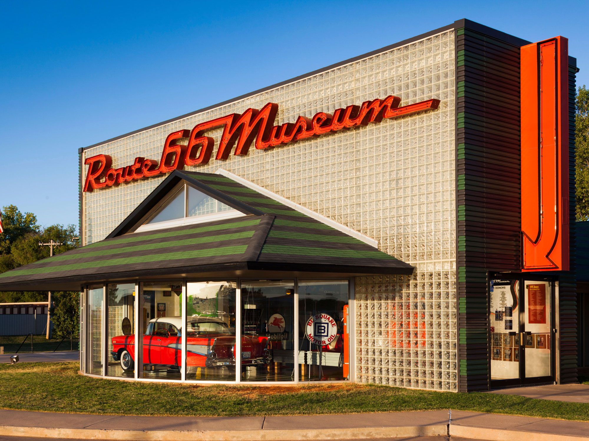
Exterior of Route 66 Museum in Oklahoma
Credit: Jon Arnold Images Ltd/ Alamy Stock Photo

There are several Route 66 museums that are well worth a visit, and this one chronicles the section of the road bisecting Oklahoma. In fact, the Sooner State is home to Route 66’s longest drivable stretch, which runs for over 400 miles. In the front window of the Oklahoma Route 66 Museum in Clinton, you’ll see a neon sign and a vintage cherry red 1957 Chevy. Step inside to walk the “Main Street of America” and read displays with interesting tidbits about spots along the route that are no longer in existence.

Blue Whale of Catoosa, Oklahoma

Blue whale sculpture off Route 66 in Oklhaoma
Credit: BD Images/ iStock

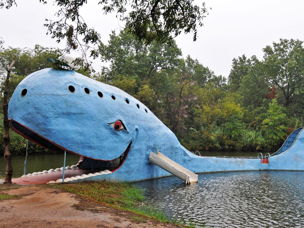
As you come to a pair of side-by-side bridges in Catoosa, it’s impossible to miss this unique Route 66 attraction: a giant, smiling blue whale. Built in 1972, the 80-foot-long creature rests in a pond that was once a popular place to swim. Hugh S. Davis, the zoologist responsible for the structure, envisioned it as a special place for his grandchildren to play, but after he passed, it fell into disrepair. Locals rallied together to restore it to its original glory, and these days, the toothy whale makes for a popular photo-op for Route 66 road trippers. Visitors can even walk through the whale’s mouth and climb a ladder onto its tail.

Cadillac Ranch – Amarillo, Texas

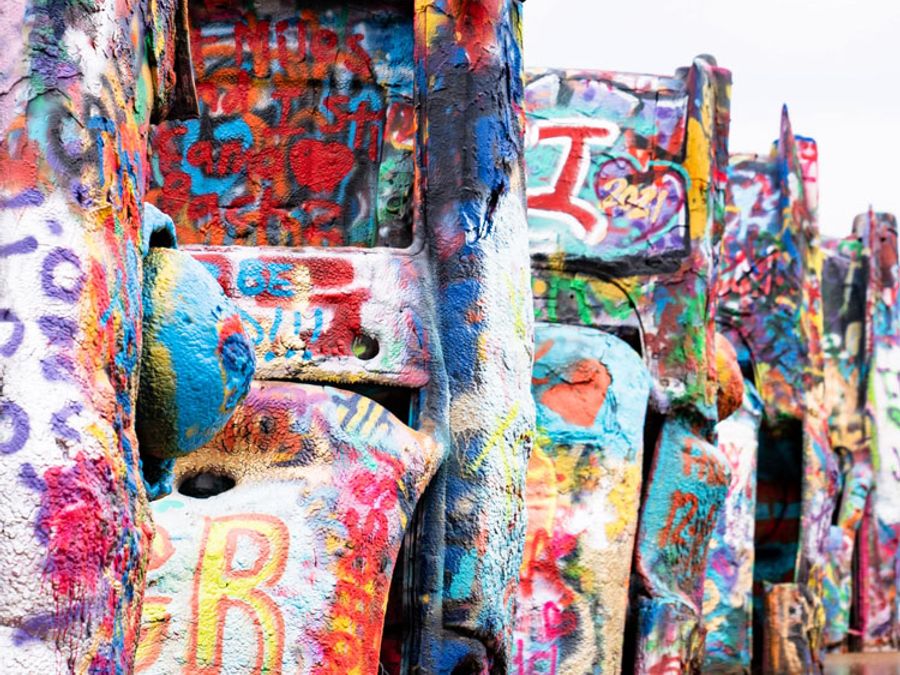
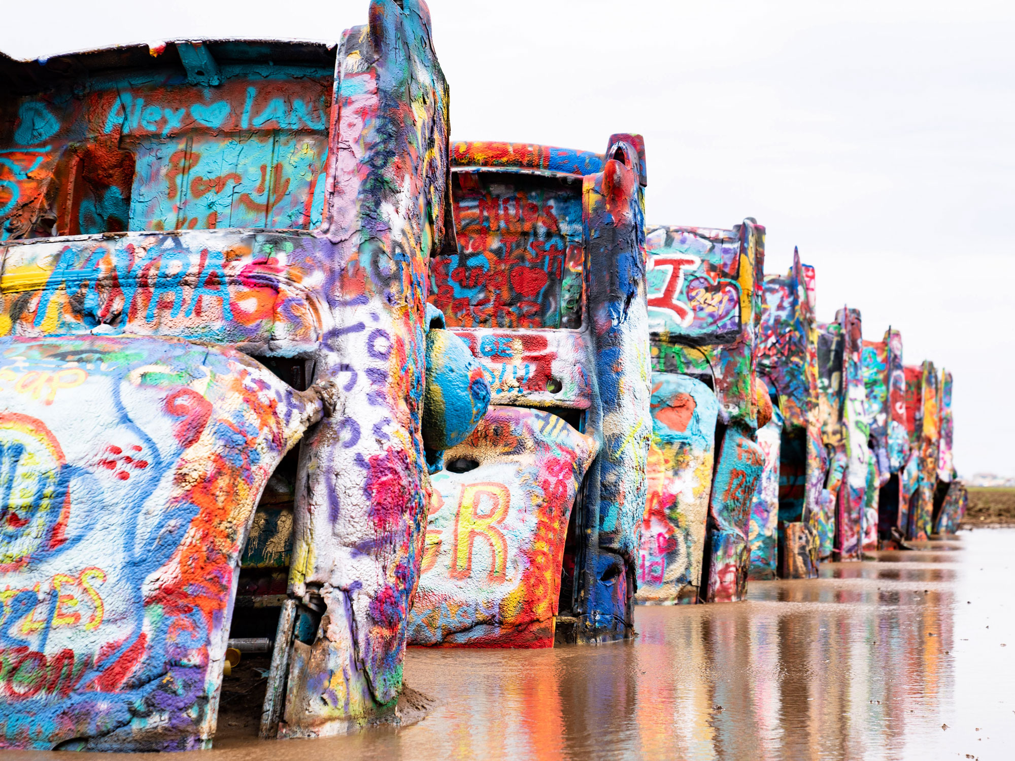
Graffiti-covered cars partially buried in sand at Cadillac Ranch in Texas
Credit: StevenStarr73/ iStock

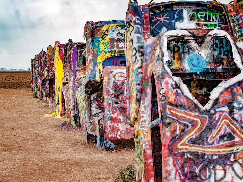
One of the most famous attractions along Route 66, Cadillac Ranch is an eye-catching art installation located about 10 miles west of Amarillo, Texas. Created in 1974 by a group of artists from San Francisco called the Ant Farm, it features 10 perfectly aligned Cadillacs half buried in the desert, with their graffiti-covered tail fins pointing skyward at the same angle as the Pyramids of Giza. Graffiti is welcome, with many coming to spray paint their initials or something unique on the unique public art installation. 

Motel Safari – Tucumcari, New Mexico

Sign for Motel Safari off Route 66 in New Mexico
Credit: Tiago_Fernandez/ iStock

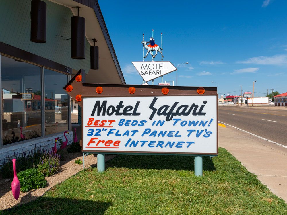
While there are quite a few retro motels along Route 66, one of the most popular is Motel Safari in Tucumcari, about 2.5 hours before you hit Albuquerque. A classic mid-century 1959 motor inn has a historic camel sign you can’t miss, and features modernized replicas of technology from the era, such as retro radios with Bluetooth and “rotary” phones with buttons to push instead of the rotating dial. And as the hotel’s website notes, “in classic motor court fashion, you can park right at your door.”

Sandia Peak Aerial Tramway – Albuquerque, New Mexico

Sandia Peak Aerial Tramway in Albuquerque, seen from above
Credit: sherwoodimagery/ iStock

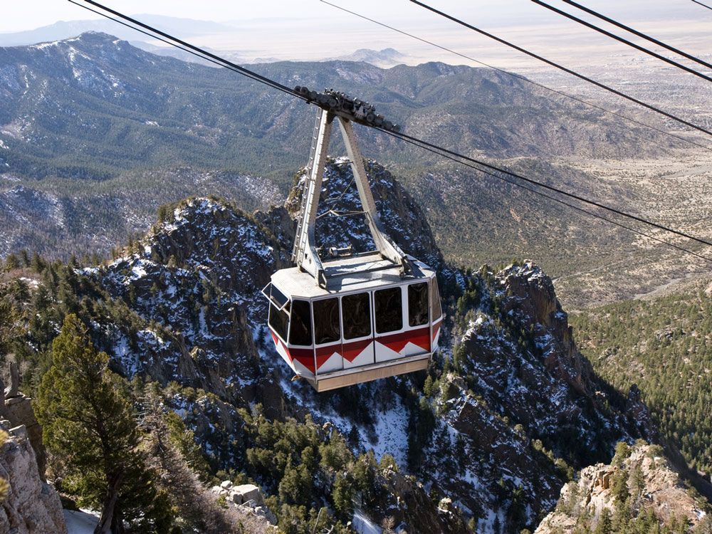
Just east of Albuquerque is the longest aerial tramway in the world. The Sandia Peak Aerial Tramway ascends 2.7 miles up the steep Sandia Mountains, and from the observation deck that sits at 10,378 feet above sea level, riders can see all the way to Santa Fe. After leaving, plan extra time for the many photo ops along the route’s section between Albuquerque and Gallup. It’s one of the most scenic stretches of Route 66, revealing why New Mexico’s nickname is “the Land of Enchantment.”

Petrified Forest National ParkHolbrook, Arizona

Landscape of Petrified Forest National Park in Arizona
Credit: encrier/ iStock

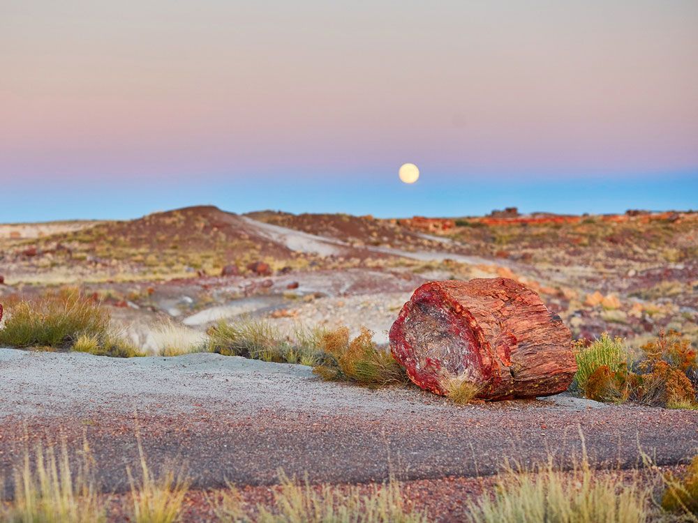
Covering 230 square miles in northeastern Arizona, Petrified Forest National Park protects one of the world’s largest and most colorful collections of petrified wood, along with several fascinating historic structures and archaeological sites. The ancient “trees” are fossilized logs that are around 250 million years old, some spanning as much as six feet in diameter. Many come in a rainbow array of colors, and one even spans a ravine, forming a natural bridge.

Grand Canyon Railway – Williams, Arizona

Head-on view of the Grand Canyon Railway in Arizona
Credit: Ingus Kruklitis/ iStock

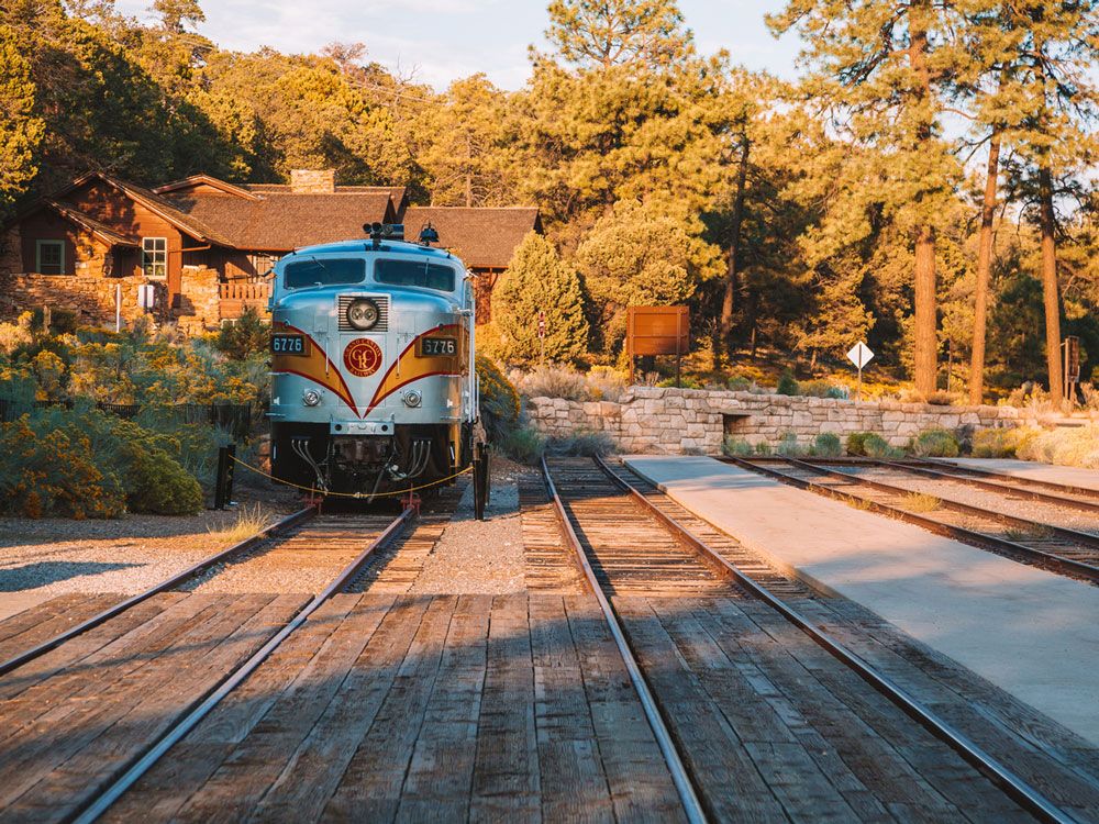
The Grand Canyon is about a 55-mile detour off Route 66, but in Williams, you can catch the Grand Canyon Railway to visit the canyon and enjoy mesmerizing views along the way (and a break from being behind the wheel). The train departs daily at 9:30 a.m. and returns to Williams at 5:45 p.m. — just in time for the 7 p.m. Old West shootout that takes place every night between cowboys and outlaws downtown. 

Featured image credit: Steve Wrzeszczynski/ Unsplash

Post Banner Image
Geography

The 10 Islands With the Largest Populations

By Daily Passport Team
Read time: 6 minutes
May 11, 2023
Updated: May 23, 2024

The 10 Islands With the Largest Populations

By Daily Passport Team
Author
Daily Passport Team
Daily Passport writers have been seen in publications such as National Geographic, Food & Wine, CBC, Condé Nast Traveler, and Business Insider. They're passionate about uncovering unique destinations and sharing expert tips with curious travelers.

Scientists estimate there are approximately 11,000 permanently inhabited islands in the planet’s lakes, oceans, and seas. More than 730 million people — nearly 10% of Earth’s population — live on islands. While some are tiny, remote outcroppings home to only a handful of people, other islands host some of the globe’s most congested urban areas. Below, discover the 10 most populous islands in the world. 

10. Sri Lanka

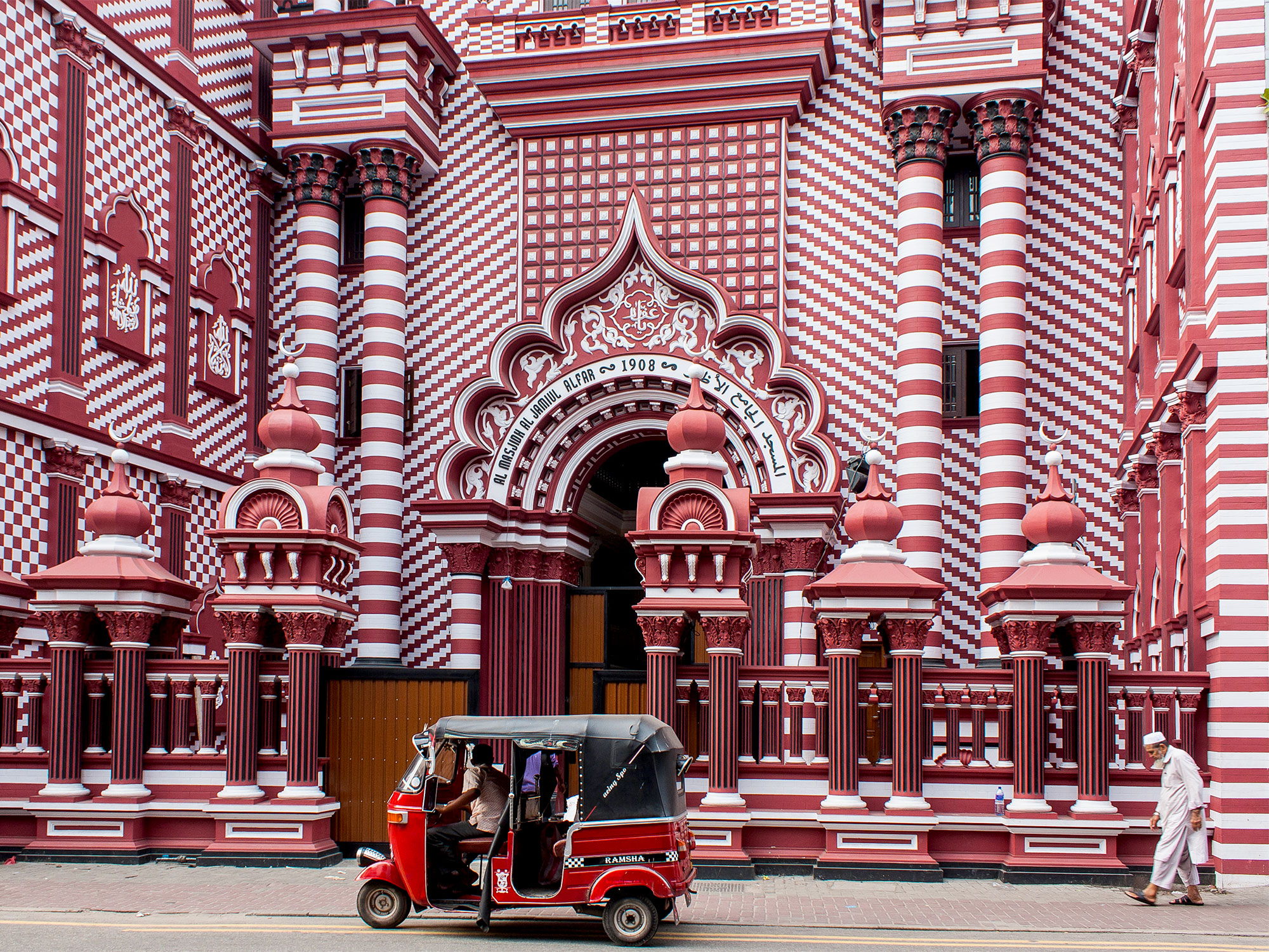
Red-and-white facade of Jamiul Alfar Mosque in Colombo, Sri Lanka
Photo credit: Athikhom Saengchai/ Shutterstock

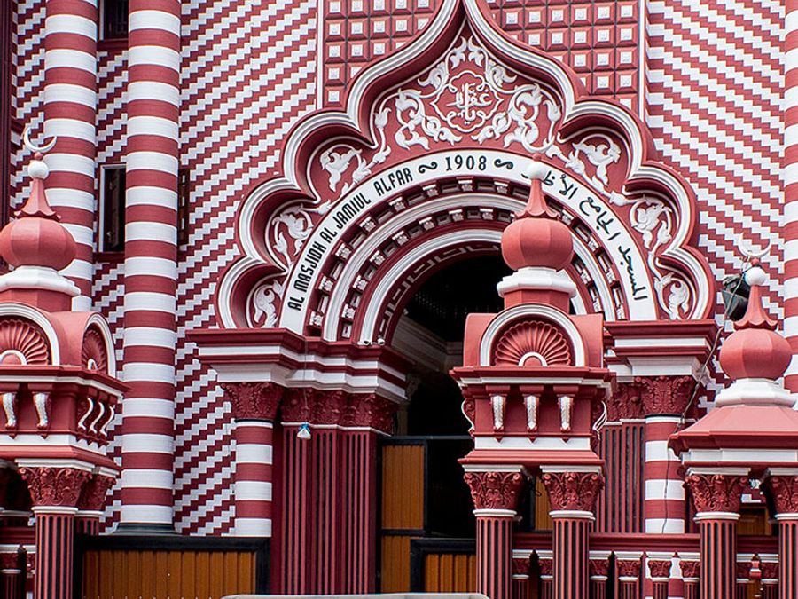
Separated from the southern tip of India by the Palk Strait, Sri Lanka is roughly the size of West Virginia, but much more densely populated. Much of the island’s estimated population of 22 million people is concentrated in the southern part of the island, where the country’s largest city and industrial center, Colombo, is located. These flat coastal areas give rise to the Central Highlands, a region of stunning mountains and land ridges recognized as a UNESCO World Heritage Site. Rivers crisscross the island, providing a rich soil system for evergreen forests and terraced paddy fields. A variety of religions and fascinating cultural traditions coexist in Sri Lanka, with literature, art, and dance all dating back more than 2,500 years.

9. Hispaniola

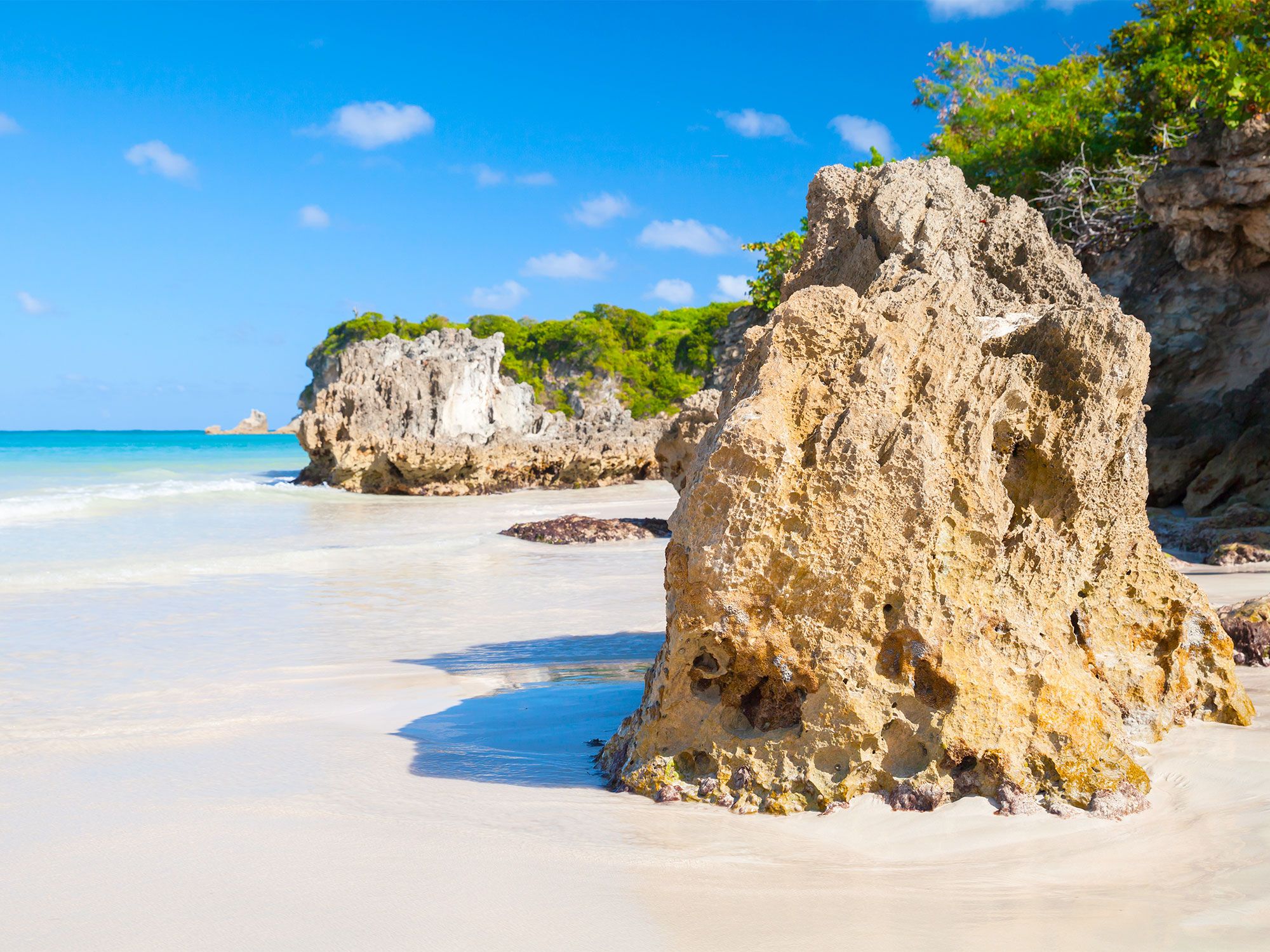
Rock formations along sandy coastline of Hispaniola
Photo credit: Evannovostro/ Shutterstock

The Caribbean island of Hispaniola is the second-largest in the region by area (after Cuba) but home to the largest population, with over 20 million people calling the island home. Part of the Greater Antilles, it is divided into two countries that are home to an estimated 22 million people: Haiti covers the western part of Hispaniola, while the eastern two-thirds comprise the Dominican Republic. The island was a key strategic spot for the Spanish during the colonial era. Today, much of the original forest has been removed to make room for cultivation of coffee, rice, tobacco, and cacao. The Dominican Republic also has a thriving tourist industry, while Haiti is home to a number of colonial landmarks.

8. Taiwan

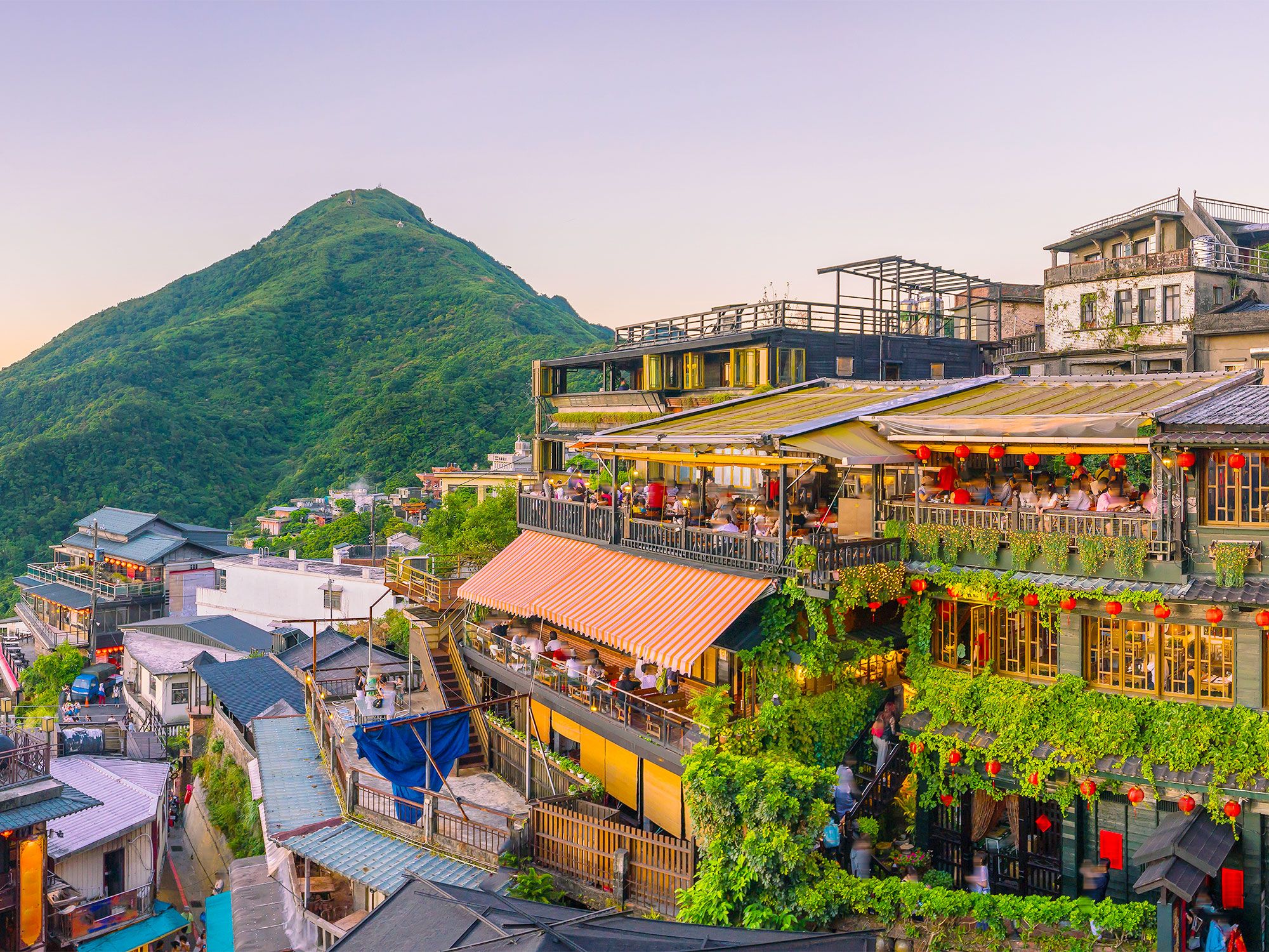
Overview of Jiufen Old Street in Taipei, Taiwan
Photo credit: f11photo/ Shutterstock

The island of Taiwan has a land area of about 14,000 square miles, but almost 24 million people are packed into that space, making it one of the most densely populated places on Earth. While Taiwan is widely known for its manufacturing industries, the country also has much to offer tourists, including the National Palace Museum and its permanent collection of more than 650,000 ancient Chinese artifacts. The 89th-floor observation deck of Taipei 101 (once the tallest building in the world) offers gorgeous views of the Taipei skyline. And you won’t go hungry when exploring the capital: There are night markets galore, with plenty of opportunities to try Taiwan’s beloved dumplings.

7. Mindanao

View from end of dock toward island of Mindanao in the Philippines
Photo credit: N8Allen/ Shutterstock

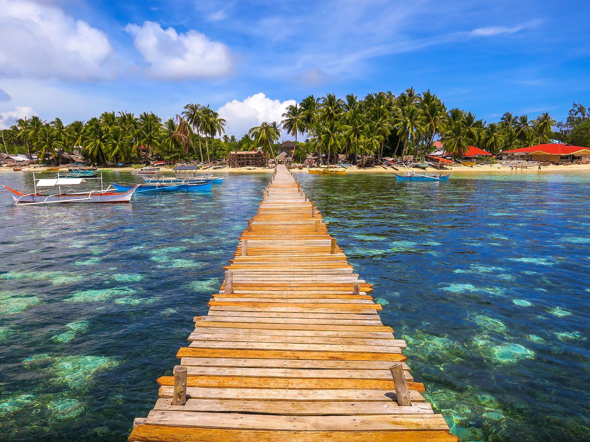
Mindanao is the second-most populous island in the Philippines, but despite the island being home to over 26 million people, it’s still possible to find secluded spots away from the crowds. Mount Apo, the country’s highest peak at 9,692 feet above sea level, is technically still an active volcano, although, like most throughout the archipelago, it hasn’t erupted in many years. There are beach resorts around the island, and water sports such as scuba diving and surfing are a big attraction. One added bonus is the climate: May is the warmest month with an average temperature of 83 degrees Fahrenheit, but even the coolest month, January, enjoys an average of 78 degrees Fahrenheit.

6. Madagascar

Distinctive baobab trees lining dirt road in Madgascar
Photo credit: KENTA SUDO/ Shutterstock

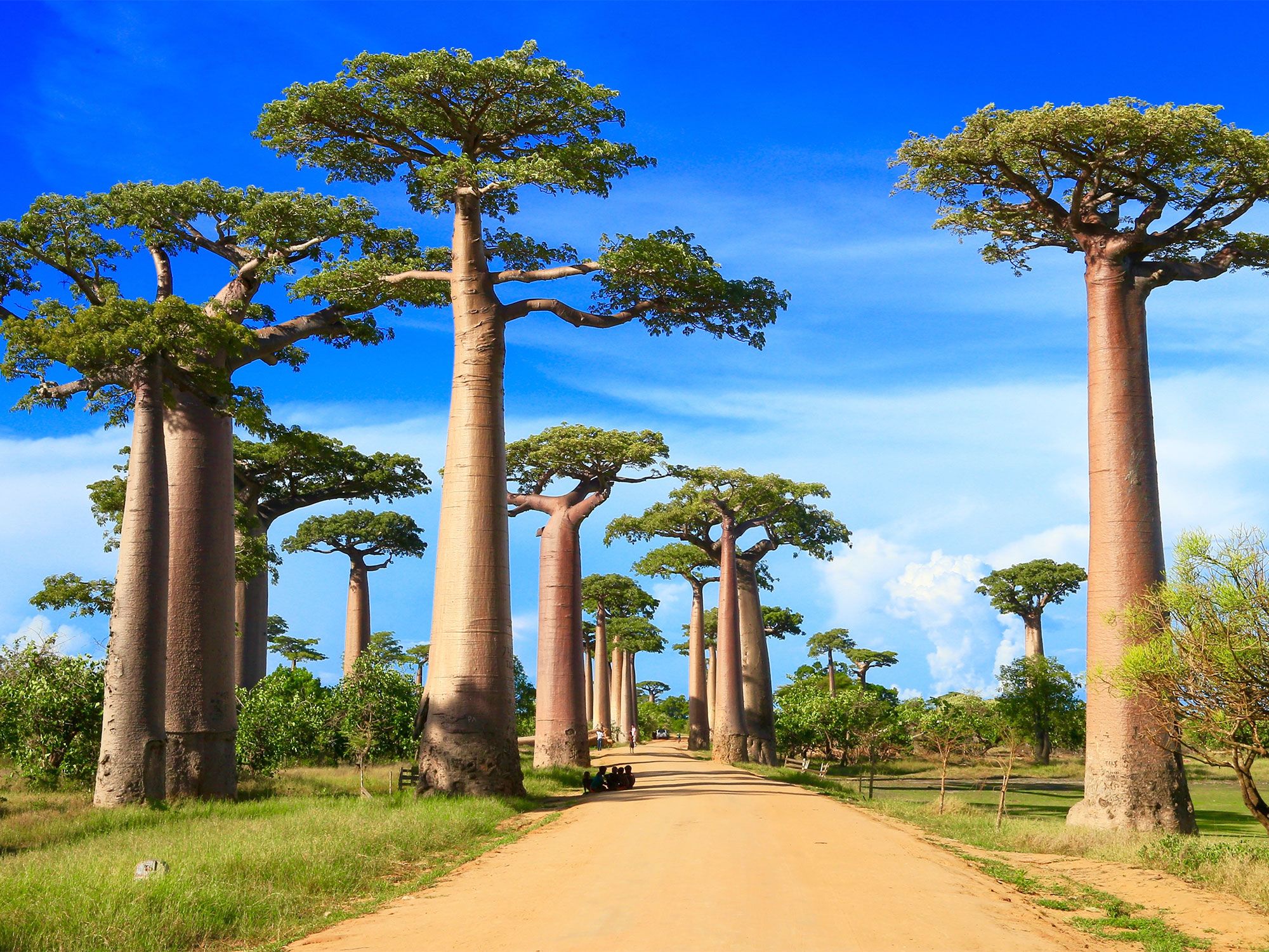
The fourth-largest island in the world by area, Madagascar brings together both African and South Asian cultures. Although it lies just 250 miles off the coast of Mozambique, much of its 28 million people are culturally closer to the former French colonies of western Africa. A major attraction of Madagascar is its wildlife. The island’s geographic isolation means that 90% of species here are endemic, including 40 species of lemurs and multiple varieties of birds, butterflies, and chameleons. In terms of island culture, the Zafimaniry community has earned a spot on the UNESCO World Heritage List for its decorative woodcraft tradition.

5. Luzon

Rainy street on Luzon in the Philippines
Photo credit: Svetlana Bykova/ Shutterstock

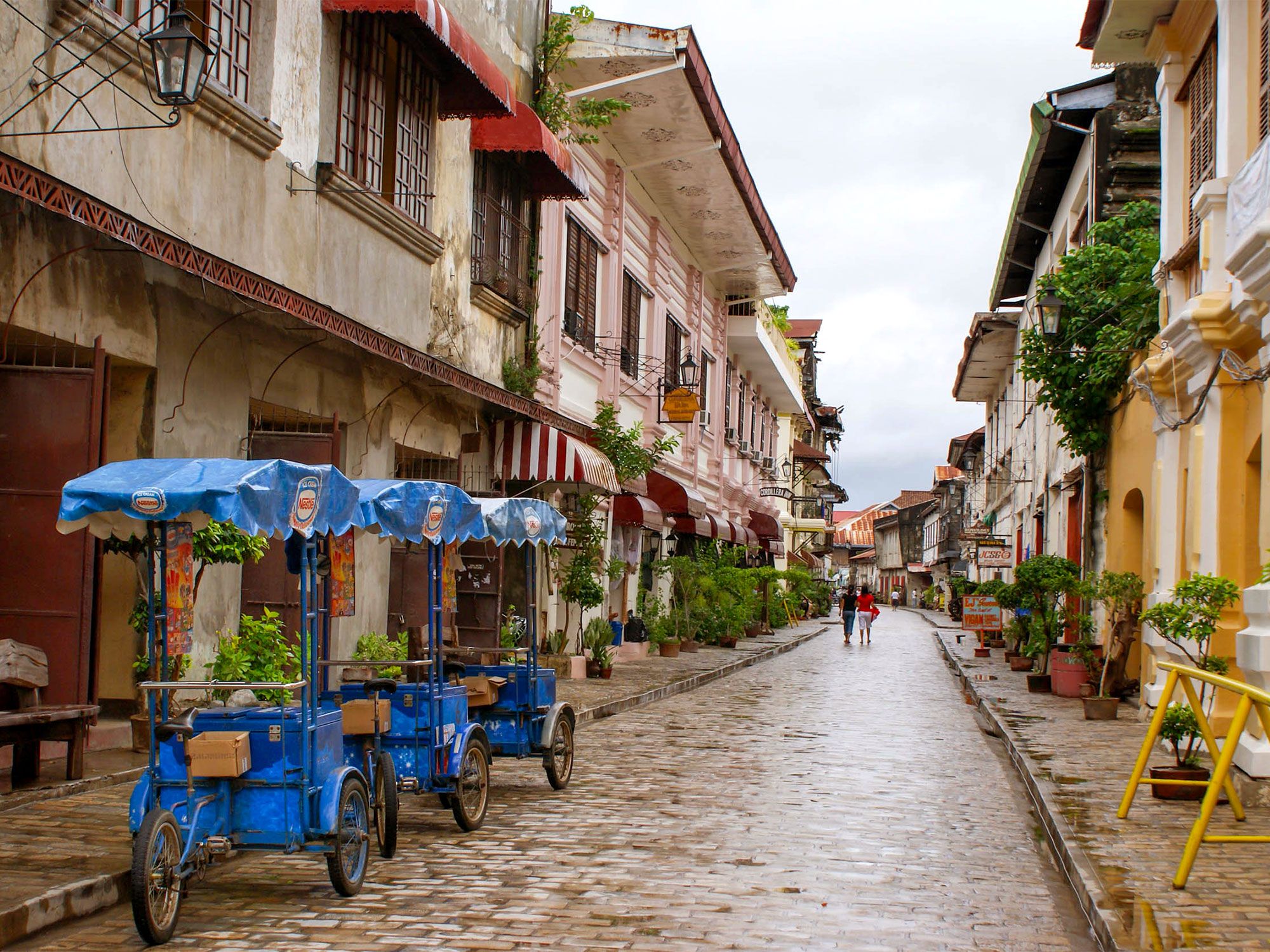
The Philippines consists of more than 7,000 islands, but even so, more than half of the nation’s population (approximately 57,000 people) lives on Luzon. The capital city, Manila, is a bustling hub of culture and shopping. Spanish colonial architecture lines the streets, and the city is also home to one of the world’s oldest Chinatowns. In the north, Balbalasang Balbalan National Park is a biodiverse forest park, protected by local elders. Luzon is also rich in natural resources: Iron, copper, gold, and manganese are all mined here, while coconuts, rice, sugar, mangoes, and bananas are key agricultural crops.

4. Sumatra

Flowers framing pool and mountains on Indonesian island of Sumatra
Photo credit: Hendropranyoto/ Shutterstock

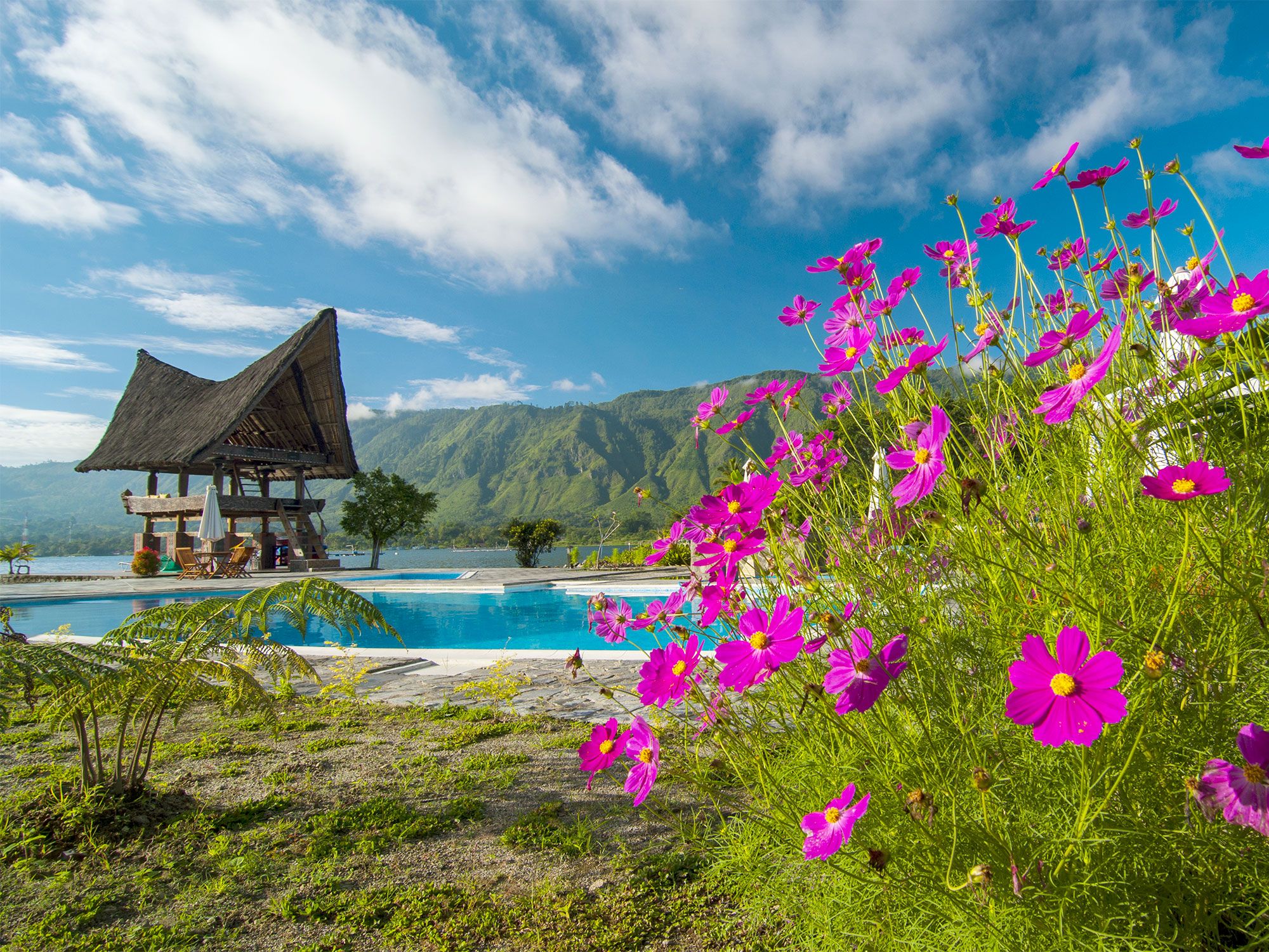
Sumatra is the second-largest and the second-most populated island in the Asian nation of Indonesia, home to an estimated 60 million inhabitants. Although you certainly won’t be exploring the island alone, Sumatra has much to offer visitors who want to get off the beaten path. Large expanses of the island’s rainforests remain unspoiled. On the southern part of the island, Sembilang National Park is home to several endangered species, including the Sumatran tiger and the siamang, a black-furred gibbon primate, as well as elephants, bears, leopards, and more than 213 species of birds.

3. Great Britain

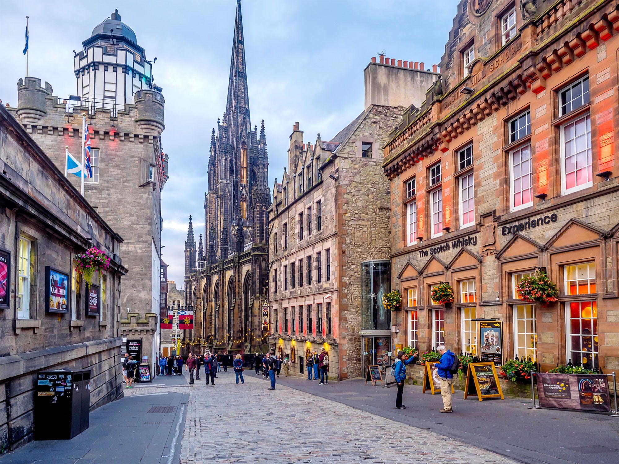
View of the Royal Mile with church spires in Edinburgh, Scotland
Photo credit: Jeff Whyte/ Shutterstock

Great Britain is an island consisting of the countries of England, Scotland, and Wales. Together with Northern Ireland and various other island communities off the coast, it makes up the United Kingdom. The largest island in Europe, Great Britain is home to an estimated 65 million of the U.K.’s 67 million residents. The English (and U.K.) capital, London, is located here, as are Edinburgh and Cardiff, the Scottish and Welsh capitals. With a rich history stretching back more than 5,000 years, the island has plenty to explore. Popular tourist destinations include Stonehenge, castles, and the island’s many coastal resorts. Further north, the more rugged terrain is suitable for climbing and other outdoor adventures.

2. Honshu

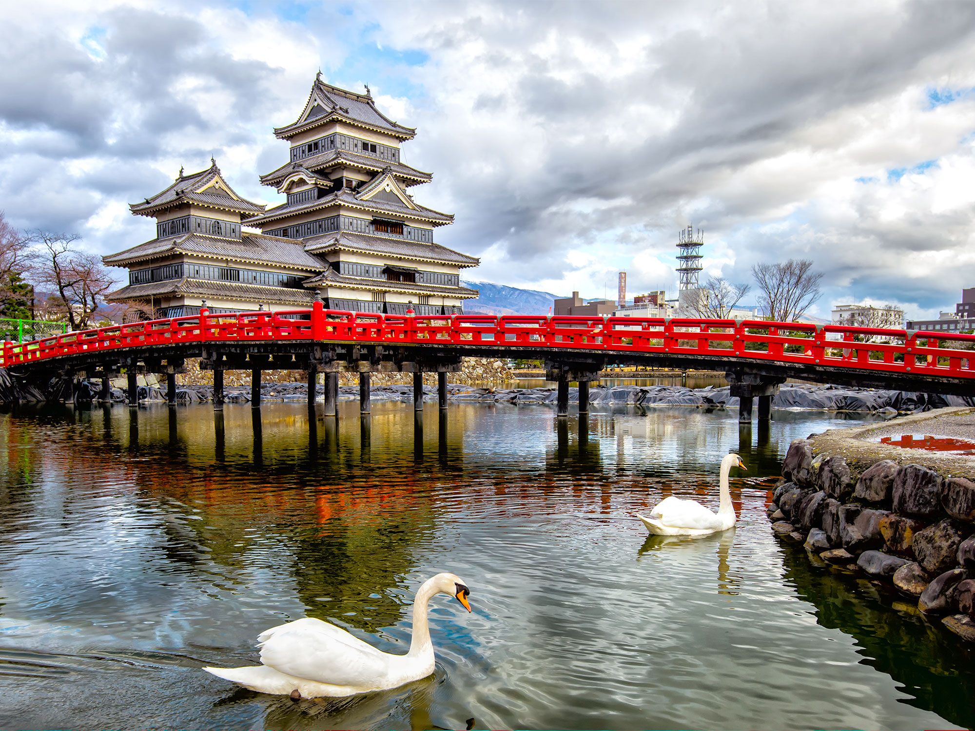
Swans in river with red bridge and traditional Japanese temple in background
Photo credit: Phattana Stock/ Shutterstock

Honshu, Japan’s largest island, is also the second-most populous island in the world with approximately 104 million inhabitants. Many of the country’s biggest cities — including Tokyo (the world’s most populous city), Yokohama, Osaka, and Kyoto — are found on Honshu, and are all extremely densely populated. The island’s highest mountain, Mount Fuji, is a treasured national symbol, while Biwa, Japan’s largest lake and a popular tourist resort, is also located on Honshu. Like the rest of Japan, Honshu offers a fascinating mix of the ultramodern and the traditional — even among the bright lights of Tokyo’s business district, you can easily turn a corner to find a Shinto shrine.

1. Java

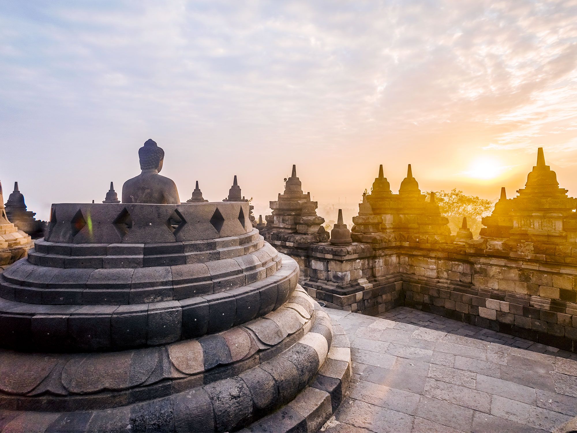
View of sunrise from temple on Indonesian island of Java
Photo credit: Merabet Hichem/ Shutterstock

Java tops the list as the world’s most populous island. Although it is not the largest island in Indonesia by area, it is where more than half of the country’s population lives — an estimated 156 million people. Located on the Pacific Ring of Fire, Java is home to many volcanoes, including Mount Semeru, the highest peak on the island. The large number of volcanoes makes for rich, fertile soil, and dense rainforests and bamboo woodlands cover much of the island.. The population density on the island is an average of 2,600 people per square mile, but don’t let this fool you: While the cities are growing rapidly, much of Java’s population is still very rural.

Post Banner Image
Geography

Which Countries Have the Shortest Coastlines?

By Daily Passport Team
Read time: 7 minutes
May 11, 2023
Updated: July 25, 2023

Which Countries Have the Shortest Coastlines?

By Daily Passport Team
Author
Daily Passport Team
Daily Passport writers have been seen in publications such as National Geographic, Food & Wine, CBC, Condé Nast Traveler, and Business Insider. They're passionate about uncovering unique destinations and sharing expert tips with curious travelers.

Some countries are blessed with seemingly endless coastlines — take Canada’s 125,567 miles, the longest of any country in the world, for example. On the other side of the coin, there are 44 landlocked nations with no coastline to speak of. Historically, direct access to the sea has been economically advantageous, which may explain why the lucky nations that do lay claim to ocean frontage make the most of it — no matter how small. Take a look at the 10 countries with the shortest coastlines in the world. 

10. Niue – 39.8 Miles

Staircase leading down hillside to coast in Niue
Photo credit: Molly Brown NZ/ Shutterstock

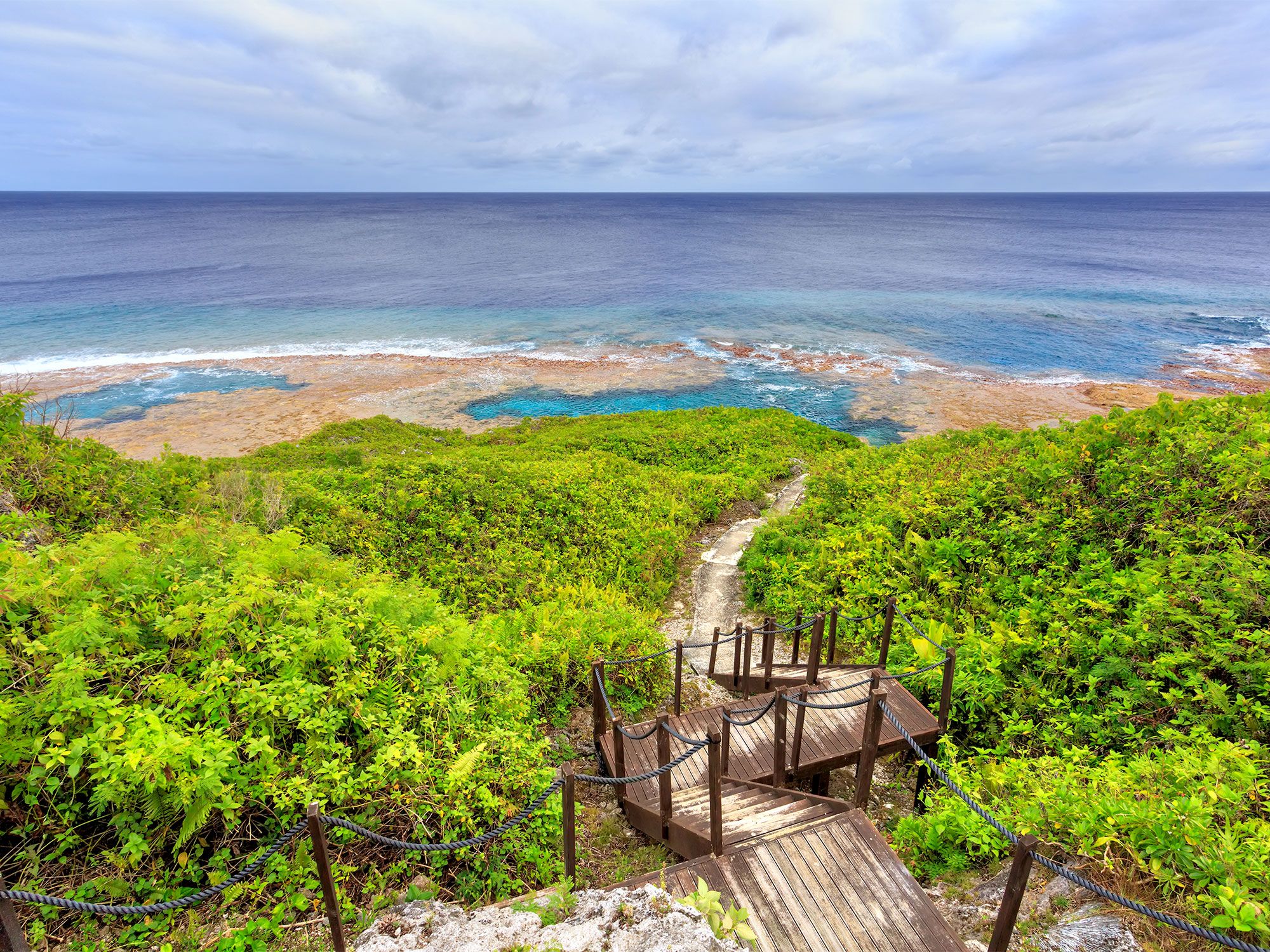
As one of the smallest countries on Earth, the tiny island nation of Niue unsurprisingly also has one of the world’s shortest coastlines. Located 1,340 miles northeast of New Zealand, the atoll maintains 39.8 miles of shoreline, much of which consists of steep, stunning limestone cliffs. At only 200 feet above sea level, Niue is a coral island, which means it was naturally built from the skeletons of corals over time. As a result, the coastline of Niue is particularly distinctive, with rocky coves, limestone caves, and empty beaches that make it an exotic playground for anyone willing to travel the distance. Popular island activities include snorkeling and diving in the surrounding turquoise waters and watching the humpback whale migration between the months of July and October.

9. Iraq – 36 Miles

River running through Iraq
Photo credit: Al Orfali/ Shutterstock

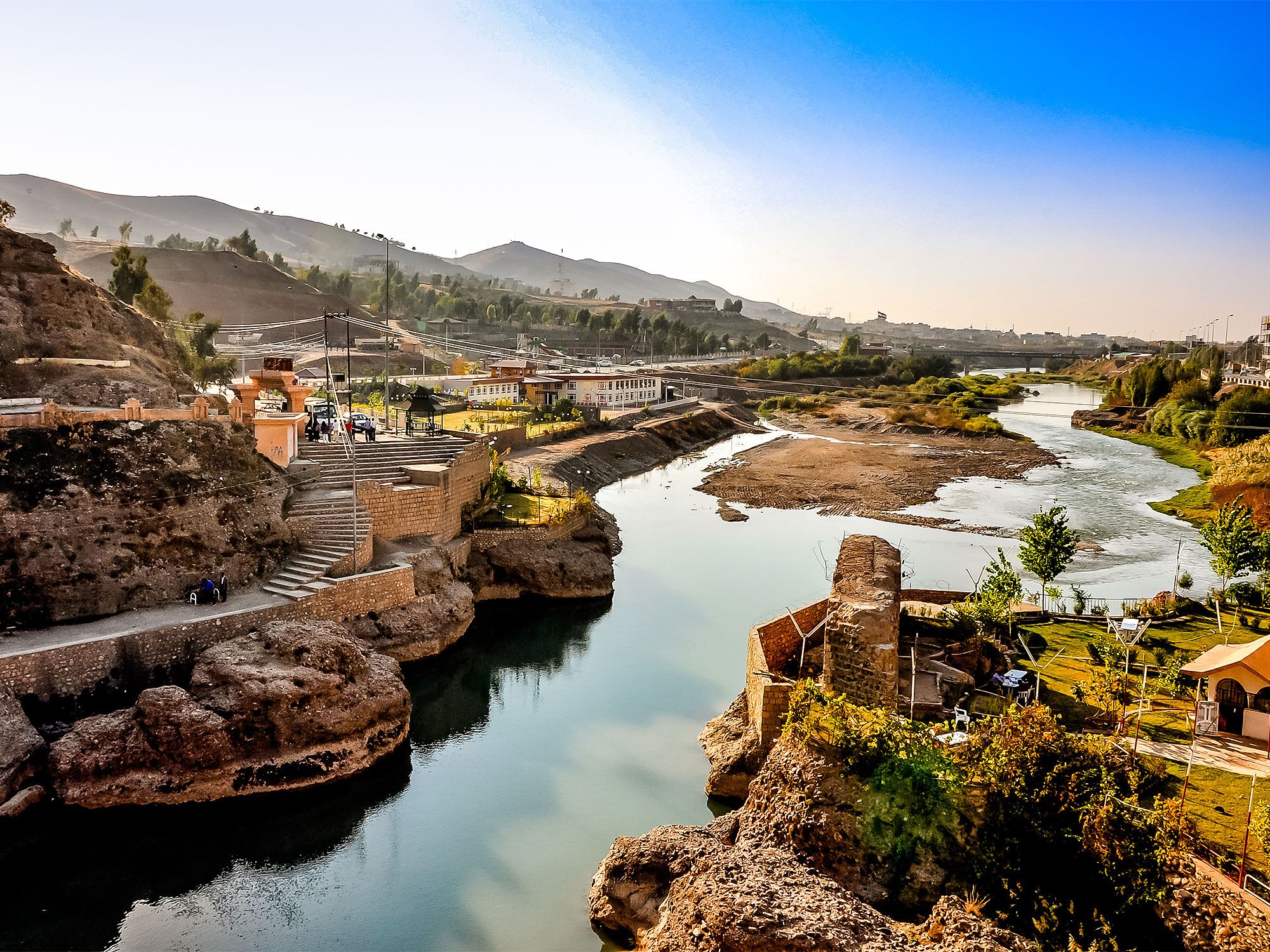
Iraq’s landscape consists largely of harsh desert and uninhabitable mountains, which means much of the population lives in Al-Jazirah, also known as “the island.” This fertile region located between the Tigris and the Euphrates rivers was the site of ancient Mesopotamia. The two rivers flow south to the Persian Gulf, where Iraq claims 36 miles of shoreline. Access to this body of water has played an important role in both Iraq’s history and economy, as the Persian Gulf has extensive oil resources and is home to the world’s largest offshore oil field. The borders of Iraq were drawn by France and Great Britain after World War I, which resulted in tension around Iraq’s water access. Coastal boundary issues along the Persian Gulf have led to territorial disputes with neighboring Kuwait over accessibility to the gulf and its significant oil production.

8. Togo – 34.8 Miles

Traditional homes in Togo
Photo credit: traveloskop/ Shutterstock

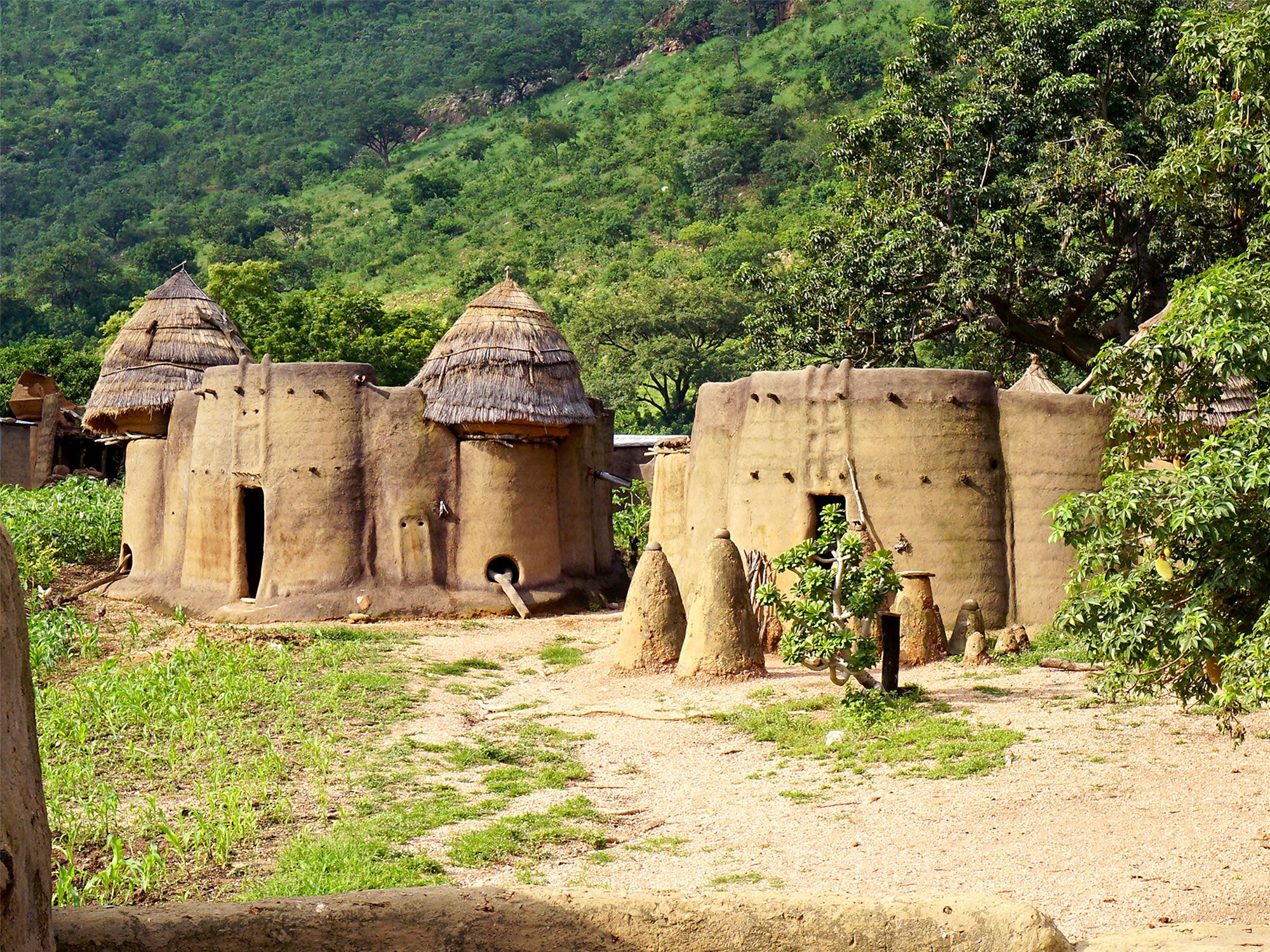
A sliver of a country sandwiched between Ghana and Benin on Africa’s western coast, the nation of Togo has 34.8 miles of land along the Atlantic seaboard. The capital city of Lomé is situated upon this coastline, and the port city is often filled with Togolese fishermen selling their catches of the day alongside white-sand beaches and palm trees. Other coastal communities spread along the seashore, including a fishing village called Agebkope, which has been subject to strong coastal erosion. As a result, Togo received funds fom the World Bank to fix the shoreline’s sand dunes and to build seawalls to protect the coastal communities.

7. Slovenia – 29 Miles

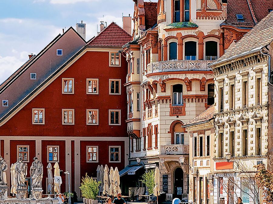
Cobblestone city square in Slovenia
Photo credit: Roman Babakin/ Shutterstock

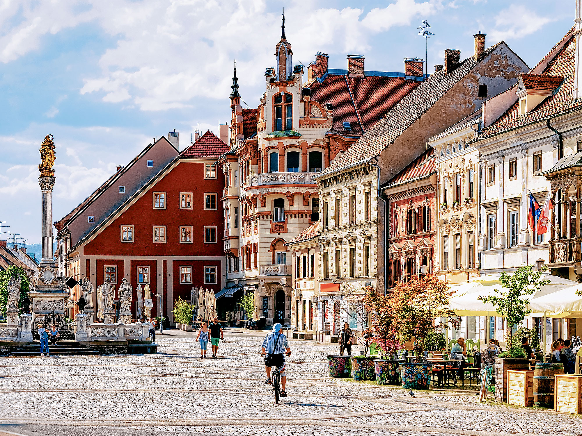
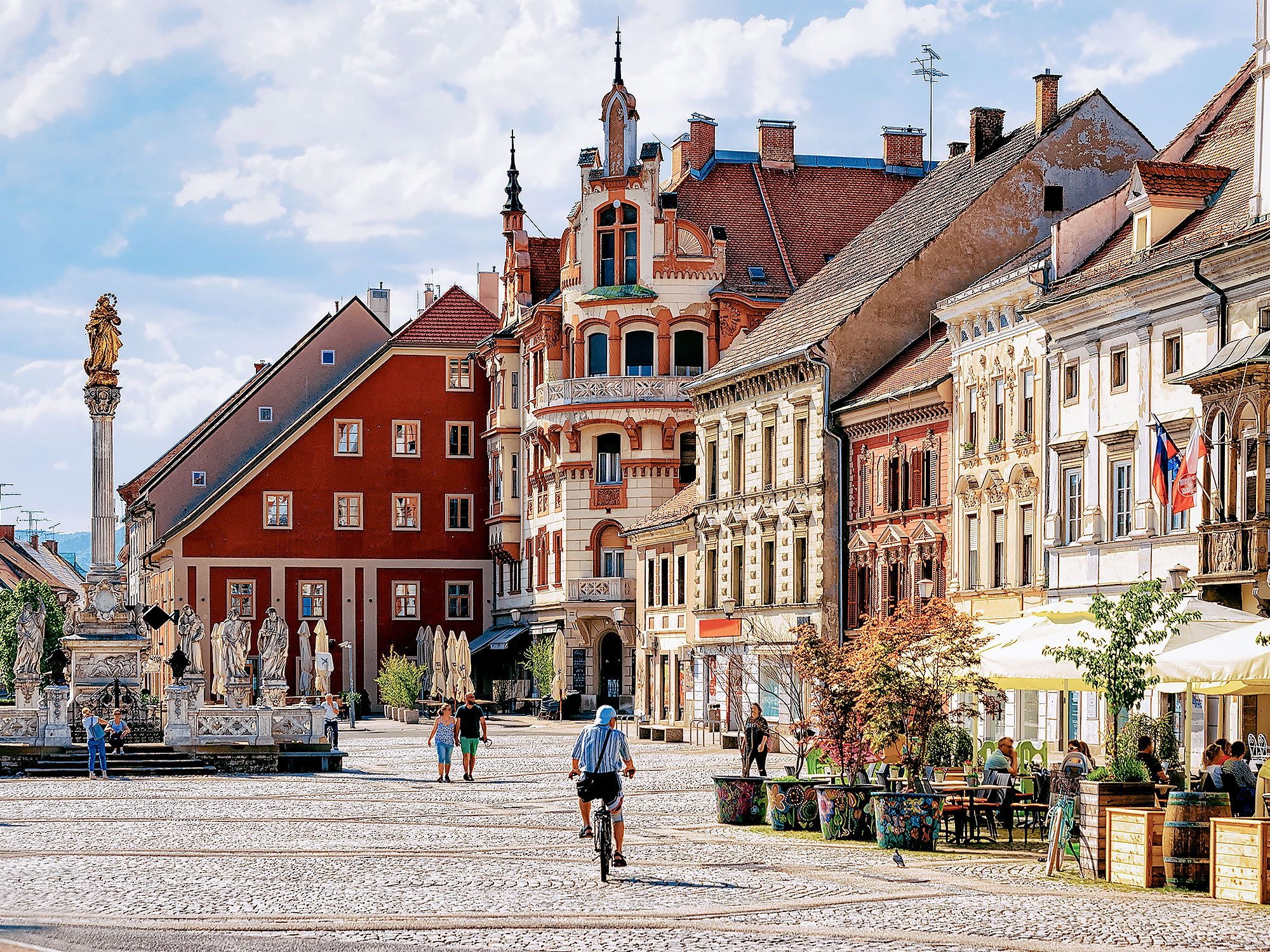
It seems like Slovenia has it all — ski resorts, medieval castles, hot springs, and gorgeous beaches along the Adriatic Sea. Despite the fact that its coastline stretches just 29 miles, the area is home to three seaside towns: Koper, Izola, and Piran. Slovenia’s coast has something for everyone, which is why it’s most often bustling from May to September. As the largest of the three, Koper is a port town that is also home to medieval churches and an old European square. Four miles from Koper is the fishing port of Izola, filled with excellent restaurants and lively bars. But the town of Piran is by far the most popular, featuring an extremely well-preserved Old Town filled with Venetian Gothic architecture. To get away from the hustle and bustle, trek to Moon Bay, a crescent-shaped pebble beach that offers dramatic views of the coast.

6. Democratic Republic of the Congo – 23 Miles

Riverfront cityscape in the Democratic Republic of the Congo
Photo credit: Kimja Vanderheyden/ Shutterstock

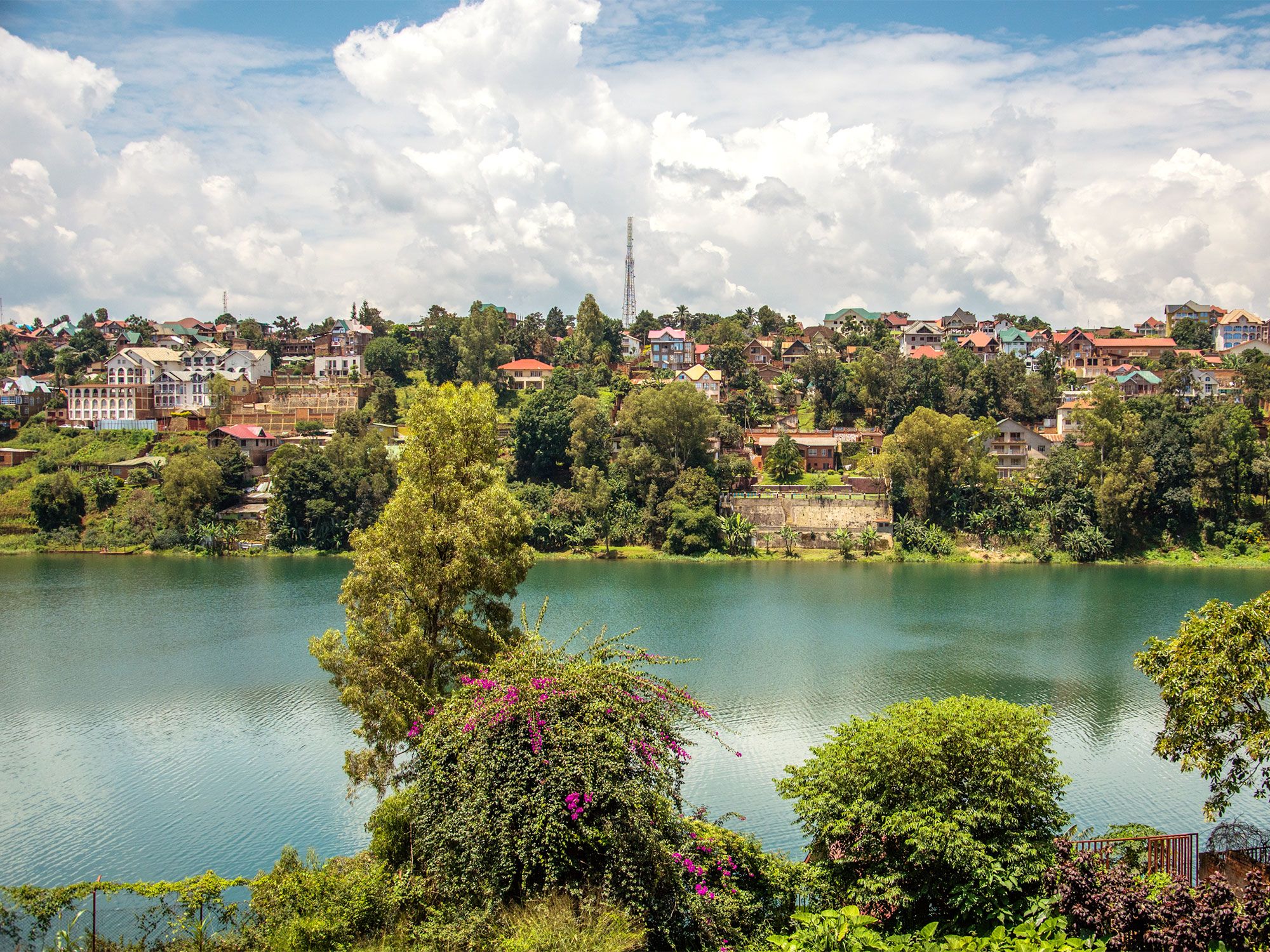
Located in Central Africa, the Democratic Republic of the Congo is the second-largest country on the continent, with a whopping 905,400 square miles of land area. In contrast, its coastal frontage is quite small, stretching only 23 miles along the Atlantic Ocean. Despite its diminutive coastline, this area of the Congo is home to a rich and diverse ecosystem. The Congo River meets the Atlantic seaboard at a point called Banana, a small port and a one-time colonial settlement located adjacent to a protected mangrove forest. Turtles are frequently spotted on the beaches there, while Mangroves National Park is home to parrots, hippos, and crocodiles. Further down the coast is the popular tourist town of Muanda.

5. Nauru – 18.7 Miles

Rock formations and sandy beach in Nauru
Photo credit: Robert Szymanski/ Shutterstock

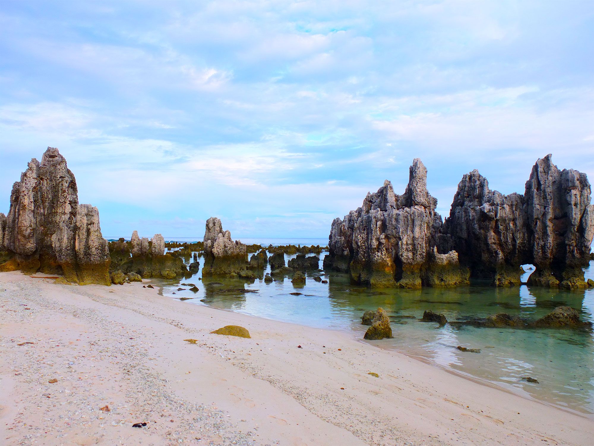
Just 25 miles south of the Equator lies the island of Nauru, a small, rocky outcrop in the southeastern Pacific Ocean. Measuring 18.7 miles in circumference, the island nation was once home to a lush plateau, filled with palm trees and greenery, and peacefully inhabited by the indigenous Nauruan peoples. After the island nation was discovered by sailors in 1798, it was mined for phosphate. As a result of excessive mining, the island’s interior was ravaged and remains barren to this day, although the shoreline is largely unchanged. Surrounded by coral reefs, the island’s seacoast is filled with jagged rocks that are most often seen at low tide, with white sand beaches that line the perimeter. Although Nauru isn’t a particularly popular tourist destination, it does attract diving enthusiasts, who come to explore a large underwater cavern nearly 100 feet below sea level.

4. Jordan – 16.2 Miles

Temple ruins in Jordan
Photo credit: xamnesiacx84/ Shutterstock

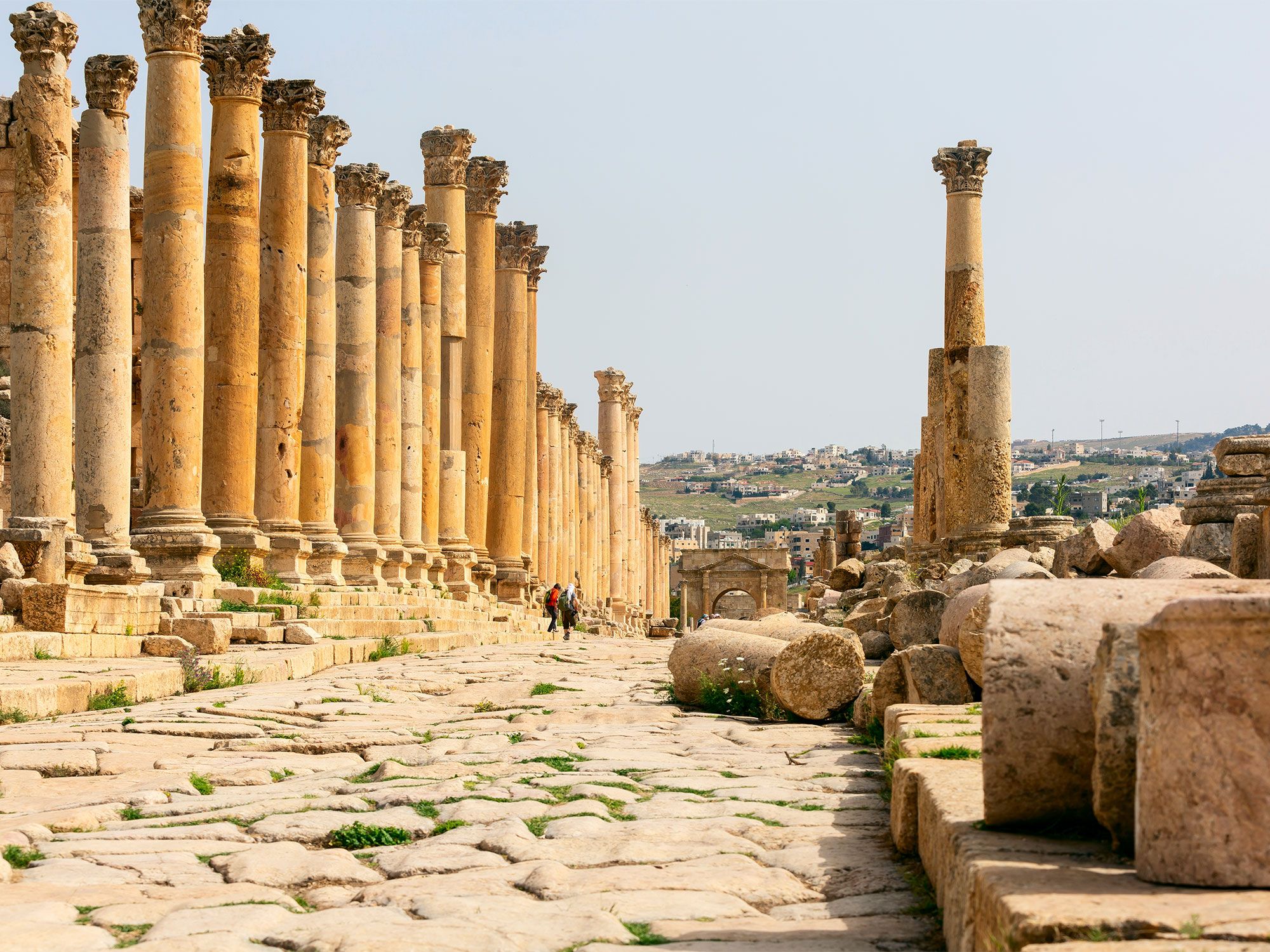
In addition to having access to the Dead Sea, the country of Jordan also boasts ocean frontage on the equally remarkable Red Sea. With 16.2 miles of shoreline along the Gulf of Aqaba — an inlet of the Red Sea that also borders Israel, Egypt, and Saudi Arabia — Jordan makes the most of every mile. The port town of Aqaba attracts tourists and locals alike, with activities such as glass bottom boats, snorkeling trips, and plenty of beach resorts for lounging. And while Aqaba is a favorite spot for windsurfing, it is even more renowned for diving. With dive centers dotted across the 16 miles of shoreline, divers from around the world flock to this small stretch of coastline to access the Gulf of Aqaba’s warm waters and pristine reefs.

3. Tuvalu – 15 Miles

Birds flying over palm trees, white sands, and turquoise waters in Tuvalu
Photo credit: maloff/ Shutterstock

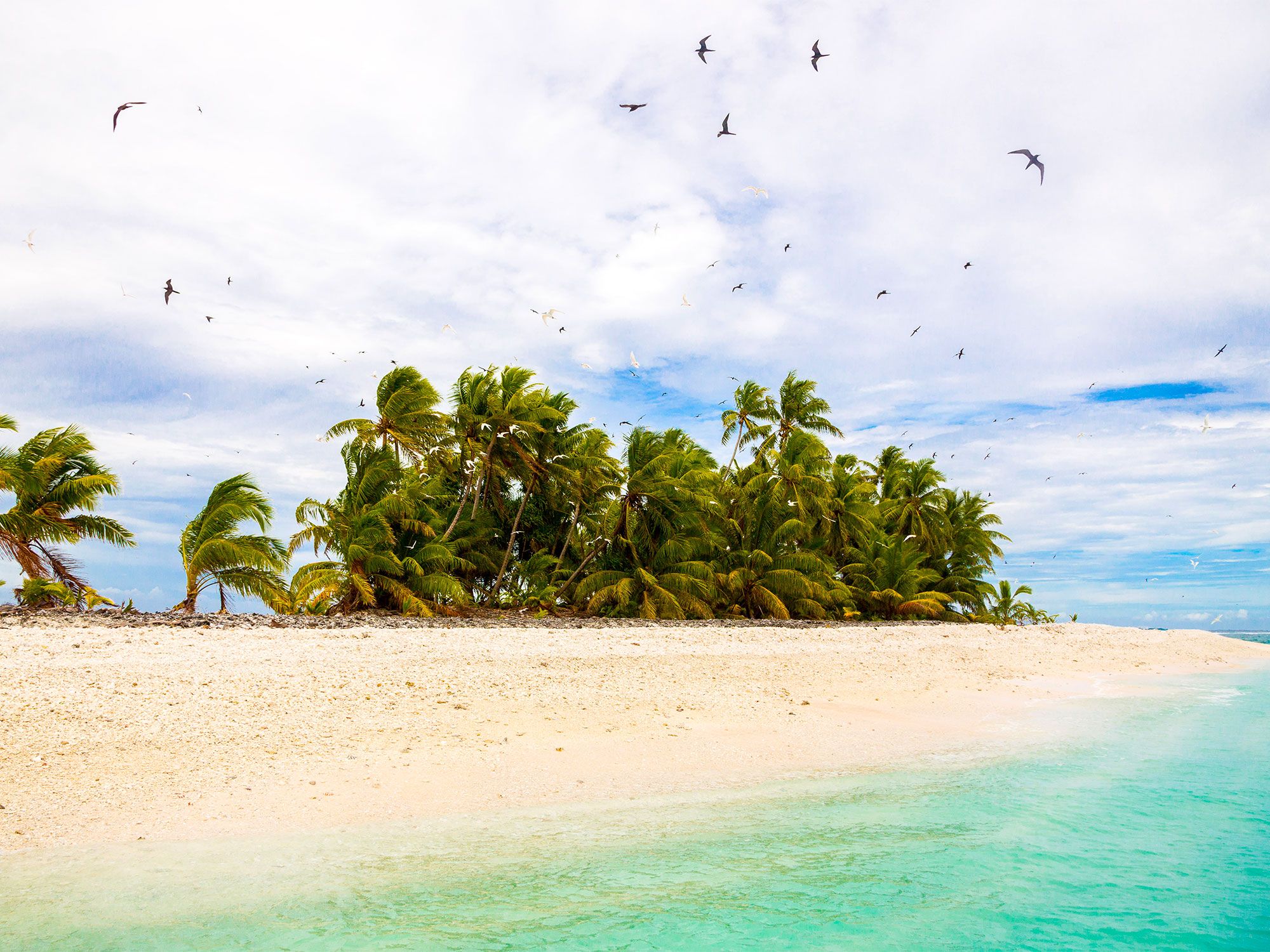
The nation of Tuvalu consists of three reef islands and six atolls that add up to 10 square miles of land and 15 miles of coastline. During World War II, American troops were stationed on Tuvalu and erected air force bases along the coast. Today, visitors to the island nation can still view the wreck of a landing craft off the coast of Nanumea. Despite its history, most people visit Tuvalu to gain access to the Funafuti Marine Conservation, which consists of 33 square miles of protected reef, lagoon, and islets on the western side of the Funafuti atoll. Accessible only by boat, visitors to the conservation area can snorkel through Funafuti’s clear waters to see an abundance of fish and underwater creatures in this tropical paradise.

2. Bosnia and Herzegovina – 12.4 Miles

Person walking on stone bridge over canal in Bosnia and Herzegovina
Photo credit: Bborriss.67/ Shutterstock

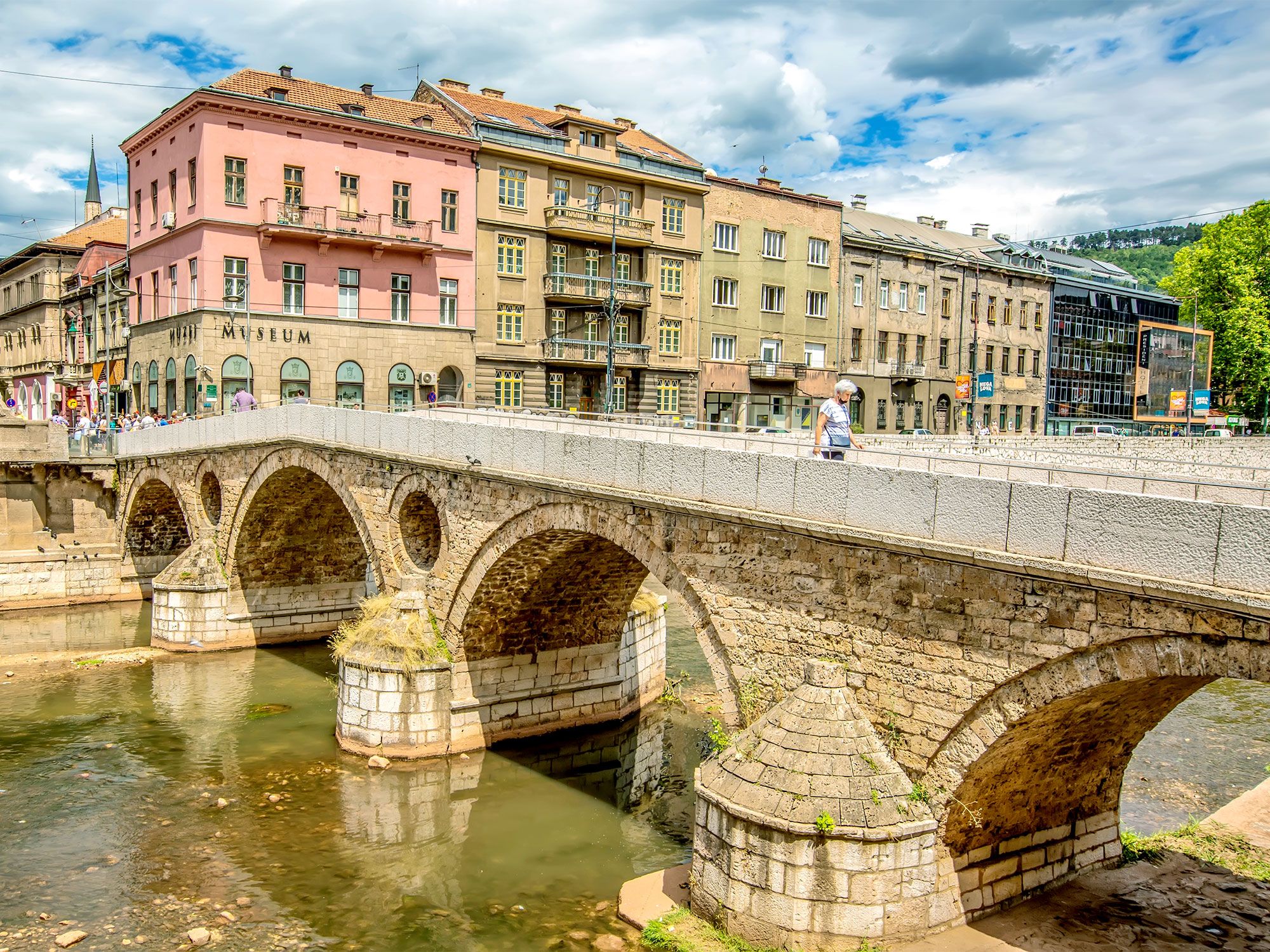
At a quick glance, Bosnia and Herzegovina may appear landlocked, without access to the nearby Adriatic Sea. But upon closer inspection, one will notice a tiny section of shoreline wedged in between Croatia’s long coast. This small sliver of coastline is called the Neum Corridor, and it consists of white sand beaches and red-roofed buildings against a beautiful hilly backdrop. The story behind this stretch of land goes back to 1699, when Croatia granted it to the Ottoman Empire to create a buffer against a potential Venetian attack of the Croatian city of Dubrovnik. In 1991, when Yugoslavia was being divided into independent countries, Bosnia (once a province of the Ottoman Empire) staked its claim to the corridor. These 12.4 miles separate Dubrovnik from the rest of the country, which is why Croatia is building a bridge to bypass the Bosnian coast.

1. Monaco – 2.5 Miles

Person walking along coastal path in Monaco
Photo credit: Da_Ja_25/ Shutterstock

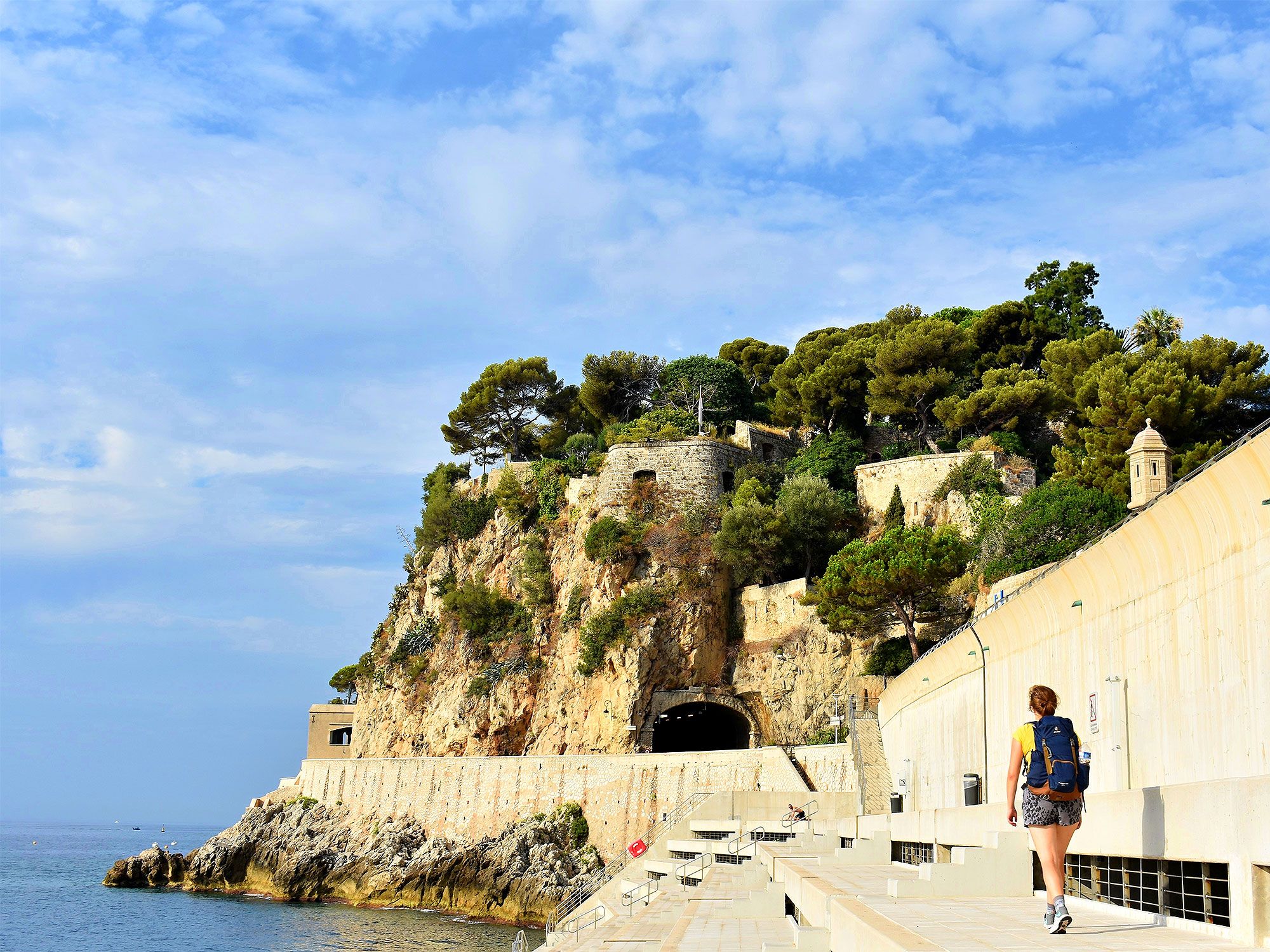
With less than one square mile of land, it probably doesn’t come as much surprise that Monaco has the shortest coastline in the world. Situated between France and Italy, Monaco has a mere 2.5 miles of coastline along a world-famous section of the Mediterranean called the French Riviera. Known for its glitz, glamour, and enormous wealth, the tiny city-state is home to over 12,000 millionaires. And since it’s where the wealthy go to play, Monaco’s harbors are littered with magnificent sailboats and superyachts, while the small local beach is packed with stylish beach-goers. But Monaco’s short shoreline has become so congested that the country is undergoing a billion-dollar project to artificially extend it by 15 acres, with the hopes of adding a park, promenade, and marina.

Post Banner Image
Outdoors

Fascinating Facts You Might Not Know About Mount Everest

By Daily Passport Team
Read time: 4 minutes
May 11, 2023
Updated: July 25, 2023

Fascinating Facts You Might Not Know About Mount Everest

By Daily Passport Team
Author
Daily Passport Team
Daily Passport writers have been seen in publications such as National Geographic, Food & Wine, CBC, Condé Nast Traveler, and Business Insider. They're passionate about uncovering unique destinations and sharing expert tips with curious travelers.

Mount Everest has captured the world’s imaginations for centuries. The highest peak on Earth, Everest sits an incredible 29,032 feet above sea level, straddling the border of China and Nepal in the Himalayas. Thousands attempt the treacherous climb each year, but considerably fewer can claim the prize of reaching its elusive summit. Find yourself fascinated by Mount Everest? Here are five facts you might not know.

Edmund Hillary and Tenzing Norgay May Not Have Been the First to Reach the Summit

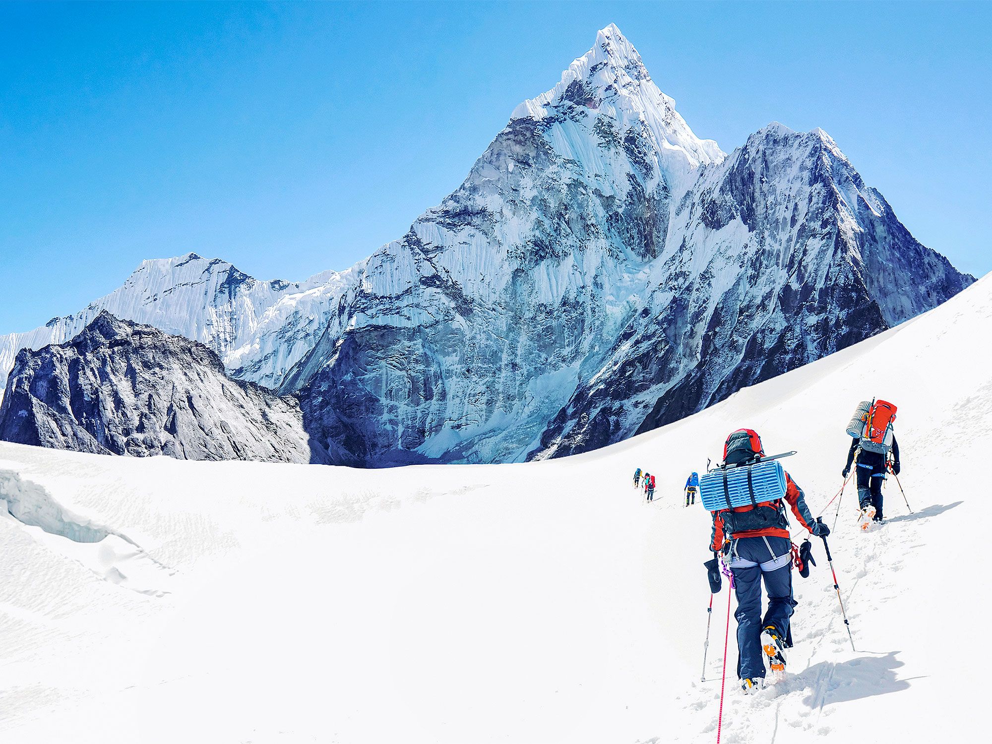
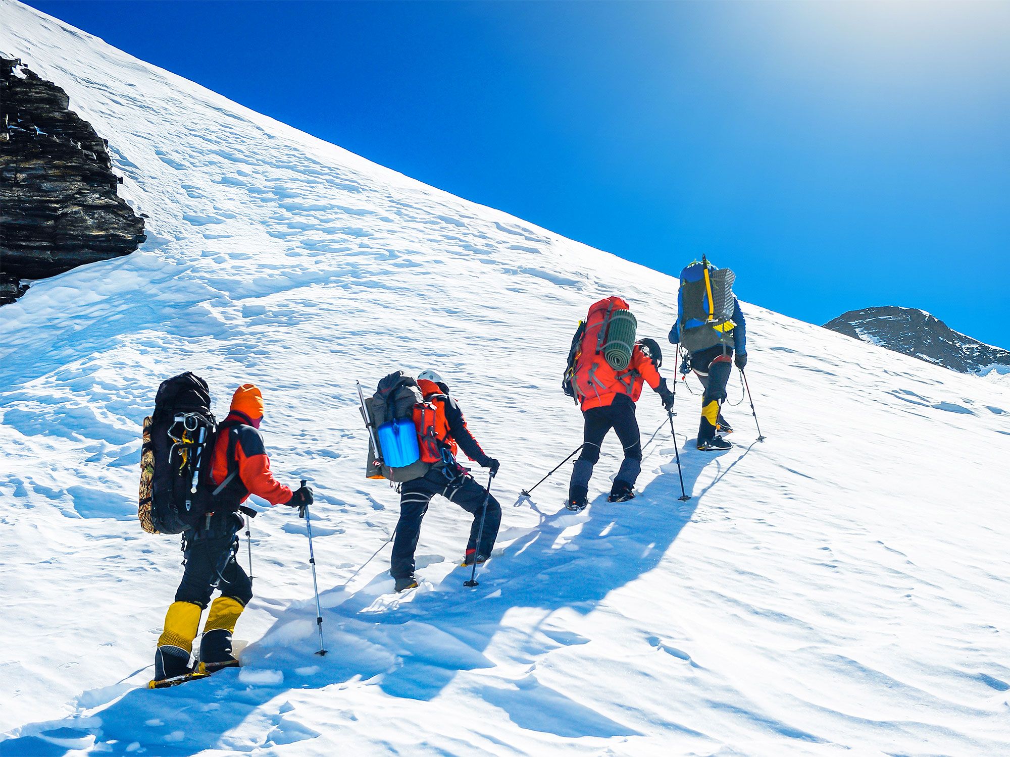
Trekkers climbing up a snowy Mount Everest
Photo credit: Vixit/ Shutterstock

New Zealand climber Edmund Hillary and Sherpa mountaineer Tenzing Norgay were famously the first people to reach the summit of Mount Everest on May 29, 1953. However, they may not actually have been the first individuals to conquer the rugged mountain.

British climbers George Mallory led an expedition with Andrew Irvine to the summit nearly 30 years earlier in 1914. According to local legend, both Irvine and Mallory were seen climbing to the top. After the first sightings of the men, however, they were never seen again. A search team found Mallory’s body on the mountain in 1999, a few thousand feet from the top. Was he going up or coming back down? No one knows, and, unfortunately, Mallory’s camera wasn’t found with his body. The camera would have contained photographic evidence that Mallory and Irvine reached the summit nearly three decades before Sir Edmund Hillary. The search team never found Irvine’s body, however. If it’s recovered along with the camera, it could put the mystery to rest almost 100 years after the men attempted to scale the imposing mountain.

Everest Isn’t the Mountain’s Only Name

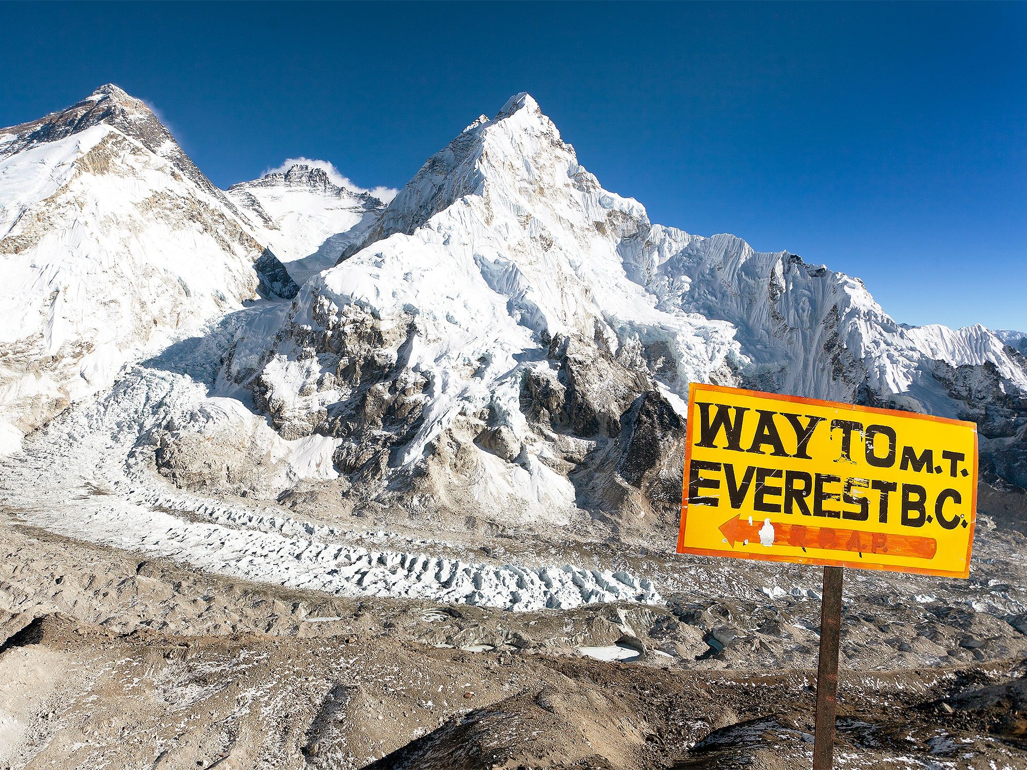
Yellow sign indicating way to Mount Everest with snowy peak in background
Photo credit: Daniel Prudek/ Shutterstock

Everest was named after Sir George Everest, who first surveyed the mountain for the British government in 1865. The mountain sits on the border between Nepal and Tibet, and the Indigenous peoples living in the surrounding area knew of the mountain for centuries before Sir George Everest came along. They, of course, had their own names for it.

The mountain is also known by its Tibetan name “Chomolungma,” which means “Goddess Mother of the World.” It also has a Sanskrit name “Sagarmatha,” which means “Peak of Heaven.” Both names indicate that even before officials measured the mountain, its rugged majesty impressed the people living nearby.

The Mountain Reached New Heights in 2020

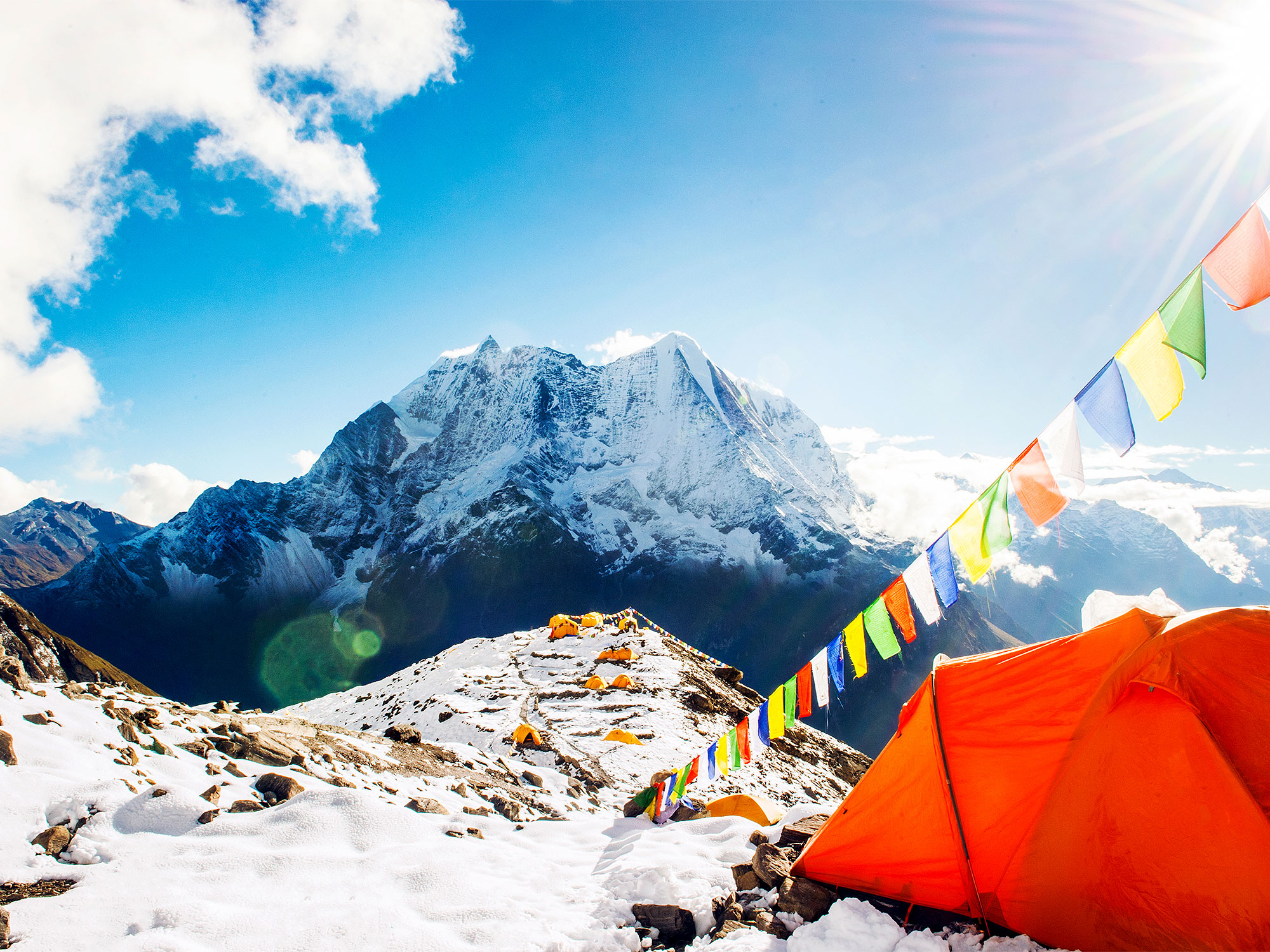
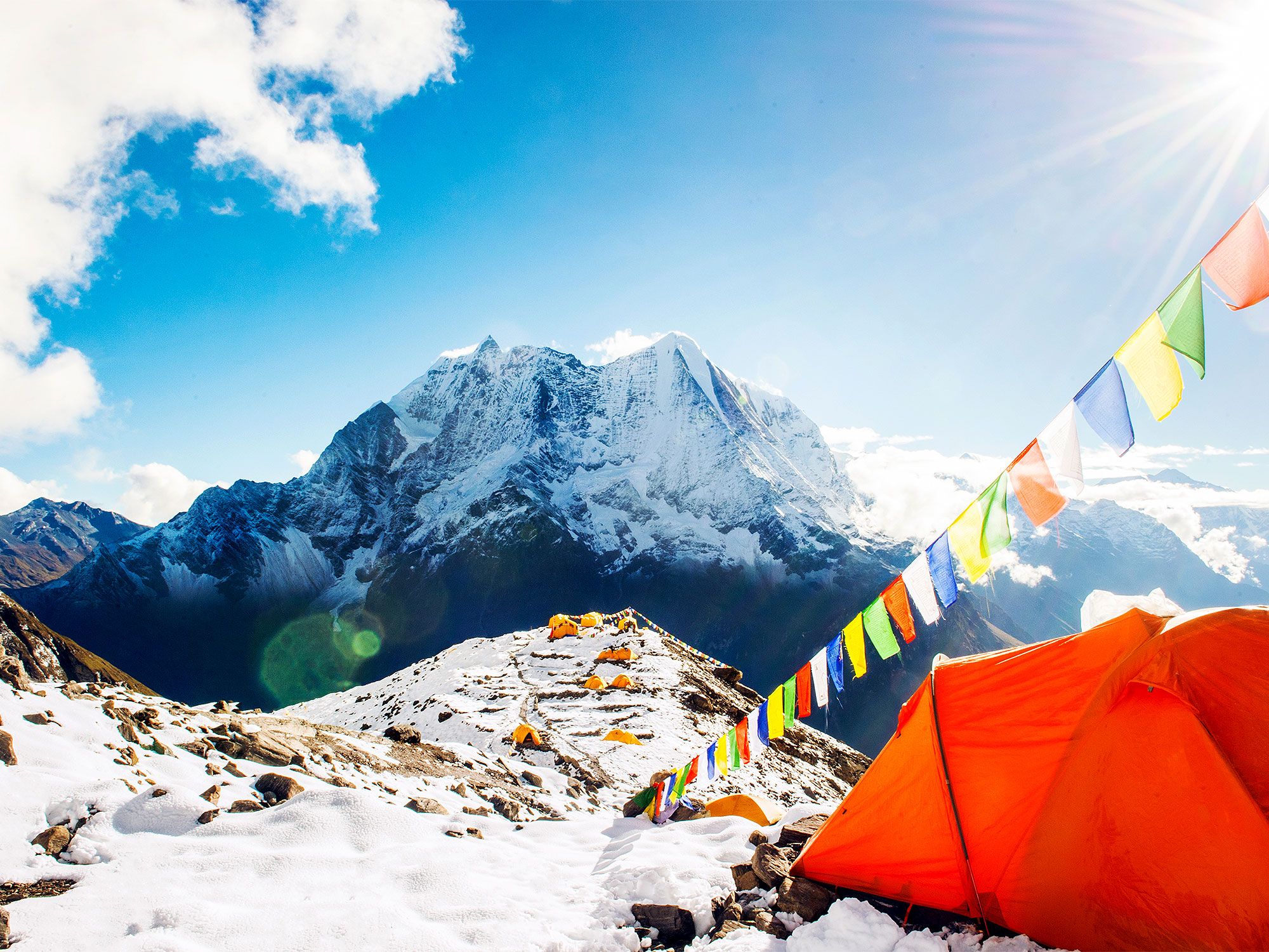
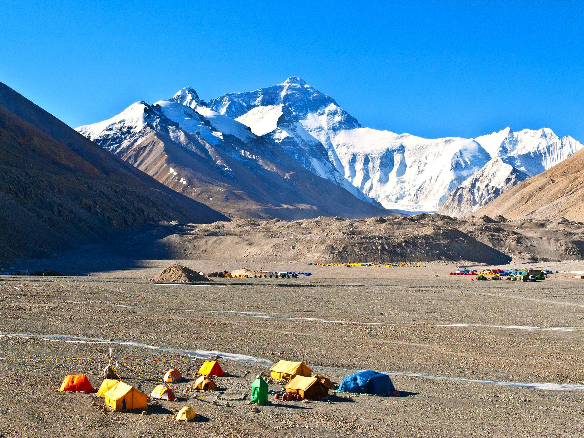
Colorful flags flying over tents on Mount Everest
Photo credit: Vixit/ Shutterstock

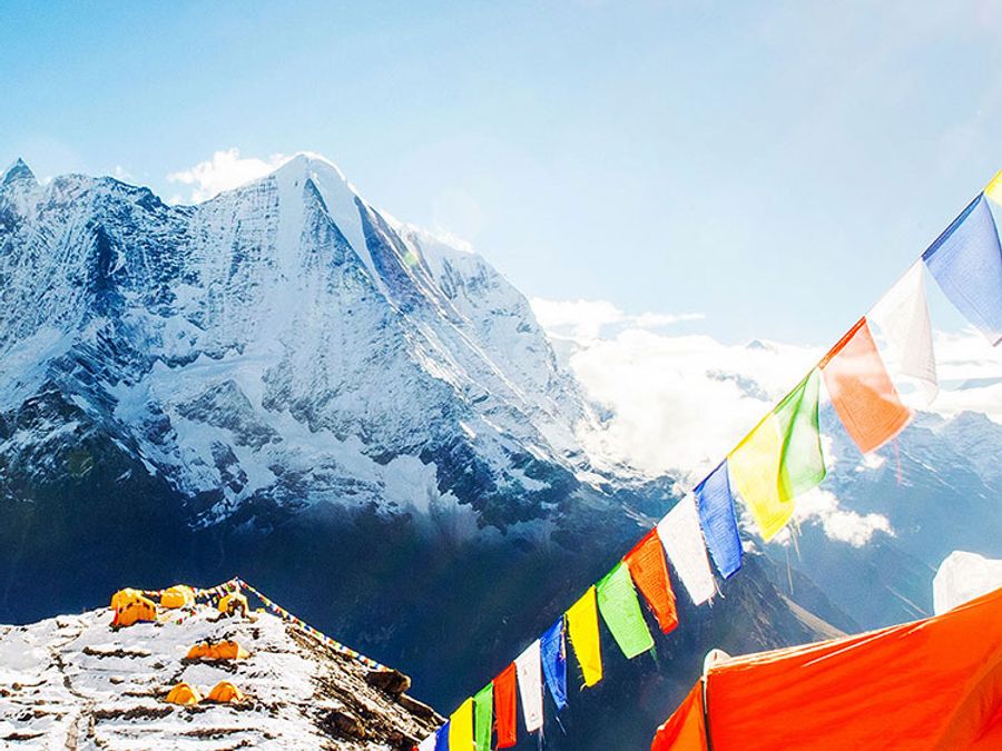
It turns out Mount Everest isn’t done growing. In December 2020, Nepal and China jointly announced that the world’s tallest peak is even taller than we originally thought. After both countries conducted revised mapping surveys, they determined the new height of Mt. Everest is 29,031.69 feet above sea level, more than two feet taller than some previous measurements. Before this, China’s official height for the mountain — which straddles both countries — was about 13 feet lower than Nepal’s. Mount Everest rises about 1.6 feet each century as the Indian and Eurasian tectonic plates beneath it move. It’s had the world’s tallest peak title since 1856, when mathematician Radhanath Sickdhar measured the mountain while working for the Great Trigonometrical Survey.

Expeditions to the Summit Take About Two Months

Colorful tents in valley of the Himalayas, seen from above
Photo credit: Meiqianbao/ Shutterstock

If climbing to the top of Mount Everest is on your bucket list, you may need to take a sabbatical or quit your job. The average expedition takes about two months. But you won’t spend the entire time climbing the peak — you’ll be doing a lot of sitting around in those two months. This is because climbers must spend the majority of the time allowing their bodies to acclimatize to the environment. There’s much less oxygen at that altitude, so your body will start to feel oxygen-deprived unless it’s allowed to adapt gradually to the changes. At each camp along the way, climbers will need to spend a few nights getting used to the environment before moving on. Most climbers use supplemental oxygen once they get to higher altitudes.

Climbers Can Expect to Lose Between 30 and 50 Pounds on Their Trek

Trekkers in line hiking up snowy Mount Everest
Photo credit: Vixit/ Shutterstock

Mountaineers who make the trek can expect to lose up to 50 pounds during the two-month climb. It’s the environment on the mountain that leads to so much weight loss. The combination of the cold temperatures, physical activity, and lower oxygen levels all lead the body to burn more calories than it does at lower altitudes. Weight loss can become a life-threatening issue for climbers, however. Burning so many calories within such a short period can make climbers more susceptible to frostbite and fatigue. Both can prove deadly when trying to reach the peak.

Post Banner Image
Architecture

A Feat of Engineering: 5 Things You May Not Know About the Panama Canal

By Daily Passport Team
Read time: 3 minutes
May 10, 2023
Updated: July 25, 2023

A Feat of Engineering: 5 Things You May Not Know About the Panama Canal

By Daily Passport Team
Author
Daily Passport Team
Daily Passport writers have been seen in publications such as National Geographic, Food & Wine, CBC, Condé Nast Traveler, and Business Insider. They're passionate about uncovering unique destinations and sharing expert tips with curious travelers.

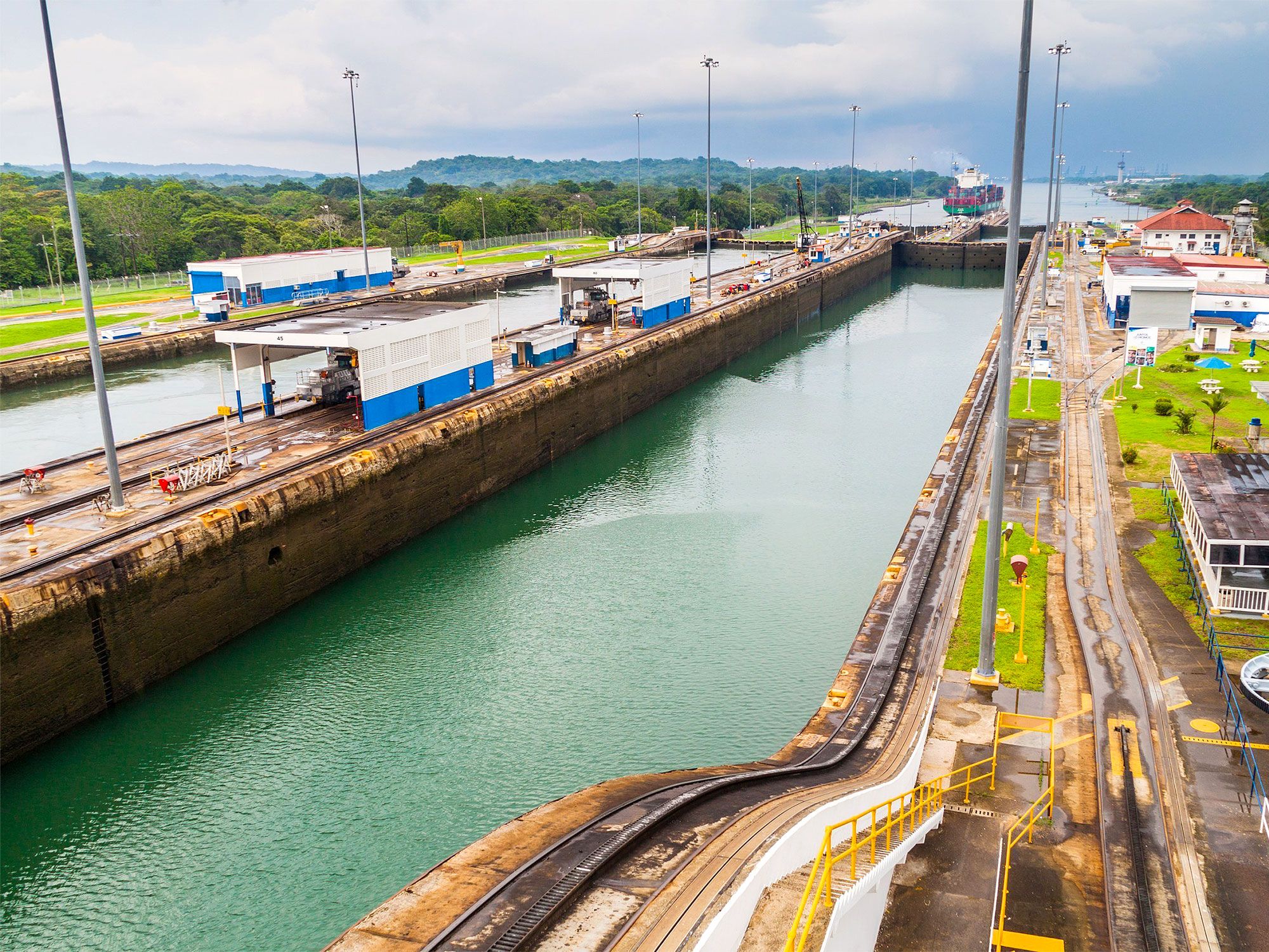
The opening of the Panama Canal on August 15, 1914, revolutionized world trade and global development. A feat of modern engineering, it allowed ships sailing from the Atlantic to the Pacific Oceans to avoid the two-week journey around Chile’s treacherous Cape Horn. Today, the 50-mile canal connects the Pacific Ocean to the Atlantic Ocean across the Isthmus of Panama, dividing the continents of North America and South America. How much do you know about this world-famous waterway? Find out with these five interesting facts about the Panama Canal.

The Idea for the Canal Originated in the 1500s

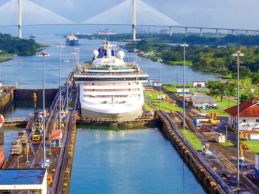
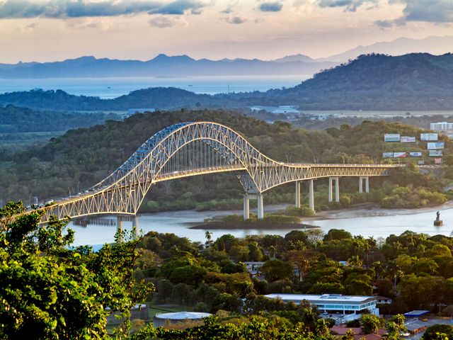
Bridge spanning over the Panama Canal
Photo credit: Milosz Maslanka/ Shutterstock

The Panama Canal celebrated its historic 100-year anniversary in 2014, but many people don’t know that plans for this canal had been in motion long before it opened in 1914. When Spanish conquistador and explorer Vasco Núñez Balboa discovered that the Isthmus of Panama was just a tiny sliver of land separating the Pacific and Atlantic oceans in 1513, he began to search for a waterway to bypass it.

When Balboa didn’t find one by 1534, Roman Emperor Charles V ordered that his men find a way to build one — but this didn’t work out either. In the 1880s, a French company began construction on a canal, but the project failed due to poor planning and bankruptcy. In 1904, President Theodore Roosevelt established the Isthmian Canal Commission (ICC) to see through the construction, and finally, after 10 more years, the Panama Canal was completed.

Traveling Through the Canal Isn’t Cheap

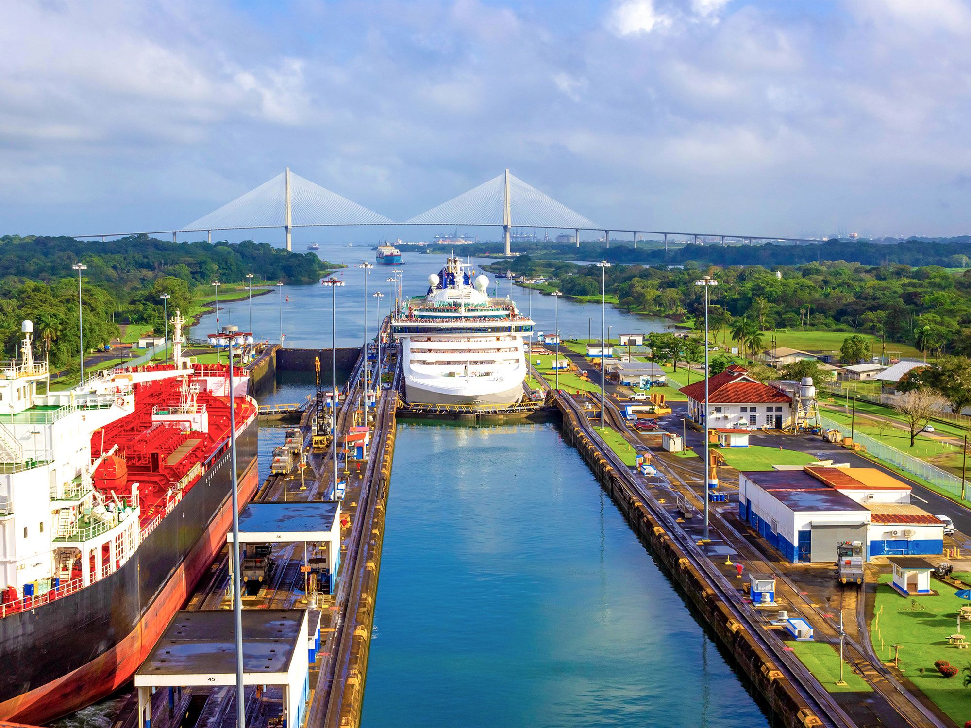
Aerial view of ship in the Panama Canal
Photo credit: Solarisys/ Shutterstock

On average, it takes around eight to 10 hours for a ship to travel through the Panama Canal, as opposed to two weeks if it made the journey around Cape Horn. However, there’s a hefty fee for the convenience. Each commercial ship that passes through the canal has to pay a toll based on its weight. The average toll is around $150,000, but some larger ships pay much more — the record is held by a cargo ship called MOL Benefactor from Hong Kong, which paid over $829,400 to pass through.

But It Is if You Can Swim Through the Canal

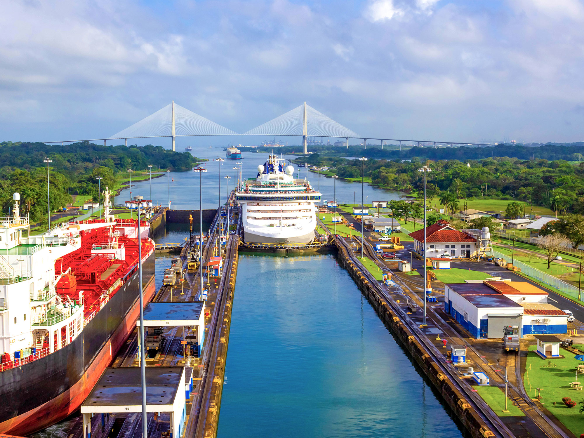
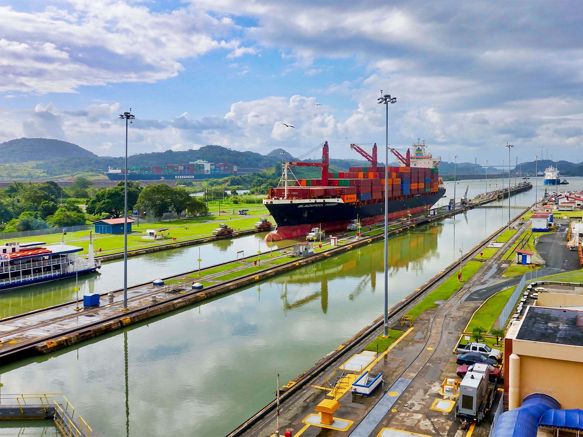
Cargo ship in the Panama Canal
Photo credit: Erwin Widmer/ Shutterstock

While ships regularly pay hundreds of thousands of dollars to pass through the Panama Canal (even privately-owned boats have to pay between $800 and $3,200), the lowest toll ever paid was paid by an American man named Richard Halliburton, who swam the entire length of the canal in 1928. Since the toll price is based on weight, he only had to pay 36 cents.

It Was Almost Called the Nicaragua Canal

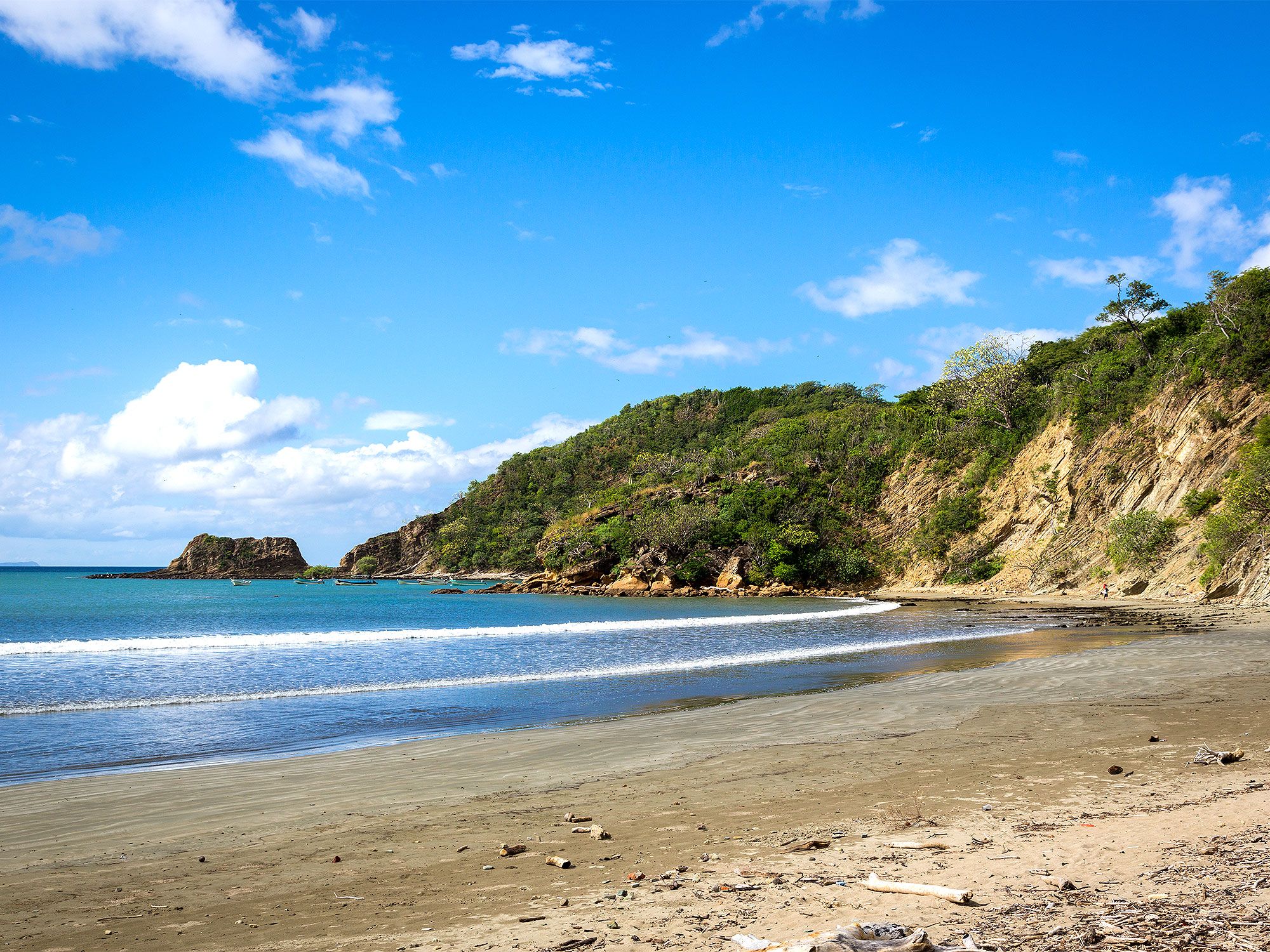
Sandy beach in Nicaragua
Photo credit: LMspencer/ Shutterstock

American engineers’ first choice for connecting the Atlantic and Pacific oceans was to build a canal through Nicaragua instead of the Isthmus of Panama. They had seen the hardships the French had endured trying to build the canal in Panama in the 1800s (including malaria and yellow fever, which led to the deaths of more than 20,000 workers), so they wanted a fresh start in Nicaragua instead.

However, French engineer Philippe-Jean Bunau-Varilla strongly suggested that they reconsider this placement, as Nicaragua posed a significant seismic risk due to its close proximity to a volcano. Eventually, he was able to convince them to pick up where the French had left off in Panama.

The Panama Canal Is Constantly Expanding

Panama Canal seen from above
Photo credit: Matyas Rehak/ Shutterstock

The Panama Canal brings in billions of dollars in revenue per year, some of which is then used for expansion purposes. Many larger ships used to have trouble bypassing the smaller canal, so it has been being expanded fairly steadily over the last few decades. New lock systems have been put into place, allowing more ships to pass through at the same time, as well as larger ships that can carry more cargo. This is no surprise, as the Panama Canal facilitates at least 5% of the world’s trade and has to keep up with the times.

Post Banner Image
History

Here’s Where 6 Iconic American Fast-Food Chains Got Their Start

By Daily Passport Team
Read time: 6 minutes
May 10, 2023
Updated: June 6, 2024

Here’s Where 6 Iconic American Fast-Food Chains Got Their Start

By Daily Passport Team
Author
Daily Passport Team
Daily Passport writers have been seen in publications such as National Geographic, Food & Wine, CBC, Condé Nast Traveler, and Business Insider. They're passionate about uncovering unique destinations and sharing expert tips with curious travelers.

It’s a fact: Americans have a love affair with fast food — roughly 83% of Americans say they eat fast food once per week and over one-third report eating it daily. And as U.S.-born fast food chains have boomed in popularity, more people around the globe are consuming fast food than ever before. But Big Macs and pumpkin spice lattes weren’t always a part of everyday life. Here’s a look at where six popular fast-food franchises got their start.

In-N-Out – Baldwin Park, California

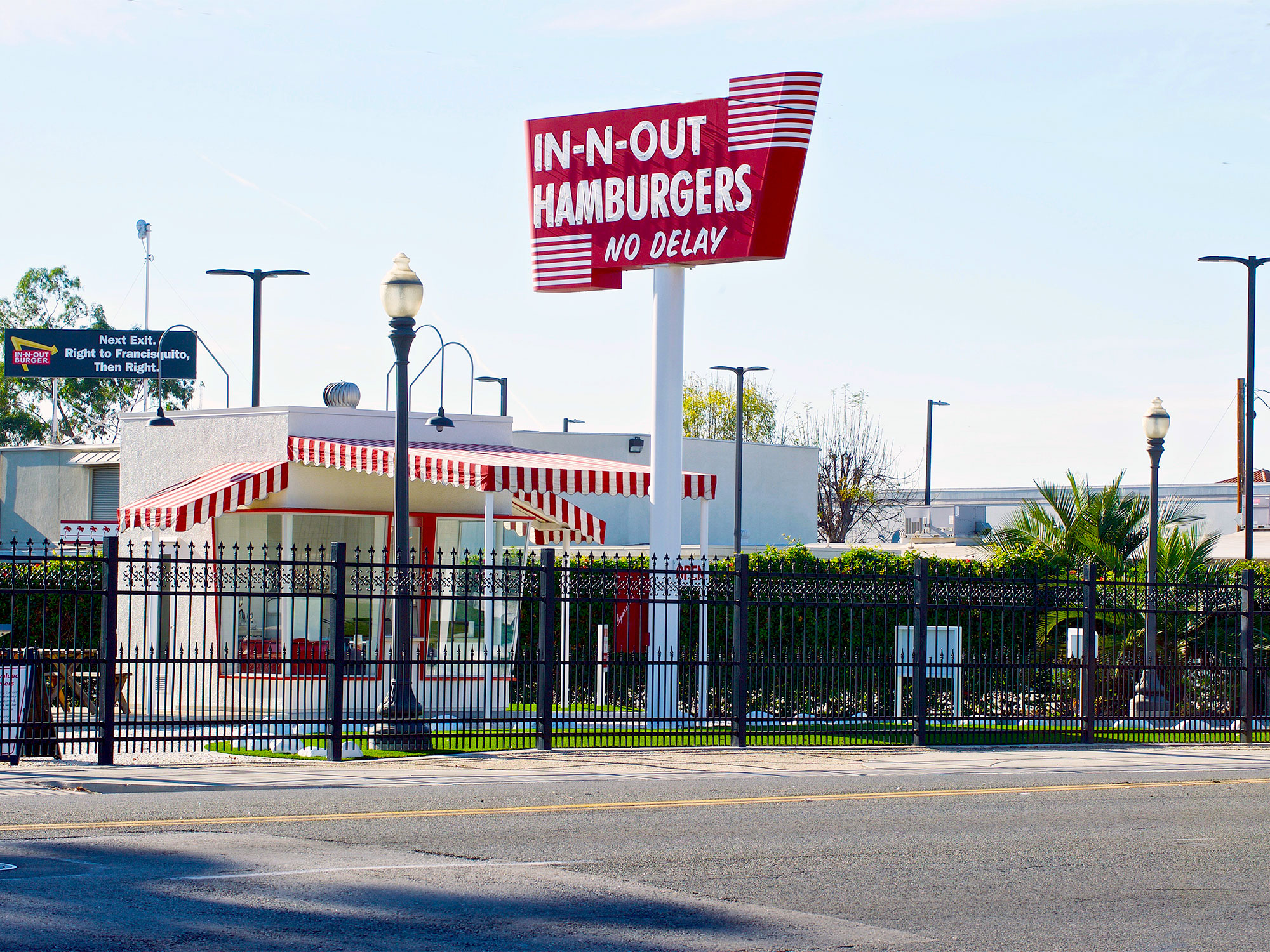
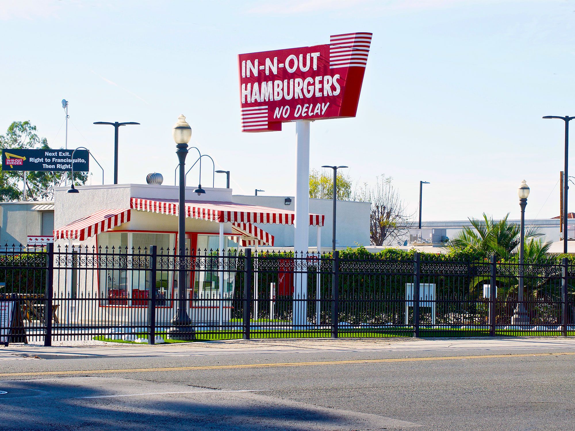
Vintage In-N-Out restaurant in Baldwin Park, California
Photo credit: Philip Pilosian/ Shutterstock

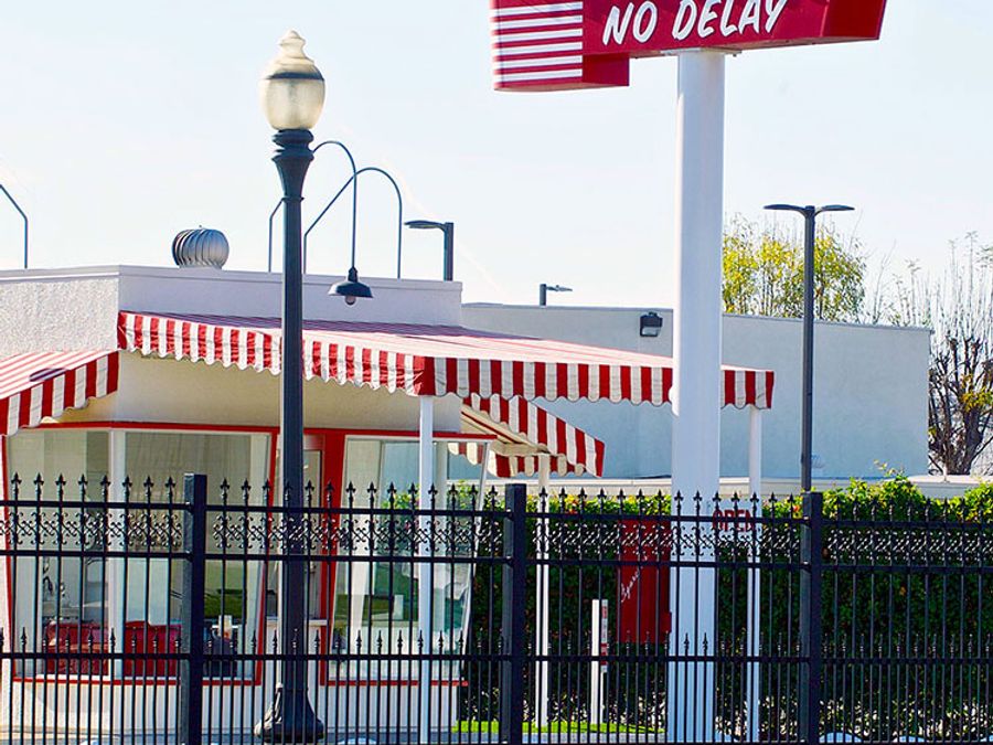
Opened in 1948, the original In-N-Out hamburger in Baldwin Park stand took up no more than 10 square feet, but size had nothing to do with the quality of the food. Every morning, In-N-Out’s founder, Harry Snyder, visited the L.A. area’s meat and produce markets to source the freshest ingredients for his homemade burgers. While he flipped beef patties, his wife took care of the accounting from their home, located just around the corner. Shortly after the stand’s opening, Snyder implemented an innovative two-way intercom system in the chain’s drive-thrus that allowed customers to order and receive their meals without leaving their vehicles.

Fast-forward to 1973, and Snyder had 13 locations operating in Los Angeles County. Cheeseburgers, fountain sodas, and milkshakes are still regulars on the menu, but die-hard In-N-Out fans know they can order off the secret menu: “animal-style” burgers (topped with secret sauce), “monkey-style” burgers (a burger topped with fries and secret sauce), and the “Flying Dutchman” (two meat patties with melted cheese) aren’t advertised but are very much for sale. The original location is still open and slings burgers, fries, and secret menu items to their loyal fanbase in the L.A. area seven days a week.
Starbucks – Seattle, Washington

Iconic red sign for Pike Place Market in downtown Seattle, Washington
Photo credit: Nadia Yong/ Shutterstock

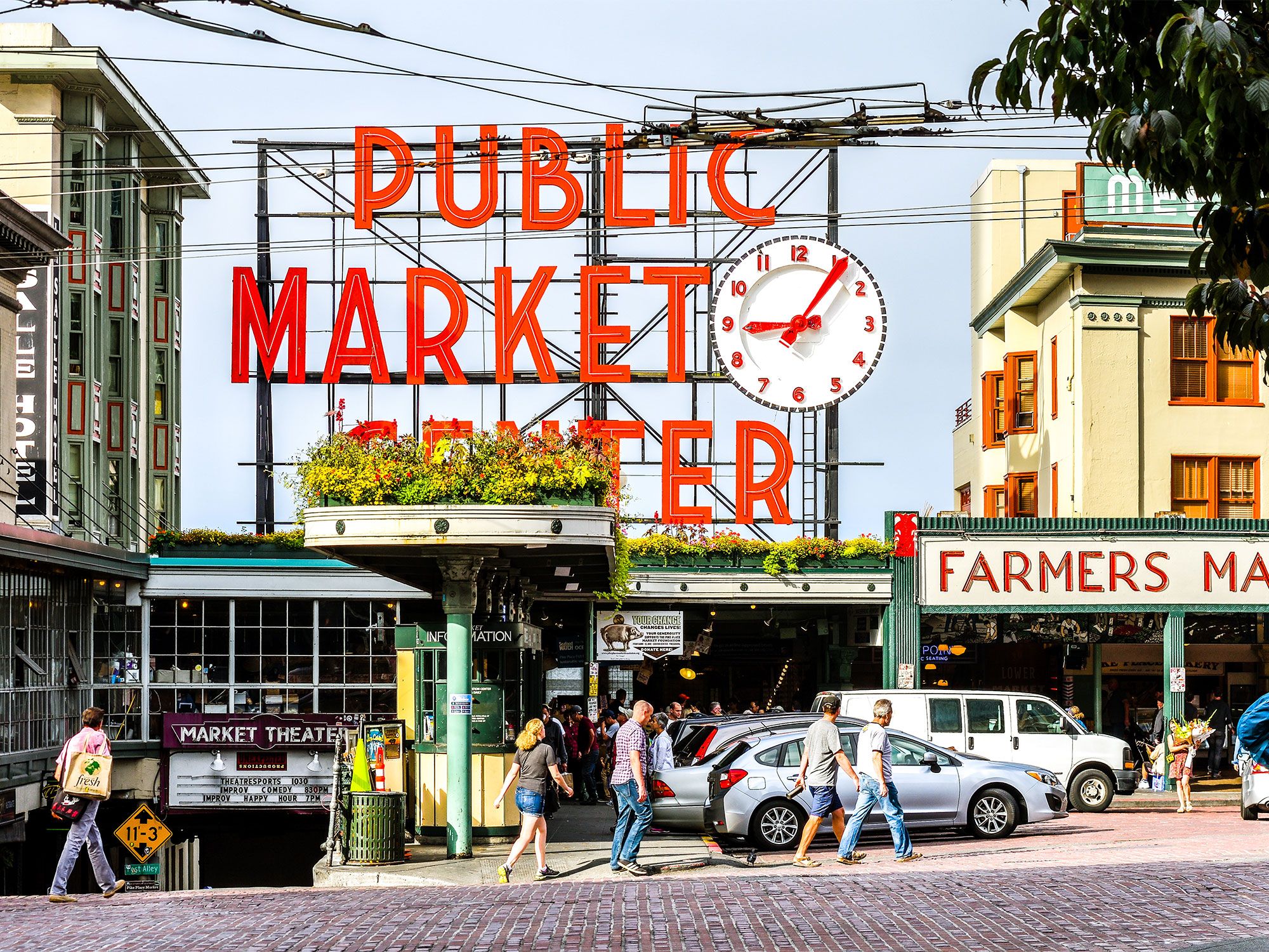
The world’s largest coffee chain got its start in Seattle’s historic Pike Place Market in 1971. Three friends — teachers Jerry Baldwin and Zev Siegal, and their friend, writer Gordon Bowker — pooled their money together to open the first Starbucks. Howard Schultz joined the trio in 1983 and catapulted Starbucks to the next level after an inspiring trip to Milan whet his appetite for Italian coffee culture. The ambitious founders worked tirelessly and Starbucks eventually reached national and then international fame in the 1980s and 1990s, with the opening of franchises across North America and overseas in Europe and Asia.

What’s now known as the Original Starbucks at 1912 Pike Place actually isn’t the address of the first very location, which stood a little over 300 feet away at 2000 Western Avenue before moving to its final spot in 1976. The Original Starbucks, which is still in operation today, has preserved the same countertops, floors, and fixtures, and welcomes a never-ending line of customers who line out the door and down the street for a chance to sip coffee at this momentous coffeehouse.

McDonald’s – San Bernardino, California

Palm tree-lined street in downtown San Bernardino, California, with mountains in background
Photo credit: DenisTangneyJr/ iStock

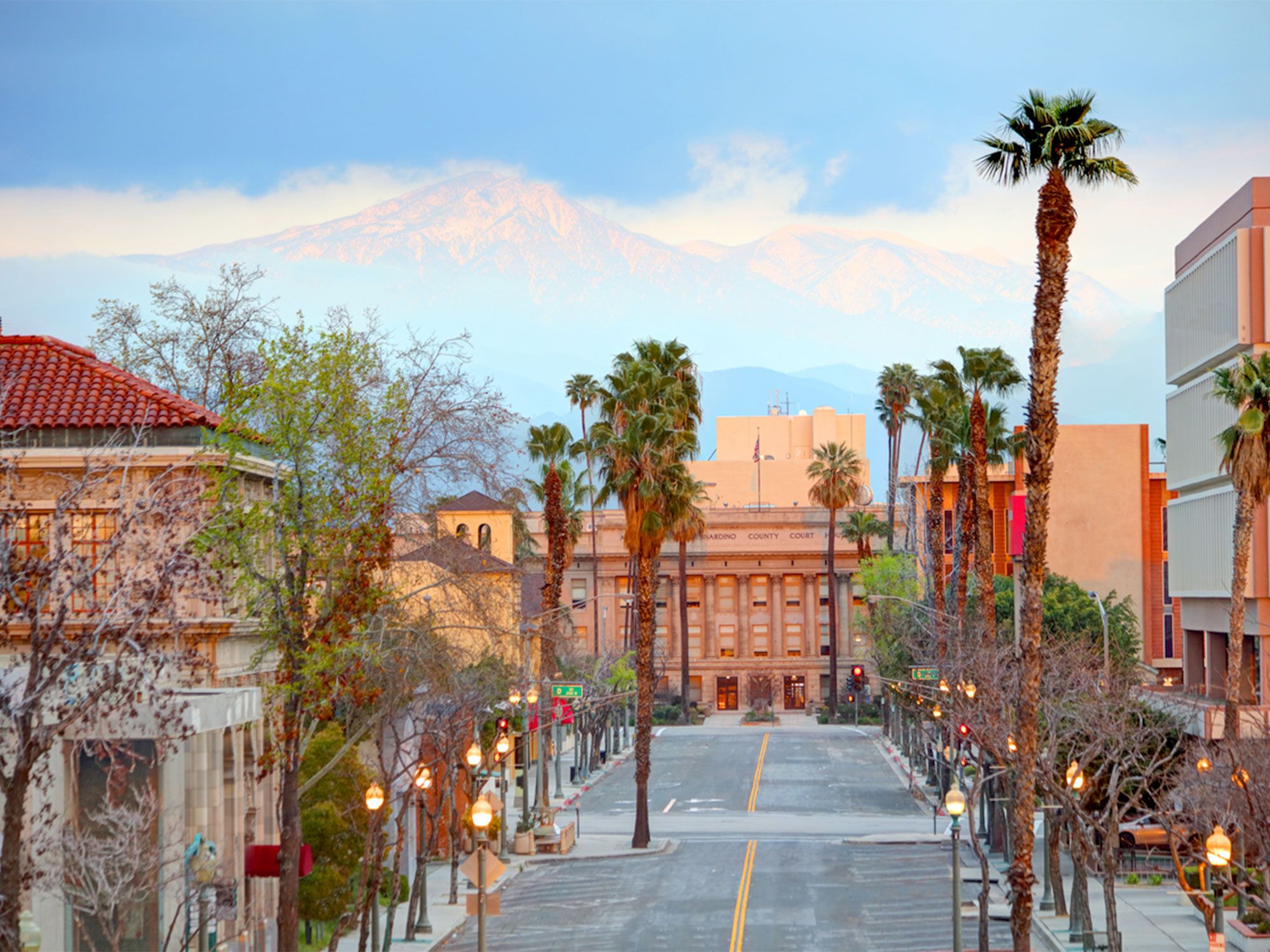
While the chain today is world-famous for their Big Macs, McDonald’s wasn’t always a burger joint. In 1940, brothers Maurice and Richard McDonald opened a drive-in restaurant in San Bernardino, which offered a wide variety of fare from barbecue ribs to pork sandwiches, delivered to customers via carhops. In 1948, the brothers redefined their concept to include inexpensive quality grub made fast, and a few months later, the new and improved McDonald’s opened.

The McDonald brothers kept costs low by limiting their menu to a few items (hamburgers, potato chips, milkshakes, fountain sodas, and deep-fried hand pies) and creating a self-service system that eliminated the need for waitstaff. A McDonald’s hamburger at the time cost just 15 cents — 50% less than a burger at competing locations. The fast-food approach took off, and the rest is history.
The groundbreaking first McDonald’s was purchased and turned into a museum by another fast-food enterprise owner, Juan Pollo, and still stands today. The museum features exhibits displaying historic memorabilia, such as original menus, packaging, ketchup dispensing machines, and newspaper clippings about the restaurant’s successful history.
Wendy’s – Columbus, Ohio

Park along downtown Columbus, Ohio, skyline
Photo credit: f11photo/ Shutterstock

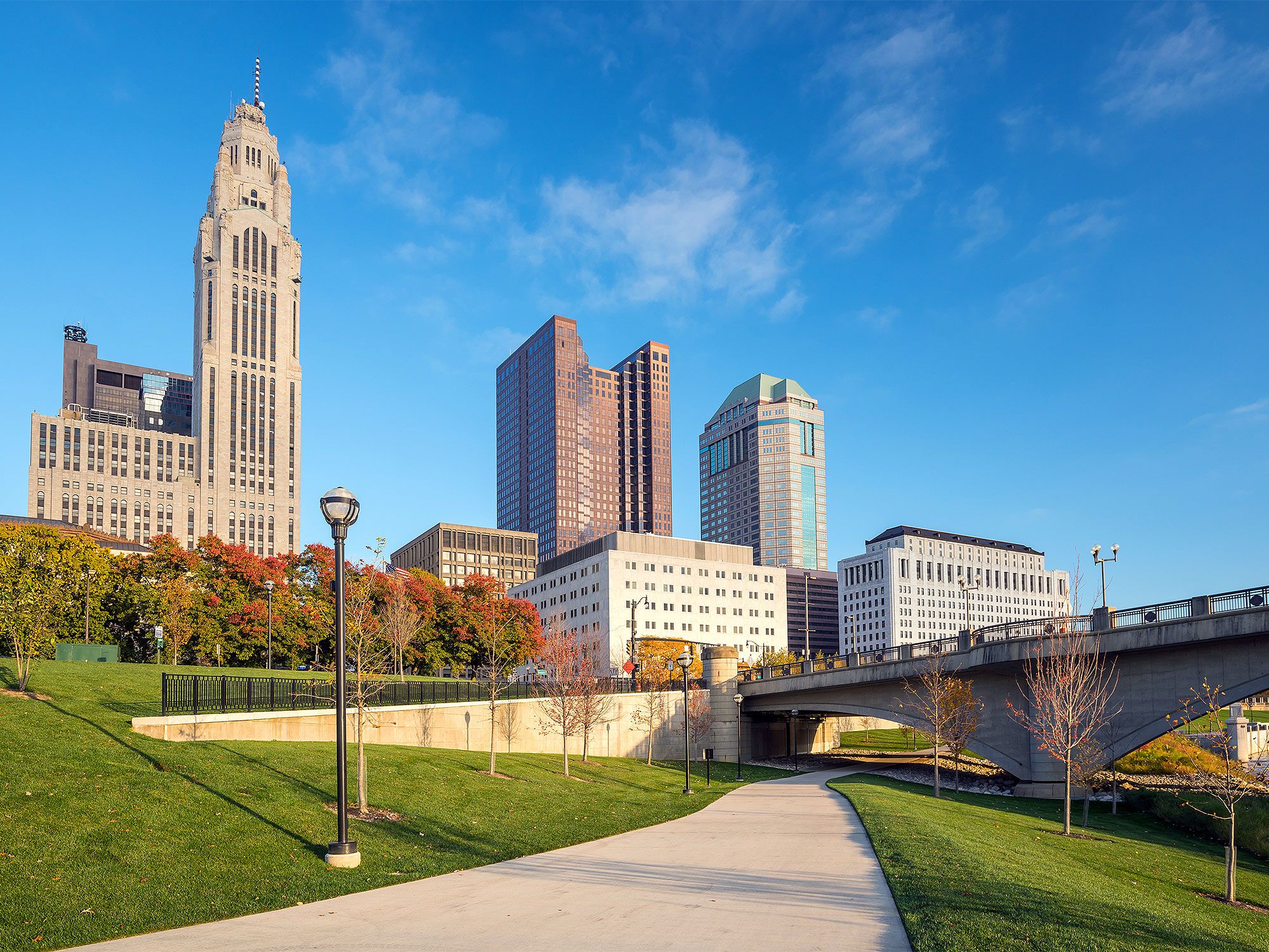
Even as a young boy, Dave Thomas loved food and people, and he wasn’t shy about sharing his dream of one day opening his own restaurant. In 1969, Thomas fulfilled his boyhood aspirations when he opened Wendy’s (named after one of his daughters) in Columbus, Ohio. Wendy’s was known for its square patty hamburgers, french fries, chili, and frosty desserts — main menu items that still live on today.

Not only did Thomas build and operate a successful business, he revolutionized the fast-food industry with his creation of the first modern pick-up window, complete with an intercom for ordering. With the help of his family, Thomas’ business grew rapidly, and there are now over 6,500 Wendy’s locations in the U.S. today. The flagship restaurant in Columbus closed due to dwindling sales in 2007.

Waffle House – Avondale Estates, Georgia

Serene lake scene in Avondale Estates, Georgia
Photo credit: ElenaAdanPhotography/ Shutterstock

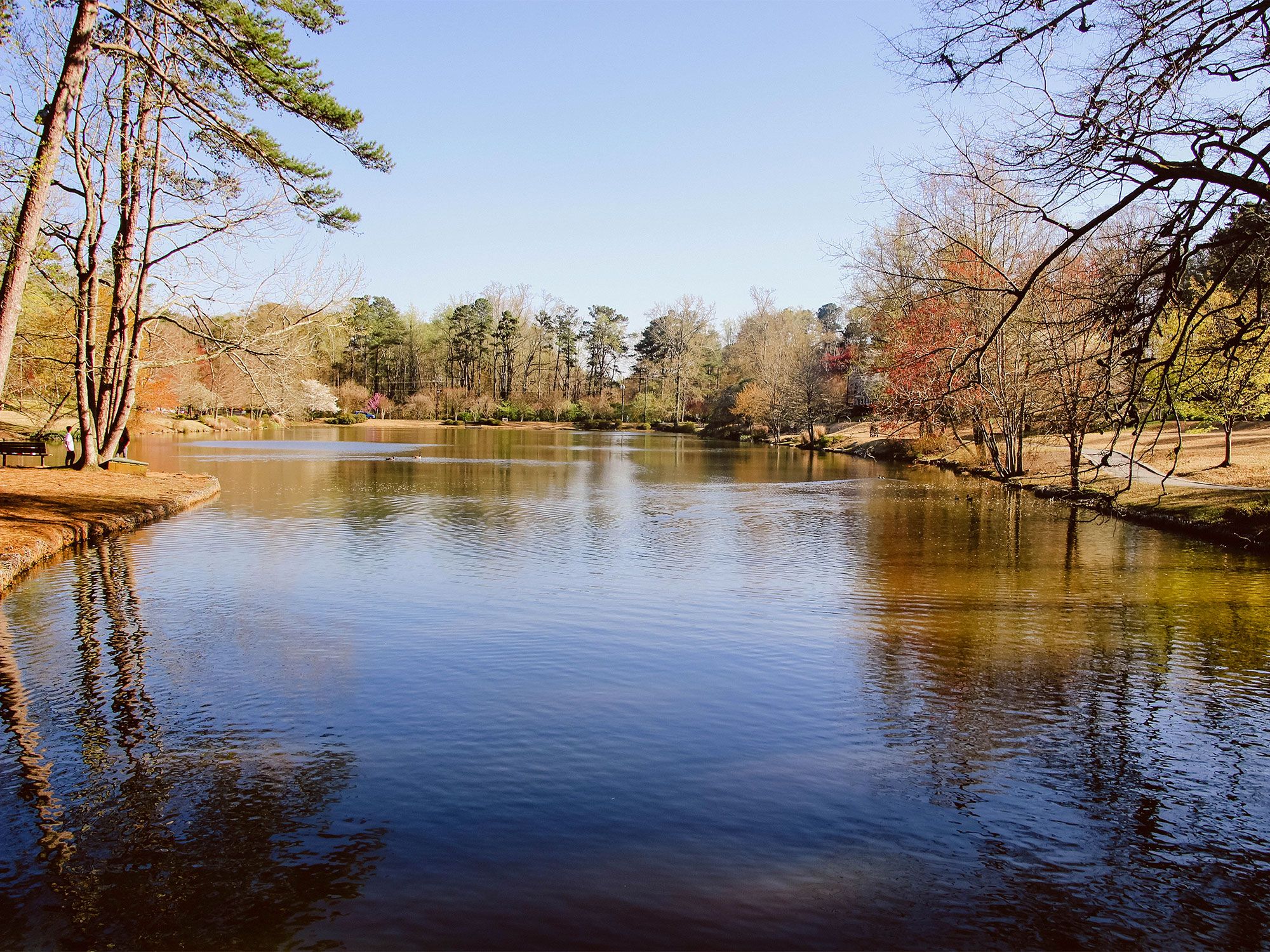
You know what they say — don’t go into business with a friend. But they don’t say anything about the guy next door. Joe Rogers Sr. and Tom Forkner, two neighbors living in Avondale Estates, Georgia, decided to open a 24-hour, diner-style restaurant that offered “good food fast” to their friends and neighbors. The two founders learned that waffles earned them the biggest profit, so they named their restaurant “Waffle House” in hopes of enticing customers to order them the most.

The first Waffle House opened in 1955, serving southern breakfast staples like waffles and hash browns. The now-iconic yellow sign swept the nation and today, there are roughly 19,000 Waffle Houses open across 25 states that employ over 40,000 people. The first establishment in Avondale Estates is now a museum that houses over 60 years of Waffle House memorabilia.

Kentucky Fried Chicken – North Corbin, Kentucky

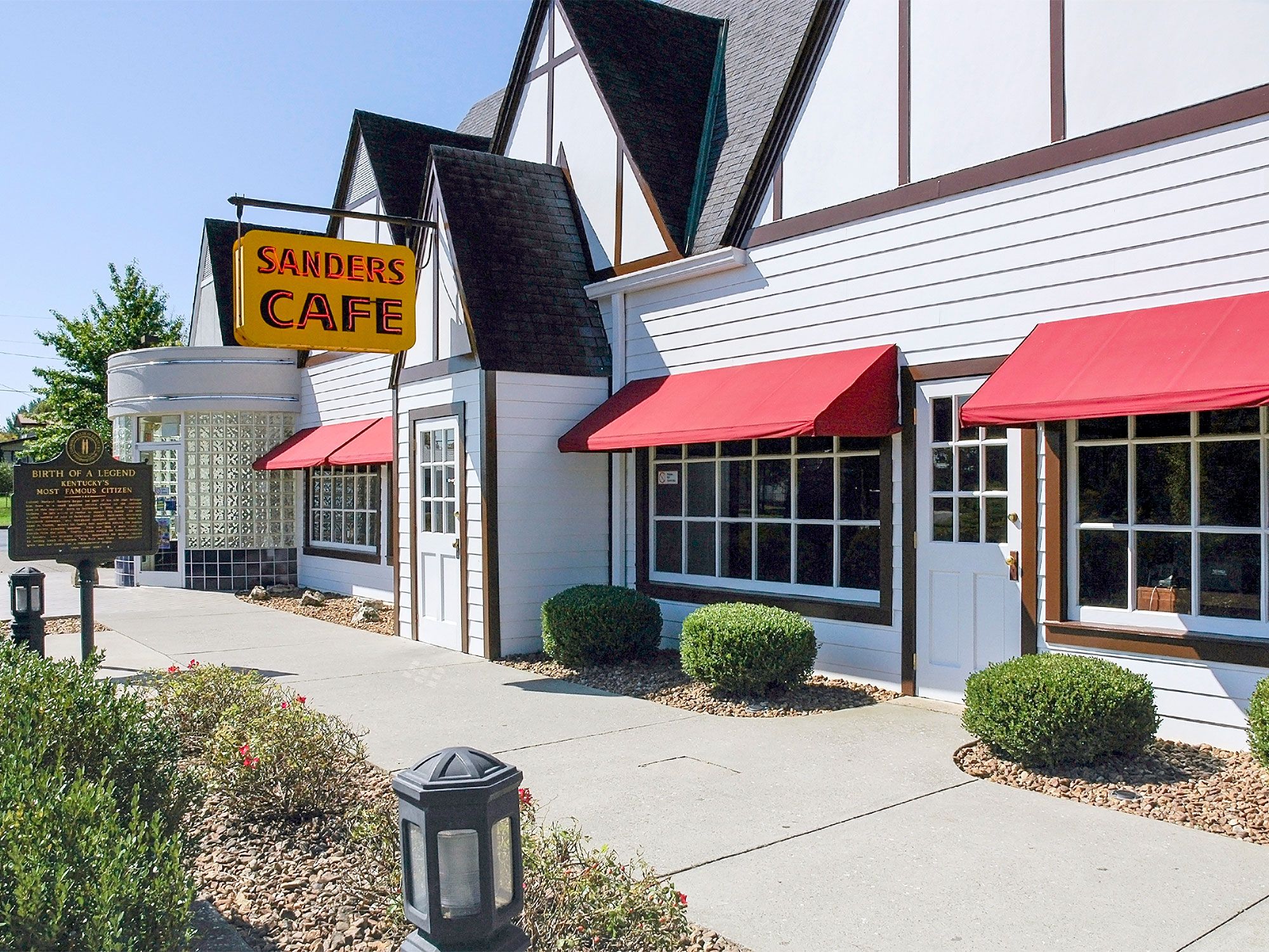
Exterior of Sanders Cafe, birthplace of Kentucky Fried Chicken, in North Corbin, Kentucky
Photo credit: Gerry Matthews/ Shutterstock

During a time when everyone else was jumping on the burger train, Colonel Harland Sanders had a different idea: fried chicken. Sanders ran the Harland Sanders Café in North Corbin, Kentucky, from 1940 to 1956, and it’s here where he perfected his fried chicken recipe. Using a secret blend of 11 herbs and spices on chicken strips pressure-cooked to perfection, Sanders Café earned a reputation for having the best fried chicken in town.

When the business started to struggle, Sanders decided to travel the U.S. in search of restaurants interested in franchising his chicken recipe. He struck gold in Salt Lake City, when he reached an agreement with Pete Harman. The first Kentucky Fried Chicken opened there with a menu of fried chicken buckets, mashed potatoes, and coleslaw in 1952.

Although the original Harland Sanders Café wasn’t technically the first KFC, it is where the idea of KFC was born. The former restaurant has since been restored as a museum and placed on the National Register of Historical Places. A modern KFC kitchen was installed, so you can get your fried chicken fix and check out the displays of early-day KFC mementos.

Post Banner Image
History

5 of the Oldest Airports in the U.S.

By Daily Passport Team
Read time: 4 minutes
May 10, 2023
Updated: June 25, 2024

5 of the Oldest Airports in the U.S.

By Daily Passport Team
Author
Daily Passport Team
Daily Passport writers have been seen in publications such as National Geographic, Food & Wine, CBC, Condé Nast Traveler, and Business Insider. They're passionate about uncovering unique destinations and sharing expert tips with curious travelers.

After the Wright brothers piloted an airplane into flight for the first time on December 17, 1903, it didn’t take long for airports to spring up around the United States to support a burgeoning aviation industry. But do you know which of the country’s airfields were the first to be built? There’s a chance you may have even landed at one recently. Below, discover five airports which have stood the test of time and are among the oldest operating airports in the U.S.

5. Chicago Midway International Airport – Chicago, Illinois

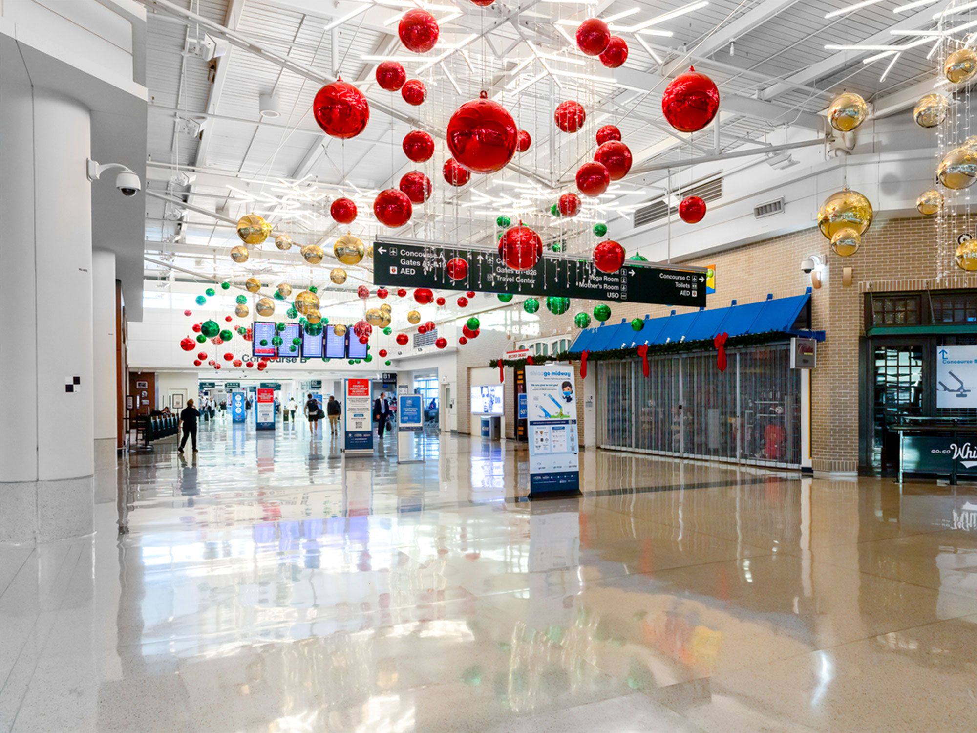
Inside the terminal at Chicago Midway International Airport
Photo credit: Joe Hendrickson/ iStock

Before it was known as Midway Airport, the Chicago Air Park opened in 1923 and, like many early airfields, was used primarily for airmail. As the aviation industry expanded, commercial flights came to the airfield, and its name was changed to the Chicago Municipal Airport in 1927. By the following year, the Chicago airport serviced 41,660 passengers on 14,498 flights.

From 1932 to 1961, Chicago Municipal Airport was the busiest airport in the world, serving a peak of 10 million passengers in 1959. During this time, the airport changed its name again to Midway in honor of the famous World War II battle in the Pacific. The arrival of the nearby O’Hare International Airport, today the fourth-busiest airport in the country, soon changed Midway’s top status. Nonetheless, as of 2023, Midway ranks among the 30 busiest airports in the U.S. and serves as a major hub for Southwest Airlines.

4. Minneapolis-St. Paul International Airport – St. Paul, Minnesota

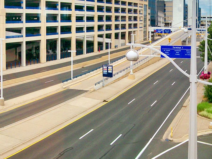
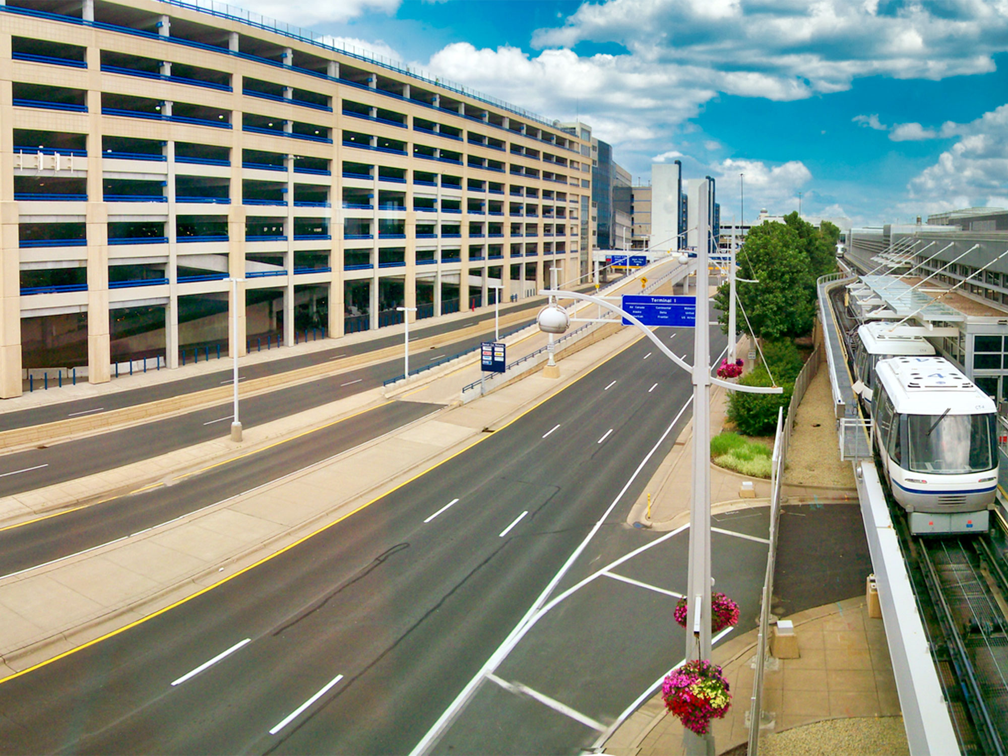
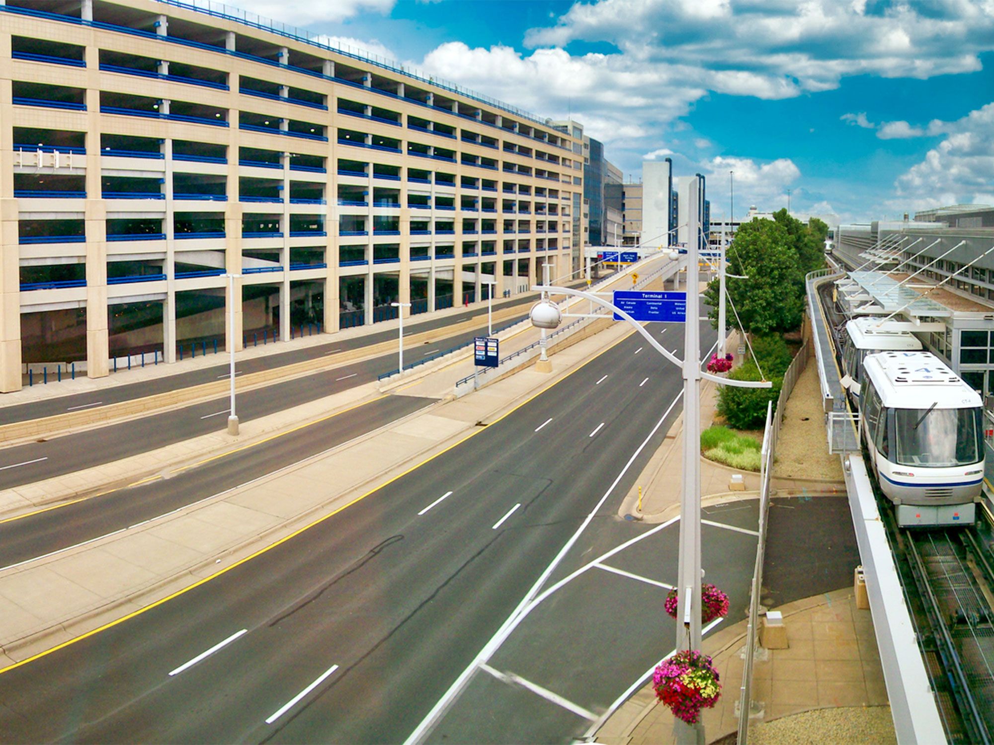
Tram, roadway, and parking garage at Minneapolis-St. Paul International Airport
Photo credit: stockphoto52/ iStock

Founded on the site of Snelling Speedway, the Minneapolis-St. Paul Airport’s first hangar was constructed in 1920. Initially used for airmail, the airport began passenger service in 1929 and has grown exponentially since then in terms of flights and passengers. The airport was first named Speedway Field; however, the airport was renamed Wold-Chamberlain Field in the aftermath of World War I. This renaming was in honor of two local pilots who died in the war: Ernest Groves Wold and Cyrus Foss Chamberlain. When the airport began offering international service in 1948, it was renamed again to Minneapolis-St. Paul International Airport.

The Twin Cities airport also served as the headquarters for Northwest Airlines from 1961 until the company merged with Delta Air Lines in 2010. Nowadays, Minneapolis-St. Paul continues to be Delta Air Lines’ second-largest hub, and it is also the base of Minnesota-based Sun Country Airlines. It is also the 16th-busiest airport in the United States in terms of passengers.

3. Stinson Municipal Airport – San Antonio, Texas

Sign for Stinson Municipal Airport in Texas
Photo credit: ZUMA Press Inc/ Alamy Stock Photo

Located in San Antonio, Texas, Stinson Municipal Airport got its start as the Stinson School of Flying in 1915. At this school, both civilian and military students learned to fly under the direction of the three Stinson siblings: Marjorie, Katherine, and Eddie. As laws surrounding aviation changed, the field was run by the city from World War I to World War II. During this time, Stinson Municipal Airport briefly offered commercial flights from American, Braniff, and Eastern Airlines. During World War II, the airport changed hands again when the Air Force took control of it in order to use the facilities as a training base.

With the subsequent construction of the San Antonio International Airport, commercial airlines never returned to Stinson Municipal Airport. However, the field is still in use as a municipal airport today. It currently sees an average of 255 flights per day and is home to 84 aircraft.

2. Pearson Field – Vancouver, Washington

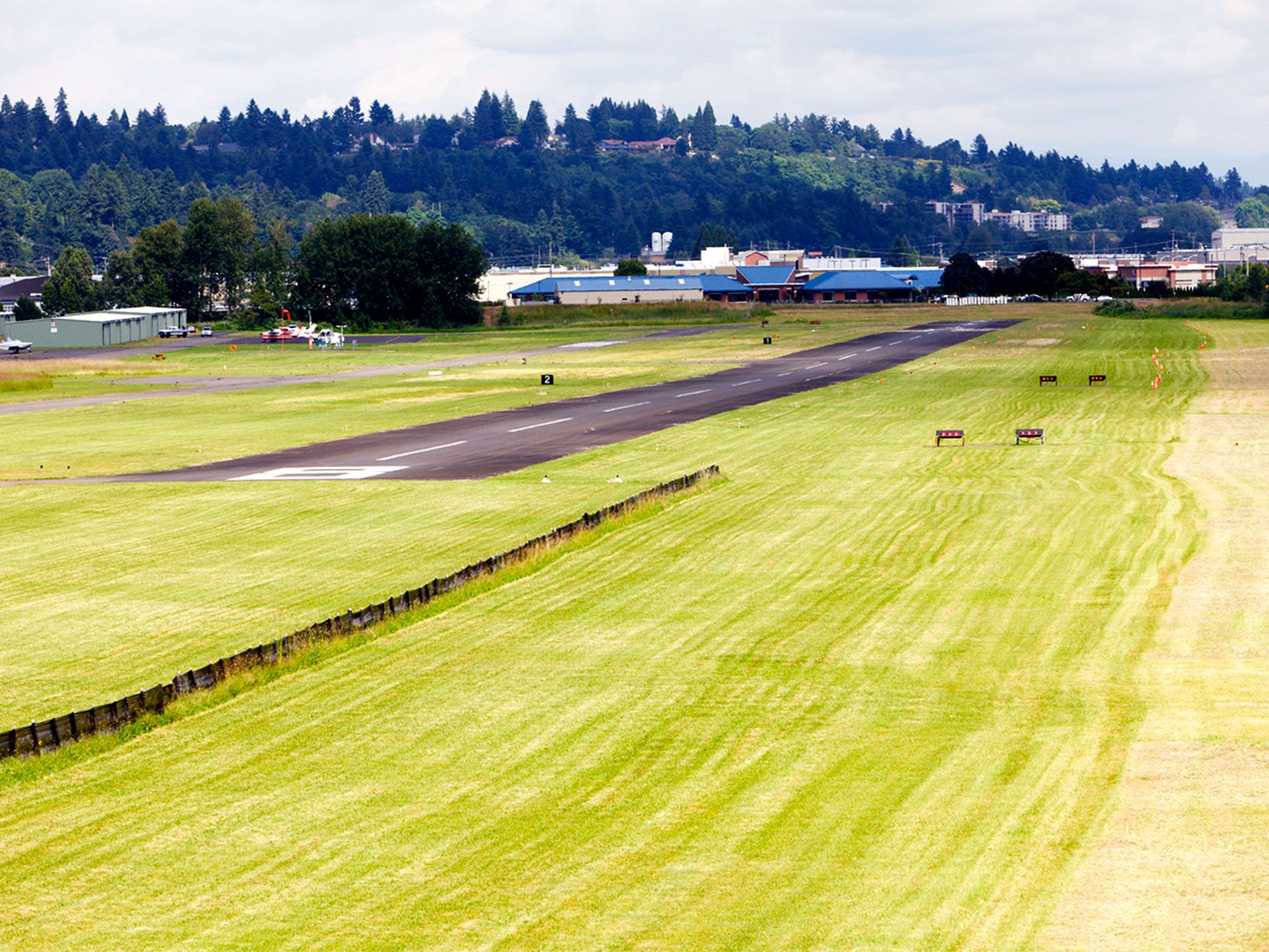
Aerial view of single runway at Pearson Field in Vancouver, Washington
Photo credit: JMWScout/ iStock

Located in Vancouver, Washington, Pearson Field saw its first airplane flight in 1911. Before even that, it was the landing site for a dirigible airship six years earlier. That date leads some historians and flight lovers to consider Pearson Field the oldest operating airfield in the country. The site was also the landing place for the first non-stop transpolar flight, achieved in 1937 by the Russian ANT-25 monoplane.

While the earliest flights at Pearson were military, an adjacent commercial field was established in 1925. The two were eventually combined into a single airpark. It was in 1925, as well, that the field received its name honoring Lieutenant Alexander Pearson. Lieutenant Pearson was an Air Force pilot who was killed the previous year during a practice flight. Today, the airport stays busy with an average of 144 operations per day. Also, it is the home base for 128 various aircraft.

1. College Park Airport – College Park, Maryland

Biplane covered in snow at College Park Airport in Maryland
Photo credit: tomwachs/ iStock

Widely accepted as the oldest continuously operated airport in the world, College Park Airport in Maryland has been in use since 1909. During that year, it was founded by Wilbur Wright to train the country’s very first military pilots. It has since continued to play an important role in the history of the nation’s aviation. This airport has seen the first female to fly as a passenger, the first controlled helicopter flight, the first night landing, and other flying firsts.

College Park, in addition to being recognized on the American Register of Historic Places, is still a fully functional airport. This is due in part to its proximity to Washington, D.C. As of 2023, it sees an average of 79 flights per week, and it is currently home to 32 aircraft, including both planes and helicopters. The grounds are also home to the College Park Aviation Museum, a Smithsonian affiliate.