Why Portugal’s Azores Islands Should Be on Your Bucket List
Why Portugal’s Azores Islands Should Be on Your Bucket List


Over 22.3 million people traveled to Portugal in 2022, many heading straight to the picturesque coastal cities of Lisbon and Porto or the historic Douro Valley wine region. But outside of these popular mainland spots lies a remote Portuguese archipelago in the North Atlantic Ocean that many overlook — the Azores. Today, adventurers visit this autonomous region to explore its remarkable natural wonders and immerse themselves in the islands’ local culture and unspoiled paradise. Below, discover everything you need to know about the region’s fascinating history, its otherworldly volcanic landscapes, and essential tips for planning the bucket-list trip to the Azores you never knew you needed.
Before You Go
In the Azores, like in much of Portugal, it’s common to come across locals who speak English, especially in tourist hubs like Ponta Delgada on São Miguel Island. But in other parts of the islands, knowing some Portuguese will definitely come in handy. That’s where Babbel can help. Their lessons can help you master Portuguese in as little as 10 minutes a day. Say “bom dia” to days of adventure in the Azores, with Babbel.
A Fascinating History
Discovered by Portuguese explorers in the 15th century, the Azores are a group of nine islands located about 900 miles west of the Portuguese mainland. While newer evidence suggests that Norse seafarers might have actually predated Portuguese settlement by about 700 years, Portuguese explorers Diogo de Silves and Gonçalo Velho Cabral first reached the uninhabited southernmost island of Santa Maria in the Azores in 1427. The archipelago remained sparsely populated until 1439, when settlers from mainland Portugal and, eventually, other European countries such as France and Spain, started arriving. Over the next 60 years, all of the islands would eventually be settled.
Settlers harnessed the islands’ fertile volcanic soil to initially cultivate wheat and sugarcane. After European farm animals were introduced to the islands, dairy also fueled economic expansion. By the early 17th century, the islands had become susceptible to European attacks, eventually falling under Spanish control. However, by 1640, the Azores were once again under Portuguese rule. By this point, Ponta Delgada had become — and still remains — the capital of the Azores.
Following the restoration of the Portuguese monarchy, the islands maintained their importance as an agricultural and economic center — boosted significantly by the export of oranges to England starting at the the end of the 18th century.
During World War II, the Azores also played a significant role as a base for Allied forces. The U.S. Navy established an air base on Santa Maria, later relocating it to its current home at Lajes Field on Terceira Island. The post-WWII period saw an increase in inter-island and European travel. Since then, the cultural tapestry of this archipelago has continued to be woven with both Portuguese traditions and distinct regional ones, all set against the backdrop of the Azores’ remarkable geology.
A Complex Landscape
Long before it was an idyllic vacation destination, the Azores existed deep within the earth. About 10 million years ago, the rugged island chain began to form over a mantle hotspot in the Atlantic Ocean. The Azores are often referred to as the “Hawaii of Europe,” due to the similarities in how they formed. However, unlike Hawaii, which is in the middle of a tectonic plate, the Azores formed along the edges of the North American, Eurasian, and African tectonic plates. These tectonic plates and their thickened crust experienced complex interactions and shifting, creating a perfect storm for the formation of the Azores.
The nine major islands and several islets that compose the archipelago add up to just over 900 square miles of land area. Each island has distinctive features that represent different stages in their geological evolution.
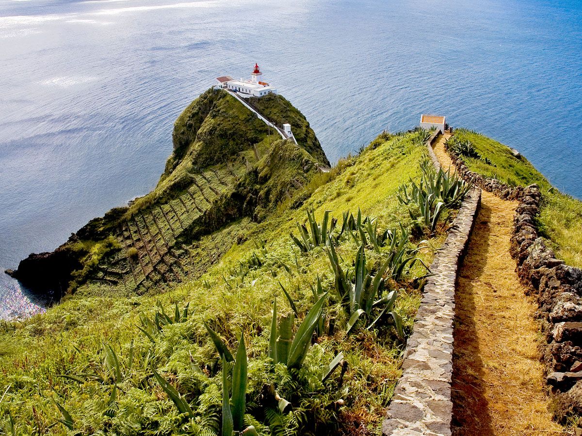
Corvo — the smallest and most remote island — was formed by a major Plinian eruption, while São Jorge’s shape is long and slender, the result of fissure eruptions over millennia. The rugged terrain of valleys and escarpments on Flores were sculpted by extensive lava flow. Faial stands out as having the most recent volcanic formations, left after the devastating 1957 eruption.
Meanwhile, Pico reigns as the highest peak in the archipelago, reaching over 7,700 feet, while Graciosa boasts the Furnas do Enxofre, the largest volcanic dome in Europe. The island of Terceira is nearly circular. São Miguel, the largest island, is the most volcanically active and is marked by numerous craters and spatter cones. Lastly, Santa Maria, the archipelago’s oldest island, is flatter than the other islands and is home to golden-sand beaches — a rarity among the region’s dark volcanic shores.
Off-the-Beaten Path Natural Wonders

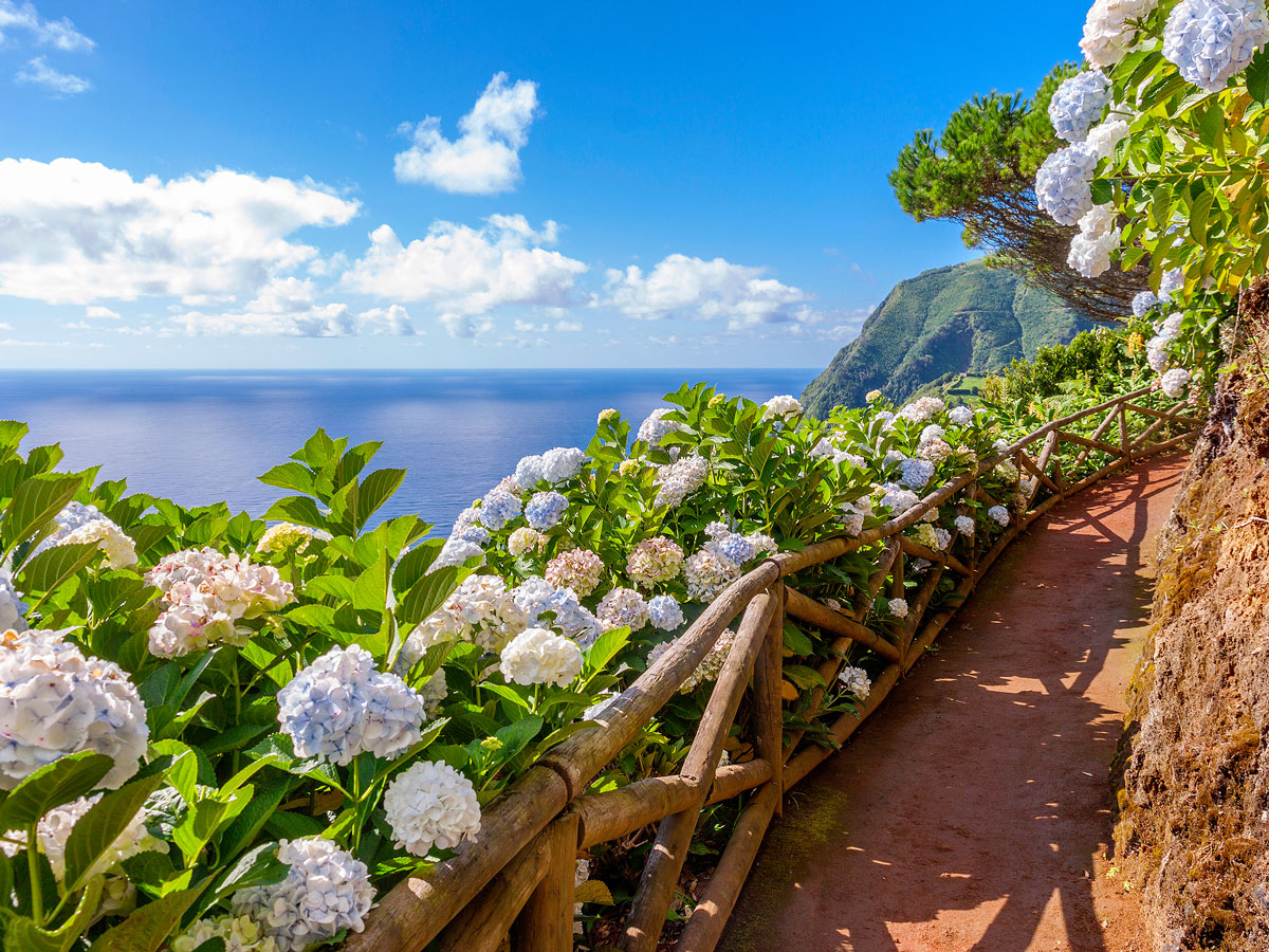
Although the Azores have seen recent record increases in tourism, the region remains relatively unspoiled by mass tourism and is committed to being a sustainable destination. From the lush landscapes of São Miguel to the volcanic beauty of Terceira, Faial, Pico, and São Jorge, the Azores are a haven for outdoor enthusiasts.
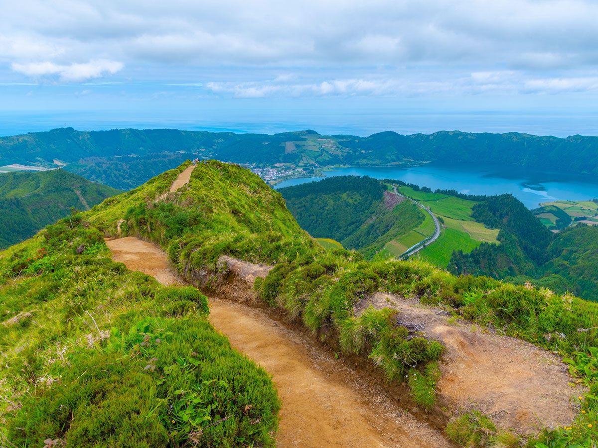
São Miguel, the largest island in the Azores, is home to the breathtaking Sete Cidades (which translates to “Seven Cities” in Portuguese). One of the archipelago’s top sights, the crater features picturesque twin blue and green lakes. The island’s Furnas region is known for its many hot springs and geysers and also has several famous black sand beaches — just be wary of the sand getting extra hot in the summer.
On Terceira, the stunning Algar do Carvão offers a rare opportunity to explore an ancient volcanic vent cave, while another dormant volcano, Monte Brasil, offers breathtaking panoramic views.
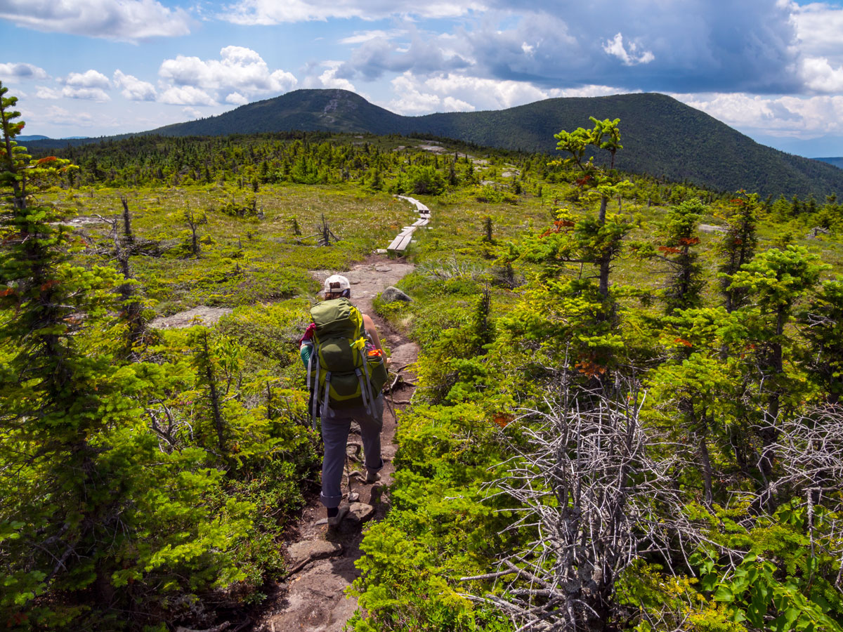
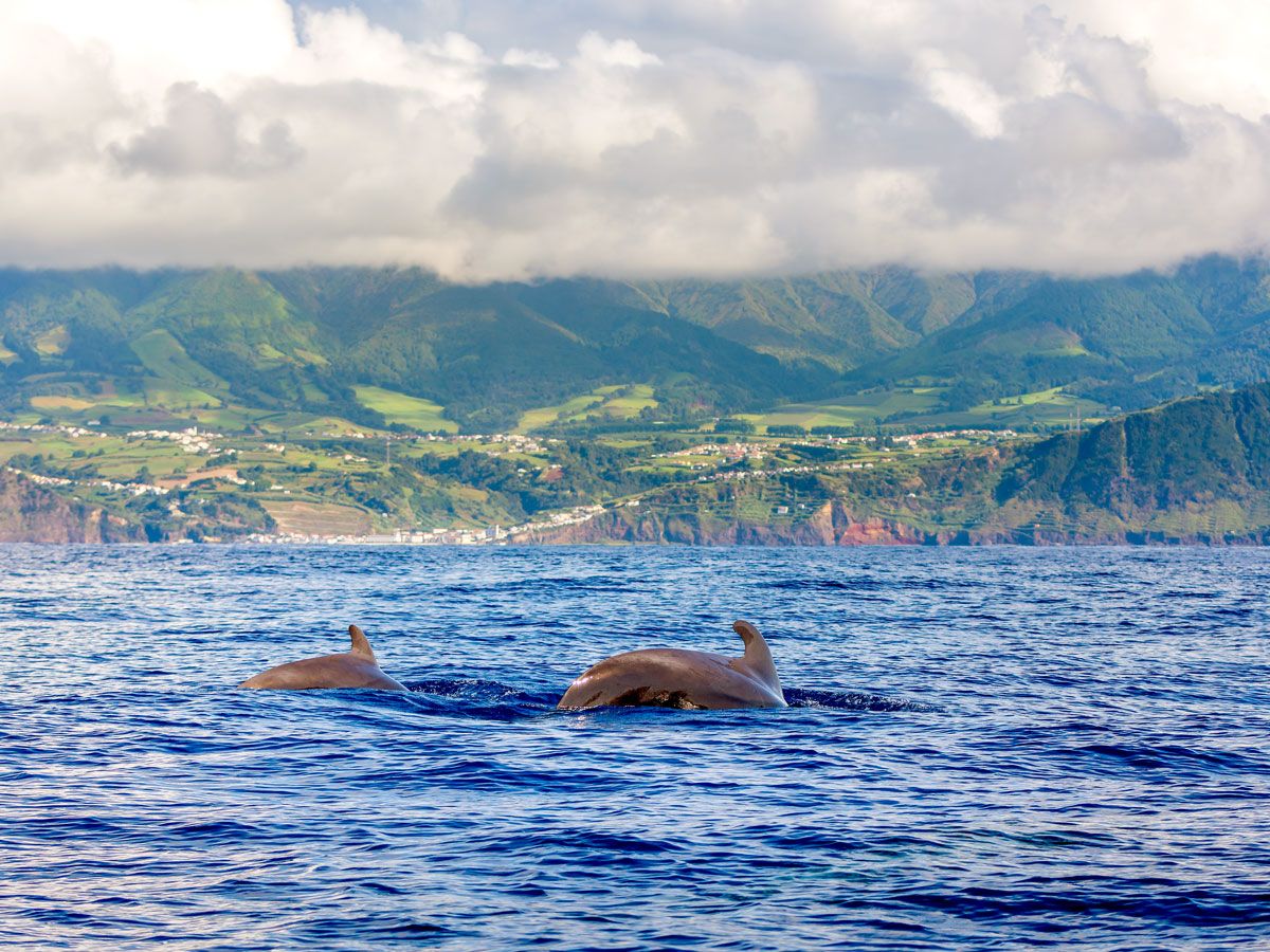
Elsewhere on the archipelago, hiking the extensive network of trails available throughout the islands is a must — the ascent of Pico’s Mount Pico is a particularly challenging but rewarding option. Try canyoning in the lush forests, embark on whale-watching tours, go horseback riding, or paraglide over volcanic craters. For the more adventurous, the Azores boast numerous diving spots and expeditions with incredibly diverse marine life.
Embracing the Local Culture
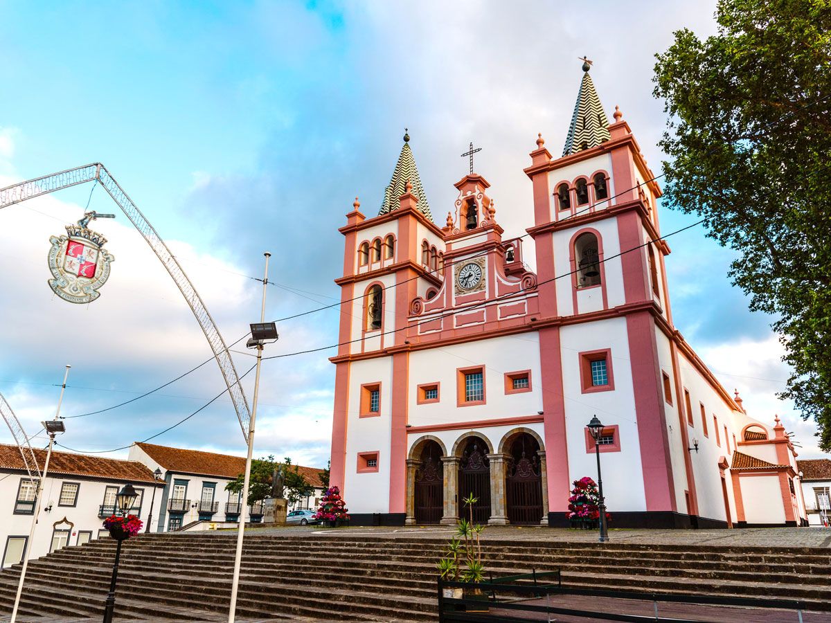
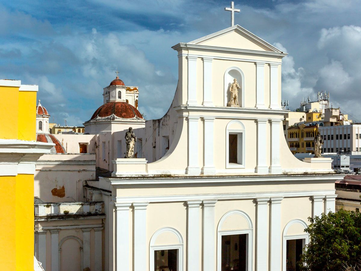
Aside from the most stunning natural beauty, the Azores are rich in culture. Among the top cultural attractions on the islands is the city of Angra do Heroísmo on Terceira island, a UNESCO World Heritage Site fielled with charming streets and well-preserved architecture — the centerpiece of which is the majestic 16th-century Cathedral of Angra.
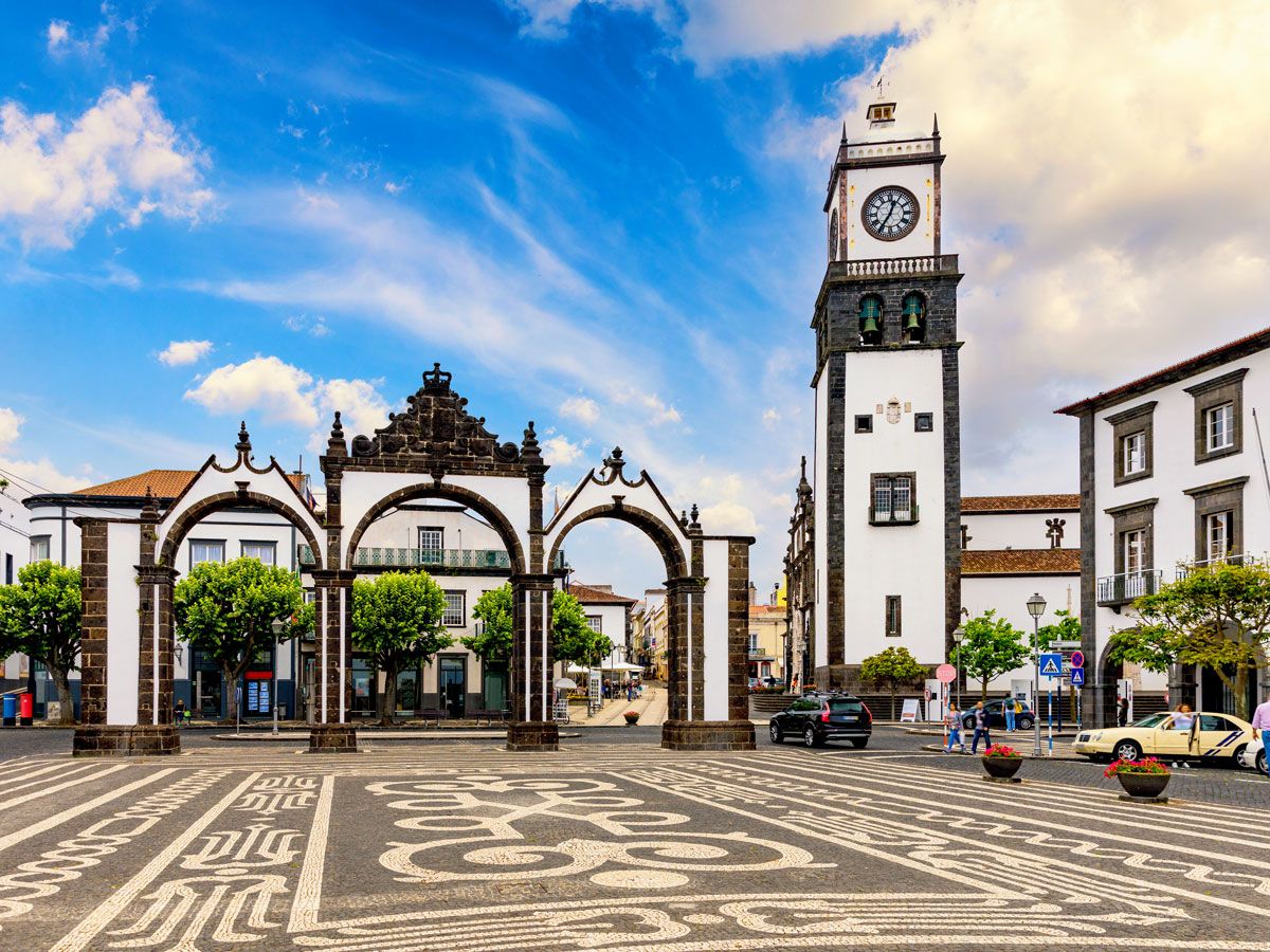
São Miguel’s capital, Ponta Delgada, is another cultural gem, with elegant churches and cathedrals, the vibrant Mercado da Graca food market, and several interesting museums. The Forte de Sao Bras details the island’s military history, while the Carlos Machado Museum houses a diverse collection of art and artifacts.
Local festivals and events also offer a deeper experience of Azorean culture. Not to be missed is the Sanjoaninas festival on Terceira. For 10 days in June, lively parades, music, and traditional performances take place through the streets. On São Miguel, the Festival of the Lord Holy Christ of Miracles takes place during the fifth week after Easter, drawing thousands of devotees and spectators to immerse themselves in the Azores’ faith-based culture.
And then there’s the traditional Azores cuisine. Don’t miss the opportunity to try dishes such as cozido das furnas (a traditional meat dish cooked slowly underground in volcanic vents), alcatra (Portuguese pot roast), and queijadas (traditional custard tarts). Pico island’s wine region has long been revered for its ingenuity, and the UNESCO-recognized vineyards are cultivated in the island’s unique volcanic soil. To experience other Azorean industries, consider chartering a fishing boat, visiting dairy farms, or checking out São Miguel’s Gorreana tea factory — the oldest operational tea farm in Europe.
What to Know When Visiting the Azores
The Azores are grouped into Western, Central, and Eastern island clusters, and it’s important to plan your travel strategically. Plus, it’s always helpful to learn a few key Portuguese phrases before you go.
Inter-island flights are the most efficient (if also the most expensive) way to hop between islands, particularly when moving from one group to another. Ferries are a great option for shorter inter-group island trips. Taxis are readily available on the islands, and if you have a car rental, make sure you check with the rental agency before bringing it from one island to another. (And note that many of the roads in Azores are narrow and winding.) It’s also important to reserve your ferry trip in advance, as not all ferry lines or times allow vehicles.
Fortunately, the Azores’ location in the Atlantic means the climate is relatively mild year-round. However, the islands’ cool, damp mist and frequent winds can make it feel much colder, and the weather can be unpredictable — even with sunny skies, it’s a good idea to carry a light rain jacket and maybe even an umbrella, considering things can change quickly, according to locals. Hiking attire, such as shorts and sturdy shoes, is also recommended for often muddy trails.
All told, the Azores promise an off-the-beaten adventure in a pristine natural paradise. By carefully planning your itinerary and immersing yourself in the local culture and landscapes, you’ll make the most of your visit to the one-of-a-kind archipelago.
Note: All featured products and deals are selected independently and objectively by the author. Daily Passport may receive a share of sales via affiliate links in content.
More from our network
Daily Passport is part of Inbox Studio, an email-first media company. *Indicates a third-party property.