Bennett is a New York City-based staff writer for Daily Passport. He previously contributed to television programs such as the Late Show With David Letterman, as well as digital publications like the Onion. Bennett has traveled to 48 U.S. states and all 30 Major League Baseball stadiums.
Prior to taking off or landing at an airport, you may notice a large number painted on the runway. While it may not mean much to the average traveler, ask any pilot or air traffic controller and they’ll tell you exactly what the numbers represent, as these indicators are essential to an aircraft’s flight plan. If we’ve piqued your curiosity, read on to decode what the big numbers painted on airport runways actually mean.
The Basics of Airport Runway Numbering
Credit: Gu/ Image Source via Getty Images
To understand the runway numbering system, it’s important to visualize how a compass works. The bearings of a compass rotate 360 degrees, in which 90 degrees indicates east, 180 degrees is south, 270 degrees is west, and 360 degrees is true north. Airport runways follow this convention based on the direction of an airplane’s takeoff or landing. Runways are numbered between 01 and 36 and are rounded to the nearest 10 degrees, with the final zero dropped from the end (e.g., 270 degrees becomes runway 27). This is based on the compass direction the plane is headed toward. For example, a plane taking off on a runway pointed directly to the north will be departing from runway 36.
You may see different numbers painted at opposite ends of the same runway. These numbers always have a difference of 18 — for example, 9 and 27 or 18 and 36. This gap represents directional opposites. Because the direction of aircraft takeoffs and landings changes based on the wind, the same physical runway will be assigned two different numbers on either end.
What Do Lettered Runways Indicate?
Credit: aapsky/ iStock via Getty Images Plus
While some airports may only have a single runway, larger airports usually have multiple runways. These airports will often have parallel runways facing the same direction, based on typically prevailing wind directions, to accommodate higher traffic. In these instances, the runways have letters in addition to numbers. For example, if there are two parallel runways facing west, those will be called 27L and 27R (for left and right). Some busier airports might have three parallel runways, meaning you’d add a 27C with the “C” standing for “center.”
Dallas-Fort Worth International Airport — one of the world’s busiest airports — is unique in that there are five parallel runways all headed the same direction at 175.4 degrees. In this case, airport officials chose to shift the two westernmost runways one number up, resulting in runways 17L, 17C, 17R, 18L, and 18R. Other airports have runways pointed in several different sets of directions. Chicago’s O’Hare International Airport has eight runways — more than any other commercial airport. These include two sets of three runways that run parallel.
How To Speak Runways Like a Pilot
Credit: ASMR/ iStock via Getty Images Plus
During in-flight communications with air traffic controllers, each runway number is pronounced individually. So, if a plane is landing on runway 27L, it will be conveyed as “two-seven-left.” This level of enunciation is necessary to prevent planes from mistakenly using the same runway at the same time. If you’re a passenger who’s privy to the lingo, then it also tells you which direction you’re flying — in this case, due west.
Featured image credit: Credit: gorodenkoff/ iStock via Getty Images Plus
Advertisement
More from our network
Daily Passport is part of Inbox Studio, an email-first media company. *Indicates a third-party property.
Jersey is a travel and lifestyle writer whose work has appeared in publications such as Condé Nast Traveler, Business Insider, and Bust. When she’s not exploring her adopted home state of Maine, she’s likely planning her next big trip.
How do you measure the peacefulness of a city? Is it a lack of traffic? An abundance of parks? An overall sense of safety? A recent study from the finance website Insider Monkey looked at a city’s tranquility based on two important factors above all else: low noise levels (those pesky city sounds contribute to stress, after all) and easy access to the outdoors (since being in nature is shown to reduce mental fatigue). Read on to see which cities promise peace of mind on your next visit with 10 of the most peaceful cities in the U.S.
Portland, Maine
Credit: KenWiedemann/ iStock via Getty Images Plus
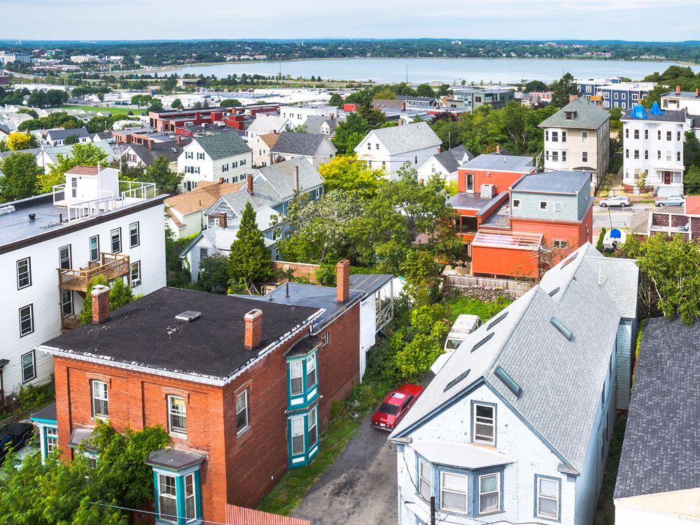
Portland is not only one of New England’s most charming coastal cities but also one of the most peaceful cities in the country. Its picturesque location on Casco Bay — a quick two-hour drive from Boston — contributes to Portland’s tranquility, as do its numerous walking trails, bike paths, and beaches. Since Maine is home to a bevy of organic farms, farmers markets abound in the summertime, and fresh produce is available from local farms throughout the year. When the city’s population swells with visitors during the summer, the Casco Bay Island Ferry helps locals get out onto the water and away from Portland’s bustling waterfront.
Fort Collins, Colorado
Credit: Mona Makela Photography/ Moment via Getty Images
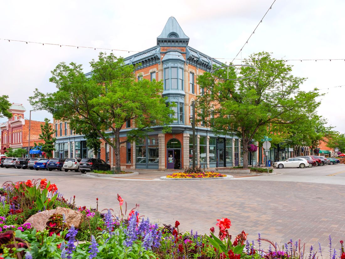
Famous for its bike-friendly culture and local craft brews, Fort Collins is located 60 miles north of Denver. With 200 miles of dedicated bike lanes and 50 miles of marked bike routes, many of the city’s 170,000 residents choose to travel on two wheels, which may contribute to the low noise levels in Fort Collins. In terms of outdoor access, nearby nature can be found in the Horsetooth Reservoir — a popular spot for camping, fishing, and swimming — and the Poudre River Trail, a 21-mile trail that meanders through diverse landscapes and into the foothills of the Rocky Mountains.
Situated on the shores of Lake Michigan, Green Bay typically offers an abundance of peace and quiet to its residents — with the notable exception of Green Bay Packers home games. This northern Wisconsin city boasts outdoor activities during all four seasons. There’s cross-country skiing, ice skating, and snowmobiling in the winter; come summer, residents and visitors can enjoy nearby places for hiking, swimming, and biking. The Bay Beach Wildlife Sanctuary provides 700 acres of pristine trails and bird-watching opportunities, while the 25-mile Fox River Trail is a favorite among local cyclists and runners.
Grand Rapids, Michigan
Credit: DenisTangneyJr/ iStock via Getty Images Plus
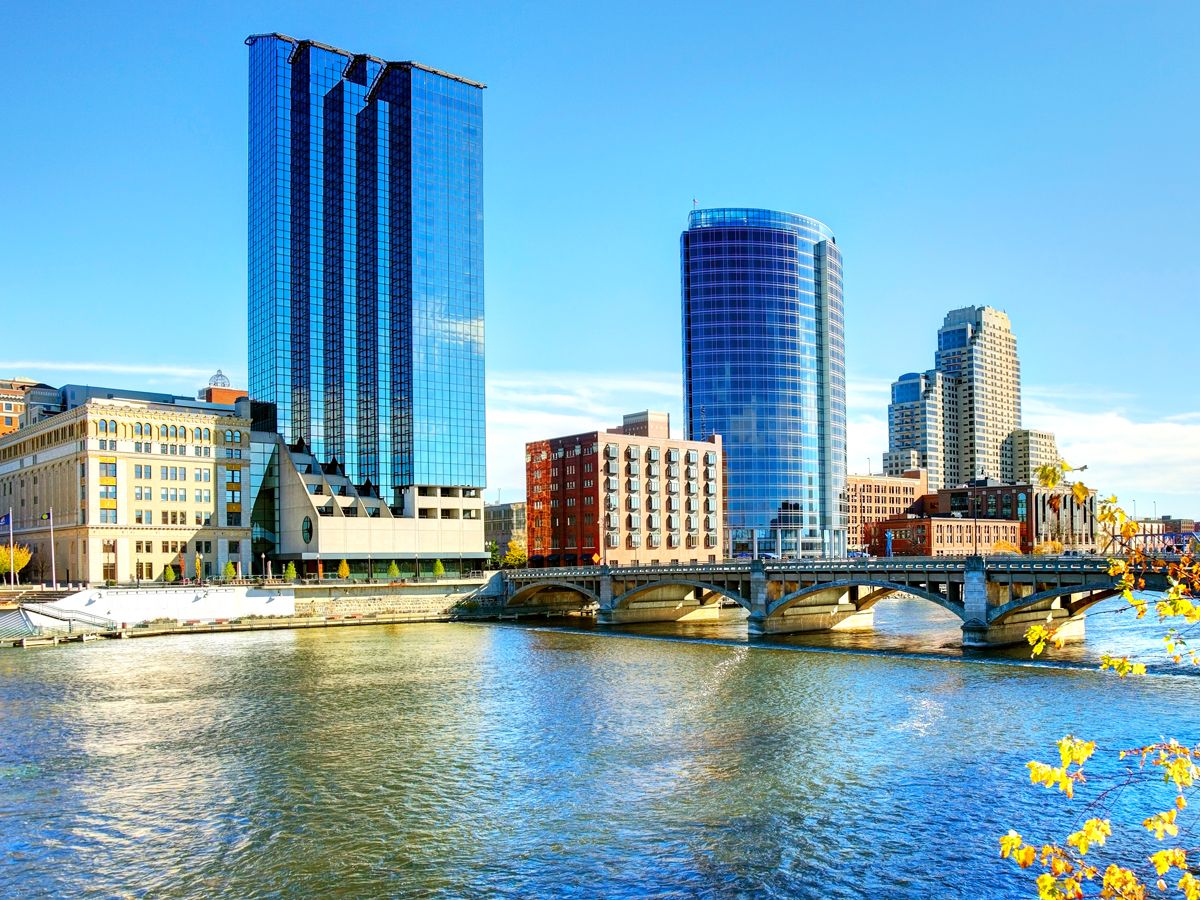
Surrounded by acres of farmland and leafy suburbs, Grand Rapids is a low-key city with a strong emphasis on nature and the arts. It’s home to the annual ArtPrize, an international art competition, and public works of art are stationed throughout town for locals and visitors alike to enjoy throughout the event. As for public green spaces, Fred Meijer Millennium Park has an extensive network of walking and biking trails, while the White Pine Trail runs from Grand Rapids to Cadillac, stretching 92 miles in total.
Ann Arbor, Michigan
Credit: espiegle/ iStock via Getty Images Plus
Home to the prestigious University of Michigan, Ann Arbor is a tranquil college town with a high quality of life, low noise levels, and plenty of green space — all factors that make it one of America’s most peaceful cities. At the Matthaei Botanical Gardens and Nichols Arboretum, visitors will find a network of riverside trails that meander through natural woodlands and landscaped gardens. There’s also the Bird Hills Nature Area, which offers the largest natural terrain in the city, and the Huron River, home to several launch points for relaxed tubers who want to spend a day on the water.
Boulder, Colorado
Credit: DenisTangneyJr/ iStock via Getty Images
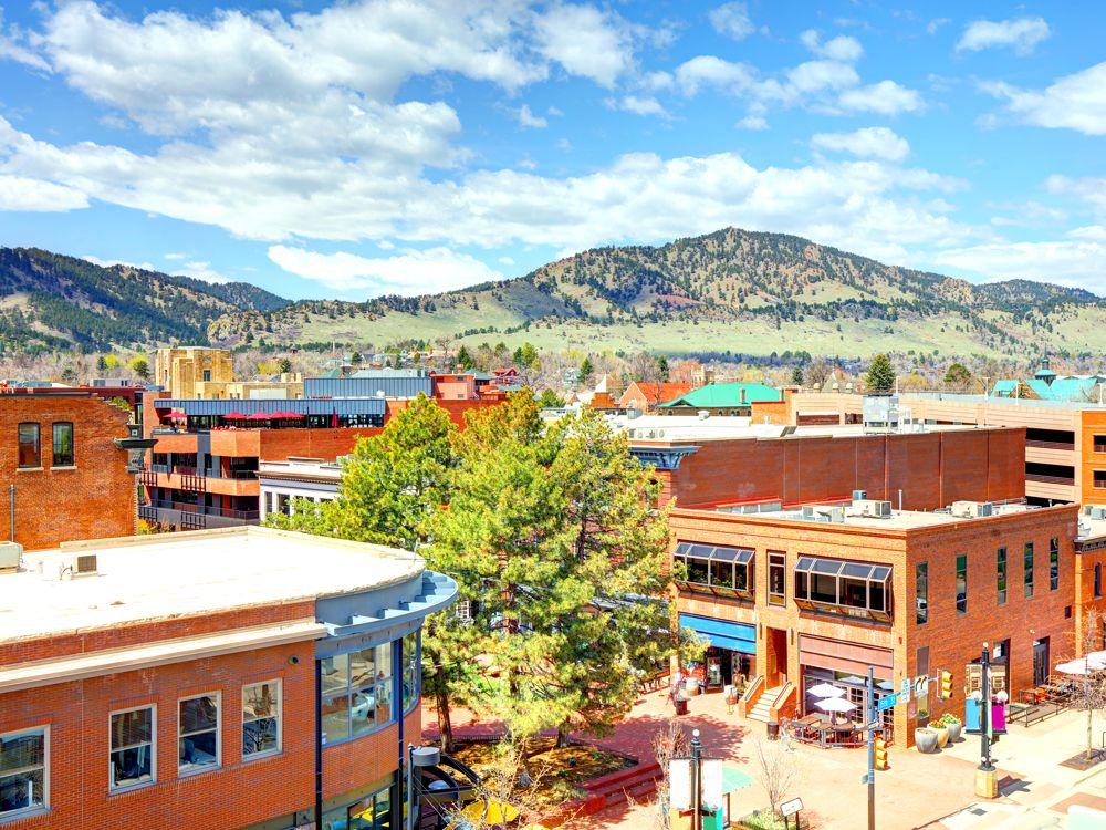
Colorado’s famous outdoor lifestyle is highly accessible in Boulder, an active community situated in the foothills of the Rocky Mountains. Regardless of the season or the weather, residents of this laid-back city are likely to find reasons to be outside. From downhill skiing at the nearby Eldora Mountain Resort to the challenging climb up Mount Sanitas, Boulder’s outdoorsy lifestyle draws many of its residents and visitors. With plentiful hiking trails and recreation areas, the city’s focus on well-being and balance also contributes to its relaxed vibe.
Rochester, New York
Credit: Luis Avila/ iStock via Getty Images
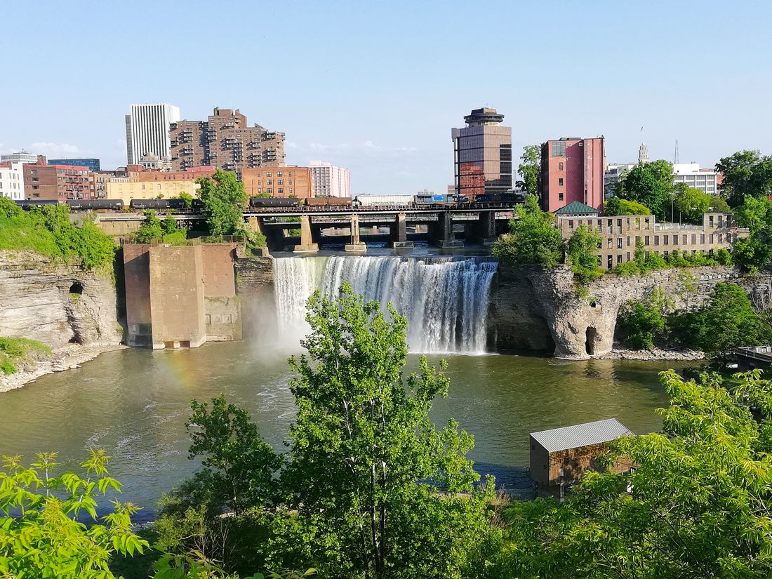
Despite being the third-largest metropolis in New York state, Rochester ranks as one of the most peaceful cities in the U.S., largely thanks to its abundance of open spaces. Of its many parks, Highland Park is especially popular with residents. The 150-acre space is located approximately 2 miles south of Rochester’s downtown, with leafy trees, large lawns, the Lamberton Conservatory, and the Sunken Garden situated inside a castle. Held annually in the spring, the annual Lilac Festival celebrates both the olfactory and visual beauty of the park’s many lilac bushes, which number over 1,200 in total.
Lancaster, Pennsylvania
Credit: dhughes9/ iStock via Getty Images Plus
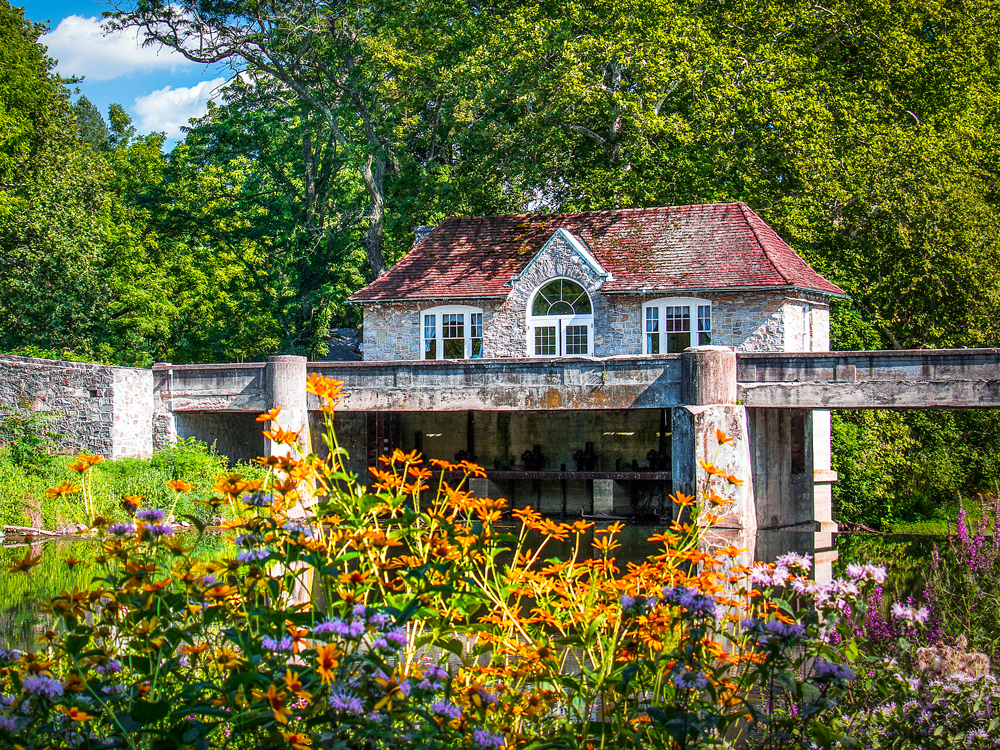
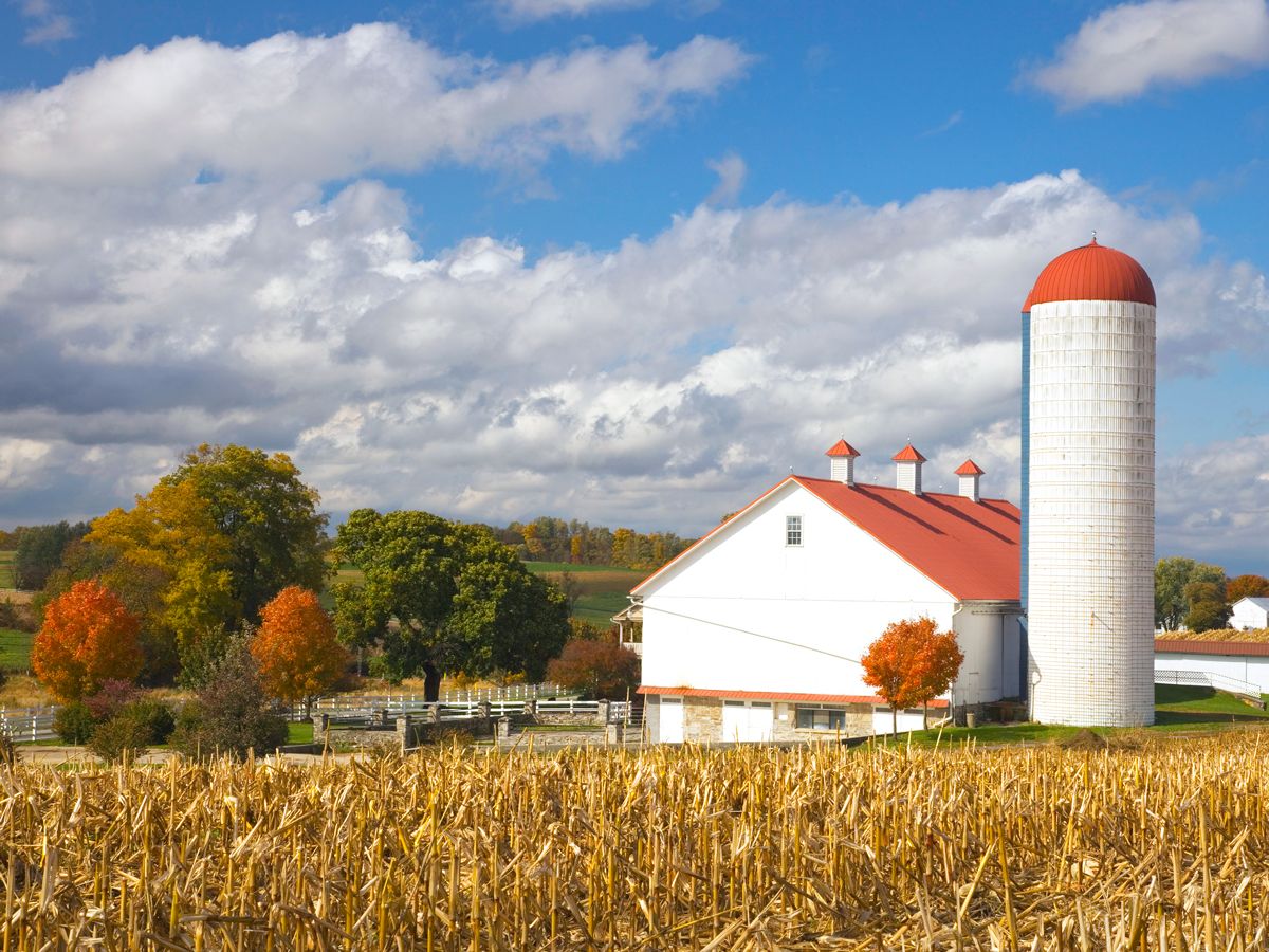
Lancaster is home to the largest Amish settlement in the world. Since Amish culture calls for an avoidance of modern technology, locals tend to prefer horses and buggies over cars, and candles over power lines. It’s no surprise, then, that the community’s noise levels stay relatively low. Lancaster also offers easy access to peaceful outdoor activities, including hiking trails and waterfalls along Tucquan Creek and bird-watching at Middle Creek Wildlife Management Area.
Madison, Wisconsin
Credit: UWMadison/ iStock via Getty Images Plus
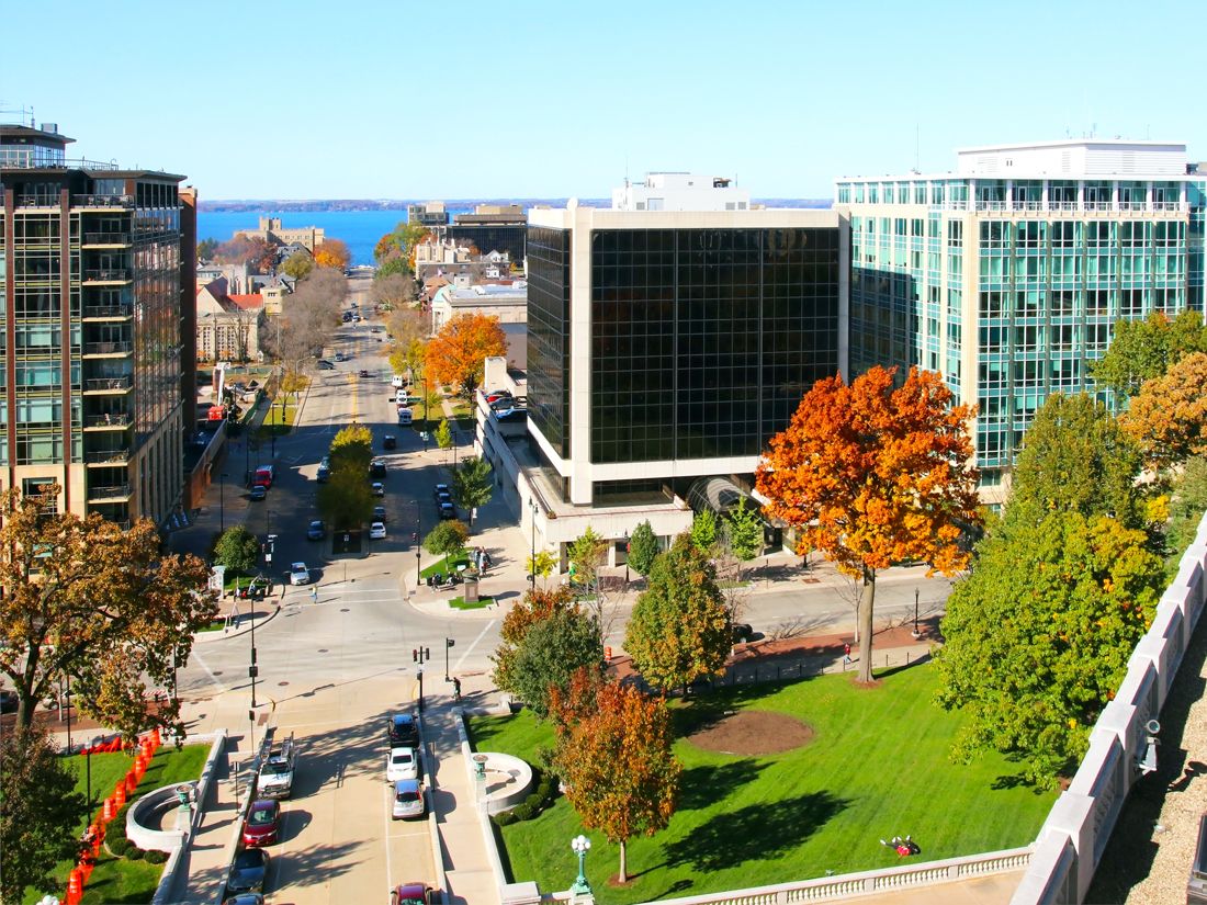
Ranked as one of the best cities for quality of life in the U.S., Madison is a vibrant city of approximately 290,000 people. Madison’s location on Lake Mendota contributes to its residents’ contentment and the city’s peaceful vibe. Thanks to easy access to the outdoors, the average local boasts an active outdoor lifestyle throughout all four seasons, with opportunities to paddle, ski, and hike throughout the year. The city’s extensive bike trail system, including the Lake Monona Loop, helps locals and visitors alike make use of Madison’s ample outdoor space.
Despite its proximity to two major metropolitan areas, Philadelphia and Lehigh Valley, Reading continues to remain a peaceful enclave in southern Pennsylvania’s Schuylkill Valley. The city scored highest in terms of access to outdoor spaces — which include Hawk Mountain Sanctuary, home to numerous hiking trails and bird-watching opportunities, along with the nearby Appalachian Mountains. The Schuylkill River is also a popular recreational area for paddlers, anglers, and boaters, or anyone who seeks quiet respite from their busy lives in Reading.
Advertisement
More from our network
Daily Passport is part of Inbox Studio, an email-first media company. *Indicates a third-party property.
7 of the World’s Most Beautiful Pedestrian Bridges
By
Daily Passport Team
Read time: 5 minutes
July 3, 2024
Updated: July 3, 2024
7 of the World’s Most Beautiful Pedestrian Bridges
Architecture •July 3, 2024•Updated: July 3, 2024
By Daily Passport Team
Author
Daily Passport Team
Daily Passport writers have been seen in publications such as National Geographic, Food & Wine, CBC, Condé Nast Traveler, and Business Insider. They're passionate about uncovering unique destinations and sharing expert tips with curious travelers.
Bridges aren’t just for cars or trains — they’re often shared with or even purpose-built for pedestrians. Many offer a unique vantage point of cities and countrysides and featuring striking architectural design, which makes these types of bridges fantastic tourist attractions. From a Vietnamese bridge held up giant stone hands to a Renaissance Revival stunner over the Danube River, these are seven of the most beautiful bridges pedestrians can cross.
Golden Bridge – Vietnam
Credit: LINH PHAM/ AFP via Getty Images
One might say you’ll be in good hands as you walk across this pedestrian bridge suspended high above the mystical landscapes of Vietnam. Cau Vang (which translates to “Golden Bridge”) winds for 500 feet across the verdant mountain scenery of the popular Ba Na Hills amusement park and resort, but its practical purpose — to connect a cable-car station with the resort’s picturesque gardens — isn’t what draws millions of eager tourists each year.
That would be the pair of giant weathered stone hands that hold the bridge in place, stretching upward toward the sky as if they were plucked out of a centuries-old fairy tale. Opened in 2018, the awe-inspiring bridge was designed, according to its architects, to mimic the “giant hands of Gods, pulling a strip of gold out of the land.” As part of a multibillion-dollar investment to bring more visitors to the amusement park, it appears to have done the trick — the attraction, seemingly tailor-made for the Instagram age, went viral almost as soon as it opened.
Rialto Bridge – Venice, Italy
Credit: adisa/ iStock via Getty Images Plus
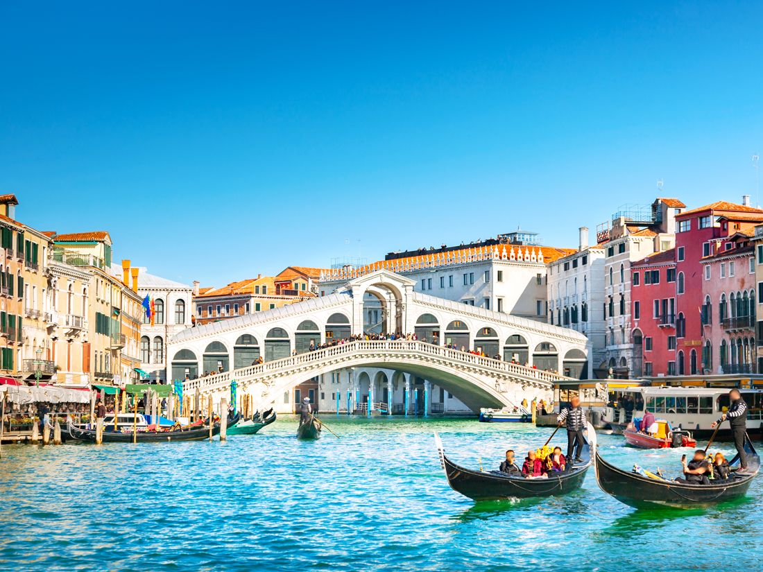
In a city awash with amore, the Rialto Bridge manages to maintain supremacy as one of the most romantic spots in the city. The oldest of the four bridges spanning the Grand Canal, the Rialto had several earlier versions connecting the districts of San Marco and San Polo, which were destroyed before the current stone structure was approved. Michelangelo was one of the architects whose proposed design didn’t make the cut, but Antonio da Ponte was up to the task, and completed his version of the bridge in 1591. Today the elegant arched bridge is one of Venice‘s most popular tourist attractions.
Mostar Bridge – Bosnia and Herzegovina
Credit: Xantana/ iStock via Getty Images Plus
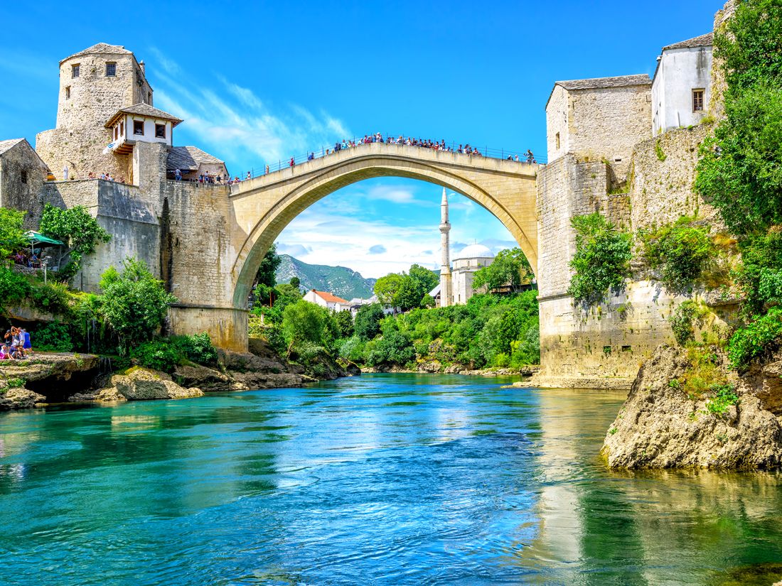
This iconic span is a reproduction of one that had stood here for more than four centuries before being destroyed in 1993 in the Croat-Bosniak War. Indeed, the Mostar Bridge is so central to the town’s identity that the name Mostar itself derives from the Serbo-Croatian words for “old bridge” (stari most).
The previous span — which linked 15th-century Ottoman settlements on either side of the river Neretva — was commissioned under threat of death. According to lore, should that effort, like previous ones, have ended in quick collapse, Sultan Suleiman the Magnificent planned to execute the offending engineer, who was reportedly found making burial preparations as the bridge debuted in 1566. That pessimism proved premature, however. The structure not only stood for 429 years, but the replica that replaced it (which opened in 2004) has also become an enduring symbol of the beauty and brilliance of Ottoman architecture.
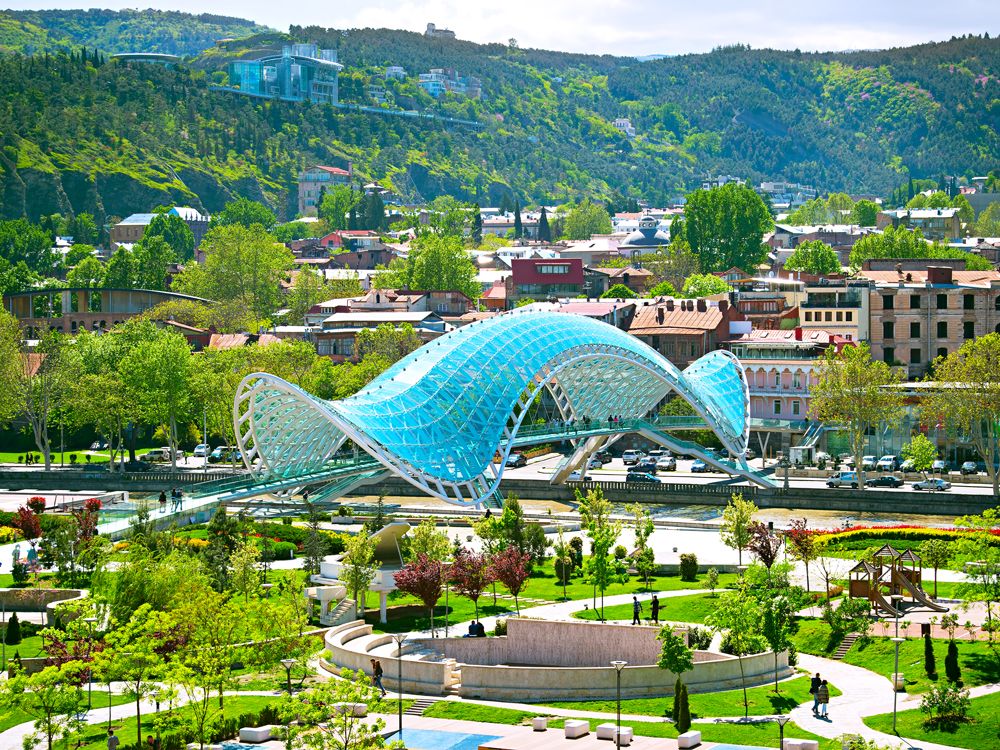
The Bridge of Peace could’ve been just another footbridge connecting Tbilisi’s Old City to Rike Park to the east. But instead, the city chose to erect a contemporary monument that glows with some 30,000 individual LED lights and gorgeously contrasts with Tbilisi’s traditional architecture. Italian architect Michele De Lucchi — who had already created a pair of well-loved buildings for the Georgian government — designed the 400-foot expanse in 2010 as a celebration of peace and progress in the wake of Georgia’s turbulent past. The bridge’s modern, amorphous aesthetic drew some criticism upon opening, but the views — incredible sunsets along with many of the city’s most iconic sights — soon put that to rest.
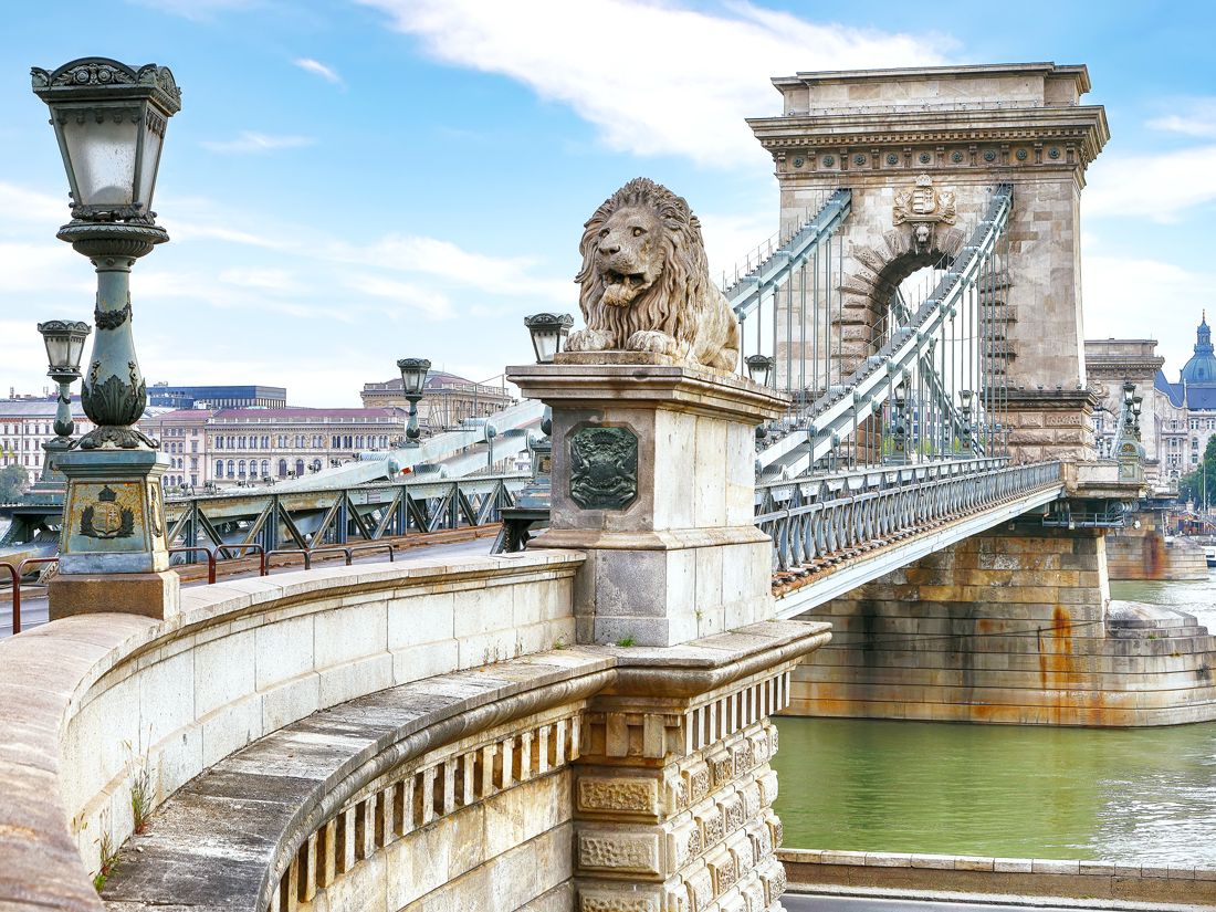
“Grand” doesn’t begin to describe this lion-guarded stone bridge straddling the Danube River. The Széchenyi Chain Bridge connects Clark Ádám Square in Buda and Széchenyi Square on the Pest side of Hungary’s historic capital. The two sites were previously only connected by a precarious pontoon bridge, but Count István Széchenyi dreamed of a grander, more permanent structure in the early 19th century. Although the count’s vision took 50 years to come to fruition (and was mostly destroyed by the Nazis in 1945), the reconstructed 1,230-foot Renaissance Revival bridge is once again the jewel of the city.
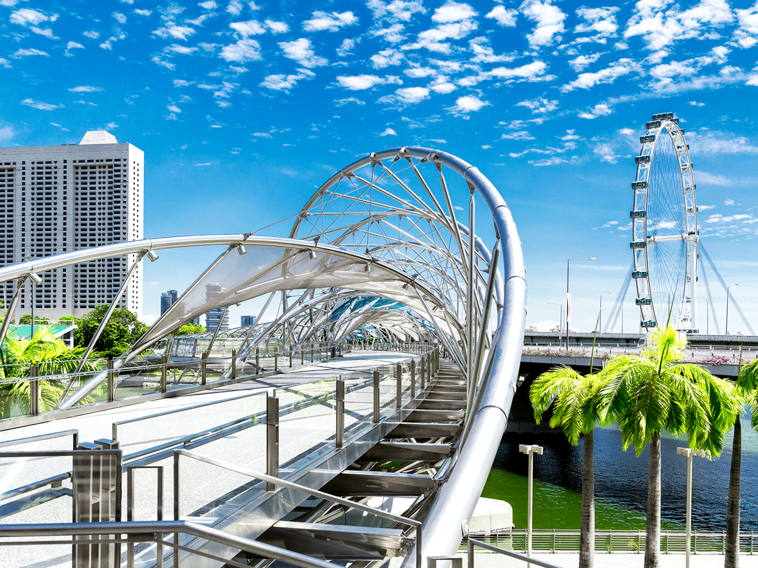
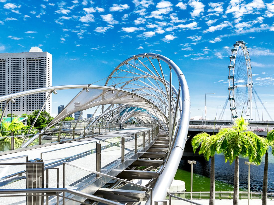
Singapore certainly doesn’t do small-scale, and the cutting-edge Helix is no exception. This futuristic footbridge in the island nation’s sleek Marina Bay area allows pedestrians to stroll across the Singapore River from the city center to the “new downtown” on the waterfront. Completed in 2010, the 919-foot bridge is inspired by the appearance of human DNA; the tubular truss is encircled by a stainless steel double helix structure. Viewing pods along the bridge offer stunning vignettes of the city’s modern skyline.
Brooklyn Bridge – New York City
Credit: haveseen/ iStock via Getty Images Plus
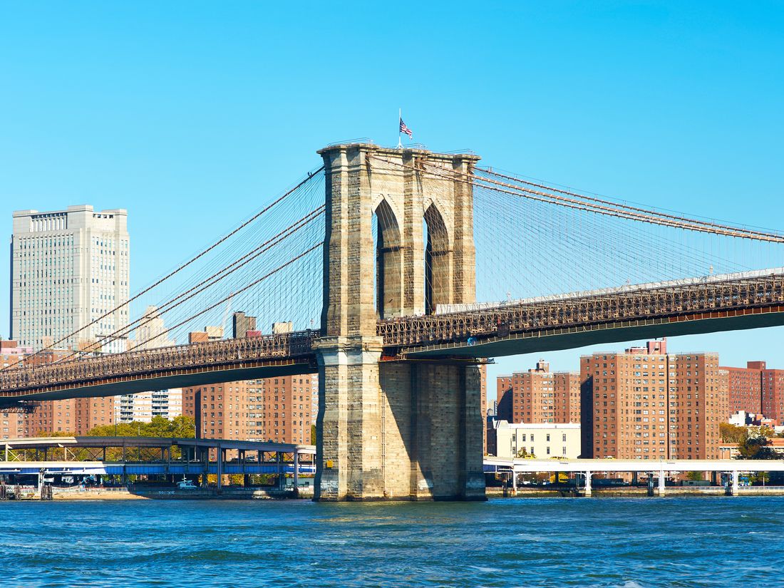
The first steel-wire suspension bridge in the world, the Brooklyn Bridge accommodates both six lanes of vehicles (no trucks) on its lower span, as well as a protected pedestrian walkway above. It was also the first fixed crossing point over New York City’s East River, connecting the boroughs of Manhattan and Brooklyn. Known for its graceful masonry arches, the Brooklyn Bridge took 14 years to complete (from 1869 to 1883) and is more than a mile in length, with a main span of almost 1,600 feet. Plagued by construction problems (including decompression sickness for workers toiling underwater), the hybrid cable-stayed/suspension bridge was a marvel of 19th-century engineering and retains its status as an iconic symbol of New York City.
Advertisement
More from our network
Daily Passport is part of Inbox Studio, an email-first media company. *Indicates a third-party property.
10 U.S. Cities That Are Becoming Way More Expensive To Visit
By
Rachel Gresh
Read time: 6 minutes
July 3, 2024
Updated: July 18, 2024
10 U.S. Cities That Are Becoming Way More Expensive To Visit
Tips •July 3, 2024•Updated: July 18, 2024
By Rachel Gresh
Author
Rachel Gresh
Rachel is a Washington, D.C.–based travel and lifestyle writer with roots in the Great Lakes region. When she’s not writing for publications such as The Discoverer and Interesting Facts, you’ll find her wandering through museums or exploring destinations off the beaten path.
Have you noticed significant price increases at some of your favorite destinations around the United States? If so, you’re not alone. Every year, the financial experts at Business Travel News analyze the average tourism costs for 100 popular U.S. cities, using hotel, car rental, and meal prices to determine the average cost per day to visit a city. We looked at the last five years of data and identified which cities have experienced the highest price hikes, comparing the fourth quarter of 2018 to the most recent data from the end of 2023. What resulted was a list of cities from around the country, both small and large — some expected and some surprising. Check out the 10 U.S. tourist destinations with the biggest price increases in recent years.
10. Savannah, Georgia – 22.38% Increase
Credit: Sean Pavone/ iStock via Getty Images
Average Daily Cost: 2018: $284.90 2023: $348.65
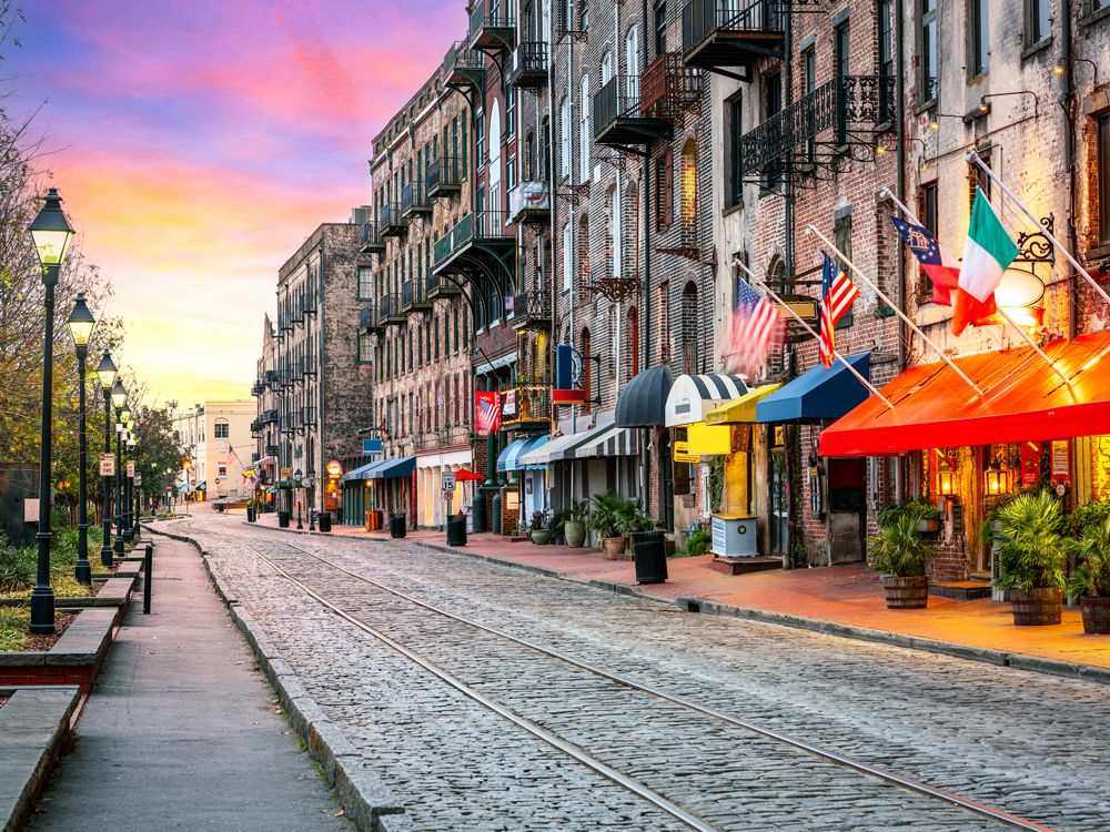
With more and more tourists visiting Georgia’s most charming coastal city each year, Savannah shows no signs of slowing down. Savannah is the oldest city in the state, and its federally designated historic district is one of the largest in the country. Tourists flock here to admire Savannah’s many historic mansions, stroll under its moss-draped trees, and try the fantastic Southern cuisine. But with an influx of visitors come some painful price hikes. While car rental and meal prices have remained relatively flat, the most significant price increase was for lodging, which skyrocketed from an average of $155.71 per night to $219.06 — a 40.68% increase.
9. Phoenix, Arizona – 22.56% Increase
Credit: KingWu/ E+ via Getty Images
Average Daily Cost: 2018: $316.41 2023: $387.80
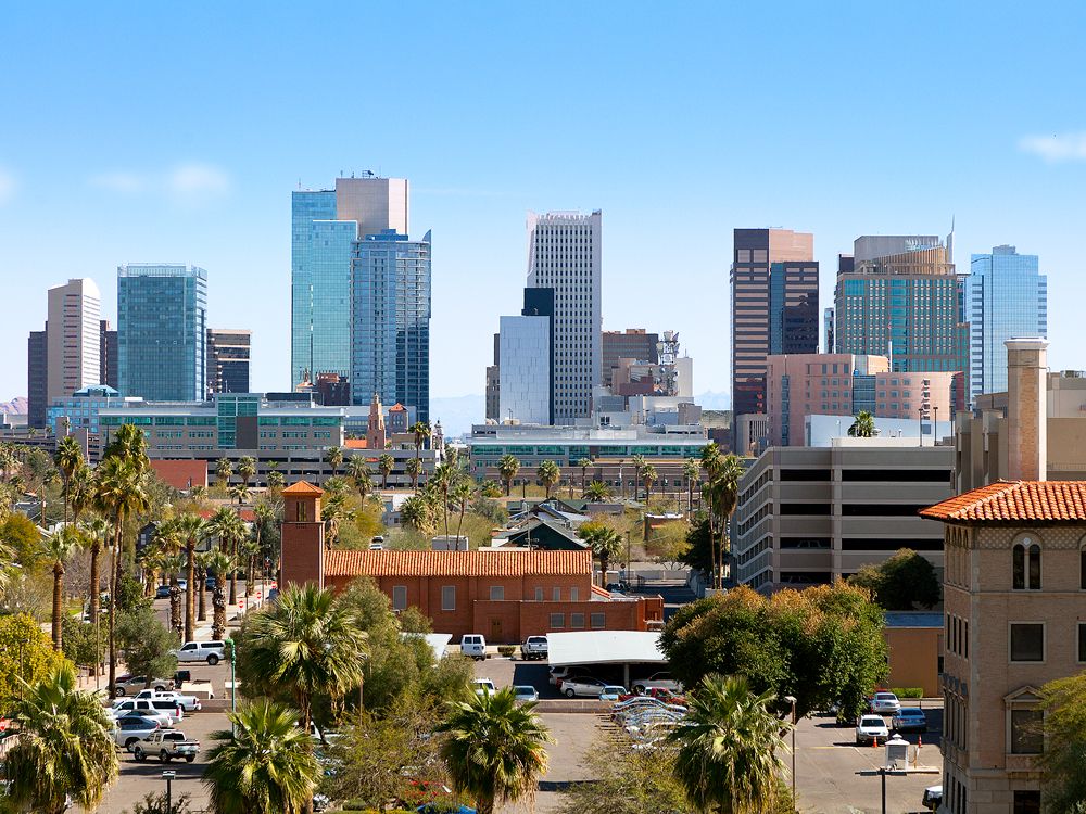
Arizona’s capital city — the most populous capital in the country — is renowned for its golf resorts, wellness retreats, and stunning desert and mountain landscapes. It’s also one of America’s sunniest cities, so it’s little wonder that tourists flock here (especially in the winter months). But as more and more people visit, prices have gone up considerably. Though car rental costs have remained flat, meal costs have increased by around 12.2%. As in Savannah, the most significant factor in Phoenix’s soaring tourism prices was the cost of hotels. The average nightly room rate surged from $172.36 to $235.47, an increase of 36.22%. Evidently, though, many tourists are happy to pay for the sprawling desert views Phoenix is known for.
8. Miami, Florida – 23.93% Increase
Credit: Alexander Spatari/ Moment via Getty Images
Average Daily Cost: 2018: $354.54 2023: $439.39
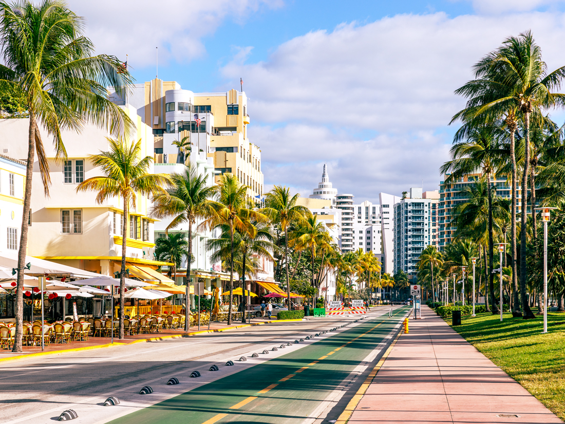
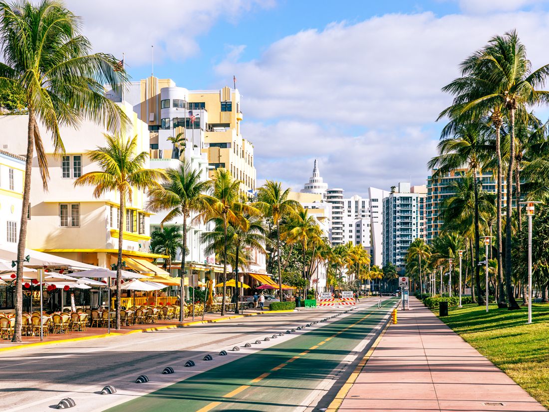
Southern Florida’s entertainment hub on the Atlantic Ocean is a longtime vacation mainstay. Due to its popularity — along with nationwide inflation — it’s also becoming one of Florida’s most expensive beach cities to visit. As in other cities on this list, meal and car rental prices have remained relatively steady in Miami, but hotels are becoming pricier every year. In 2018, a stay in the average Miami hotel room would have set you back around $193.98, but by the end of 2023, that price rose to $280.70 per night, a 44.71% increase.
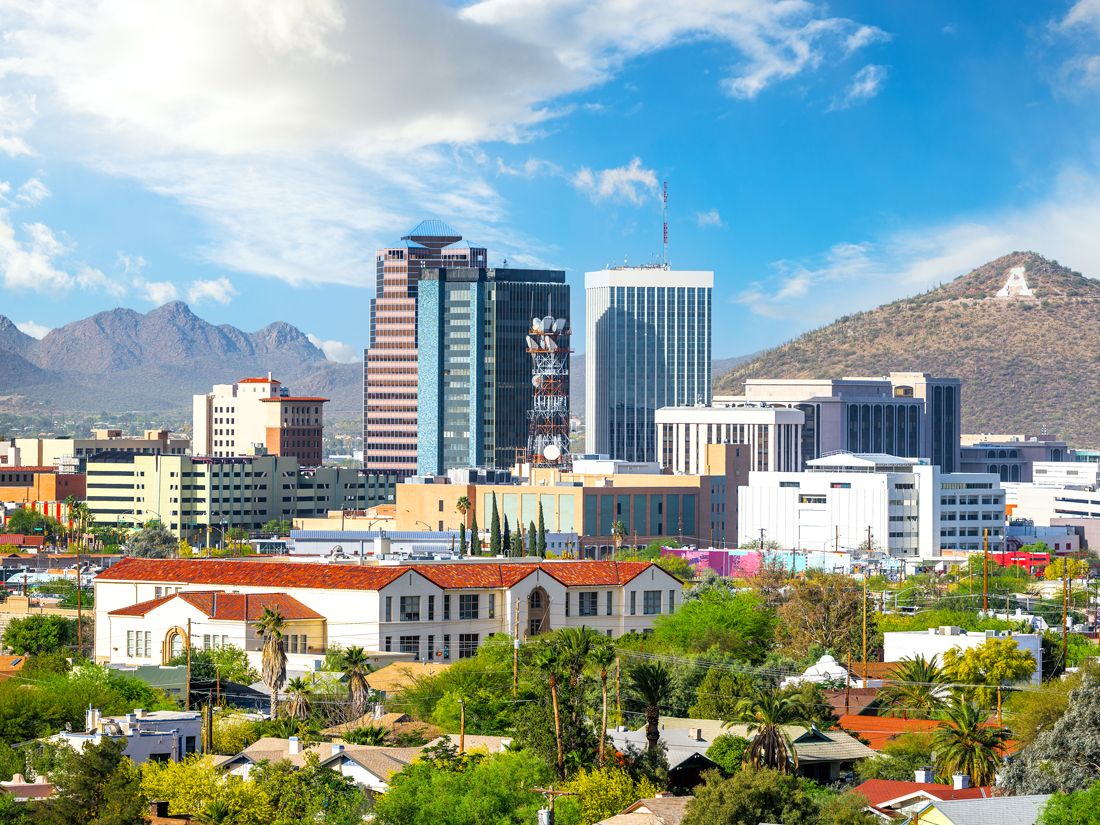
Home to Saguaro National Park, the University of Arizona, and plenty of historical sights, Tucson gives its neighbor Phoenix a run for its money — both as a popular tourist destination and, quite literally, for the cost to visit. Average meal costs went up nearly 12%, and car rentals rose almost 15% in the past five years. Hotels once cost an average of $133.41 per night in Tucson, but now, a typical room would cost you $181.40. Of course, that’s relatively low compared to the cost of hotels in other cities on this list, but for Tucson, it’s a notable jump.
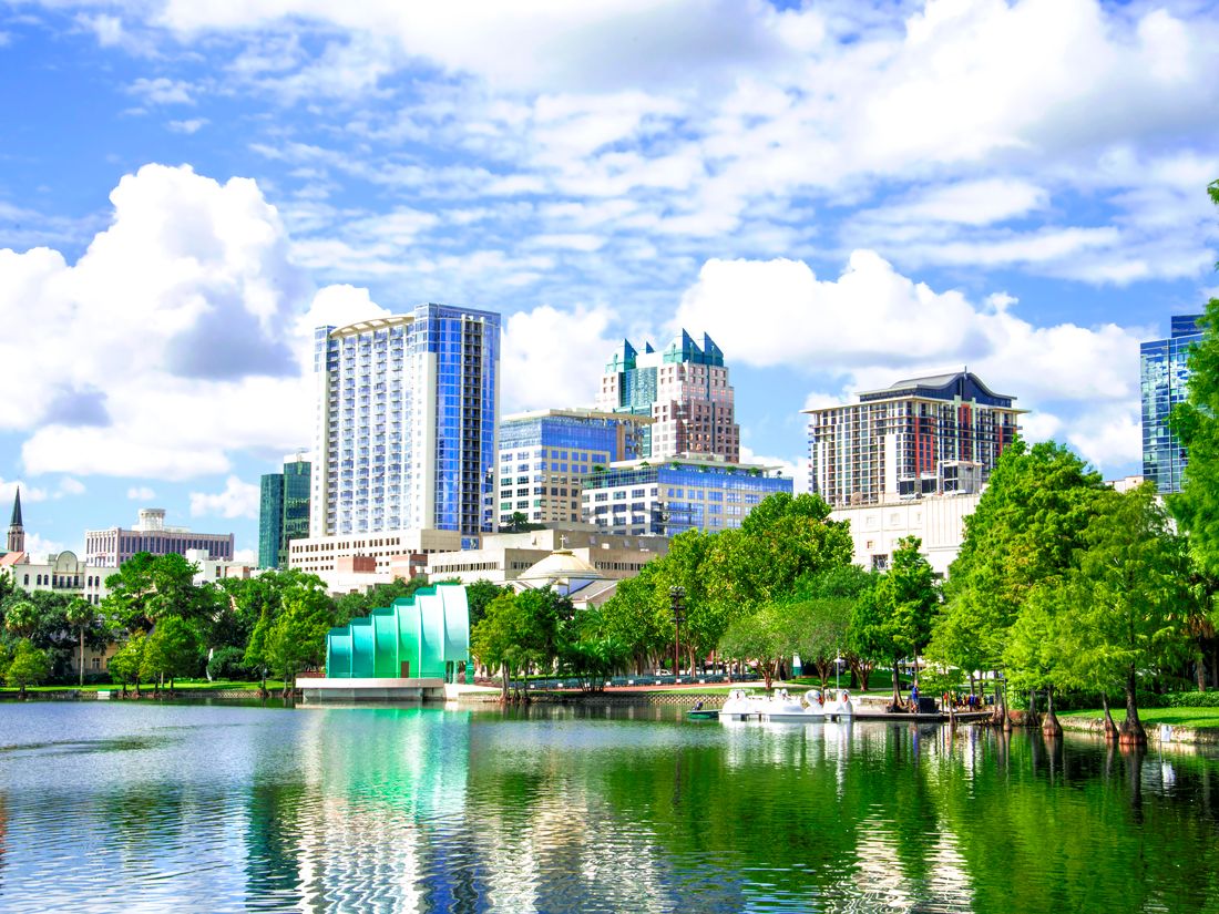
6. Orlando, Florida – 28.61% Increase
Credit: Gina Pricope/ Moment via Getty Images
Average Daily Cost: 2018: $303.70 2023: $390.59
Thanks to its many theme parks, Orlando is one of the most expensive tourist destinations in the U.S., and it also has experienced some of the highest price increases in recent years. The price of meals and car rentals has increased by only a few dollars a day on average, but tourists spend most of their money on hotels. A hotel that would have cost $171.00 per night in 2018 cost $247.69 in 2023, a 44.85% increase. Conversely, many theme parks have kept admission prices steady in recent years (though tickets are by no means cheap). For example, Walt Disney World’s Magic Kingdom ticket prices have actually decreased since 2018, from $122 to $109.
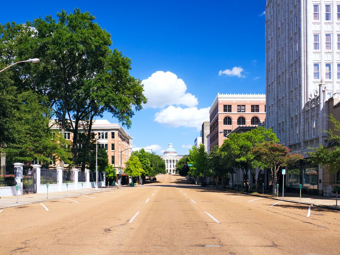
5. Jackson, Mississippi – 28.68% Increase
Credit: Jeremy Woodhouse/ DigitalVision via Getty Images
Average Daily Cost: 2018: $233.78 2023: $300.82
There is much to do and see in Mississippi’s capital city, perhaps an overlooked tourist destination by many, but unfortunately, it’s become one of the most expensive cities in the state to visit. Hotel prices are up 47.48%, from $113.87 to $167.94. Meal and rental car prices also increased by around 11%, making it a bit more costly to enjoy the town’s dozens of museums and historical sights — including the Mississippi Civil Rights Museum and the Mississippi State Capitol.
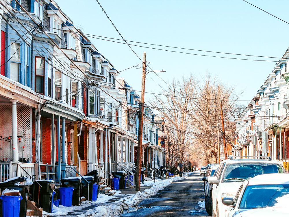
4. Allentown, Pennsylvania – 29.94% Increase
Credit: peeterv/ iStock via Getty Images Plus
Average Daily Cost: 2018: $253.50 2023: $329.40
Located about 60 miles northwest of Philadelphia, Allentown is Pennsylvania’s third-most-populated city. Allentown’s small-town charm becomes apparent the moment you step foot here, from its minor league baseball games to its many farmers markets, gardens, and museums. But despite flying under the radar as a tourist destination, this Lehigh Valley city isn’t cheap. Hotels are up 45.5%, with an average nightly cost of $193.35 in 2023, compared to 2018’s $132.89 average. Rental car prices are steady, but food costs have also increased. The average daily meal cost has risen by 16.74%, from $78.69 to $91.86.
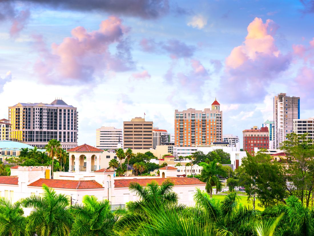
3. Sarasota, Florida – 36.86% Increase
Credit: SeanPavonePhoto/ iStock via Getty Images Plus
Average Daily Cost: 2018: $327.85 2023: $448.67
Home to esteemed art museums and pristine beaches including Siesta Key, the Gulf Coast city of Sarasota offers plenty of appeal for visitors — but the secret seems to be out. Although rental car prices have increased by only around $1 per day, everything else is more expensive than five years ago, driven by a recent increase in tourism, a growing city, and national trends in inflation. Meals increased by nearly 9%, but hotels shot up by 57.87% — the most significant jump on this list. What cost $197.96 per night in 2018 now costs an average of $312.51. Still, many travelers will say enjoying a beautiful coastal sunset in Sarasota is worth the expense.
2. Tampa, Florida – 37.01% Increase
Credit: anouchka/ iStock via Getty Images Plus
Average Daily Cost: 2018: $271.81 2023: $372.40
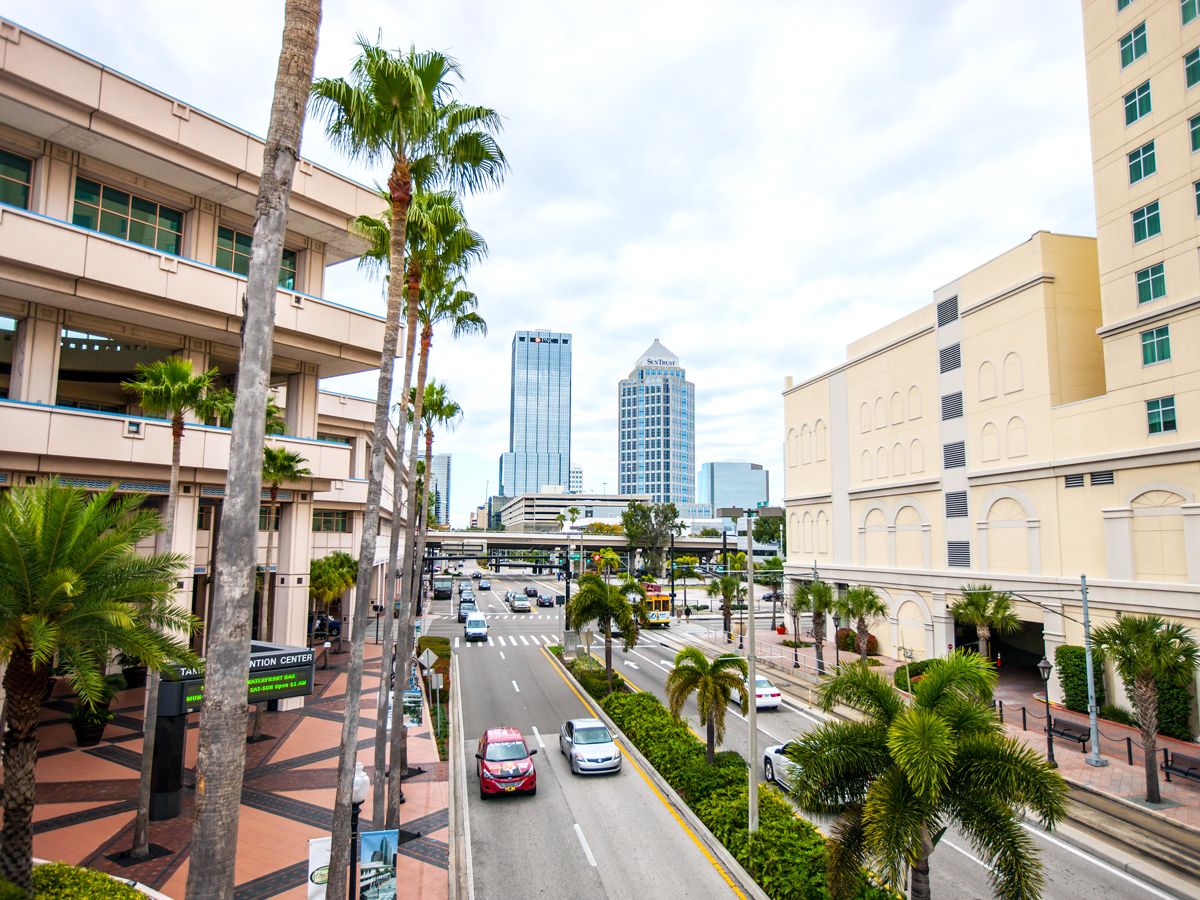
Sarasota’s neighbor about an hour’s drive to the north has also seen a significant price jump over the past five years. Tampa has experienced a hotel price increase of 51%, with an average price of $234.69 per night at the end of 2023. Meals are also making a dent in tourists’ wallets, with an increase of 29.17%, the most significant meal cost increase on this list. With its shimmering Gulf Coast beaches, amusement parks, riverwalk, and sports teams, there is no shortage of activities for locals and visitors alike. Just be prepared to shell out a little extra cash in this coastal Florida city.
1. Las Vegas, Nevada – 44.50% Increase
Credit: aldo_dz/ iStock via Getty Images Plus
Average Daily Cost: 2018: $306.97 2023: $443.32
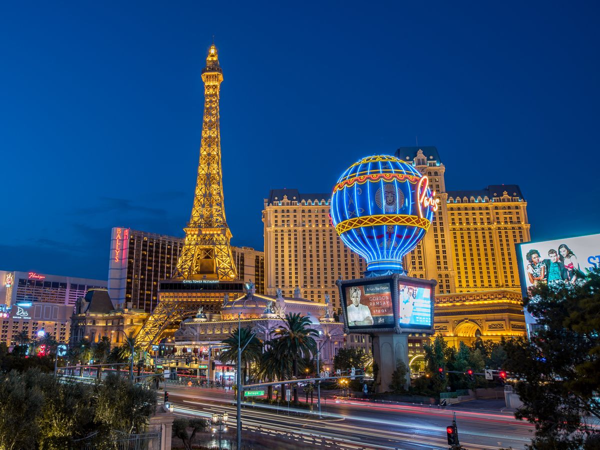
Las Vegas has one of the country’s cheapest airports to fly to, but sadly, the good news ends there. Average hotel prices have risen 54.98%, from $173.11 per night in 2018 to $268.29 in 2023 — and high-end hotels on the Strip will set you back much further. Meal prices aren’t much better, with a nearly 14% increase. Interestingly, while all other cities on this list saw slight increases in rental car prices, Las Vegas has seen a sharp increase of over 61%. Tourists once paid $47.77 per day for a car rental, but now, an average rental car costs $77.12. This makes exploring nearby sights like the Red Rock Canyon and the Hoover Dam more expensive, but luckily, there’s plenty to keep you entertained in Vegas itself.
Advertisement
More from our network
Daily Passport is part of Inbox Studio, an email-first media company. *Indicates a third-party property.
What Info Is Actually Stored on Your Hotel Key Card?
By
Bennett Kleinman
Read time: 3 minutes
July 3, 2024
Updated: July 3, 2024
What Info Is Actually Stored on Your Hotel Key Card?
Tips •July 3, 2024•Updated: July 3, 2024
By Bennett Kleinman
Author
Bennett Kleinman
Bennett is a New York City-based staff writer for Daily Passport. He previously contributed to television programs such as the Late Show With David Letterman, as well as digital publications like the Onion. Bennett has traveled to 48 U.S. states and all 30 Major League Baseball stadiums.
Hotel key cards may just be tiny pieces of plastic, but they’re an essential part of a safe hotel stay. These cards are designed to allow access into one room and one room only, keeping unwanted intruders out. But you may be wondering how such key cards work and whether any sensitive personal information is stored on these pocket-sized passes. Here’s what type of data is actually stored on your hotel key card.
The majority of modern hotels use either key cards with a magnetic stripe that the guest swipes along the lock, or RFID-enabled cards that utilize radio frequencies to unlock a door by tapping. Both of these technologies rely upon the same basic information to grant access to the card holder. There are some older hotels that still use archaic hole punch technology, with key cards that are specific to each lock and don’t rely on any virtual data, but hole punch key cards are quite rare these days.
When you check in to a hotel, the front desk clerk takes a blank card that’s been wiped clean of any data and loads it with two specific pieces of information: the room number and the dates of your stay. Once programmed, the key card will grant you access to the room until your checkout date, at which point the card will automatically deactivate. You may have heard some people claim that key cards contain personal information, such as your name, credit card number, and other sensitive details. This is an urban legend — none of those details are necessary for room access.
It happens: Sometimes you lose your key card. However, if that’s the case, you needn’t worry about someone hacking into the hotel’s computer system and stealing your identity. The more pressing concern is someone using the card to access your hotel room. Fortunately, there’s no way for that person to know which room is yours unless they go door-to-door trying to unlock each one. If you lose a key card, head to the front desk as soon as possible, and they should be able to invalidate the old card and issue a new one. If you’re particularly anxious about the situation, you can always request to change rooms if a similar one is available.
Other Key Card Safety Tips
Credit: Antonio_Diaz/ iStock via Getty Images Plus
First, you should never take a marker and write the hotel room number on the card itself. If you do that and you end up losing the card, the person who finds it will know exactly which room it belongs to. Similarly, you should never store the card in the default paper sleeve you receive at check-in. That sleeve usually contains information like the room number and your last name.
Should You Turn in Your Key Card?
Credit: Anchiy/ E+ via Getty Images
Some people return their hotel key cards upon checkout, while others keep them as souvenirs. But is there any reason that you should do one or the other? Not really. If you return your key card, it’ll be wiped clean and nobody will have access to your personal info. But if you keep the card as a memento, nobody at the hotel is likely to come after you and demand that you return the card. It all comes down to personal preference.
Advertisement
More from our network
Daily Passport is part of Inbox Studio, an email-first media company. *Indicates a third-party property.
Nicole is a writer and researcher with over 15 years of experience seeking out arts, culture, and lifestyle stories in places like remote northern Quebec and the unforgettable streets of Amsterdam. Her work has also appeared in PureWow, Brit + Co, AUX TV, and CBC.
Most people are aware that America is made up of 50 states, but the country also includes several overseas territories. Many are small, uninhabited atolls, but five of these territories are home to significant year-round populations: Puerto Rico, Guam, the U.S. Virgin Islands, American Samoa, and the Northern Mariana Islands. Each is administered by the U.S. federal government, and their residents are U.S. citizens by birth (with the exception of American Samoa, whose residents are instead considered U.S. nationals), though residents of the U.S. territories have limited political representation. These territories are also home to stunning natural landscapes and distinct cultures that have taken root over thousands of years, making any one of them a worthy addition to your travel wish list. Get acquainted with the five major U.S. territories and explore their differences in size, history, culture, and top attractions below.
American Samoa
Credit: SCStock/ iStock via Getty Images
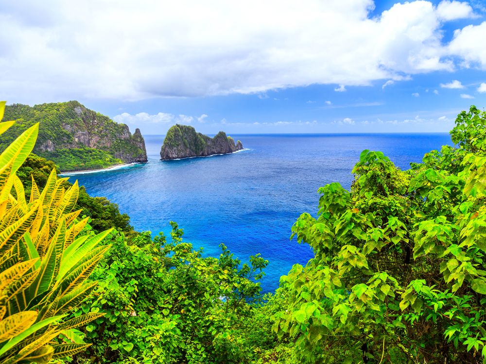
The U.S. territory of American Samoa sits about 2,200 miles southwest of Hawaii and 1,600 miles northeast of New Zealand. Approximately 46,000 people live in its 77 square miles, which consist of five inhabited volcanic islands — Tutuila, Aunu’u, Ofu, Olosega, and Ta’u — and two uninhabited atolls, Rose and Swains Island. Polynesian peoples have inhabited the region for over 3,000 years. After European explorers arrived in 1722, the islands fell under the rule of various colonial powers until 1900, when the territory was formally ceded to the U.S. by the matai (local chiefs) of Tutuila.
The islands of American Samoa are known for their lush tropical landscapes, with about 90% of them covered with rainforest. The National Park of American Samoa — the only U.S. national park located south of the equator — spans three of the islands. It’s home to mountainous volcanic landscapes and unique wildlife including the Samoan flying fox (essentially a large fruit bat). It’s also home to stunning coral reefs and marine life such as rare and endangered sea turtles and humpback whales.
In terms of culture, American Samoans emphasize community, family, and respect for elders, a guiding principle known as fa’a Samoa, or “the Samoan way.” In the capital of Pago Pago, the Jean P. Haydon Museum showcases over 650 Polynesian artifacts, while the Blunts Point Battery, a National Historic Landmark, is home to a rare, still-intact World War II Pacific coastal gun. The Tauese P.F. Sunia Ocean Center also offers exhibits on the island’s natural history and marine environment. For an immersive local experience, head to the Fagatogo Market to peruse traditional artisan crafts and taste Samoan delicacies such as palusami (taro leaves baked in coconut milk) and oka (raw fish marinated in citrus juice and coconut milk).
Northern Mariana Islands
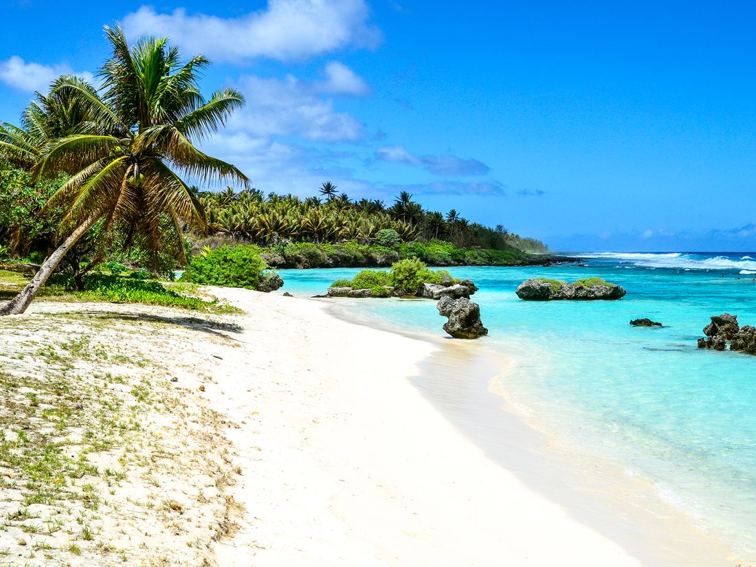
Credit: CampPhoto/ iStock via Getty Images
The chain of the 14 northernmost islands in the Mariana archipelago form the territory known as the Northern Mariana Islands (officially, the Commonwealth of the Northern Mariana Islands). Located in the western Pacific Ocean between the Philippines and Japan, the island chain runs roughly north to south, spans about 375 miles, and has a total land area of approximately 179 square miles. The most populated islands are Saipan, Tinian, and Rota. The capital, Saipan, boasts an average year-round temperature of about 84 degrees Fahrenheit — the most equable climate in the world, according to the Guinness World Records.
The approximately 50,000 people who call the Northern Mariana Islands home share a vibrant and diverse culture of Indigenous Chamorro and Carolinian traditions, Spanish colonial influence, and, more recently, Japanese, Filipino, and American contributions. The islands came under U.S. administration in 1975 after an agreement established them as a commonwealth in political union with the United States.
Local festivals such as the annual Flame Tree Arts Festival showcase traditional music, dance, and crafts. Historical highlights include the House of Taga in Tinian, with its ancient latte stones, and the American Memorial Park in Saipan, commemorating World War II. The islands are also renowned for their biodiversity. The Mariana Trench Marine National Monument, the deepest place on Earth, protects over 95,000 square miles of marine life.
Guam
Credit: Yagi-Studio/ iStock via Getty Images
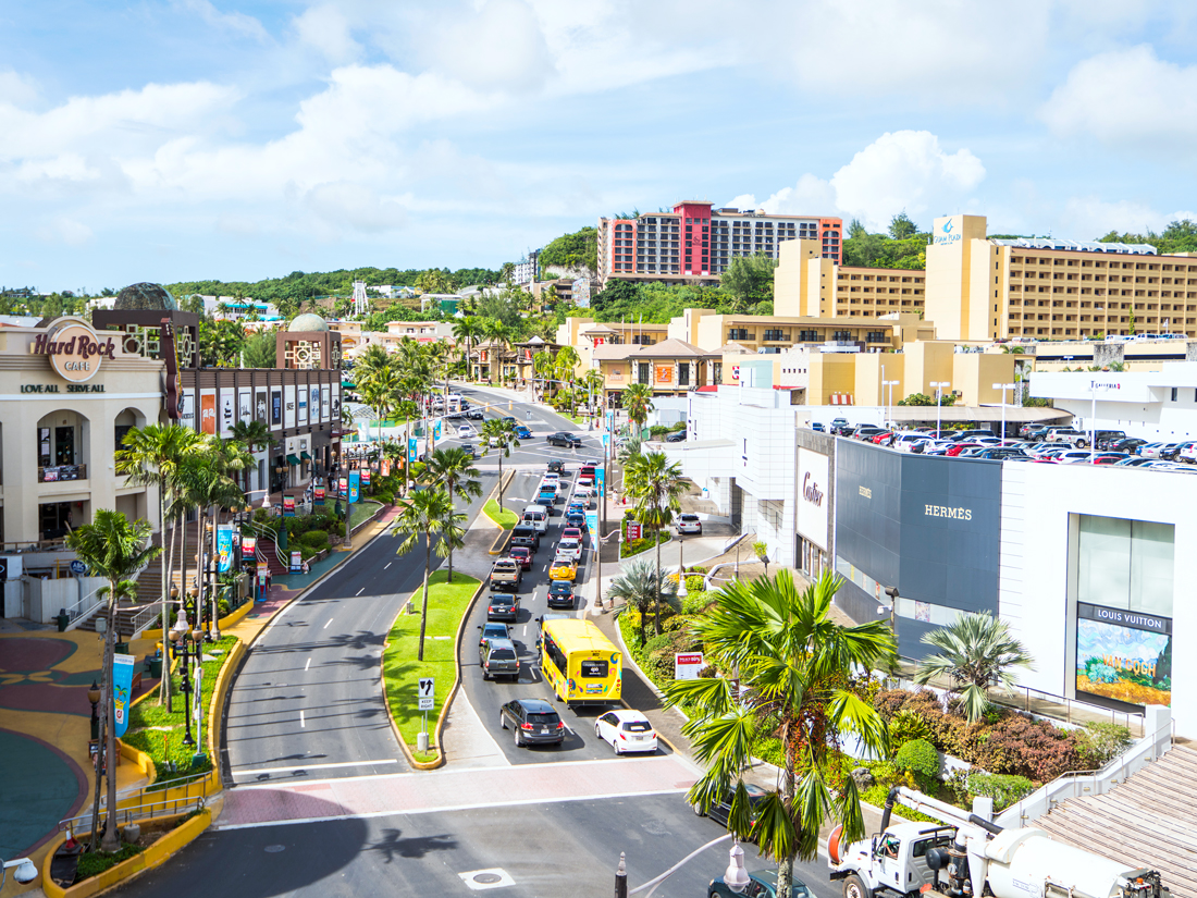
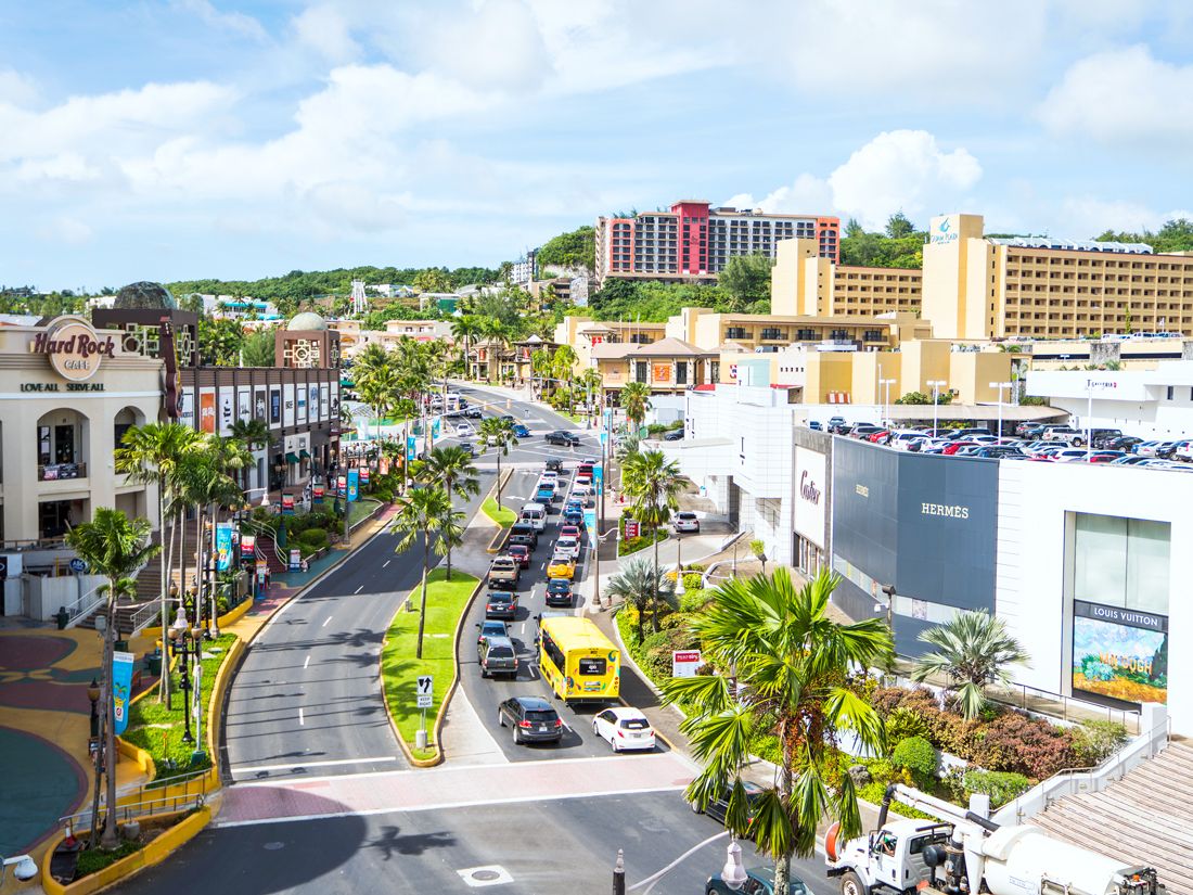
Though Guam is the largest and southernmost island of the Mariana Islands chain, it is a U.S. territory in and of itself. In 1898, following defeat in the Spanish-American War, Spain ceded its former colony to the U.S., and Guam has been a significant American military outpost ever since. The Chamorro Indigenous peoples have inhabited the island for over 4,000 years and still influence the culture of the modern and multicultural island. About 47,000 people speak the endangered Chamorro language, and a local specialty known as kelaguen — marinated chicken, or sometimes seafood, served with red rice — is one of the island’s culinary highlights.
Guam’s landscape is characterized by limestone plateaus in the north, hilly volcanic terrain in the south, and tropical greenery all around, with over half of the island covered in forest. The island’s warm waters make it a popular spot for snorkeling and diving, as do the 42 square miles of shallow coral reefs along its shoreline. Visit the ancient Latte Stone Park for a glimpse into Guam’s Chamorro history, or take in the luxury resorts, soft sand beaches, and shopping in the bustling Tumon Bay.
U.S. Virgin Islands
Credit: Don Hebert/ Stockbyte via Getty Images
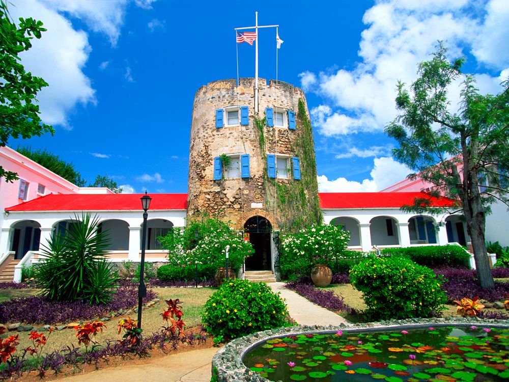
Indigenous peoples have inhabited these Caribbean islands for over 2,500 years, but in 1917, the U.S. acquired the territory — then known as the Danish West Indies — from Denmark for $25 million in gold coin. The main islands of St. Thomas, St. John, and St. Croix, as well as surrounding smaller islands, were renamed the Virgin Islands and became a base for the U.S. Navy during World War I and II. Every year, on May 31, the islands celebrate Transfer Day to commemorate becoming a U.S. territory.
Since the Department of the Interior took over jurisdiction from the Navy in 1931, tourism has become the territory’s defining economic driver, and it isn’t hard to see why. On St. Thomas, the capital city of Charlotte Amalie is famous for its historical Danish architecture and bustling waterfront. Meanwhile, St. John is home to Virgin Islands National Park, and on St. Croix, visitors can explore the colonial-era buildings of the Christiansted National Historic Site or the marine sanctuary at Buck Island Reef National Monument. About 105,000 people call the territory’s 133 square miles home, but upwards of 2 million tourists flock to the Caribbean paradise each year.
Puerto Rico
Credit: Sean Pavone/ iStock via Getty Images Plus
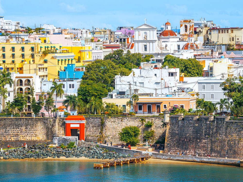
Spanning 3,500 square miles and housing 3.3 million people, Puerto Rico is the largest and most populous of the U.S. territories. The U.S. took control of the former Spanish colony, along with Guam, following the 1898 end of the Spanish-American War. More than 1,000 years before the arrival of Spanish settlers, the Taíno peoples inhabited the island; their Indigenous history lives on in museums such as the El Cemí Museum and the Caguana Indigenous Ceremonial Site.
San Juan, Puerto Rico’s vibrant capital, isn’t just a place to go for amazing food and beaches — it’s also an architectural dream with styles ranging from Colonial to Baroque, Gothic, and Neoclassical. The island is also home to El Yunque National Forest, the only tropical rainforest in the U.S. National Forest System and a sacred site in Puerto Rican folklore. For decades, there have been discussions and efforts to make Puerto Rico the 51st state, a move that proponents say would benefit the island’s economy and provide other needed federal support. As of yet, however, Puerto Rico remains an unincorporated territory.
Advertisement
More from our network
Daily Passport is part of Inbox Studio, an email-first media company. *Indicates a third-party property.
Peter is a Toronto-based journalist, editor, content strategist, and self-professed avgeek with 15 years of experience covering all things travel. Prior to joining Daily Passport, he oversaw newsletter publication for Travelzoo. His favorite destinations to explore include Japan, France, Chile, New Zealand, and his adopted home country of Canada.
Thanks to the wonders of modern engineering, commercial airliners can now fly distances that were once unthinkable. Consider this: In 1941, in the nascent days of aviation, a typical journey from Los Angeles to Boston took more than 15 hours and required 12 refueling stops along the way. These days, passengers can sit back, relax, and reach one end of the globe from another in a single flight. Word to the wise: Make sure you’re cozy onboard, because you could be on the plane for more than 19 hours. Below, check out seven of the world’s longest flights based on distance traveled, as of 2025.
7. New York (JFK) – Auckland (AKL)
Credit: Iacob MADACI/ iStock via Getty Images
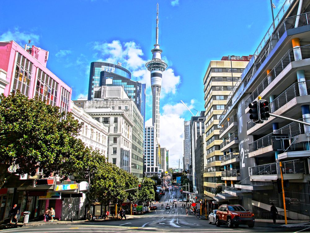
New Zealand is the most isolated temperate landmass in the world — its closest neighbor, Australia, is located more than 2,500 miles away. So, it’s no surprise to see this remote locale on the list of the world’s longest flights. Air New Zealand launched its ultra-long-haul service between Auckland and New York City in 2022. The route (which is now also flown by Australian carrier Qantas) covers a distance of 8,829 miles and is typically scheduled for 17 hours and 30 minutes when flying westbound.
6. Perth (PER) – Paris (CDG)
Credit: Nikada/ E+ via Getty Images
Another remote locale appears at No. 6 on the list of longest flights in the world. Perth is one of the most isolated cities on the planet; the closest major city, Adelaide, is a three-hour flight away. Starting in July 2024 (just in time for the Summer Olympics), Qantas will fly direct from Perth to Paris’ Charles de Gaulle Airport. The flight will take about 17 hours and 20 minutes and cover a distance of 8,864 miles.
5. Dallas/Fort Worth (DFW) – Melbourne (MEL)
Credit: wiesdie/ iStock via Getty Images
Sensing a theme? Journeying to the land Down Under will definitely take you a while. Qantas flies direct from Dallas/Fort Worth International Airport in Texas — one of the world’s busiest airports — to Melbourne, Australia’s second-largest city. Passengers can expect a westbound flight time of 17 hours and 35 minutes onboard the state-of-the-art Boeing 787-9 aircraft (the same aircraft that operates several other flights on this list). The total distance? 8,990 miles.
4. Perth (PER) – London (LHR)
Credit: Scott E Barbour/ The Image Bank via Getty Images
As it turns out, the flight from Perth to Paris isn’t even the longest route offered from Australia’s westernmost city (which is actually closer to Indonesia than it is to Melbourne or Sydney). Qantas stretches the legs of its Boeing 787-9 with daily flights to London’s Heathrow Airport — a distance of 9,009 miles and a flight time of 17 hours and 45 minutes.
3. Auckland (AKL) – Doha (DOH)
Credit: Henryk Sadura/ Moment via Getty Images
Another flight from New Zealand lands in the No. 3 spot on the list of the world’s longest flights. When Qatar Airways launched nonstop service from Doha, Qatar, to Auckland in 2017, it was the world’s longest flight at the time. The flight covered a distance of 9,026 miles and took nearly 17.5 hours to operate. The airline paused service during the pandemic, but it relaunched the route in late 2023.
2. Newark (EWR) – Singapore (SIN)
Credit: guvendemir/ E+ via Getty Images
In 2018, Singapore Airlines took over the crown for the world’s longest flight with its nonstop service between Singapore and Newark, New Jersey (near New York City). However, this isn’t the first time Singapore Airlines has flown this 19-hour flight, which covers a distance of 9,525 miles. The airline originally operated the route from 2004 to 2013 on its Airbus A340-500 aircraft, which has since been retired. These days, passengers will make the incredibly long journey on the cutting-edge Airbus A350-900ULR (Ultra Long Range) aircraft.
1. New York (JFK) – Singapore (SIN)
Credit: samaro/ iStock via Getty Images
The world’s longest flight is also flown by Singapore Airlines, and it’s just 2 miles longer than Newark-to-Singapore. In 2021, Singapore Airlines launched direct flights to New York’s JFK Airport. The service takes a whopping 19 hours, but fortunately, none of the passengers will be stuck in coach — Singapore Airlines configures the A350-900ULR with only Business Class and Premium Economy seats (offering wider seats with more legroom).
However, Singapore Airlines may not hold onto the No. 1 spot for long. Australian carrier Qantas is set to break the longest flight record with its “Project Sunrise” service. It aims to connect Sydney with both London and New York, with flight times each in excess of 20 hours. However, aircraft delivery delays have pushed back the launch date, and the service is now expected to take off in mid-2026.
Advertisement
More from our network
Daily Passport is part of Inbox Studio, an email-first media company. *Indicates a third-party property.
7 Fascinating and Unexpected Places to Visit in France
By
Daily Passport Team
Read time: 7 minutes
July 3, 2024
Updated: July 3, 2024
7 Fascinating and Unexpected Places to Visit in France
Culture •July 3, 2024•Updated: July 3, 2024
By Daily Passport Team
Author
Daily Passport Team
Daily Passport writers have been seen in publications such as National Geographic, Food & Wine, CBC, Condé Nast Traveler, and Business Insider. They're passionate about uncovering unique destinations and sharing expert tips with curious travelers.
France has been the most-visited country in the world for the past 30 years, and with good reason. For starters, this European nation is home to some of the planet’s most romantic cities, centuries of fascinating history, beautiful architecture, renowned cuisine and wine, priceless art, and stunning natural landscapes. Chances are, you’ve already visited France at least once — but if that’s the case, these often overlooked destinations should also be at the top of your list for your next visit. Check out seven of the most fascinating and unexpected places to visit in France below.
Verdon Gorge
Credit: photosimysia/ iStock via Getty Images Plus
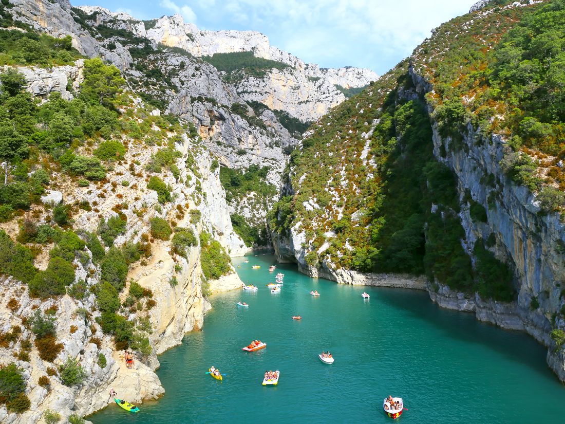
The juxtaposition of impossibly turquoise waters and white limestone cliffs is one reason so many visitors flock to this gorgeous canyon in the foothills of the Alps. Rising nearly half a mile above the Verdon River, Les Gorges du Verdon (Verdon Gorge) is one of the most popular tourist attractions in southeastern France’s Provence region. Often referred to as the “Grand Canyon of Europe,” the canyon stretches over 13 miles and plunges to depths greater than 2,200 feet. It’s no surprise, then, that it’s a favorite with hikers, rock climbers, and cyclists. And on the river itself, canoers and kayakers stop at the canyon’s many small, rocky beaches to enjoy picnics and brisk swims.
During high season, many visitors also drive the twisting and narrow roads and stop at the scenic villages that encircle the canyon’s rim. In Moustiers-Sainte-Marie — one of the most picturesque villages in France — don’t miss the 12th-century Notre Dame de Beauvoir Chapel. In nearby Castellane, which has been settled since prehistoric times, you’ll be surrounded by another of Provence’s most famous sights: seemingly endless rows of lavender fields.
Mont-Saint-Michel
Credit: Ilya Shimanskiy/ iStock via Getty Images Plus
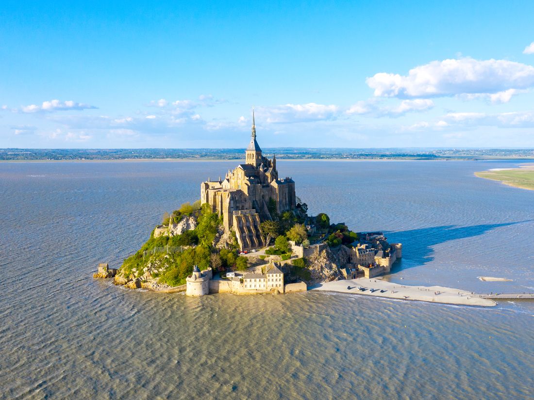
One of Europe’s most enchanting medieval vistas is this Benedictine abbey that dominates a small tidal island just off the coast of Normandy. If it appears straight out of a Disney film, that’s because it is: The magical island inspired Disney animators when they drew up Rapunzel’s birthplace in the 2010 film Tangled. The island’s namesake abbey flaunts slender spires that jut up from the surrounding rocky cliffs, with architecture that dates back to the eighth century. Remarkably left intact following the Hundred Years’ War and both World Wars, Mont-Saint-Michel is now a UNESCO World Heritage Site that welcomes more than 3 million visitors annually.
The changing tides of Mont-Saint-Michel present a fascinating contrast: As tides recede, a bed of shimmering, sifting sand appears as a cushion around the island, but when waters are high, it seems to float in the bay. The abbey was cut off from the mainland until the late 19th century, but visitors can now cross a bridge to discover a walled village of narrow cobblestone alleys and stairways, home to restaurants, hotels, and a full-time population of just 30 people.
Aiguille du Midi
Credit: Gregory_DUBUS/ E+ via Getty Images
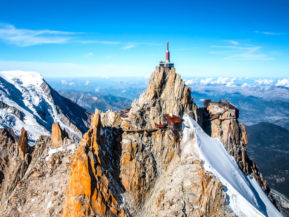
Nestled along France and Switzerland’s southern border is Chamonix, a French extreme sports mecca that hosted the first Winter Olympics. Chamonix stands in the giant shadow of Aiguille du Midi, a mountain that reaches magnificent vantages 12,605 feet above sea level. Getting to the top requires a nearly 6-mile round-trip hike or 30-minute cable car trip. But you might want to opt for the latter, and not just to avoid the legwork — the last leg of the aerial journey comprises the highest vertical ascent you’ll find on any cable car in the world, and the views are out-of-this-world.
But the experience awaiting riders at the top may be even more impressive. Upon exiting, travelers beeline for a tiny steel bridge — less than 50 feet long — that connects Aiguille du Midi’s north and south peaks. The vertigo-inducing bridge provides 360-degree views of the French, Swiss, and Italian Alps, including nearby Mont Blanc, Europe’s second-tallest mountain, and the famous Matterhorn on clear days. If you’re somehow still craving an adrenaline rush, there’s an elevator to an attraction called “Step Into the Void” — a cube featuring five reinforced glass sides to give the impression that you’re levitating above a precipitous 3,400-foot drop.
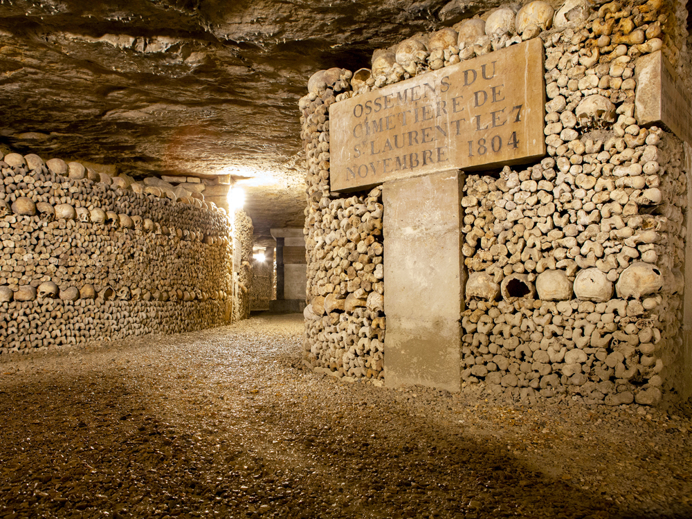
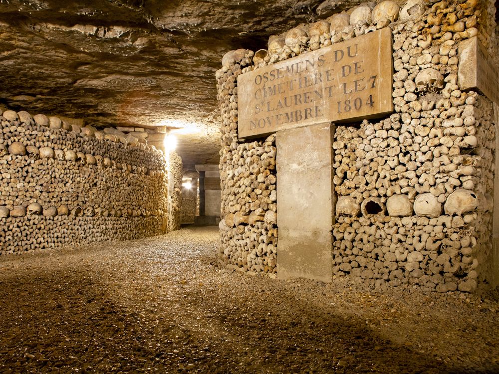
Looking like the work of a White Walker (at least, for Game of Thrones fans), the meticulously arrayed skeletal remains that deck the halls of this subterranean warren beneath the streets of Paris are, in fact, the work of Louis-Étienne François Héricart-Ferrand, viscount of Thury. When ancient Parisian cemeteries were overflowing at the turn of the 19th century and becoming a public health threat, the politician, scientist, and mining engineer repurposed a defunct quarry into the municipal ossuary.
Carefully orchestrated wall patterns began to emerge under the viscount’s curatorial eye: waves of skulls cresting and falling around crosses, rows of alternating tibias and skulls, and cabinets full of curiosities, for starters. Some of the reinterred remains date back more than a thousand years, but Revolutionary era icons, from Robespierre to Marat, were also buried there. Opened to the public in 1809, the site has become a popular attraction, especially those who tend to prefer a more macabre view of Paris. After descending 131 stairs into the tunnels’ depths, you can explore about a mile’s worth on your own, or on a fantastic guided tour.
Arles
Credit: bbsferrari/ iStock via Getty Images Plus
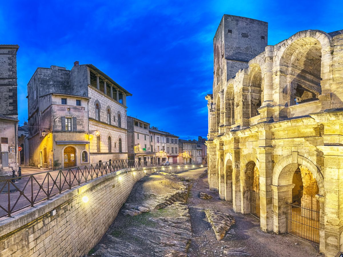
The Provence region of southern France is best-known for its fabled riviera, the Côte d’Azur. But Arles, along the Rhône River about 60 miles northwest of Marseille, also deserves a spot high on your list. As one of the oldest cities in France, Arles was once a Phoenician trading port before the Romans conquered the town in the first century BCE, digging a canal to the Mediterranean and making it an important provincial capital. The city is now a UNESCO World Heritage Site and filled with monuments from this era, including a well-preserved amphitheater that once held 20,000 spectators, an aqueduct, a large necropolis, and an ornate theater.
The mistral wind blesses Provence with clear skies, and many artists have flocked to Arles. Paul Gauguin and Picasso painted here, but the most famous is Van Gogh, who found inspiration and painted some of his best-known works while living in “The Yellow House” on Place Lamartine. The house was destroyed in World War II, but the tourist office organizes a walking tour of locations familiar to his fans.
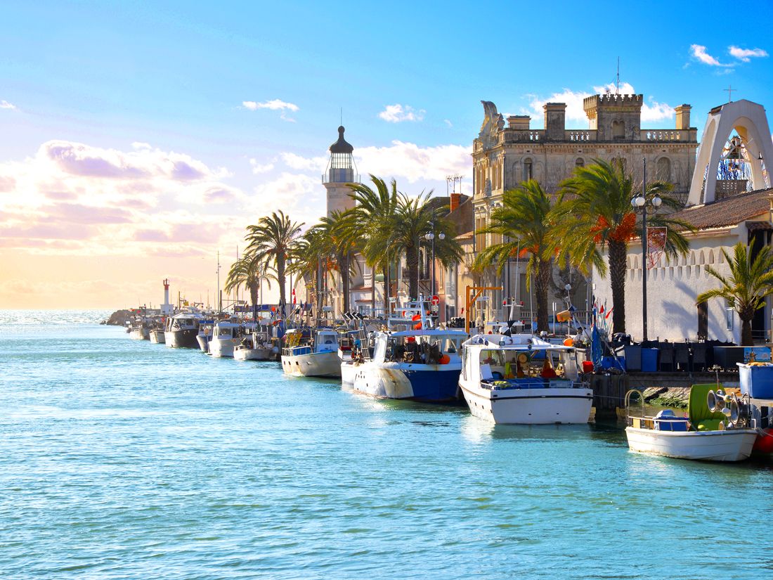
Arles is located at the northern end of France’s Camargue region. The greater region offers some of the country’s most spectacular biodiversity, highlighted by the area’s emblematic white horses running freely along its sandy shores and pink flamingos wading by the thousands in the marshy wetlands bordering the Mediterranean Sea. The semi-wild horses, which are indigenous to the area, are considered one of the world’s oldest breeds, and today some are used by ranchers (known as the “guardians of the Camargue”) for corralling native groups of black bulls. The guardians also host an annual Festival of Abrivado every November along the beaches of Saintes-Maries-de-la-Mer, where they gather on horseback to showcase their impressive herding skills.
At the center of this vast expanse lies the Camargue Regional Nature Park, a 210,000-acre preserve that includes a renowned ornithological section home to a wide variety of bird species. Geographically, the Camargue sits between channels of the Rhône River, creating a lush wetland known for being the only location in France where rice is grown — a farming practice that began in World War II to meet national demand.
Place de La Concorde
Credit: RichieChan/ iStock via Getty Images
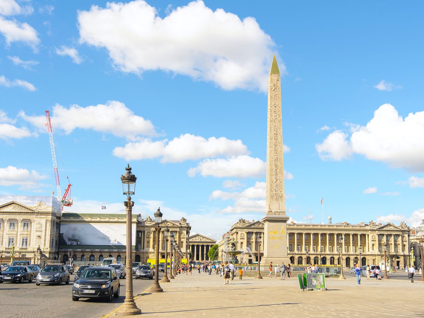
Covering almost 19 acres, this 18th-century tribute to Louis XV remains the largest square in Paris. So yes, it’s a well-known destination, but many visitors don’t realize that, looming even larger than the dimensions, is the local lore. It was here on the right bank of the Seine — where the Tuileries Gardens meet the Champs-Élysées — that everyone from Louis XVI to Marie Antoinette to Robespierre were publicly guillotined during the French Revolution. In those days, the square was better known as the Place de la Révolution, one of several names bestowed upon the site over the centuries.
But not until the mid-1800s was the square modified in ways that modern visitors would recognize. First was the installation of the approximately 3,000-year-old, 75-foot Luxor Obelisk at the center, followed by the construction of the Orangerie and Jeu de Paume (now two of Paris’ most beloved museums) along the periphery. Though there’s clearly plenty to see at Place de la Concorde anytime, if you’re in town on July 14 for the Bastille Day celebrations, the famed annual military parade ends right here.
Advertisement
More from our network
Daily Passport is part of Inbox Studio, an email-first media company. *Indicates a third-party property.
Daily Passport writers have been seen in publications such as National Geographic, Food & Wine, CBC, Condé Nast Traveler, and Business Insider. They're passionate about uncovering unique destinations and sharing expert tips with curious travelers.
From caverns deep underground to former cell blocks, there are many places across America where you’d never expect to find overnight accommodations. Many are landmark properties with a storied past, and the hoteliers behind them have opted to highlight their quirky, grandiose, or industrial characters through inspiring décor, unique amenities, and other thoughtful touches. These eight U.S. hotels are highly unusual, but very much worth booking if you’re searching for a one-of-a-kind overnight experience.
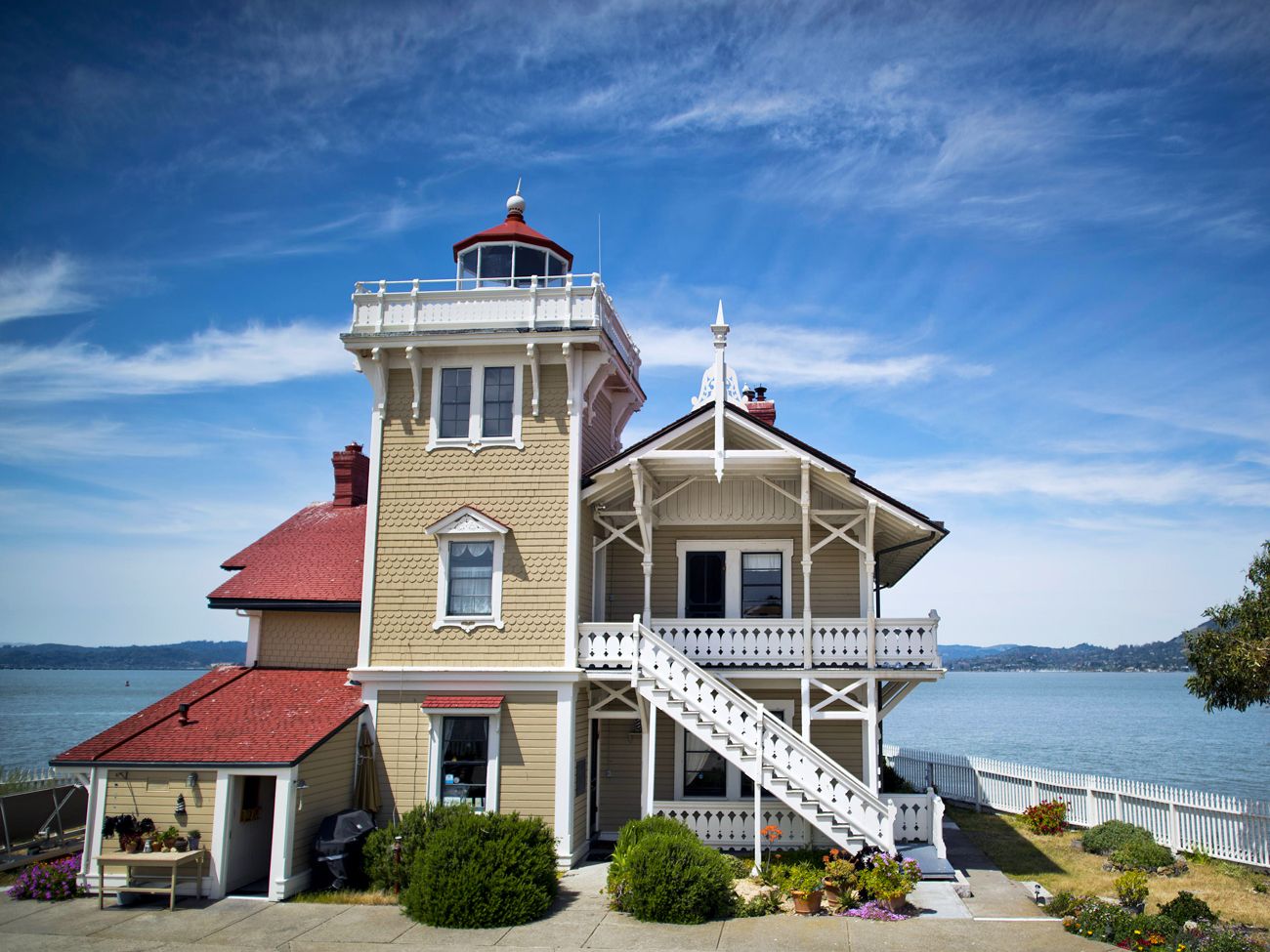
The East Brother Light Station bed-and-breakfast is one of the few hotels in the world housed within a former lighthouse. Built in 1873, the restored Victorian B&B is perched atop a small island in the strait between the San Francisco and San Pablo bays. Adventurous guests will have to brave a 10-minute boat ride across the water and climb a 12-foot ladder to reach the property. The complex was home to a staffed lighthouse from 1873 until the 1960s. After the lighthouse was automated, the Coast Guard was set to tear down the structure, but local preservationists stepped in and turned it into a B&B, which opened in 1980 with five bedrooms. Guests will receive a tour of the grounds, hors d’oeuvres, wine, a multicourse dinner, and breakfast with their stay.
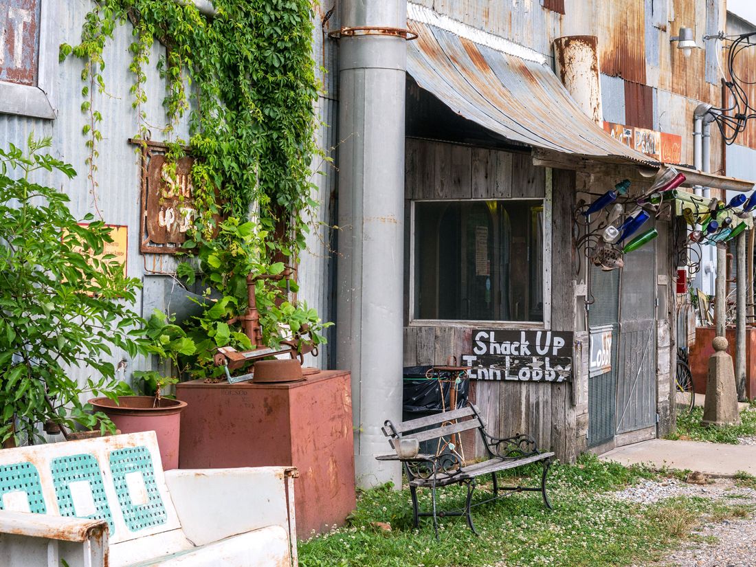
Would you spend upwards of $100 a night to stay in a shack? Deep in the Mississippi Delta, guests have the opportunity to imbibe at the world’s oldest “bed and beer” and sleep in their very own rustic room outfitted with a corrugated tin roof and homespun furniture. Luckily, guests can enjoy modern amenities such as air conditioning and indoor plumbing, too. These former cotton sharecropper shacks were abandoned after mechanical cotton pickers were introduced in the 1940s, but the inn’s owners bought them and turned them into these unique accommodations in 1998. They have since hosted famous guests such as Elvis Costello and Tom Waits. “The Ritz we ain’t” may be its motto, but the Shack Up Inn promises a memorable stay nonetheless.
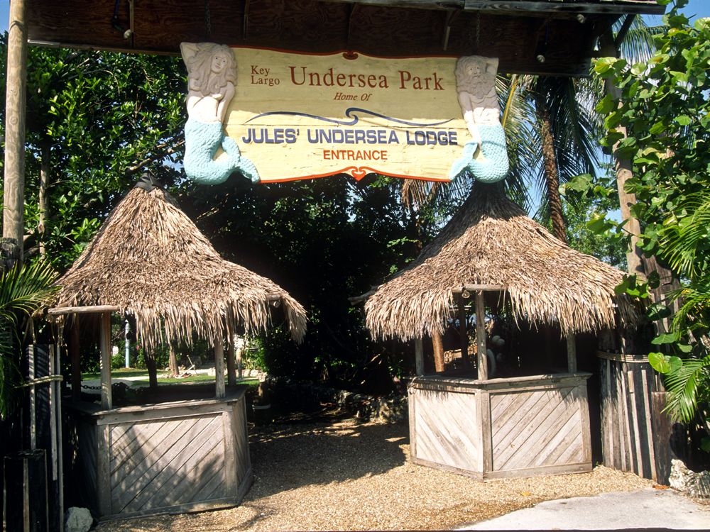
You’ll have to be scuba-certified to stay at this unique accommodation in the Florida Keys. Jules Undersea Lodge is the only hotel in the world that requires guests to make the dive into the lagoon to reach rooms, which are located 30 feet under the surface. Your room will include a window of the watery abyss and ocean-inspired décor. Even better, you can get pizza delivered to your underwater abode and watch TV, as there is electricity inside the capsule. And if you aren’t yet scuba-certified, the property offers an instructor-led course on site for an additional cost.
You won’t get locked in your room from the outside at the Liberty Hotel in Boston, but that wasn’t always the case. Built in 1851, the historic Charles Street Jail on Beacon Hill once housed some of Boston’s most notorious criminals, but it is now a four-star hotel boasting playful nods to the building’s past. These include jail bar doors at the on-site restaurant Clink, keys to the cells framed on display, and ball and chain accents throughout the property.
In the Ozarks of northwestern Arkansas, nature lovers will find one-of-a-kind accommodations at the Beckham Creek Cave Lodge. Eight guests can fit comfortably inside the 5,800-square-foot house nestled within a bluff overlooking the valley. Each room within the lodge has stalactites overhead, and the exposed rock walls complement the minimalist interior décor. Best of all, guests will have the property’s 256 acres all to themselves. Perhaps one of the perks of being so isolated is that you’ll be able to drift to sleep in total darkness here with no noise to disturb you.
Photo credit: Image courtesy of Kruger Images – Jim Kruger
The bell won’t wake you up if you fall asleep at your desk — or rather, bed. This former junior high school constructed in 1921 is now a 45-room, schoolhouse-inspired hotel in Iowa, complete with a gymnasium-turned-ballroom featuring the original basketball court floor for events, a cafeteria converted into bunks, and locker rooms that now house the hotel’s bar and restaurant, aptly named Periodic Table. Rooms include chalkboards, bench seating, and other nods to academia. The school officially closed in the 1970s, but class is still in session — at least for hotel guests.
Credit: Image courtesy of Bruce Black/ Kokopelli’s Cave Bed & Breakfast
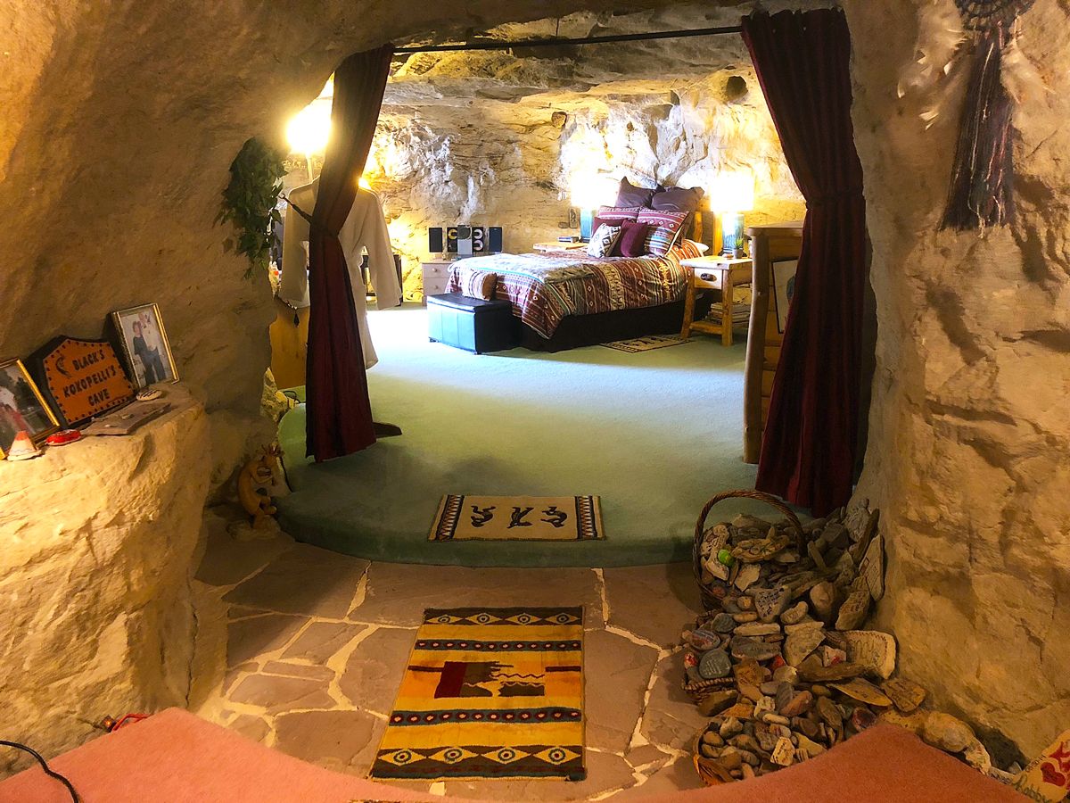
Carved into a 60 million-year-old sandstone cliff face, Kokopelli’s B&B is another accommodation you’ll need to see in person to believe. Here, guests can watch the sun dip on the horizon and appreciate unparalleled views of Colorado, Utah, Arizona, and New Mexico in the Four Corners region. There is no elevator to reach your room, so it’s not recommended for those with limited mobility, but guests can appreciate rustic touches including a replica Native American kiva (circular communal space), a waterfall shower with a rock wall, and Southwest-inspired décor throughout.
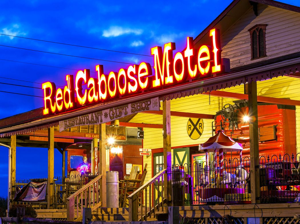
In 1969, the Pennsylvania Railroad put a total of 19 surplus cabooses — each weighing 25 tons — up for auction, and local businessman Donald M. Denlinger was the lucky bidder. Denlinger chose to convert the cars into hotel rooms, and the Red Caboose Motel was born in Lancaster County on Mother’s Day 1970. In the decades since, it has expanded to include 38 cars and has hosted countless travelers in search of a one-of-a-kind accommodation.
Note: All featured products and deals are selected independently and objectively by the author. Daily Passport may receive a share of sales via affiliate links in content.
Advertisement
More from our network
Daily Passport is part of Inbox Studio, an email-first media company. *Indicates a third-party property.
The Fascinating History of New England’s Stone Walls
By
Julia Hammond
Read time: 6 minutes
July 1, 2024
Updated: July 1, 2024
The Fascinating History of New England’s Stone Walls
History •July 1, 2024•Updated: July 1, 2024
By Julia Hammond
Author
Julia Hammond
Julia is a U.K.-based travel writer whose work has been featured in The Independent, The Telegraph, The New Zealand Herald, and Culture Trip, among others. She’s an enthusiastic advocate for independent travel and a passionate geographer who has had the privilege of traveling to more than 130 countries in search of a story.
Humans have created walls, henges, cairns, and other stone structures since prehistoric times. These structures have served a variety of purposes, from defensive barriers to waymarkers and religious sites. And while many of the most famous stone walls are found in Europe, the United States is also home to a fascinating array of centuries-old walls. Though their purpose was often simple — to demarcate land used for agricultural or residential purposes — the methods used to construct them were ahead of their time. Their ubiquity gives them a cultural significance within this region, too. Discover the fascinating history of New England’s stone walls and how to visit them for yourself.
The Role of European Settlers
Credit: Nick Brundle Photography/ Moment via Getty Images
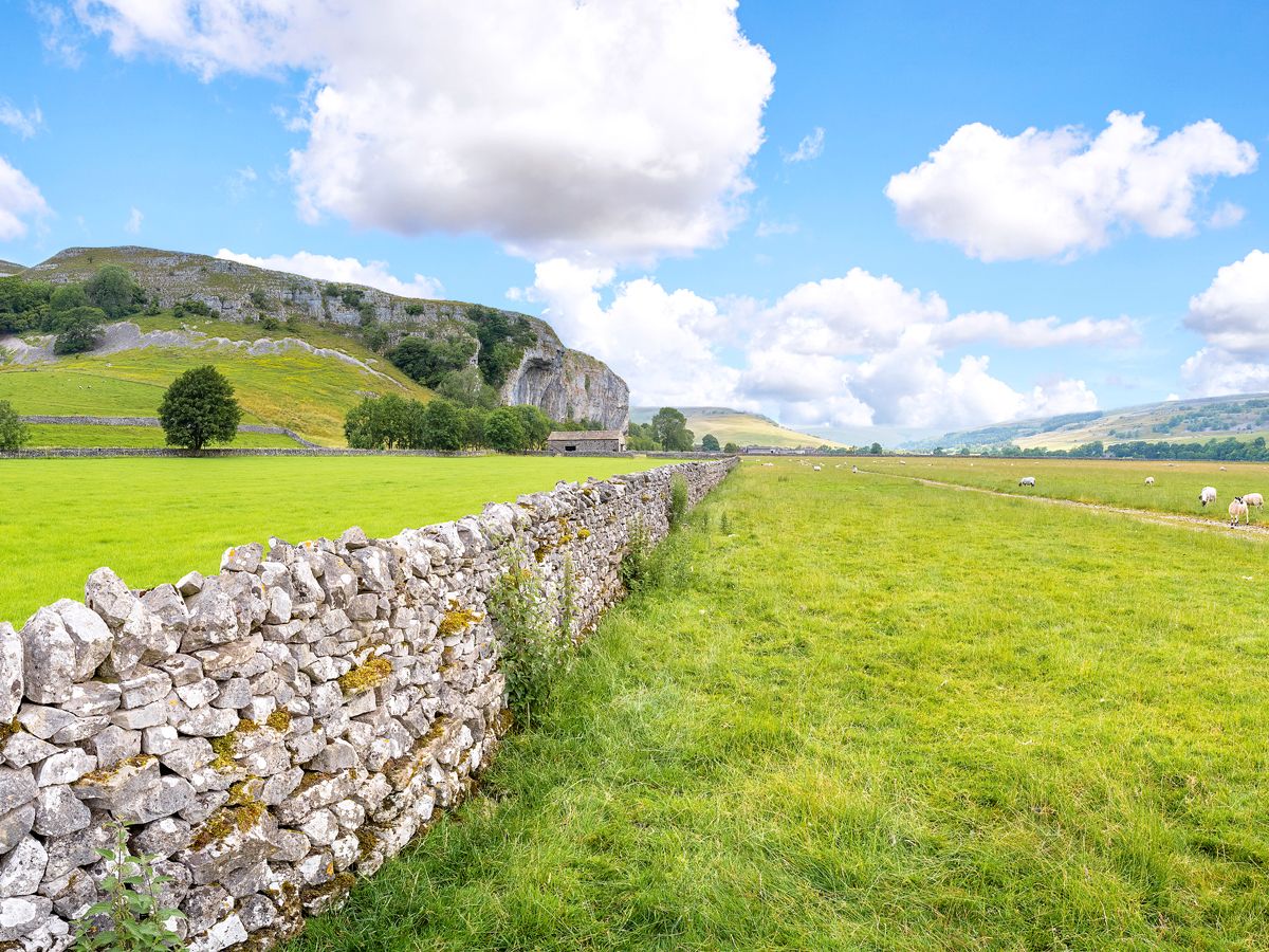
The earliest stone walls date from Neolithic times, and they’re a feature you’ll see in many European countries today. For example, they’re abundant in Ireland, Scotland, and northern England, as well as throughout the Mediterranean region.
In fact, they’re such an important part of the local landscape that UNESCO inscribed the craft of dry stone walling on its Intangible Cultural Heritage list in 2018. The method involves large stones being laid on a bed of gravel. A wall of stones is carefully constructed on top that tapers slightly as it rises from the ground. Smaller stones called filling stones are used in the gaps, while through stones placed perpendicular to the wall also help to keep it stable. Finally, flat rocks known as coping stones are placed on top.
When Europeans migrated to North America beginning in the 17th century, many of them intended to farm and brought livestock with them. To keep their crops and animals separate, they needed to erect some kind of barrier. They did so in the way they knew how, and dry stone walls sprang up in the U.S. as a consequence. New England had an especially large number, thanks to a combination of the right kind of rock, glacial soils, and a prevalence of small family farms.
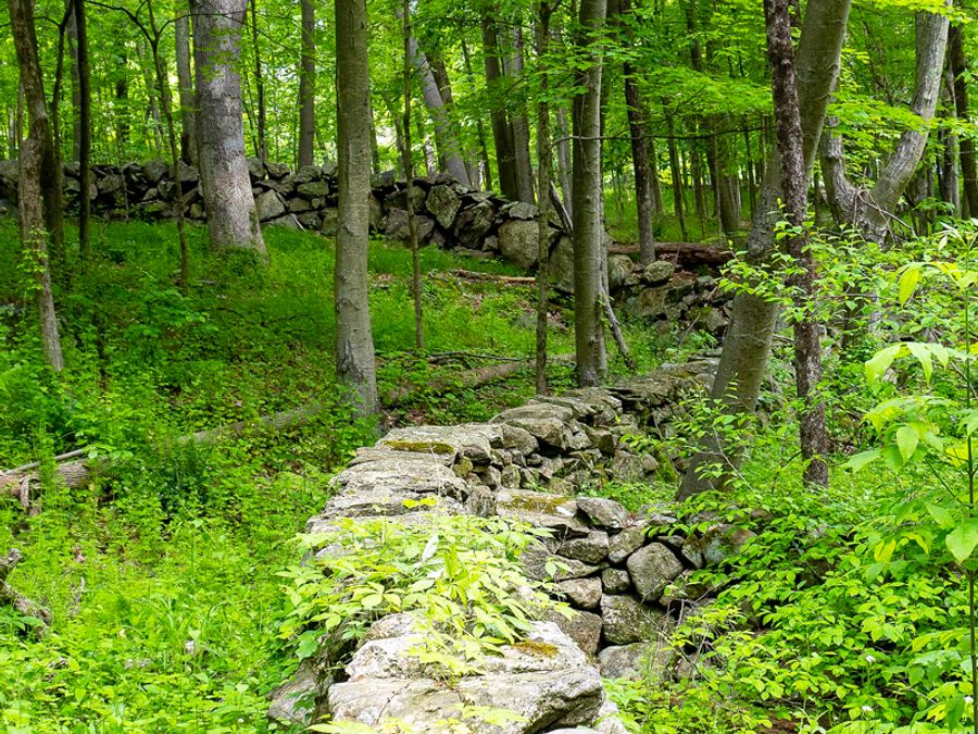
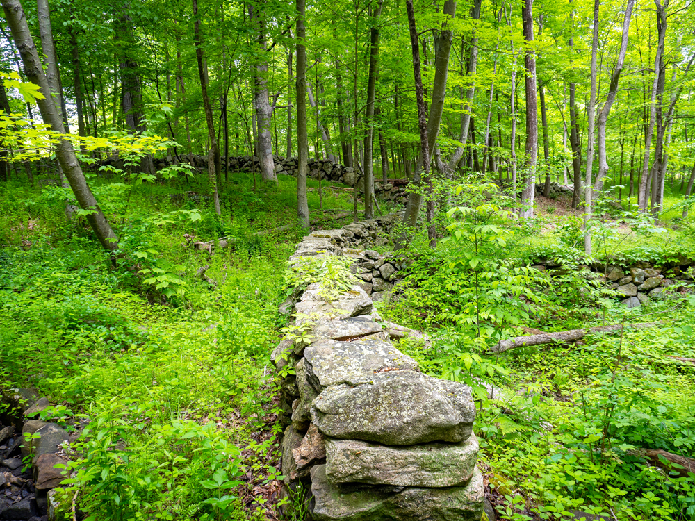
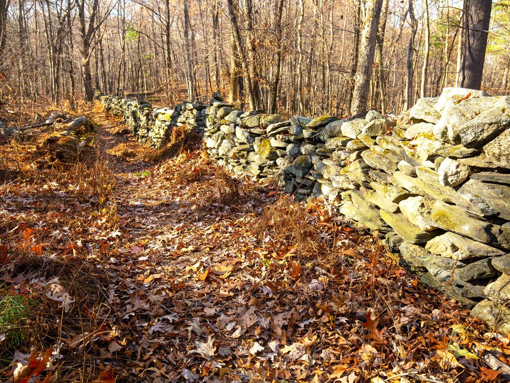
Fieldstone walls encapsulate the history of New England. Thousands of years ago, glaciers advanced and then retreated, depositing their rocky moraine throughout the region. Forests grew and then were cut back to make space for farming, and those same stones were cleared and stacked to demarcate fields and clarify boundaries.
Though many remain standing today, the stone walls that were lost to history are gradually being rediscovered through the use of techniques such as light and detection ranging (LIDAR) and geographic information science (GIS). In the 1930s, mining engineer Oliver Bowles suggested that the region’s total could have been as much as 240,000 miles of walls, though mapping is still a work in progress.
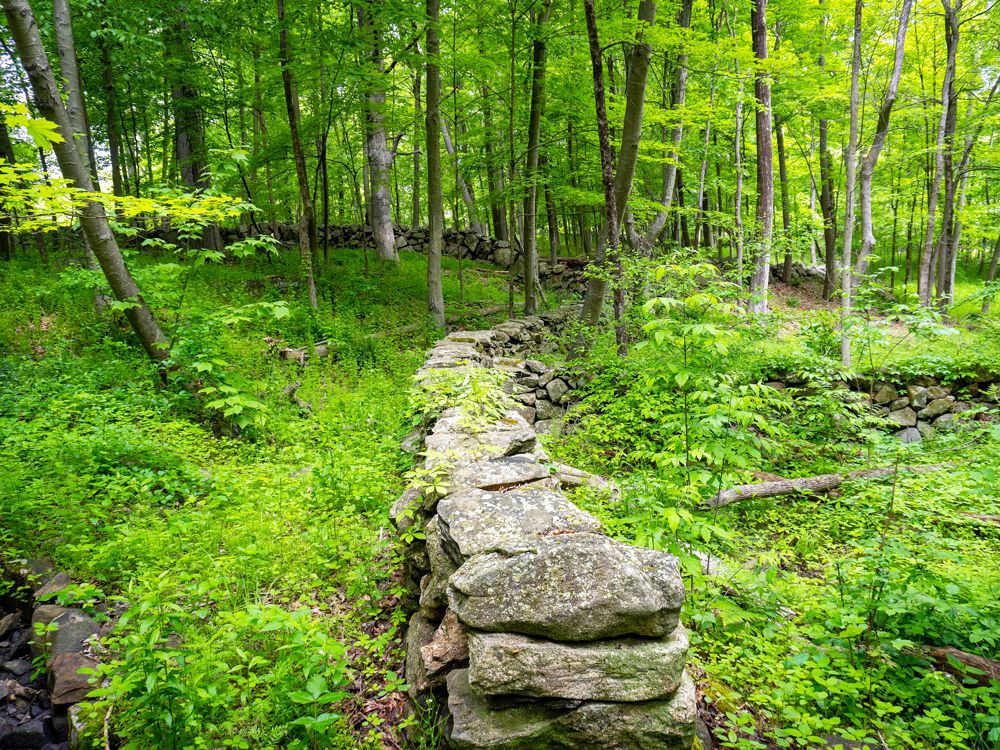
The building of dry stone walls reached its peak between 1750 and 1850, but times changed. As the nation industrialized and cities grew, rural land holdings were abandoned. Without people to maintain them, some stone walls were simply left to collapse, as there was no longer anyone around who knew how to make repairs. Vegetation cleaved and scattered the stone, while woodland recolonized what had once been pasture or plowed furrows.
Other walls fell victim to plunder, the stones repurposed in other structures. In Stamford, Connecticut, there are records of a purchase of a portable stone crusher in 1909 so that the material from redundant walls could form the base layer of new roads. A 1914 article in the magazine Guide to Nature lamented the loss of some of these “picturesque stone walls” but also argued that “a few stone walls go a long way in making enduring roads.”
However, more recently, an appreciation has taken root for the cultural value of these once unremarkable stone walls and the contribution they make to an area’s architectural heritage. For instance, the Stone Wall Initiative, coordinated by Robert M. Thorson, professor of earth sciences at the University of Connecticut, has been established to help catalog and preserve this unique characteristic of the New England landscape.
Where Can You Find New England’s Stone Walls?
Credit: Daniel Hanscom/ iStock via Getty Images
Fieldstone walls are found all throughout New England, but some are especially noteworthy. The earliest stone wall to be documented dates from 1607. It was built at the mouth of the Kennebec River (then the Sagadahoc River) north of Portland, Maine, near present-day Phippsburg. In the early 1600s, English settlers attempted to establish a permanent settlement here, known as the Popham Colony, but it was short-lived and abandoned in 1608. Samuel Maverick, an Englishman who visited in the 1620s, reported seeing “some old walls,” though no tangible evidence of the original walls remains today.
One of the most famous stone walls you can see in New England is located on Frost Farm in Derry, New Hampshire. This was the home of poet Robert Frost, who penned a work called “The Mending Wall,” which was published in his 1914 anthology North of Boston. A line that’s often quoted — “Good fences make good neighbors” — plays with the idea that walls and boundaries both join and separate us.
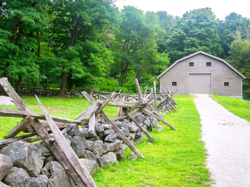
Meanwhile, the stone walls in Concord, Massachusetts, are wrapped up in the birth of an independent nation. North Bridge was the site of a significant battle during the American Revolutionary War. Now preserved as part of Minute Man National Historical Park, its agricultural stone walls would have provided much-needed cover for colonial fighters as they fended off the British in April 1775.
Another site of historic interest is Randall’s Ordinary in North Stonington, Connecticut. This homestead was built in 1685 and formed part of the National Underground Railroad Network. It offered a safe haven to enslaved peoples, who hid in the cellar and rested before continuing north to freedom in Canada. Within the grounds, you can find examples of lace walls, which are unusual dry-stacked structures with deliberate gaps between the stones. It’s not currently open to the public, but there are hopes to restore the site.
Where To Find Stone Walls Elsewhere in the U.S.
Though New England is most famous for its stone walls, there are many other parts of the U.S. in which you’ll find them.
Pennsylvania
Credit: Jonathan W. Cohen/ iStock via Getty Images
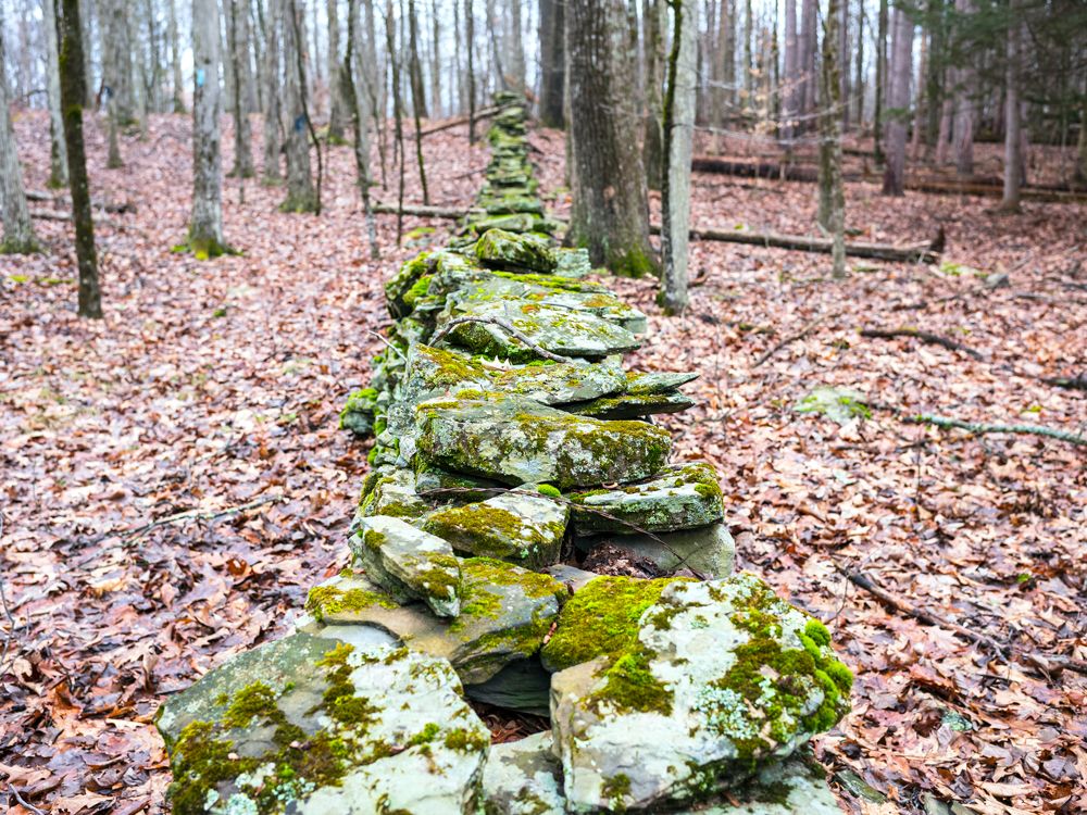
In northeastern Pennsylvania’s Wayne County, stone walls indicate where there was once agriculture, even if the land use has since changed. Around 200 years ago, stones scattered about the fields would have made tasks like plowing more difficult, so piling them up to demarcate boundaries made sense. At the start of spring, farmers would use a “stone boat” to gather loose rocks and simply pile them on top of the existing wall. You’ll also see them in Woodbourne Forest and Wildlife Preserve farther west near Montrose.
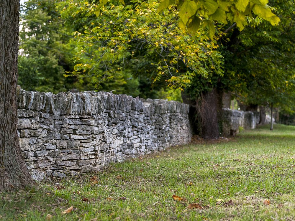
Walls made out of chunks of limestone characterize much of the Bluegrass region of Kentucky. Irish and Scottish immigrants, some of them skilled stonemasons, built these walls approximately 200 years ago. Later, they were constructed by indentured servants and enslaved peoples. The walls lined turnpikes and enclosed farms, mills, and cemeteries. The Dry Stone Conservancy in Lexington helps preserve and promote the craft for all to appreciate today.
Virginia
Credit: cindygoff/ iStock via Getty Images
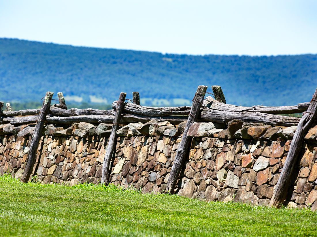
Stone walls are also a common sight in Augusta County, close to the Blue Ridge Parkway in western Virginia. In this area, they are what remains of the structures built to contain or separate grazing cattle and hogs that would sniff around for acorns and chestnuts. Measuring up to 6 feet thick and as high as a human chest, they stretch for miles through leafy deciduous forest. Stone walls also line the road in Upperville, Virginia, nestled in the foothills of the Piedmont.
Advertisement
More from our network
Daily Passport is part of Inbox Studio, an email-first media company. *Indicates a third-party property.